Fish Passage Site 20401343
Coordinates (dec. deg.): 61.71077°, -149.11888°
Legal Description: S019N002E29
Region: South Central
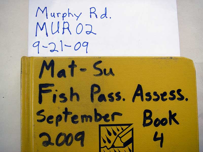
Road Name: Murphy Road
Datum: NAD83
Quad Name / ITM: Anchorage C-6
AWC Stream #: 247-50-10260-2019-3120
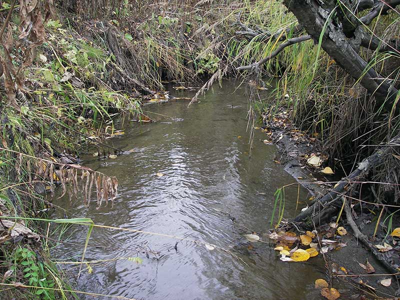
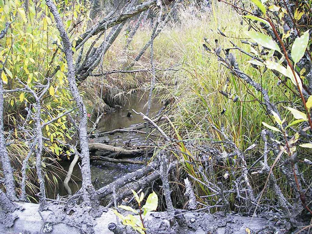
Stream Name: Wasilla Creek tributary
Elevation:
Site Comments: None
arrow to the right of the survey date below to choose a different report for this site.
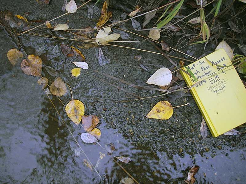
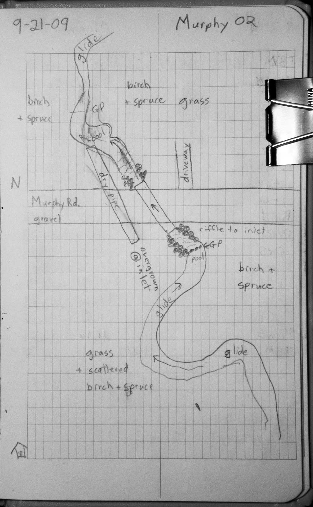
Survey MSB09-MUR02
Project Supervisor: Gillian O'Doherty, ADFG
Observers: Heidi Zimmer, Ben Histand
Overall Fish Passage Rating:
Tidal: No
Backwatered: No
Step Pools: Yes
Construction Year: 2008
Site Observations:
- None of this type
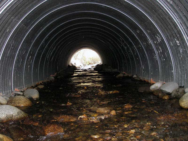
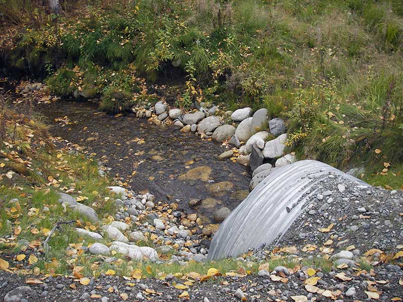
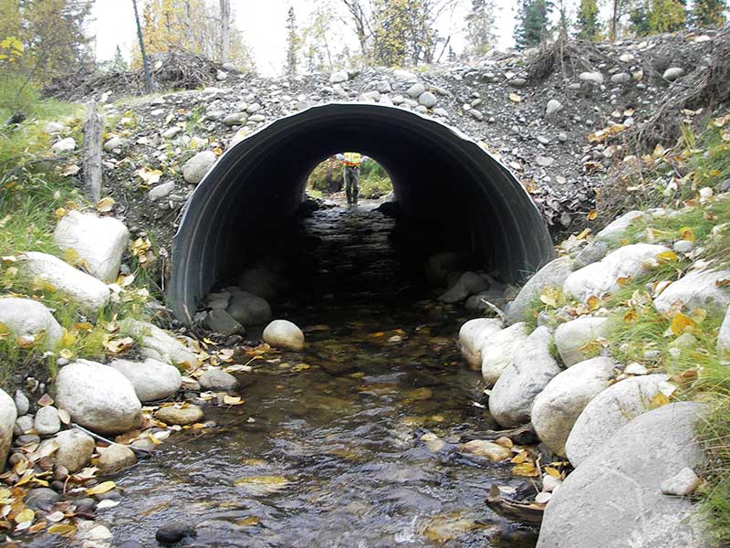
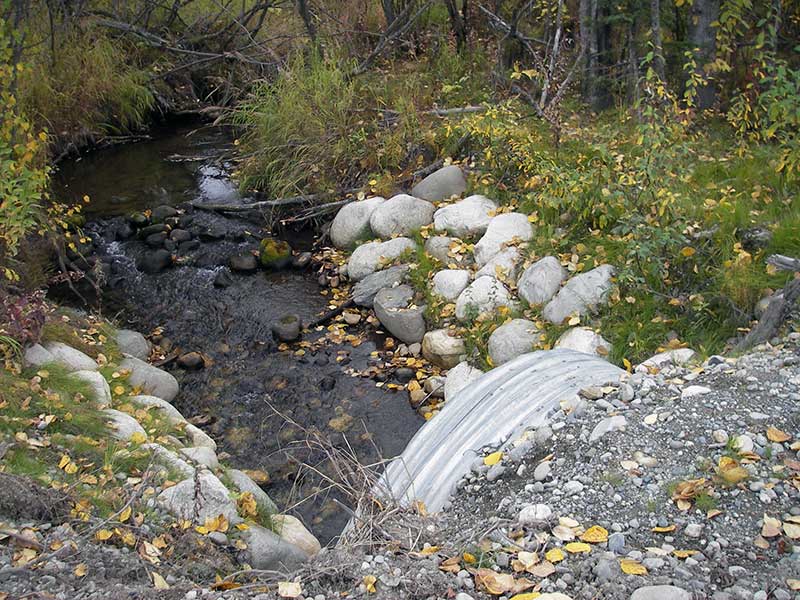
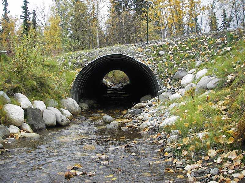
Comments: Post-replacement survey of MSCS1WA039; step pools with jumps <4", fry obs upstream.
Culvert Measurements
| ID: 1 | Structure Type: Circular pipe (Corrugated steel) | Fish Passage Rating: | ||||||||||||||||||||||||||||||||||||||||||
|
|
|
||||||||||||||||||||||||||||||||||||||||||
Comments: Post-replacement survey of MSCS1WA039;fry obs upstream; upstream grade is 0.5%. |
||||||||||||||||||||||||||||||||||||||||||||
Culvert Observations:
|
||||||||||||||||||||||||||||||||||||||||||||
Stream Measurements
|
|
| Stream Width Type | Distance From Crossing (ft) |
Stream Width (ft) |
|---|---|---|
| Upstream ordinary high water | 54.0 | 6.00 |
| Upstream ordinary high water | 89.0 | 7.00 |
| Upstream ordinary high water | 128.0 | 8.00 |
Elevations
| Locator ID | Culvert Number |
River Distance (ft)1 |
Distance From Crossing (ft)2 |
Relative Elevation (ft) |
|---|---|---|---|---|
| D/S Water Surface Elev (water surface used for stream grad) | 1 | 0.00 | 94.64 | |
| D/S Grade Ctrl (Thalweg) (grade pt at pool below riffle) | 1 | 92.00 | 93.63 | |
| D/S Water Surface Elev | 1 | 92.00 | 95.02 | |
| D/S Water Surface Elev (water surface used for stream grad) | 1 | 112.00 | 95.19 | |
| D/S Water Surface Elev | 1 | 140.00 | 95.42 | |
| D/S Grade Ctrl (Thalweg) (grade pt at riffle) | 1 | 140.00 | 94.95 | |
| Outlet Culvert Top | 1 | 156.00 | 100.00 | |
| Outlet Invert (invert on substrate) | 1 | 156.00 | 95.45 | |
| D/S Water Surface Elev (outlet water surface) | 1 | 156.00 | 95.93 | |
| Road Elev | 1 | 181.00 | 102.31 | |
| Inlet Culvert Top | 1 | 206.80 | 101.05 | |
| Inlet Culvert Invert (invert on substrate) | 1 | 206.80 | 96.21 | |
| U/S Water Surface Elev (inlet water surface) | 1 | 206.80 | 96.92 | |
| U/S Grade Ctrl (Thalweg) (top of cobble riffle) | 1 | 226.80 | 97.17 | |
| U/S Water Surface Elev | 1 | 226.80 | 97.56 | |
| U/S Water Surface Elev | 1 | 246.80 | 97.87 | |
| U/S Grade Ctrl (Thalweg) (resting pool) | 1 | 246.80 | 96.75 |
Notes:
- River distance is measured continuously throughout the survey reach along the thalweg of the stream.
- Measured from each end of the crossing along the thalweg of the stream.
Fish Sampling Efforts
| Gear Type: Visual Observation, Ground (A) | ||
| Comments: Juvenile salmonids observed upstream from culvert. | ||
Fish Observations
No fish observations occurred during this survey.
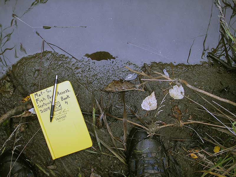
Photos
Questions or comments about this report can be directed to dfg.dsf.webmaster@alaska.gov