Fish Passage Site 20401300
Coordinates (dec. deg.): 61.52724°, -149.52698°
Legal Description: S017N001W31
Region: South Central
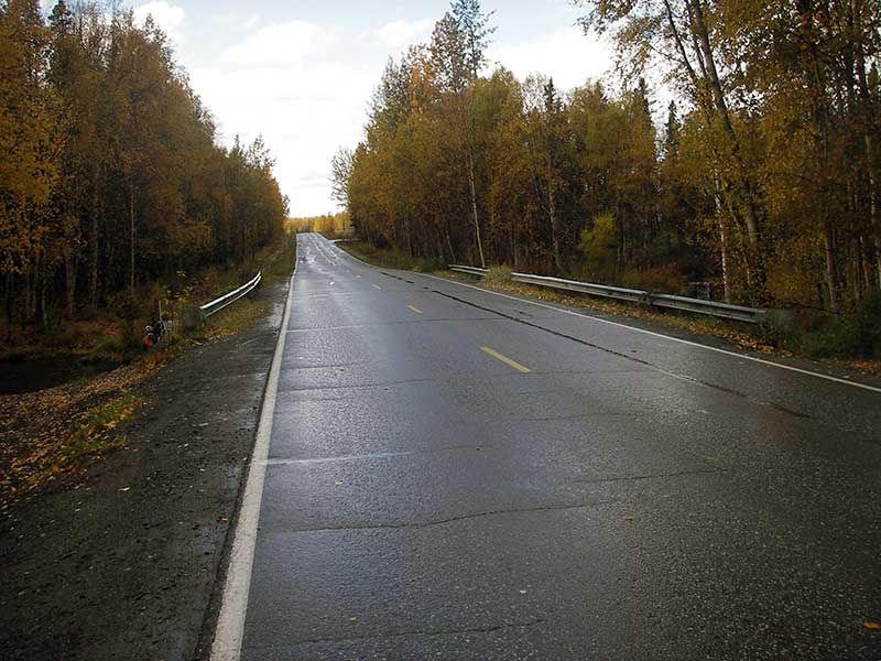
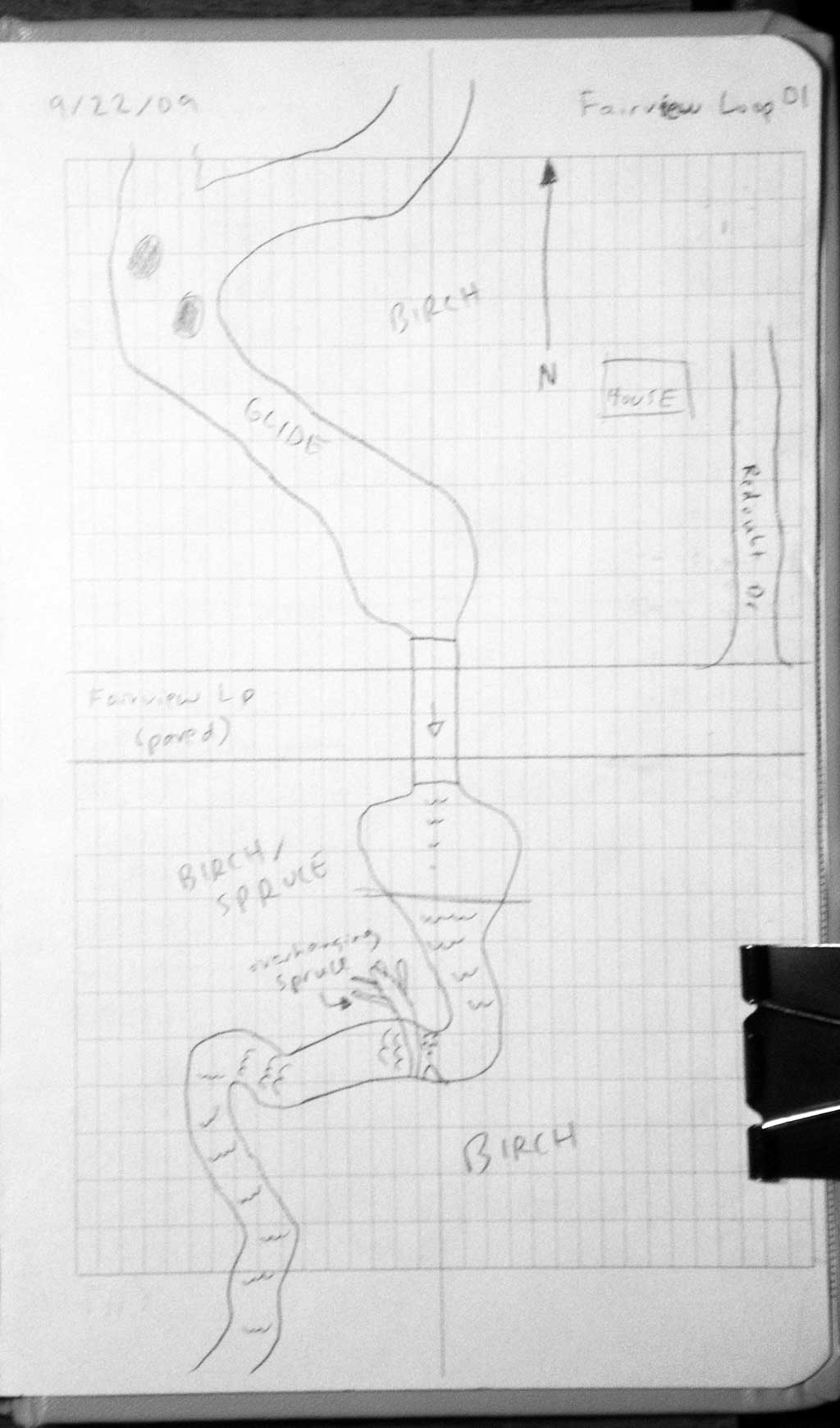
Road Name: Fairview Loop Road
Datum: NAD83
Quad Name / ITM: Anchorage C-7
AWC Stream #: 247-50-10300
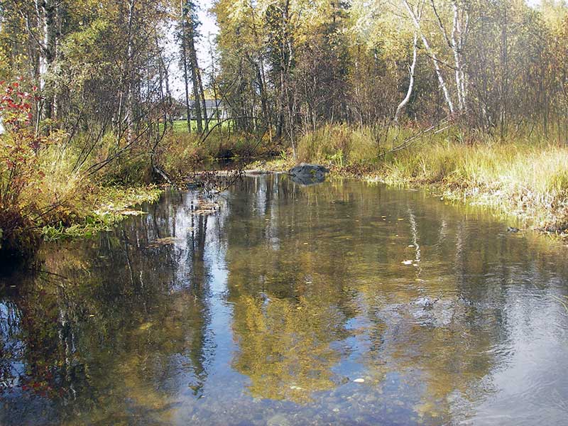
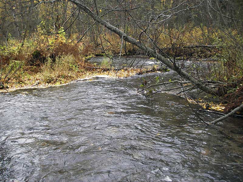
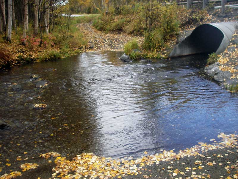
Stream Name: Cottonwood Creek
Elevation:
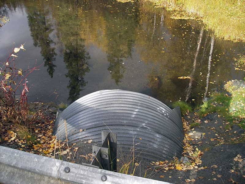
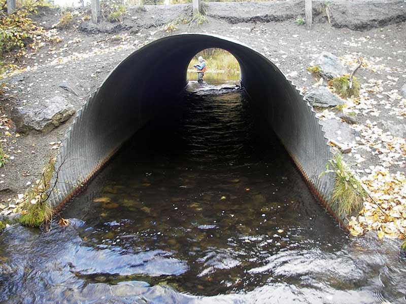
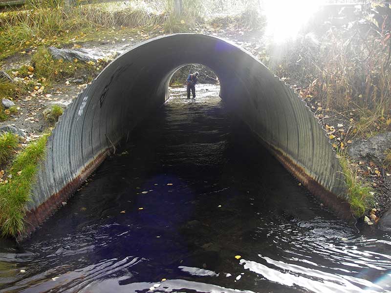
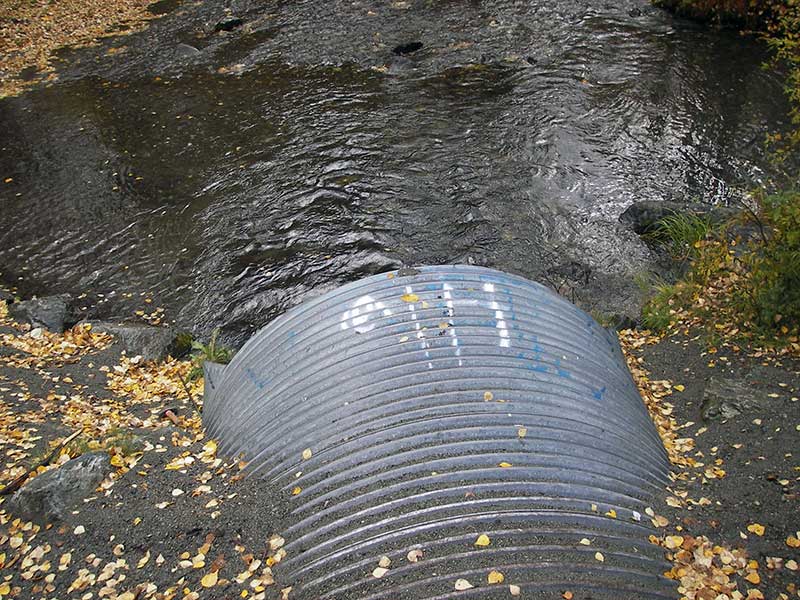
Site Comments: ATV trails thru outlet area & over top of culvert.
arrow to the right of the survey date below to choose a different report for this site.
Survey MSB09-FVL01
Project Supervisor: Gillian O'Doherty, ADFG
Observers: Heidi Zimmer, Ben Histand
Overall Fish Passage Rating:
Tidal: No
Backwatered: Yes
Step Pools:
Construction Year:
Site Observations:
- Constriction ratio gray
- Culvert is poorly aligned
- Compound gradient in pipe
Comments: Resurvey of MSCS1CT151. Visual observation of adult coho u/s and d/s, juv salmonids u/s. Inlet miter 8', outlet miter 6'.
Culvert Measurements
| ID: 1 | Structure Type: Circular pipe (Corrugated steel) | Fish Passage Rating: | |||||||||||||||||||||||||||||||||||||||||
|
|
|
|||||||||||||||||||||||||||||||||||||||||
Culvert Observations:
|
|||||||||||||||||||||||||||||||||||||||||||
Stream Measurements
|
|
| Stream Width Type | Distance From Crossing (ft) |
Stream Width (ft) |
|---|---|---|
| Upstream ordinary high water | 100.0 | 15.00 |
| Upstream ordinary high water | 135.0 | 15.50 |
| Upstream ordinary high water | 225.0 | 13.50 |
Elevations
| Locator ID | Culvert Number |
River Distance (ft)1 |
Distance From Crossing (ft)2 |
Relative Elevation (ft) |
|---|---|---|---|---|
| Outlet Pool Water Elev | 1 | 90.51 | ||
| U/S Headwater | 1 | 90.88 | ||
| D/S Water Surface Elev (@GP) | 1 | 0.00 | 80.0 | 89.96 |
| D/S Grade Ctrl (Thalweg) | 1 | 0.00 | 80.0 | 89.00 |
| D/S Tailcrest or 1st Thalweg | 1 | 60.00 | 20.0 | 89.97 |
| D/S Water Surface Elev (@TWC) | 1 | 60.00 | 20.0 | 90.51 |
| D/S Thalweg (bottom of outlet pool) | 1 | 70.00 | 10.0 | 89.19 |
| D/S Thalweg | 1 | 75.00 | 5.0 | 89.52 |
| Outlet Invert | 1 | 80.00 | 0.0 | 89.52 |
| Outlet Culvert Top (top of pipe @ top of outlet miter) | 1 | 80.00 | 0.0 | 95.75 |
| D/S Thalweg (in thalweg @ top of outlet miter) | 1 | 86.00 | -6.0 | 89.36 |
| Road Elev | 1 | 113.50 | 98.67 | |
| U/S Water Surface Elev (@GP) | 1 | 134.50 | -12.5 | 90.84 |
| U/S Grade Ctrl (Thalweg) (high point inside pipe) | 1 | 134.50 | -12.5 | 89.59 |
| Inlet Culvert Top (in thalweg @ top of inlet miter) | 1 | 139.00 | -8.0 | 89.13 |
| Inlet Culvert Invert | 1 | 147.00 | 0.0 | 88.97 |
| Inlet Culvert Top (top of pipe @ top of inlet miter) | 1 | 147.00 | 0.0 | 96.09 |
Notes:
- River distance is measured continuously throughout the survey reach along the thalweg of the stream.
- Measured from each end of the crossing along the thalweg of the stream.
Fish Sampling Efforts
| Gear Type: Visual Observation, Ground (A) | ||
| Comments: Visual observation of adult coho upstream and downstream of culvert. | ||
| Gear Type: Visual Observation, Ground (B) | ||
| Comments: Juvenile salmonids visually observed upstream from culvert. | ||
Fish Observations
No fish observations occurred during this survey.
Photos
Questions or comments about this report can be directed to dfg.dsf.webmaster@alaska.gov