Fish Passage Site 20401296
Coordinates (dec. deg.): 61.52290°, -149.57120°
Legal Description: S017N002W35
Region: South Central
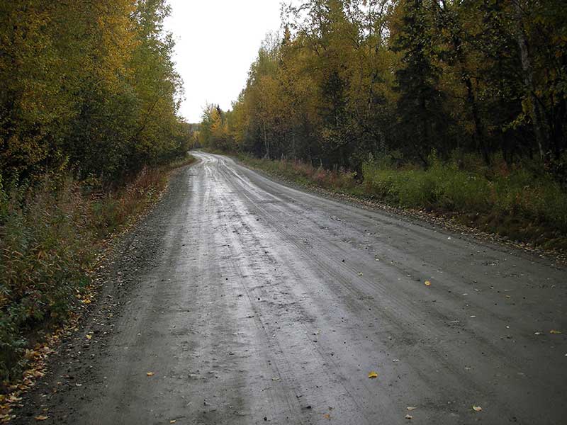
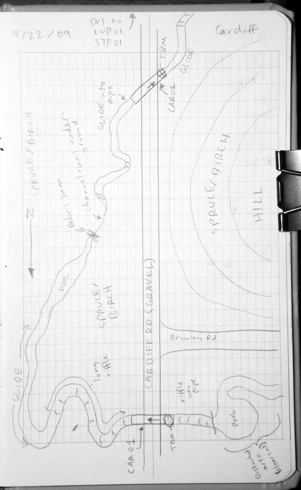
Road Name: Cardiff Road
Datum: NAD83
Quad Name / ITM: Anchorage C-7
AWC Stream #:
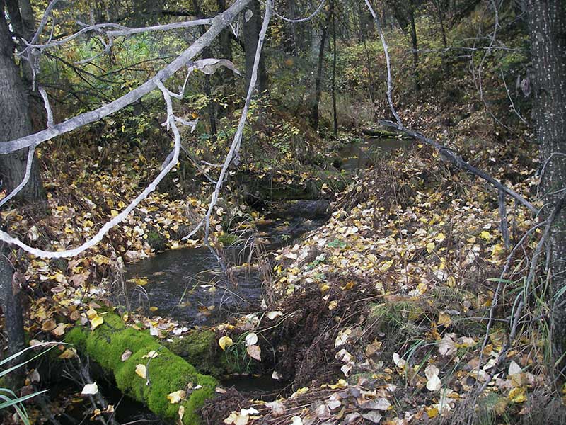
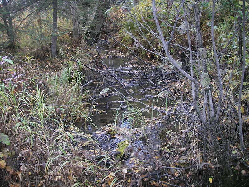
Stream Name: Lucy Creek tributary
Elevation:
Site Comments: CAR01 is upstream from this site.
arrow to the right of the survey date below to choose a different report for this site.
Survey MSB09-CAR02
Project Supervisor: Gillian O'Doherty, ADFG
Observers: Heidi Zimmer, Ben Histand
Overall Fish Passage Rating:
Tidal: No
Backwatered: No
Step Pools: No
Construction Year: 2004
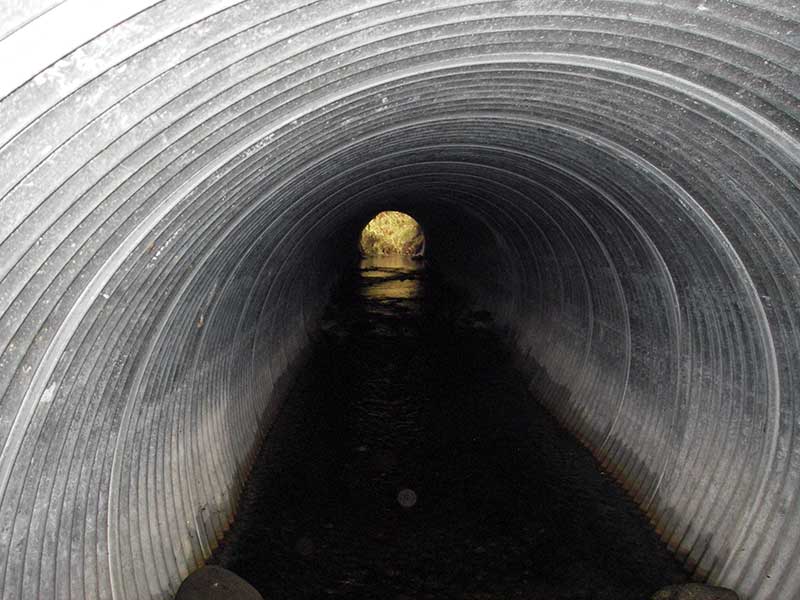
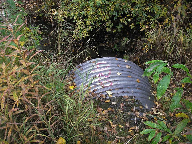
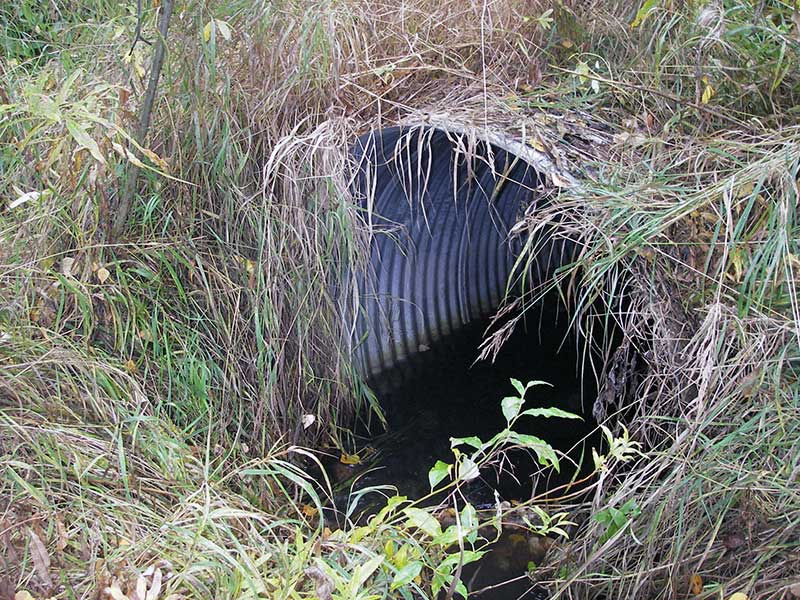
Site Observations:
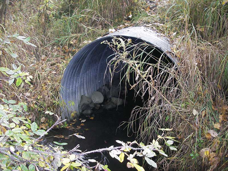
- Material inadequate for designed use
- Compound gradient in pipe
- Culvert is poorly aligned
Comments: Post-replacement survey of MSCS1CT147; pipe probably set to embed, but outlet has scoured out.
Culvert Measurements
| ID: 1 | Structure Type: Circular pipe (Corrugated steel) | Fish Passage Rating: | |||||||||||||||||||||||||||||||||||||||||
|
|
|
|||||||||||||||||||||||||||||||||||||||||
Culvert Observations:
|
|||||||||||||||||||||||||||||||||||||||||||
Stream Measurements
|
|
| Stream Width Type | Distance From Crossing (ft) |
Stream Width (ft) |
|---|---|---|
| Upstream ordinary high water | 82.0 | 6.00 |
| Upstream ordinary high water | 183.0 | 4.50 |
| Upstream ordinary high water | 240.0 | 4.00 |
Elevations
| Locator ID | Culvert Number |
River Distance (ft)1 |
Distance From Crossing (ft)2 |
Relative Elevation (ft) |
|---|---|---|---|---|
| Outlet Pool Water Elev | 1 | 96.61 | ||
| U/S Headwater | 1 | 96.92 | ||
| D/S Grade Ctrl (Thalweg) | 1 | 0.00 | 83.0 | 94.62 |
| D/S Water Surface Elev (@GP) | 1 | 0.00 | 83.0 | 95.10 |
| D/S Tailcrest or 1st Thalweg | 1 | 77.00 | 6.0 | 96.06 |
| D/S Water Surface Elev (@TWC) | 1 | 77.00 | 6.0 | 96.61 |
| D/S Thalweg (bottom of outlet pool) | 1 | 80.00 | 3.0 | 95.74 |
| Outlet Culvert Top (Top of pipe at outlet) | 1 | 83.00 | 0.0 | 99.99 |
| Outlet Invert | 1 | 83.00 | 0.0 | 95.50 |
| Road Elev | 1 | 115.90 | 101.57 | |
| Inlet Culvert Top (Top of pipe at inlet) | 1 | 148.80 | 0.0 | 100.24 |
| Inlet Culvert Invert | 1 | 148.80 | 0.0 | 96.55 |
| U/S Grade Ctrl (Thalweg) (1st TC u/s) | 1 | 158.80 | 10.0 | 96.80 |
| U/S Water Surface Elev (@GP) | 1 | 158.80 | 10.0 | 97.14 |
| U/S Water Surface Elev (u/s) | 1 | 263.80 | 115.0 | 97.94 |
Notes:
- River distance is measured continuously throughout the survey reach along the thalweg of the stream.
- Measured from each end of the crossing along the thalweg of the stream.
Fish Sampling Efforts
| Gear Type: Visual Observation, Ground (A) | ||
| Comments: Visual observations of adults salmonids upstream from culvert. | ||
Fish Observations
No fish observations occurred during this survey.
Photos
Questions or comments about this report can be directed to dfg.dsf.webmaster@alaska.gov