Fish Passage Site 20401291
Coordinates (dec. deg.): 61.52220°, -149.52682°
Legal Description: S017N001W31
Region: South Central
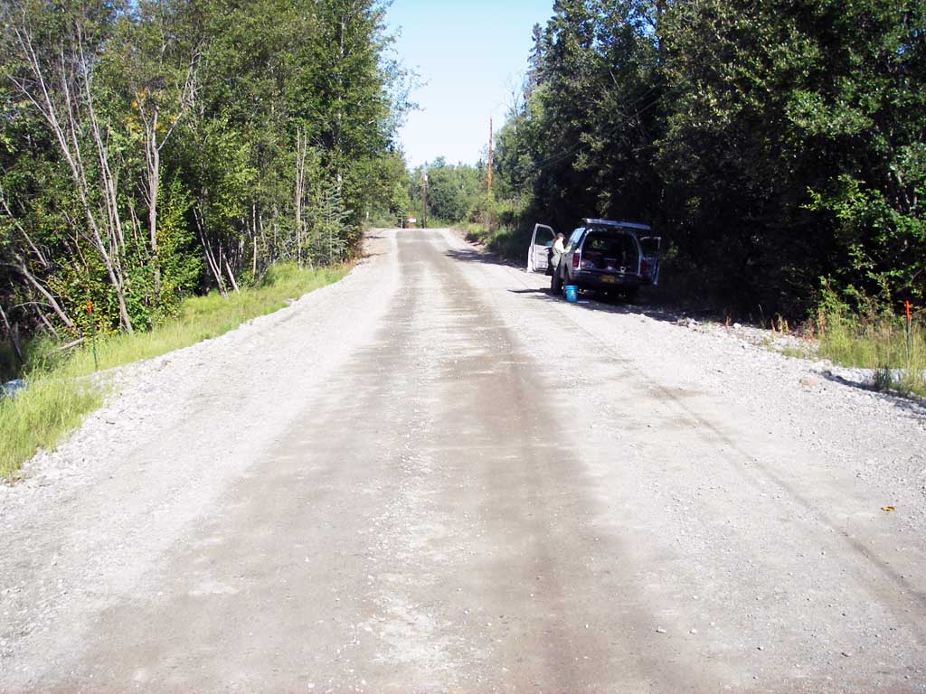
Road Name: Surrey Road
Datum: NAD83
Quad Name / ITM: Anchorage C-7
AWC Stream #: 247-50-10300-2012
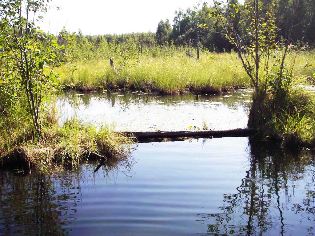
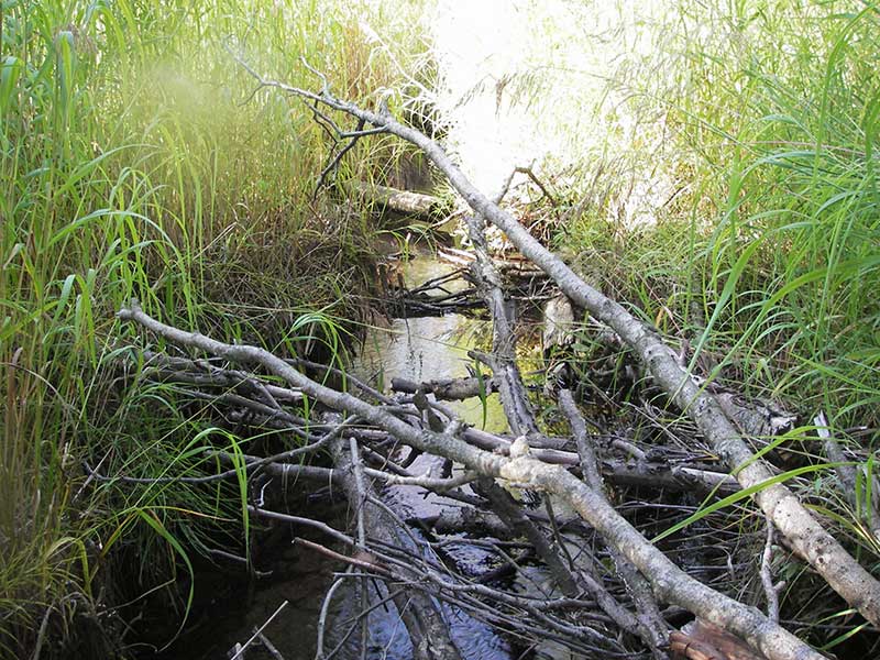
Stream Name: Cottonwood Slough
Elevation:
Site Comments: None
arrow to the right of the survey date below to choose a different report for this site.
Survey MSB09-SUR01
Project Supervisor: Gillian O'Doherty, ADFG
Observers: Heidi Zimmer, Ben Histand
Overall Fish Passage Rating:
Tidal: No
Backwatered: No
Step Pools: No
Construction Year: 2007
Site Observations:
- Shallow fill; inadequate roadfill volume above culvert
Comments: Post-Replacement survey of MSCS1CT140;.
Culvert Measurements
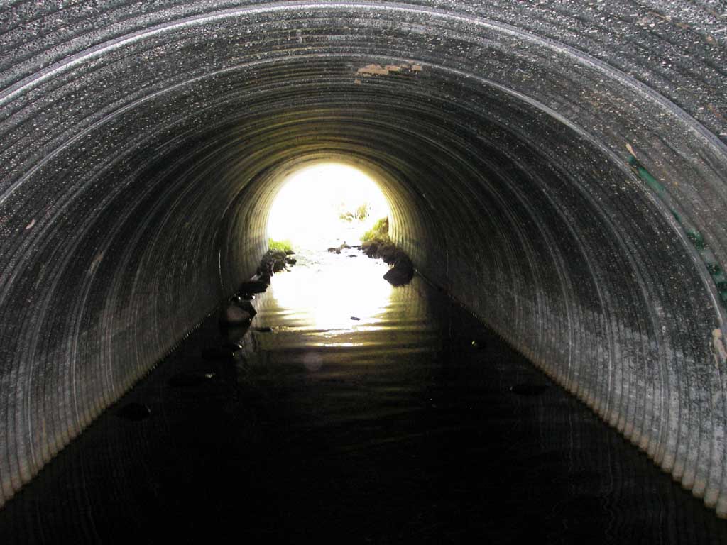
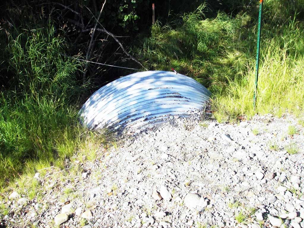
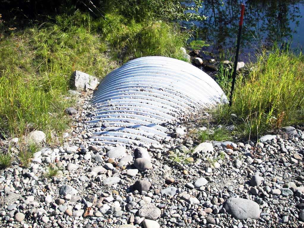
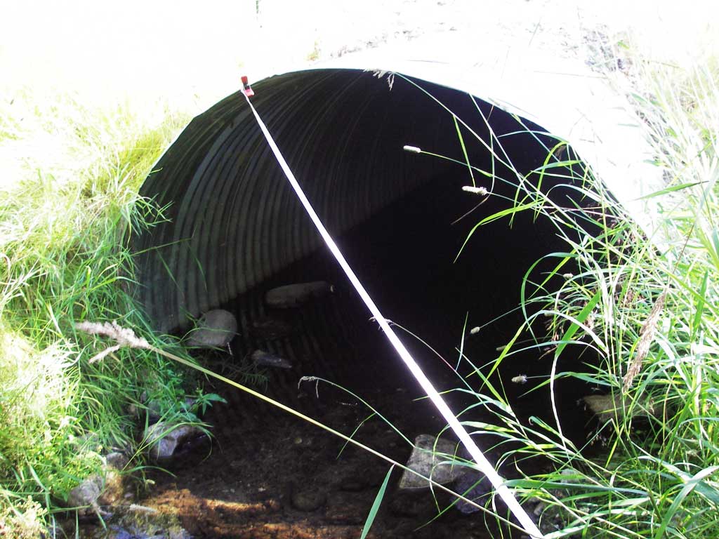
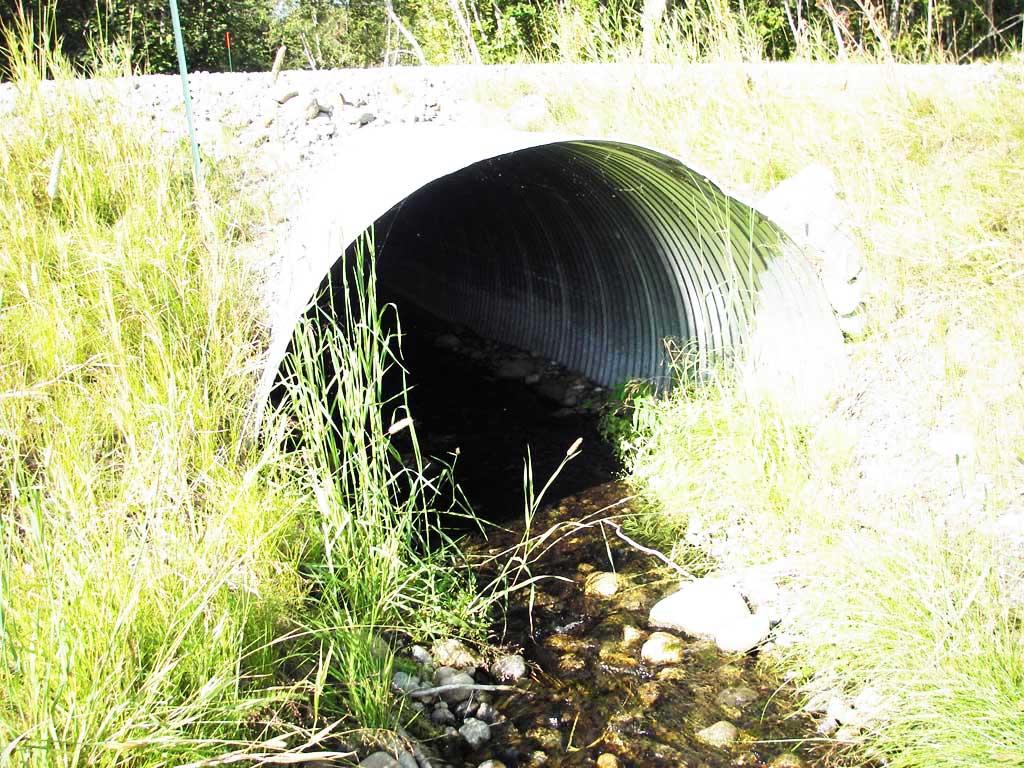
| ID: 1 | Structure Type: Circular pipe (Corrugated steel) | Fish Passage Rating: | ||||||||||||||||||||||||||||||||||||||||||
|
|
|
||||||||||||||||||||||||||||||||||||||||||
Comments: Downstream stream gradient = 0.78%. |
||||||||||||||||||||||||||||||||||||||||||||
Culvert Observations:
|
||||||||||||||||||||||||||||||||||||||||||||
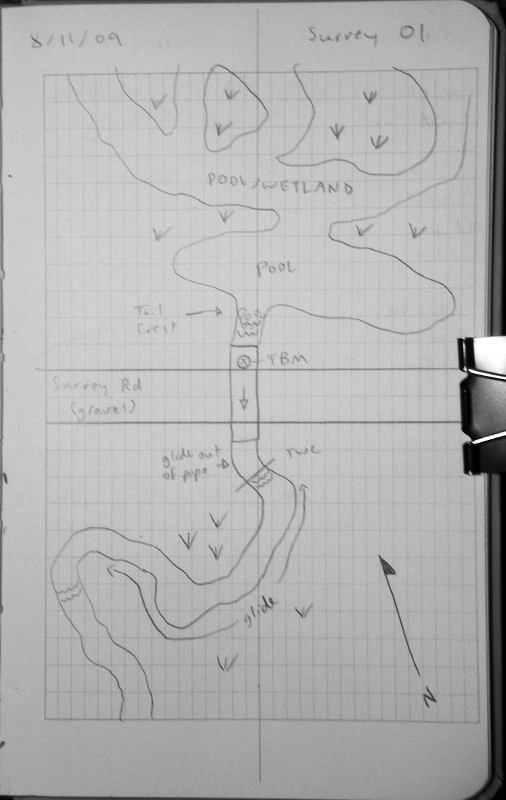
Stream Measurements
|
|
| Stream Width Type | Distance From Crossing (ft) |
Stream Width (ft) |
|---|---|---|
| Downstream ordinary high water | 35.0 | 5.50 |
| Downstream ordinary high water | 70.0 | 4.50 |
| Downstream ordinary high water | 110.0 | 4.50 |
Elevations
| Locator ID | Culvert Number |
River Distance (ft)1 |
Distance From Crossing (ft)2 |
Relative Elevation (ft) |
|---|---|---|---|---|
| Road Elev | 1 | 100.95 | ||
| D/S Grade Ctrl (Thalweg) | 1 | 0.00 | 111.0 | 94.12 |
| D/S Water Surface Elev (ws @ gp) | 1 | 0.00 | 111.0 | 94.49 |
| D/S Tailcrest or 1st Thalweg | 1 | 98.50 | 12.5 | 94.89 |
| D/S Water Surface Elev (ws @ TWC) | 1 | 98.50 | 12.5 | 95.07 |
| D/S Water Surface Elev | 1 | 107.50 | 3.5 | 95.09 |
| D/S Thalweg (high pt) | 1 | 107.50 | 3.5 | 94.77 |
| Outlet Pool Water Elev | 1 | 111.00 | 95.09 | |
| Outlet Invert | 1 | 111.00 | 0.0 | 94.59 |
| Inlet Culvert Invert | 1 | 161.20 | 0.0 | 95.15 |
| U/S Headwater | 1 | 161.20 | 95.46 | |
| U/S Grade Ctrl (Thalweg) (TC of pool/wetland u/s (constructed?)) | 1 | 169.20 | 8.0 | 96.03 |
| U/S Water Surface Elev (ws @ gp) | 1 | 169.20 | 8.0 | 96.18 |
Notes:
- River distance is measured continuously throughout the survey reach along the thalweg of the stream.
- Measured from each end of the crossing along the thalweg of the stream.
Fish Sampling Efforts
| Gear Type: Minnow Trap (A) | Trap Duration(h): 1.0 | |
| Comments: 50ft u/s | ||
| Gear Type: Minnow Trap (B) | Trap Duration(h): 1.0 | |
| Comments: 80ft d/s | ||
Fish Observations
| Species: juvenile coho salmon | Life History: Anadromous | ||
| Total Fish Observed: 42 | Fish Measured: 42 | Fork Lengths (mm) Min: 42 Max: 113 Mean: 73 | |
| Collected/Observed by Gear Type: Downstream Minnow Trap (31) Upstream Minnow Trap (11) | |||
| Species: stickleback-unspecified | Life History: Resident | ||
| Total Fish Observed: 8 | Fish Measured: 0 | Fork Lengths (mm) Min: Max: Mean: | |
| Collected/Observed by Gear Type: Downstream Minnow Trap (8) | |||
Photos
Questions or comments about this report can be directed to dfg.dsf.webmaster@alaska.gov