Fish Passage Site 20401231
Coordinates (dec. deg.): 61.52496°, -149.52979°
Legal Description: S017N001W31
Region: South Central
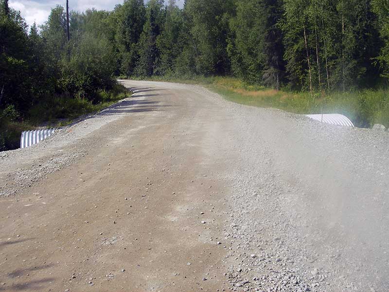
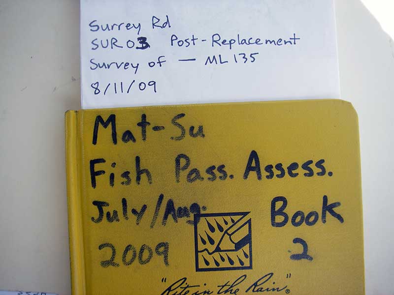
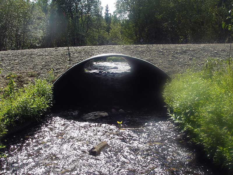
Road Name: Surrey Road
Datum: WGS84
Quad Name / ITM: Anchorage C-7
AWC Stream #:
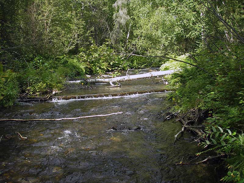
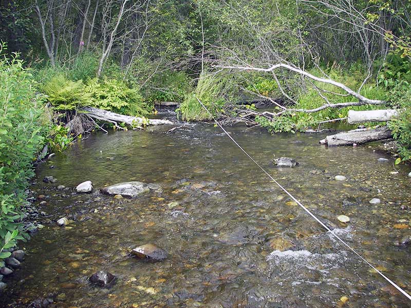
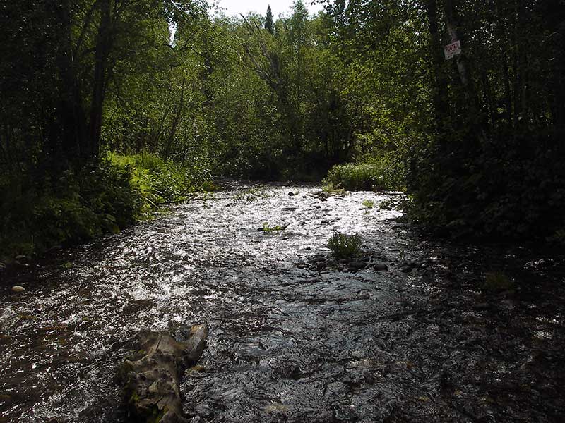
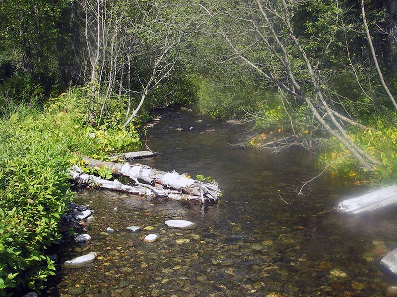
Stream Name: Cottonwood Creek Trib
Elevation:
Site Comments: None
arrow to the right of the survey date below to choose a different report for this site.
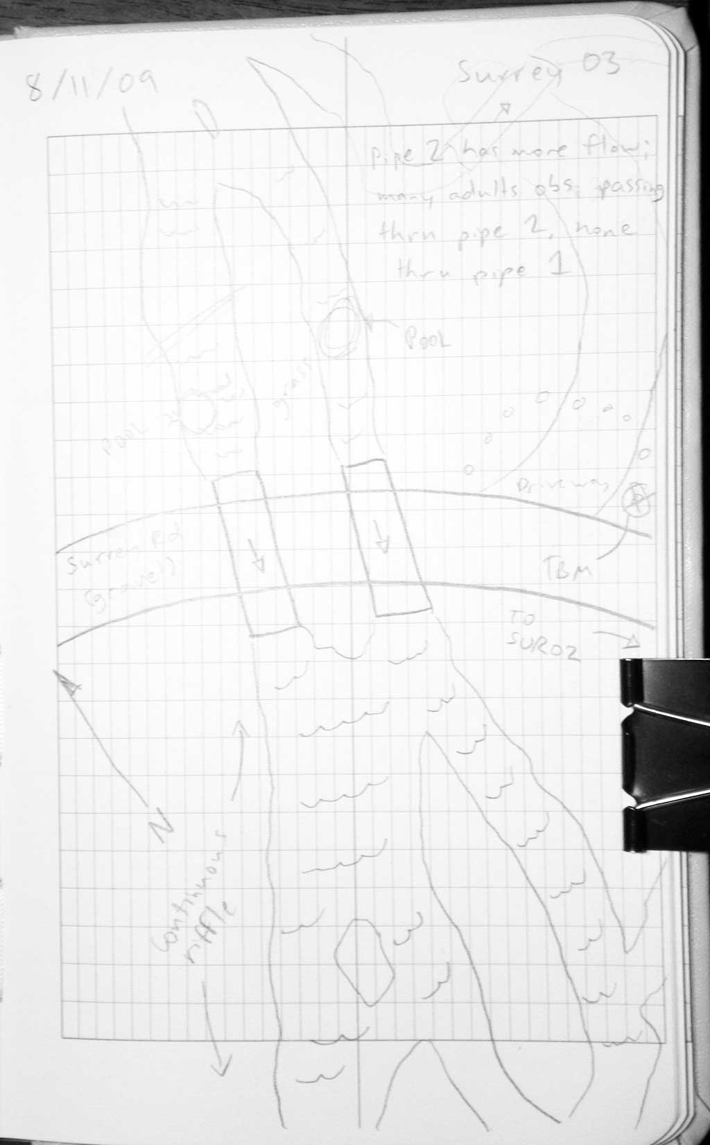
Survey MSB09-SUR03
Project Supervisor: Gillian O'Doherty, ADFG
Observers: Heidi Zimmer, Ben Histand
Overall Fish Passage Rating:
Tidal: No
Backwatered: No
Step Pools: Maybe
Construction Year: 2007
Site Observations:
- Shallow fill; inadequate roadfill volume above culvert
Comments: No channel widths because anas. channel.. Post-replacement survey of MS135 (USFWS id not ADFG); coho adults swimming upstream.
Culvert Measurements
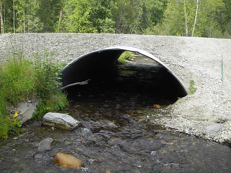
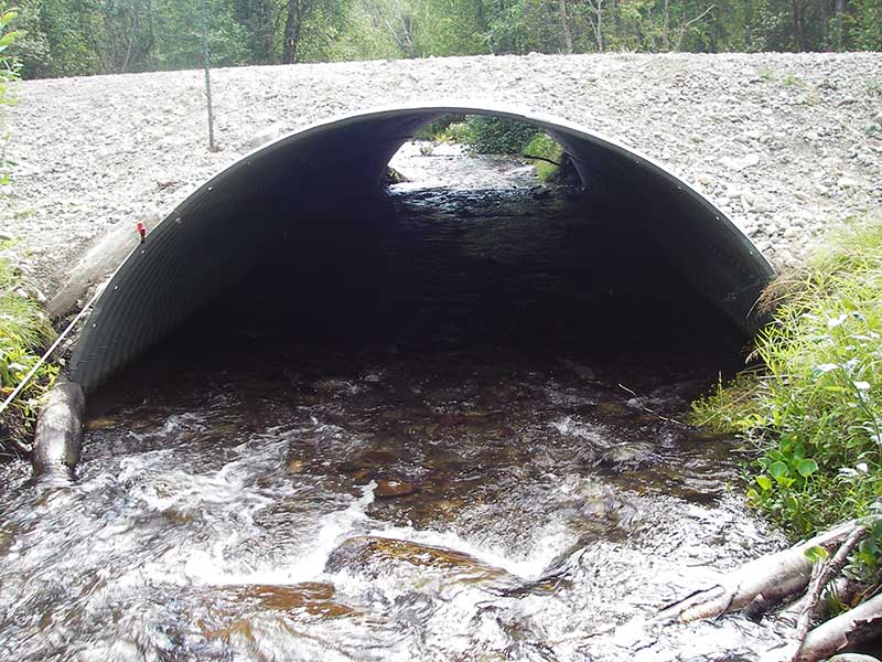
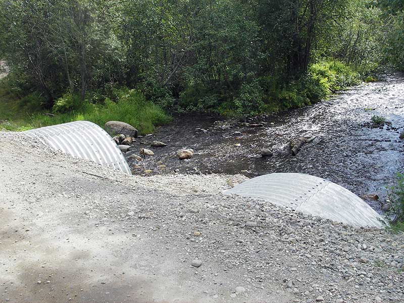
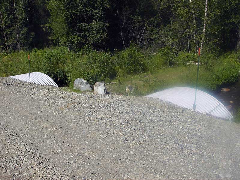
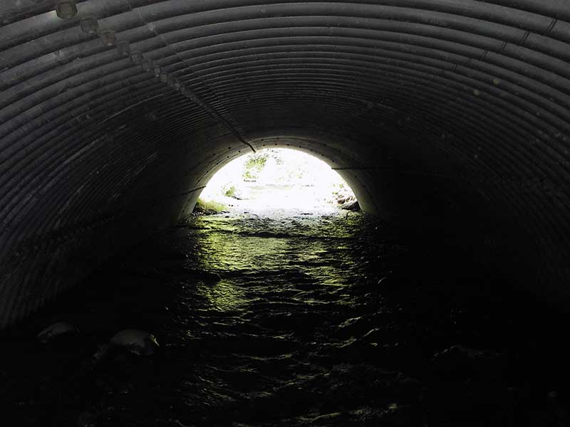
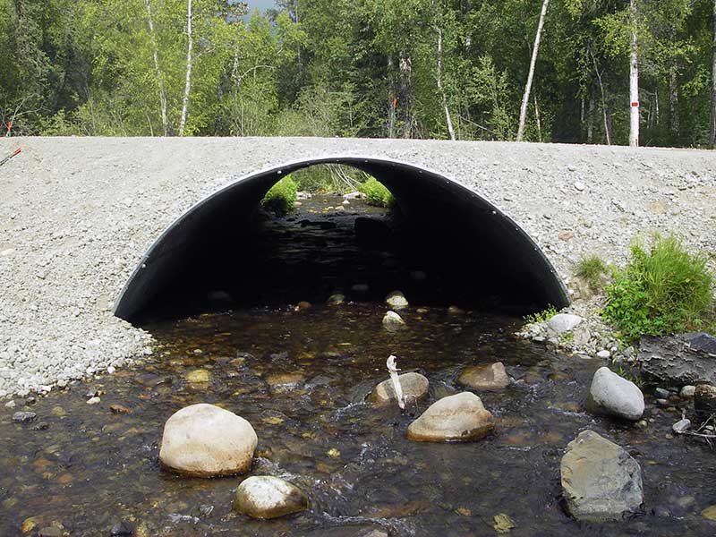
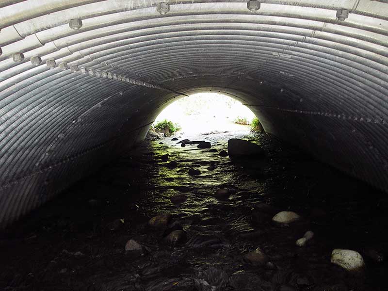
| ID: 1 | Structure Type: Open-bottom arch (Structural steel plate) | Fish Passage Rating: | |||||||||||||||||||||||||||||||||||||||||
|
|
|
|||||||||||||||||||||||||||||||||||||||||
Comments: Upstream stream grade = 1.11%. Uniform riffle in pipe; |
|||||||||||||||||||||||||||||||||||||||||||
Culvert Observations:
|
|||||||||||||||||||||||||||||||||||||||||||
| ID: 2 | Structure Type: Open-bottom arch (Structural steel plate) | Fish Passage Rating: | |||||||||||||||||||||||||||||||||||||||||
|
|
|
|||||||||||||||||||||||||||||||||||||||||
Comments: u/s grade = 1.95% Uniform riffle in pipe. pipe slope calc'd based on inverts |
|||||||||||||||||||||||||||||||||||||||||||
Culvert Observations:
|
|||||||||||||||||||||||||||||||||||||||||||
Stream Measurements
|
|
| Stream Width Type | Distance From Crossing (ft) |
Stream Width (ft) |
|---|---|---|
| Upstream ordinary high water | ||
| Upstream ordinary high water | ||
| Upstream ordinary high water | ||
| Upstream ordinary high water | ||
| Upstream ordinary high water | ||
| Upstream ordinary high water |
Elevations
| Locator ID | Culvert Number |
River Distance (ft)1 |
Distance From Crossing (ft)2 |
Relative Elevation (ft) |
|---|---|---|---|---|
| Road Elev | 102.39 | |||
| D/S Water Surface Elev (d/s in thalweg of main channel) | 0.00 | 103.0 | 92.64 | |
| D/S Thalweg (d/s of pipe 2) | 2 | 98.00 | 5.0 | 94.95 |
| D/S Tailcrest or 1st Thalweg | 1 | 101.00 | 2.0 | 95.37 |
| D/S Water Surface Elev (ws @ TWC) | 1 | 101.00 | 2.0 | 95.70 |
| Outlet Pool Water Elev | 2 | 103.00 | 95.71 | |
| Outlet Pool Water Elev | 1 | 103.00 | 95.70 | |
| Outlet Invert | 2 | 103.00 | 0.0 | 95.08 |
| Outlet Invert | 1 | 103.00 | 0.0 | 95.26 |
| Inlet Culvert Invert (on subs) | 1 | 153.90 | 0.0 | 96.42 |
| U/S Headwater | 1 | 153.90 | 96.70 | |
| U/S Headwater | 2 | 154.00 | 96.60 | |
| Inlet Culvert Invert | 2 | 154.00 | 0.0 | 96.22 |
| U/S Grade Ctrl (Thalweg) (u/s of pipe 2) | 2 | 226.00 | 72.0 | 98.26 |
| U/S Water Surface Elev | 2 | 226.00 | 72.0 | 98.66 |
| U/S Water Surface Elev (ws @ gp) | 1 | 257.90 | 104.0 | 98.73 |
| U/S Grade Ctrl (Thalweg) (u/s of pipe 1) | 1 | 257.90 | 104.0 | 98.09 |
| U/S Water Surface Elev | 2 | 268.00 | 114.0 | 99.13 |
| U/S Grade Ctrl (Thalweg) (u/s of pipe 2) | 2 | 268.00 | 114.0 | 98.50 |
Notes:
- River distance is measured continuously throughout the survey reach along the thalweg of the stream.
- Measured from each end of the crossing along the thalweg of the stream.
Fish Sampling Efforts
| Gear Type: Visual Observation, Ground (A) | ||
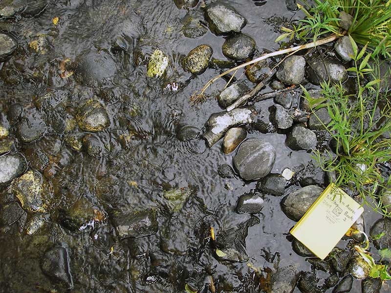
| Comments: Visual observation of many adult Coho salmon swimming upstream from culvert. | ||
Fish Observations
No fish observations occurred during this survey.
Photos
Questions or comments about this report can be directed to dfg.dsf.webmaster@alaska.gov