Fish Passage Site 20400592
Coordinates (dec. deg.): 61.73861°, -148.90591°
Legal Description: S019N003E15
Region: South Central
Road Name: Jonesville Mine Road
Datum: NAD83
Quad Name / ITM: Anchorage C-6
AWC Stream #:
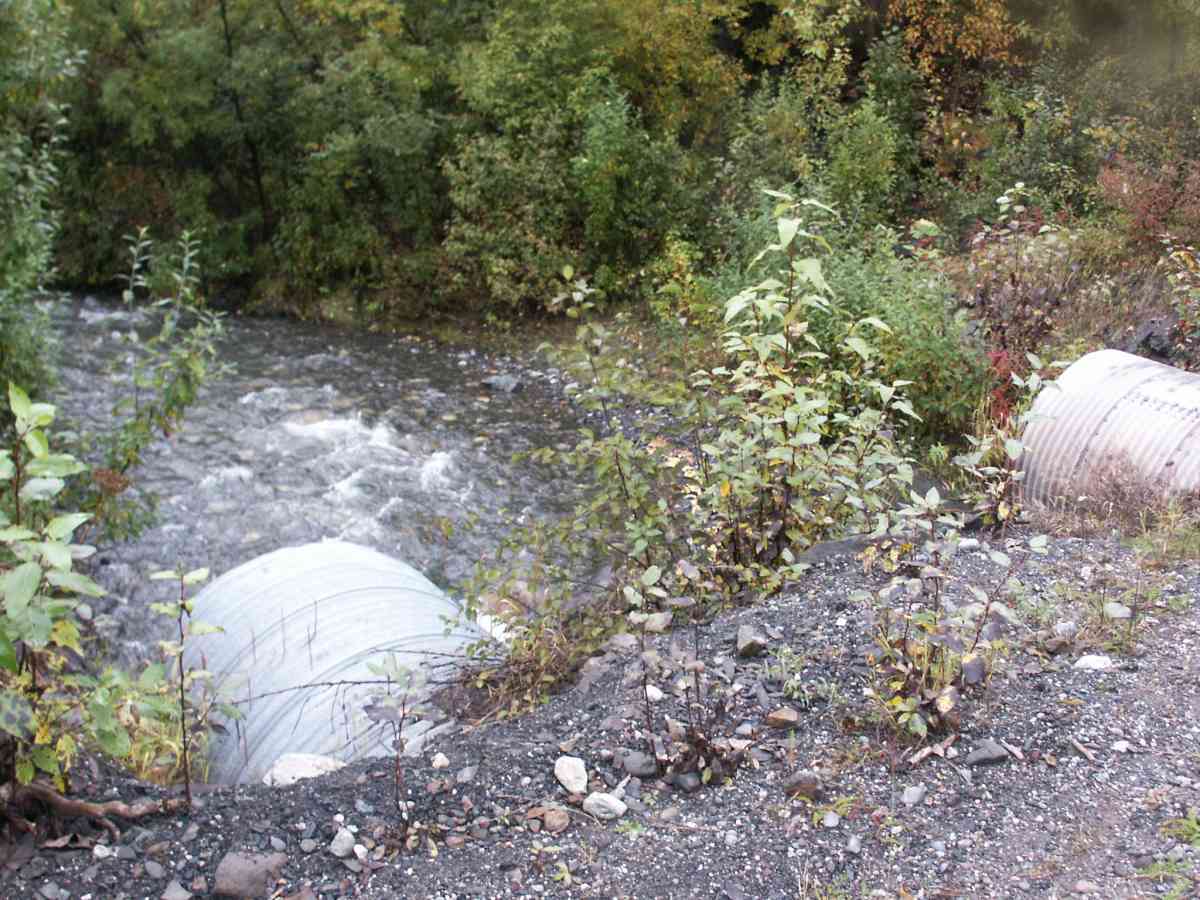
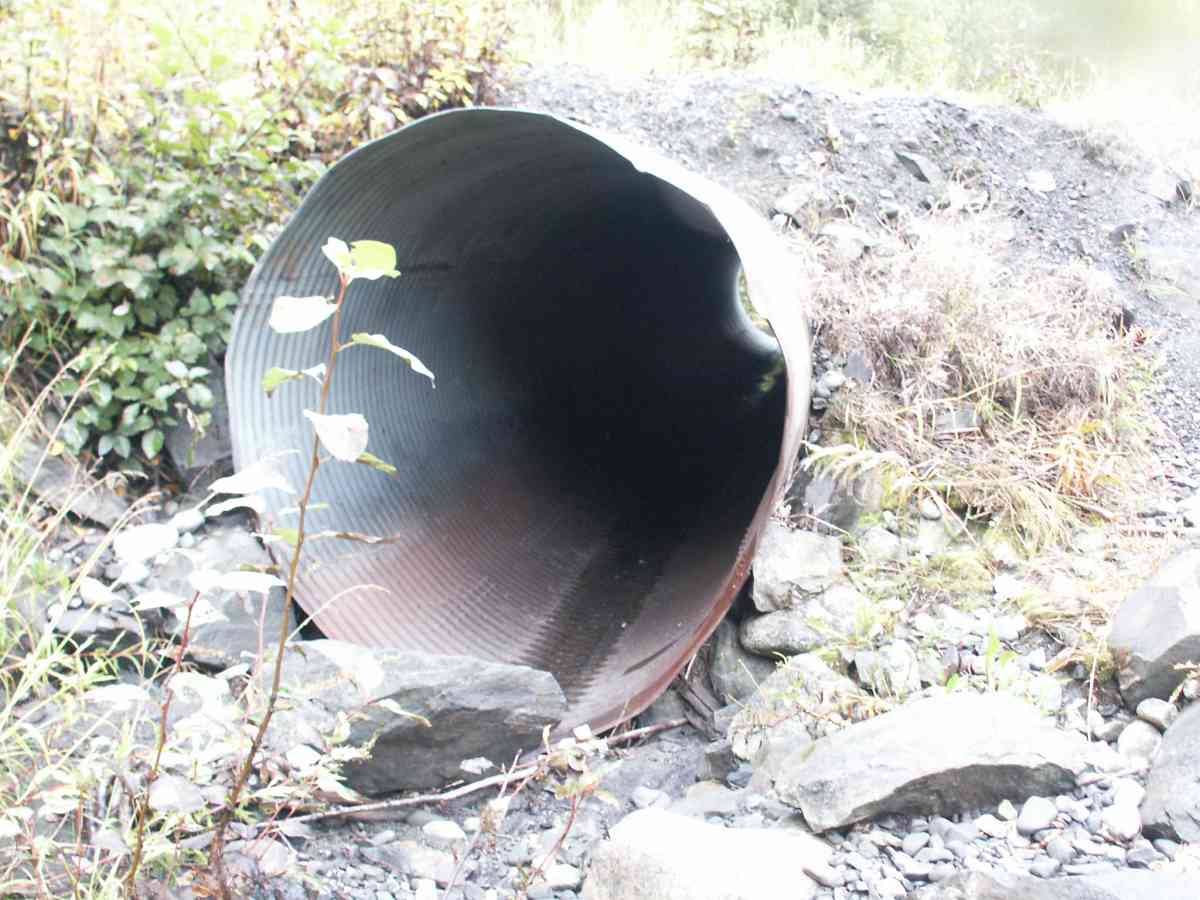
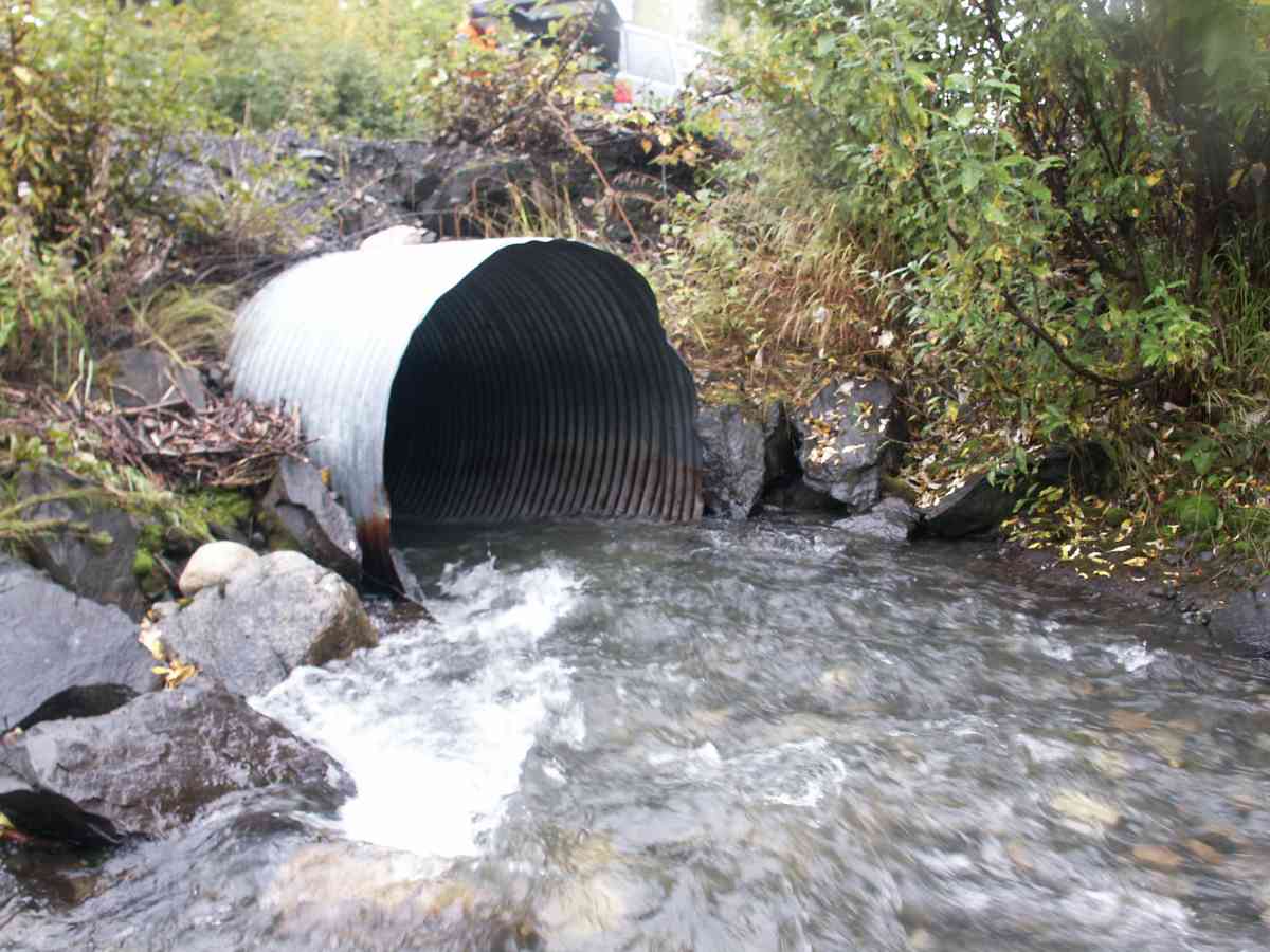
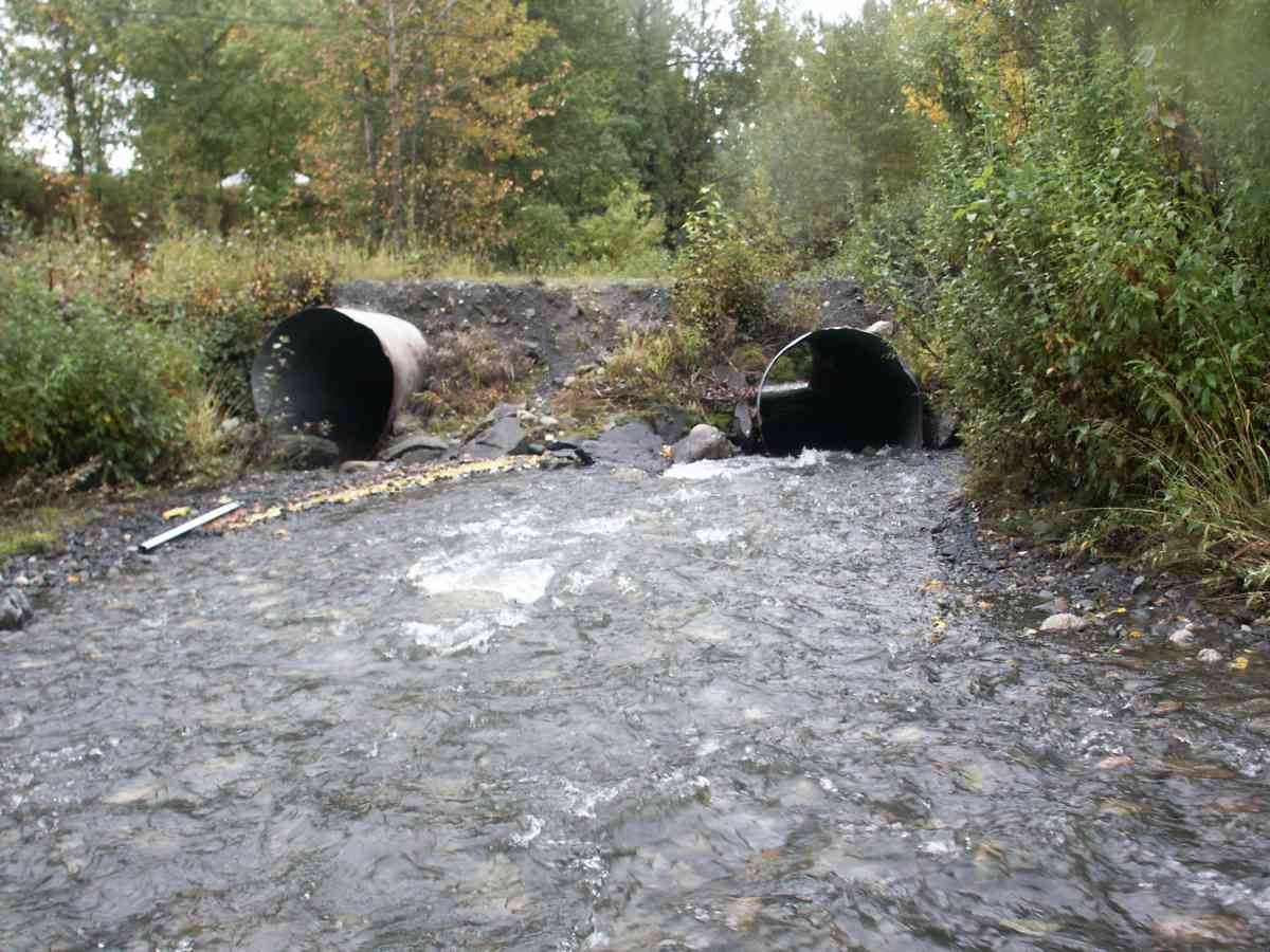
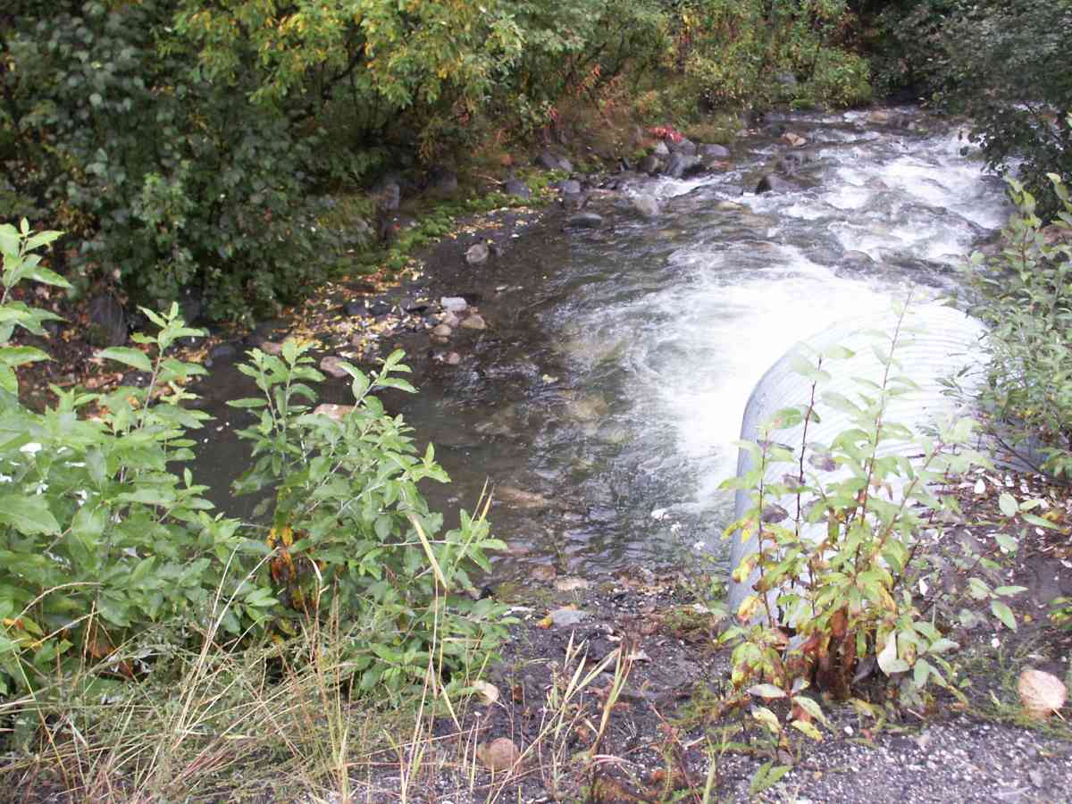
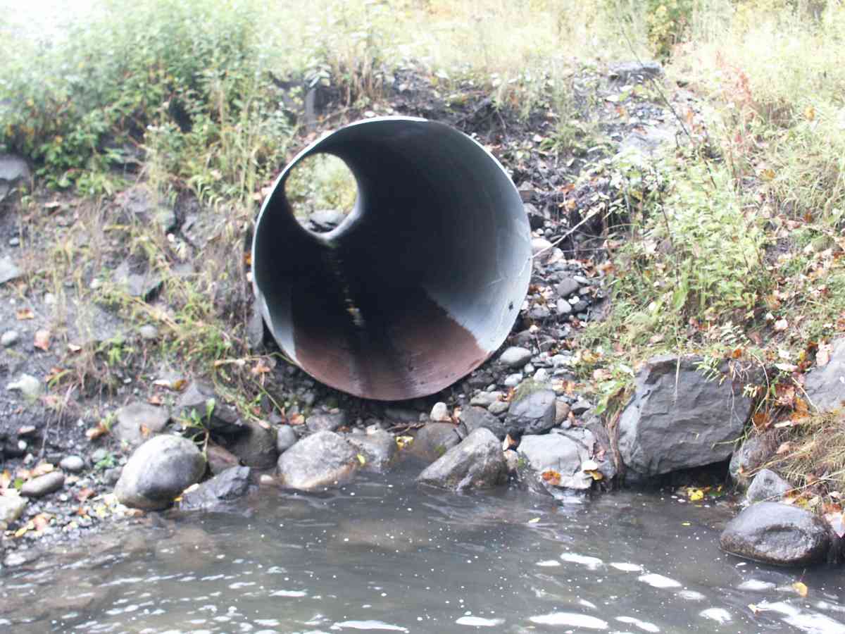
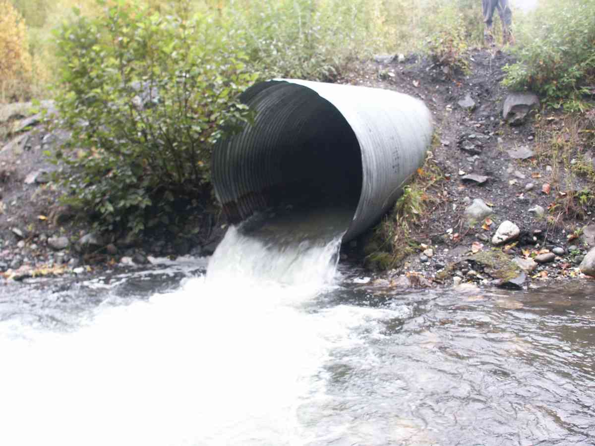
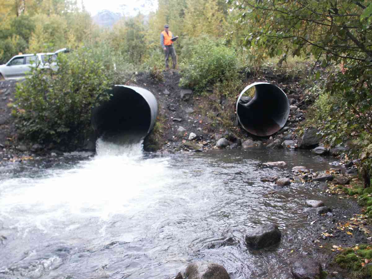
Stream Name: Eska Creek
Elevation:
Site Comments: At end of DOT maintained road on Eska Creek mainstem, 2nd crossing upstream. Replaced in 2011.
arrow to the right of the survey date below to choose a different report for this site.
Survey CRB02-JV270
Observers: Dean Beers, James Laurence, James Laurence
Overall Fish Passage Rating:
Tidal: No
Backwatered: No
Step Pools:
Construction Year:
Comments: None
Culvert Measurements
| ID: 1 | Structure Type:N/A | Fish Passage Rating: | |||||||||||||||||||||||||||||||||||||||||
|
|
|
|||||||||||||||||||||||||||||||||||||||||
| ID: 2 | Structure Type:N/A | Fish Passage Rating: | |||||||||||||||||||||||||||||||||||||||||
|
|
|
|||||||||||||||||||||||||||||||||||||||||
Stream Measurements
|
|
| Stream Width Type | Distance From Crossing (ft) |
Stream Width (ft) |
|---|---|---|
| Upstream ordinary high water | 50.0 | 29.00 |
| Upstream ordinary high water | 75.0 | 25.00 |
| Upstream ordinary high water | 100.0 | 17.00 |
Elevations
| Locator ID | Culvert Number |
River Distance (ft)1 |
Distance From Crossing (ft)2 |
Relative Elevation (ft) |
|---|---|---|---|---|
| Outlet Thalweg | 1 | 0.00 | 0.0 | 86.71 |
| Outlet Invert | 1 | 0.00 | 0.0 | 87.60 |
| Outlet Invert | 2 | 0.00 | 0.0 | 93.27 |
| Inlet Culvert Top | 2 | 58.00 | 0.0 | 94.90 |
| Inlet Thalweg | 2 | 58.00 | 0.0 | 88.56 |
| Inlet Culvert Invert | 1 | 58.00 | 0.0 | 90.22 |
| Inlet Thalweg | 1 | 58.00 | 0.0 | 90.22 |
Notes:
- River distance is measured continuously throughout the survey reach along the thalweg of the stream.
- Measured from each end of the crossing along the thalweg of the stream.
Fish Sampling Efforts
No fish sampling occurred during this survey.
Fish Observations
No fish observations occurred during this survey.
Photos
Questions or comments about this report can be directed to dfg.dsf.webmaster@alaska.gov