Location
- Latitude: 60.704513
- Longitude: -151.295714
- USGS Map: KENAI C-4
- Elevation (m): 44
- MTRS: S007N012W12
- Management Area: Kenai (Upper Kenai Peninsula)
Access
- Latitude: 60.704513
- Longitude: -151.295714
- Directions: Mile 94.3 Sterling Hwy. North on Kenai Spur Hwy. 25.8 miles to Island Lake Road. Right on Island Lake Rd. 2.3 miles to Pipeline Road. Left on Pipeline Rd. 0.7 mile to Moose Run Road. Left on Moose Run Rd. 0.8 mile to Estes Rd. Left on Estes Rd. to limited parking in cul-de-sac, sandy boat launch area. NOTE: Please respect property. Keep lake and access sites free of litter.
- Improvements:
- boat launch
- Status: Road ROW
Lake Characteristics
- Surface Area (ha): 108.5
- Bathymetric Map: island.gif
- Lake Category: Landlocked
- Maximum Depth (m): 9.4
- Most Recent Survey Date: 8/28/1961
Photos
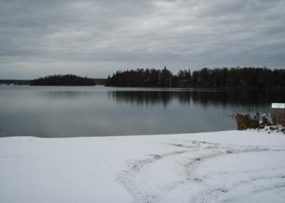
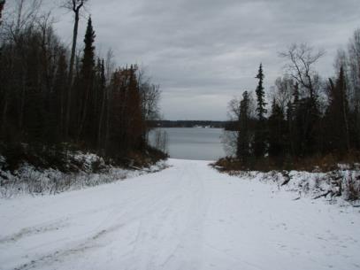
Download Linked Documents
- Island Lake site evaluation.pdf
- 2000-2007_Lake_Assessment_ Report.pdf
- Island_Historic_Fish_Sampling_Summary.pdf
- Island_Historic_Lake_Survey_Summary.pdf
- Island_Historic_Misc.pdf
- Island_Historic_Fish_Stocking_Record.pdf
- Island_Historic_Net_Record.pdf
- Island_Historic_Water_Analysis.pdf
- Island_Historic_Bathymetric_Map.pdf
- Island_Historic_Temp_Profile.pdf
- Island_Brochure_2022.pdf