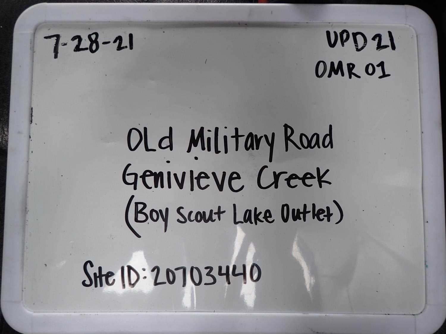
Fish Passage Site 20703440
Coordinates (dec. deg.): 57.76481°, -152.48702°
Legal Description: S028S020W11
Region: Southwest
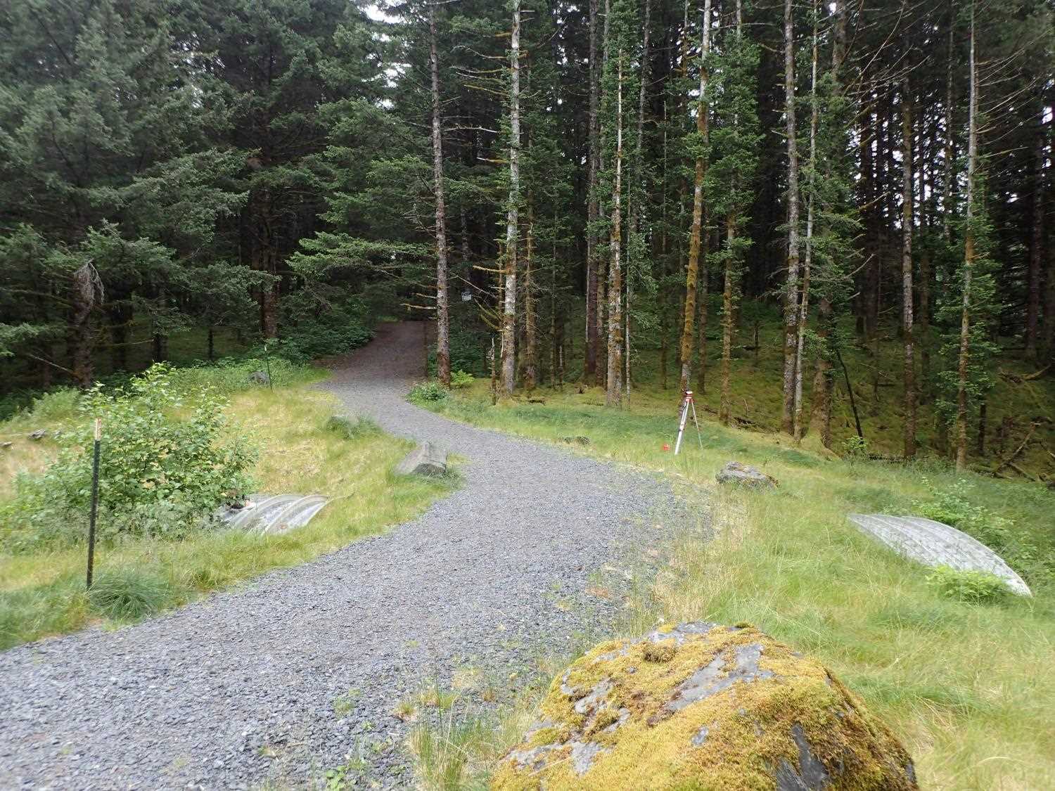
Road Name: Old Military Road
Datum: WGS84
Quad Name / ITM: Kodiak D-2
AWC Stream #: 259-21-10120-2006-3050
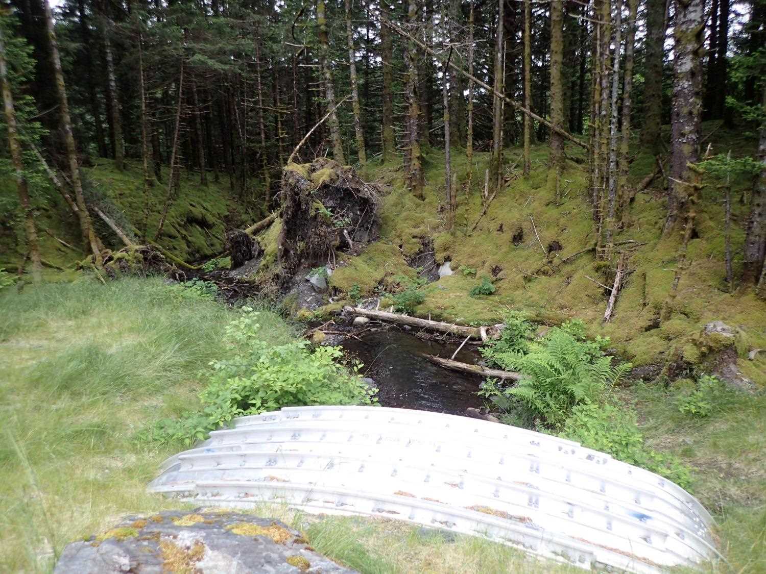
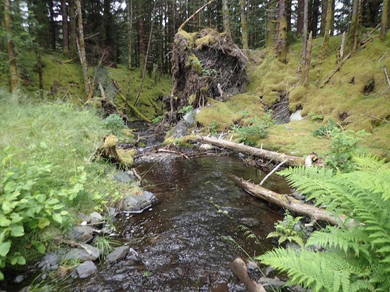
Stream Name: Genivieve Creek
Elevation:
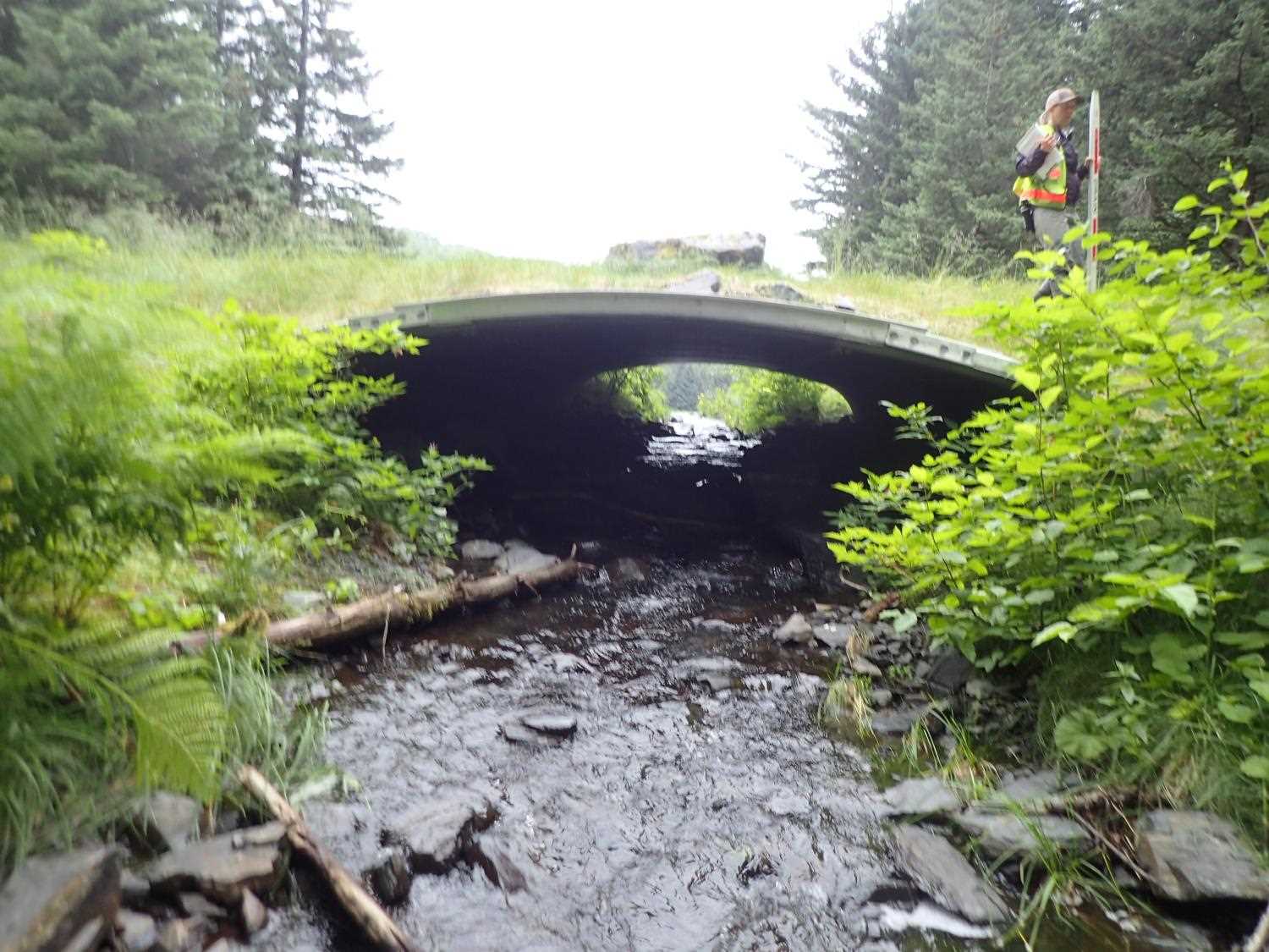
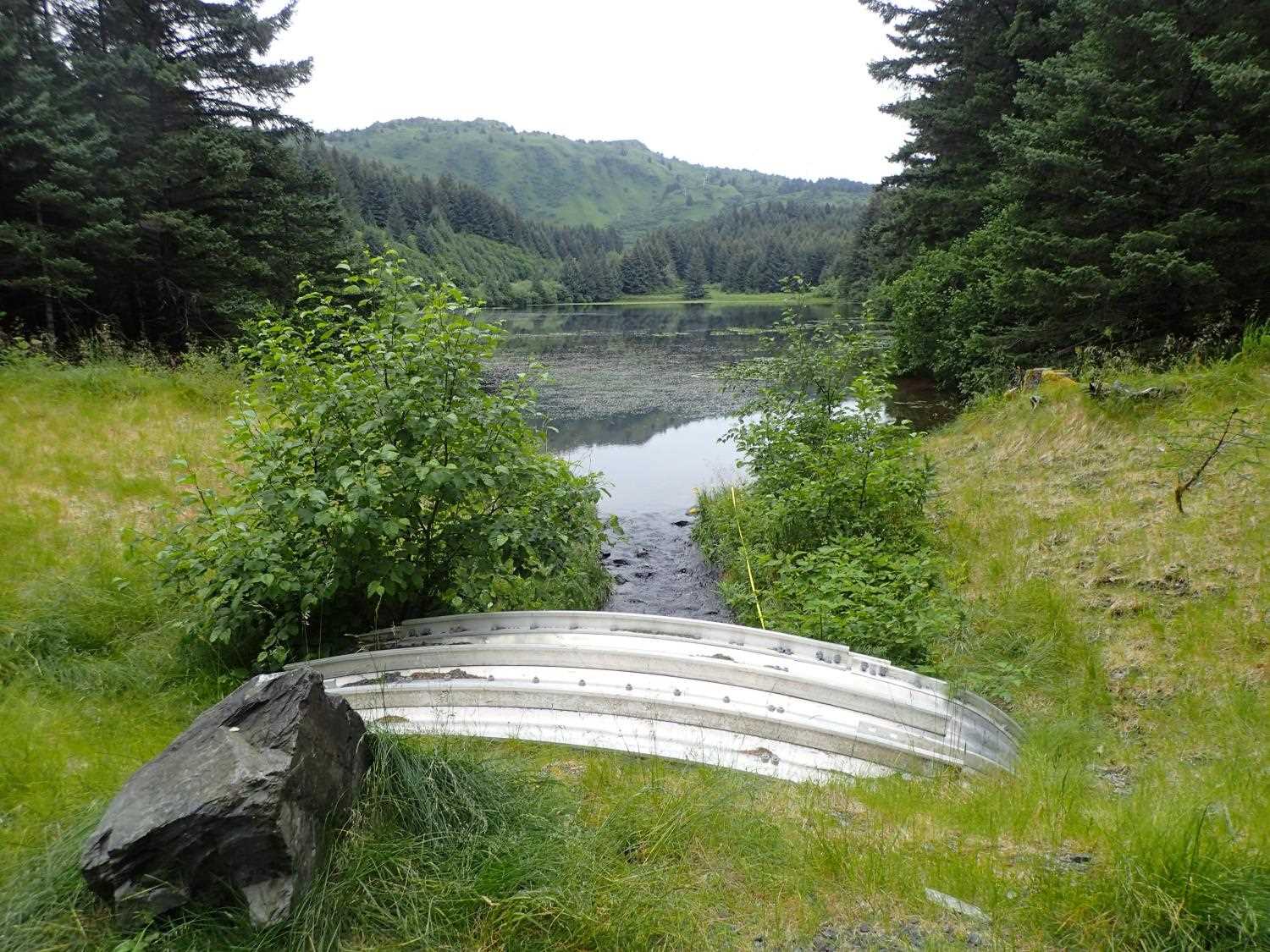
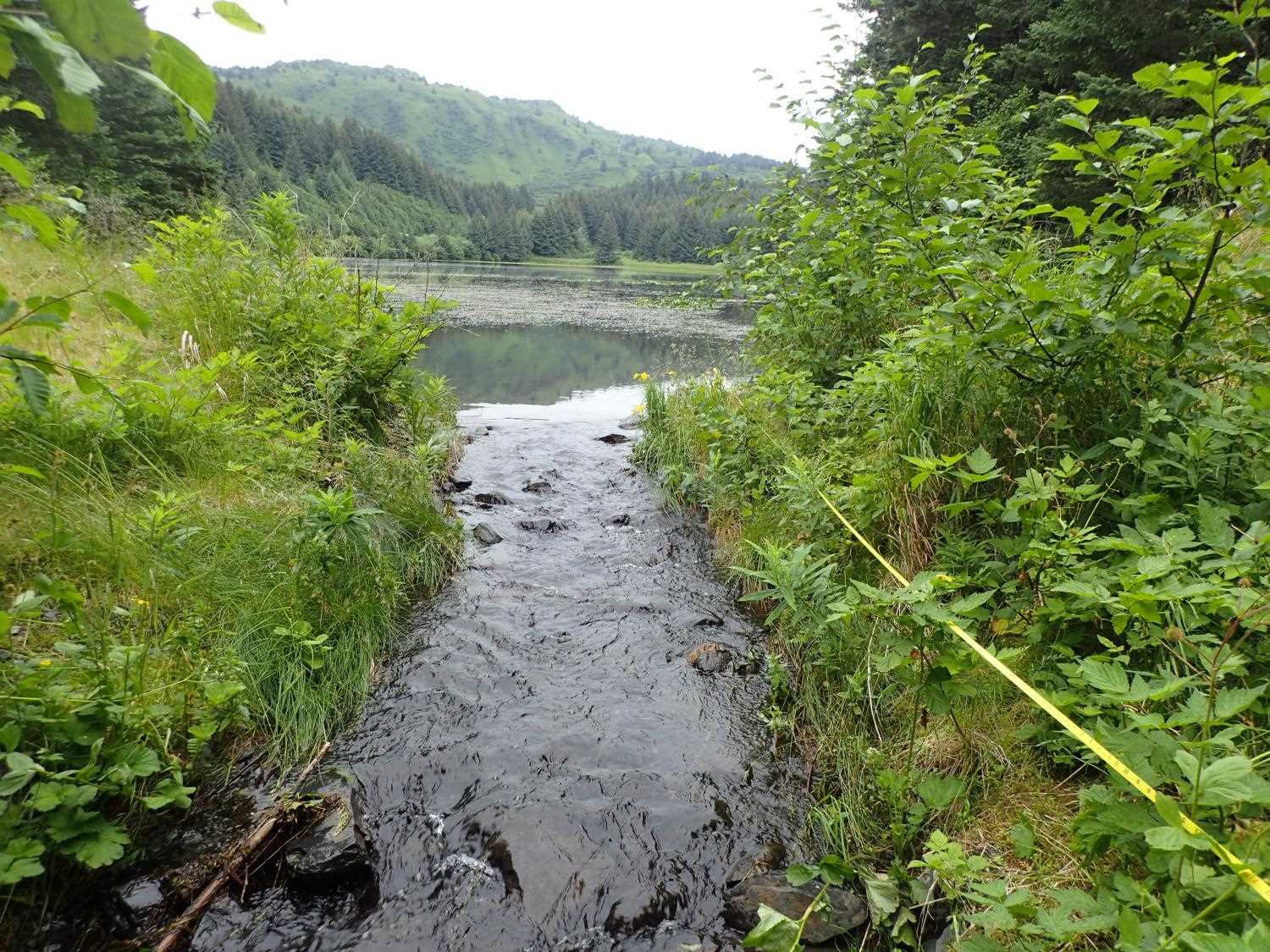
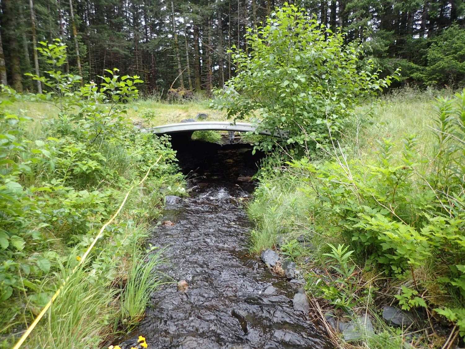
Site Comments: This is an old road converted to a trail over the outlet of Boy Scout Lake.
arrow to the right of the survey date below to choose a different report for this site.
Survey UPD21-OMR01
Project Supervisor: Kim Clark, ADFG
— Anchorage, AK
Observers: Kim Clark, Michael Mazzacavallo
Overall Fish Passage Rating:
Tidal: No
Backwatered: No
Step Pools: No
Construction Year: 2018
Comments: There is a lake 28 feet upstream of the culvert. Sandbag still present near lake/creek transition. Upstream stream slope is 0, downstream is 5.77%.
Culvert Measurements
| ID: 1 | Structure Type: Box culvert (Structural aluminum plate) | Fish Passage Rating: | ||||||||||||||||||||||||||||||||||||||||||
|
|
|
||||||||||||||||||||||||||||||||||||||||||
Comments: Culvert is at a lake outlet. Measured culvert gradient is Top: 4.12%, Water surface: 5.34%, and Invert 4.12%. Culvert dimensions per design are 16'6" x 6'8" |
||||||||||||||||||||||||||||||||||||||||||||
Stream Measurements
|
|
| Stream Width Type | Distance From Crossing (ft) |
Stream Width (ft) |
|---|---|---|
| Downstream ordinary high water | 59.0 | 9.80 |
| Downstream ordinary high water | 85.0 | 6.20 |
| Downstream ordinary high water | 98.0 | 7.20 |
Elevations
| Locator ID | Culvert Number |
River Distance (ft)1 |
Distance From Crossing (ft)2 |
Relative Elevation (ft) |
|---|---|---|---|---|
| D/S Water Surface Elev (tailwater control) | 0.00 | 90.11 | ||
| D/S Thalweg (tailwater control) | 0.00 | 89.86 | ||
| D/S Water Surface Elev (pool water surface) | 3.00 | 90.07 | ||
| D/S Thalweg (pool depth) | 3.00 | 89.19 | ||
| D/S Thalweg (on wood) | 6.00 | 90.25 | ||
| D/S Water Surface Elev | 6.00 | 90.44 | ||
| D/S Thalweg (tailwater control, head of riffle) | 40.00 | 92.07 | ||
| D/S Water Surface Elev | 40.00 | 92.13 | ||
| D/S Water Surface Elev | 43.00 | 92.20 | ||
| D/S Thalweg | 43.00 | 91.59 | ||
| D/S Water Surface Elev | 44.00 | 92.43 | ||
| D/S Thalweg (on wood) | 44.00 | 92.44 | ||
| D/S Thalweg | 71.00 | 92.91 | ||
| D/S Water Surface Elev | 71.00 | 93.36 | ||
| D/S Thalweg (pool tailwater control) | 82.00 | 94.46 | ||
| D/S Water Surface Elev | 82.00 | 94.87 | ||
| D/S Water Surface Elev | 89.00 | 94.92 | ||
| D/S Thalweg (max pool depth) | 89.00 | 94.08 | ||
| D/S Thalweg | 95.00 | 94.76 | ||
| D/S Water Surface Elev | 95.00 | 95.02 | ||
| D/S Water Surface Elev | 103.00 | 95.21 | ||
| Outlet Culvert Top (on rib) | 103.00 | 100.00 | ||
| Outlet Invert | 103.00 | 94.83 | ||
| Inlet Culvert Top | 139.17 | 101.49 | ||
| Inlet Culvert Invert | 139.17 | 96.78 | ||
| U/S Water Surface Elev | 139.17 | 97.14 | ||
| U/S Thalweg (top of grade control) | 149.17 | 97.46 | ||
| U/S Water Surface Elev | 149.17 | 97.65 | ||
| U/S Thalweg (head of riffle) | 166.17 | 97.92 | ||
| U/S Water Surface Elev | 166.17 | 98.19 | ||
| U/S Water Surface Elev (lake water surface) | 172.17 | 98.21 | ||
| U/S Thalweg (in the lake) | 172.17 | 97.28 |
Notes:
- River distance is measured continuously throughout the survey reach along the thalweg of the stream.
- Measured from each end of the crossing along the thalweg of the stream.
Fish Sampling Efforts
No fish sampling occurred during this survey.
Fish Observations
No fish observations occurred during this survey.
Photos


Questions or comments about this report can be directed to dfg.dsf.webmaster@alaska.gov