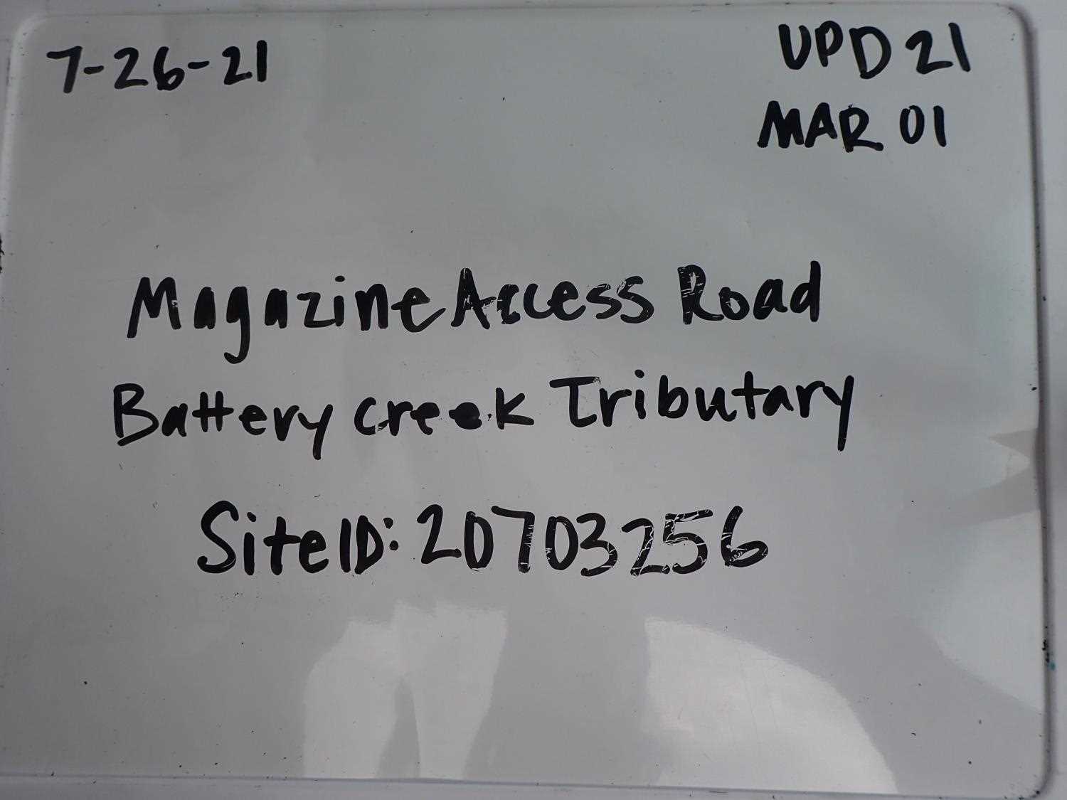
Fish Passage Site 20703256
Coordinates (dec. deg.): 57.76839°, -152.53979°
Legal Description: S028S020W09
Region: Southwest
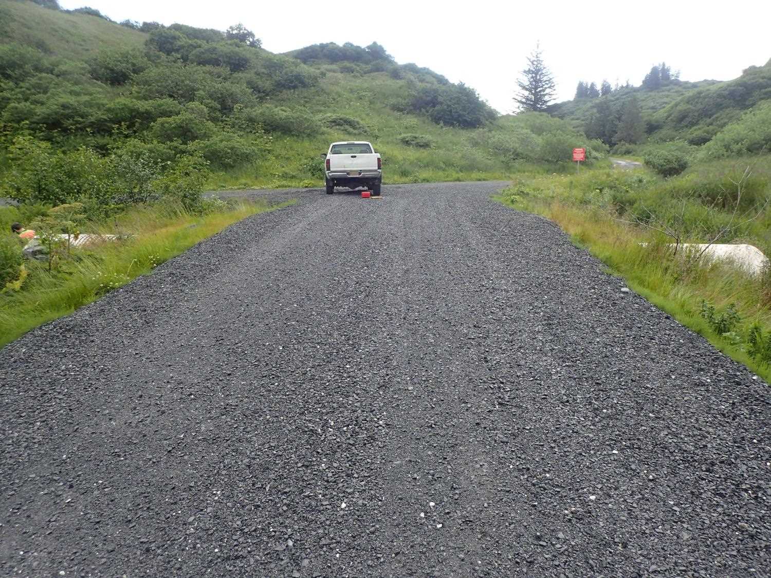
Road Name: Magazine Access Road
Datum: WGS84
Quad Name / ITM: Kodiak D-2
AWC Stream #: 259-21-10120-2011
Stream Name: Battery Creek Tributary
Elevation:
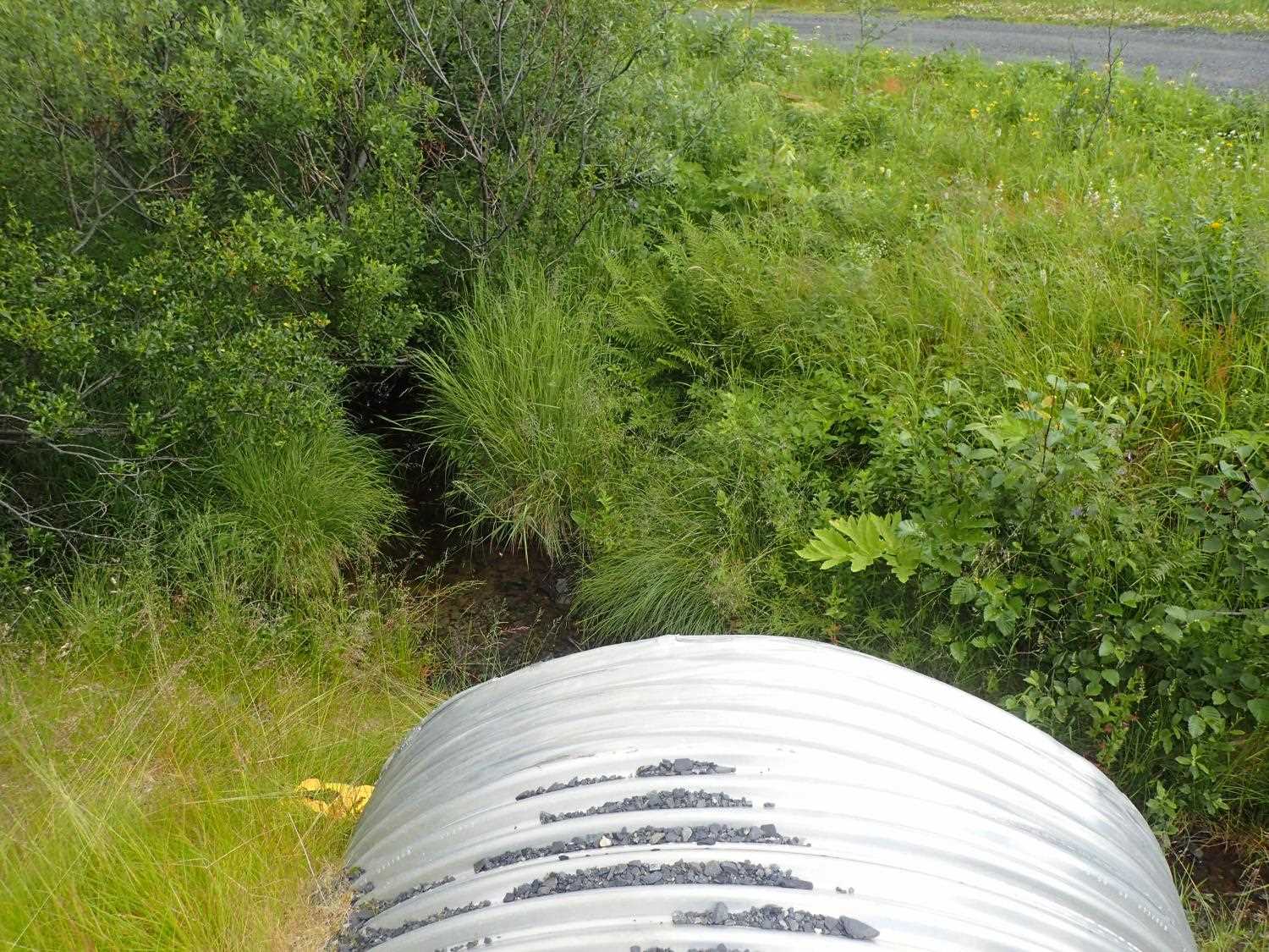
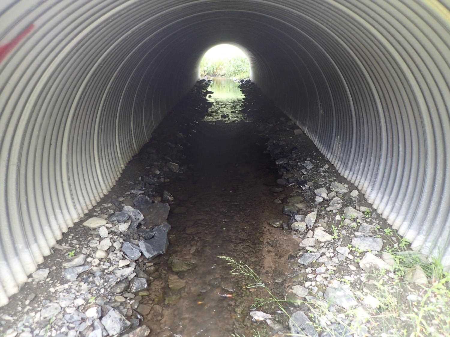
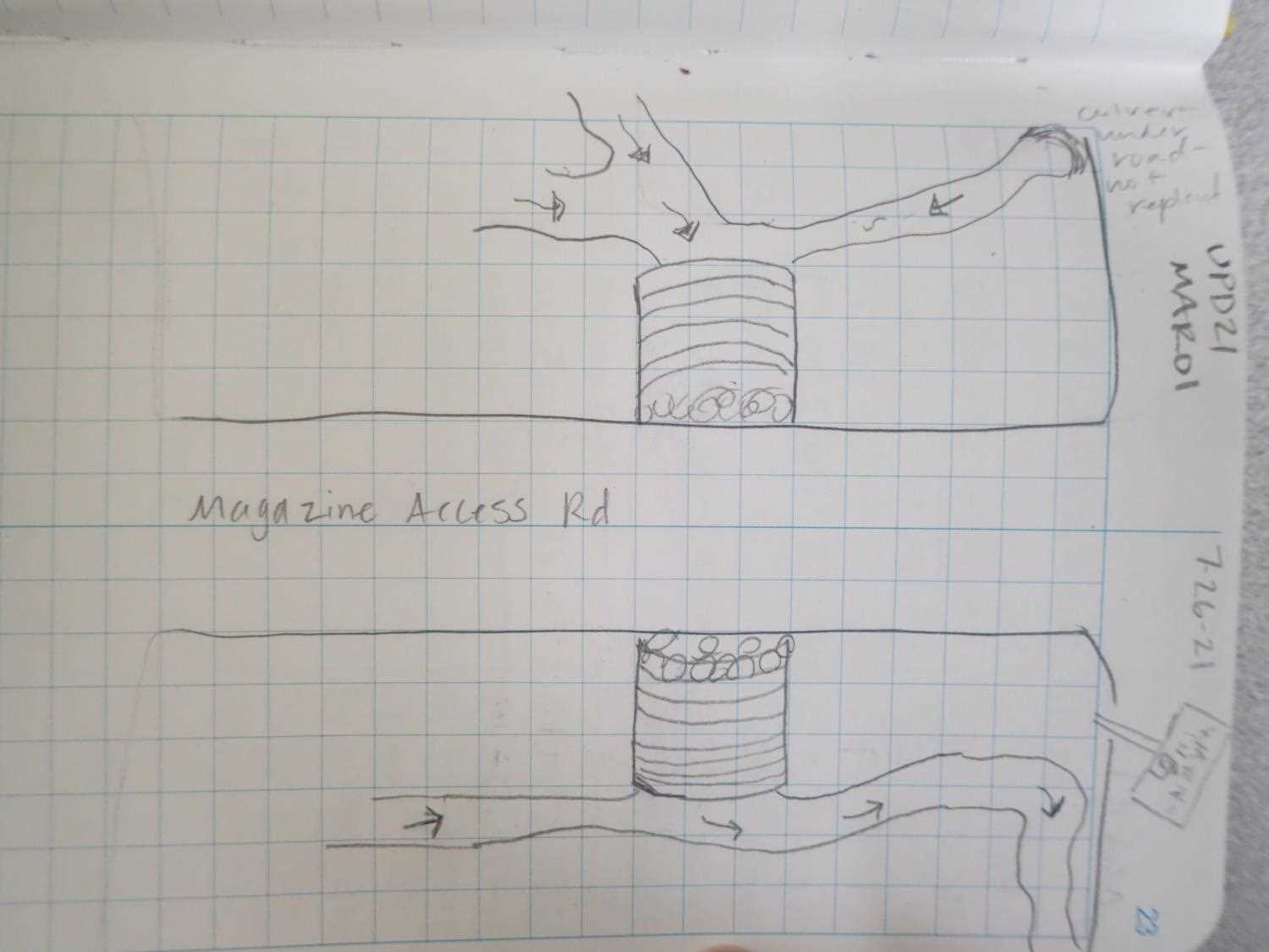
Site Comments: Culvert on the access road to two decommissioned artillery bunkers, and at the intersection with Gunnery Drive. UPD20KOD08, Site 20703257 is directly upstream from this culvert.
arrow to the right of the survey date below to choose a different report for this site.
Survey UPD21-MAR01
Project Supervisor: Kim Clark, ADFG
— Anchorage, AK
Observers: Kim Clark, Michael Mazzacavallo
Overall Fish Passage Rating:
Tidal: No
Backwatered: No
Step Pools: No
Construction Year: 2019
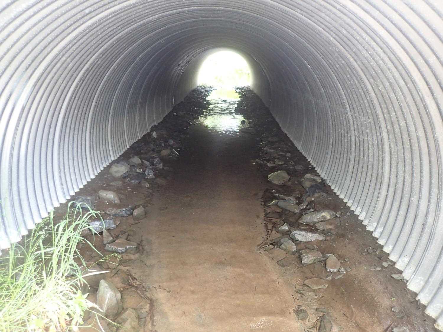
Comments: Channel is ditched on both sides. Juvenile salmonids observed in channel and in pipe. At the inlet of the culvert is a confluence of 3 channels. Small culvert upstream of inlet for drainage of adjacent road and not a fish passage pipe.
Culvert Measurements
| ID: 1 | Structure Type: Circular pipe (Corrugated aluminum) | Fish Passage Rating: | ||||||||||||||||||||||||||||||||||||||||||
|
|
|
||||||||||||||||||||||||||||||||||||||||||
Comments: Pipe gradient Top: 1.3%, Water Surface: 0.64%, Invert: 1.1% Culvert dimensins from engineering designs: 84" x 47" |
||||||||||||||||||||||||||||||||||||||||||||
Stream Measurements
|
|
| Stream Width Type | Distance From Crossing (ft) |
Stream Width (ft) |
|---|---|---|
| Downstream ordinary high water | 30.0 | 4.00 |
| Downstream ordinary high water | 55.0 | 3.70 |
| Downstream ordinary high water | 72.0 | 5.80 |
Elevations
No elevation data available.
Fish Sampling Efforts
No fish sampling occurred during this survey.
Fish Observations
No fish observations occurred during this survey.
Photos


Questions or comments about this report can be directed to dfg.dsf.webmaster@alaska.gov