Fish Passage Site 20700786
Coordinates (dec. deg.): 57.77063°, -152.52573°
Legal Description: S028S020W09
Region: Southwest
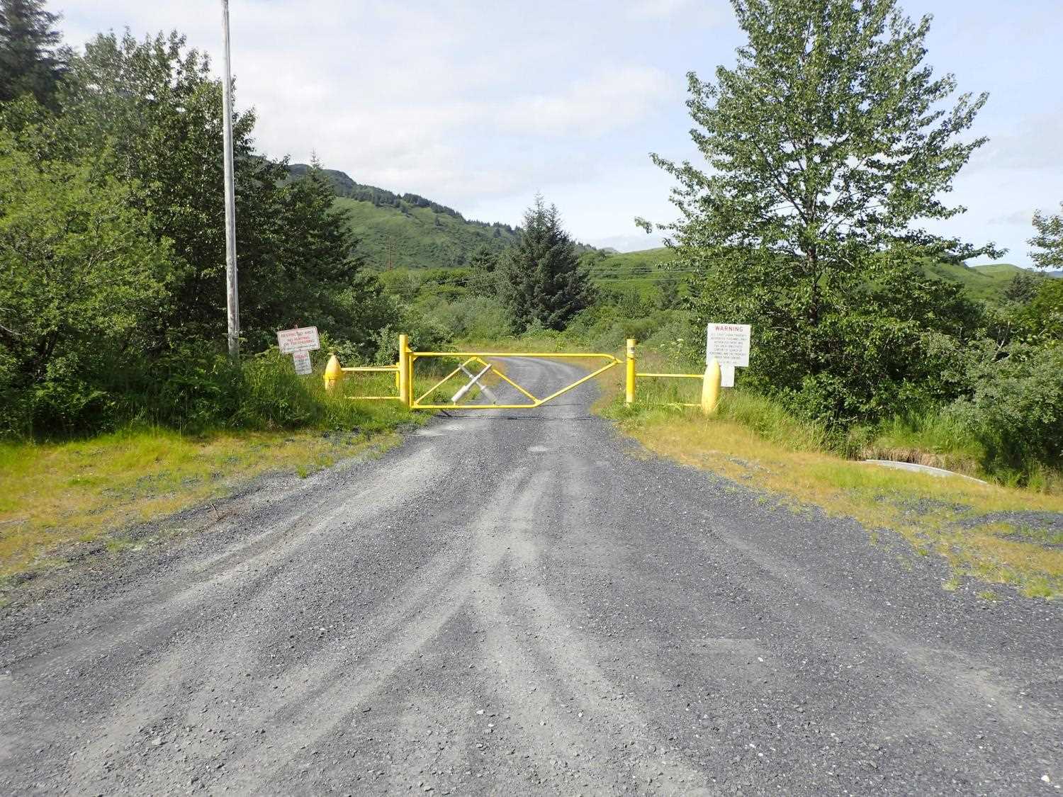
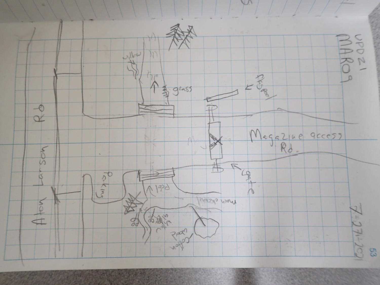
Road Name: Magazine Access Road
Datum: WGS84
Quad Name / ITM: Kodiak D-2
AWC Stream #: 259-21-10120-2011
Stream Name: Battery Creek Tributary
Elevation:
Site Comments: Site is just outside the Coast Guard gate.
arrow to the right of the survey date below to choose a different report for this site.
Survey UPD21-MAR09
Project Supervisor: Kim Clark, ADFG
— Anchorage, AK
Observers: Kim Clark, Michael Mazzacavallo
Overall Fish Passage Rating:
Tidal: No
Backwatered: No
Step Pools: No
Construction Year: 2018
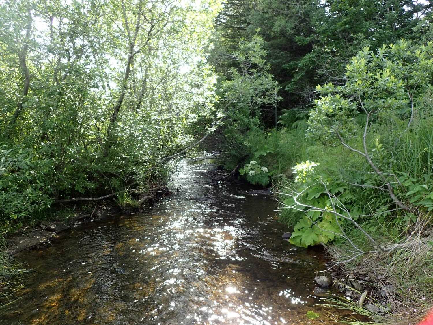
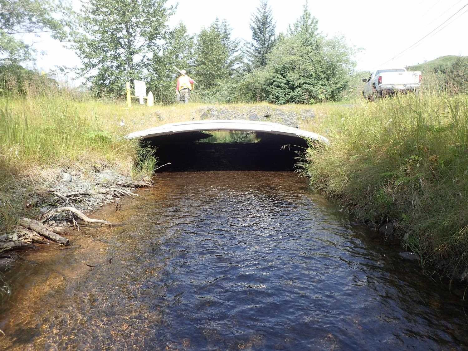
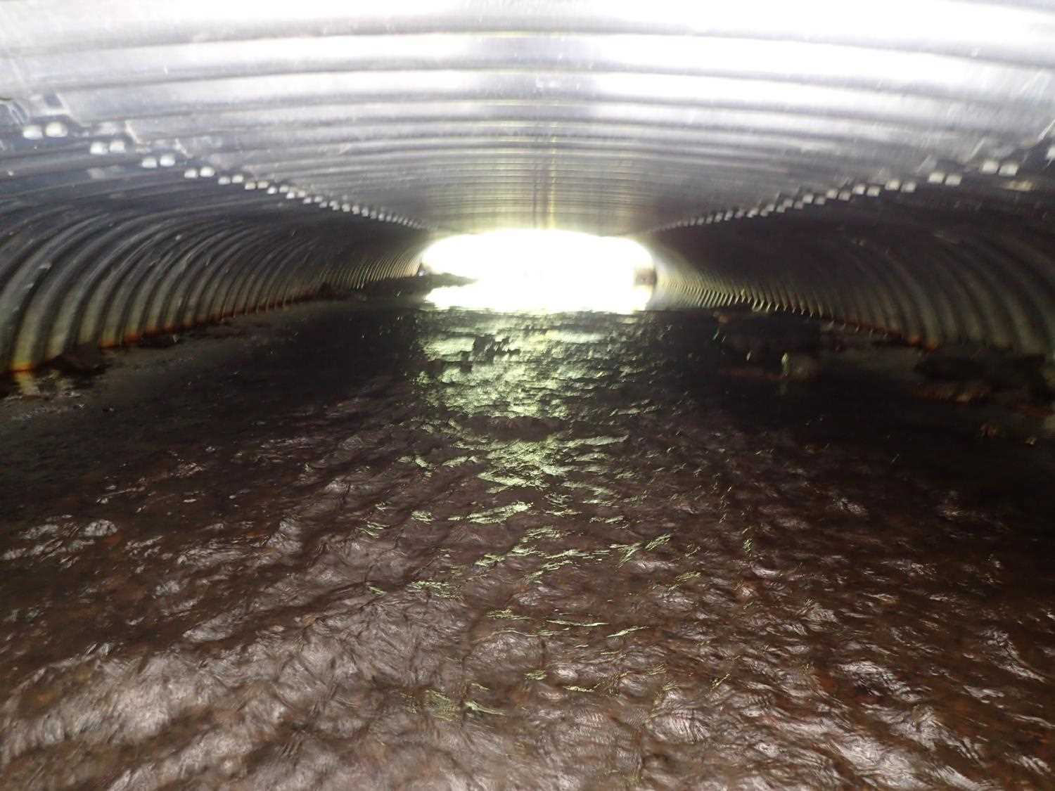
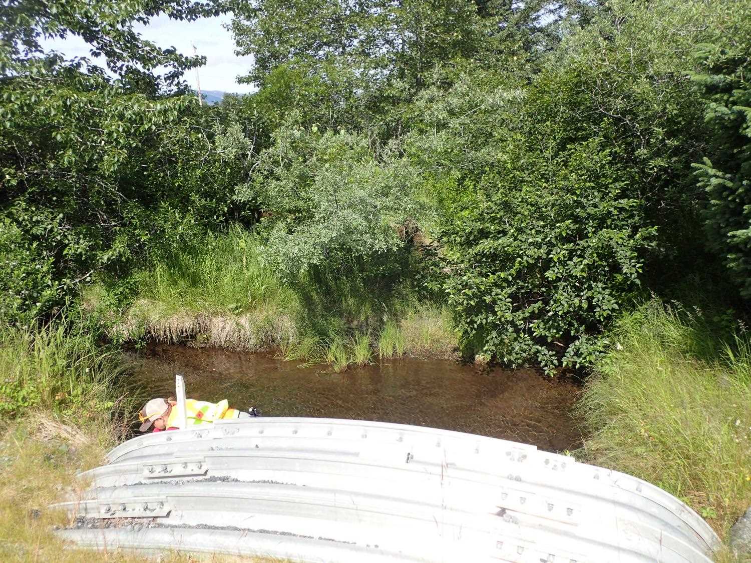
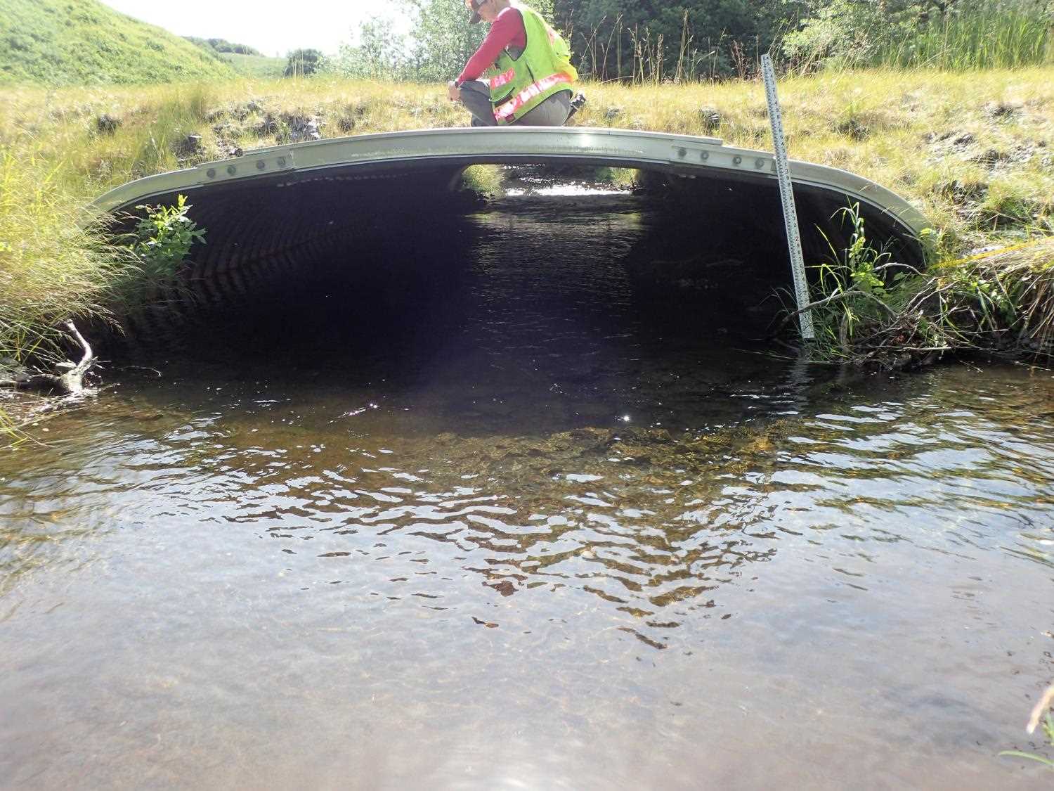
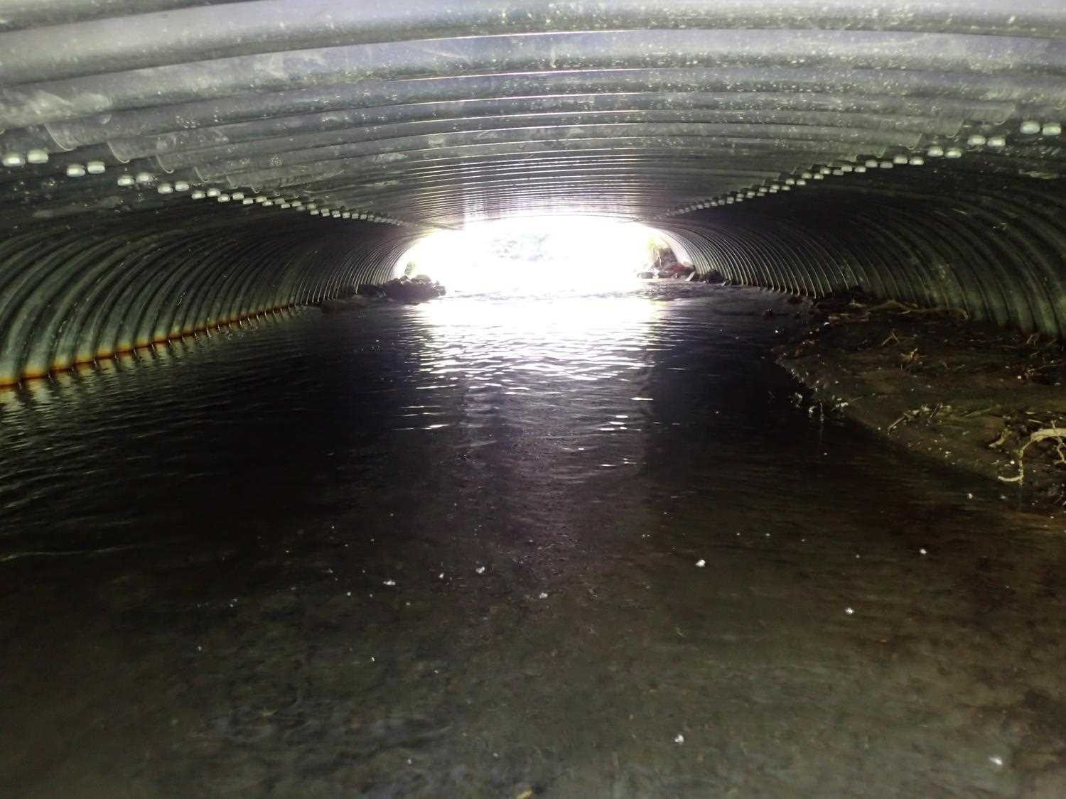
Comments: Site is just below the confluence at inlet of 2 tributaries. Main water flow comes from the tributary at 70 degrees, the other tributary is at 20 degrees. Stream gradient is from designs. Coho observed upstream from inlet, Flows downstream parallel to roadway for 1000 feet. Top half of channel inside culvert is pool with wetted width spanning whole culvert and bottom half of channel is a riffle.
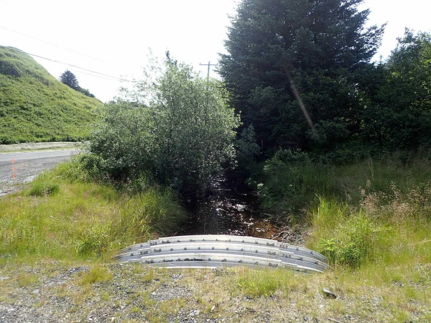
Culvert Measurements
| ID: 1 | Structure Type: Box culvert (Structural aluminum plate) | Fish Passage Rating: | ||||||||||||||||||||||||||||||||||||||||||
|
|
|
||||||||||||||||||||||||||||||||||||||||||
Comments: Measured culvert gradient is Top: 0.34%, Invert 1.17%, Water surface: 0.65% Culvert dimensions per designs are 15'4 x 6'5" |
||||||||||||||||||||||||||||||||||||||||||||
Stream Measurements
|
|
| Stream Width Type | Distance From Crossing (ft) |
Stream Width (ft) |
|---|---|---|
| Downstream ordinary high water | 30.0 | 9.75 |
| Downstream ordinary high water | 45.0 | 9.00 |
| Downstream ordinary high water | 60.0 | 10.60 |
Elevations
| Locator ID | Culvert Number |
River Distance (ft)1 |
Distance From Crossing (ft)2 |
Relative Elevation (ft) |
|---|---|---|---|---|
| Road Elev (road surface) | 101.09 | |||
| D/S Thalweg | 0.00 | 96.14 | ||
| D/S Water Surface Elev | 0.00 | 96.54 | ||
| D/S Water Surface Elev | 28.00 | 96.63 | ||
| Outlet Invert | 28.00 | 96.17 | ||
| Outlet Culvert Top (on rib) | 28.00 | 100.00 | ||
| Inlet Culvert Top (on rib) | 77.30 | 100.17 | ||
| Inlet Culvert Invert | 77.30 | 95.59 | ||
| U/S Water Surface Elev | 77.30 | 96.95 | ||
| U/S Water Surface Elev | 83.30 | 96.97 | ||
| U/S Thalweg (max pool depth) | 83.30 | 95.81 | ||
| U/S Thalweg | 99.30 | 96.03 | ||
| U/S Water Surface Elev | 99.30 | 96.99 |
Notes:
- River distance is measured continuously throughout the survey reach along the thalweg of the stream.
- Measured from each end of the crossing along the thalweg of the stream.
Fish Sampling Efforts
No fish sampling occurred during this survey.
Fish Observations
No fish observations occurred during this survey.
Photos


Questions or comments about this report can be directed to dfg.dsf.webmaster@alaska.gov