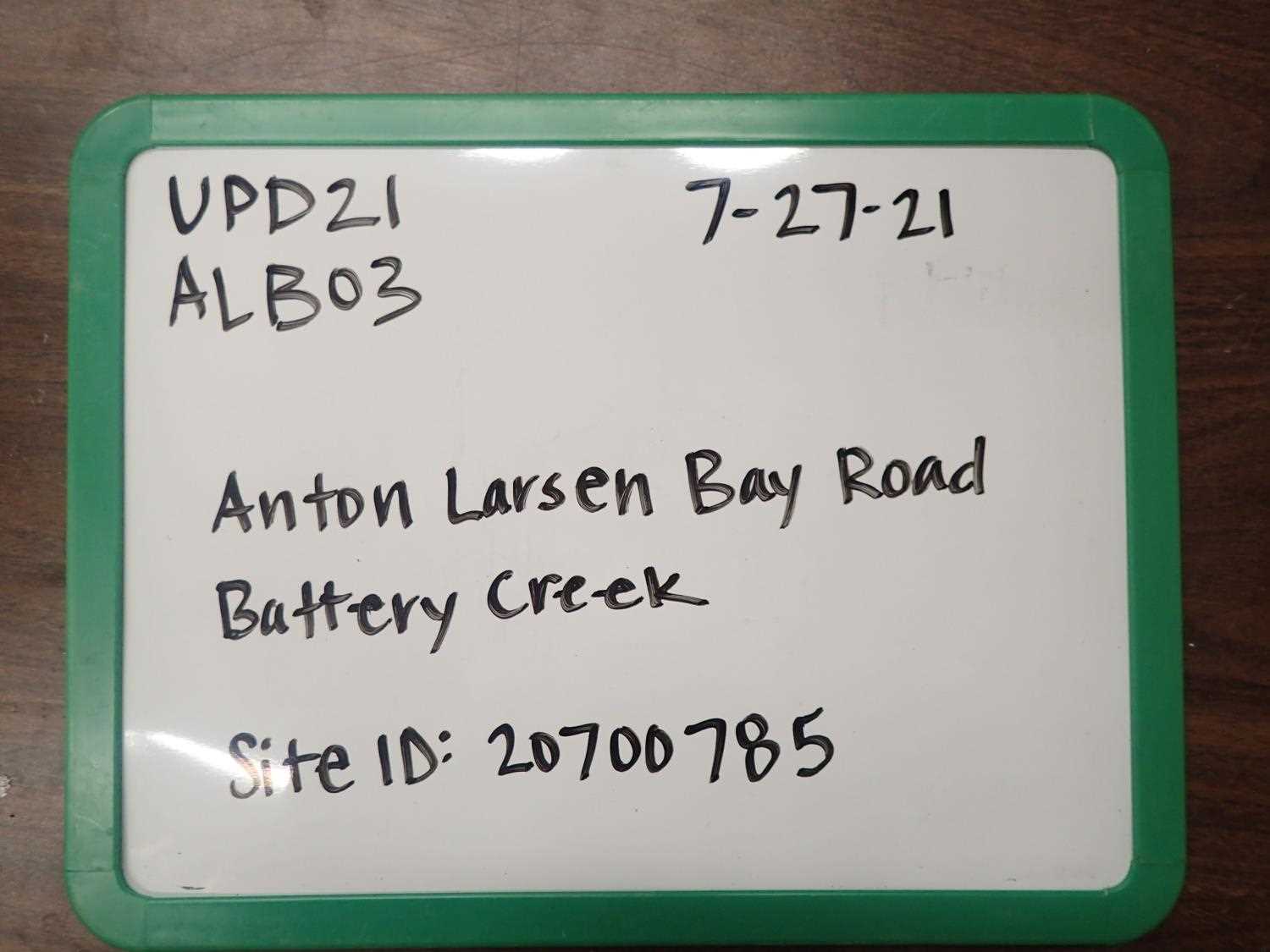
Fish Passage Site 20700785
Coordinates (dec. deg.): 57.76874°, -152.52324°
Legal Description: S028S020W09
Region: Southwest
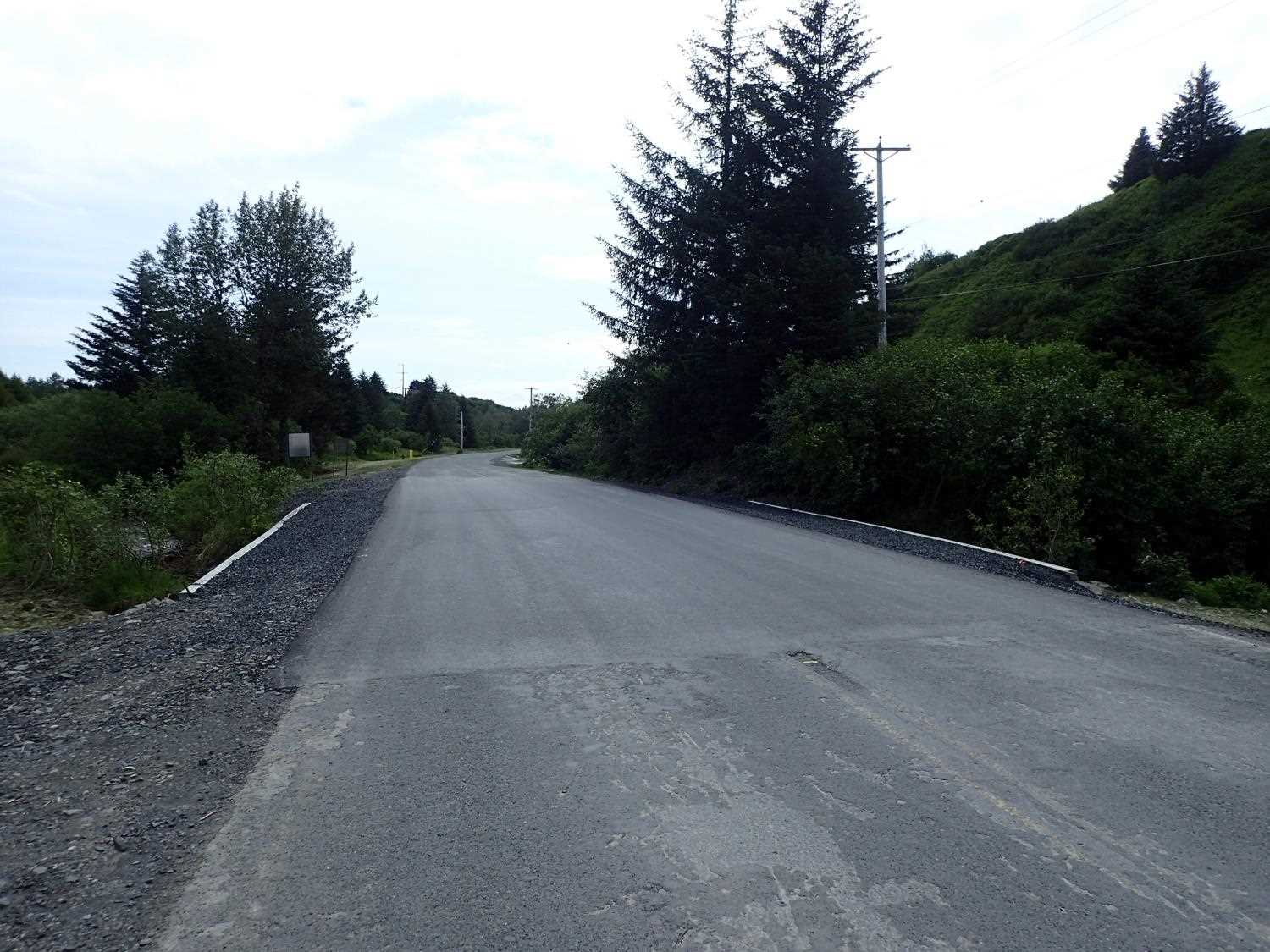
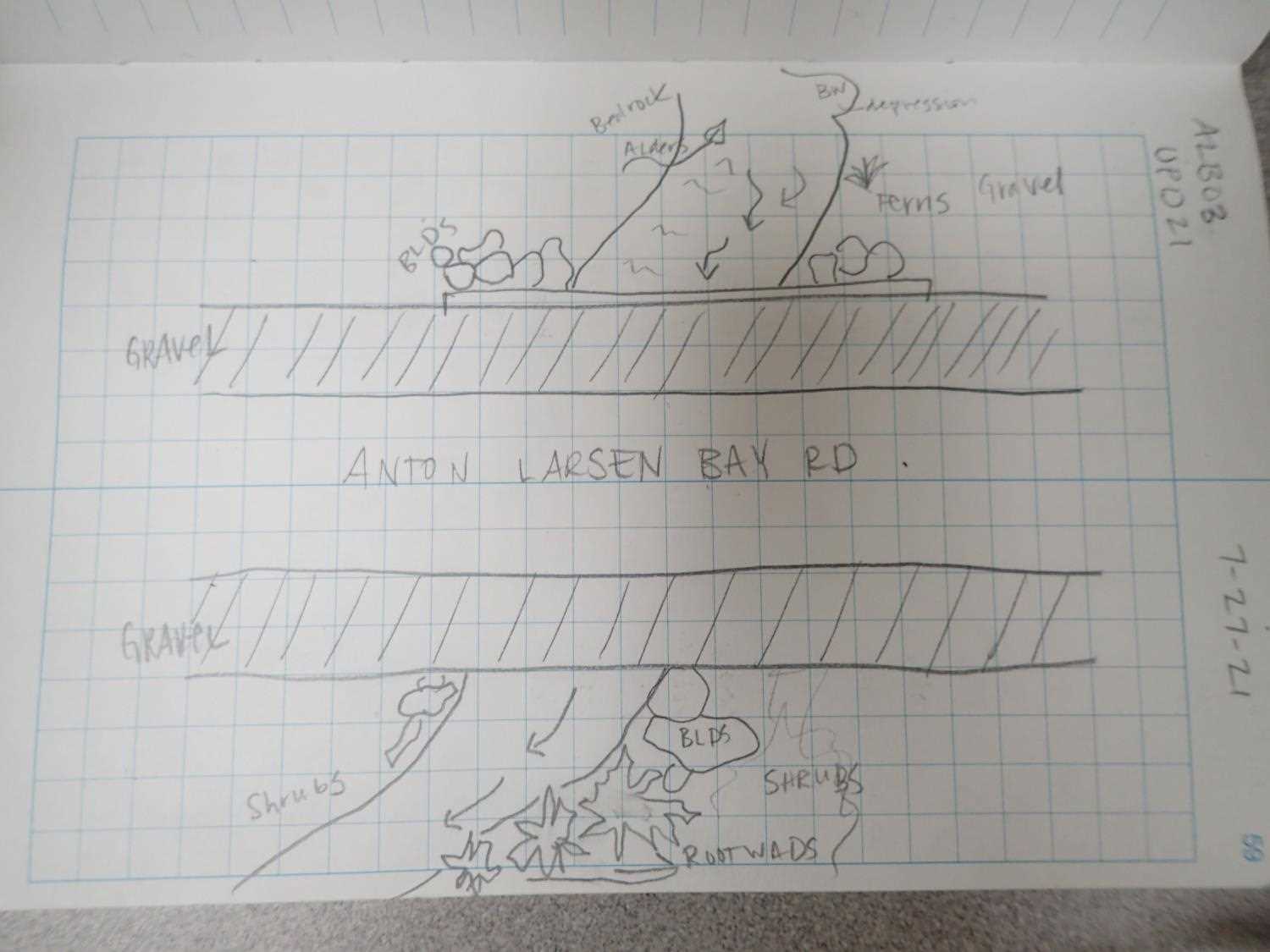
Road Name: Anton Larsen Bay Road
Datum: WGS84
Quad Name / ITM: Kodiak D-2
AWC Stream #:
Stream Name: Battery Creek Tributary
Elevation:
Site Comments: None
arrow to the right of the survey date below to choose a different report for this site.
Survey UPD21-ALBO3
Project Supervisor: Kim Clark, ADFG
— Anchorage, AK
Observers: Kim Clark, Michael Mazzacavallo
Overall Fish Passage Rating:
Tidal: No
Backwatered: No
Step Pools: No
Construction Year: 2021
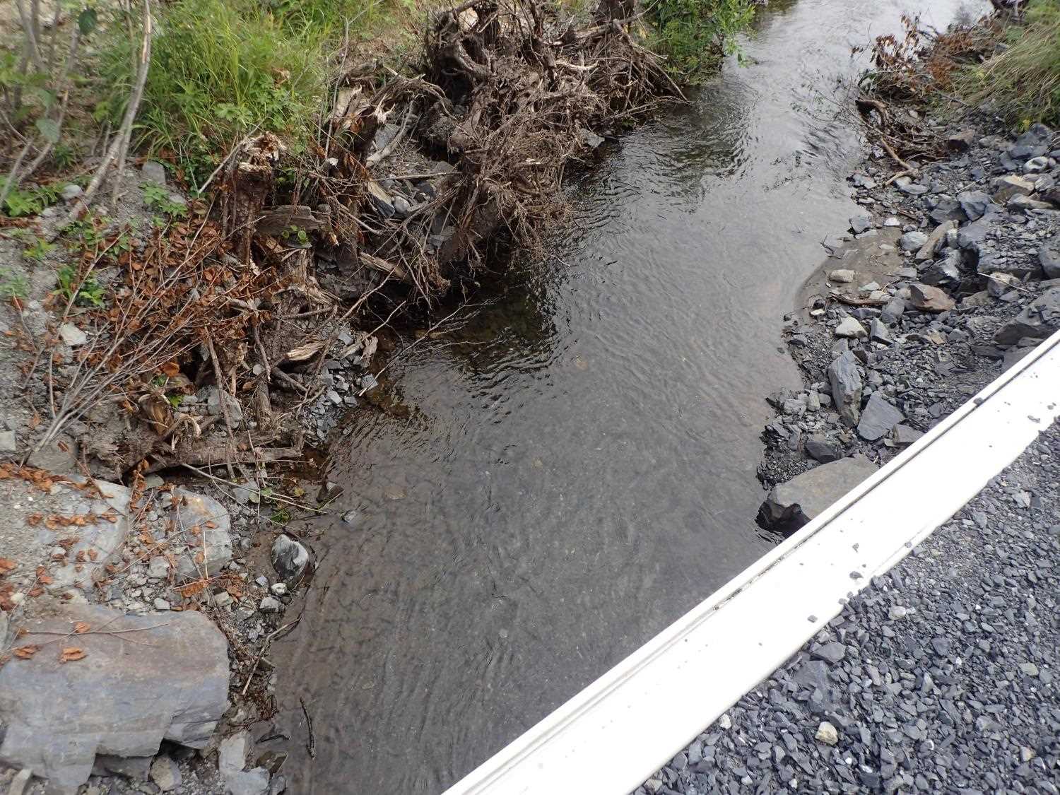
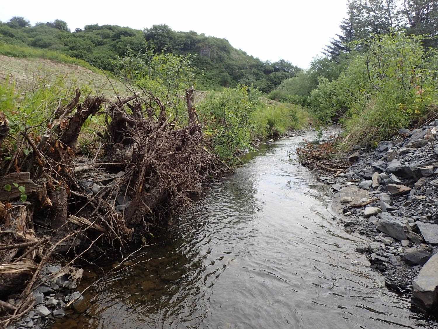
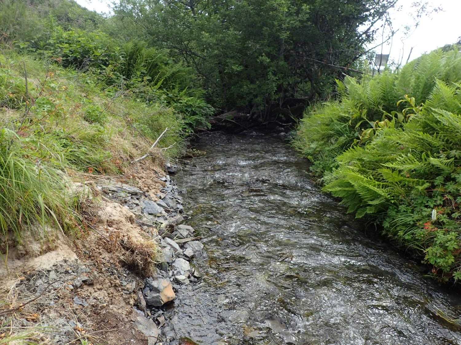
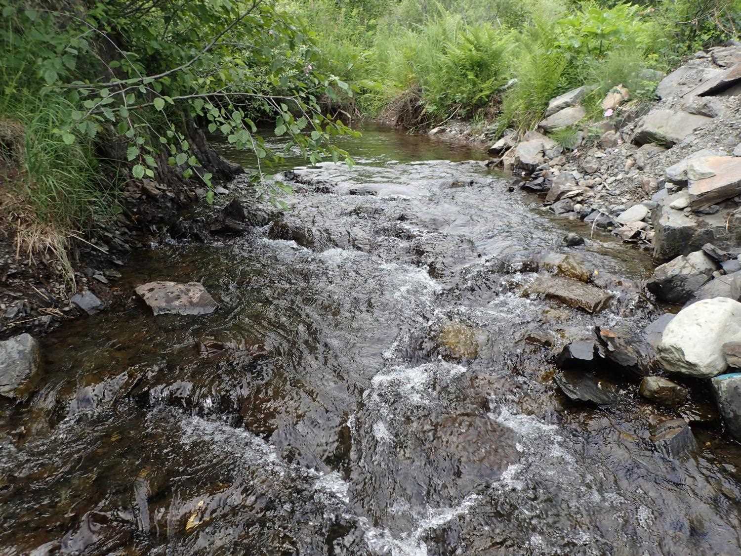
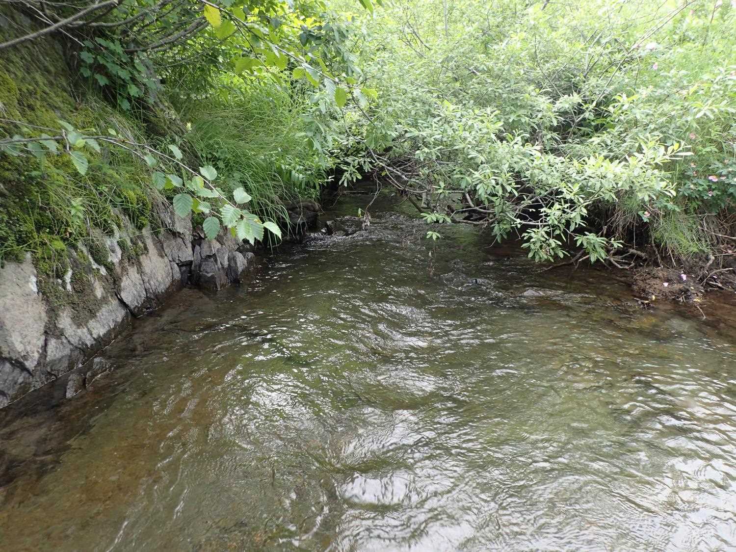
Comments: Vegetation mat has lots of alders and willows. Steepened reach above inlet.
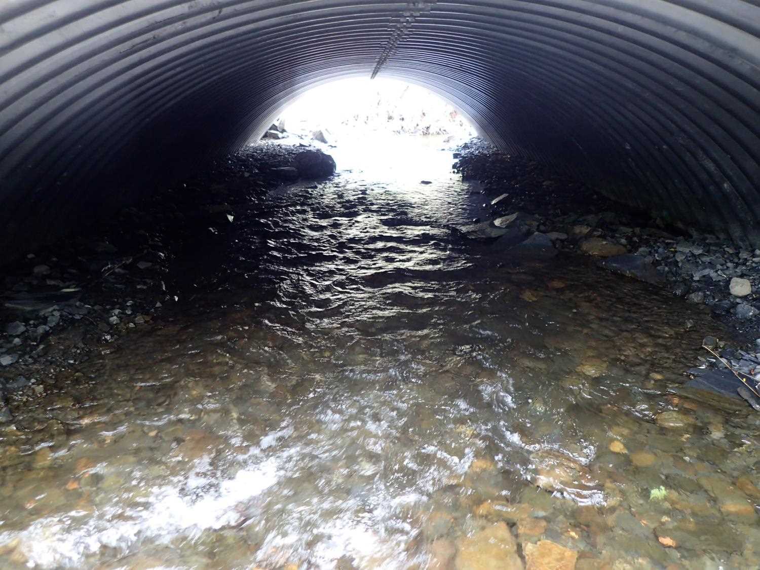
Culvert Measurements
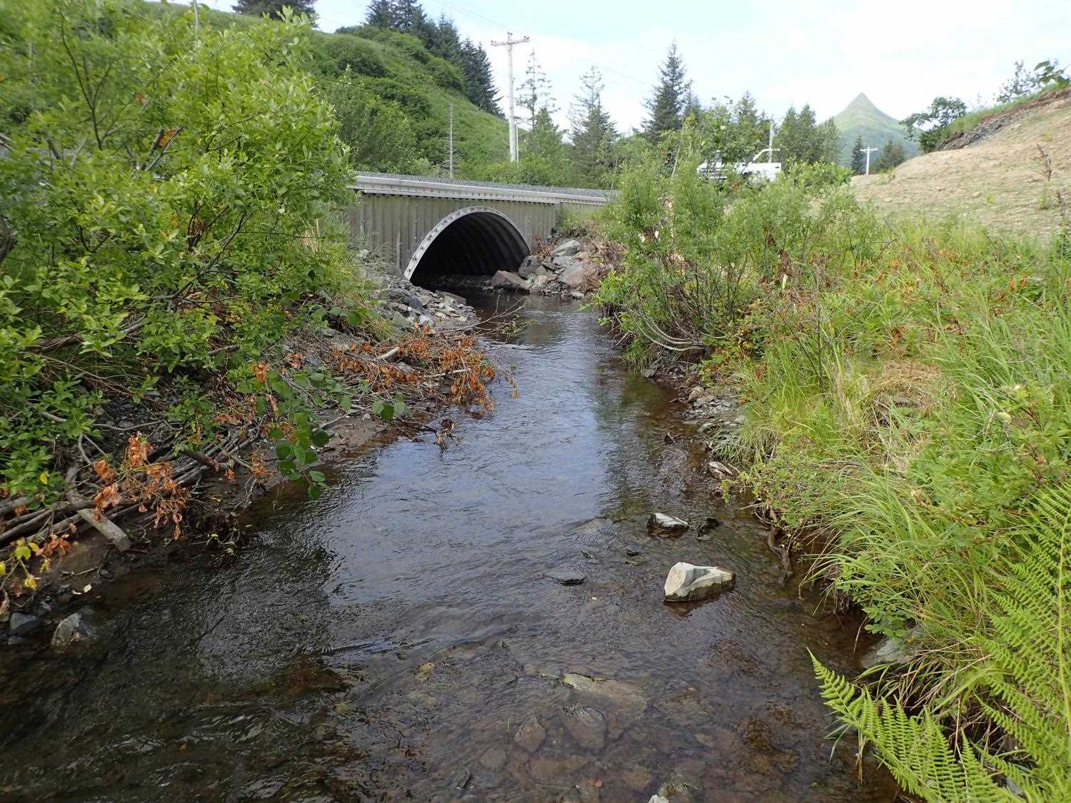
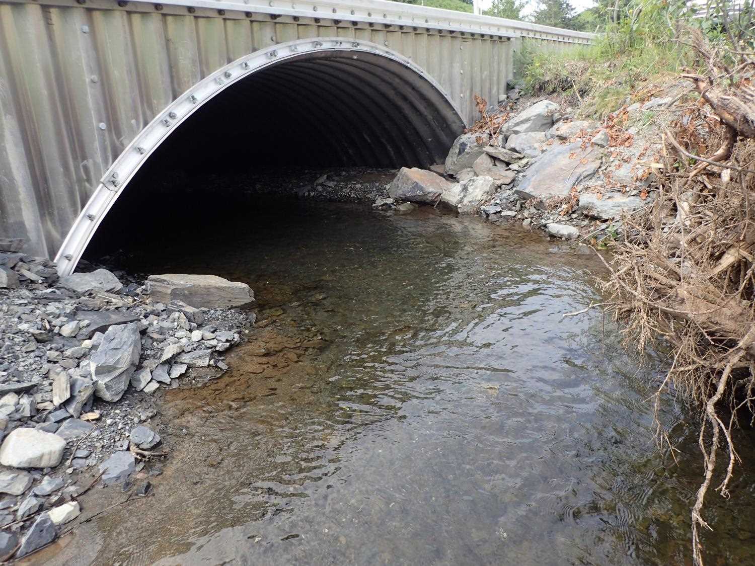
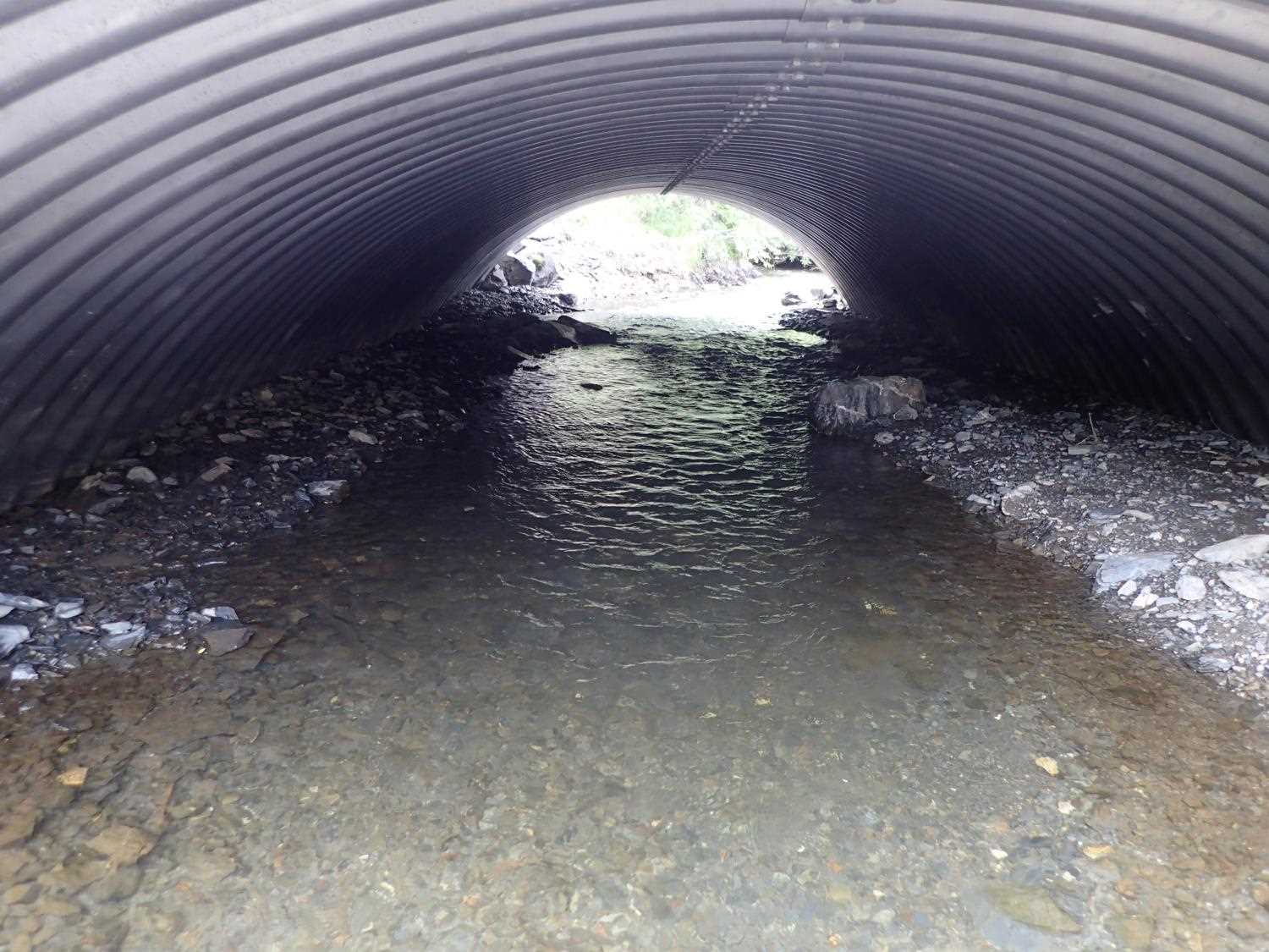
| ID: 1 | Structure Type: Open-bottom arch (Structural aluminum plate) | Fish Passage Rating: | |||||||||||||||||||||||||||||||||||||||||
|
|
|
|||||||||||||||||||||||||||||||||||||||||
Comments: Culvert is a bottomless arch. Measured culvert gradient- Top: 1.6%; Invert 1.3%, Water surface 0.78% Culvert dimensions per desgins: 15'4" X 6'5" |
|||||||||||||||||||||||||||||||||||||||||||
Stream Measurements
|
|
| Stream Width Type | Distance From Crossing (ft) |
Stream Width (ft) |
|---|---|---|
| Upstream ordinary high water | 30.0 | 9.50 |
| Upstream ordinary high water | 40.0 | 12.30 |
| Upstream ordinary high water | 65.0 | 9.80 |
| Upstream ordinary high water | 95.0 | 7.10 |
Elevations
| Locator ID | Culvert Number |
River Distance (ft)1 |
Distance From Crossing (ft)2 |
Relative Elevation (ft) |
|---|---|---|---|---|
| D/S Thalweg (bottom of riffle and reconstructed bank) | 0.00 | 91.67 | ||
| D/S Water Surface Elev | 0.00 | 92.44 | ||
| D/S Thalweg | 27.00 | 92.41 | ||
| D/S Water Surface Elev | 27.00 | 93.00 | ||
| D/S Water Surface Elev | 54.00 | 93.74 | ||
| D/S Thalweg (top of first riffle downstream of outlet) | 54.00 | 92.93 | ||
| D/S Water Surface Elev | 86.00 | 93.83 | ||
| D/S Thalweg (max depth of lateral scour pool along root wads) | 86.00 | 92.78 | ||
| Outlet Invert | 90.00 | 93.11 | ||
| D/S Water Surface Elev | 90.00 | 93.83 | ||
| Outlet Culvert Top | 90.00 | 98.60 | ||
| Inlet Culvert Top | 130.80 | 99.25 | ||
| U/S Water Surface Elev | 130.80 | 94.15 | ||
| Inlet Culvert Invert | 130.80 | 93.63 | ||
| U/S Thalweg (bottom of riffle) | 135.80 | 93.78 | ||
| U/S Water Surface Elev | 135.80 | 94.50 | ||
| U/S Thalweg (top of riffle) | 146.80 | 94.36 | ||
| U/S Water Surface Elev | 146.80 | 94.97 | ||
| U/S Water Surface Elev | 155.80 | 95.05 | ||
| U/S Thalweg (max pool depth) | 155.80 | 93.91 | ||
| U/S Thalweg | 165.80 | 94.75 | ||
| U/S Water Surface Elev | 165.80 | 95.01 |
Notes:
- River distance is measured continuously throughout the survey reach along the thalweg of the stream.
- Measured from each end of the crossing along the thalweg of the stream.
Fish Sampling Efforts
No fish sampling occurred during this survey.
Fish Observations
No fish observations occurred during this survey.
Photos


Questions or comments about this report can be directed to dfg.dsf.webmaster@alaska.gov