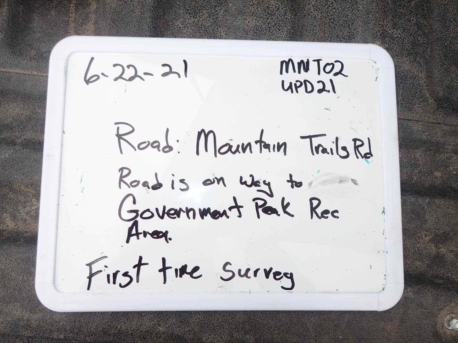
Fish Passage Site 20503952
Coordinates (dec. deg.): 61.69883°, -149.27676°
Legal Description: S019N001E33
Region: South Central
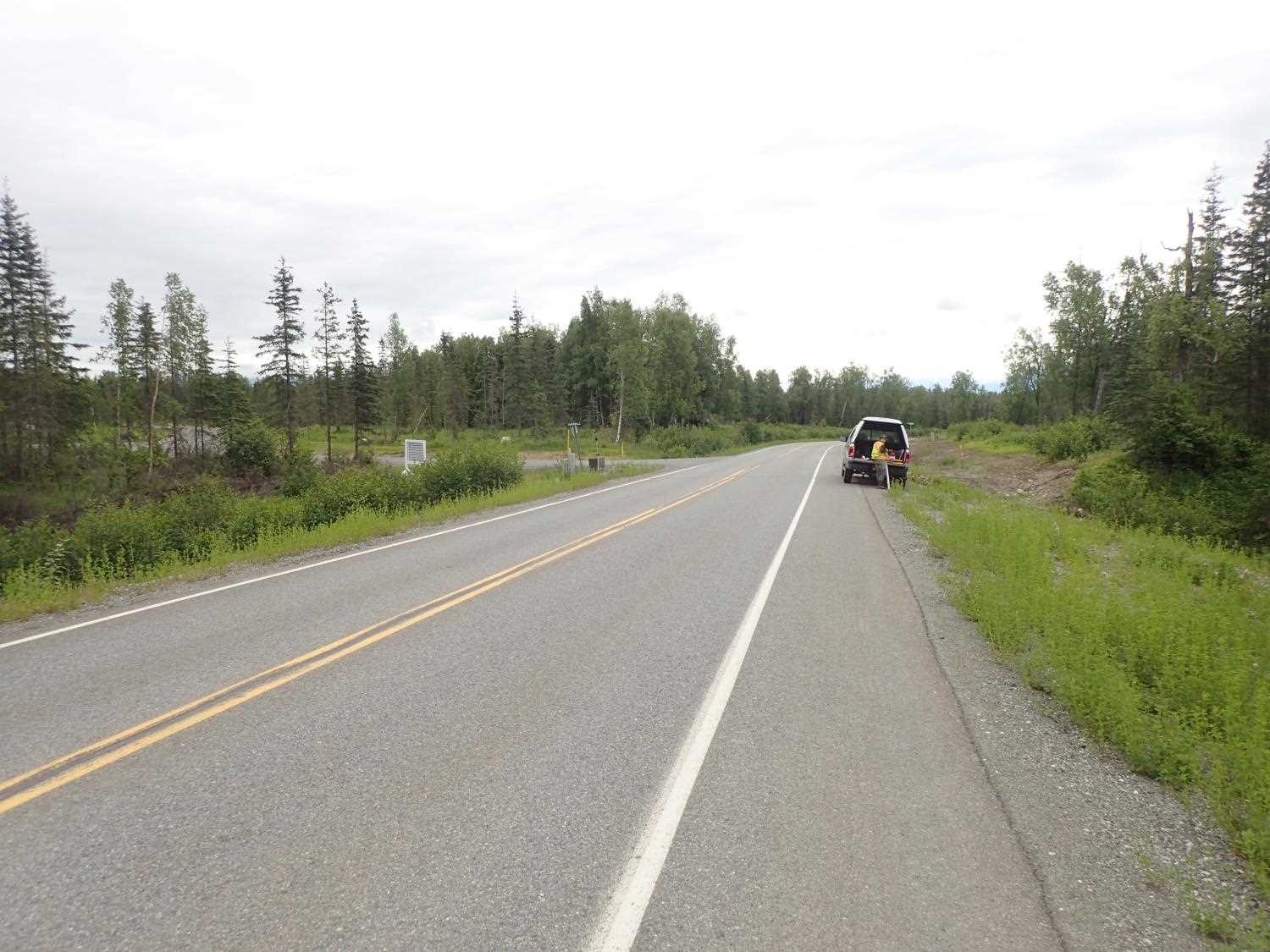
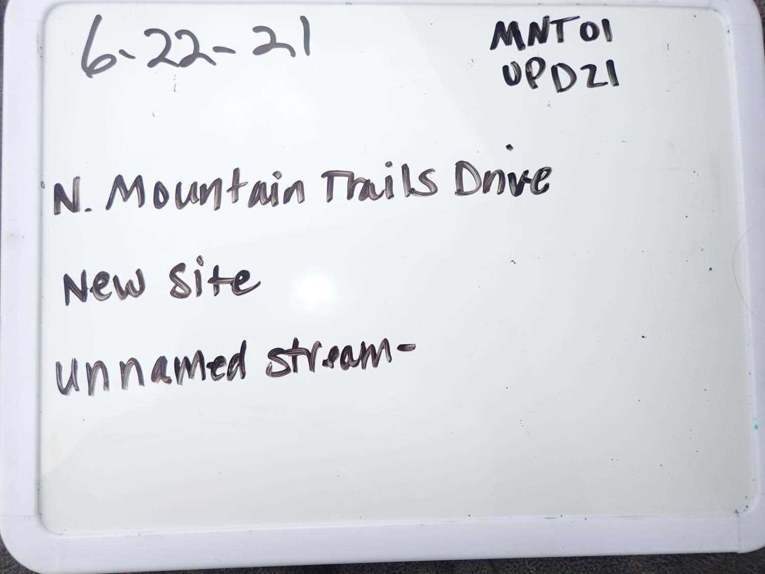
Road Name: North Mountain Trails Drive
Datum: WGS84
Quad Name / ITM: Anchorage C-7
AWC Stream #: 247-41-10100-2349-3003
Stream Name:
Elevation:
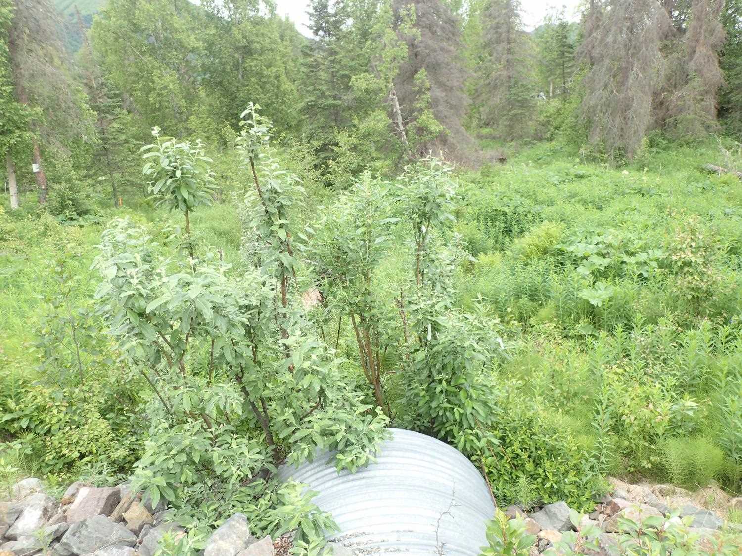
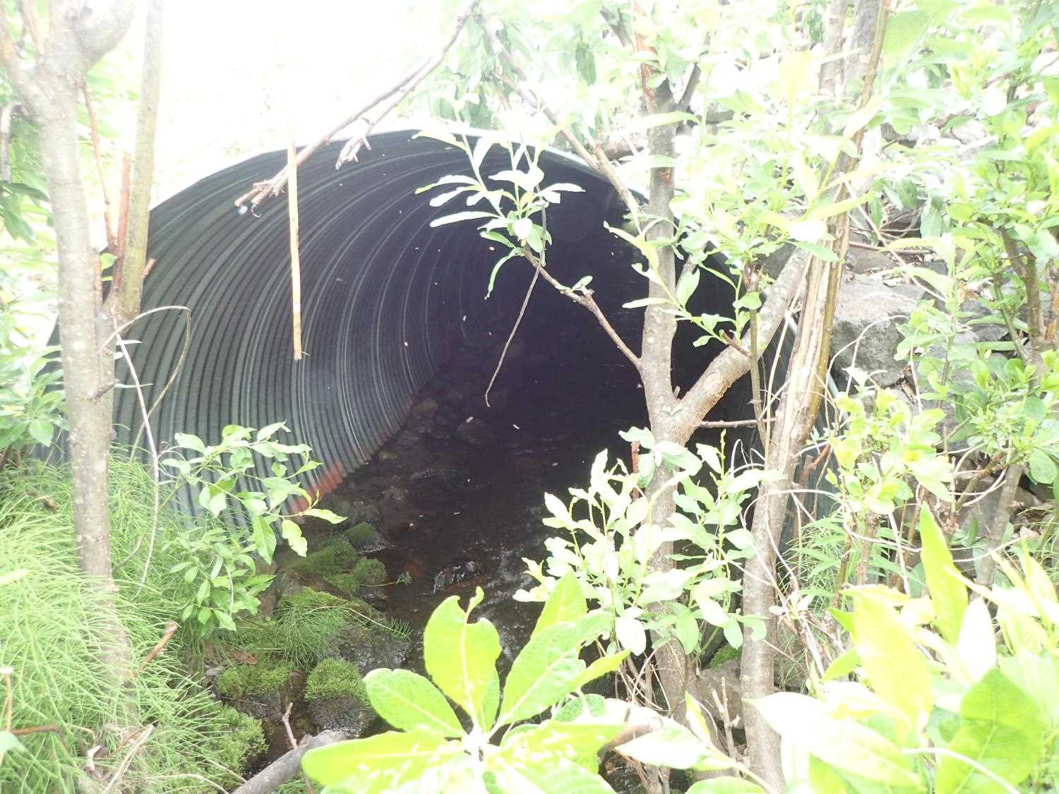
Site Comments: Government Peak Recreation Area access road.
Survey UPD21-MNT02
Project Supervisor: Kim Clark, ADFG
— Anchorage, AK
Observers: Kim Clark, Michael Mazzacavallo
Overall Fish Passage Rating:
Tidal: No
Backwatered: No
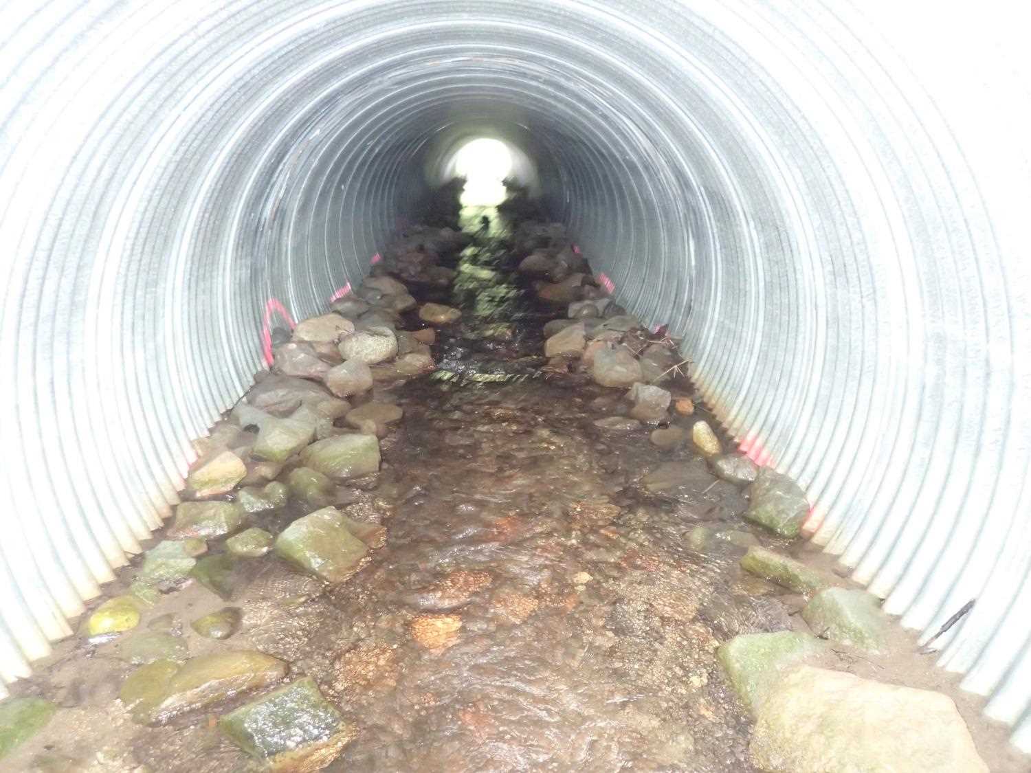
Step Pools: Yes
Construction Year:
Site Observations:
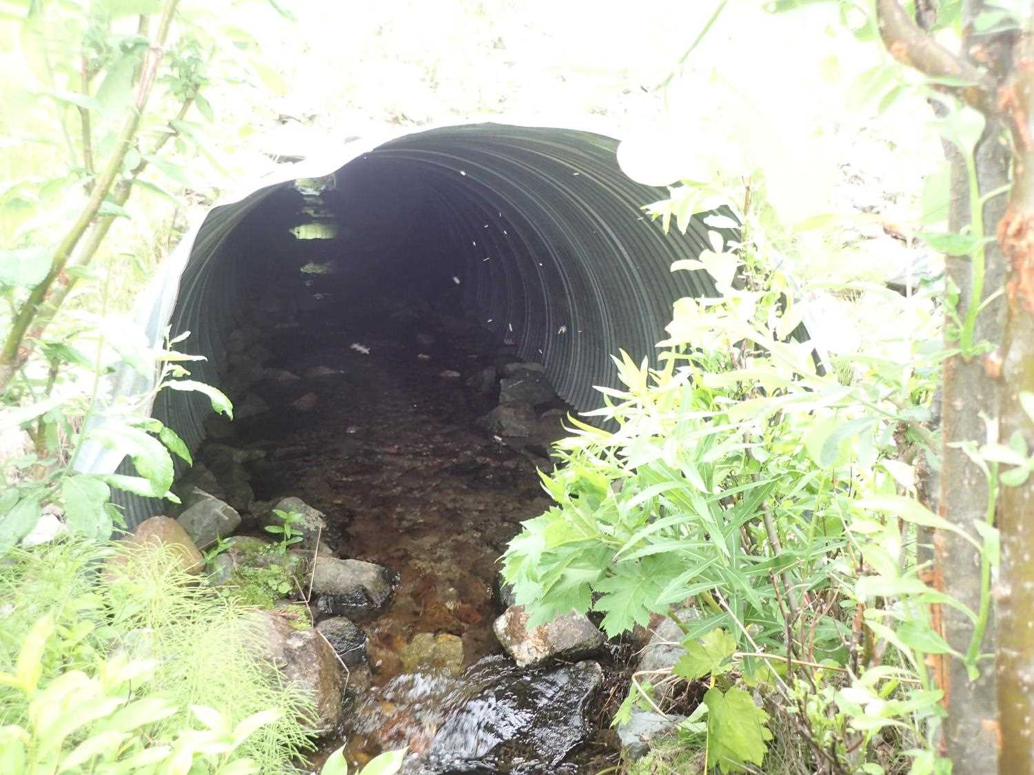
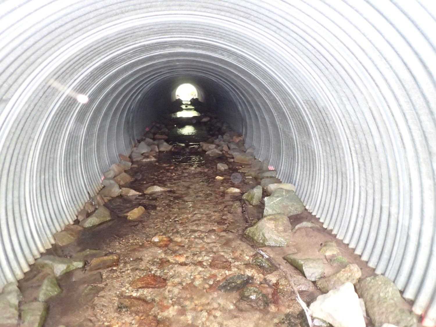
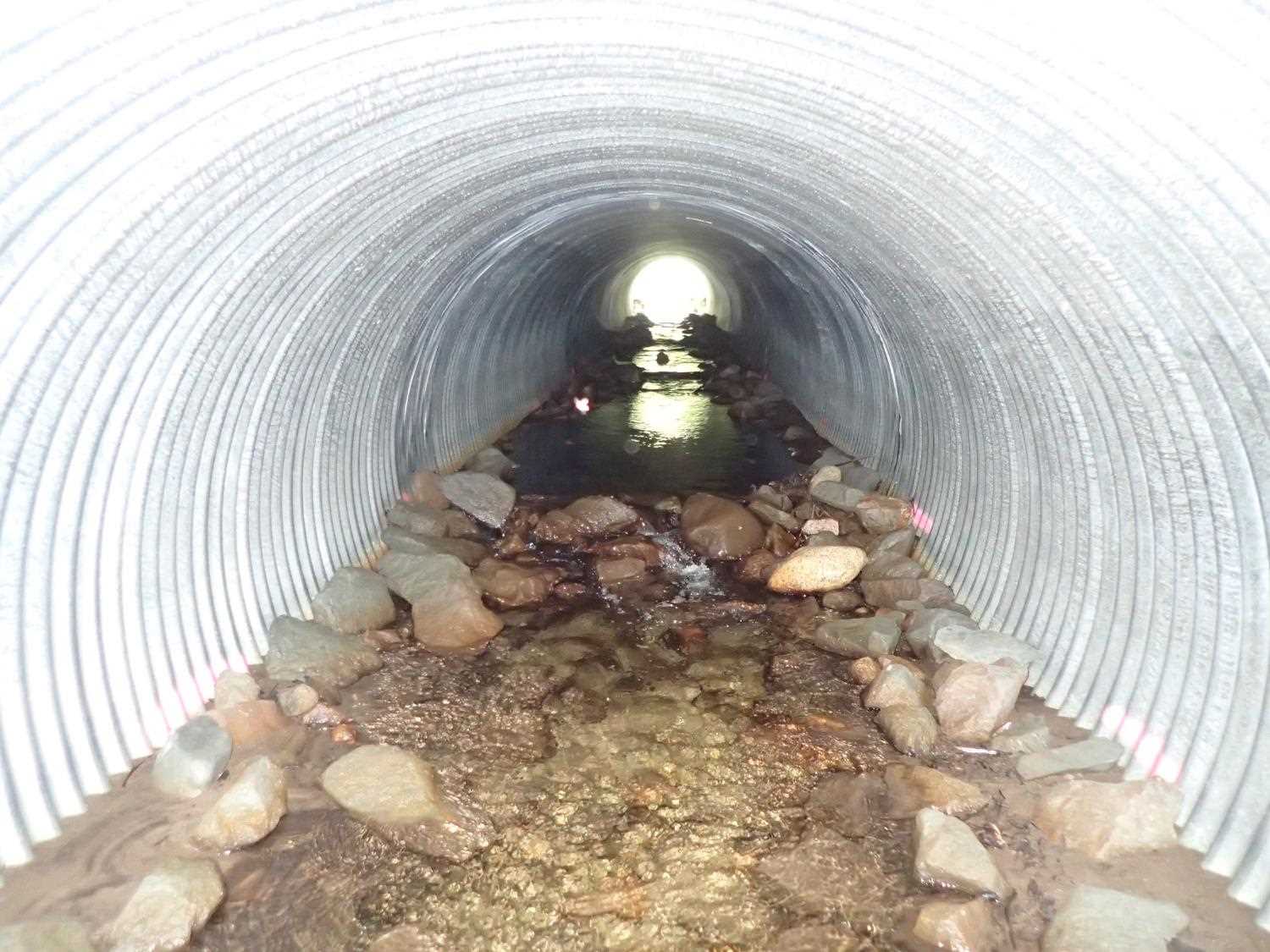
- Culvert sagging in middle
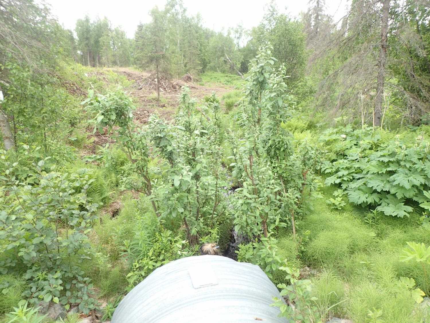
Comments: Dozer track outside riparian buffer downstream left bank. Grade controls are constructed in pipe. Top of pipe has slight curve with dip in middle. Outlet has damage. 6" fish observed upstream. Sandy depositional areas upstream of culvert, starting about 10m upstream.
Culvert Measurements
| ID: 1 | Structure Type: Circular pipe (Corrugated steel) | Fish Passage Rating: | ||||||||||||||||||||||||||||||||||||||||||
|
|
|
||||||||||||||||||||||||||||||||||||||||||
Culvert Observations:
|
||||||||||||||||||||||||||||||||||||||||||||
Stream Measurements
|
|
| Stream Width Type | Distance From Crossing (ft) |
Stream Width (ft) |
|---|---|---|
| Downstream ordinary high water | 92.0 | 4.75 |
| Downstream ordinary high water | 119.0 | 3.78 |
| Downstream ordinary high water | 124.0 | 3.80 |
Elevations
| Locator ID | Culvert Number |
River Distance (ft)1 |
Distance From Crossing (ft)2 |
Relative Elevation (ft) |
|---|---|---|---|---|
| Road Elev | 110.55 | |||
| D/S Thalweg | 0.00 | 92.67 | ||
| D/S Water Surface Elev | 0.00 | 93.09 | ||
| D/S Grade Ctrl (Thalweg) (man made from boulders) | 19.00 | 93.91 | ||
| D/S Water Surface Elev | 19.00 | 94.22 | ||
| D/S Thalweg | 32.00 | 94.41 | ||
| D/S Water Surface Elev | 32.00 | 94.72 | ||
| D/S Water Surface Elev | 35.00 | 95.01 | ||
| D/S Grade Ctrl (Thalweg) | 35.00 | 94.58 | ||
| Outlet Invert | 38.00 | 94.59 | ||
| D/S Water Surface Elev | 38.00 | 95.10 | ||
| Outlet Culvert Top | 38.00 | 100.00 | ||
| Inlet Culvert Top | 191.30 | 102.68 | ||
| Inlet Culvert Invert | 191.30 | 97.51 | ||
| U/S Water Surface Elev | 191.30 | 97.66 | ||
| U/S Water Surface Elev | 192.00 | 97.77 | ||
| U/S Grade Ctrl (Thalweg) | 192.00 | 97.13 | ||
| U/S Water Surface Elev | 221.30 | 97.95 | ||
| U/S Thalweg | 221.30 | 96.93 |
Notes:
- River distance is measured continuously throughout the survey reach along the thalweg of the stream.
- Measured from each end of the crossing along the thalweg of the stream.
Fish Sampling Efforts
No fish sampling occurred during this survey.
Fish Observations
No fish observations occurred during this survey.
Photos


Questions or comments about this report can be directed to dfg.dsf.webmaster@alaska.gov