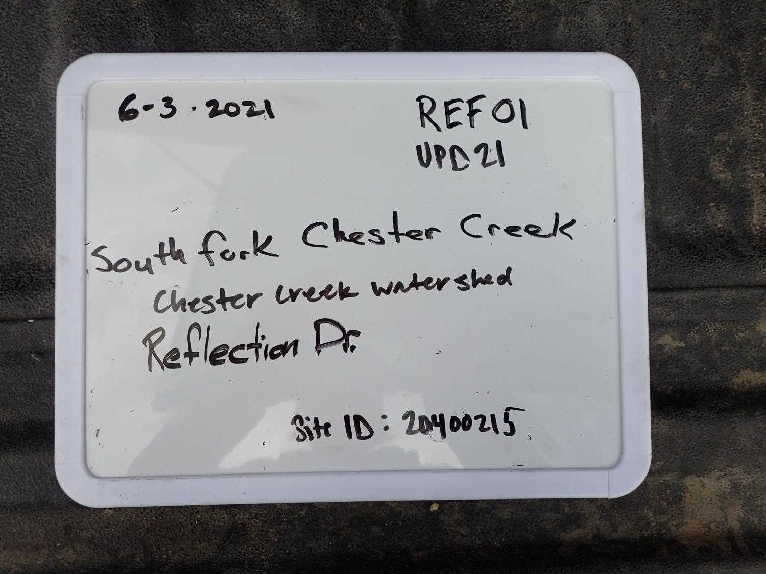
Fish Passage Site 20400215
Coordinates (dec. deg.): 61.18513°, -149.77287°
Legal Description: S013N003W26
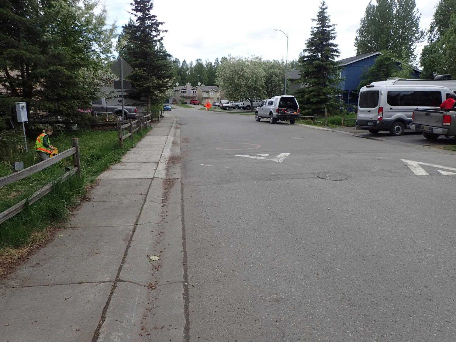
Region: South Central
Road Name: Reflection Drive
Datum: NAD83
Quad Name / ITM: Anchorage A-8
AWC Stream #: 247-50-10050-2040
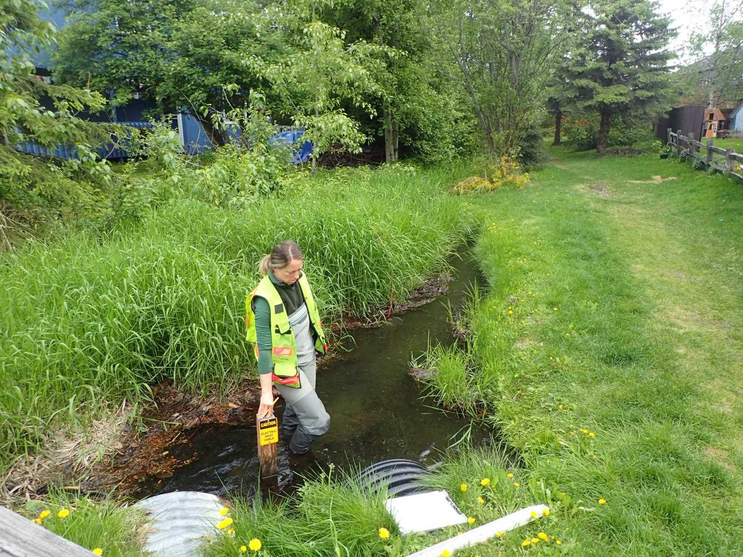
Stream Name: Chester Creek South Fork
Elevation:
Site Comments: CHESTER CREEK WATERSHED
arrow to the right of the survey date below to choose a different report for this site.
Survey UPD21-REF01
Project Supervisor: Kim Clark, ADFG
— Anchorage, AK
Observers: Kim Clark, Michael Mazzacavallo
Overall Fish Passage Rating:
Tidal: No
Backwatered: No
Step Pools: No
Construction Year:
Site Observations:
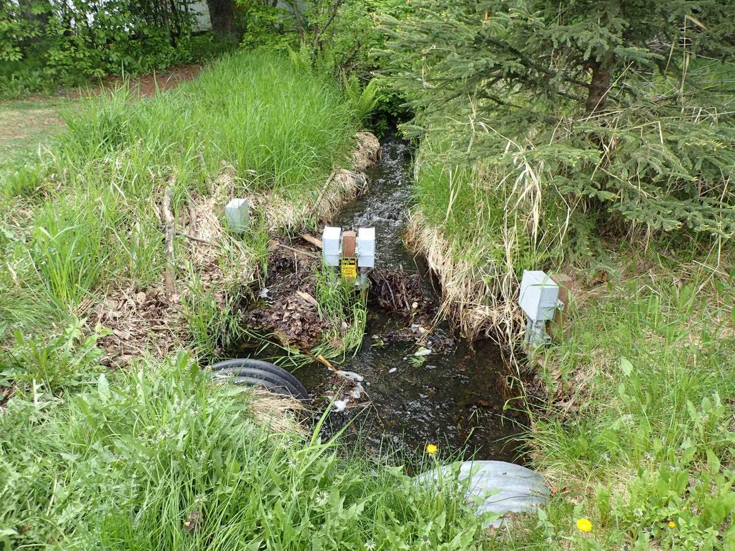
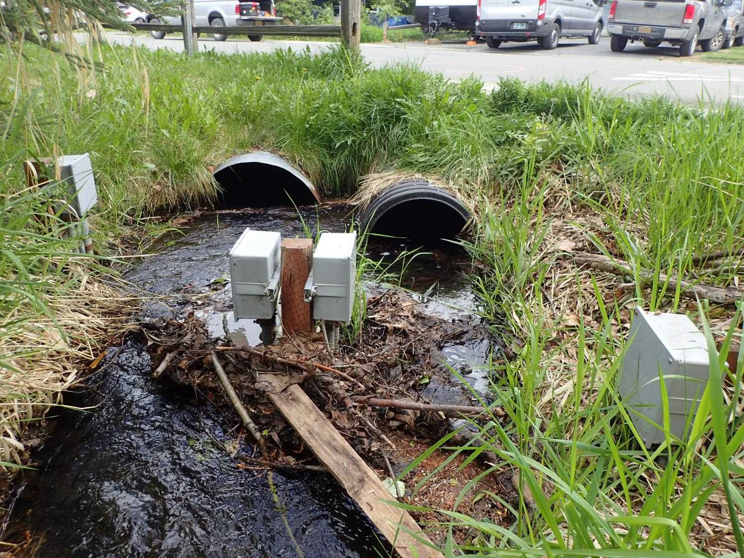
- Culvert sagging in middle
- Constriction ratio red
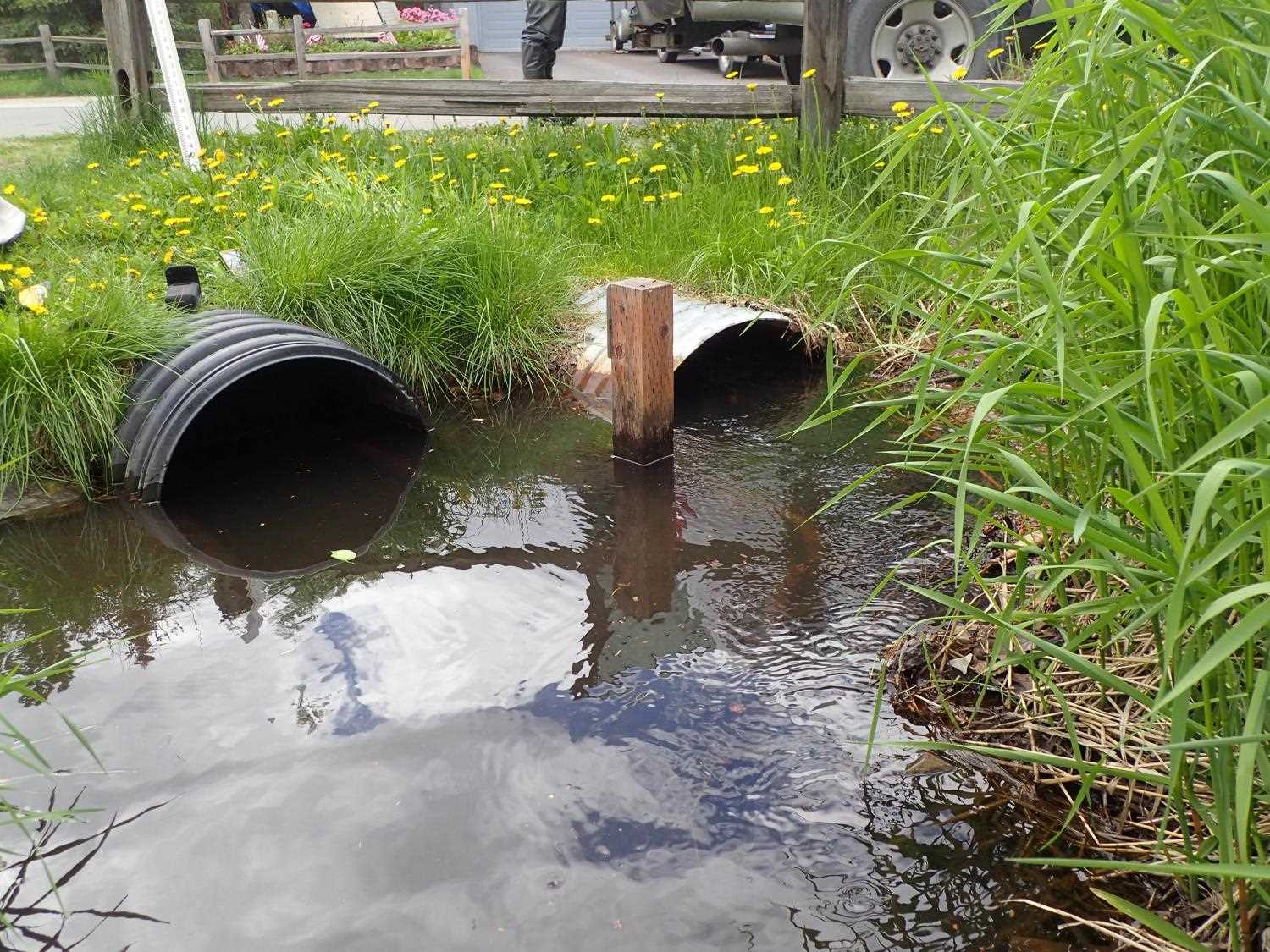
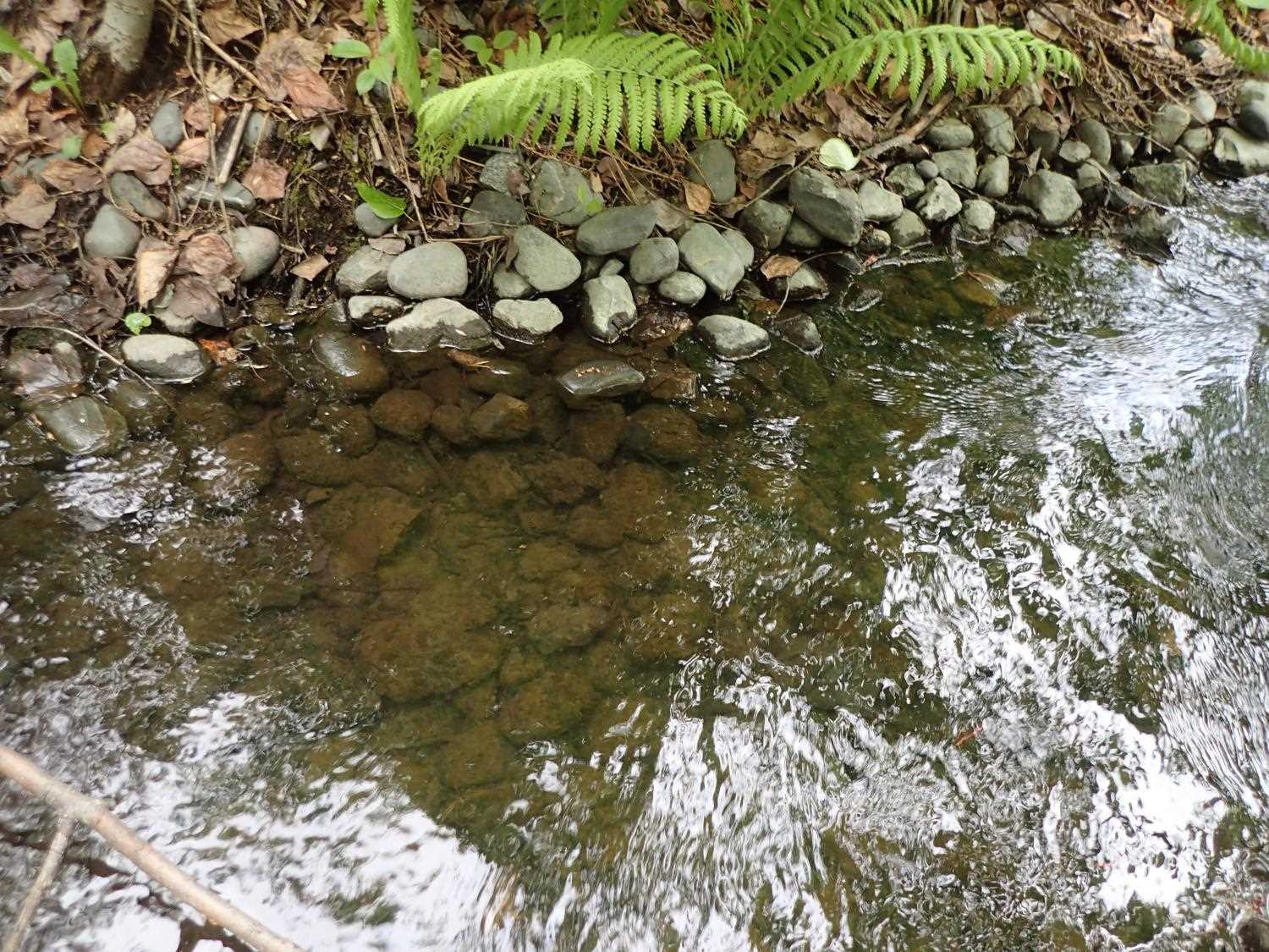
Comments: Culvert length was measured across road with laser. Not enough room to shoot within pipe. Upstream of inlet there is a build up of debris behind 4x4 posts. Stickleback observed upstream. Stickleback and juvenile coho observed downstream. Garbage in stream at site.
Culvert Measurements
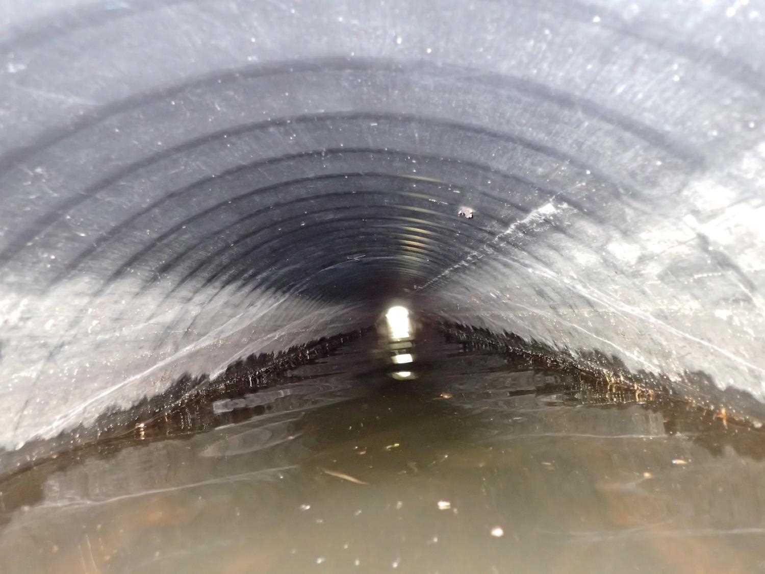
| ID: 1 | Structure Type: Circular pipe (Corrugated steel) | Fish Passage Rating: | ||||||||||||||||||||||||||||||||||||||||||
|
|
|
||||||||||||||||||||||||||||||||||||||||||
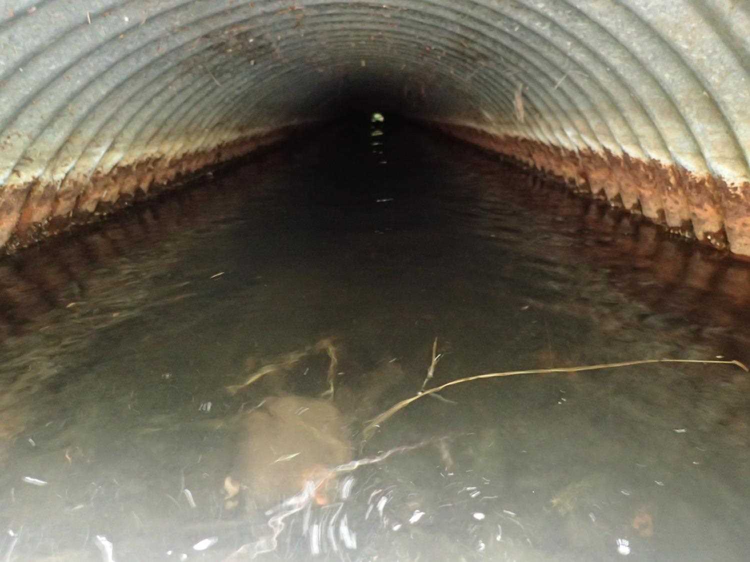
Comments: outlet height of Pipe#1 is with rod gently on top of silt and muck. If rod is pushed through silt and muck, height is 2.1. |
||||||||||||||||||||||||||||||||||||||||||||
Culvert Observations:
|
||||||||||||||||||||||||||||||||||||||||||||
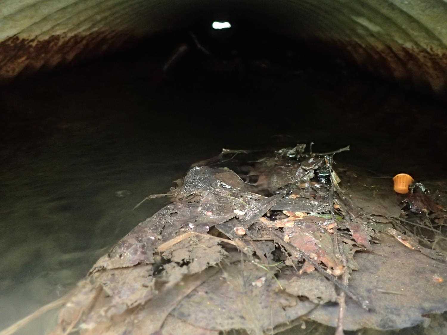
| ID: 2 | Structure Type: Circular pipe (Corrugated plastic) | Fish Passage Rating: | ||||||||||||||||||||||||||||||||||||||||||
|
|
|
||||||||||||||||||||||||||||||||||||||||||
Comments: substrate throughout the pipe. |
||||||||||||||||||||||||||||||||||||||||||||
Culvert Observations:
|
||||||||||||||||||||||||||||||||||||||||||||
Stream Measurements
|
|
| Stream Width Type | Distance From Crossing (ft) |
Stream Width (ft) |
|---|---|---|
| Upstream ordinary high water | 53.0 | 9.10 |
| Upstream ordinary high water | 61.0 | 7.30 |
| Upstream ordinary high water | 67.0 | 7.30 |
Elevations
| Locator ID | Culvert Number |
River Distance (ft)1 |
Distance From Crossing (ft)2 |
Relative Elevation (ft) |
|---|---|---|---|---|
| Road Elev (Road Surface) | 101.25 | |||
| D/S Grade Ctrl (Thalweg) | 0.00 | 98.45 | ||
| D/S Water Surface Elev | 0.00 | 99.39 | ||
| D/S Water Surface Elev (Outlet water surface Pipe 2) | 8.00 | 99.41 | ||
| D/S Water Surface Elev (Outlet water surface Pipe 1) | 8.00 | 99.41 | ||
| Outlet Invert (Outlet invert Pipe 1) | 8.00 | 98.04 | ||
| Outlet Invert (Pipe 2 outlet invert) | 8.00 | 98.19 | ||
| Outlet Culvert Top (Top of Pipe 1) | 8.00 | 100.00 | ||
| Outlet Culvert Top (Top of Pipe 2) | 8.00 | 100.25 | ||
| U/S Water Surface Elev (Inlet water surface Pipe 1) | 79.30 | 99.47 | ||
| Inlet Culvert Invert (Inlet invert Pipe 1) | 79.30 | 98.84 | ||
| Inlet Culvert Top (Top of Pipe 1) | 79.30 | 100.51 | ||
| Inlet Culvert Top (Top of Pipe 2) | 81.01 | 98.86 | ||
| Inlet Culvert Invert (Inlet invert Pipe 2) | 81.01 | 98.86 | ||
| U/S Water Surface Elev (Inlet water surface Pipe 2) | 81.01 | 99.44 | ||
| U/S Thalweg | 101.01 | 99.71 | ||
| U/S Water Surface Elev | 101.01 | 100.13 | ||
| U/S Thalweg | 145.01 | 100.27 | ||
| U/S Water Surface Elev | 145.01 | 100.74 |
Notes:
- River distance is measured continuously throughout the survey reach along the thalweg of the stream.
- Measured from each end of the crossing along the thalweg of the stream.
Fish Sampling Efforts
No fish sampling occurred during this survey.
Fish Observations
No fish observations occurred during this survey.
Photos


Questions or comments about this report can be directed to dfg.dsf.webmaster@alaska.gov