Fish Passage Site 20400025
Coordinates (dec. deg.): 61.31548°, -149.56738°
Legal Description: S014N002W12
Region: South Central
Road Name: Old Eagle River Road
Datum: NAD83
Quad Name / ITM: Anchorage B-7
AWC Stream #:
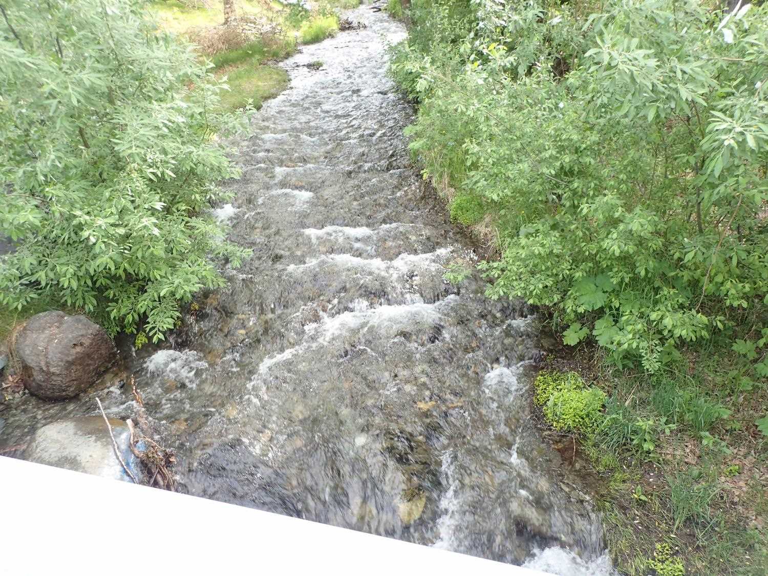
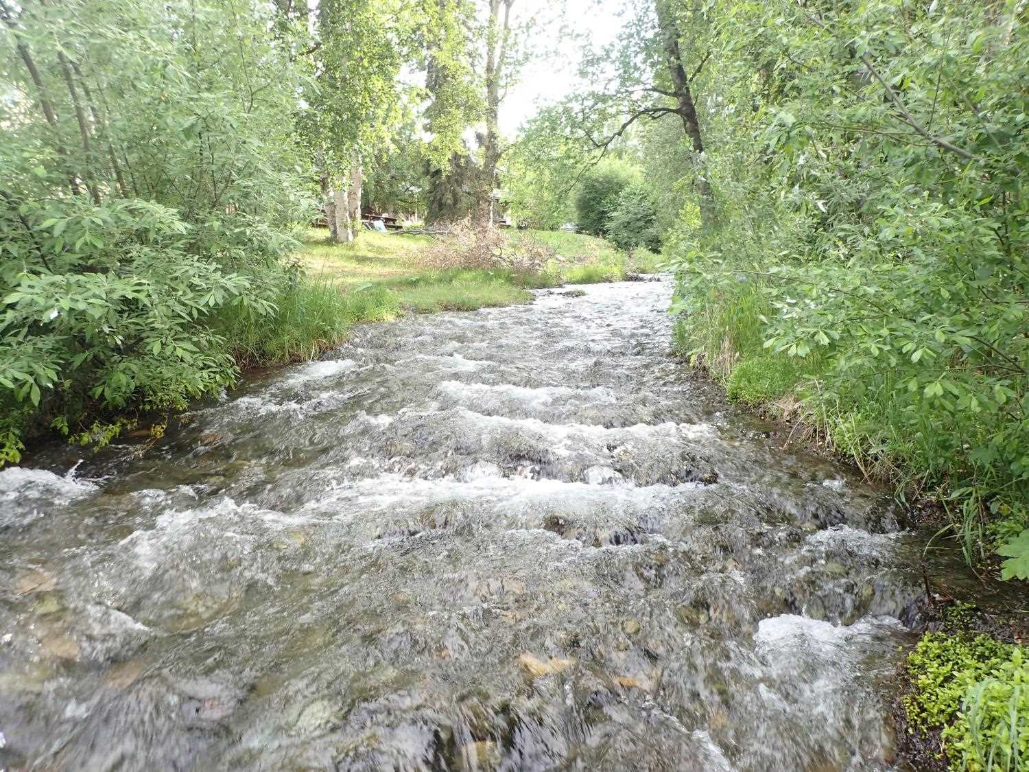
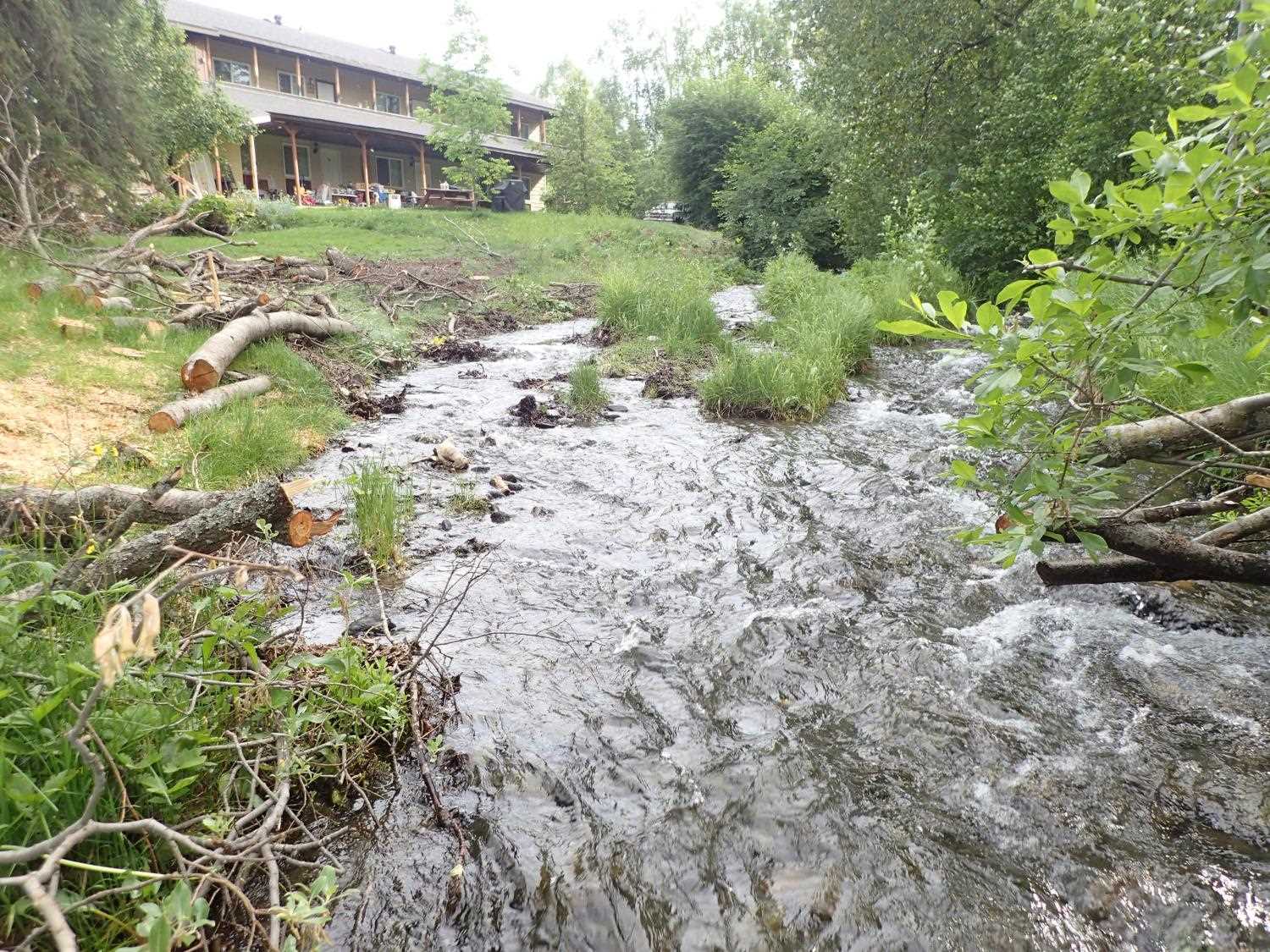
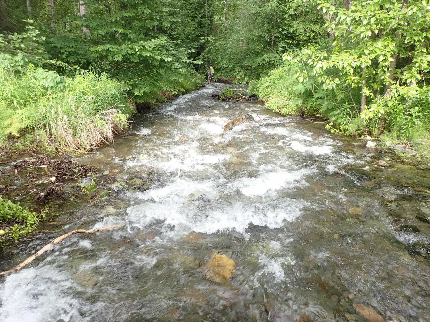
Stream Name: Meadow Creek
Elevation:
Site Comments: None
arrow to the right of the survey date below to choose a different report for this site.
Survey UPD21-OLD01
Project Supervisor: Kim Clark, ADFG
— Anchorage, AK
Observers: Kim Clark, Michael Mazzacavallo
Overall Fish Passage Rating:
Tidal: No
Backwatered: No
Step Pools: Yes
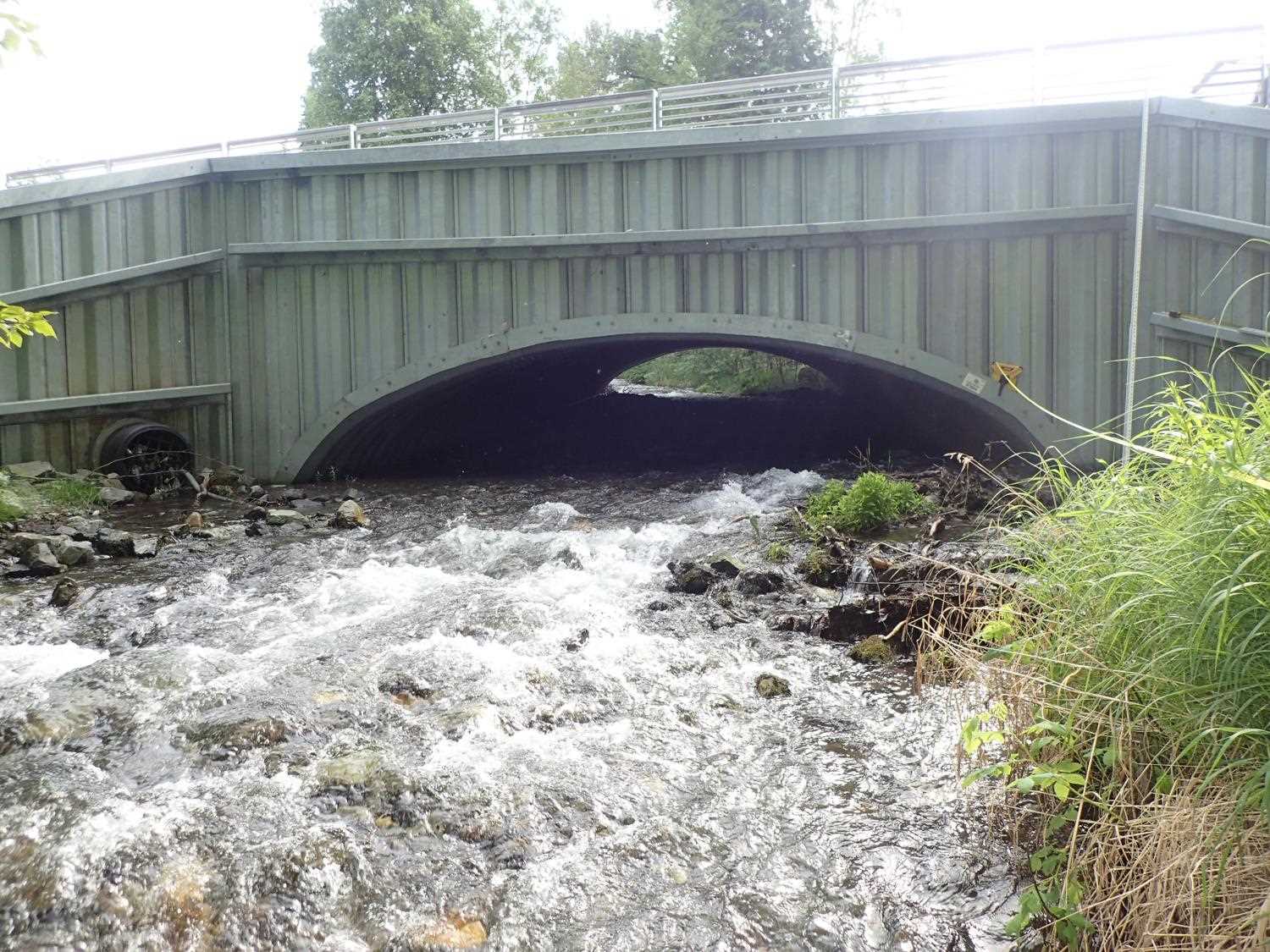
Construction Year: 2014
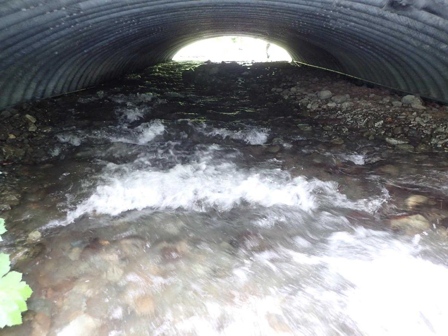
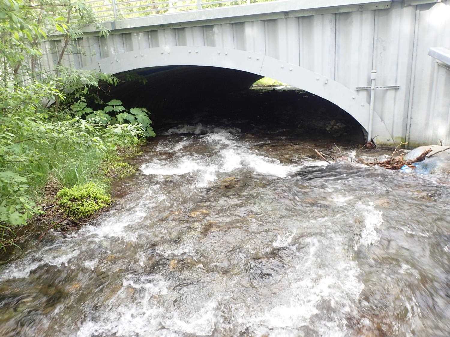
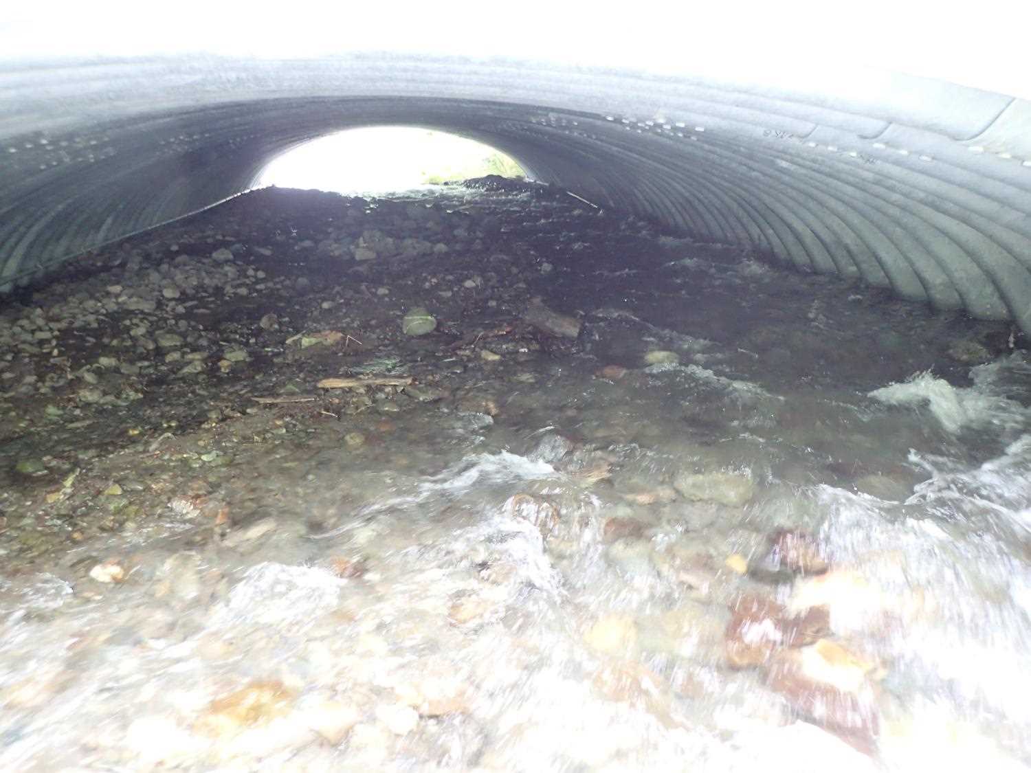
Comments: Storm drain outfall embedded in headwall, wider channel at outlet created to accommodate this. Willow stakes at inlet doing well. Bar forming on right bank inside culvert. There is an island upstream of the culvert- potentially evidence of sedimentation upstream from previous culvert. Island top and bottom measurements were included in long.pro
Culvert Measurements
| ID: 1 | Structure Type: Box culvert (Structural steel plate) | Fish Passage Rating: | ||||||||||||||||||||||||||||||||||||||||||
|
|
|
||||||||||||||||||||||||||||||||||||||||||
Comments: Stream gradient is from designs. Culvert dimensions per design are 67'9" long x 6'10" tall x 25'4" wide. Substrate depth is calculated using the measured height of the inlet and outlet of the culvert and the height on the designs. |
||||||||||||||||||||||||||||||||||||||||||||
Stream Measurements
|
|
| Stream Width Type | Distance From Crossing (ft) |
Stream Width (ft) |
|---|---|---|
| Downstream ordinary high water | 105.0 | 10.30 |
| Downstream ordinary high water | 135.0 | 11.90 |
| Downstream ordinary high water | 158.0 | 12.40 |
Elevations
| Locator ID | Culvert Number |
River Distance (ft)1 |
Distance From Crossing (ft)2 |
Relative Elevation (ft) |
|---|---|---|---|---|
| D/S Thalweg | 0.00 | 83.95 | ||
| D/S Water Surface Elev | 0.00 | 84.66 | ||
| D/S Grade Ctrl (Thalweg) | 67.00 | 87.41 | ||
| D/S Water Surface Elev | 67.00 | 88.18 | ||
| D/S Grade Ctrl (Thalweg) (Constructed grade control) | 78.00 | 88.16 | ||
| D/S Water Surface Elev | 78.00 | 89.10 | ||
| D/S Water Surface Elev | 90.00 | 89.31 | ||
| Outlet Invert | 90.00 | 88.75 | ||
| Outlet Culvert Top | 90.00 | 93.85 | ||
| U/S Water Surface Elev | 158.80 | 92.40 | ||
| Inlet Culvert Invert | 158.80 | 91.39 | ||
| Inlet Culvert Top | 158.80 | 97.19 | ||
| U/S Thalweg | 167.80 | 92.01 | ||
| U/S Water Surface Elev | 167.80 | 92.96 | ||
| U/S Thalweg | 231.80 | 94.74 | ||
| U/S Water Surface Elev | 231.80 | 95.61 | ||
| Misc. (bottom of the island) | 280.40 | 97.04 | ||
| Misc. (top of the island) | 356.80 | 99.91 |
Notes:
- River distance is measured continuously throughout the survey reach along the thalweg of the stream.
- Measured from each end of the crossing along the thalweg of the stream.
Fish Sampling Efforts
No fish sampling occurred during this survey.
Fish Observations
No fish observations occurred during this survey.
Photos


Questions or comments about this report can be directed to dfg.dsf.webmaster@alaska.gov