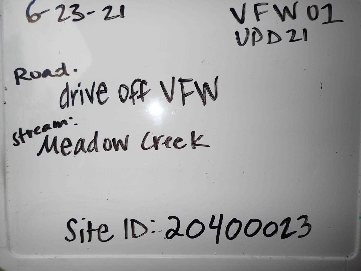
Fish Passage Site 20400023
Coordinates (dec. deg.): 61.31291°, -149.57469°
Legal Description: S014N002W11
Region: South Central
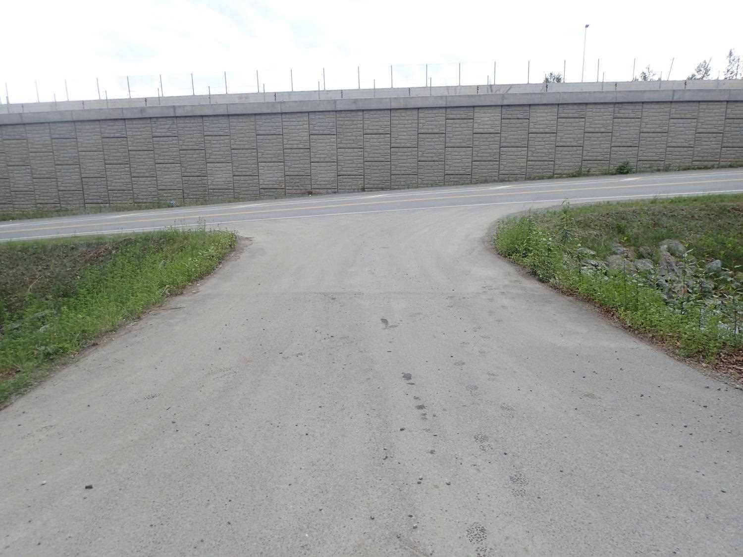
Road Name: Driveway
Datum: NAD83
Quad Name / ITM: Anchorage B-7
AWC Stream #: 247-50-10110-2053
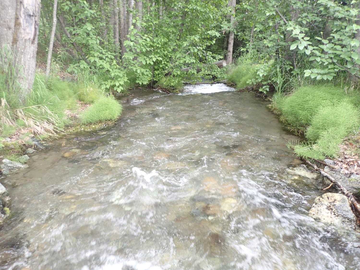
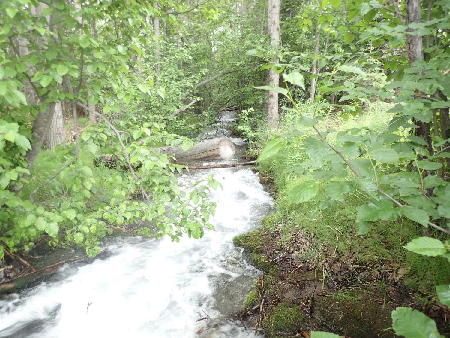
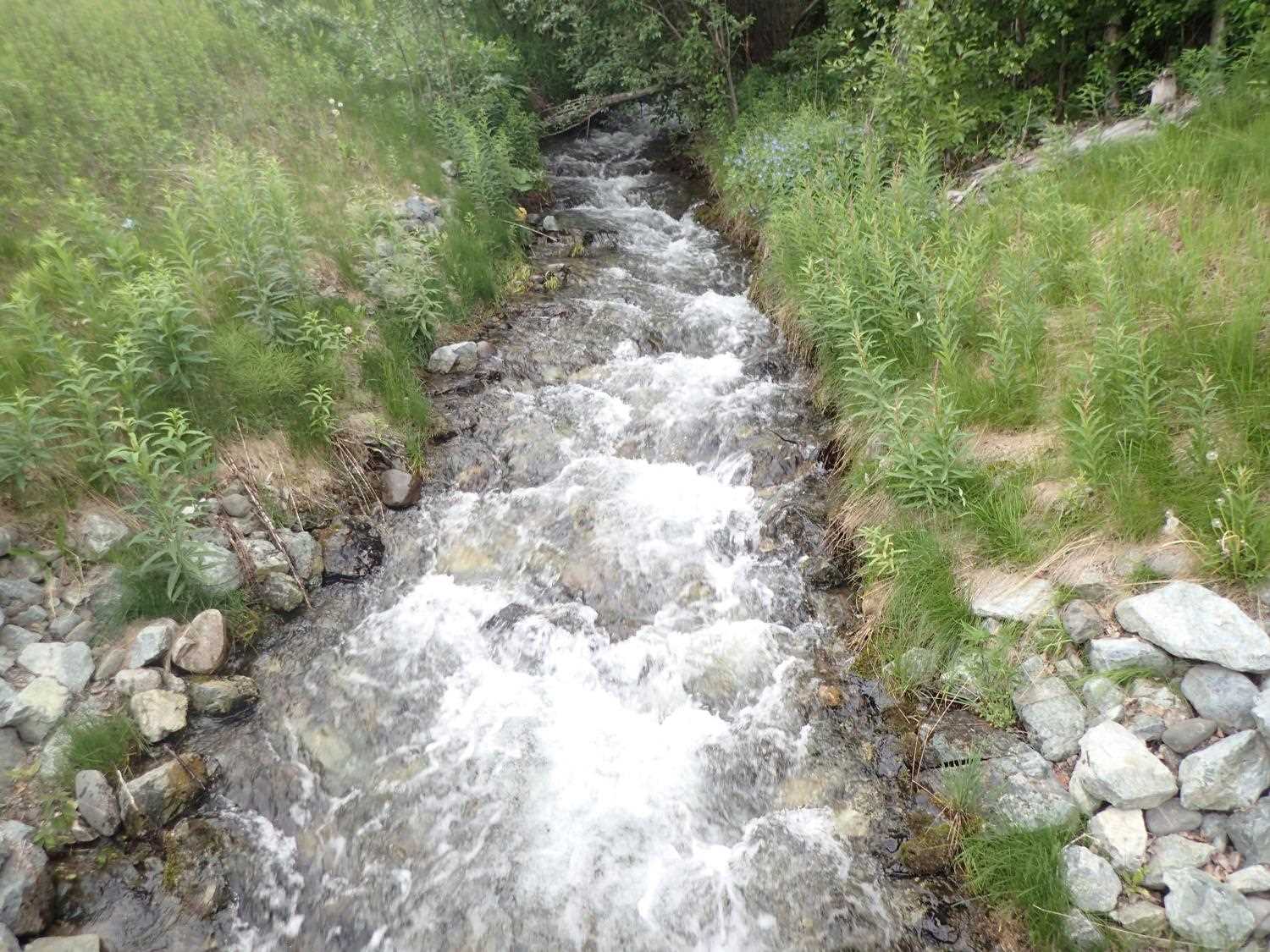
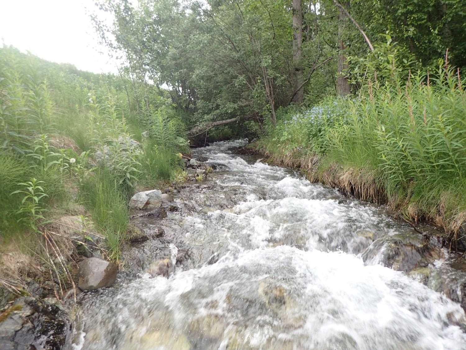
Stream Name: Meadow Creek
Elevation:
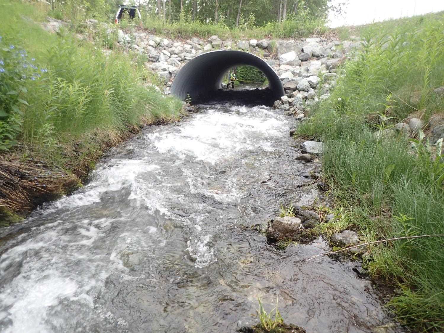
Site Comments: Eagle River Watershed. Site is on driveway off of VFW Drive. Downstream is site 20400022 at Hidden Haven Drive.
arrow to the right of the survey date below to choose a different report for this site.
Survey UPD21-VFW01
Project Supervisor: Kim Clark, ADFG
— Anchorage, AK
Observers: Kim Clark, Michael Mazzacavallo
Overall Fish Passage Rating:
Tidal: No
Backwatered: No
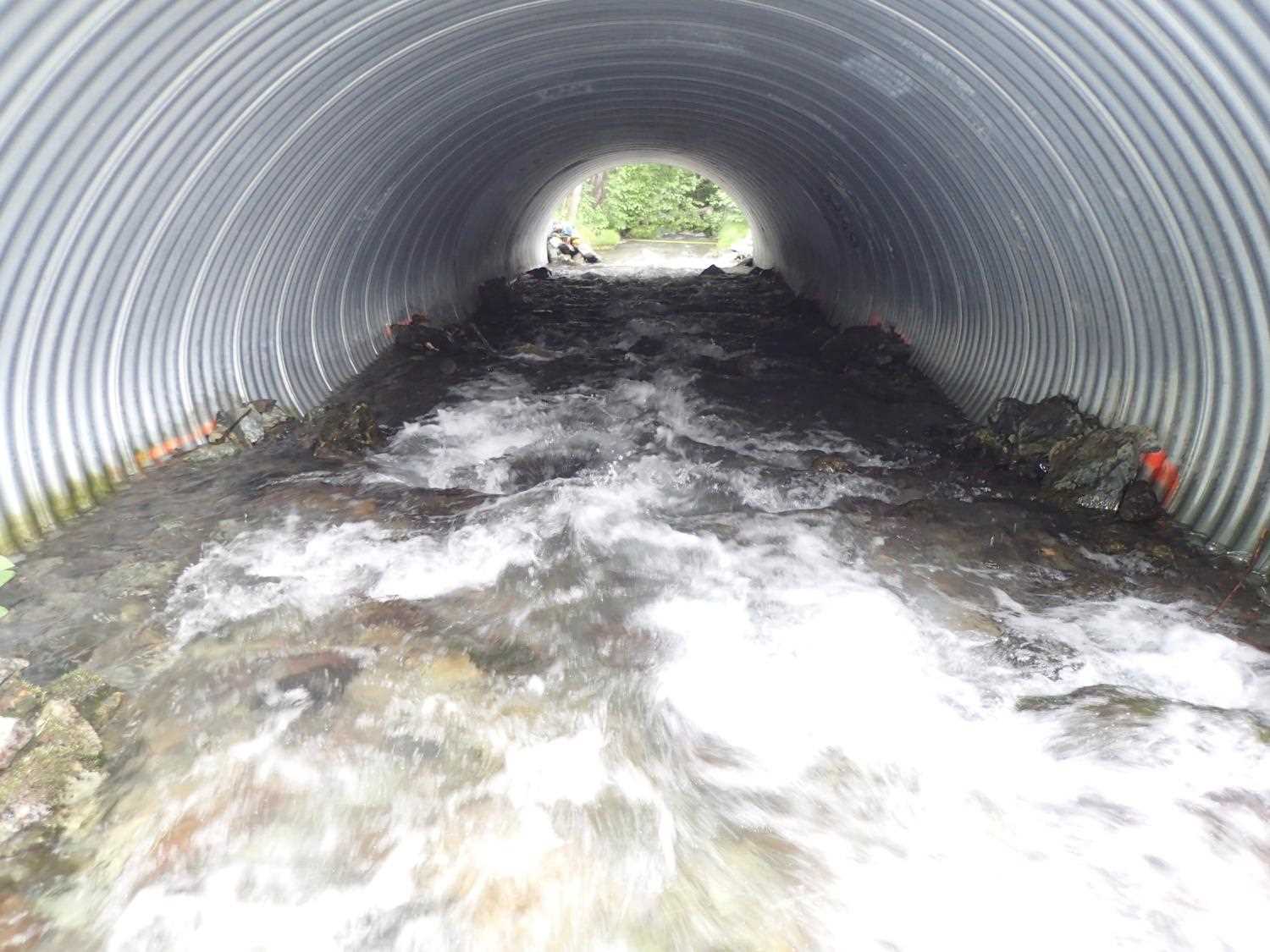
Step Pools: Yes
Construction Year: 2016
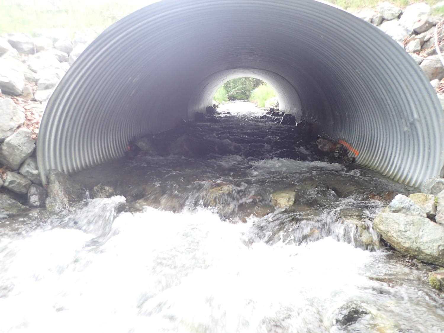
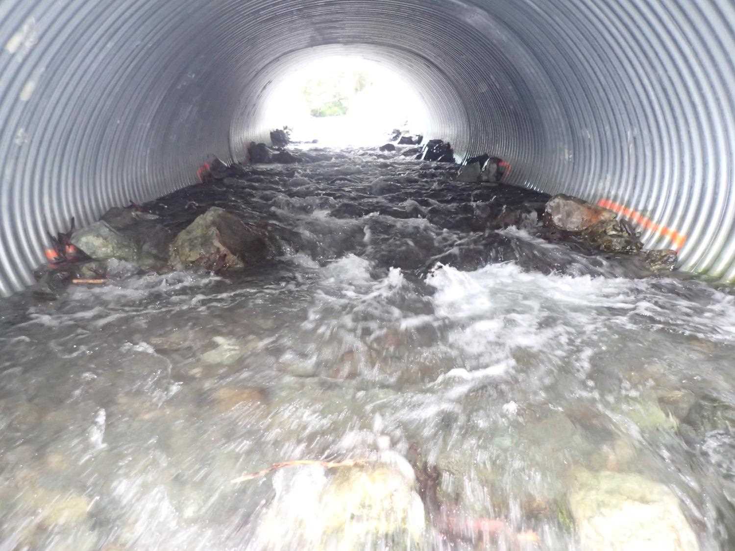
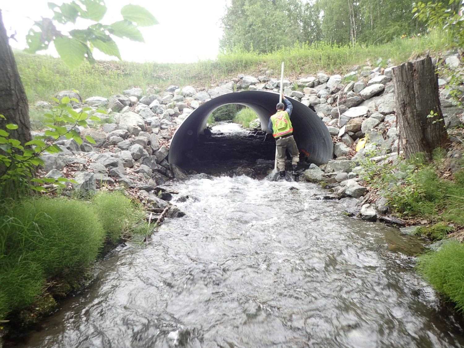
Comments: Grade control structure at and in outlet of pipe. Stream is channelized between two roads, no stream gradient was recorded. Recent waterline marks on trees downstream of outlet about 1 foot above current water surface. Drainage seep enters stream about 115ft upstream of inlet. Boulders are placed in stream.
Culvert Measurements
| ID: 1 | Structure Type: Pipe-arch (Corrugated steel) | Fish Passage Rating: | ||||||||||||||||||||||||||||||||||||||||||
|
|
|
||||||||||||||||||||||||||||||||||||||||||
Comments: Designs call pipe gradient at 5.7%. Measured pipe gradient 5.7%, Water surface gradient 5.1%, Invert gradient 5.0%. |
||||||||||||||||||||||||||||||||||||||||||||
Stream Measurements
|
|
| Stream Width Type | Distance From Crossing (ft) |
Stream Width (ft) |
|---|---|---|
| Upstream ordinary high water | 54.0 | 9.30 |
| Upstream ordinary high water | 151.0 | 10.60 |
| Upstream ordinary high water | 236.0 | 12.40 |
| Upstream ordinary high water | 255.0 | 12.70 |
Elevations
| Locator ID | Culvert Number |
River Distance (ft)1 |
Distance From Crossing (ft)2 |
Relative Elevation (ft) |
|---|---|---|---|---|
| Road Elev | 106.35 | |||
| Max Pool Depth | 0.00 | 89.03 | ||
| D/S Water Surface Elev | 0.00 | 90.77 | ||
| D/S Grade Ctrl (Thalweg) | 13.00 | 91.61 | ||
| D/S Water Surface Elev | 13.00 | 92.74 | ||
| Max Pool Depth | 37.00 | 91.97 | ||
| D/S Water Surface Elev | 37.00 | 93.15 | ||
| D/S Water Surface Elev (grade control at culvert outlet (in pipe)) | 42.00 | 93.82 | ||
| Outlet Invert | 42.00 | 92.75 | ||
| Outlet Culvert Top | 42.00 | 100.00 | ||
| Inlet Culvert Top | 99.13 | 103.28 | ||
| U/S Water Surface Elev | 99.13 | 96.72 | ||
| Inlet Culvert Invert | 99.13 | 95.58 | ||
| U/S Thalweg | 113.13 | 96.30 | ||
| U/S Water Surface Elev | 113.13 | 97.74 | ||
| U/S Thalweg | 149.13 | 98.30 | ||
| U/S Water Surface Elev | 149.13 | 99.82 |
Notes:
- River distance is measured continuously throughout the survey reach along the thalweg of the stream.
- Measured from each end of the crossing along the thalweg of the stream.
Fish Sampling Efforts
No fish sampling occurred during this survey.
Fish Observations
No fish observations occurred during this survey.
Photos


Questions or comments about this report can be directed to dfg.dsf.webmaster@alaska.gov