Fish Passage Site 20300206
Coordinates (dec. deg.): 60.95693°, -149.11571°
Legal Description: S010N002E16
Region: South Central
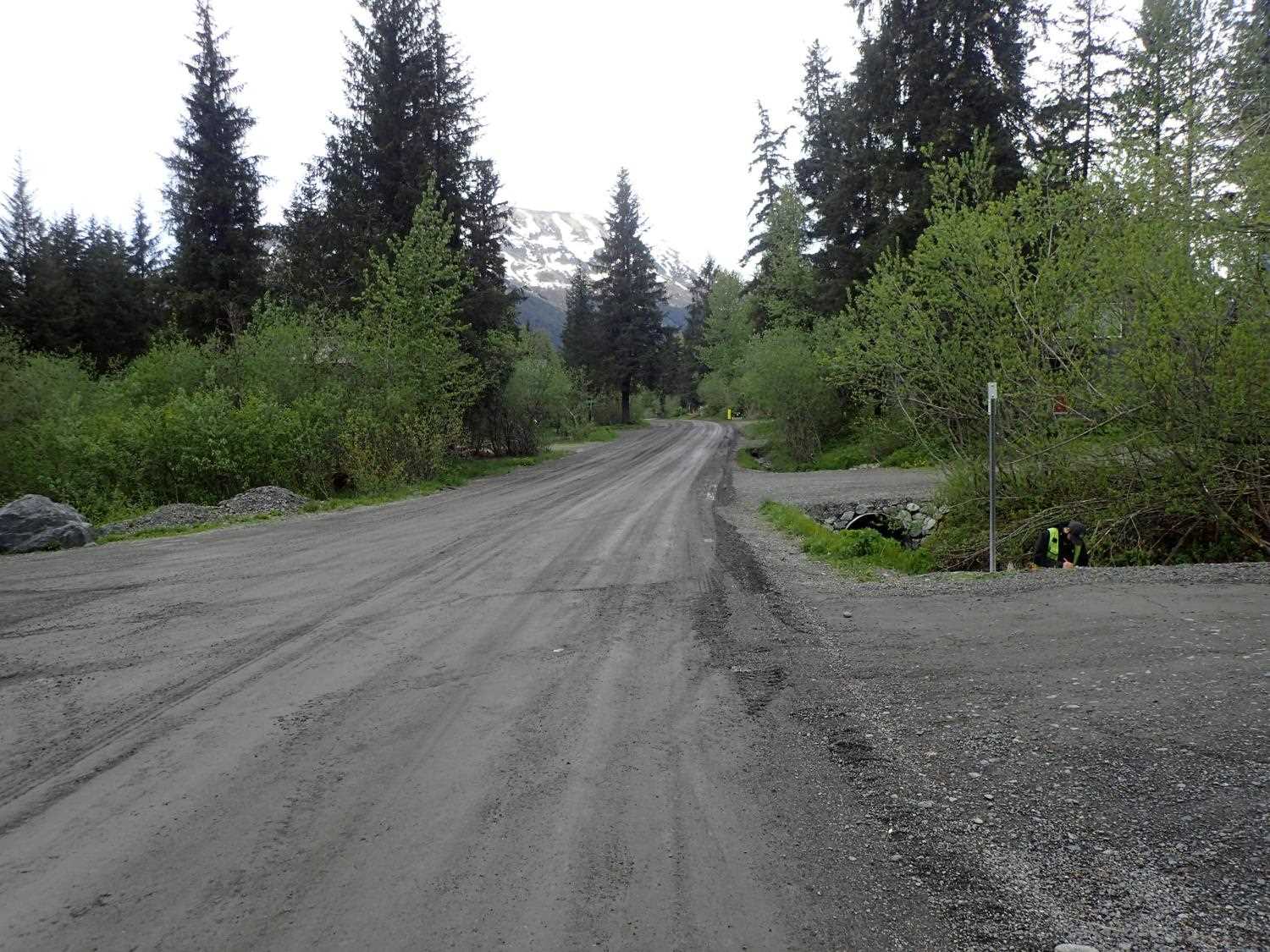
Road Name: Driveway
Datum: NAD83
Quad Name / ITM: Seward D-6
AWC Stream #:
Stream Name: Glacier Creek tributary
Elevation:
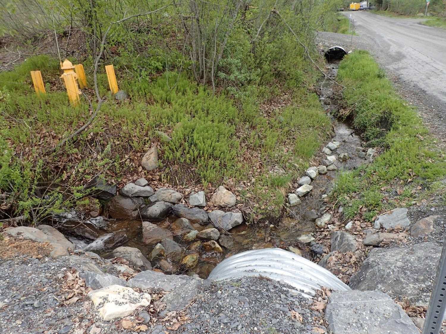
Site Comments: Driveway off of Alyeska View Avenue. Just upstream from 20300204 and 20300205.
arrow to the right of the survey date below to choose a different report for this site.
Survey UPD21-ALY06
Project Supervisor: Kim Clark, ADFG
— Anchorage, AK
Observers: Kim Clark, Michael Mazzacavallo
Overall Fish Passage Rating:
Tidal: No
Backwatered: No
Step Pools: No
Construction Year: 2019
Site Observations:
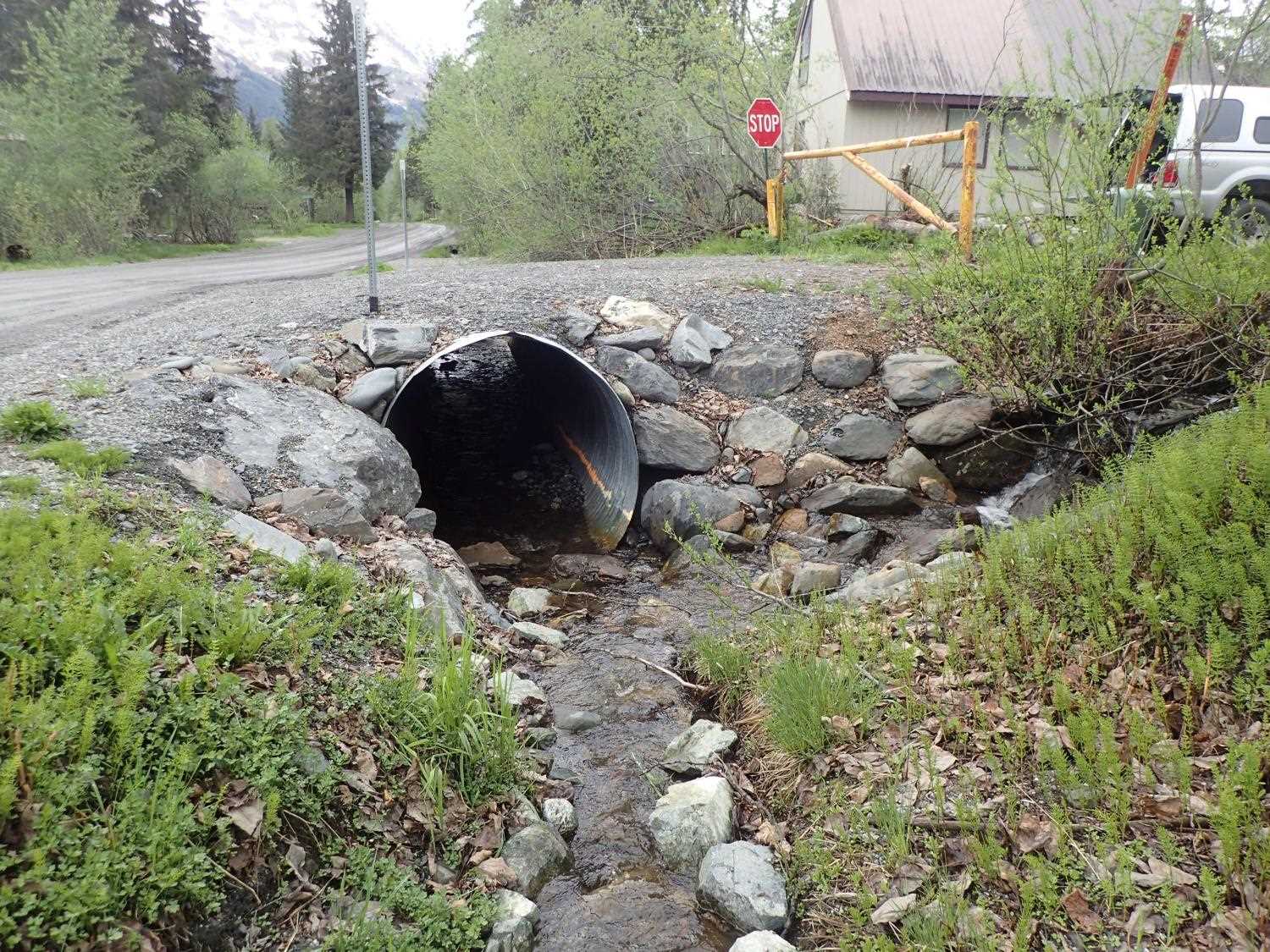
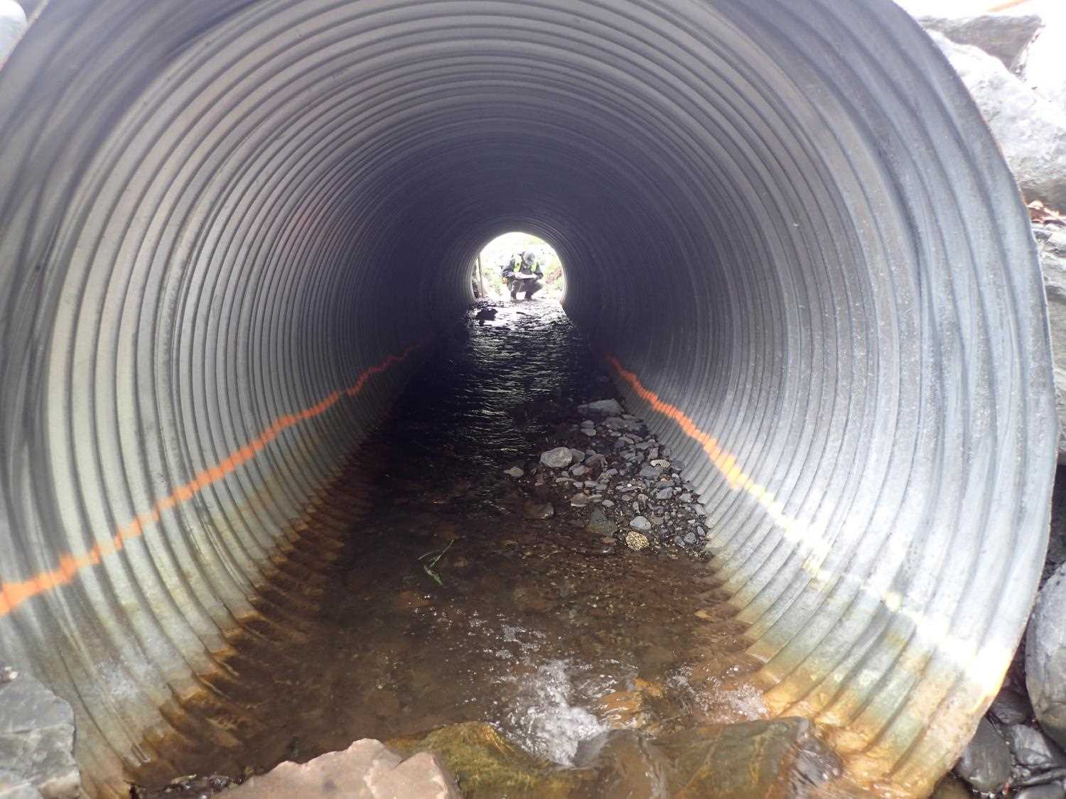
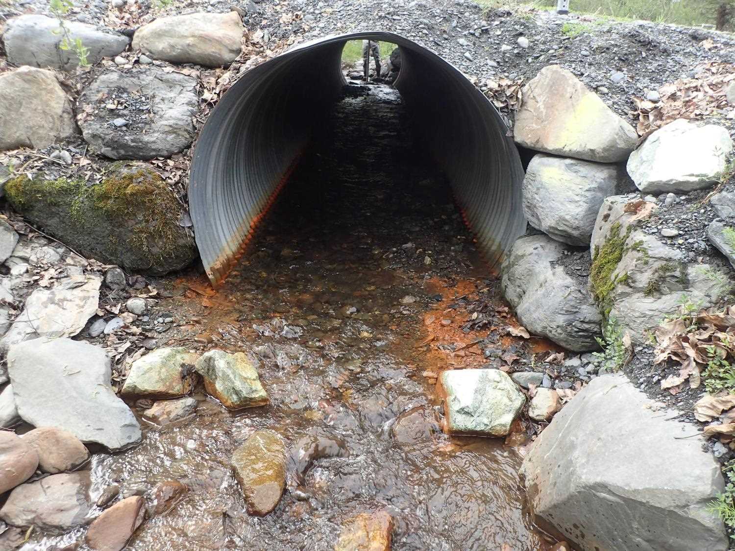
- Inlet perch
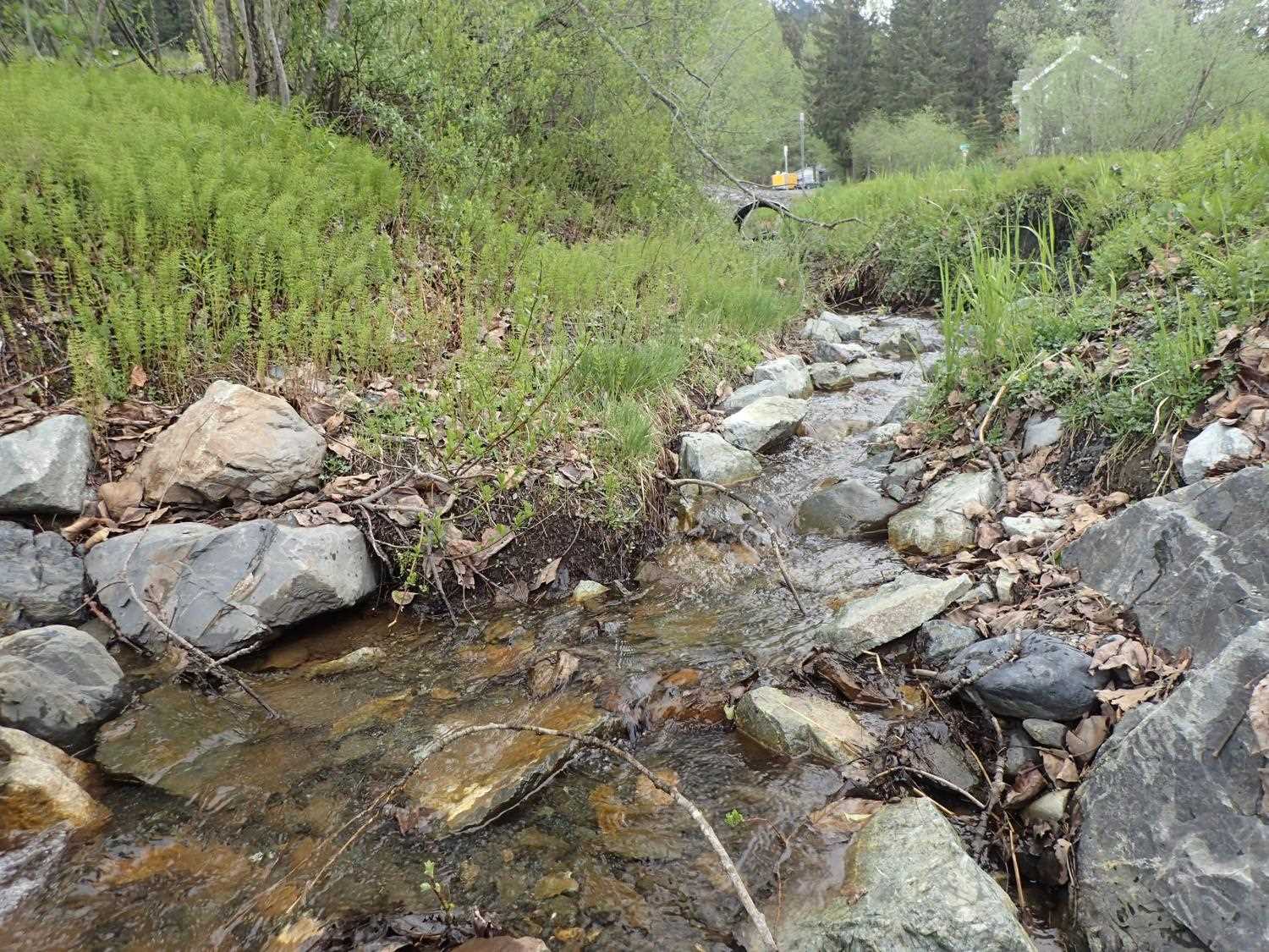
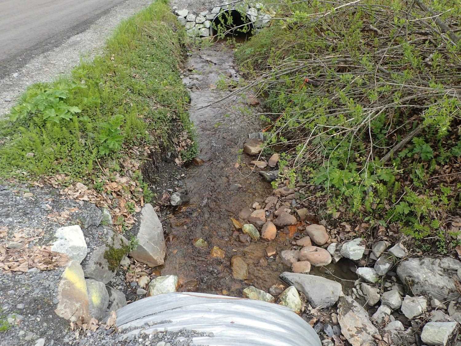
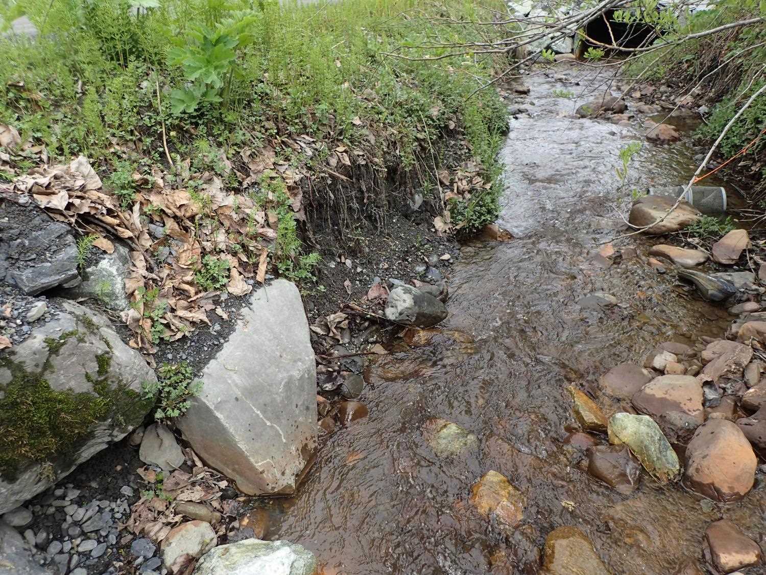
Comments: Culvert is installed steeper than stream. Sediment is about 1.4 feet below orange fill line on culvert. Rip rap has fallen in near inlet. Some bank erosion present both up and downstream. Bedload is at 80%. Monitoring recommended.
Culvert Measurements
| ID: 1 | Structure Type: Circular pipe (Corrugated steel) | Fish Passage Rating: | ||||||||||||||||||||||||||||||||||||||||||
|
|
|
||||||||||||||||||||||||||||||||||||||||||
Comments: Pipe gradient is designed at 3.84%. Stream gradient upstream of ditch and all culverts is 8.5% and stream gradient downstream is 2.7%. |
||||||||||||||||||||||||||||||||||||||||||||
Culvert Observations:
|
||||||||||||||||||||||||||||||||||||||||||||
Stream Measurements
|
|
| Stream Width Type | Distance From Crossing (ft) |
Stream Width (ft) |
|---|---|---|
| Downstream ordinary high water | 7.0 | 7.70 |
| Downstream ordinary high water | 15.0 | 7.40 |
| Downstream ordinary high water | 21.0 | 7.80 |
| Upstream ordinary high water | 15.0 | 4.20 |
| Upstream ordinary high water | 29.0 | 2.80 |
| Upstream ordinary high water | 38.0 | 4.00 |
Elevations
| Locator ID | Culvert Number |
River Distance (ft)1 |
Distance From Crossing (ft)2 |
Relative Elevation (ft) |
|---|---|---|---|---|
| D/S Water Surface Elev | 0.00 | 95.58 | ||
| D/S Thalweg | 0.00 | 95.16 | ||
| D/S Thalweg | 9.50 | 95.42 | ||
| D/S Water Surface Elev | 9.50 | 95.77 | ||
| D/S Thalweg | 17.30 | 95.91 | ||
| D/S Water Surface Elev | 17.30 | 96.16 | ||
| D/S Water Surface Elev | 20.00 | 96.30 | ||
| Outlet Invert | 20.00 | 96.02 | ||
| Outlet Culvert Top (top of outlet was bent. Measurement taken 1 corrugation back.) | 20.00 | 100.00 | ||
| Inlet Culvert Invert | 60.50 | 96.63 | ||
| U/S Water Surface Elev | 60.50 | 97.26 | ||
| Inlet Culvert Top | 60.50 | 97.49 | ||
| U/S Thalweg | 66.50 | 97.81 | ||
| U/S Water Surface Elev | 66.50 | 98.04 | ||
| U/S Thalweg | 90.10 | 99.24 | ||
| U/S Water Surface Elev | 90.10 | 99.38 |
Notes:
- River distance is measured continuously throughout the survey reach along the thalweg of the stream.
- Measured from each end of the crossing along the thalweg of the stream.
Fish Sampling Efforts
No fish sampling occurred during this survey.
Fish Observations
No fish observations occurred during this survey.
Photos

Questions or comments about this report can be directed to dfg.dsf.webmaster@alaska.gov