Fish Passage Site 20103961
Coordinates (dec. deg.): 61.57798°, -144.43779°
Legal Description: C003S005E26
Region: South Central
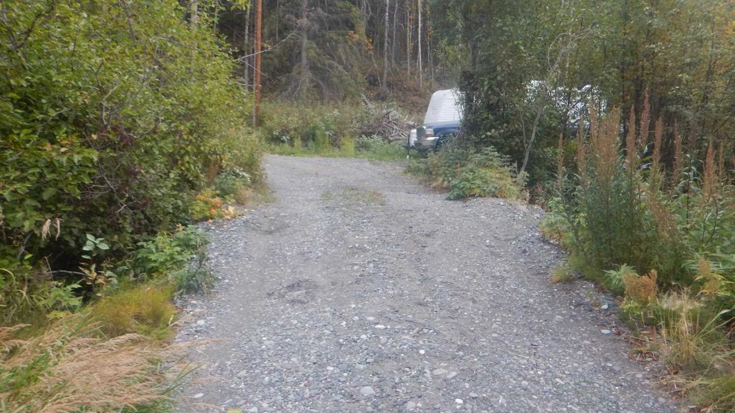
Road Name: Driveway
Datum: NAD83
Quad Name / ITM: Valdez C-2
AWC Stream #:
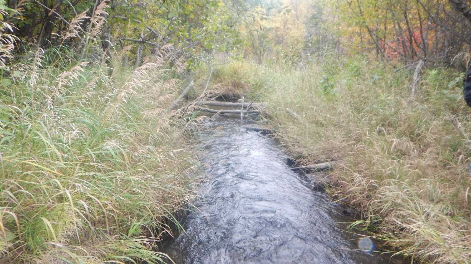
Stream Name: Chitna Creek
Elevation:
Site Comments: None
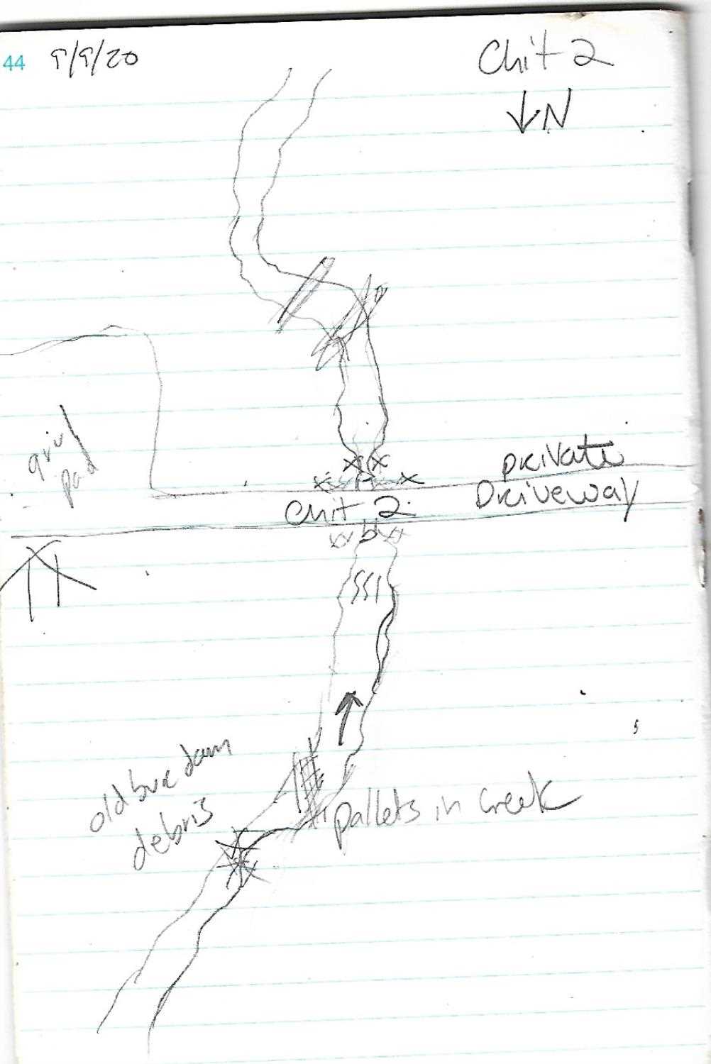
Survey UPD21-CHI02
Project Supervisor: Kim Clark, ADFG
— Anchorage, AK
Observers: Andrew Kastning
Overall Fish Passage Rating:
Tidal: No
Backwatered: No
Step Pools: No
Construction Year:
Site Observations:
- Constriction ratio gray
- Culvert gradient gray
- Culvert is too short
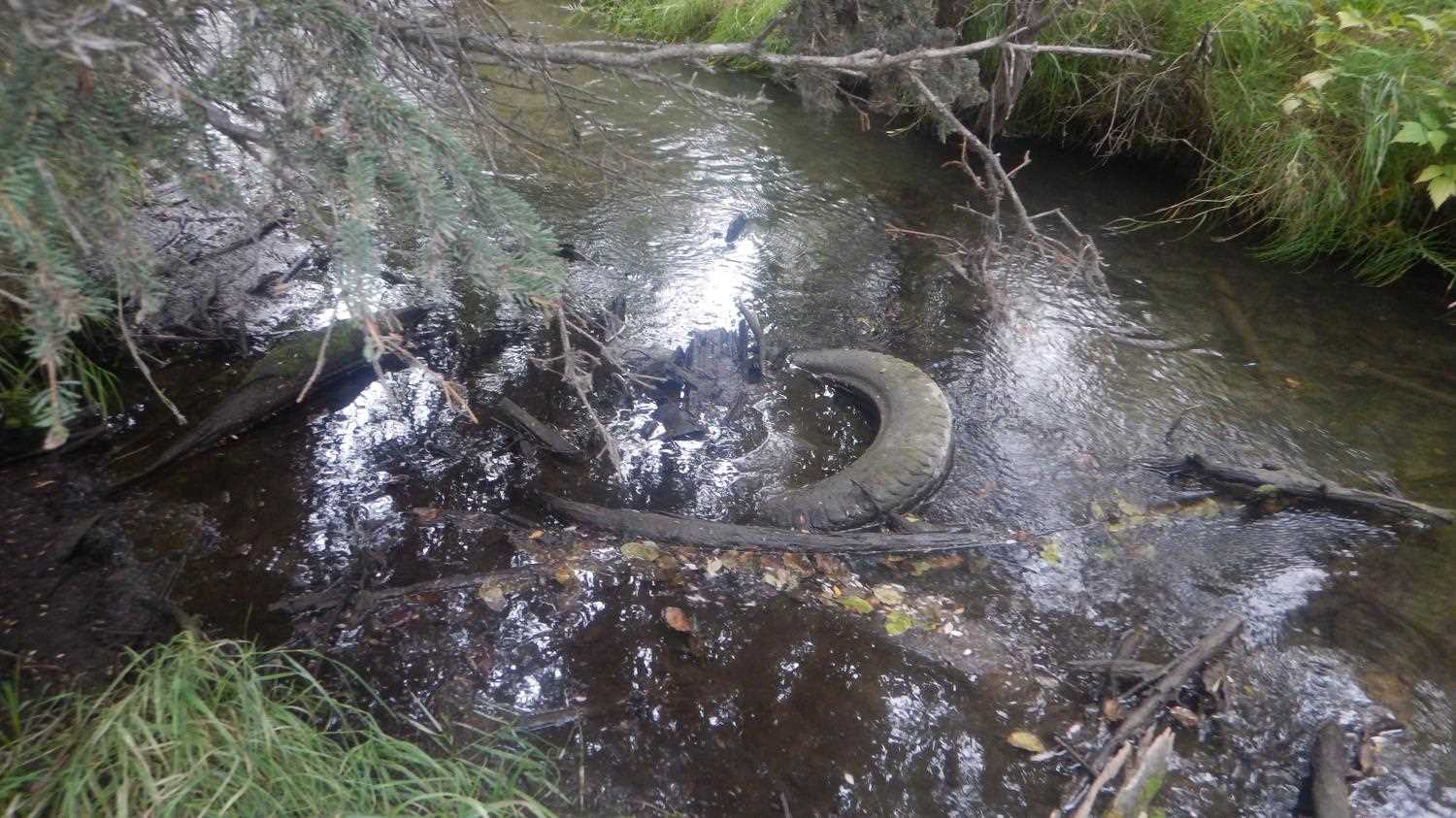
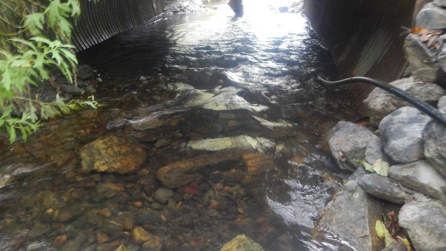
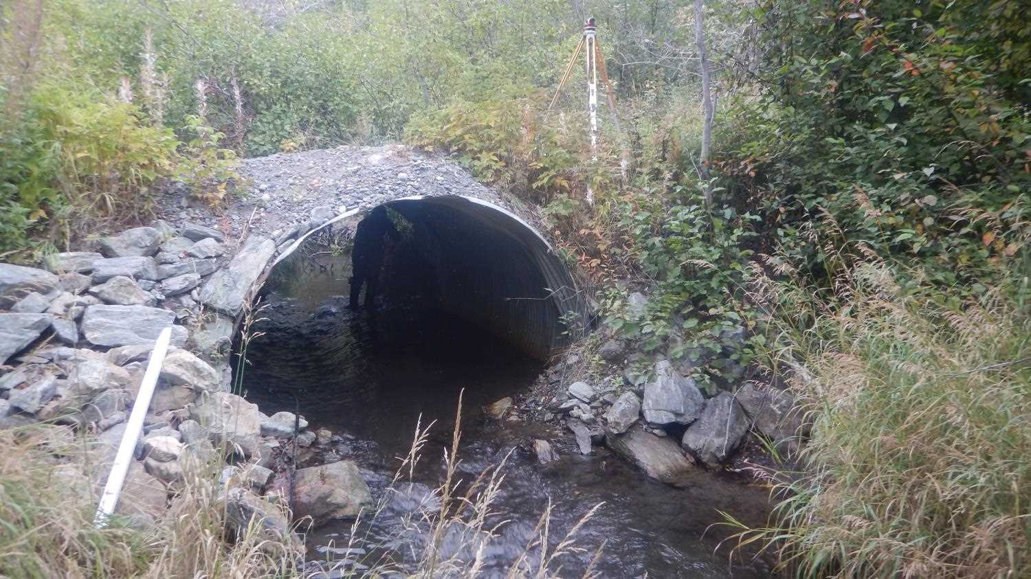
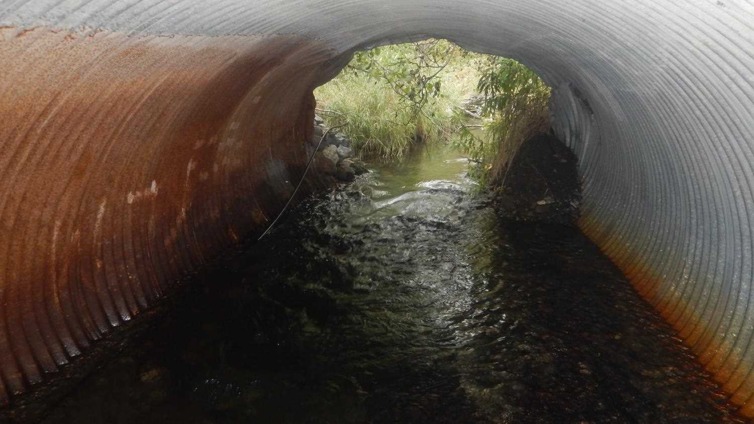
Comments: Road Fill and Armor. Rock in inlet and outlet. Stream not in AWC. Structure type noted with 'might be open bottom.' but appears to be circular pipe with severe rust from photos. Substrate depth unknown/ not recorded. Rust line height not recorded. Data collected by Kirsti Jurica with the Copper River Watershed Project.
Culvert Measurements
| ID: 1 | Structure Type: Open-bottom arch (Corrugated steel) | Fish Passage Rating: | |||||||||||||||||||||||||||||||||||||||||
|
|
|
|||||||||||||||||||||||||||||||||||||||||
Culvert Observations:
|
|||||||||||||||||||||||||||||||||||||||||||
Stream Measurements
|
|
| Stream Width Type | Distance From Crossing (ft) |
Stream Width (ft) |
|---|---|---|
| Downstream ordinary high water | 11.80 | |
| Upstream ordinary high water | 8.20 | |
| Upstream ordinary high water | 10.50 | |
| Upstream ordinary high water | 10.30 |
Elevations
| Locator ID | Culvert Number |
River Distance (ft)1 |
Distance From Crossing (ft)2 |
Relative Elevation (ft) |
|---|---|---|---|---|
| Road Elev (Road Surface) | 577.54 | |||
| U/S Water Surface Elev | 0.00 | 571.93 | ||
| U/S Thalweg (Chit 2 ups real elevations) | 0.00 | 570.55 | ||
| Inlet Culvert Invert | 16.00 | 571.17 | ||
| U/S Water Surface Elev | 16.00 | 571.76 | ||
| Top of Pipe Inlet | 16.00 | 576.84 | ||
| Outlet Culvert Top | 33.00 | 576.68 | ||
| D/S Water Surface Elev | 33.00 | 571.58 | ||
| Outlet Invert | 33.00 | 570.53 | ||
| D/S Thalweg (Outlet riffle) | 44.00 | 570.48 | ||
| D/S Water Surface Elev | 44.00 | 571.42 | ||
| D/S Water Surface Elev | 66.00 | 571.34 | ||
| D/S Thalweg | 66.00 | 570.70 |
Notes:
- River distance is measured continuously throughout the survey reach along the thalweg of the stream.
- Measured from each end of the crossing along the thalweg of the stream.
Fish Sampling Efforts
No fish sampling occurred during this survey.
Fish Observations
No fish observations occurred during this survey.
Photos


Questions or comments about this report can be directed to dfg.dsf.webmaster@alaska.gov