Fish Passage Site 20103960
Coordinates (dec. deg.): 61.51682°, -144.43941°
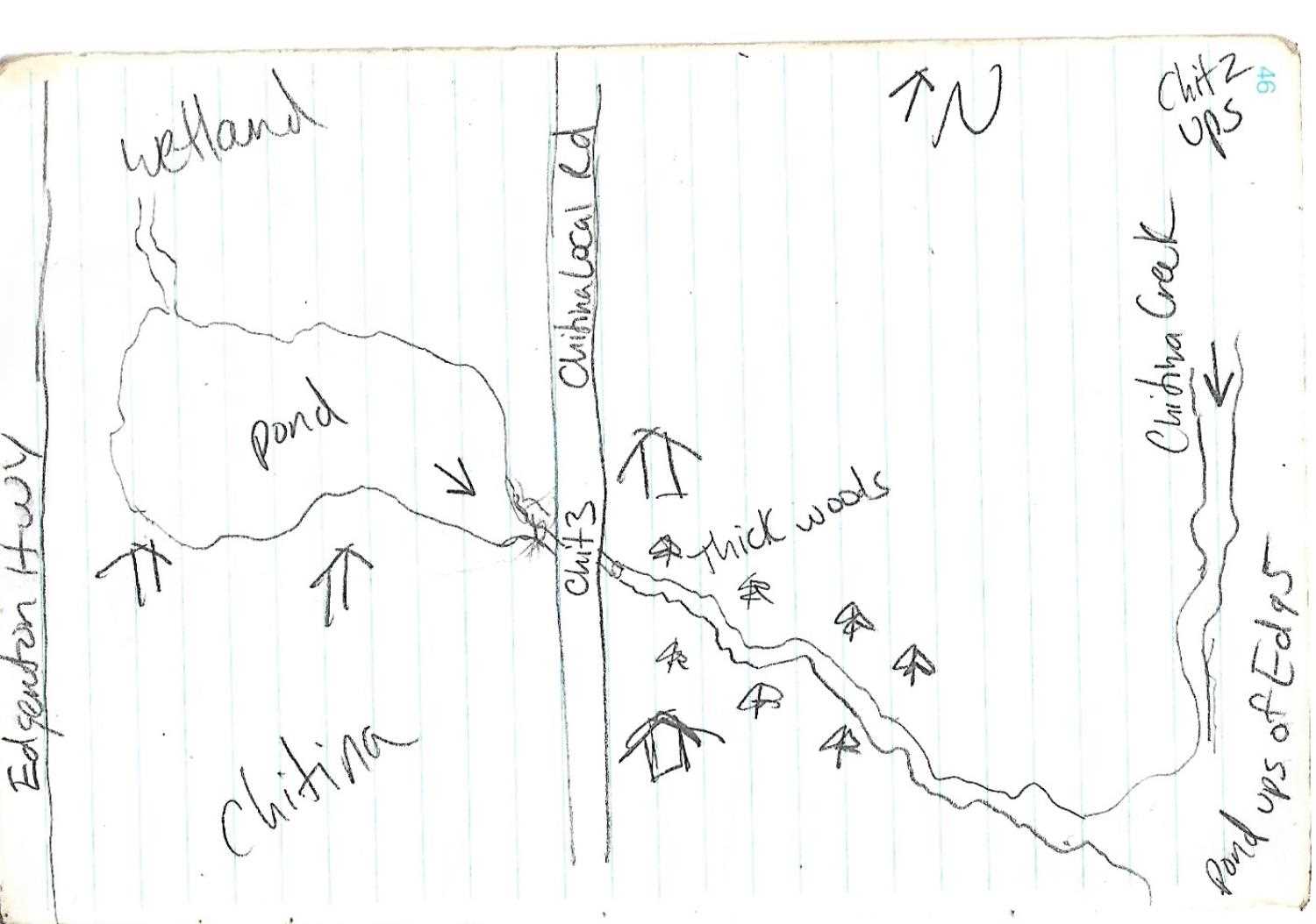
Legal Description: C004S005E14
Region: South Central
Road Name: Local Road
Datum:
Quad Name / ITM: Valdez C-2
AWC Stream #:
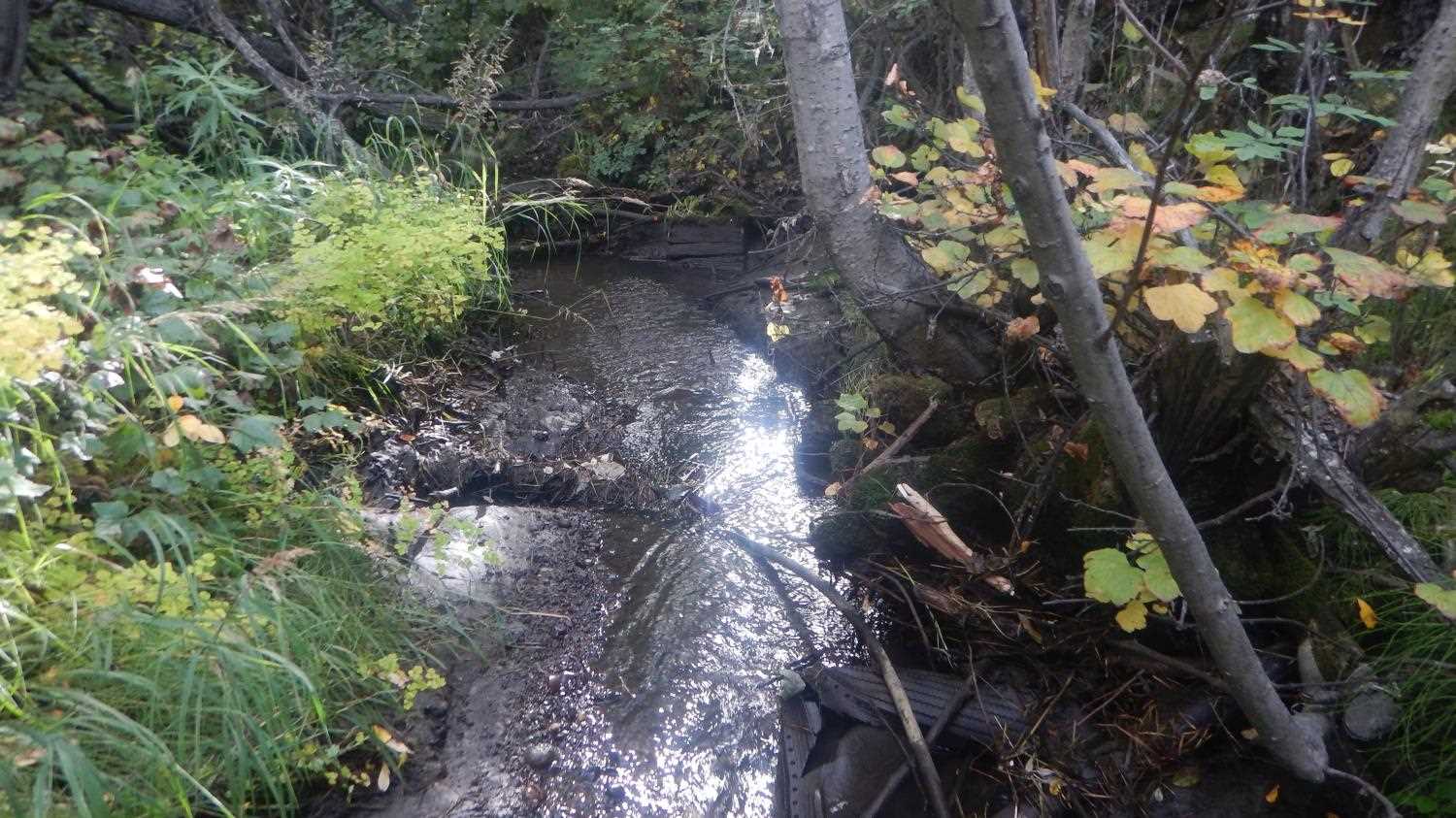
Stream Name: Chitna Creek Tributary
Elevation:
Site Comments: None
Survey UPD21-CHI03
Project Supervisor: Kim Clark, ADFG
— Anchorage, AK
Observers: Andrew Kastning
Overall Fish Passage Rating:
Tidal: No
Backwatered: No
Step Pools: No
Construction Year:
Site Observations:
- Constriction ratio red
- Outfall height red
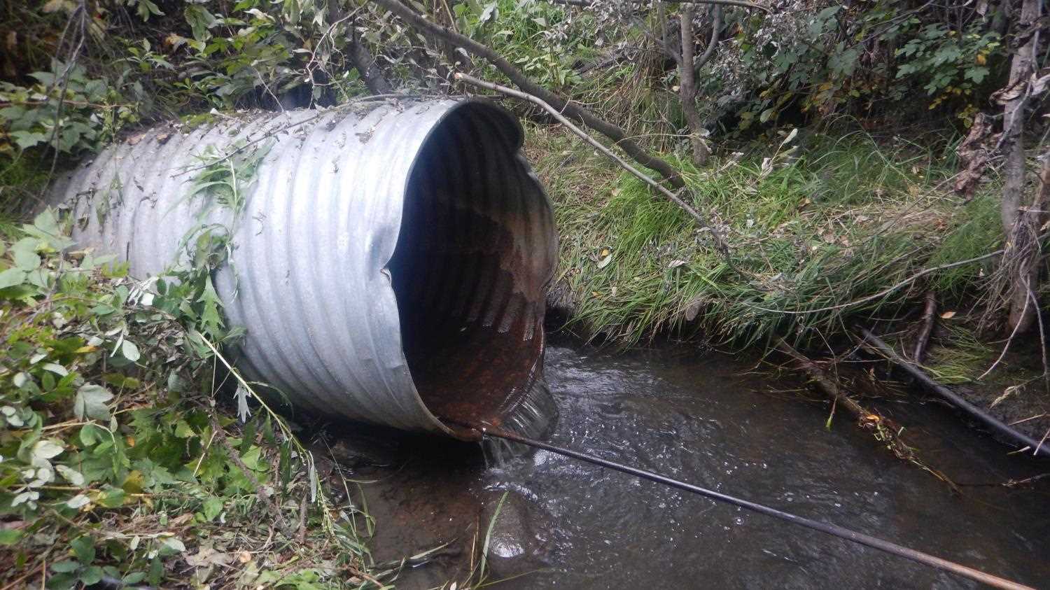
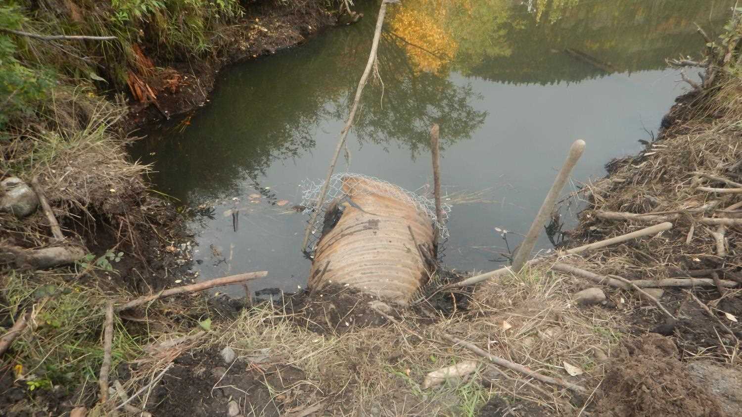
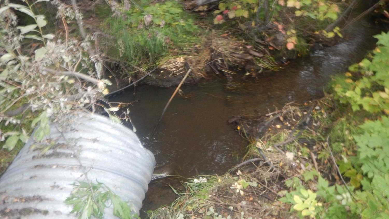
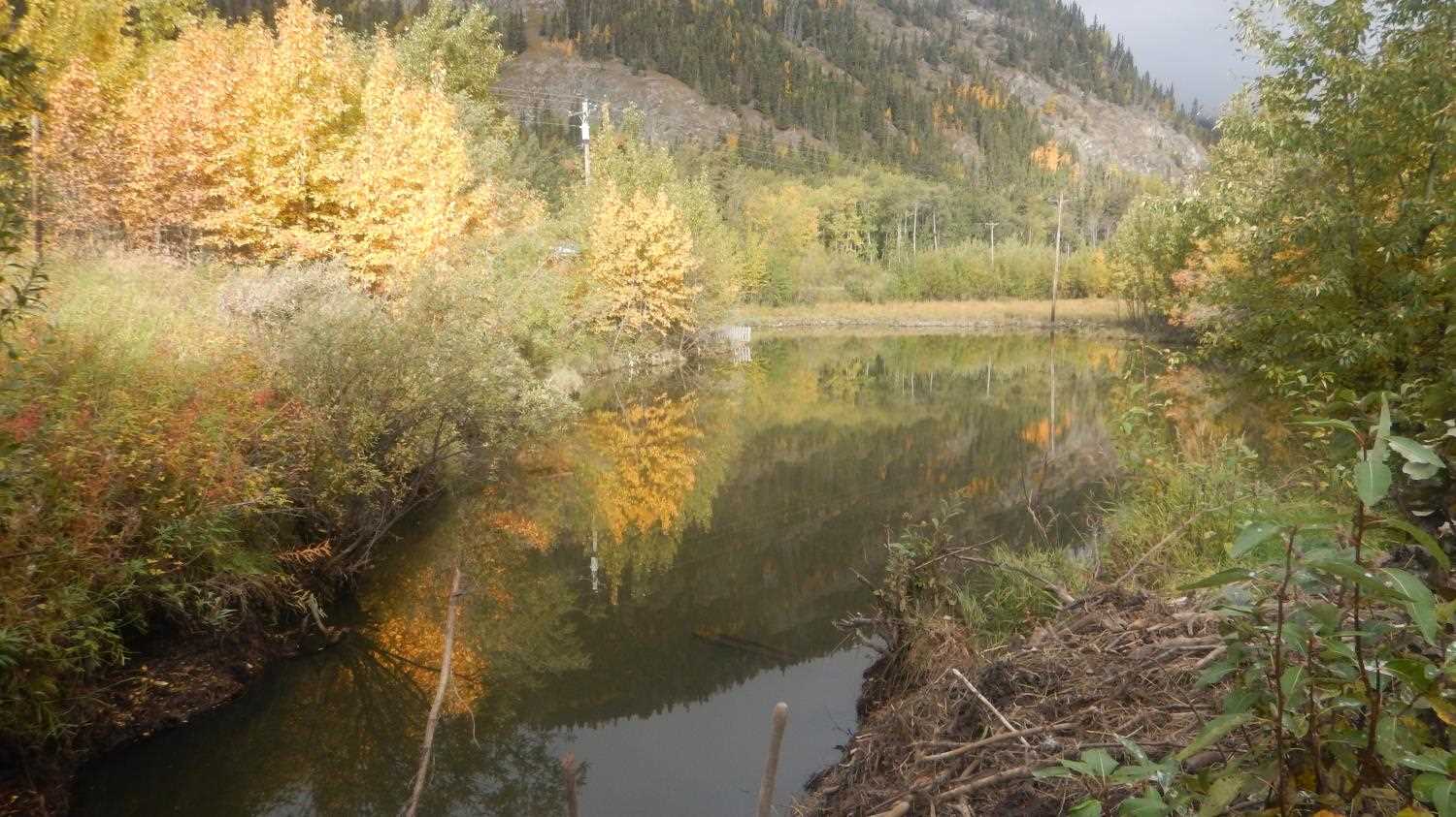
Comments: Inlet has fencing around it. Residents fighting with beavers. Highly manipulated systems. Private property surrounds system. Lots of garbage in creek.. Submitted by Kirst Jurica with Copper River Watershed Project.
Culvert Measurements
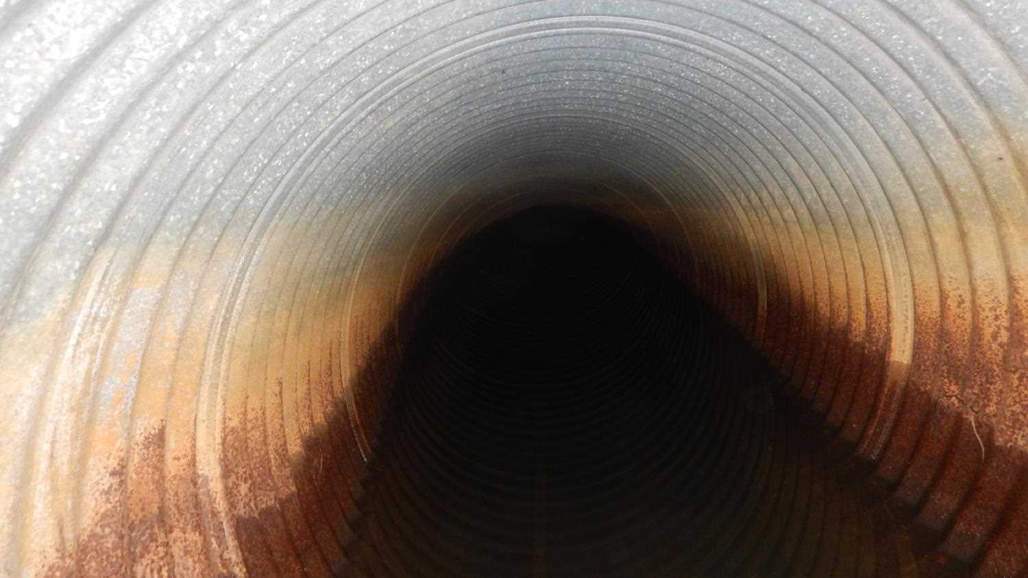
| ID: 1 | Structure Type: Circular pipe (Corrugated steel) | Fish Passage Rating: | |||||||||||||||||||||||||||||||||||||||||
|
|
|
|||||||||||||||||||||||||||||||||||||||||
Comments: Gradient measured using watersurface elevations. No access to inlet due to fending. |
|||||||||||||||||||||||||||||||||||||||||||
Culvert Observations:
|
|||||||||||||||||||||||||||||||||||||||||||
Stream Measurements
|
|
| Stream Width Type | Distance From Crossing (ft) |
Stream Width (ft) |
|---|---|---|
| Downstream ordinary high water | 5.80 |
Elevations
| Locator ID | Culvert Number |
River Distance (ft)1 |
Distance From Crossing (ft)2 |
Relative Elevation (ft) |
|---|---|---|---|---|
| Road Elev | 583.26 | |||
| U/S Water Surface Elev | 0.00 | 578.37 | ||
| U/S Thalweg | 0.00 | 577.91 | ||
| U/S Water Surface Elev | 3.00 | 578.37 | ||
| Inlet Culvert Top (Damaged) | 3.00 | 579.51 | ||
| Outlet Culvert Top | 46.00 | 578.04 | ||
| Outlet Invert | 46.00 | 578.15 | ||
| Max Pool Depth | 49.00 | 576.99 | ||
| D/S Water Surface Elev | 49.00 | 577.78 | ||
| D/S Tailcrest or 1st Thalweg | 59.00 | 577.59 | ||
| D/S Tailcrest or 1st Thalweg | 59.00 | 577.67 |
Notes:
- River distance is measured continuously throughout the survey reach along the thalweg of the stream.
- Measured from each end of the crossing along the thalweg of the stream.
Fish Sampling Efforts
No fish sampling occurred during this survey.
Fish Observations
No fish observations occurred during this survey.
Photos
Questions or comments about this report can be directed to dfg.dsf.webmaster@alaska.gov