Fish Passage Site 20103956
Coordinates (dec. deg.): 62.79747°, -145.44713°
Legal Description: C012N001W29
Region: South Central
Road Name: Pipeline Access Road
Datum:
Quad Name / ITM: Gulkana D-3
AWC Stream #:
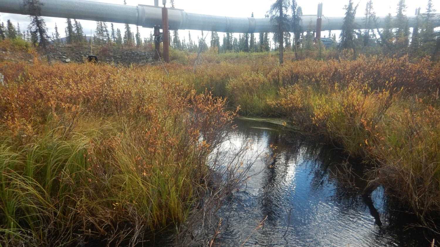
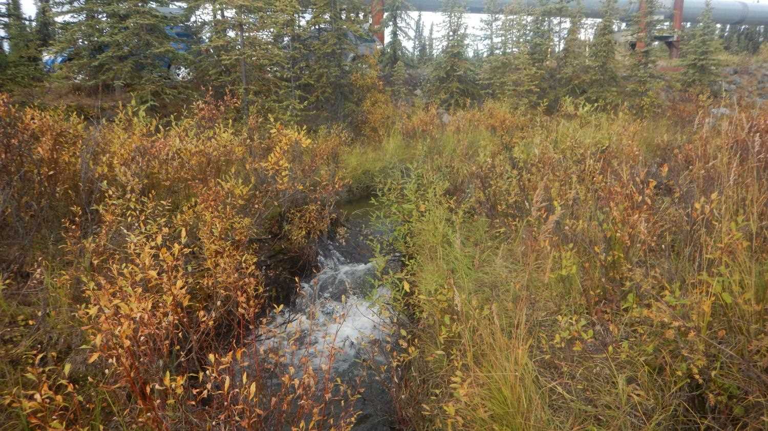
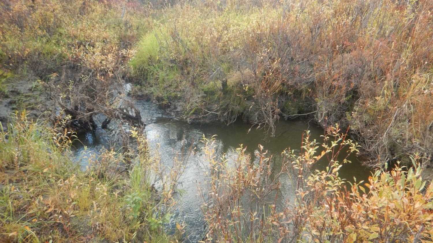
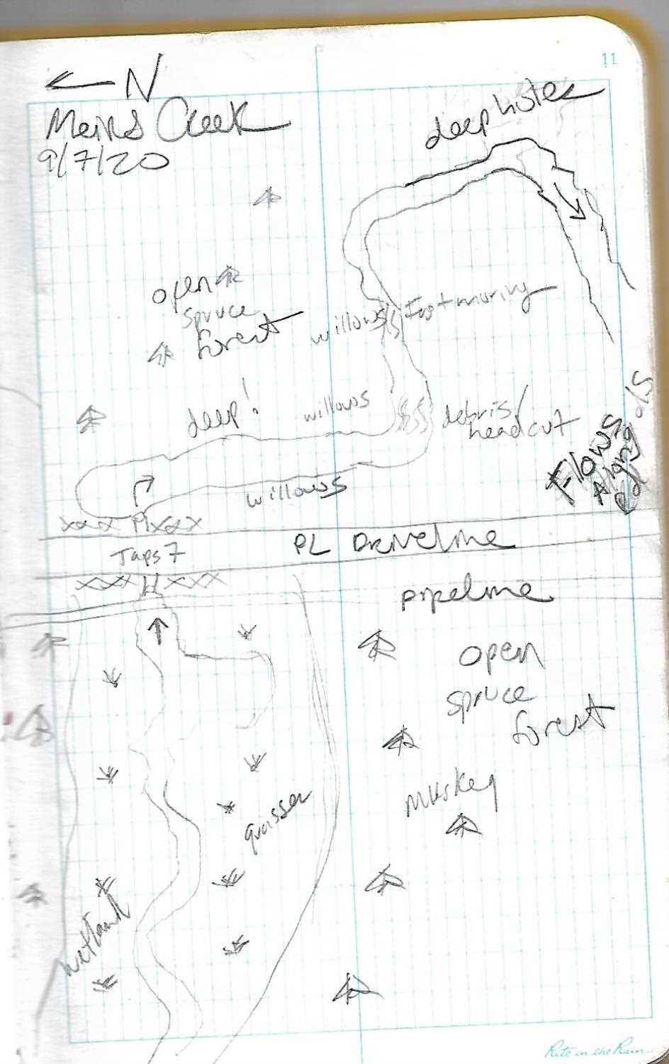
Stream Name: Meirs Creek
Elevation:
Site Comments: PLMP 634.67
Survey UPD21-TAP7
Project Supervisor: Kim Clark, ADFG
— Anchorage, AK
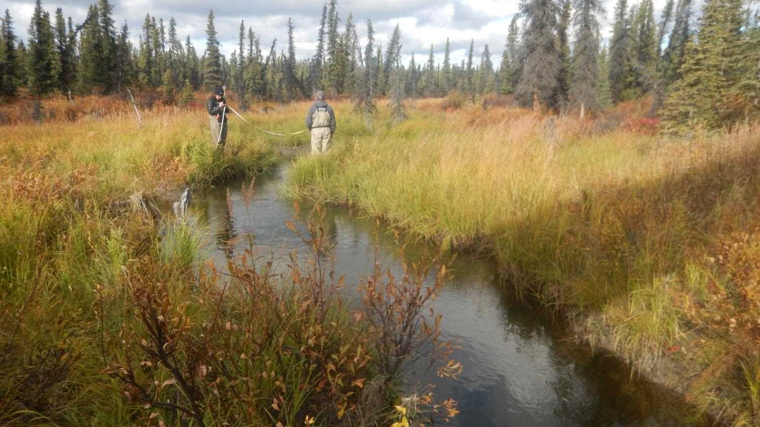
Observers: Andrew Kastning, Nicole Farnham
Overall Fish Passage Rating:
Tidal: No
Backwatered: No
Step Pools: No
Construction Year:
Site Observations:
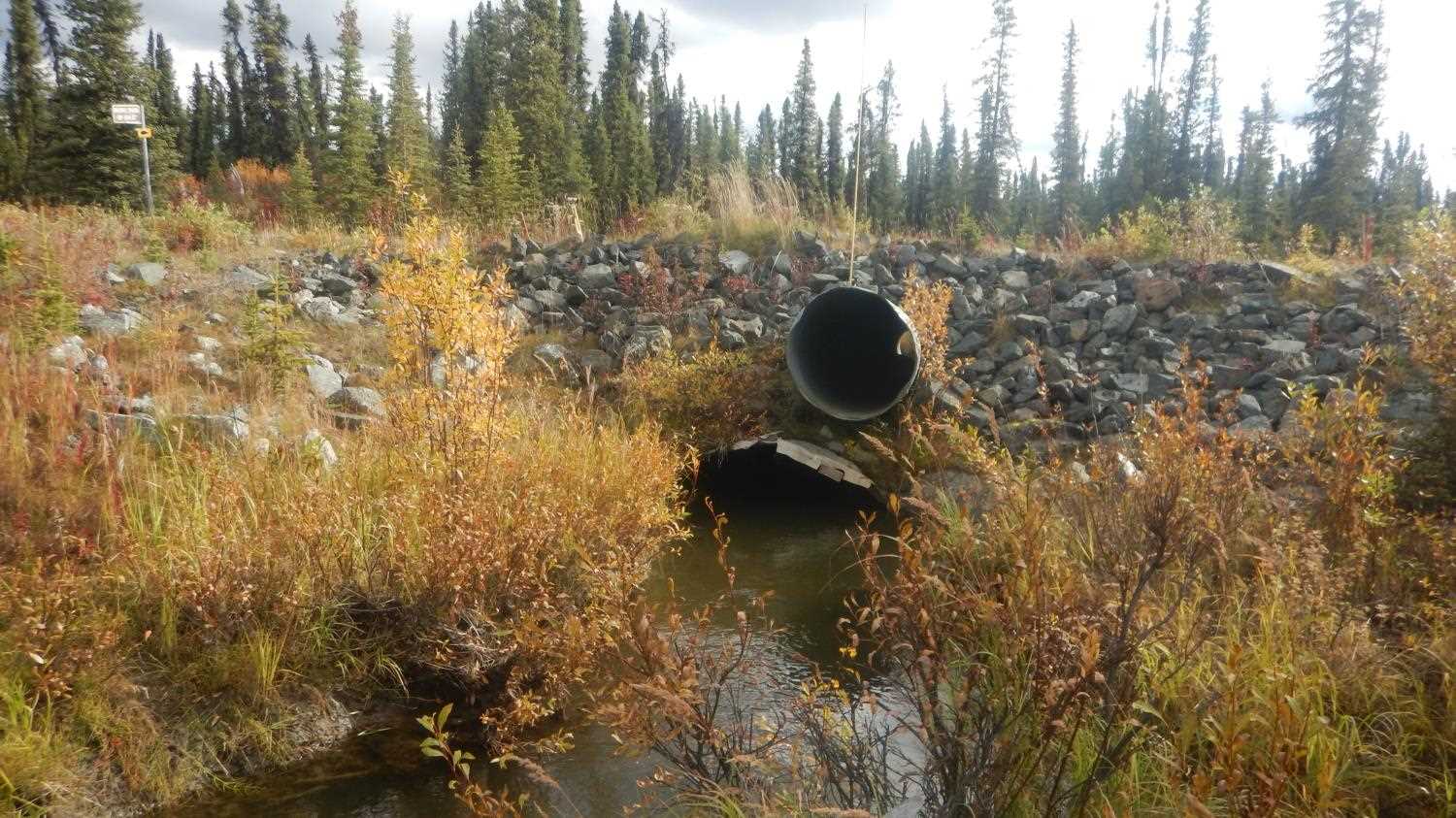
- Culvert gradient red
- Culvert is poorly aligned
- Hydraulic flows exceeded capacity
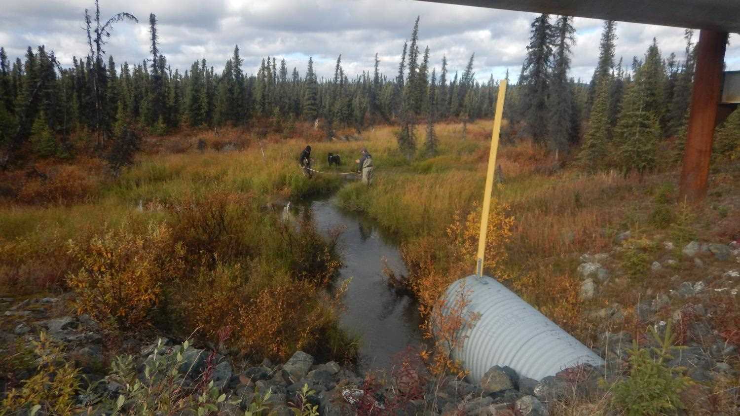
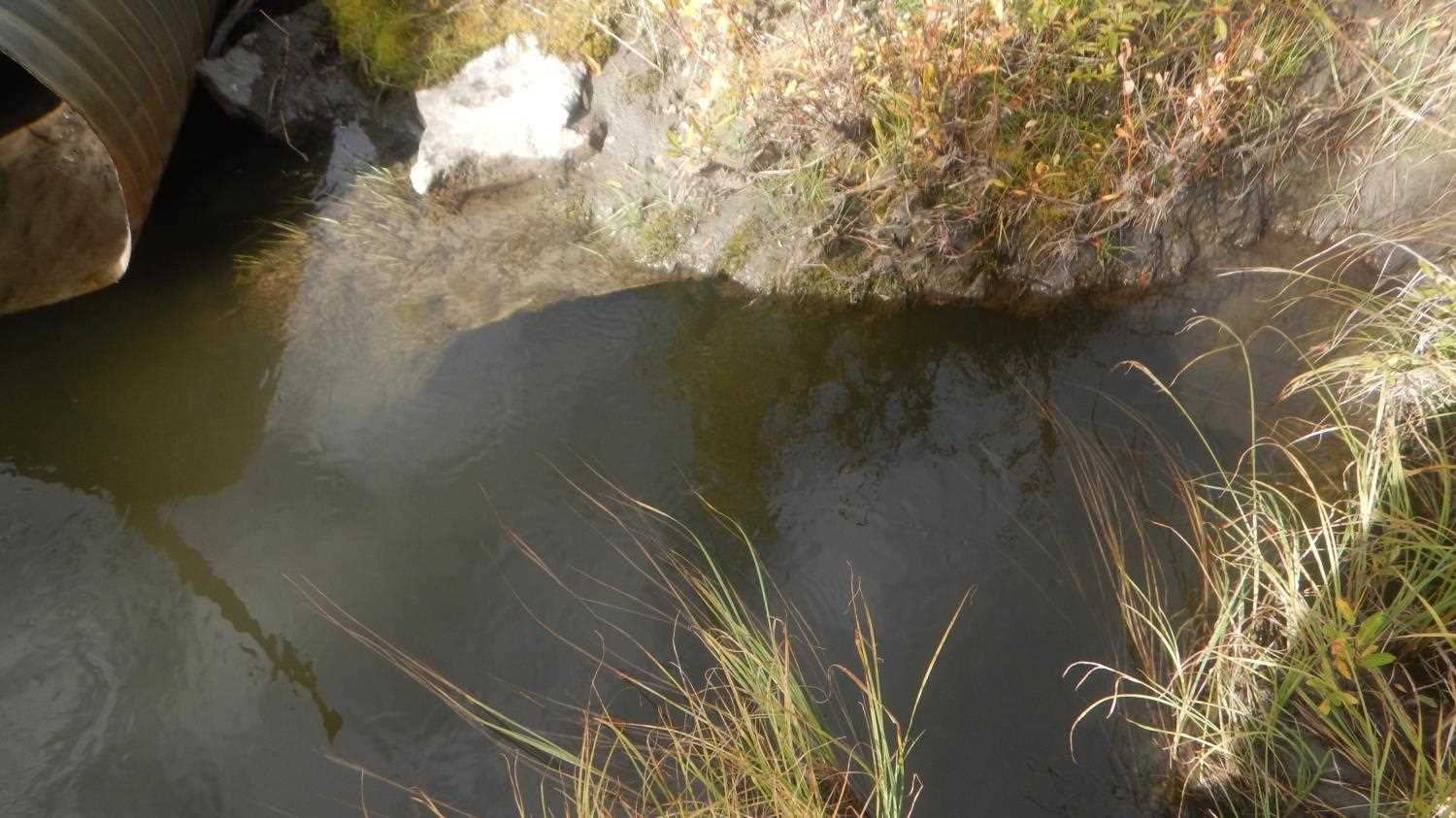
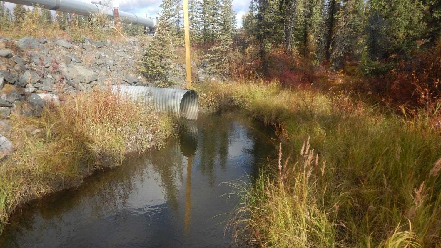
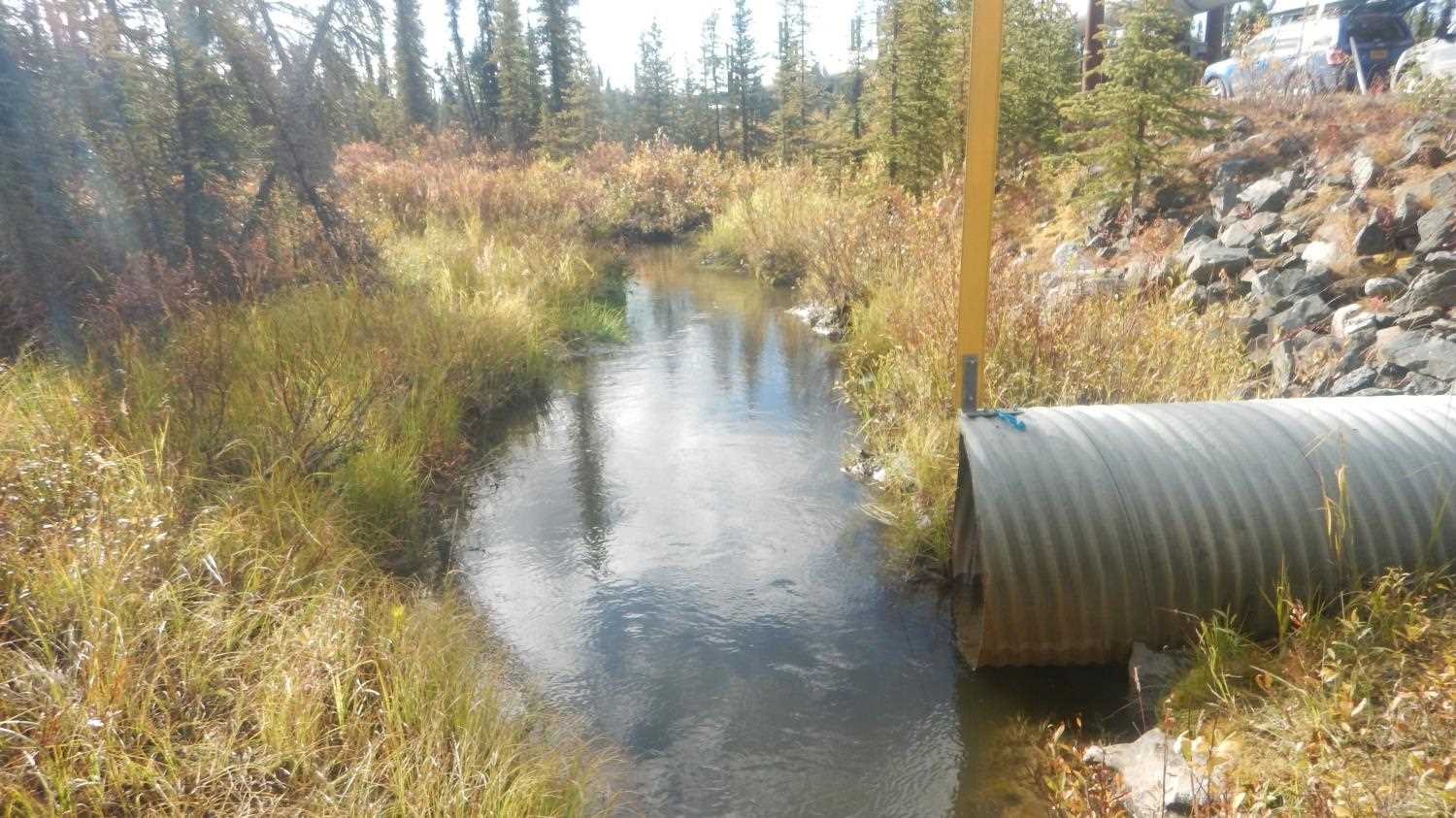
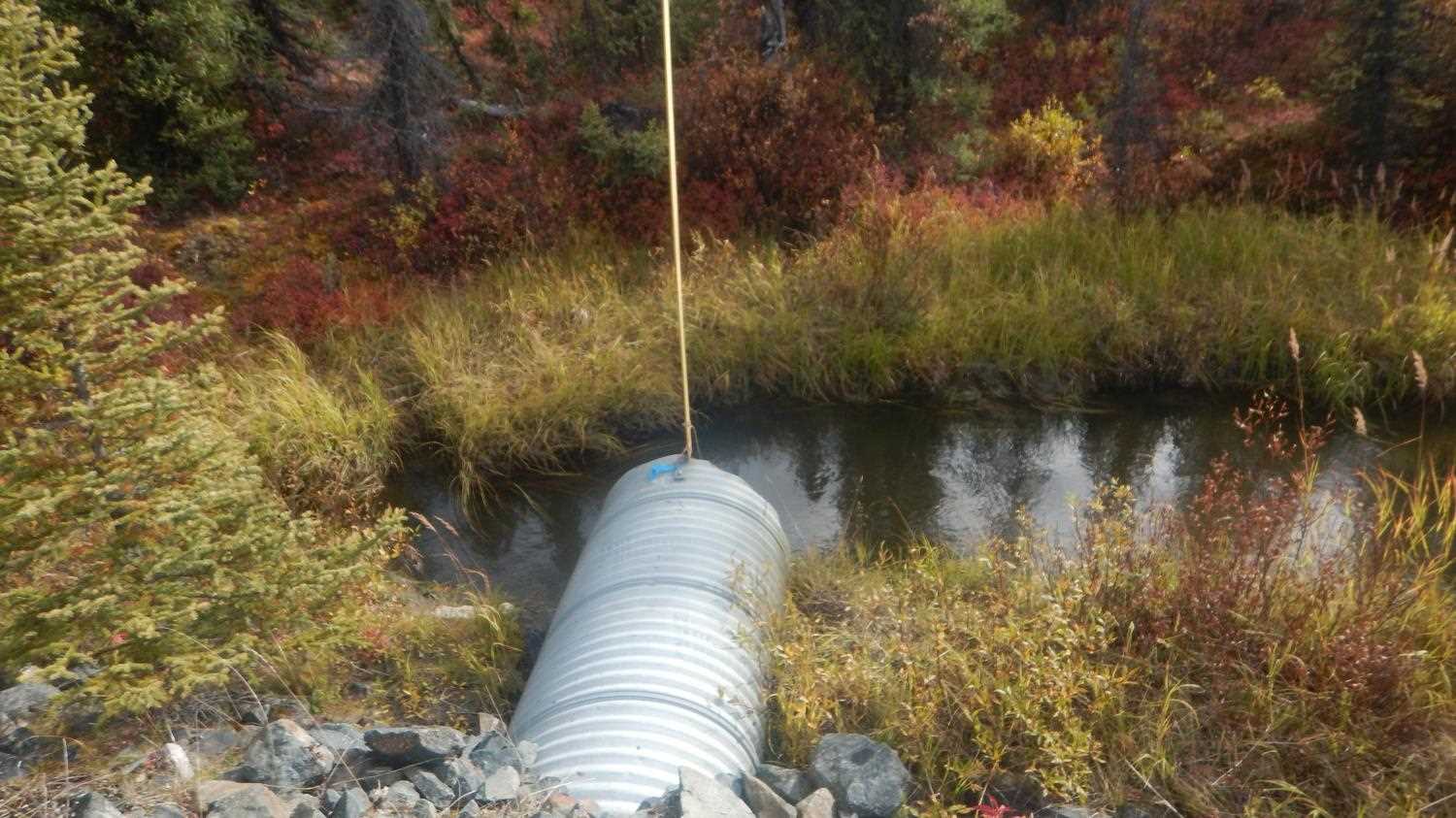
Comments: Poorly aligned downstream channel, 90 degree turn. Outlet completely underwater. Stream gradient 0.1% upstream and 1.7% downstream of crossing. Submitted by Kirsti Jurica with CRWP.
Culvert Measurements
| ID: 1 | Structure Type: Circular pipe (Corrugated aluminum) | Fish Passage Rating: | |||||||||||||||||||||||||||||||||||||||||
|
|
|
|||||||||||||||||||||||||||||||||||||||||
Comments: Water to deep at outlet to measure Width and substrate depth. Outlet noted as buried in muck. Water to deep to measure rust line and inlet substrate depth. |
|||||||||||||||||||||||||||||||||||||||||||
Culvert Observations:
|
|||||||||||||||||||||||||||||||||||||||||||
Stream Measurements
|
|
| Stream Width Type | Distance From Crossing (ft) |
Stream Width (ft) |
|---|---|---|
| Upstream ordinary high water | 6.67 | |
| Upstream ordinary high water | 6.10 | |
| Upstream ordinary high water | 5.99 |
Elevations
| Locator ID | Culvert Number |
River Distance (ft)1 |
Distance From Crossing (ft)2 |
Relative Elevation (ft) |
|---|---|---|---|---|
| Outlet Invert (Overflow Pipe) | 93.45 | |||
| Outlet Culvert Top (Pipe #1) | 93.79 | |||
| Top of Pipe Outlet (Overflow Pipe) | 96.47 | |||
| Road Elev (Road Surface) | 100.24 | |||
| U/S Water Surface Elev | 0.00 | 94.02 | ||
| U/S Thalweg | 0.00 | 90.61 | ||
| U/S Thalweg | 82.00 | 90.86 | ||
| U/S Water Surface Elev | 82.00 | 93.93 | ||
| Inlet Culvert Top (Overflow Pipe) | 140.00 | 99.01 | ||
| Inlet Culvert Invert (Pipe #1) | 140.00 | 90.96 | ||
| Top of Pipe Inlet (Pipe #1) | 140.00 | 95.35 | ||
| Inlet Culvert Invert (Overflow Pipe) | 140.00 | 95.92 | ||
| U/S Water Surface Elev | 140.00 | 93.88 | ||
| D/S Water Surface Elev | 189.00 | 93.84 | ||
| Outlet Invert (Pipe #1) | 189.00 | 89.01 | ||
| Max Pool Depth | 193.00 | 88.12 | ||
| D/S Water Surface Elev | 193.00 | 93.84 | ||
| D/S Water Surface Elev | 243.00 | 93.78 | ||
| D/S Thalweg | 243.00 | 91.84 | ||
| D/S Thalweg | 245.00 | 89.25 | ||
| D/S Water Surface Elev | 245.00 | 92.61 | ||
| D/S Thalweg | 266.00 | 88.99 | ||
| D/S Water Surface Elev | 266.00 | 92.59 |
Notes:
- River distance is measured continuously throughout the survey reach along the thalweg of the stream.
- Measured from each end of the crossing along the thalweg of the stream.
Fish Sampling Efforts
No fish sampling occurred during this survey.
Fish Observations
No fish observations occurred during this survey.
Photos

Questions or comments about this report can be directed to dfg.dsf.webmaster@alaska.gov