Fish Passage Site 20103955
Coordinates (dec. deg.): 62.27876°, -145.43544°
Legal Description: C006N001W28
Region: South Central
Road Name: Pipeline Acess Road
Datum:
Quad Name / ITM: Gulkana B-3
AWC Stream #:
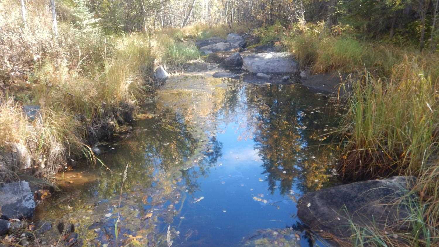
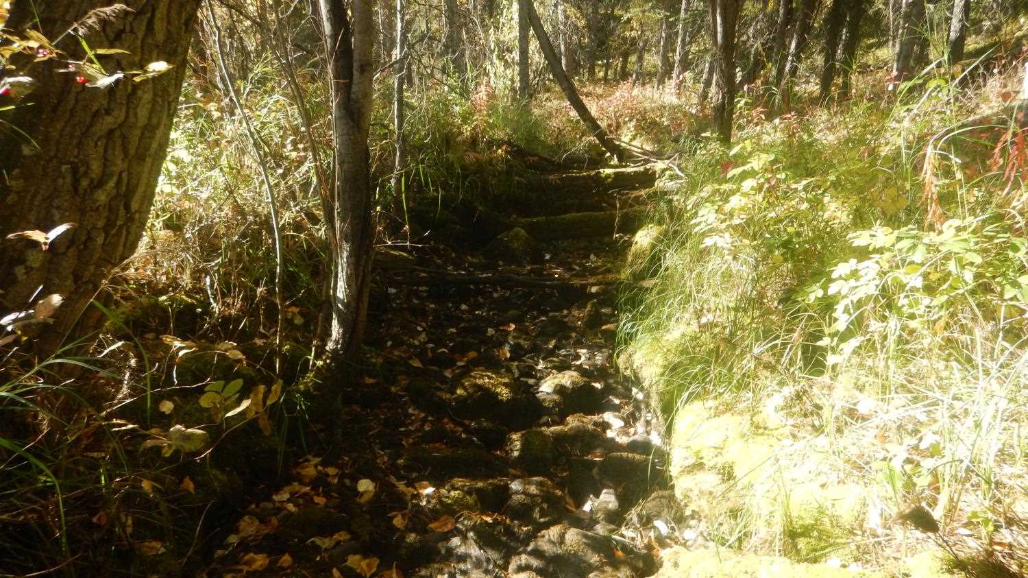
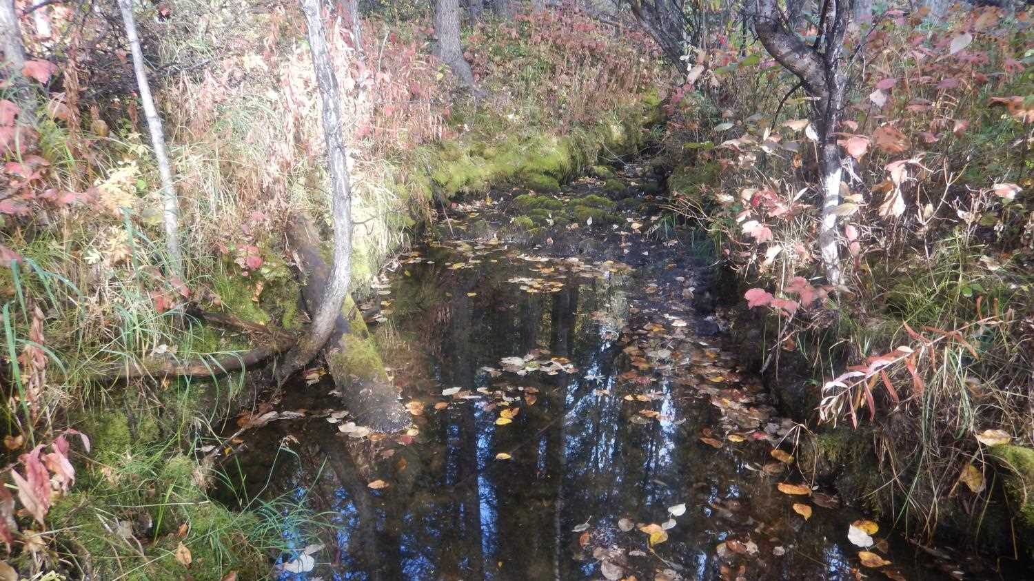
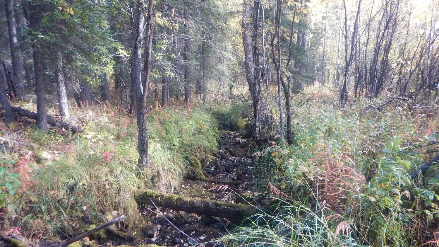
Stream Name: Bear Creek
Elevation:
Site Comments: None
Survey UPD21-TAP3
Project Supervisor: Kim Clark, ADFG
— Anchorage, AK
Observers: Andrew Kastning, Nicole Farnham
Overall Fish Passage Rating:
Tidal: No
Backwatered: No
Step Pools: No
Construction Year:
Site Observations:
- Culvert gradient gray
- Constriction ratio gray
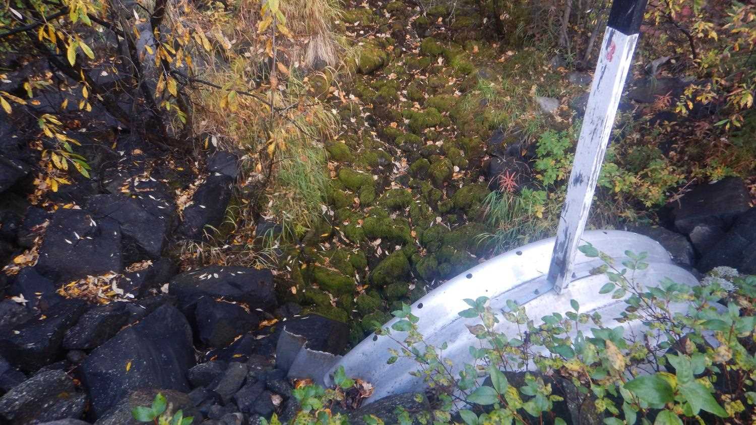
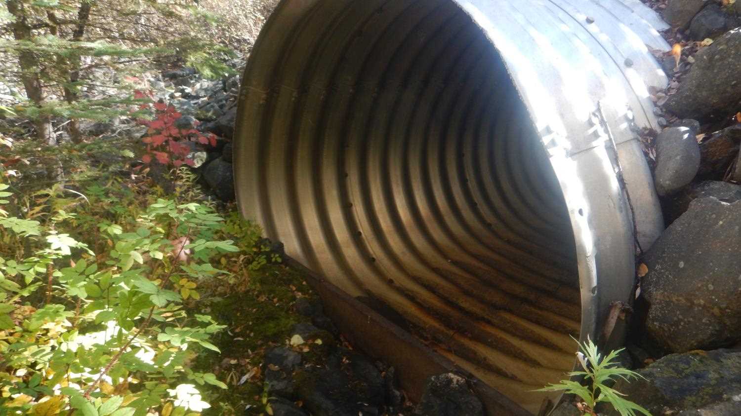
- Mechanical damage or joints parting
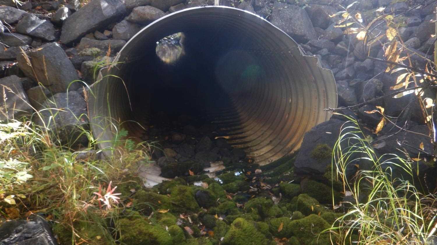
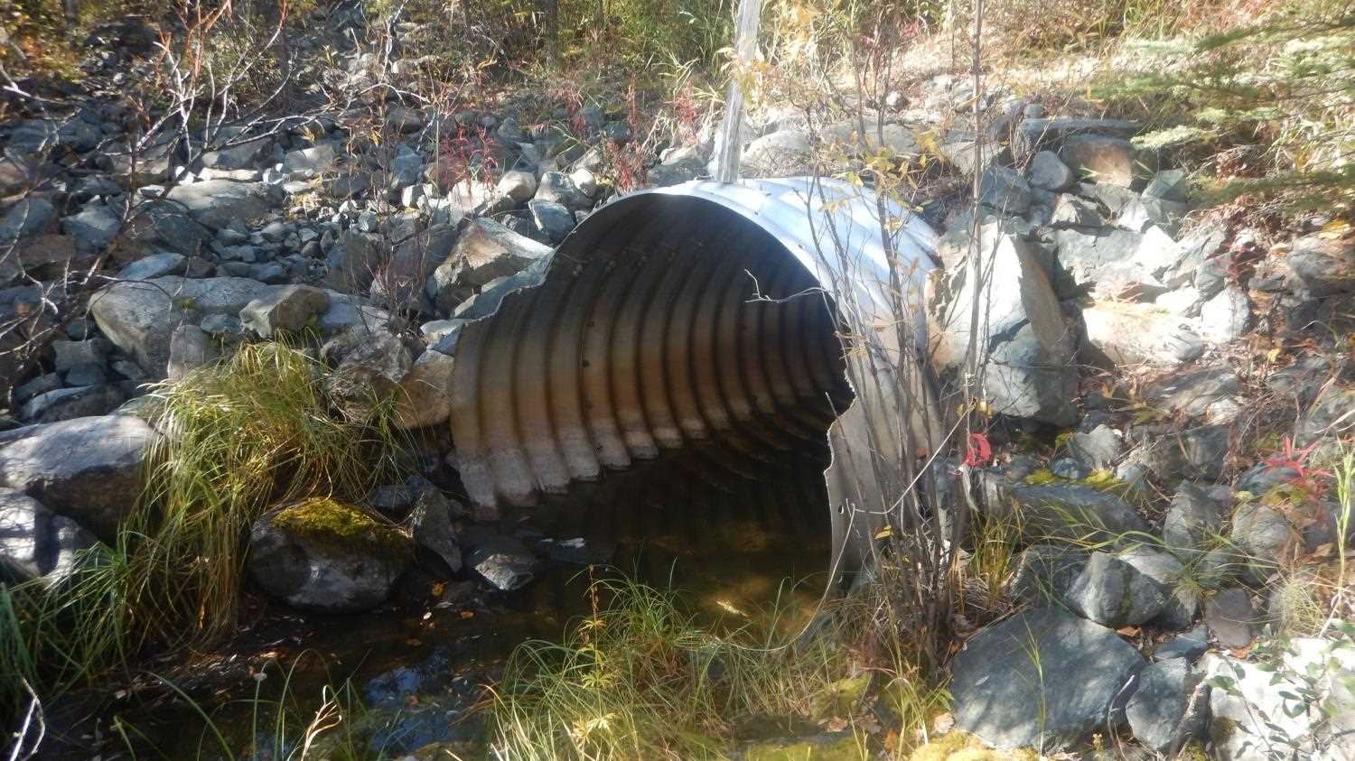
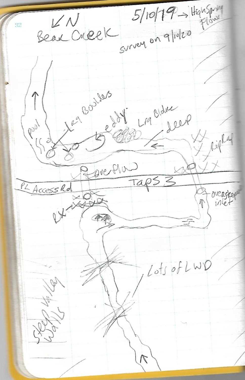
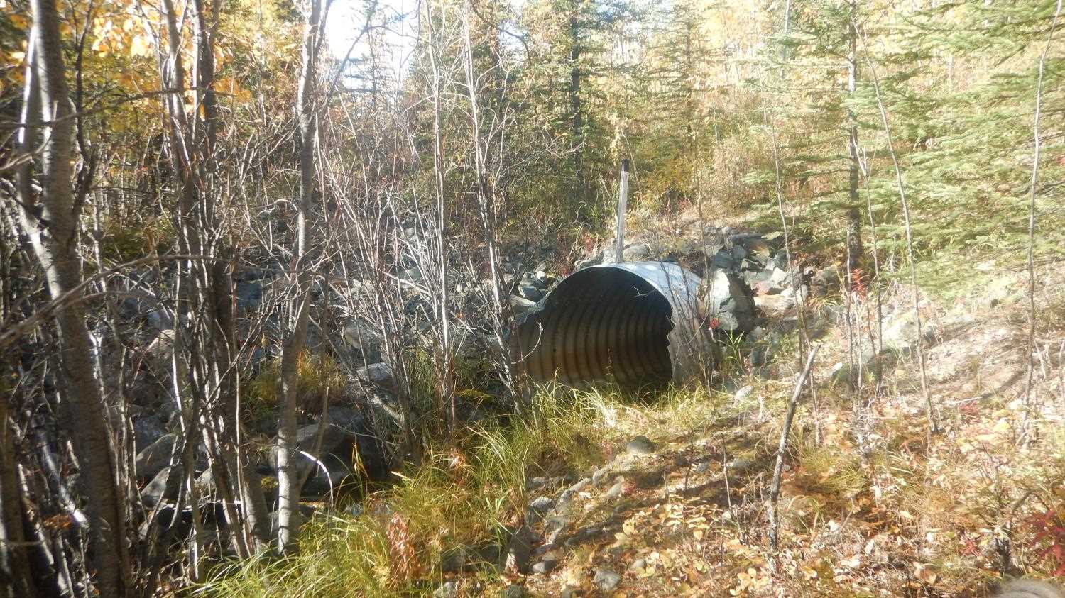
Comments: Inlet invert joints are parting. Isolated pools upstream and downstream, Abundant juvenile grayling in pools. Although approach angle is aligned, stream channel makes a 90 degree turn 50 ft upstream. Overflow pipe is aligned with valley. Rip Rap at outlet. Submitted by Kirsti Jurica with CRWP.
Culvert Measurements
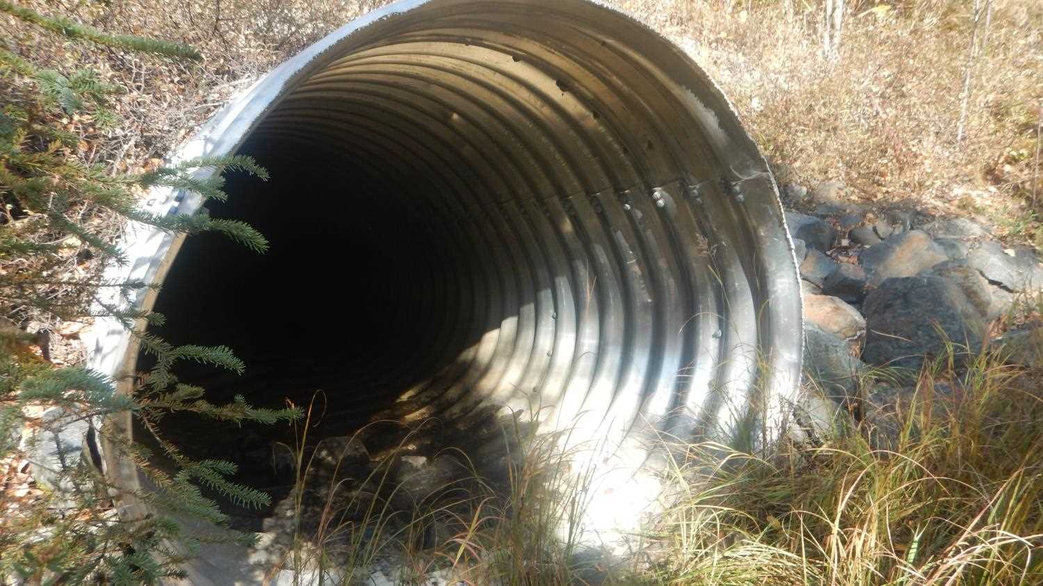
| ID: 1 | Structure Type: Pipe-arch (Structural aluminum plate) | Fish Passage Rating: | |||||||||||||||||||||||||||||||||||||||||
|
|
|
|||||||||||||||||||||||||||||||||||||||||
Comments: Substrate depth at inlet and outlet not measured or recorded. Outlet substrate noted as armored rock. Althought approach angle is aligned stream channel makes a 90 degree turn 50' upstream. Overflow pipe is aligned with valley. |
|||||||||||||||||||||||||||||||||||||||||||
Culvert Observations:
|
|||||||||||||||||||||||||||||||||||||||||||
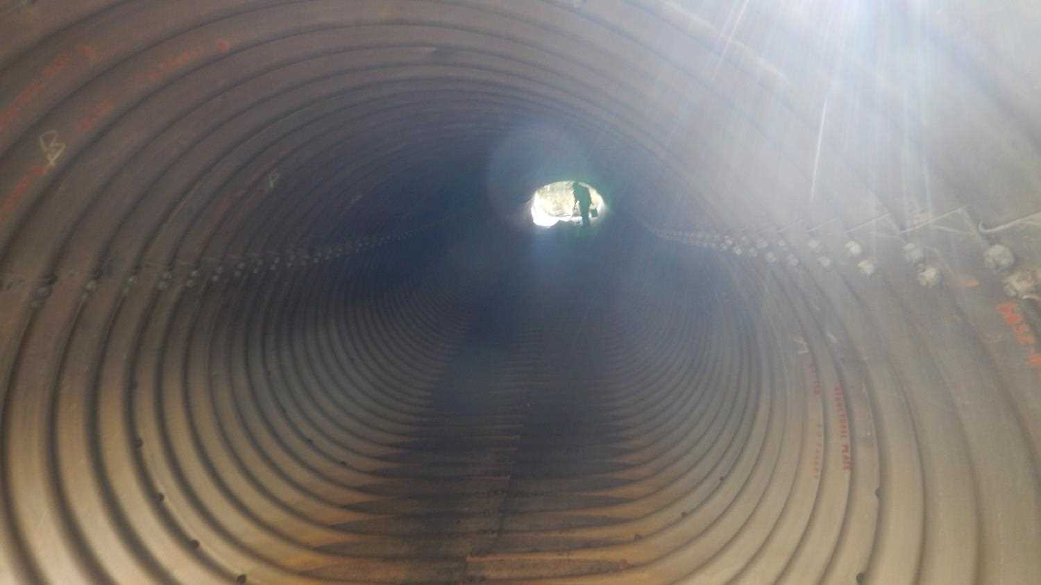
| ID: 2 | Structure Type: Pipe-arch (Structural aluminum plate) | Fish Passage Rating: | |||||||||||||||||||||||||||||||||||||||||
|
|
|
|||||||||||||||||||||||||||||||||||||||||
Comments: Inlet and outlet noted to have very small miter. Outlet has armor rock noted as substrate. A baffle is noted in the longitudinal profile for the overflow pipe. Overflow pipe is aligned with the valley. |
|||||||||||||||||||||||||||||||||||||||||||
Culvert Observations:
|
|||||||||||||||||||||||||||||||||||||||||||
Stream Measurements
|
|
| Stream Width Type | Distance From Crossing (ft) |
Stream Width (ft) |
|---|---|---|
| Upstream ordinary high water | 11.70 | |
| Upstream ordinary high water | 8.90 | |
| Upstream ordinary high water | 11.40 |
Elevations
| Locator ID | Culvert Number |
River Distance (ft)1 |
Distance From Crossing (ft)2 |
Relative Elevation (ft) |
|---|---|---|---|---|
| Outlet Invert (Overflow pipe, no distance included) | 84.68 | |||
| Inlet Culvert Invert | 87.38 | |||
| Misc. (Baffle) | 88.68 | |||
| Outlet Culvert Top | 91.63 | |||
| Inlet Culvert Top | 94.13 | |||
| Road Elev (Road Surface) | 100.08 | |||
| Road Elev (Road surface) | 100.36 | |||
| Misc. (Berm 16 feet upstream of overflow inlet) | 89.67 | |||
| U/S Thalweg (Dry 20' upstream of overflow pipe) | 0.00 | 88.11 | ||
| U/S Thalweg | 142.00 | 84.77 | ||
| U/S Water Surface Elev | 142.00 | 85.37 | ||
| Inlet Culvert Invert (Dry) | 167.00 | 84.04 | ||
| Inlet Culvert Top | 167.00 | 90.05 | ||
| Outlet Culvert Top | 256.00 | 89.27 | ||
| Outlet Invert | 256.00 | 82.74 | ||
| Max Pool Depth | 264.00 | 82.76 | ||
| D/S Water Surface Elev | 264.00 | 82.52 | ||
| D/S Water Surface Elev | 286.00 | 83.51 | ||
| D/S Thalweg | 286.00 | 83.12 | ||
| D/S Water Surface Elev | 360.00 | 83.64 | ||
| D/S Thalweg | 360.00 | 83.40 | ||
| D/S Thalweg | 371.00 | 80.06 | ||
| D/S Water Surface Elev | 371.00 | 83.31 |
Notes:
- River distance is measured continuously throughout the survey reach along the thalweg of the stream.
- Measured from each end of the crossing along the thalweg of the stream.
Fish Sampling Efforts
No fish sampling occurred during this survey.
Fish Observations
No fish observations occurred during this survey.
Photos


Questions or comments about this report can be directed to dfg.dsf.webmaster@alaska.gov