Fish Passage Site 20100629
Coordinates (dec. deg.): 60.58948°, -145.64084°
Legal Description: C015S002W07
Region: South Central
Road Name: Power Creek Road
Datum: NAD83
Quad Name / ITM: Cordova C-5
AWC Stream #: 212-10-10050-2250-3013
Stream Name: Power Creek tributary
Elevation:
Site Comments: None
arrow to the right of the survey date below to choose a different report for this site.
Survey UPD21-POW6
Project Supervisor: Kim Clark, ADFG
— Anchorage, AK
Observers: Andrew Kastning, Andrew Kastning
Overall Fish Passage Rating:
Tidal: No
Backwatered: No
Step Pools: No
Construction Year:
Site Observations:
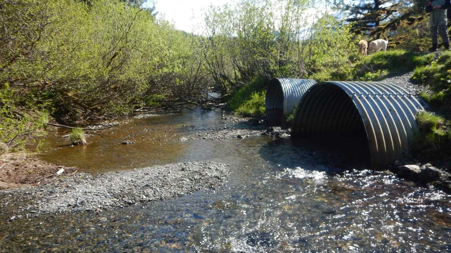
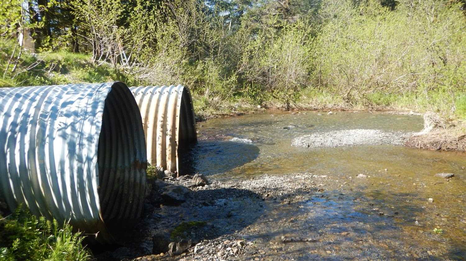
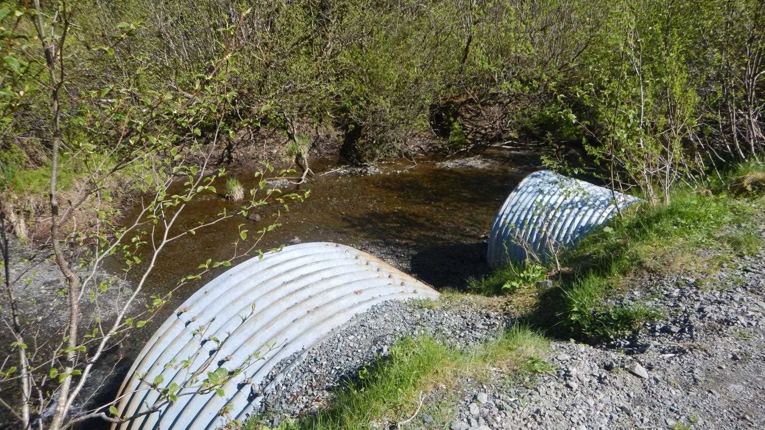
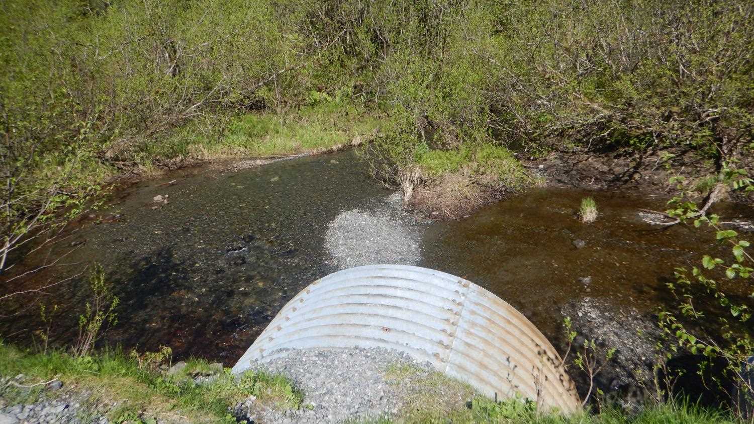
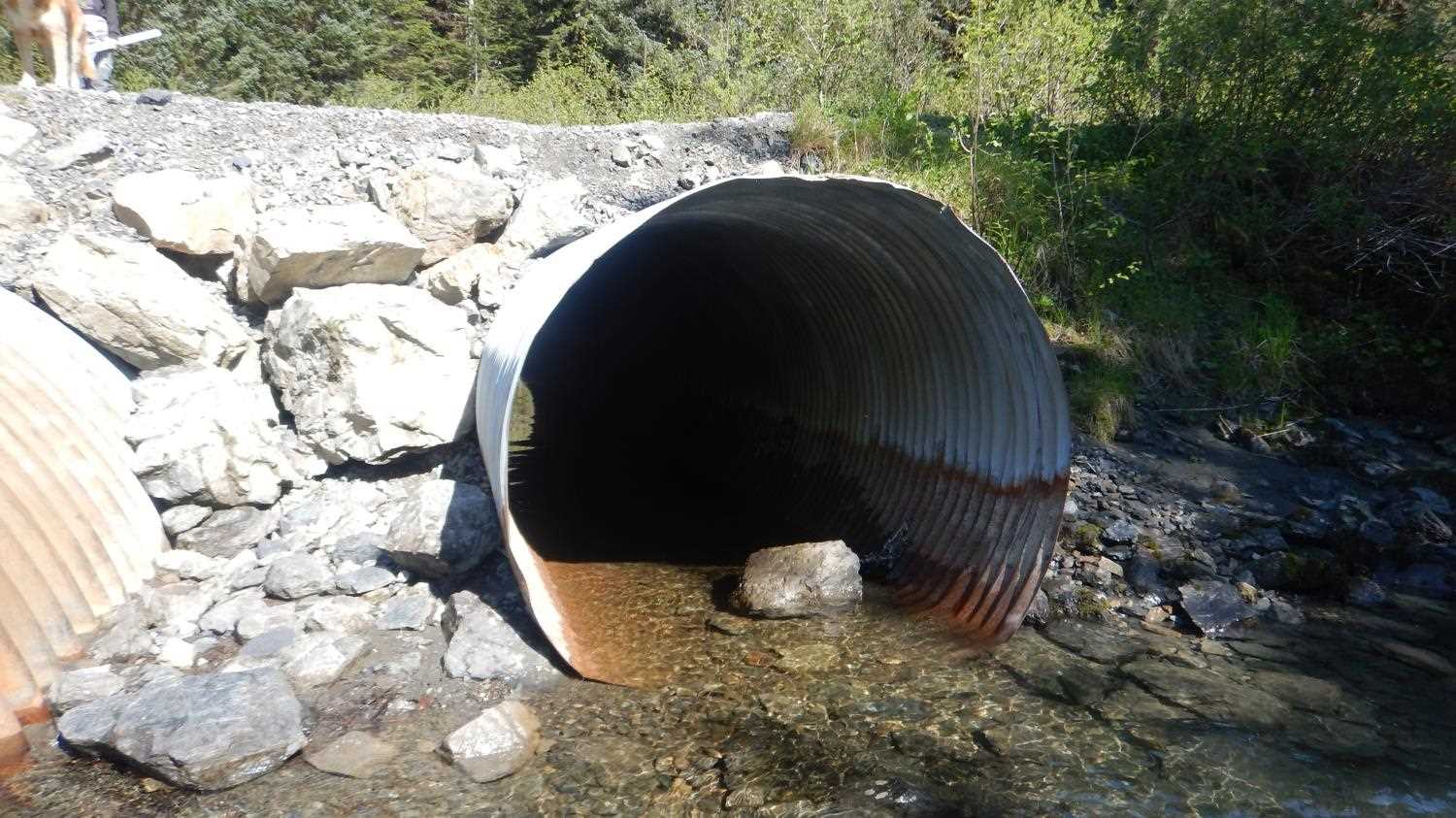
- Culvert is poorly aligned
- Constriction ratio gray
Comments: Site update submitted by Kirsti Jurica with CRWP.
Culvert Measurements
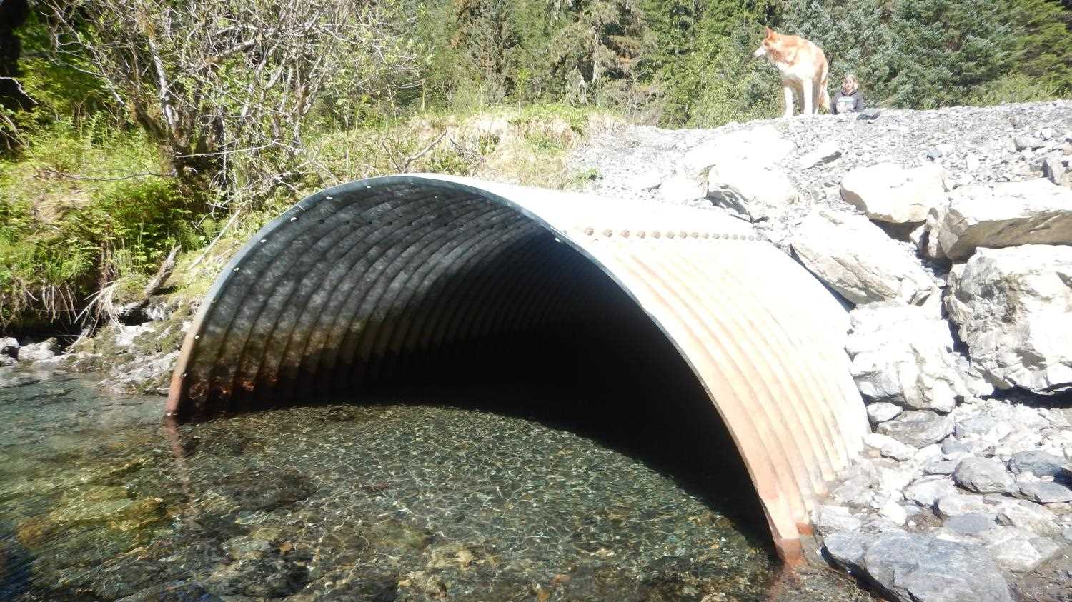
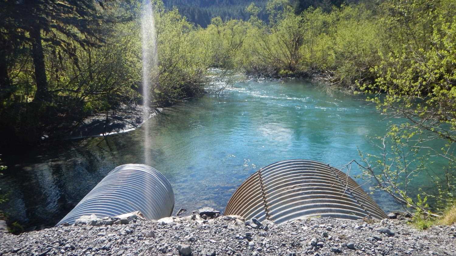
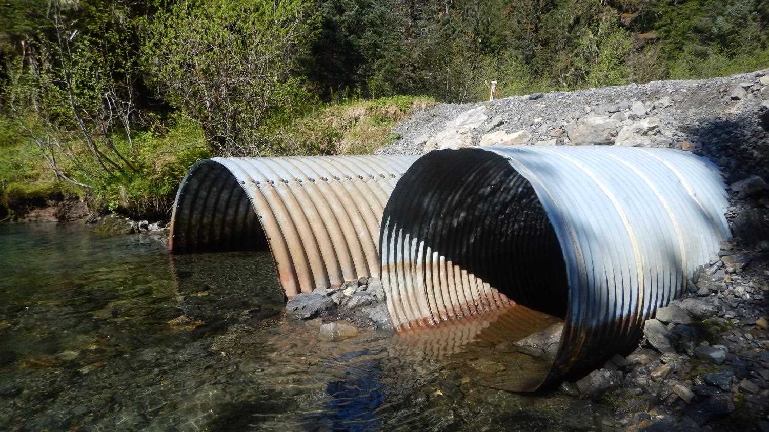
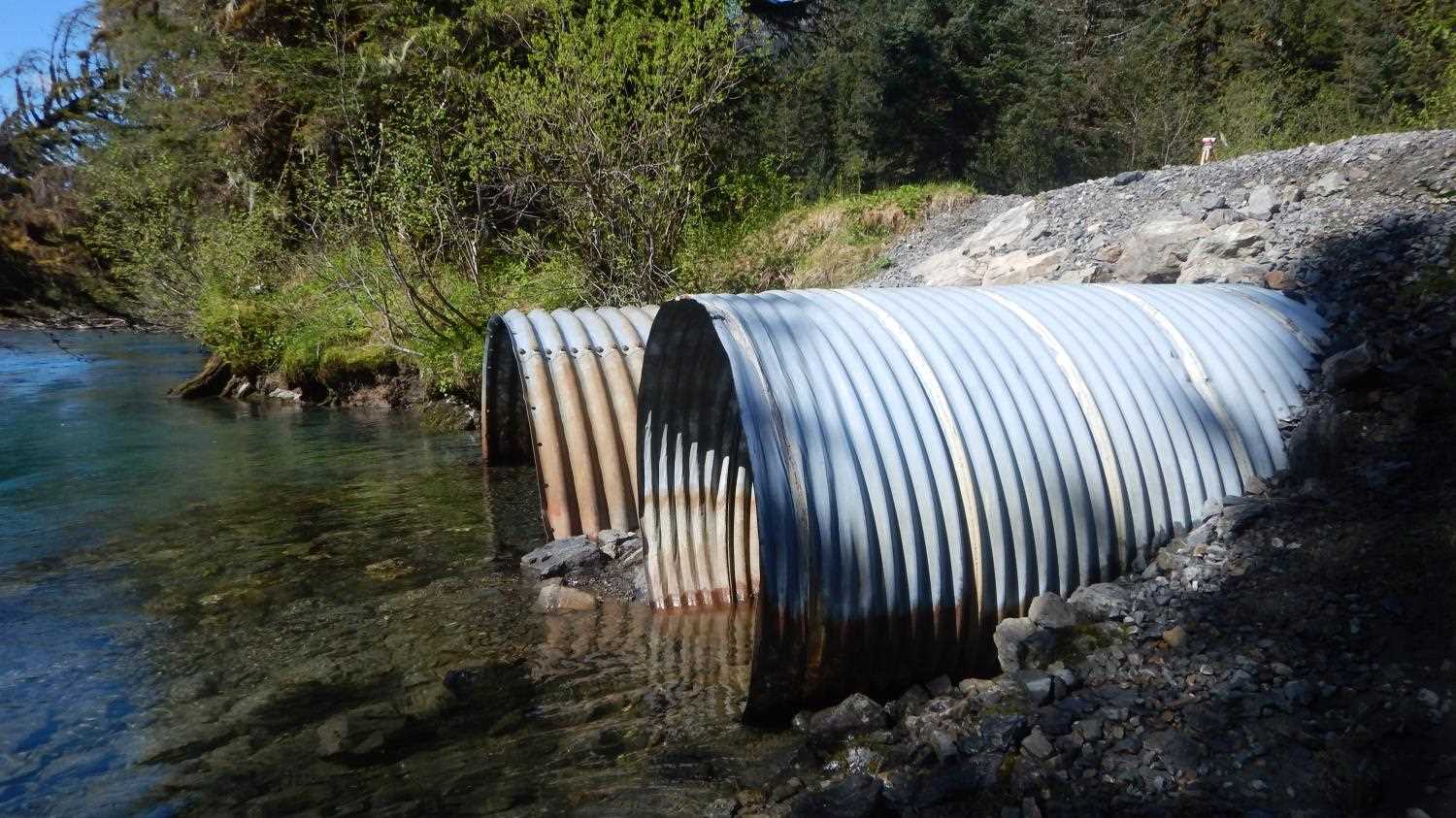
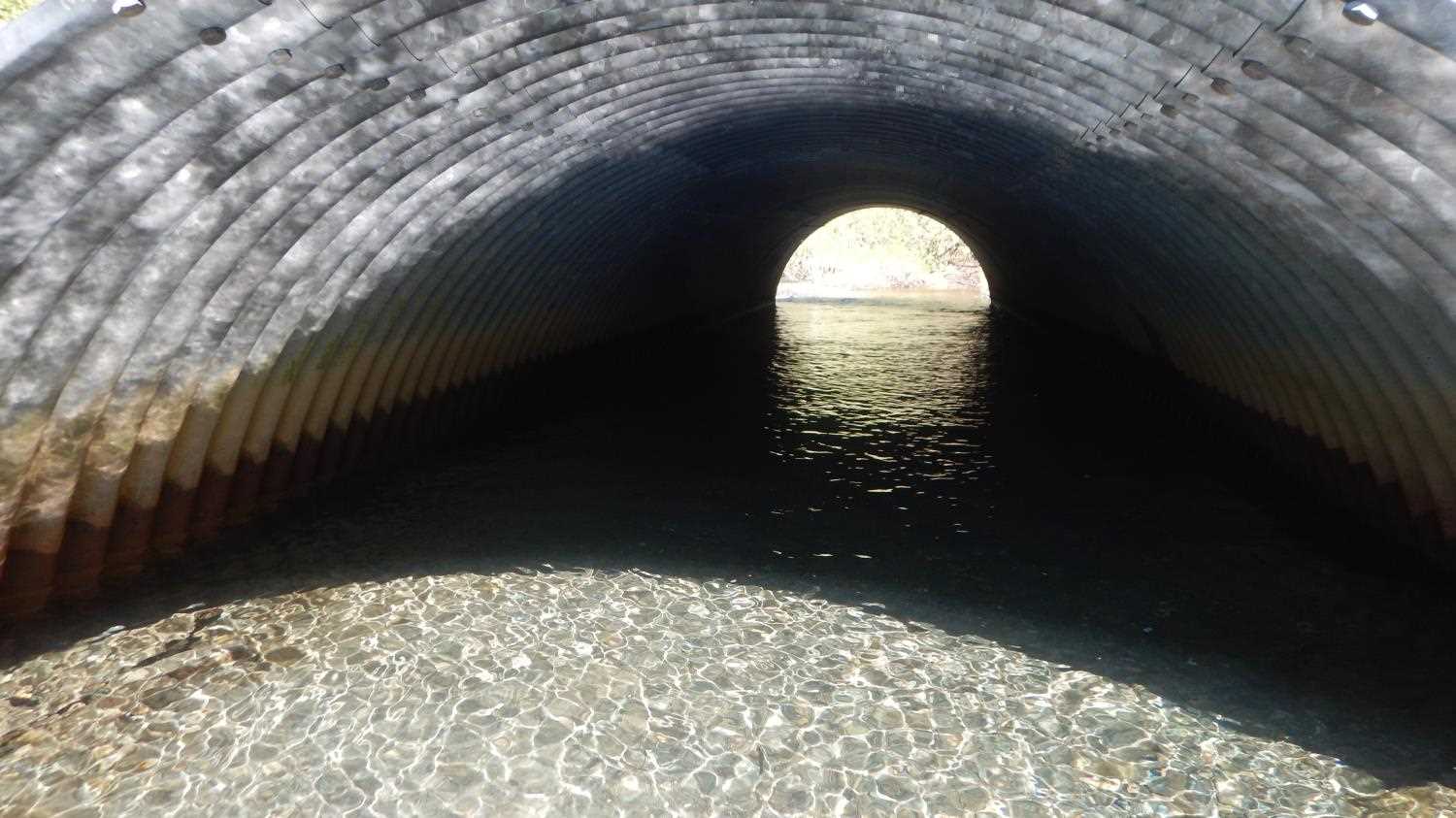
| ID: 1 | Structure Type: Circular pipe (Corrugated steel) | Fish Passage Rating: | |||||||||||||||||||||||||||||||||||||||||
|
|
|
|||||||||||||||||||||||||||||||||||||||||
Comments: Pipe #1 is placed at high elevation. Trickle at outlet of Pipe #1 during survey. On 4.20.20 during low flow conditions an elevation change of 1.38ft was observed at the outlet over a rocky apron. |
|||||||||||||||||||||||||||||||||||||||||||
Culvert Observations:
|
|||||||||||||||||||||||||||||||||||||||||||
| ID: 2 | Structure Type: Open-bottom arch (Structural steel plate) | Fish Passage Rating: | |||||||||||||||||||||||||||||||||||||||||
|
|
|
|||||||||||||||||||||||||||||||||||||||||
Comments: Substrate depth not meausred but if it is a round pipe we can infer it was 4.15 feet deep at the inlet and 4.85 feet deep at the oulet. |
|||||||||||||||||||||||||||||||||||||||||||
Culvert Observations:
|
|||||||||||||||||||||||||||||||||||||||||||
Stream Measurements
|
|
| Stream Width Type | Distance From Crossing (ft) |
Stream Width (ft) |
|---|---|---|
| Upstream ordinary high water | 22.40 | |
| Upstream ordinary high water | 20.10 | |
| Upstream ordinary high water | 18.70 |
Elevations
| Locator ID | Culvert Number |
River Distance (ft)1 |
Distance From Crossing (ft)2 |
Relative Elevation (ft) |
|---|---|---|---|---|
| Road Elev (Road Surface) | 100.00 | |||
| U/S Water Surface Elev | 0.00 | 93.48 | ||
| U/S Water Surface Elev | 0.00 | 93.57 | ||
| U/S Thalweg | 0.00 | 93.29 | ||
| U/S Thalweg (upstream of overflow pipe in side channel) | 0.00 | 93.20 | ||
| U/S Water Surface Elev | 19.00 | 93.23 | ||
| U/S Thalweg | 19.00 | 93.18 | ||
| U/S Water Surface Elev | 24.00 | 93.00 | ||
| Inlet Culvert Invert (Inlet invert of ovrflow pipe) | 24.00 | 92.85 | ||
| U/S Thalweg | 34.00 | 92.94 | ||
| U/S Water Surface Elev | 34.00 | 93.30 | ||
| U/S Thalweg | 77.00 | 92.57 | ||
| U/S Thalweg (Large sediment dump upstream of Pipe 2.) | 77.00 | 90.14 | ||
| U/S Water Surface Elev | 77.00 | 93.08 | ||
| U/S Water Surface Elev | 82.00 | 93.06 | ||
| U/S Water Surface Elev | 82.00 | 93.00 | ||
| Inlet Culvert Invert (Pipe #1) | 82.00 | 91.91 | ||
| Inlet Culvert Invert (Overflow pipe) | 82.00 | 92.85 | ||
| Inlet Culvert Top (Pipe #1) | 82.00 | 97.76 | ||
| Inlet Culvert Top (Overflow pipe) | 82.00 | 98.01 | ||
| Outlet Culvert Top (Pipe #1) | 131.00 | 96.98 | ||
| Outlet Culvert Top (Overflow pipe) | 131.00 | 97.15 | ||
| D/S Water Surface Elev (outlet invert water surface overflow and Pipe #1 not specified) | 131.00 | 92.99 | ||
| Outlet Invert (Overflow pipe) | 131.00 | 92.14 | ||
| Outlet Invert (Pipe #1) | 131.00 | 91.83 | ||
| D/S Water Surface Elev | 131.00 | 93.01 | ||
| D/S Water Surface Elev | 136.00 | 93.01 | ||
| Max Pool Depth | 136.00 | 91.00 |
Notes:
- River distance is measured continuously throughout the survey reach along the thalweg of the stream.
- Measured from each end of the crossing along the thalweg of the stream.
Fish Sampling Efforts
No fish sampling occurred during this survey.
Fish Observations
No fish observations occurred during this survey.
Photos
Questions or comments about this report can be directed to dfg.dsf.webmaster@alaska.gov