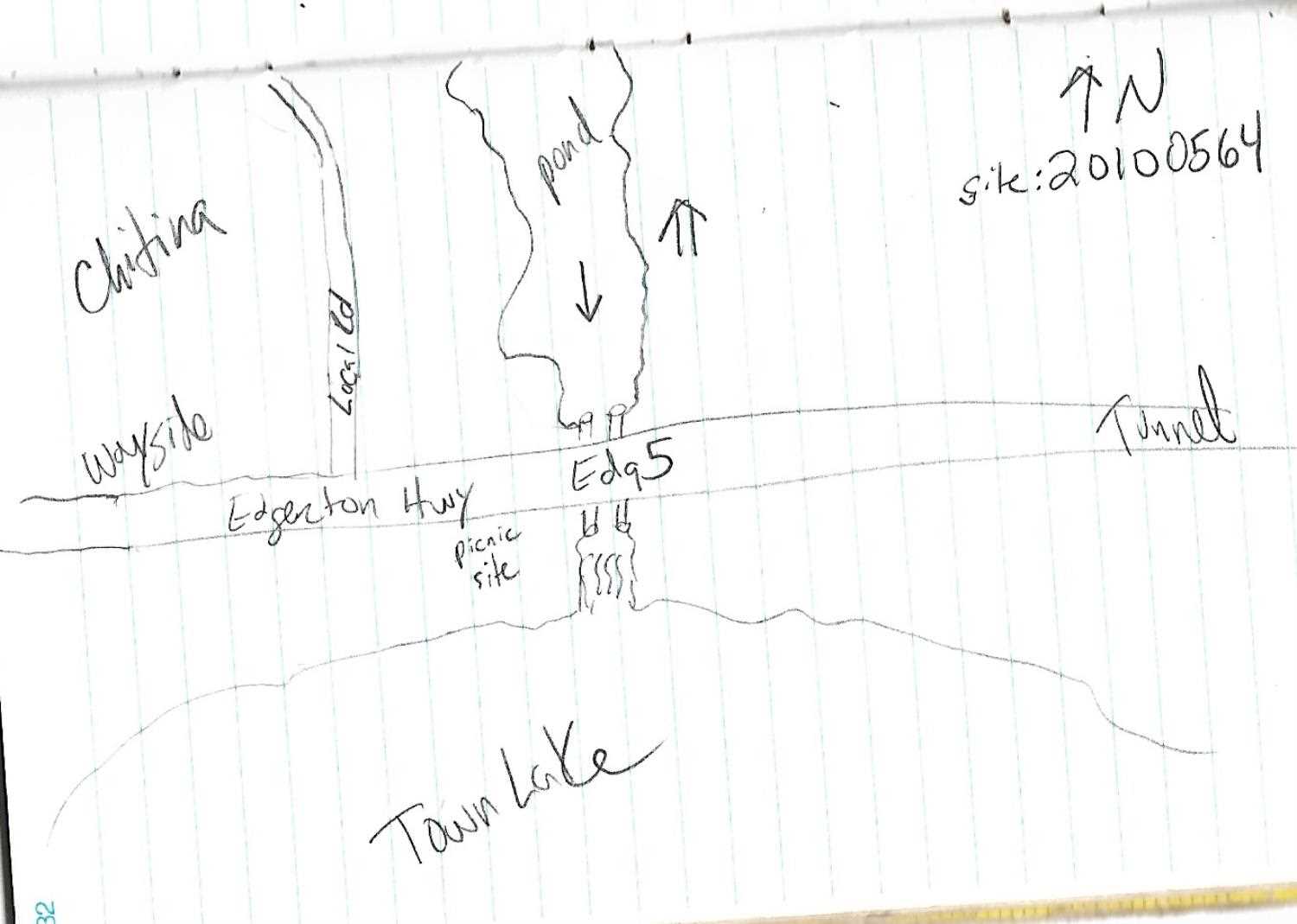
Fish Passage Site 20100564
Coordinates (dec. deg.): 61.51480°, -144.43579°
Legal Description: C004S005E13
Region: South Central
Road Name: Edgerton Highway
Datum: NAD83
Quad Name / ITM: Valdez C-2
AWC Stream #:
Stream Name: Chitina Creek
Elevation:
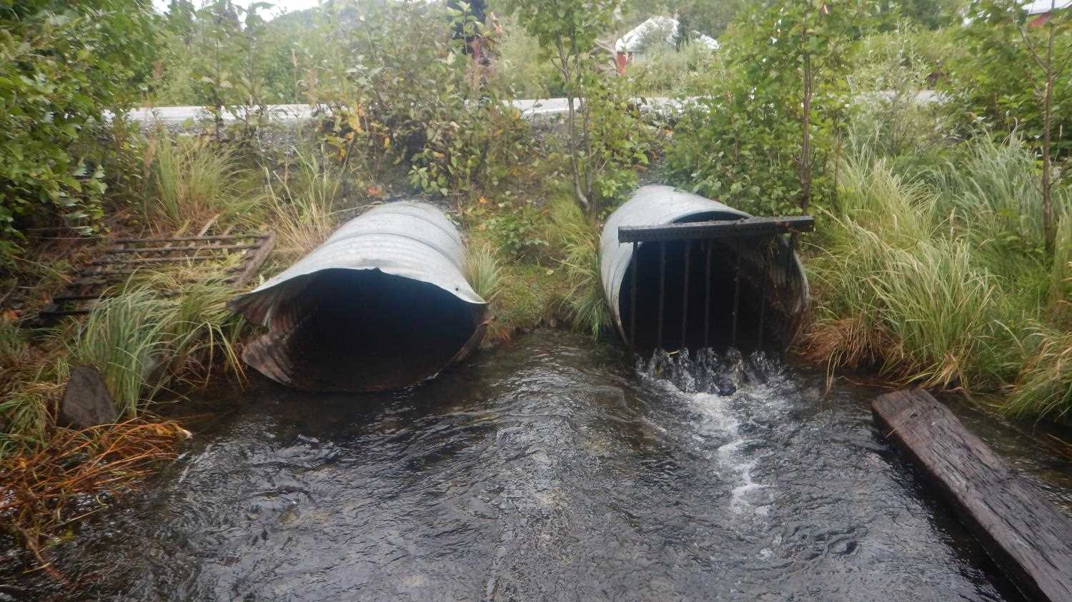
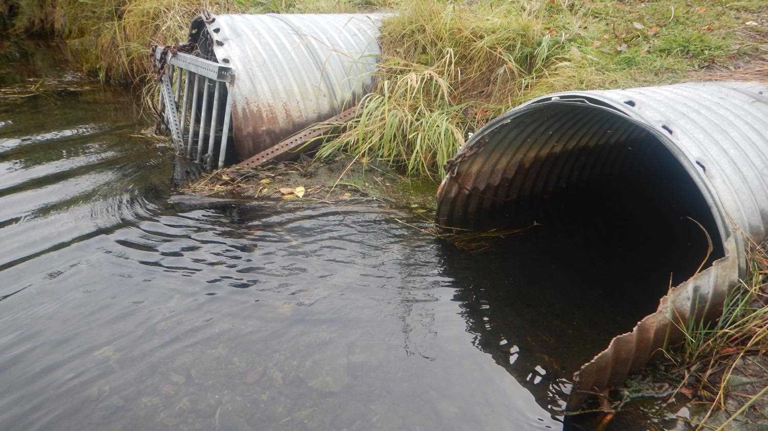
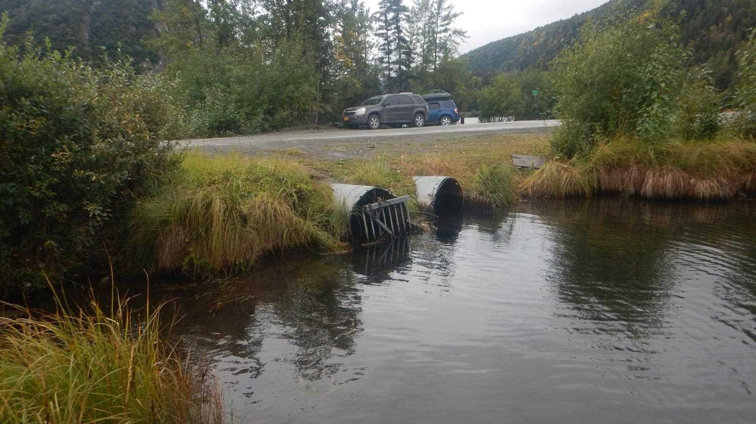
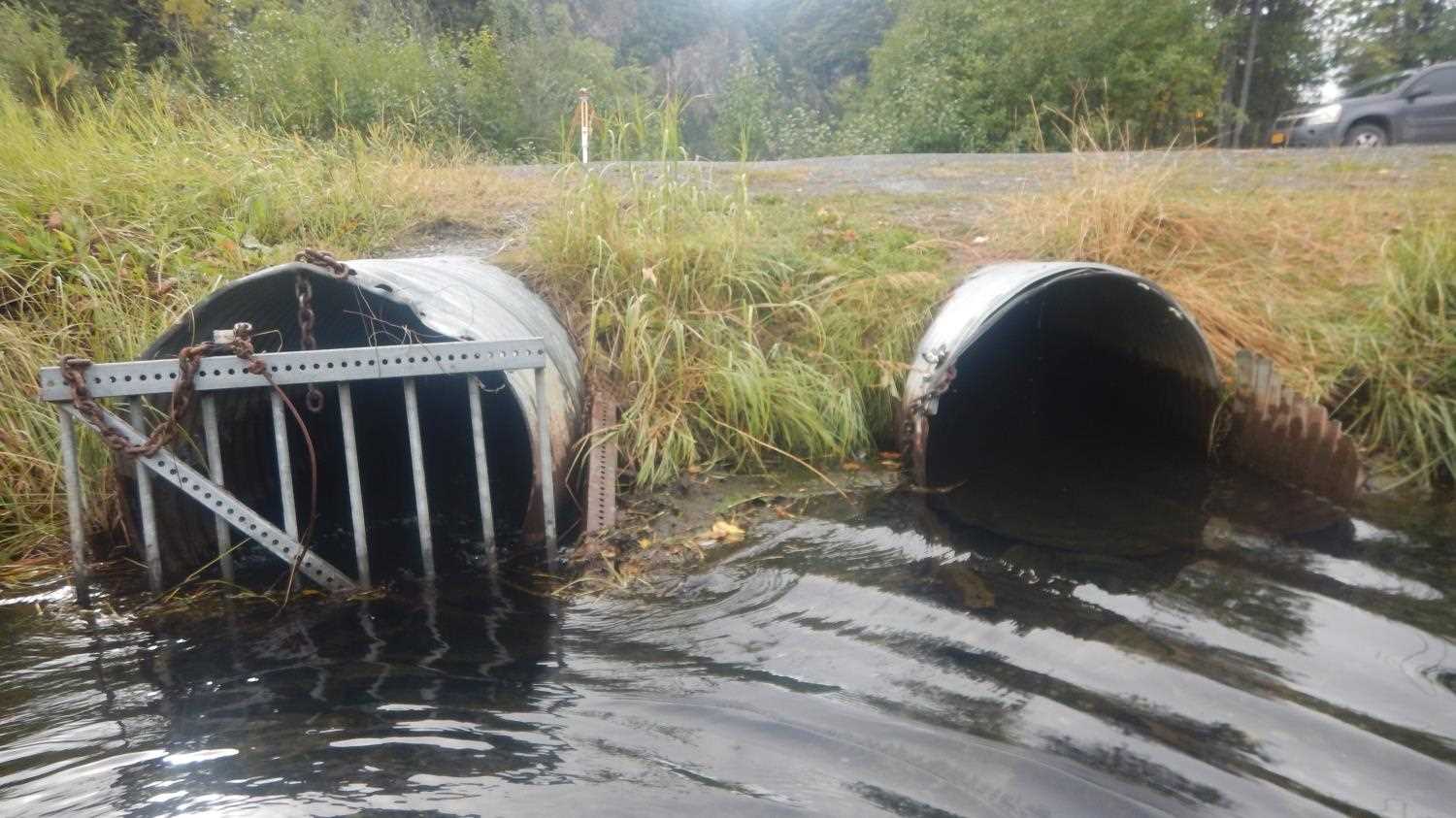
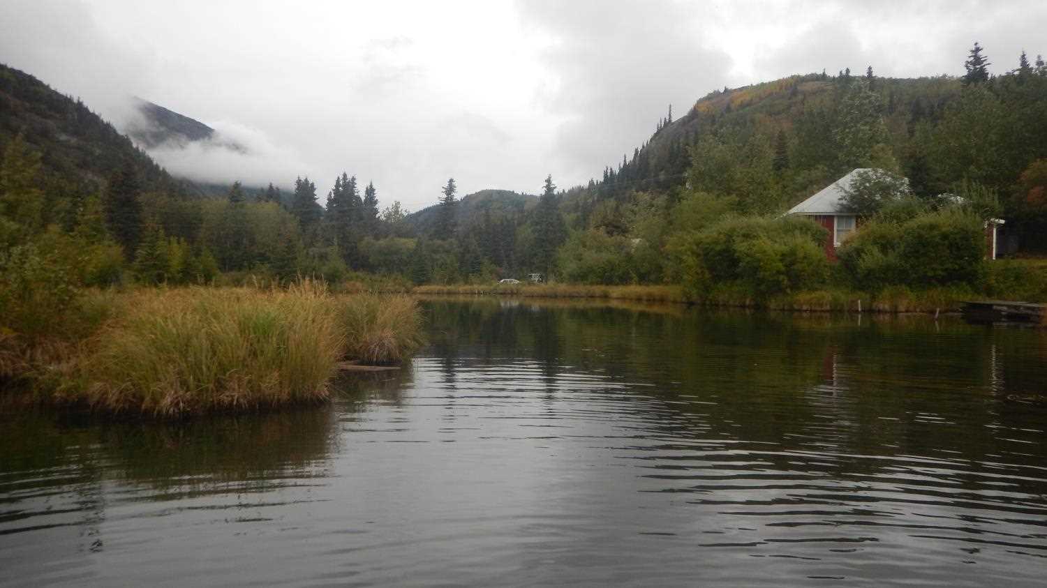
Site Comments: Culverts connecting one lake to Town Lake near town of Chilitna. Milepost 33.6
arrow to the right of the survey date below to choose a different report for this site.
Survey UPD21-EDG5
Project Supervisor: Kim Clark, ADFG
— Anchorage, AK
Observers: Andrew Kastning
Overall Fish Passage Rating:
Tidal: No
Backwatered: No
Step Pools: No
Construction Year:
Site Observations:
- Beaver Activity
- Woody Debris
- Constriction ratio gray
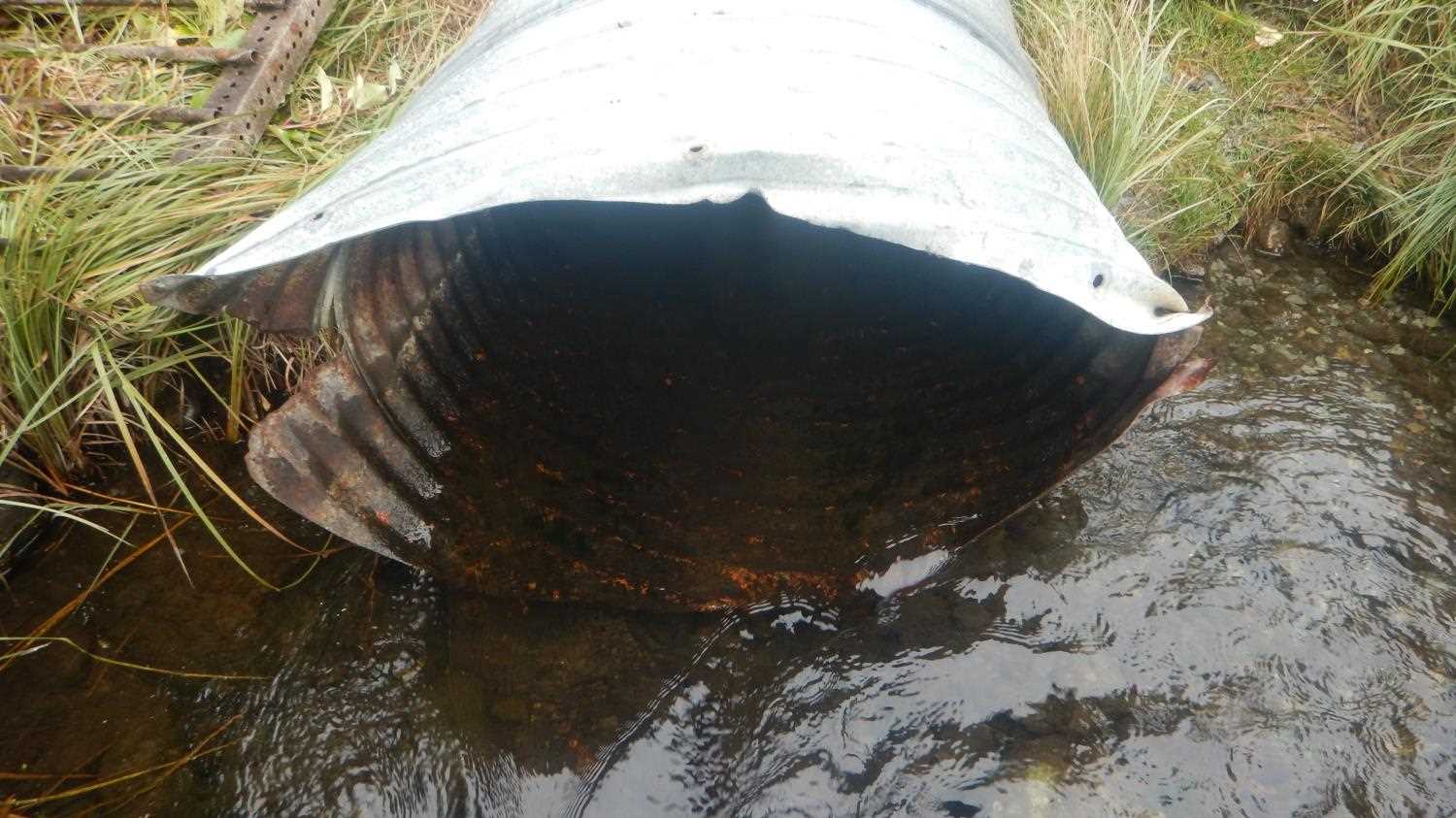
Comments: Grates on inlets and outlets. Manipulated channel upstream of ponded area- the range of stream widths reflect this. Site data submitted by Kirsti Jurica with CRWP.
Culvert Measurements
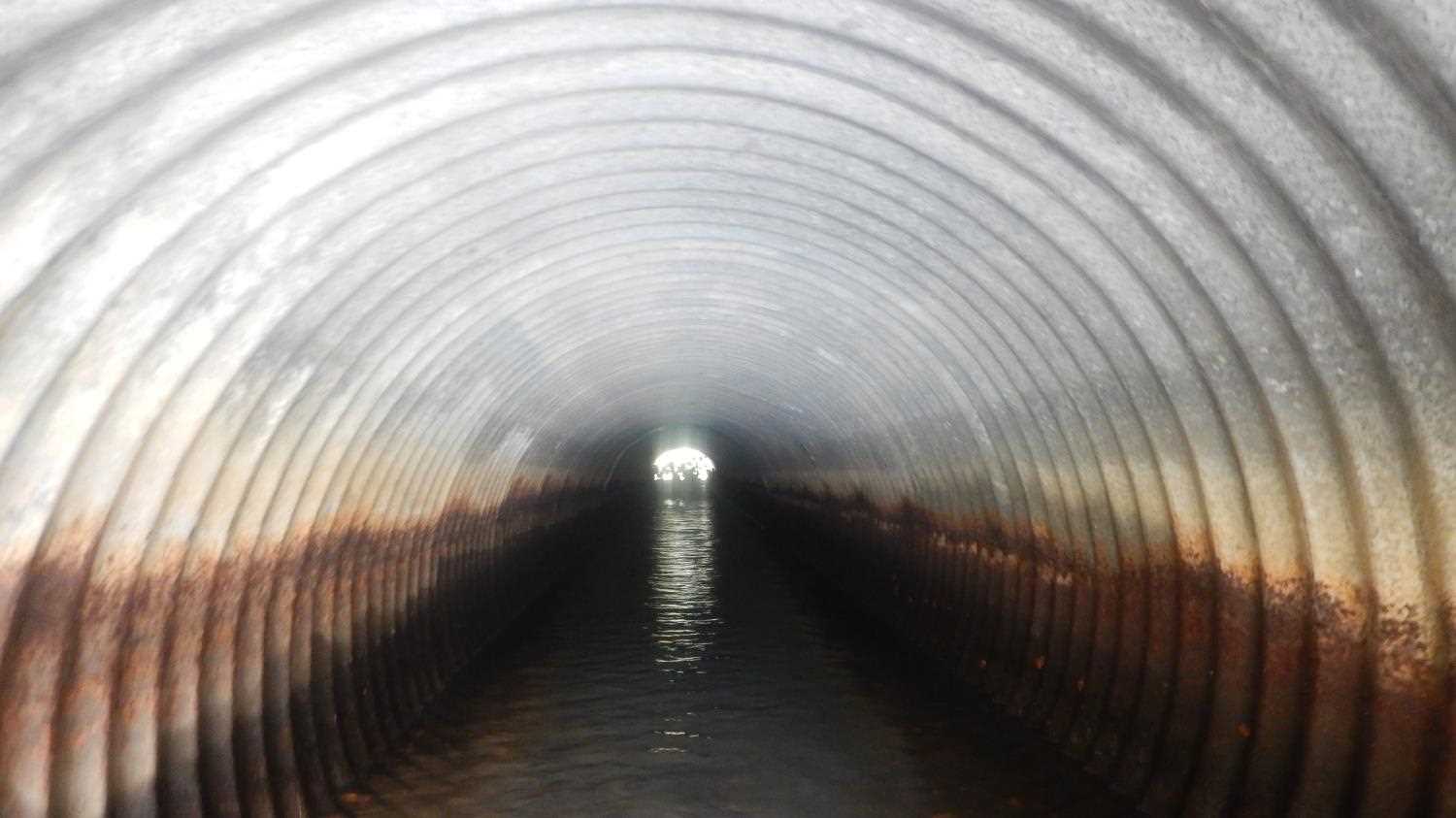
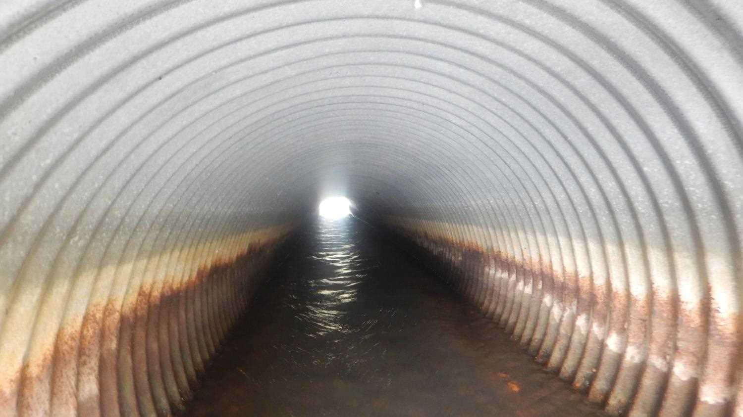
| ID: 1 | Structure Type: Circular pipe (Corrugated steel) | Fish Passage Rating: | |||||||||||||||||||||||||||||||||||||||||
|
|
|
|||||||||||||||||||||||||||||||||||||||||
Culvert Observations:
|
|||||||||||||||||||||||||||||||||||||||||||
| ID: 2 | Structure Type: Circular pipe (Corrugated steel) | Fish Passage Rating: | |||||||||||||||||||||||||||||||||||||||||
|
|
|
|||||||||||||||||||||||||||||||||||||||||
Culvert Observations:
|
|||||||||||||||||||||||||||||||||||||||||||
Stream Measurements
|
|
| Stream Width Type | Distance From Crossing (ft) |
Stream Width (ft) |
|---|---|---|
| Upstream ordinary high water | ||
| Upstream ordinary high water | 11.77 | |
| Upstream ordinary high water | 7.30 | |
| Upstream ordinary high water | 15.50 |
Elevations
| Locator ID | Culvert Number |
River Distance (ft)1 |
Distance From Crossing (ft)2 |
Relative Elevation (ft) |
|---|---|---|---|---|
| Road Elev (Road Surface) | 574.17 | |||
| U/S Thalweg | 0.00 | 568.18 | ||
| U/S Water Surface Elev | 0.00 | 570.57 | ||
| U/S Water Surface Elev | 5.00 | 570.57 | ||
| Inlet Culvert Invert (Pipe #1) | 5.00 | 569.90 | ||
| Inlet Culvert Invert (Pipe #2) | 5.00 | 569.29 | ||
| Inlet Culvert Top (Pipe #2) | 5.00 | 572.41 | ||
| U/S Water Surface Elev | 5.00 | 570.53 | ||
| Inlet Culvert Top (Pipe #1) | 5.00 | 572.67 | ||
| Outlet Invert | 62.00 | 569.41 | ||
| D/S Water Surface Elev | 62.00 | 569.91 | ||
| D/S Water Surface Elev (Debris accumulation due to grates causes slight perch) | 64.00 | 569.99 | ||
| Outlet Culvert Top (Pipe #2) | 64.00 | 571.82 | ||
| Outlet Invert (Pipe #1) | 64.00 | 569.39 | ||
| Outlet Culvert Top (Pipe #1) | 64.00 | 572.44 | ||
| D/S Water Surface Elev | 67.00 | 569.87 | ||
| Max Pool Depth (Downstream of Pipe#2) | 67.00 | 569.08 | ||
| Max Pool Depth (Downstream of Pipe#1) | 69.00 | 569.09 | ||
| D/S Water Surface Elev | 69.00 | 569.89 | ||
| D/S Water Surface Elev | 78.00 | 569.82 | ||
| D/S Grade Ctrl (Thalweg) | 78.00 | 569.34 | ||
| D/S Water Surface Elev | 126.00 | 569.55 | ||
| D/S Thalweg (Town Lake) | 126.00 | 568.67 |
Notes:
- River distance is measured continuously throughout the survey reach along the thalweg of the stream.
- Measured from each end of the crossing along the thalweg of the stream.
Fish Sampling Efforts
No fish sampling occurred during this survey.
Fish Observations
No fish observations occurred during this survey.
Photos


Questions or comments about this report can be directed to dfg.dsf.webmaster@alaska.gov