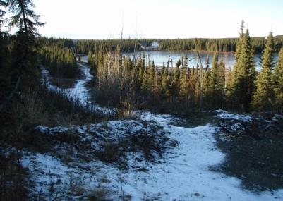
Location
- Latitude: 60.473402
- Longitude: -150.757646
- USGS Map: KENAI B-3
- Elevation (m): 78
- MTRS: S005N008W31
- Management Area: Kenai (Upper Kenai Peninsula)
Access
- Latitude: 60.473402
- Longitude: -150.757646
- Directions: Mile 96.2 Sterling Hwy. East on Funny River Rd. for 14.0 miles to Rabbit Run Rd. Right on Rabbit Run Rd. 0.9 mile to Browns Lake Road. Left on Browns Lake Rd. for 2.0 miles to Lake Road. Right on Lake Road 1.0 miles to Aurora Ave. Right on Aurora Ave. 0.7 mile to unimproved access where lake is next to road. NOTE: Please respect property. Keep lake and access sites free of litter.
- Status: Road ROW
Lake Characteristics
- Surface Area (ha): 3.2
- Bathymetric Map: Aurora.gif
- Lake Category: Landlocked
- Maximum Depth (m): 6.6
- Most Recent Survey Date: 4/16/2024
- Most Recent Survey Notes: Lake size and area data date unknown. Lake category entered 4/16/2024.
Photos