Fish Passage Site 20703440
Coordinates (dec. deg.): 57.76481°, -152.48702°
Legal Description: S028S020W11
Region: Southwest
Road Name: Old Military Road
Datum: WGS84
Quad Name / ITM: Kodiak D-2
AWC Stream #: 259-21-10120-2006-3050
Stream Name: Genivieve Creek
Elevation:
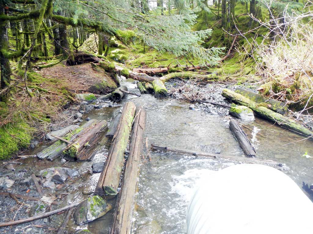
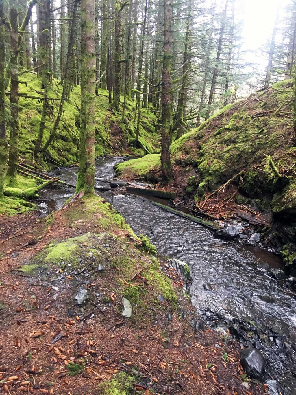
Site Comments: This is an old road converted to a trail over the outlet of Boy Scout Lake.
arrow to the right of the survey date below to choose a different report for this site.
Survey UPDATE-BSL02
Project Supervisor: Gillian O'Doherty, ADFG
Observers: William Frost
Overall Fish Passage Rating:
Tidal:
Backwatered:
Step Pools:
Construction Year:
Site Observations:
- Outfall height red
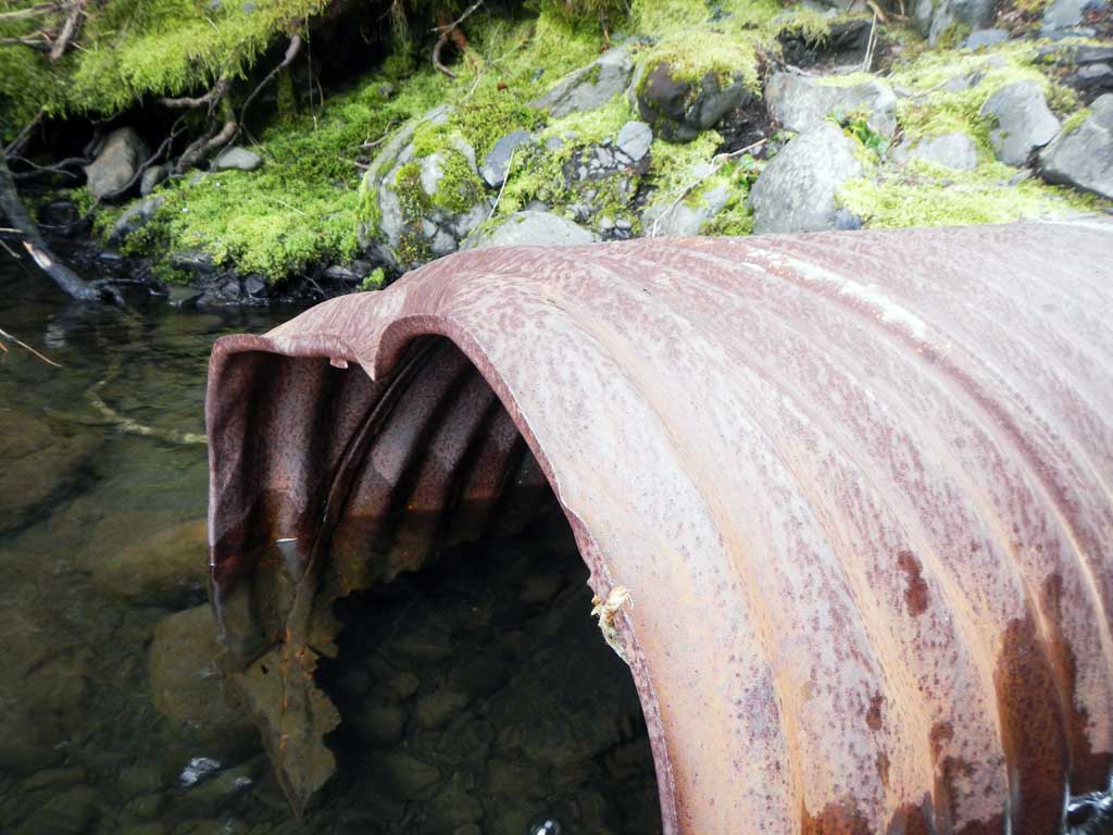
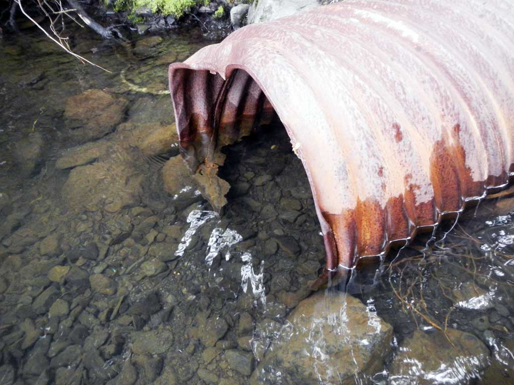
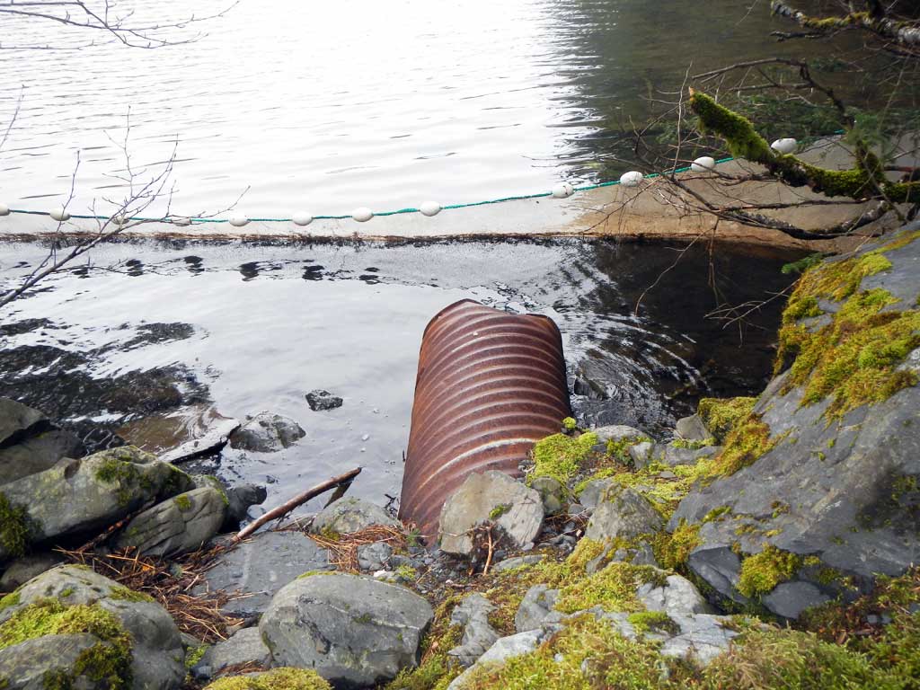
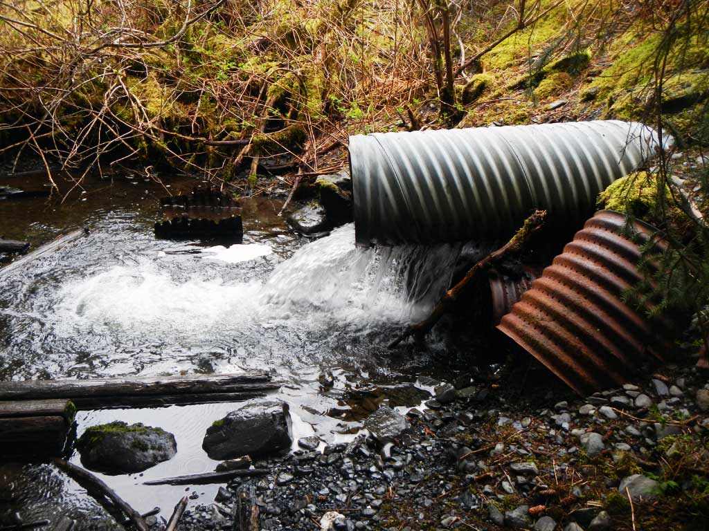
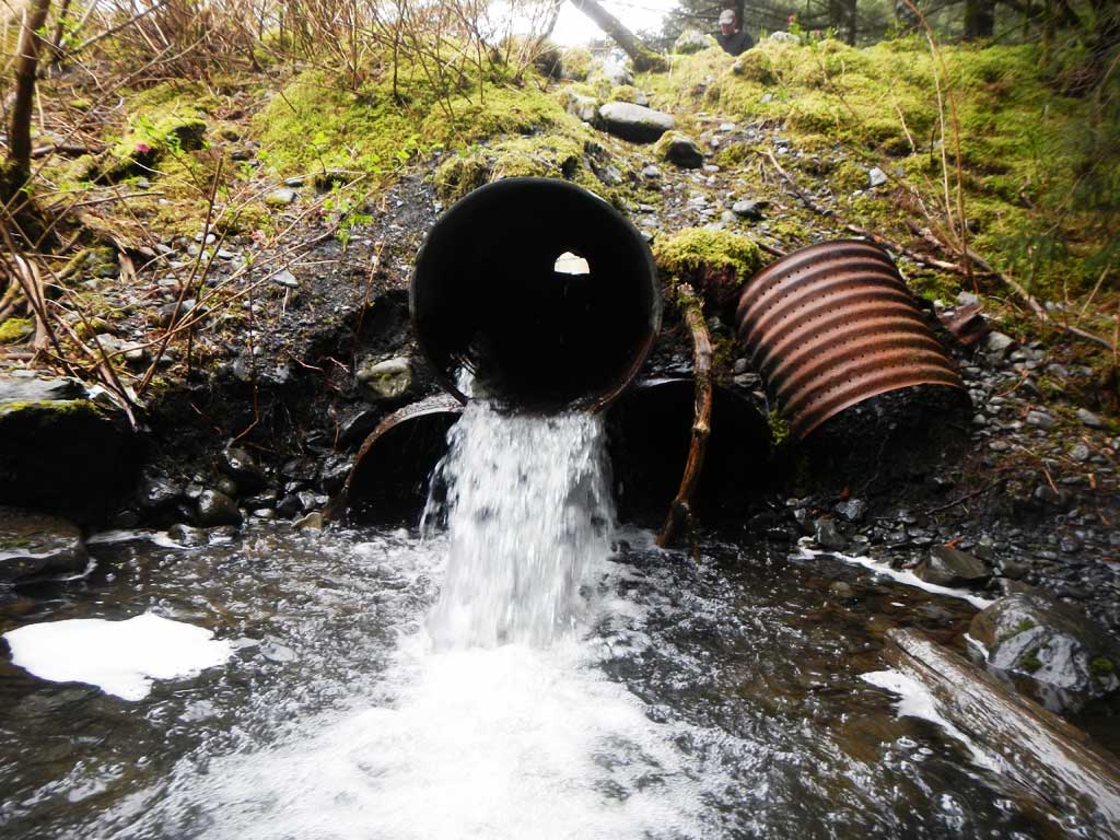
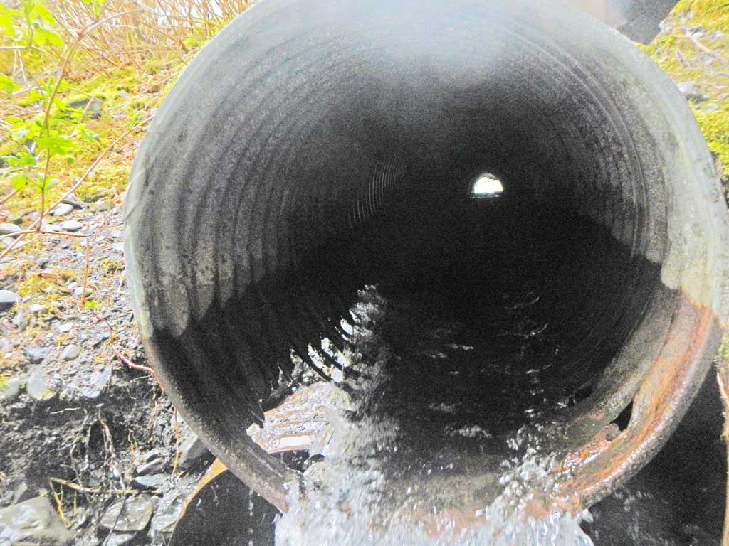
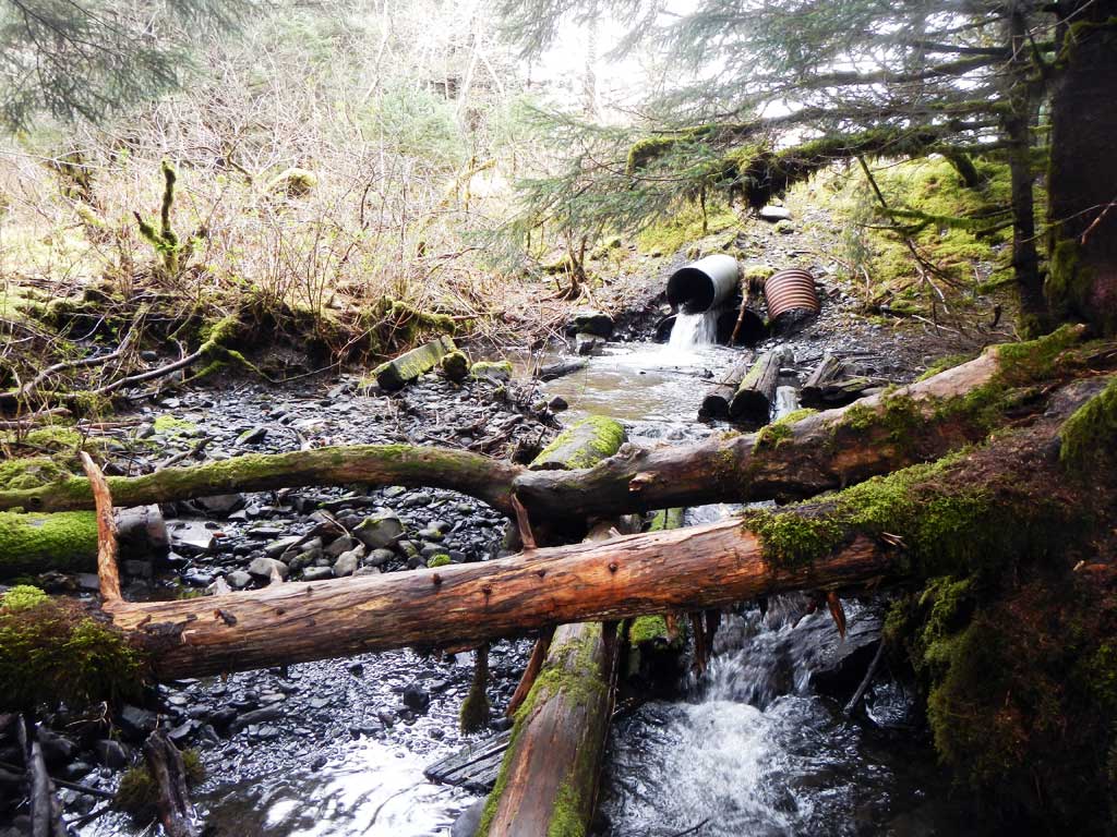
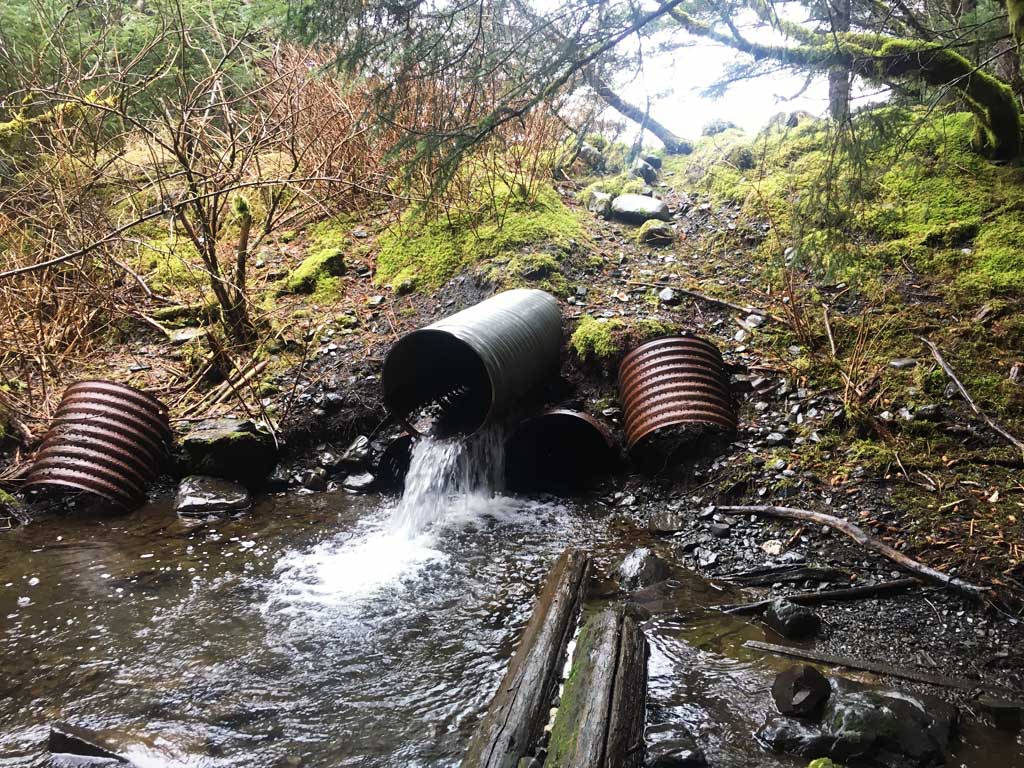
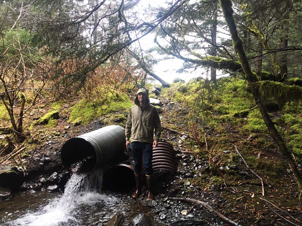
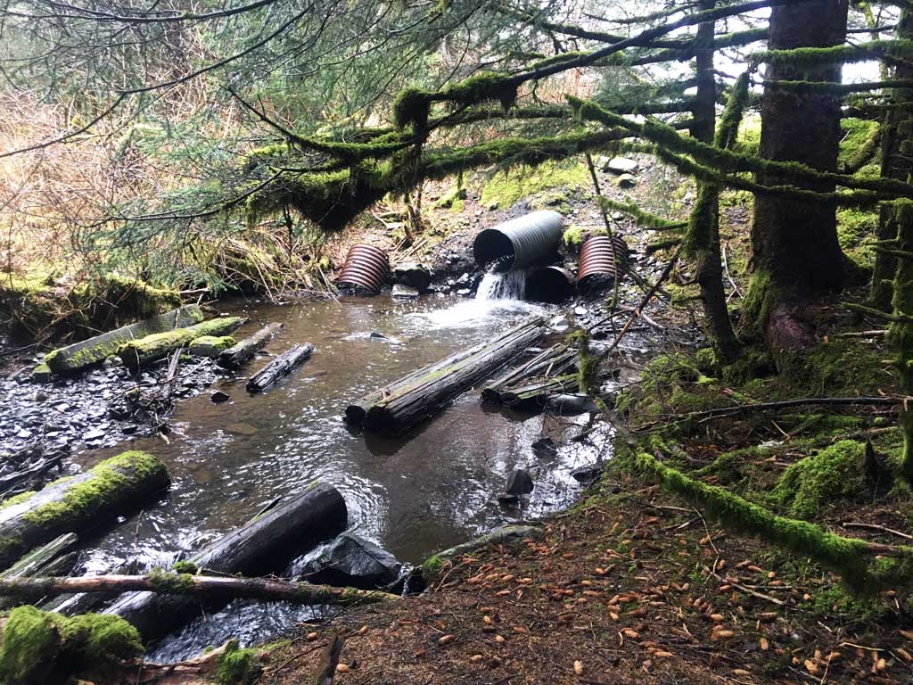
Comments: Three culverts stacked on top of each other. Only top culvert is functioning.
Culvert Measurements
| ID: 1 | Structure Type: Circular pipe (Corrugated steel) | Fish Passage Rating: | |||||||||||||||||||||||||||||||||||||||||
|
|
|
|||||||||||||||||||||||||||||||||||||||||
Comments: Outfall height is between 1 to 2 feet. Lower culverts are buried at inlet and nonfunctioning. Culvert shows signs of major deterioration at both the inlet and the outlet. |
|||||||||||||||||||||||||||||||||||||||||||
Culvert Observations:
|
|||||||||||||||||||||||||||||||||||||||||||
Stream Measurements
|
|
No stream width data available.
Elevations
No elevation data available.
Fish Sampling Efforts
No fish sampling occurred during this survey.
Fish Observations
No fish observations occurred during this survey.
Photos


Questions or comments about this report can be directed to dfg.dsf.webmaster@alaska.gov