Fish Passage Site 20703434
Coordinates (dec. deg.): 57.70792°, -152.57772°
Legal Description: S028S020W31
Region: Southwest
Road Name: Private Road
Datum: NAD83
Quad Name / ITM: Kodiak C-2
AWC Stream #: 259-22-10020-2006
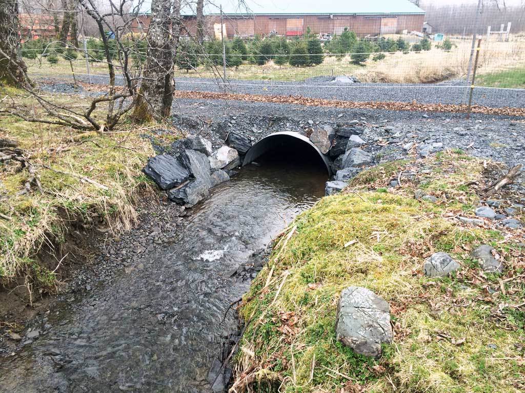
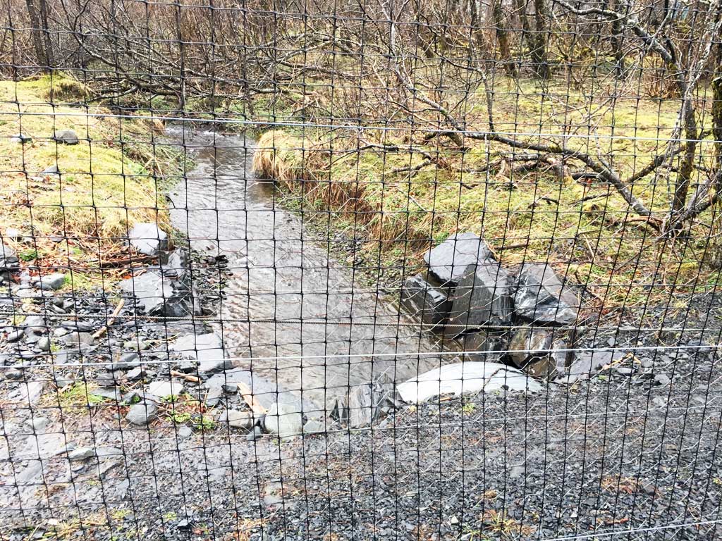
Stream Name: Lake Orbin Outlet
Elevation:
Site Comments: Culvert is located on private property tree farm.
Survey UPDATE-TRF01
Project Supervisor: Gillian O'Doherty, ADFG
Observers: Mark Eisenman
Overall Fish Passage Rating:
Tidal:
Backwatered:
Step Pools:
Construction Year: 2014
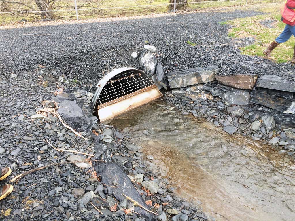
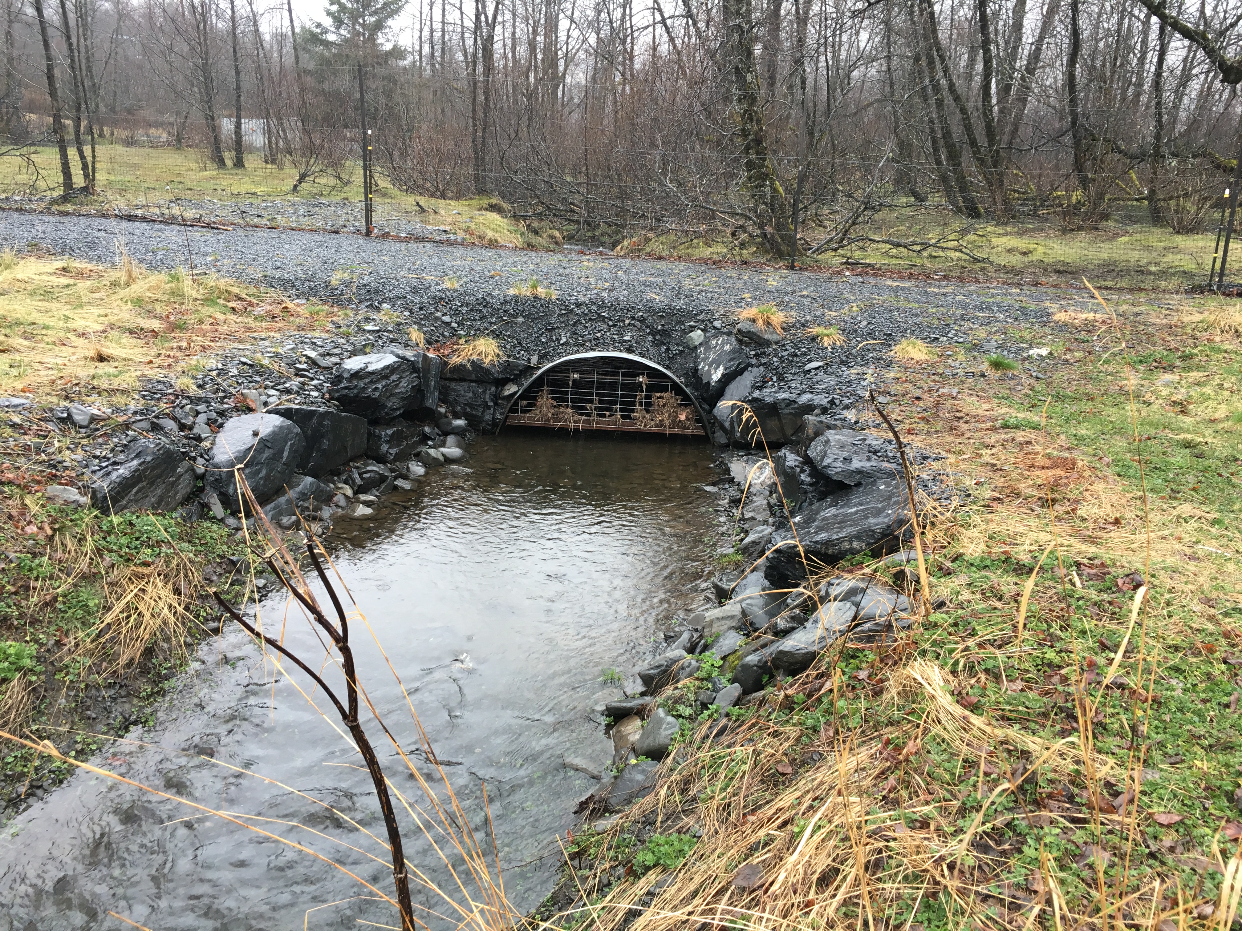
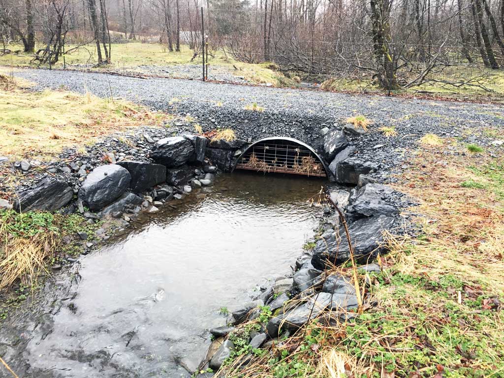
Comments: Culvert was replaced in 2014. Culvert has not been previously surveyed. Site needs survey. Additional site photos submitted by Heather Hanson, USFWS from April 2016 site visit.
Culvert Measurements
| ID: 1 | Structure Type: Circular pipe (Corrugated steel) | Fish Passage Rating: | |||||||||||||||||||||||||||||||||||||||||
|
|
|
|||||||||||||||||||||||||||||||||||||||||
Comments: Outlet has a rabbit exclusion gate. Gate is suppose to be replaced with a more fish friendly structure. Culvert was replaced in 2014. Measurements are estimated from replacement documents. Cuvlert width estimated at 6 feet. Culvert length 25 ft. |
|||||||||||||||||||||||||||||||||||||||||||
Stream Measurements
|
|
No stream width data available.
Elevations
No elevation data available.
Fish Sampling Efforts
No fish sampling occurred during this survey.
Fish Observations
No fish observations occurred during this survey.
Photos

Questions or comments about this report can be directed to dfg.dsf.webmaster@alaska.gov