Fish Passage Site 20703254
Coordinates (dec. deg.): 57.76665°, -152.53308°
Legal Description: S028S020W09
Region: Southwest
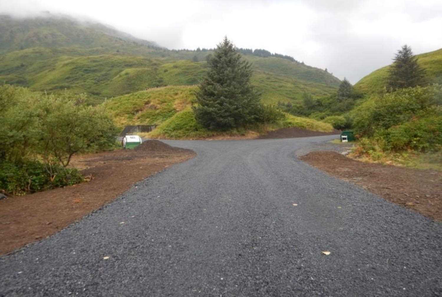
Road Name: USGS Battery Road
Datum: WGS84
Quad Name / ITM: Kodiak D-2
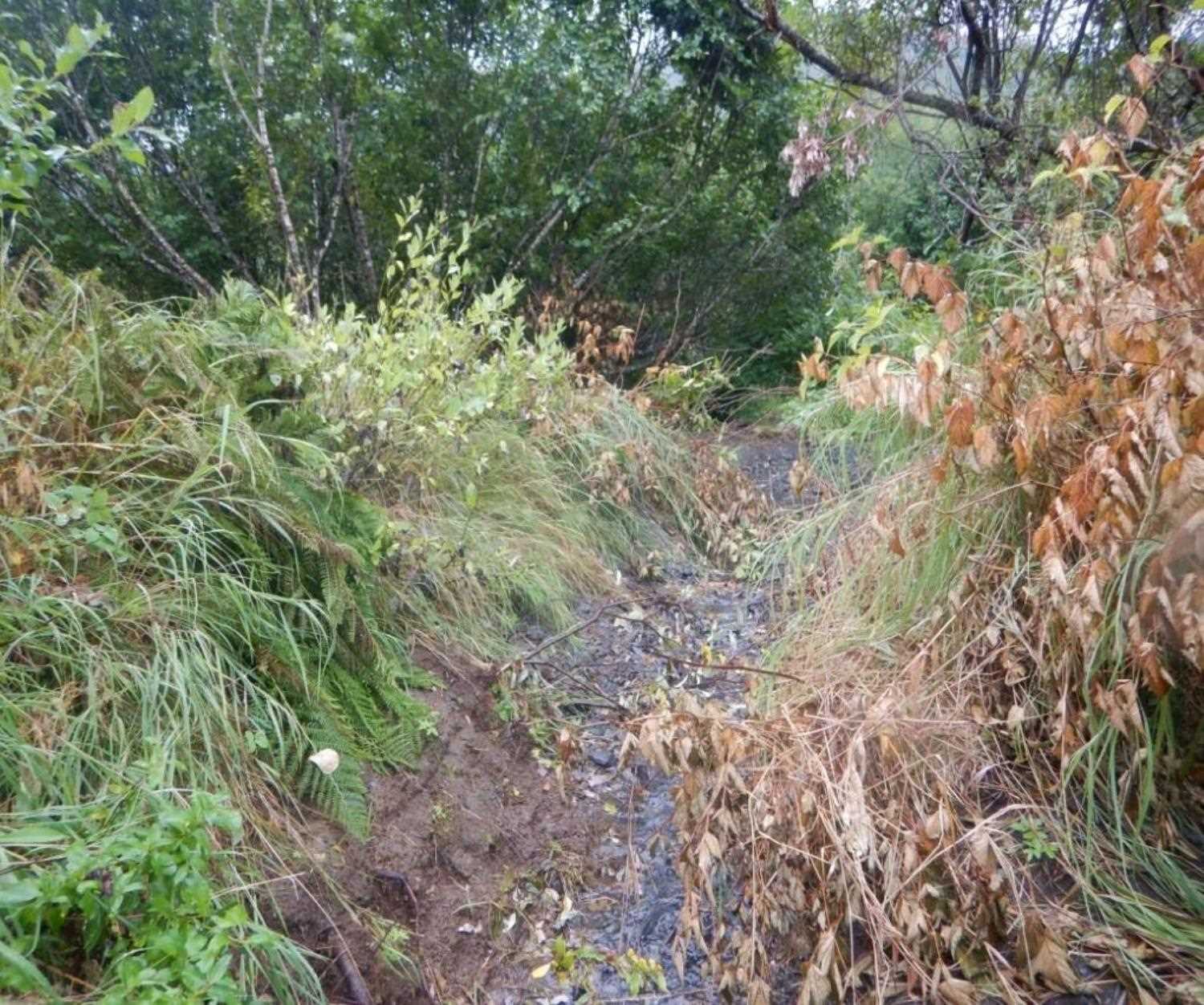
AWC Stream #: 259-21-10120-2011
Stream Name: Battery Creek Tributary
Elevation:
Site Comments: Culvert is on a road owned by the Coast Guard base.
arrow to the right of the survey date below to choose a different report for this site.
Survey UPD20-KOD01A
Project Supervisor: Gillian O'Doherty, Alaska Department of Fish and Game
— Anchorage, AK
Observers: William Frost
Overall Fish Passage Rating:
Tidal:
Backwatered:
Step Pools:
Construction Year: 2019
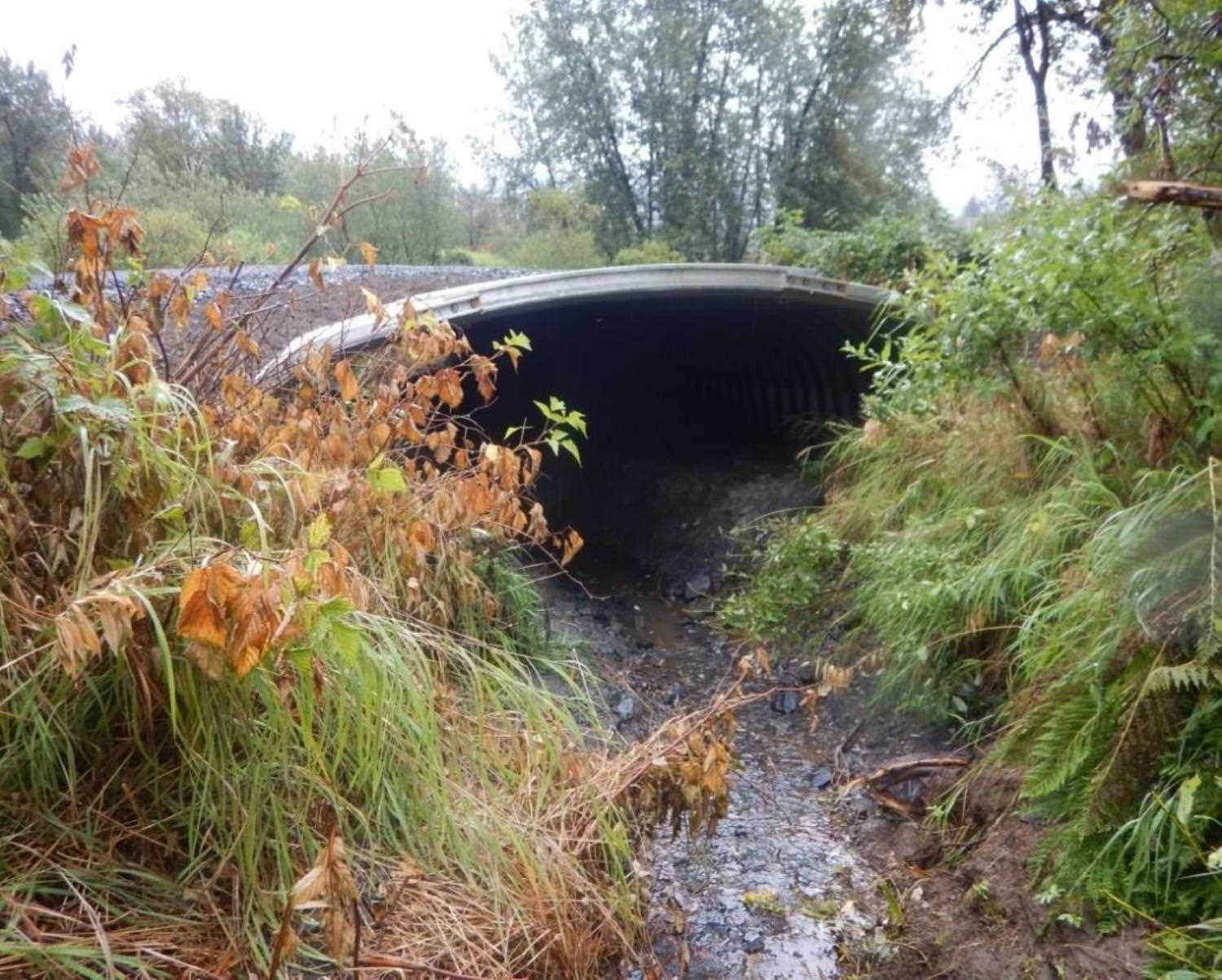
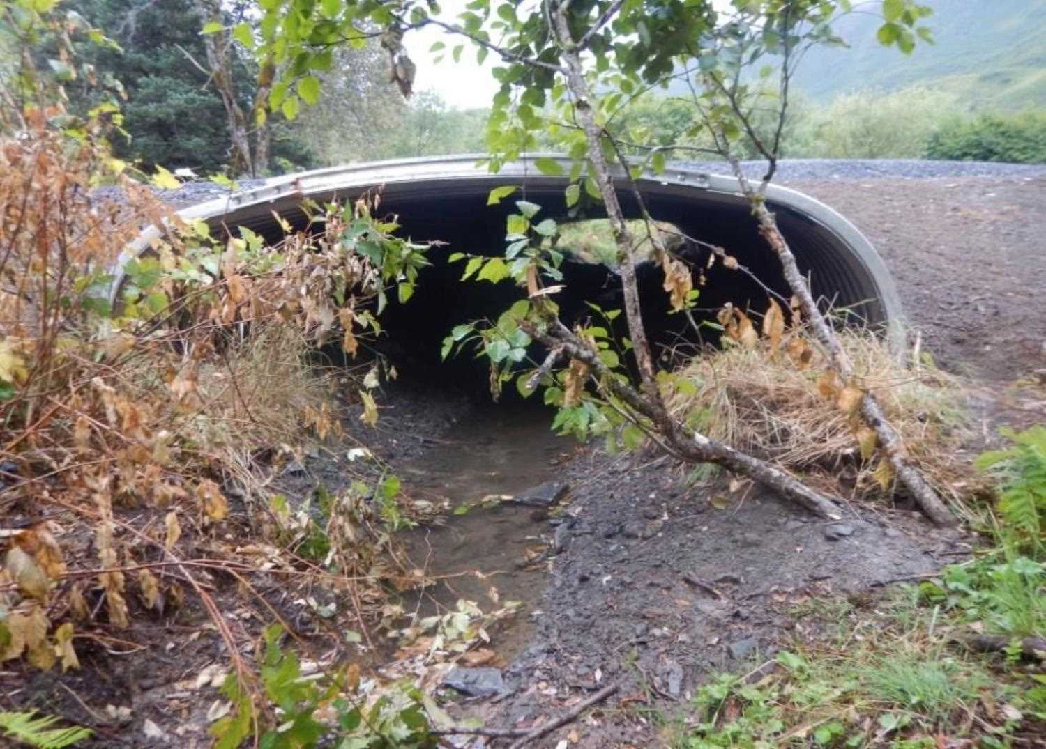
Comments: Submitted by Will Frost, ADFG. Culvert has been replaced. Needs resurvey. AIM Maintenance replaced a 36-inch culvert and backfilled new pipe for fish passage. See Habitat Permit FH 19-II-0022. Part of the Buskin River EVOS Restoration project.
Culvert Measurements
| ID: 1 | Structure Type: Pipe-arch (Corrugated aluminum) | Fish Passage Rating: | |||||||||||||||||||||||||||||||||||||||||
|
|
|
|||||||||||||||||||||||||||||||||||||||||
Stream Measurements
|
|
No stream width data available.
Elevations
No elevation data available.
Fish Sampling Efforts
No fish sampling occurred during this survey.
Fish Observations
No fish observations occurred during this survey.
Photos


Questions or comments about this report can be directed to dfg.dsf.webmaster@alaska.gov