Fish Passage Site 20700824
Coordinates (dec. deg.): 57.63972°, -152.50161°
Legal Description: S029S020W28
Region: Southwest
Road Name: Chiniak Highway
Datum: WGS84
Quad Name / ITM: Kodiak C-2
AWC Stream #:
Stream Name:
Elevation:
Site Comments: None
arrow to the right of the survey date below to choose a different report for this site.
Survey UPDATE-CR22
Project Supervisor: Gillian O'Doherty, ADFG
Observers: William Frost
Overall Fish Passage Rating:
Tidal: No
Backwatered: No
Step Pools: No
Construction Year: 2013
Site Observations:
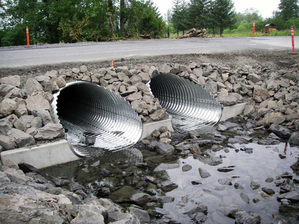
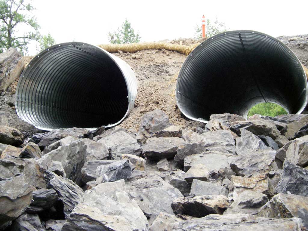
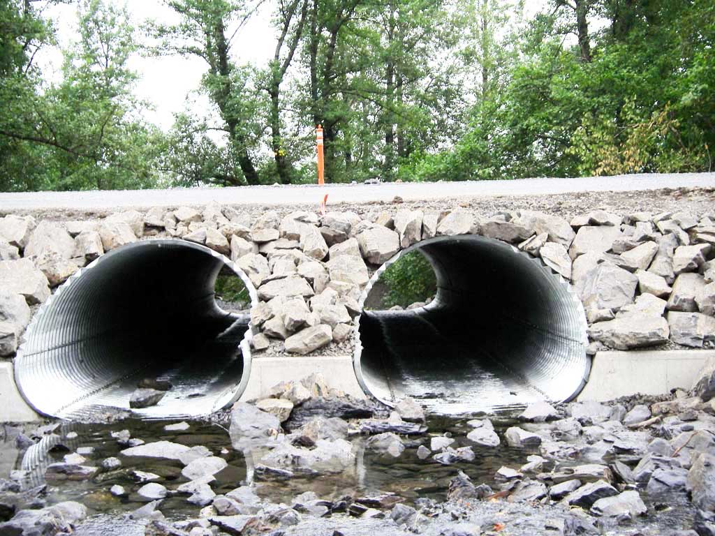
- Outfall height red
Comments: Replacement culverts were not designed for fish passage due to limited upstream fish habitat. Culverts were replaced July 2013 and need to be resurveyed. Culvert still rated red due to rip rap outfall.
Culvert Measurements
| ID: 1 | Structure Type: Pipe-arch (Structural aluminum plate) | Fish Passage Rating: | |||||||||||||||||||||||||||||||||||||||||
|
|
|
|||||||||||||||||||||||||||||||||||||||||
Comments: Culvert dimensions taken from site plans and have not been verified. Culvert width 7 ft. Culvert height 5 ft. Culvert length 60 ft. |
|||||||||||||||||||||||||||||||||||||||||||
Culvert Observations:
|
|||||||||||||||||||||||||||||||||||||||||||
| ID: 2 | Structure Type: Pipe-arch (Structural aluminum plate) | Fish Passage Rating: | |||||||||||||||||||||||||||||||||||||||||
|
|
|
|||||||||||||||||||||||||||||||||||||||||
Comments: Culvert dimensions taken from site plans and have not been verified. Culvert width 7 feet, culvert hieght 5 feet. |
|||||||||||||||||||||||||||||||||||||||||||
Culvert Observations:
|
|||||||||||||||||||||||||||||||||||||||||||
Stream Measurements
|
|
No stream width data available.
Elevations
No elevation data available.
Fish Sampling Efforts
No fish sampling occurred during this survey.
Fish Observations
No fish observations occurred during this survey.
Photos

Questions or comments about this report can be directed to dfg.dsf.webmaster@alaska.gov