Fish Passage Site 20603482
Coordinates (dec. deg.): 61.25658°, -150.91428°
Legal Description: S014N009W33
Region: South Central
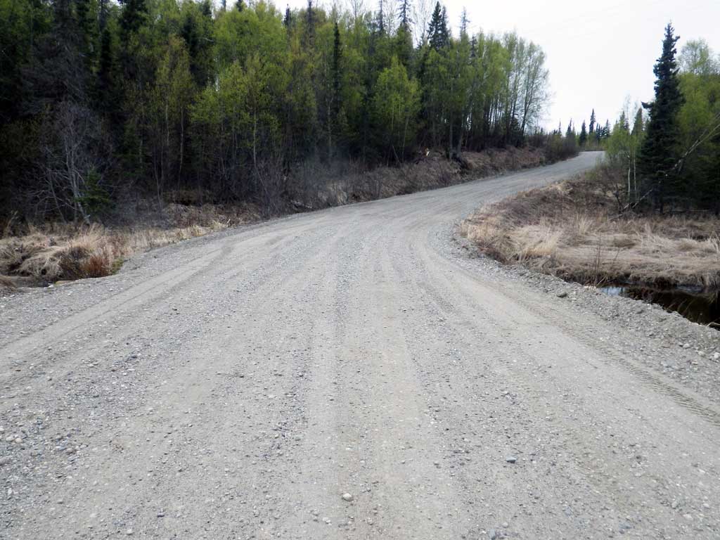
Road Name: Beluga Highway
Datum: NAD83
Quad Name / ITM: Tyonek B-3
AWC Stream #:
Stream Name: Unnamed
Site Comments: None
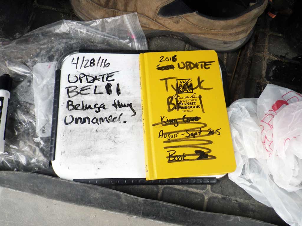
Survey Date: Apr 28, 2016
Survey UPDATE-BEL11
Project Supervisor: Gillian O'Doherty, ADFG
Observers: Mark Eisenman, Robert Pype
Overall Fish Passage Rating: Black
Tidal: No
Backwatered: Maybe
Step Pools: No
Construction Year:
Site Observations:
- Beaver Activity
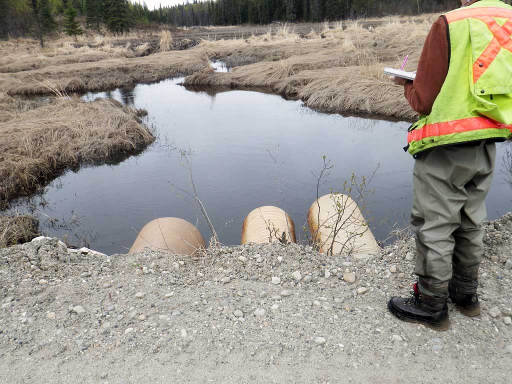
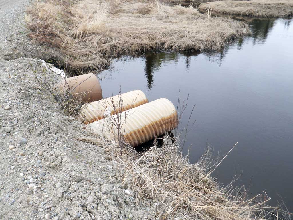
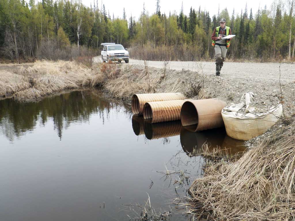
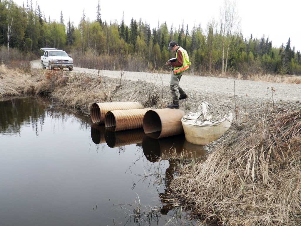
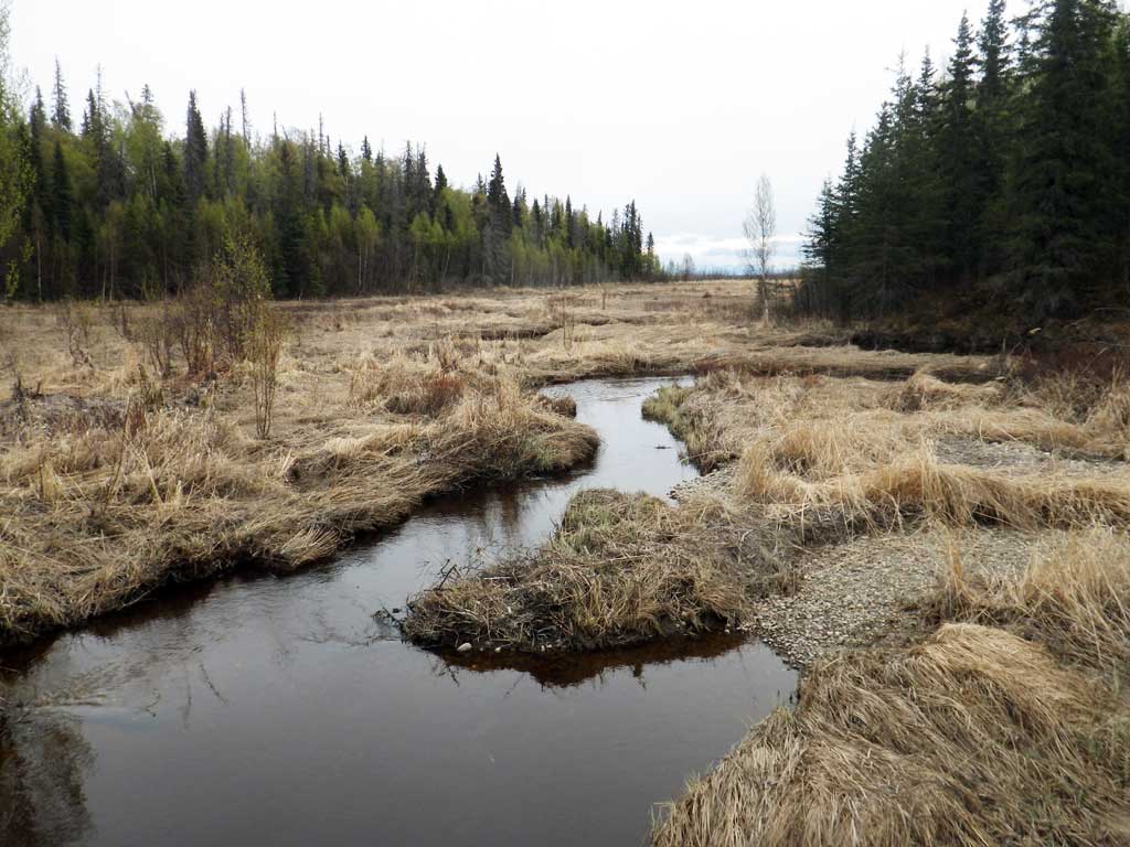
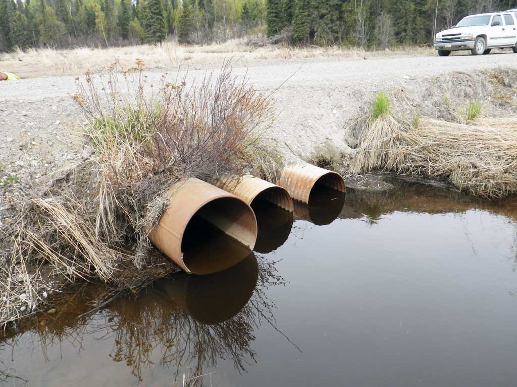
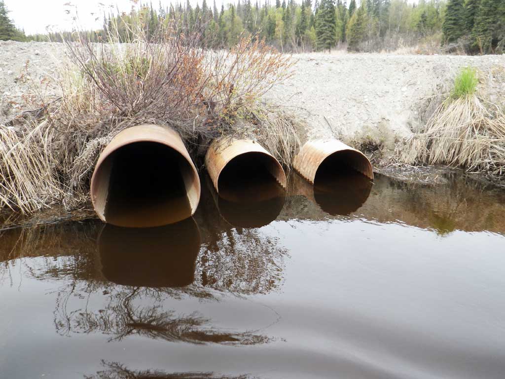
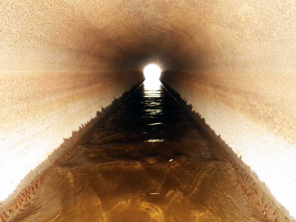
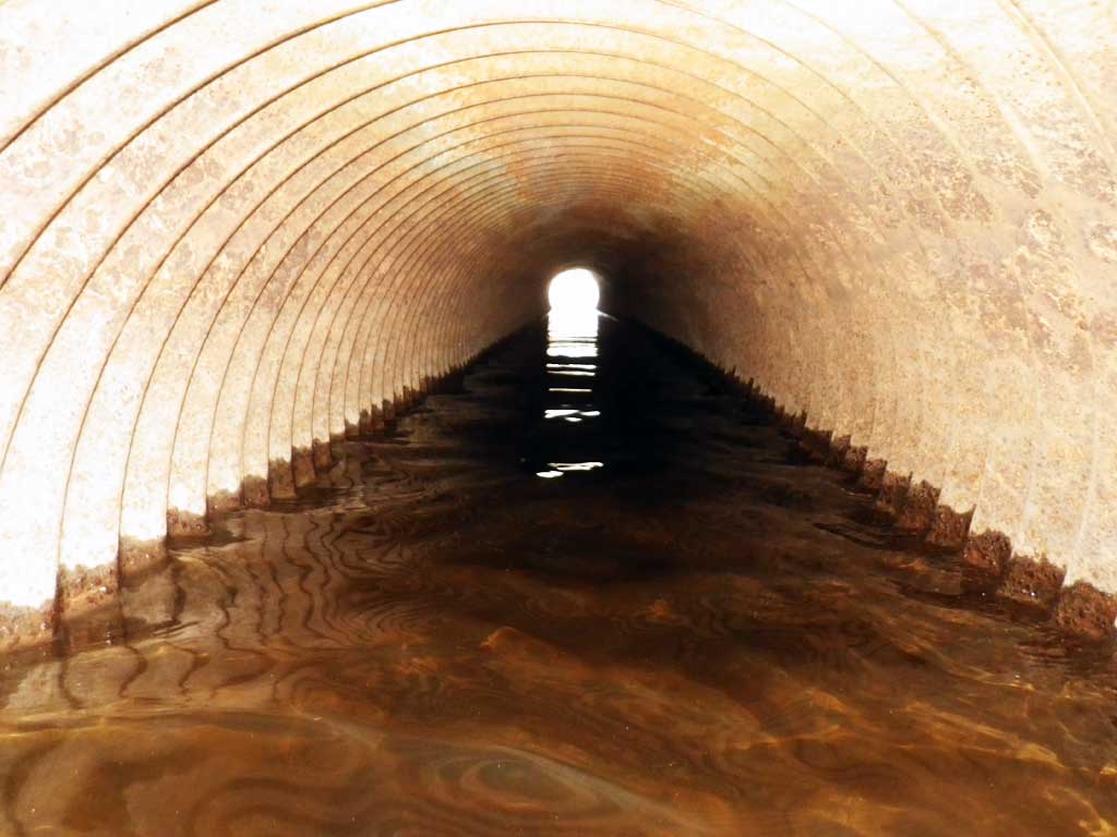
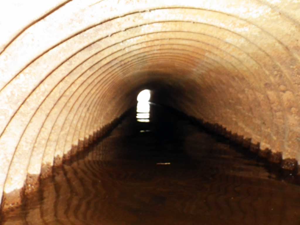
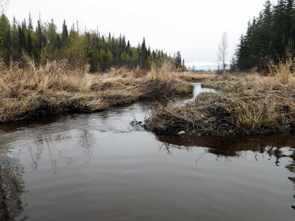
Comments: The three main culverts are sitting on top of two larger mostly buried culverts. Large beaver dam about 200 feet upstream and another lodge dam complex about 600 feet upstream of that. Nice downstream channel and substrate.
Culvert Measurements
| ID: 1 |
Structure Type: Circular pipe (Corrugated steel) |
Fish Passage Rating: Black |
| |
| Length(ft): 40.3 |
| Inlet Type: Projecting |
| Outlet Type: Projecting |
| Corrugation Depth(in.): 0.5 |
| Corrugation Width(in.): 2.5 |
| Condition Rating(1-5): 3 |
| Approach Angle: 0.0 |
| Sedimentation At Inlet: Yes |
| Inlet Substrate: None |
| Outlet Substrate: None |
|
| Inlet | Outlet |
|---|
| Width(ft): | 2.0 | 2.0 |
| Height(ft): | 2.2 | 2.3 |
| Apron Length(ft): | | |
| Water Depth(ft): | | |
| Rustline Height(ft): | | |
| Substrate Depth(ft): | | |
|
| Backwatered?: |
| Baffles Present: No |
| Embedded?: No |
| Outfall Height: 0.0 |
| Outfall Type: At Stream Grade |
Constriction Ratio: |
| Culvert Gradient: |
| Max Slope: |
| Max Slope Length: |
|
| |
Culvert Observations:
- Beaver Activity
|
| ID: 2 |
Structure Type: Circular pipe (Corrugated steel) |
Fish Passage Rating: Black |
| |
| Length(ft): 40.3 |
| Inlet Type: Projecting |
| Outlet Type: Projecting |
| Corrugation Depth(in.): 0.5 |
| Corrugation Width(in.): 2.5 |
| Condition Rating(1-5): 3 |
| Approach Angle: 0.0 |
| Sedimentation At Inlet: Yes |
| Inlet Substrate: None |
| Outlet Substrate: None |
|
| Inlet | Outlet |
|---|
| Width(ft): | 2.0 | 2.0 |
| Height(ft): | 2.0 | 2.1 |
| Apron Length(ft): | | |
| Water Depth(ft): | | |
| Rustline Height(ft): | | |
| Substrate Depth(ft): | | |
|
| Backwatered?: |
| Baffles Present: No |
| Embedded?: No |
| Outfall Height: 0.0 |
| Outfall Type: At Stream Grade |
Constriction Ratio: |
| Culvert Gradient: |
| Max Slope: |
| Max Slope Length: |
|
| ID: 3 |
Structure Type: Circular pipe (Non-corrugated metal) |
Fish Passage Rating: Black |
| |
| Length(ft): 40.0 |
| Inlet Type: Projecting |
| Outlet Type: Projecting |
| Corrugation Depth(in.): |
| Corrugation Width(in.): |
| Condition Rating(1-5): 3 |
| Approach Angle: 0.0 |
| Sedimentation At Inlet: Yes |
| Inlet Substrate: None |
| Outlet Substrate: None |
|
| Inlet | Outlet |
|---|
| Width(ft): | 2.55 | 2.5 |
| Height(ft): | 2.55 | 2.5 |
| Apron Length(ft): | | |
| Water Depth(ft): | | |
| Rustline Height(ft): | | |
| Substrate Depth(ft): | | |
|
| Backwatered?: |
| Baffles Present: No |
| Embedded?: No |
| Outfall Height: 0.0 |
| Outfall Type: At Stream Grade |
Constriction Ratio: |
| Culvert Gradient: |
| Max Slope: |
| Max Slope Length: |
|
Stream Measurements
| Stream Substrates | Upstream | Downstream |
|---|
| Dominant: | Silt/Clay | Silt/Clay |
| Subdominant: | Organic | Gravel |
|
| Stream Slope(deg.): | |
|---|
| Stream Flow Stage: | Medium |
|---|
|
No stream width data available.
Elevations
No elevation data available.
Fish Sampling Efforts
| Gear Type: Minnow Trap (A) |
Trap Duration(h): 2.0 |
Fish Observations
| Species: adult threespine stickleback |
Life History: Unknown |
| Total Fish Observed: 1 |
Fish Measured: |
Fork Lengths (mm) Min: Max: Mean: |
| Collected/Observed by Gear Type: Downstream Minnow Trap (1) |
Questions or comments about this report can be directed to dfg.dsf.webmaster@alaska.gov