Fish Passage Site 20601543
Coordinates (dec. deg.): 61.05783°, -151.40369°
Legal Description: S011N012W09
Region: South Central
Road Name: Tyonek Timber Road
Datum: NAD83
Quad Name / ITM: Tyonek A-4
AWC Stream #:
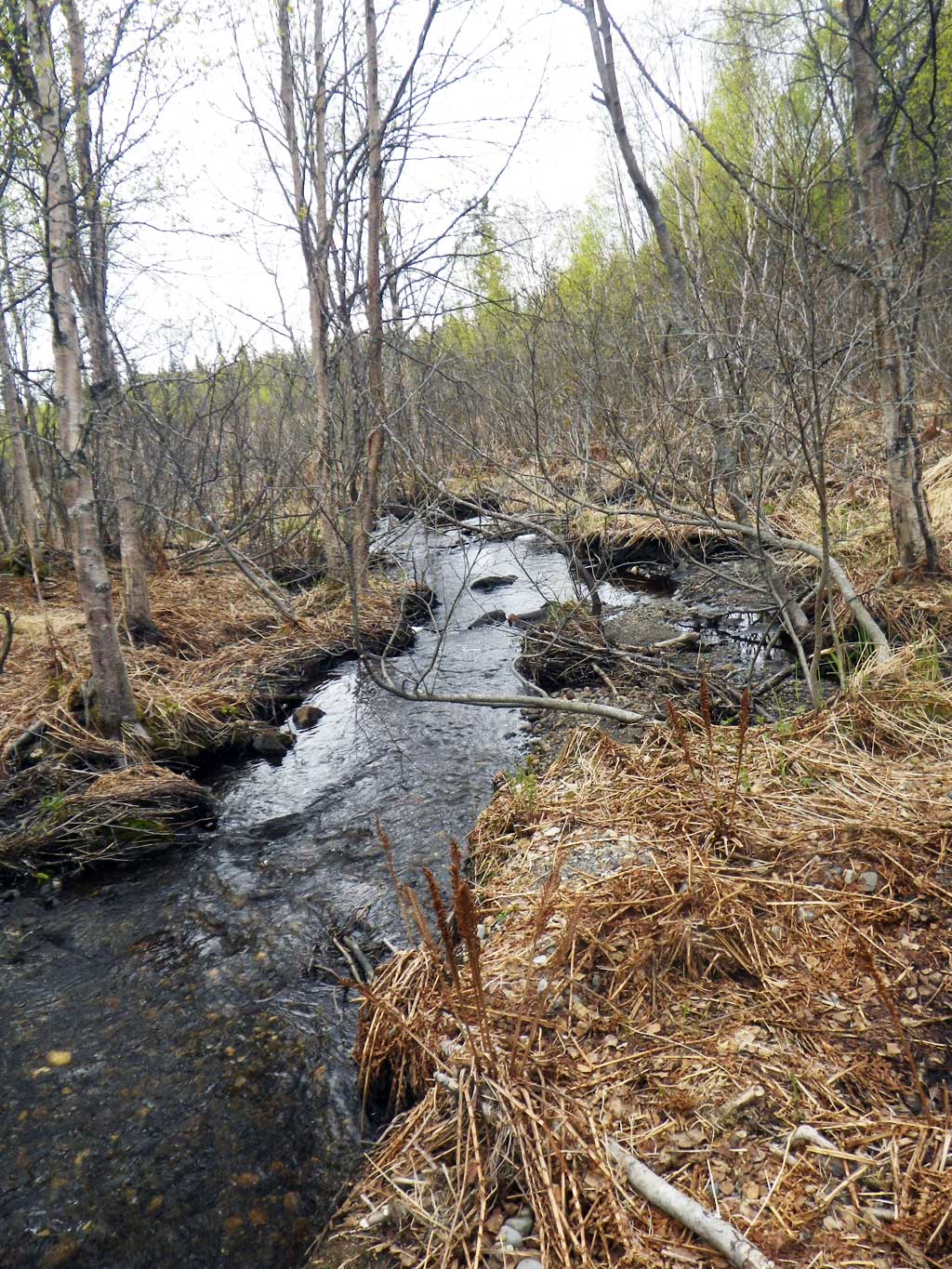
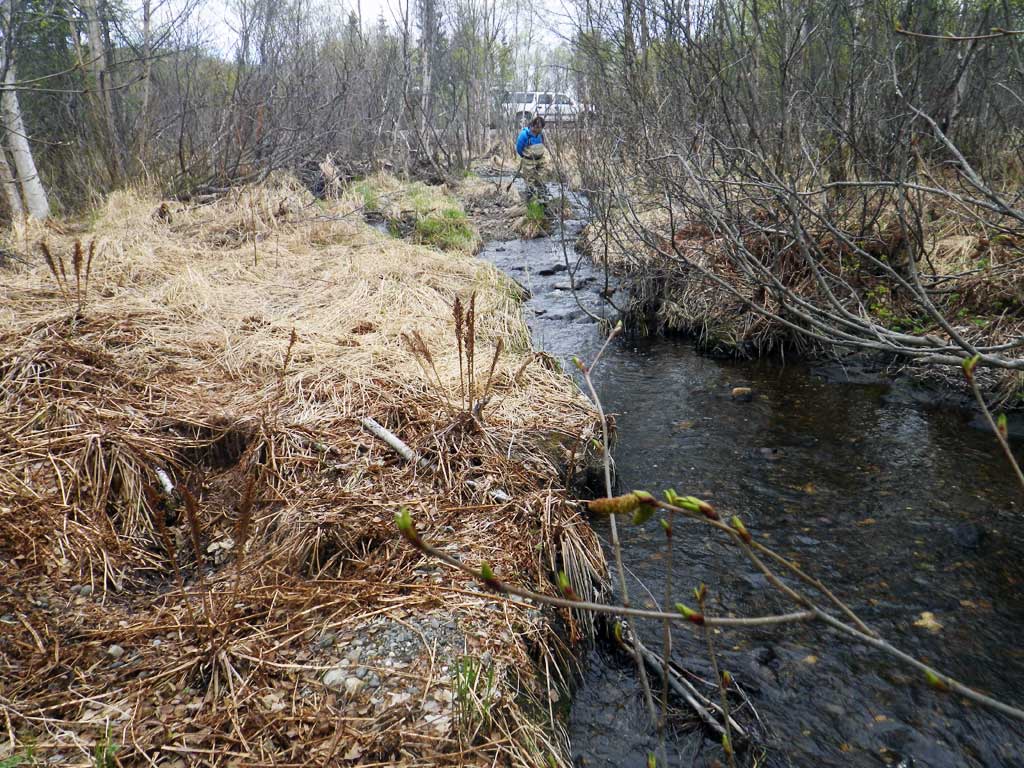
Stream Name: Bird Lake outlet
Elevation:
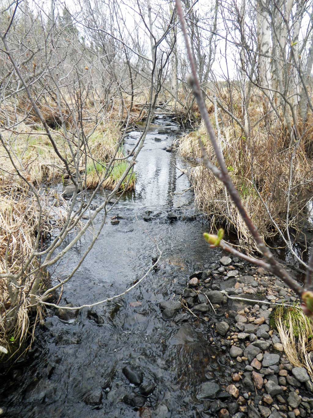
Site Comments: Bird Lake upstream of crossing.
arrow to the right of the survey date below to choose a different report for this site.
Survey UPDATE-1543
Project Supervisor: Gillian O'Doherty, ADFG
Observers: Mark Eisenman, Gillian O'Doherty, Robert Pype
Overall Fish Passage Rating:
Tidal:
Backwatered:
Step Pools:
Construction Year:
Site Observations:
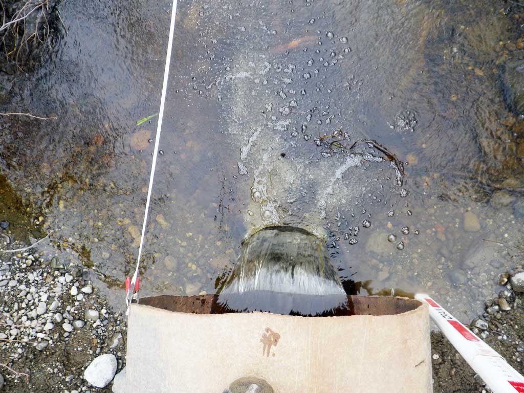
- Constriction ratio red
- Outfall height red
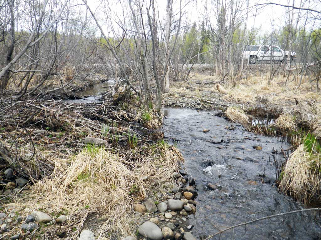
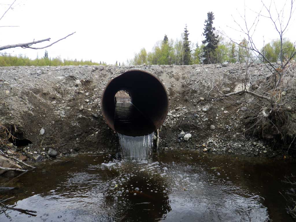
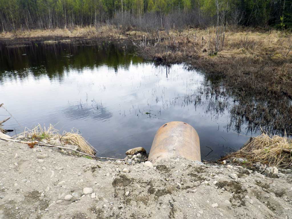
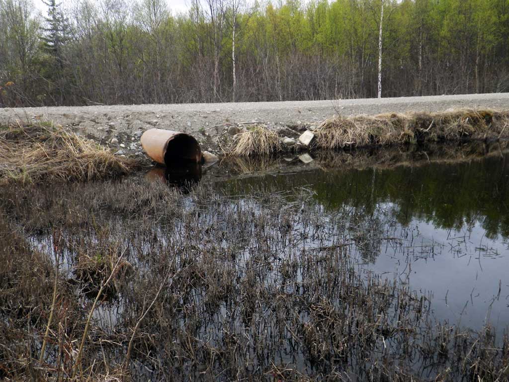
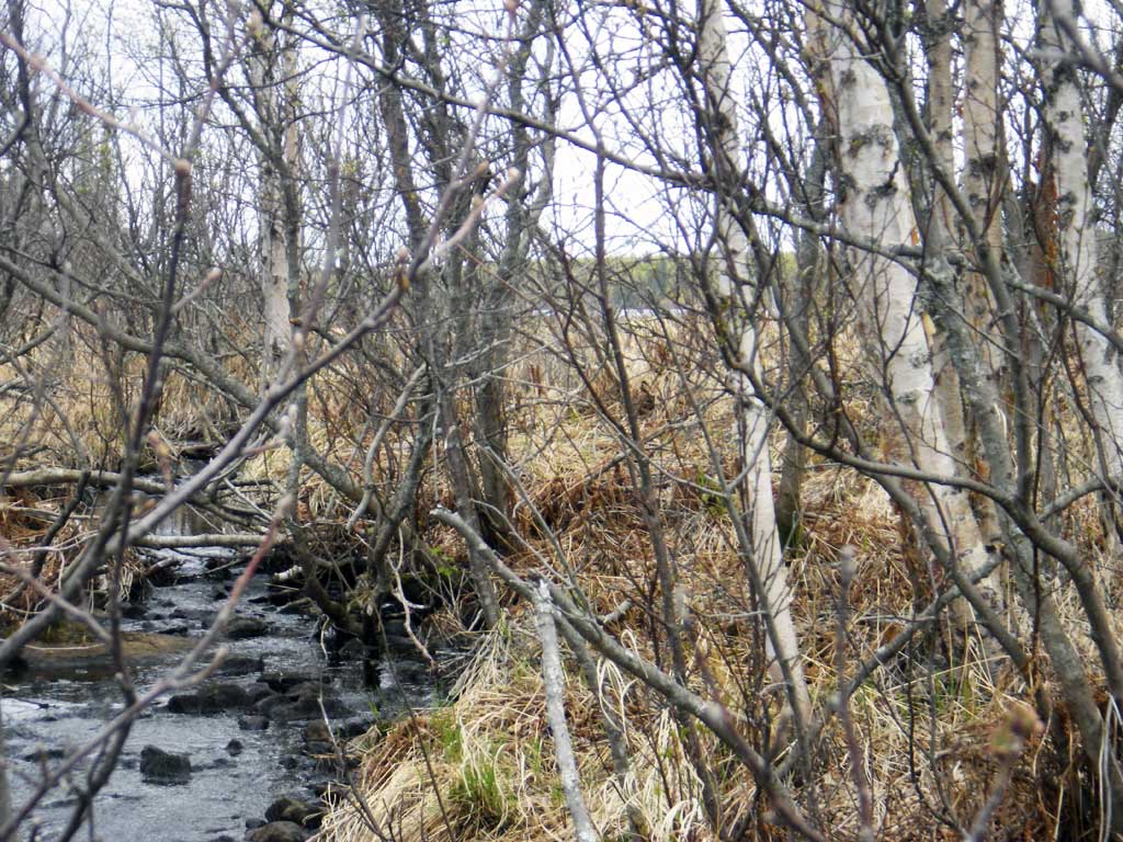
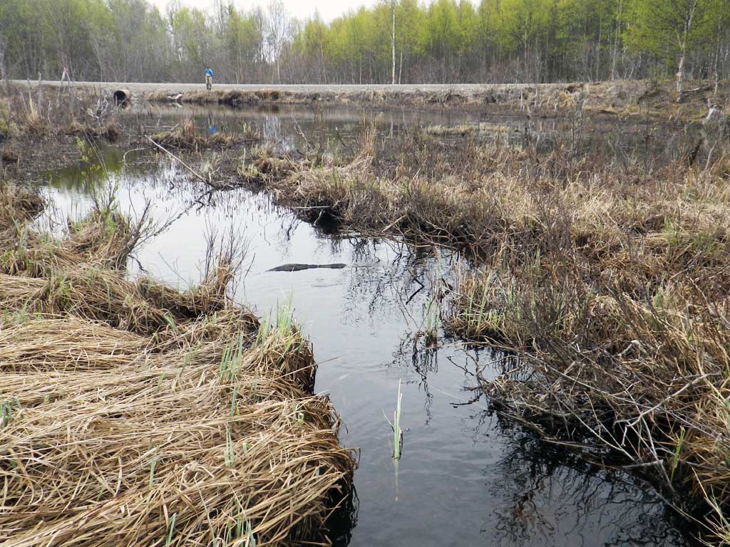
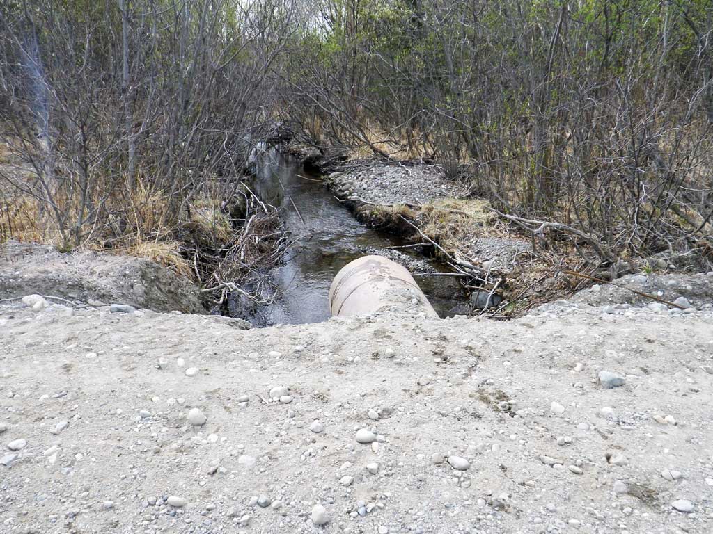
Comments: Culvert has blown out multiple times. Road fill observed over 600 feet downstream. This culvert has been here at least 5 years. Large fish observed downstream likely rainbow trout spawning. Downstream flattens out and becomes a marsh. Ponded upstream.
Culvert Measurements
| ID: 1 | Structure Type: Circular pipe (Non-corrugated metal) | Fish Passage Rating: | |||||||||||||||||||||||||||||||||||||||||
|
|
|
|||||||||||||||||||||||||||||||||||||||||
Comments: Culvert set at adverse angle impounding water above culvert. |
|||||||||||||||||||||||||||||||||||||||||||
Culvert Observations:
|
|||||||||||||||||||||||||||||||||||||||||||
Stream Measurements
|
|
| Stream Width Type | Distance From Crossing (ft) |
Stream Width (ft) |
|---|---|---|
| Downstream ordinary high water | 150.0 | 7.50 |
| Downstream ordinary high water | 200.0 | 6.00 |
Elevations
| Locator ID | Culvert Number |
River Distance (ft)1 |
Distance From Crossing (ft)2 |
Relative Elevation (ft) |
|---|---|---|---|---|
| Road Elev | 101.00 | |||
| D/S Water Surface Elev (Pool) | 0.00 | 96.12 | ||
| D/S Thalweg | 0.00 | 95.50 | ||
| D/S Tailcrest or 1st Thalweg | 10.50 | 95.92 | ||
| Max Pool Depth | 23.20 | 94.08 | ||
| D/S Thalweg (Downstream gas pipe in stream) | 23.20 | 95.38 | ||
| Outlet Pool Water Elev | 23.20 | 96.26 | ||
| Outlet Culvert Top | 25.20 | 100.01 | ||
| Outlet Invert (On pipe) | 25.20 | 97.05 | ||
| D/S Water Surface Elev | 25.20 | 97.28 | ||
| U/S Water Surface Elev | 58.50 | 97.49 | ||
| Inlet Culvert Top | 58.50 | 99.66 | ||
| Inlet Culvert Invert (On pipe) | 58.50 | 96.68 |
Notes:
- River distance is measured continuously throughout the survey reach along the thalweg of the stream.
- Measured from each end of the crossing along the thalweg of the stream.
Fish Sampling Efforts
| Gear Type: Minnow Trap (A) | Trap Duration(h): 1.0 | |
| Gear Type: Minnow Trap (B) | Trap Duration(h): 1.0 | |
| Gear Type: Visual Observation, Ground (C) | ||
Fish Observations
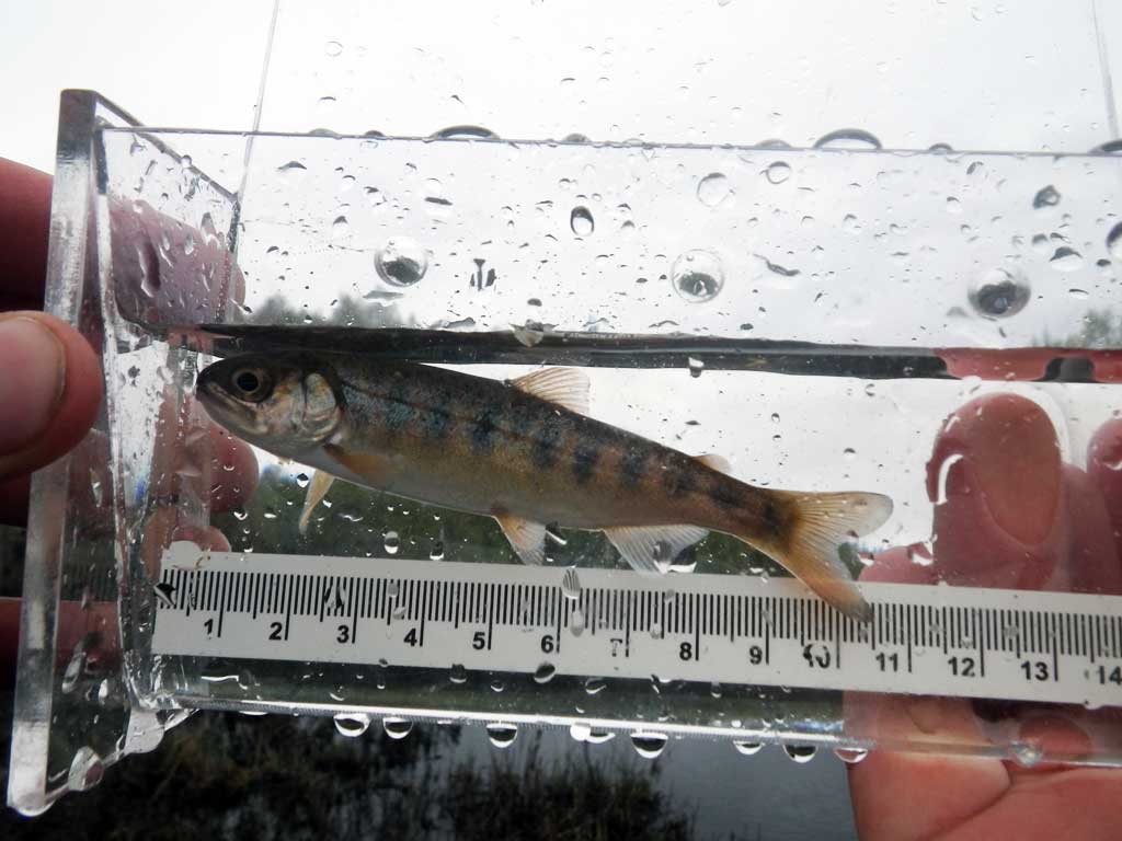
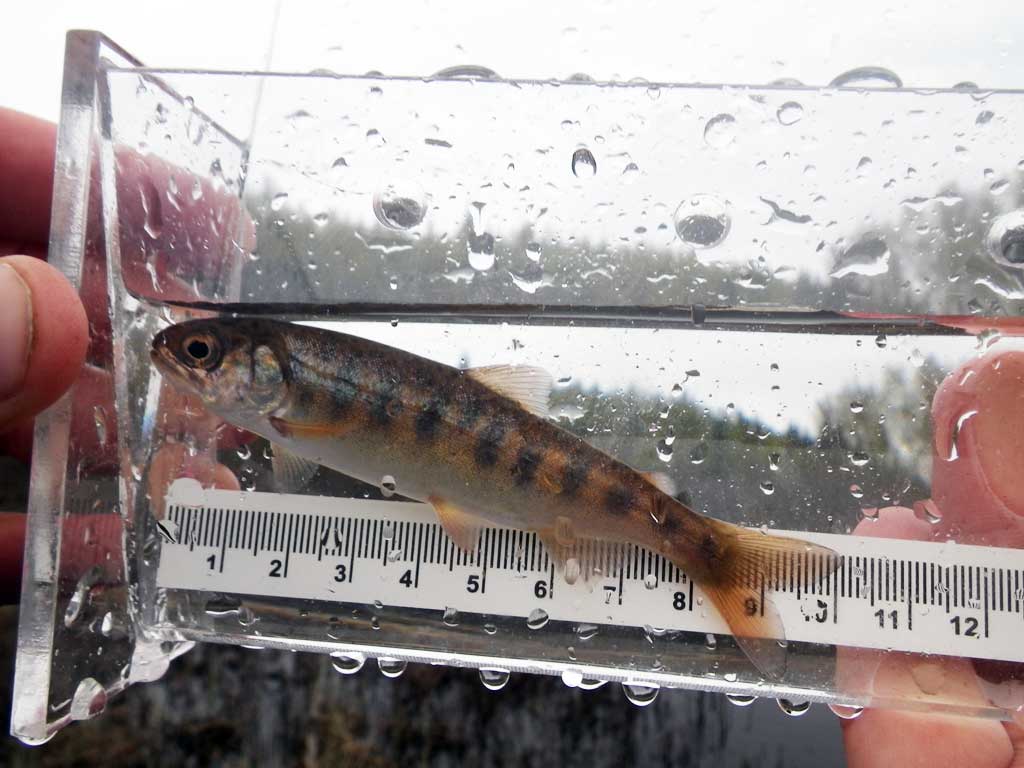
| Species: juvenile coho salmon | Life History: Anadromous | ||
| Total Fish Observed: 1 | Fish Measured: 1 | Fork Lengths (mm) Min: 94 Max: 94 Mean: 94 | |
| Collected/Observed by Gear Type: Upstream Minnow Trap (1) | |||
| Species: adult rainbow trout | Life History: Unknown | ||
| Total Fish Observed: 3 | Fish Measured: | Fork Lengths (mm) Min: Max: Mean: | |
| Collected/Observed by Gear Type: Downstream Visual Observation, Ground (3) | |||
| Comments: Adults appeared to be spawning | |||
Photos


Questions or comments about this report can be directed to dfg.dsf.webmaster@alaska.gov