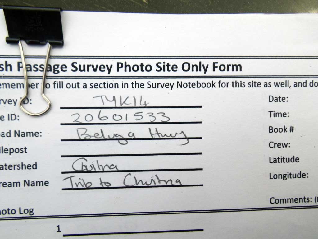
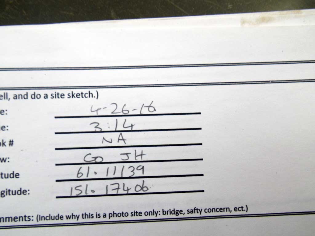
Fish Passage Site 20601533
Coordinates (dec. deg.): 61.11139°, -151.17406°
Legal Description: S012N011W23
Region: South Central
Road Name: Logging Road
Datum: NAD83
Quad Name / ITM: Tyonek A-4
AWC Stream #:
Stream Name: Unnamed
Elevation:
Site Comments: None
Survey TYCS1-TY007
Observers: Cecil Rich, Michael Anderson, Joe Buckwalter
Overall Fish Passage Rating:
Tidal: No
Backwatered: No
Step Pools:
Construction Year:
Site Observations:
- Constriction ratio red
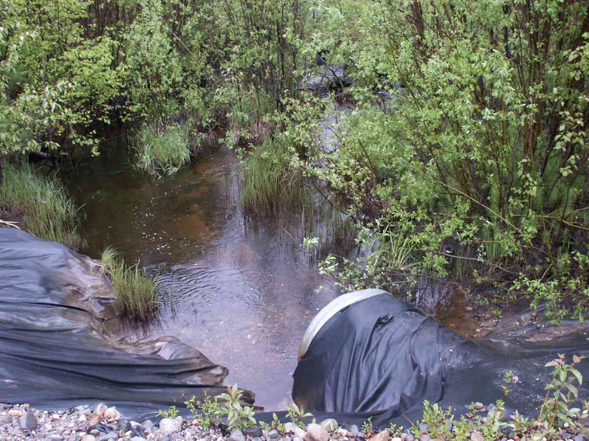
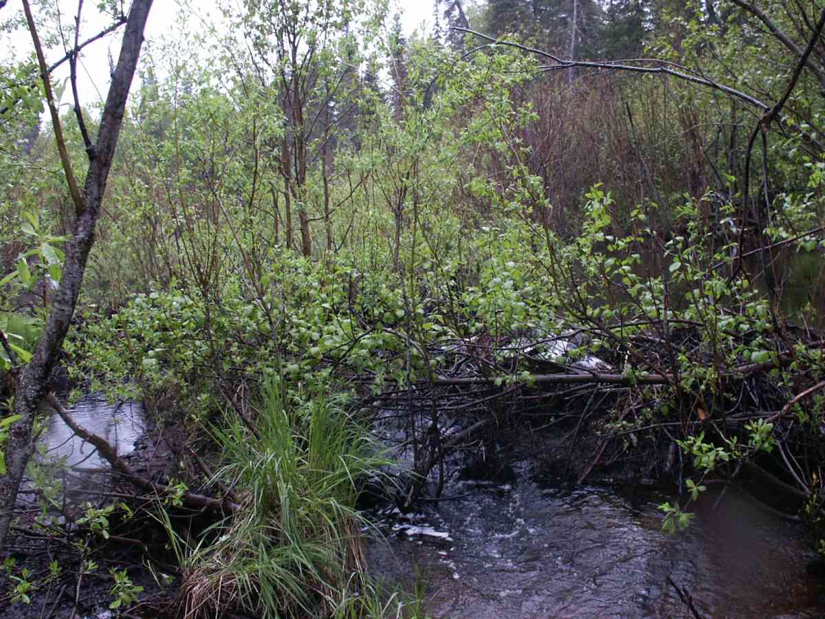
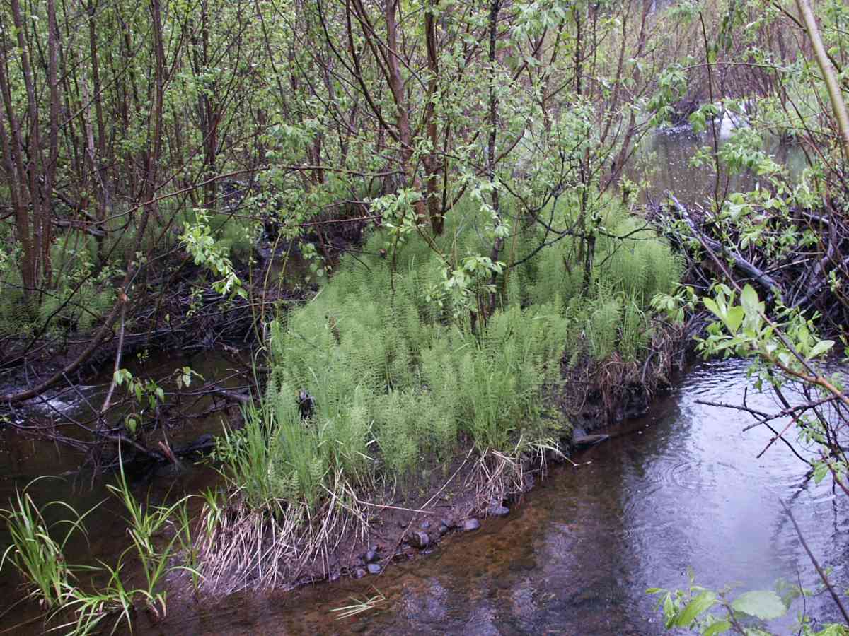
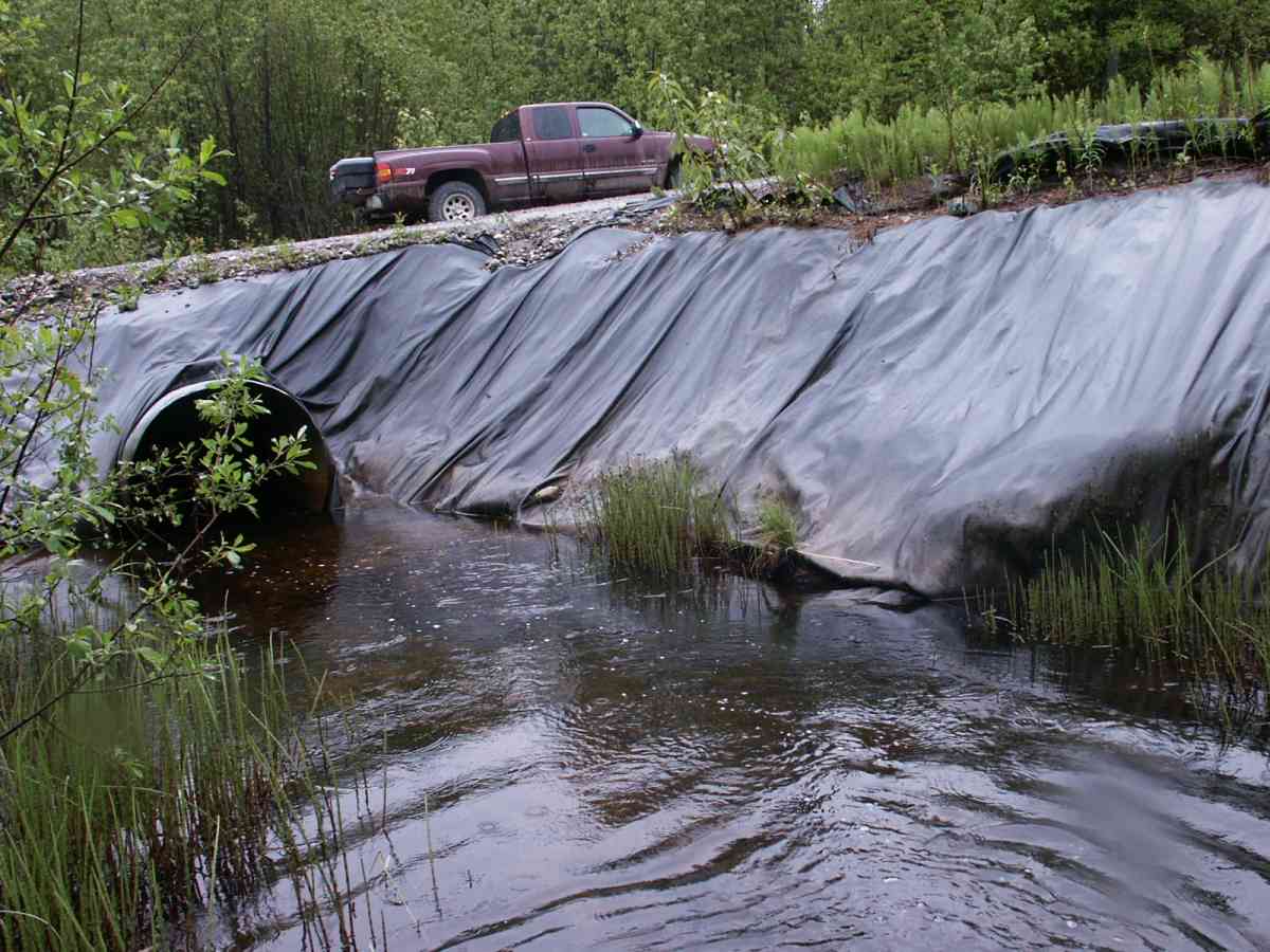
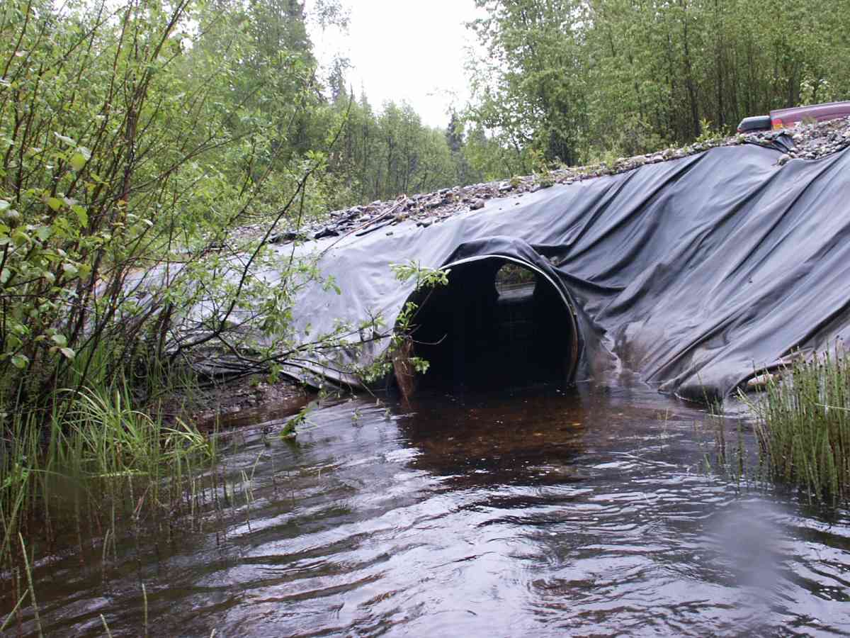
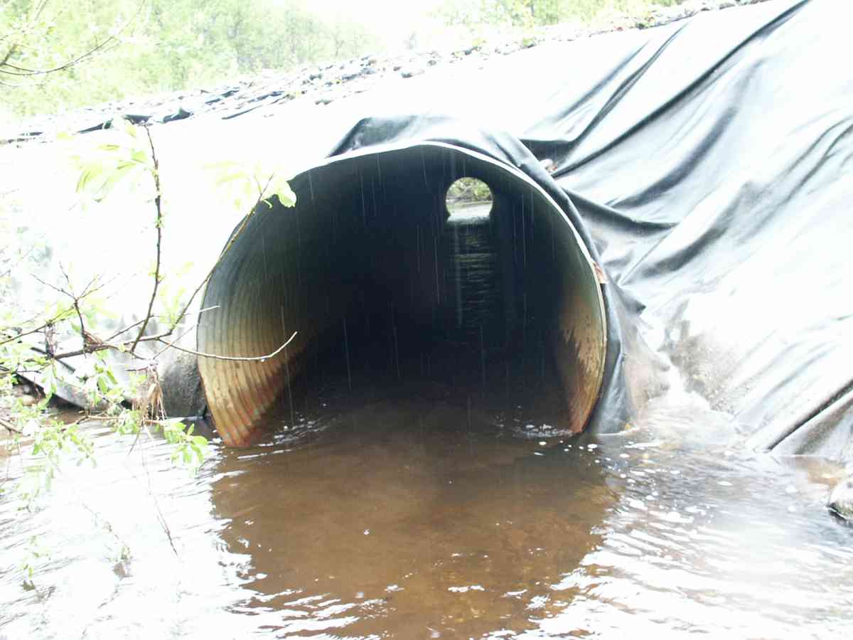
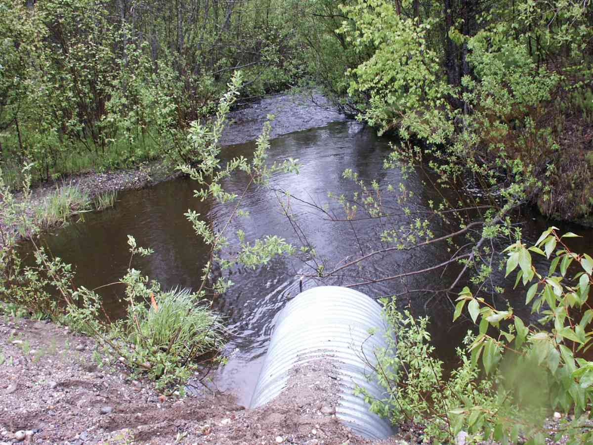
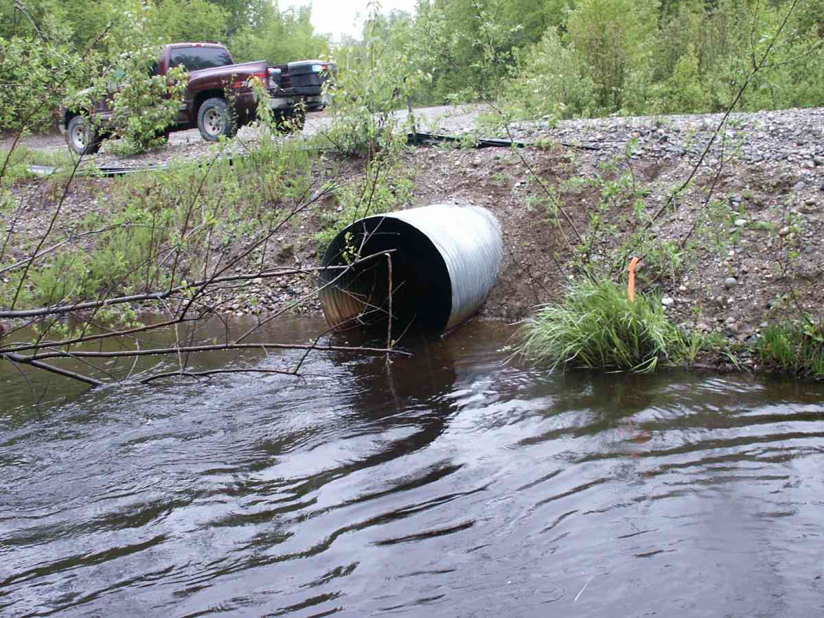
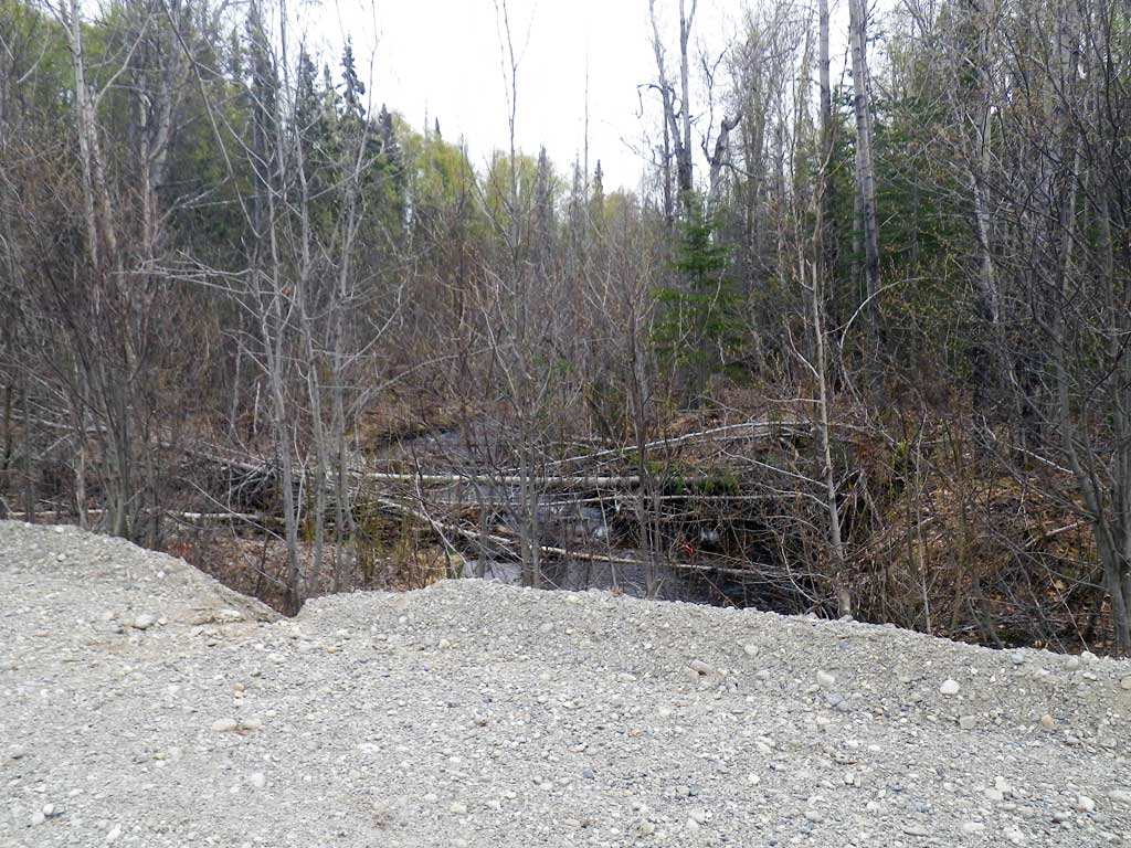
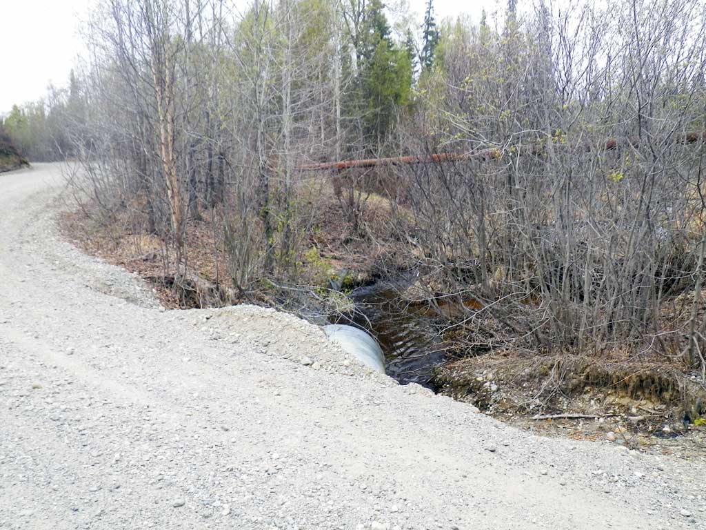
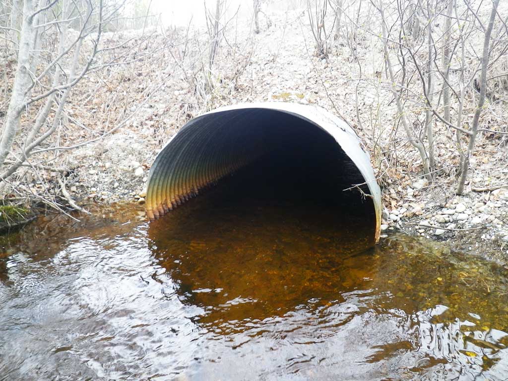
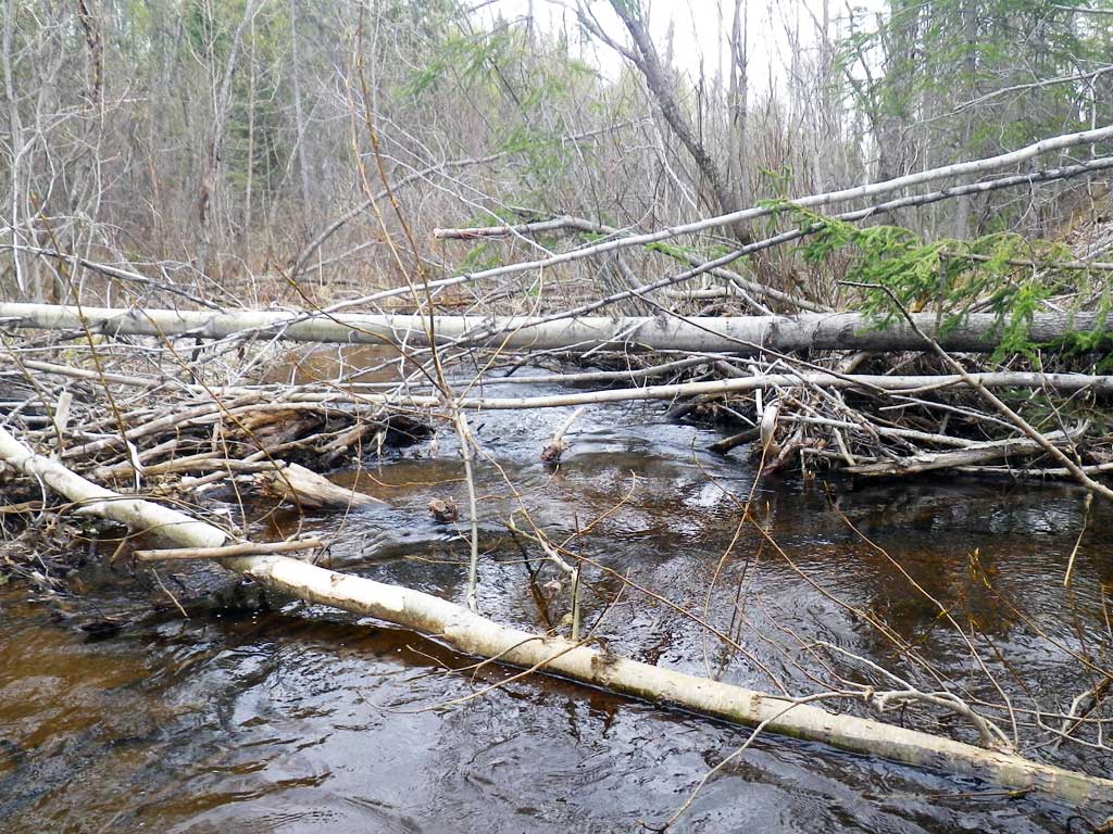
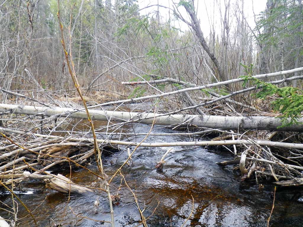
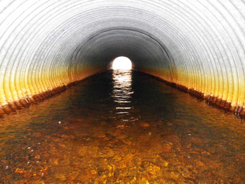
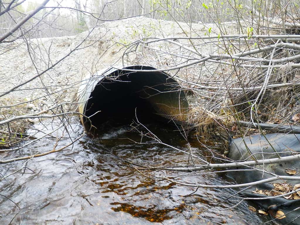
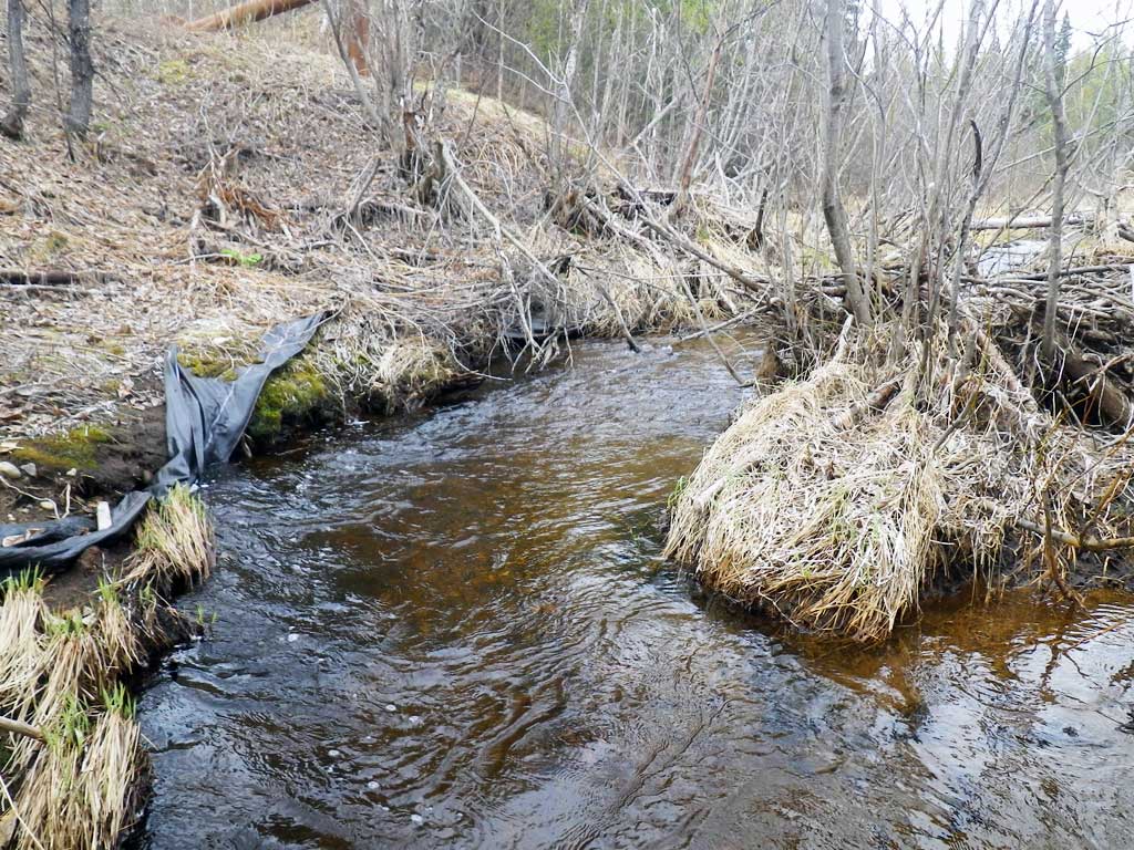
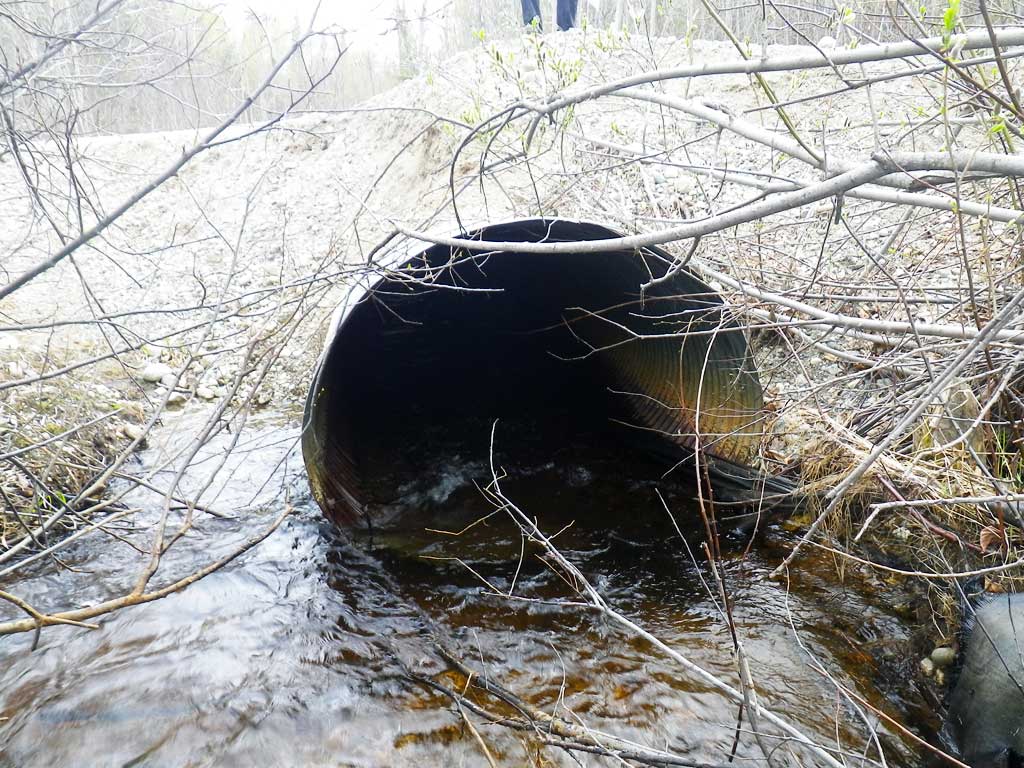
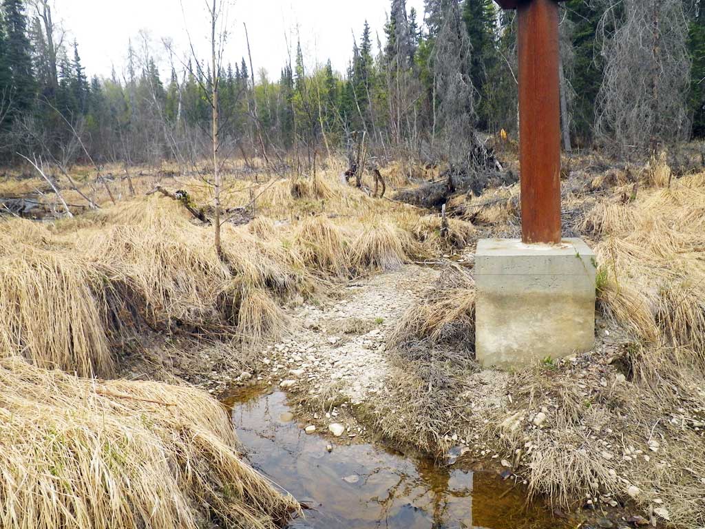
Comments: Datum = WGS84. gps accuracy = 24.7 ft. Erosion control fabric wrapped around entire inlet fill slope. Beaver pond located upstream of culvert.. 2016 Site visit notes: Big scour pool at outlet. Silt fence and landscape fabric all over site. Evidence of road failures. Site rating changed to Red to reflect constriction, culvert is not backwatered.
Culvert Measurements
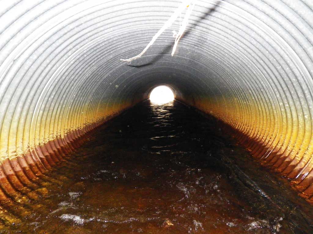
| ID: 1 | Structure Type: Circular pipe (Corrugated Metal) | Fish Passage Rating: | |||||||||||||||||||||||||||||||||||||||||
|
|
|
|||||||||||||||||||||||||||||||||||||||||
Culvert Observations:
|
|||||||||||||||||||||||||||||||||||||||||||
Stream Measurements
|
|
| Stream Width Type | Distance From Crossing (ft) |
Stream Width (ft) |
|---|---|---|
| Downstream ordinary high water | 37.0 | 19.50 |
| Downstream ordinary high water | 62.0 | 16.00 |
| Downstream ordinary high water | 93.0 | 9.00 |
| Upstream ordinary high water | 5.0 | 13.80 |
| Upstream ordinary high water | 40.0 | 24.00 |
Elevations
| Locator ID | Culvert Number |
River Distance (ft)1 |
Distance From Crossing (ft)2 |
Relative Elevation (ft) |
|---|---|---|---|---|
| OHW Left Bank | 91.37 | |||
| OHW Left Bank | 91.65 | |||
| D/S Thalweg | 0.00 | 93.0 | 89.46 | |
| D/S OHW Elev | 0.00 | 93.0 | 90.21 | |
| D/S Water Surface Elev | 0.00 | 93.0 | 89.75 | |
| D/S OHW Elev | 31.50 | 61.5 | 90.94 | |
| D/S Water Surface Elev | 31.50 | 61.5 | 90.46 | |
| D/S Thalweg | 31.50 | 61.5 | 89.67 | |
| D/S Tailcrest or 1st Thalweg | 56.00 | 37.0 | 90.87 | |
| D/S Thalweg | 83.00 | 10.0 | 86.90 | |
| Max Pool Depth | 1 | 88.00 | 5.0 | 87.15 |
| Outlet Invert | 1 | 93.00 | 0.0 | 90.73 |
| Outlet Thalweg | 1 | 93.00 | 0.0 | 89.77 |
| Outlet Rustline Height | 1 | 93.00 | 0.0 | 91.54 |
| Outlet Culvert Top | 1 | 93.00 | 0.0 | 94.25 |
| Road Elev | 122.50 | 96.87 | ||
| Road Elev | 122.50 | 96.96 | ||
| Inlet Culvert Top | 1 | 152.00 | 0.0 | 94.65 |
| Inlet Rustline Height | 1 | 152.00 | 0.0 | 92.22 |
| Inlet Culvert Invert | 1 | 152.00 | 0.0 | 91.15 |
| Inlet Thalweg | 1 | 152.00 | 0.0 | 90.82 |
| U/S Thalweg | 1 | 153.00 | 1.0 | 90.94 |
| U/S Thalweg | 1 | 157.00 | 5.0 | 90.97 |
| U/S Water Surface Elev | 1 | 157.00 | 5.0 | 92.11 |
| U/S OHW elevation | 1 | 157.00 | 5.0 | 92.49 |
| U/S Thalweg | 1 | 159.00 | 7.0 | 91.09 |
| U/S Water Surface Elev | 192.00 | 40.0 | 92.15 | |
| U/S Headwater (beaver pond upstream) | 192.00 | 40.0 | 92.40 | |
| U/S Thalweg | 192.00 | 40.0 | 91.76 |
Notes:
- River distance is measured continuously throughout the survey reach along the thalweg of the stream.
- Measured from each end of the crossing along the thalweg of the stream.
Fish Sampling Efforts
| Gear Type: Minnow Trap, 1/4 in. Mesh (B) | Trap Duration(h): 1 | |
| Gear Type: Minnow Trap (C) | Trap Duration(h): 18.0 | |
| Comments: Trap set about 20 feet downstream | ||
Fish Observations
| Species: adult Dolly Varden | Life History: Unknown | ||
| Total Fish Observed: 2 | Fish Measured: 1 | Fork Lengths (mm) Min: 111 Max: 111 Mean: 111 | |
| Collected/Observed by Gear Type: Downstream Minnow Trap, 1/4 in. Mesh (2) | |||
| Species: threespine stickleback | Life History: Resident | ||
| Total Fish Observed: 2 | Fish Measured: | Fork Lengths (mm) Min: Max: Mean: | |
| Collected/Observed by Gear Type: Downstream Minnow Trap (1) Downstream Minnow Trap, 1/4 in. Mesh (1) | |||
| Species: juvenile coho salmon | Life History: Anadromous | ||
| Total Fish Observed: 61 | Fish Measured: 12 | Fork Lengths (mm) Min: 60 Max: 103 Mean: 74 | |
| Collected/Observed by Gear Type: Downstream Minnow Trap (2) Downstream Minnow Trap, 1/4 in. Mesh (59) | |||
Photos

Questions or comments about this report can be directed to dfg.dsf.webmaster@alaska.gov