Fish Passage Site 20601532
Coordinates (dec. deg.): 61.11343°, -151.14975°
Legal Description: S012N011W24
Region: South Central
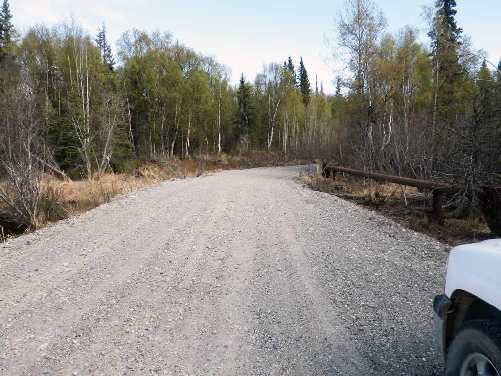
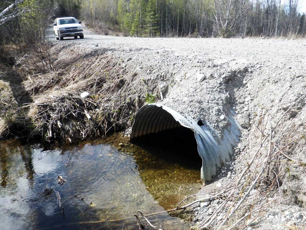
Road Name: Logging Road
Datum: NAD83
Quad Name / ITM: Tyonek A-4
AWC Stream #:
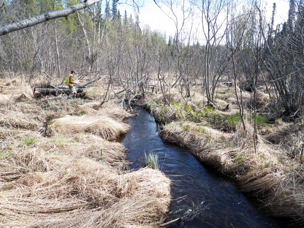
Stream Name: Chuitbuna Lake outlet
Elevation:
Site Comments: None
arrow to the right of the survey date below to choose a different report for this site.
Survey UPDATE-1532
Project Supervisor: Gillian O'Doherty, ADFG
Observers: Mark Eisenman, Robert Pype
Overall Fish Passage Rating:
Tidal: No
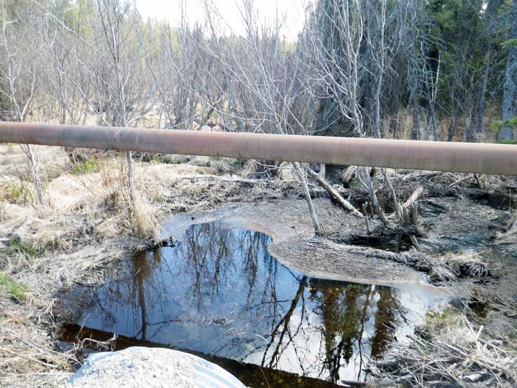
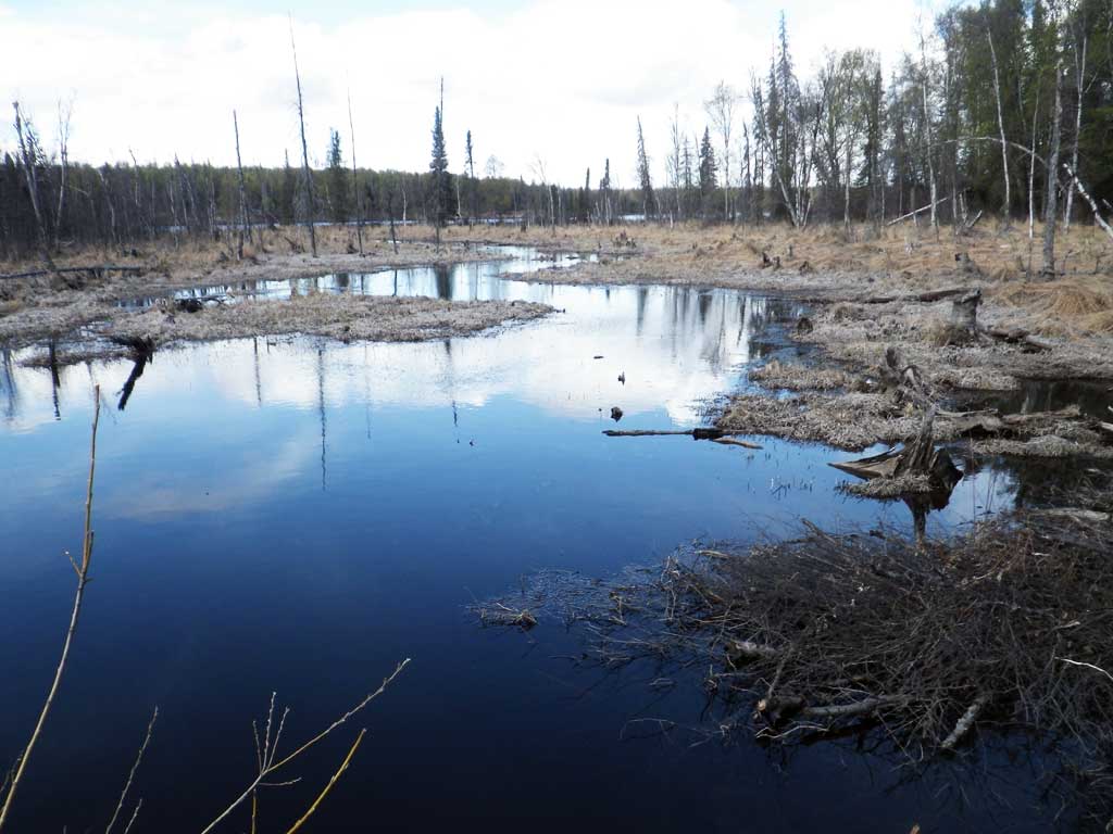
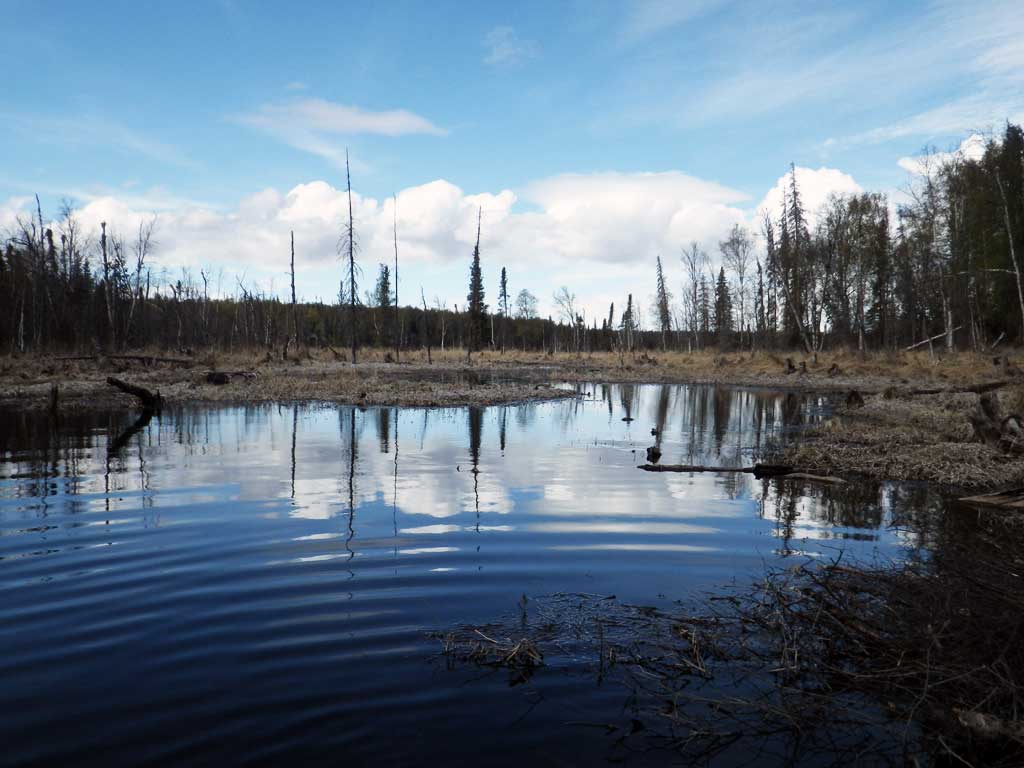
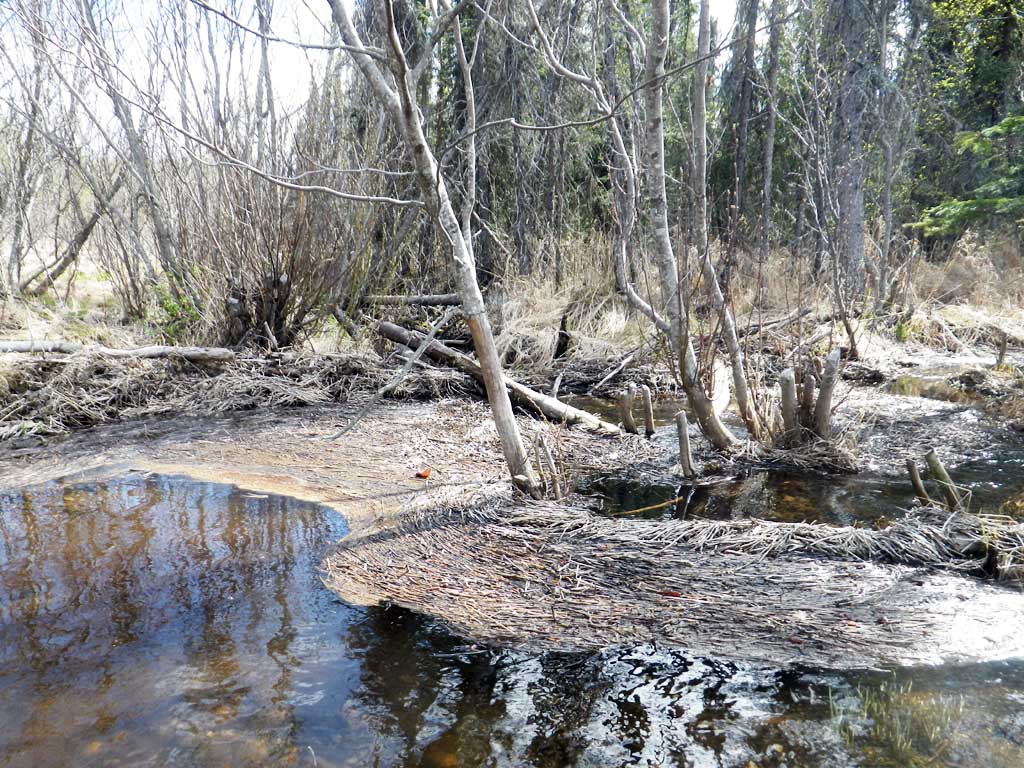
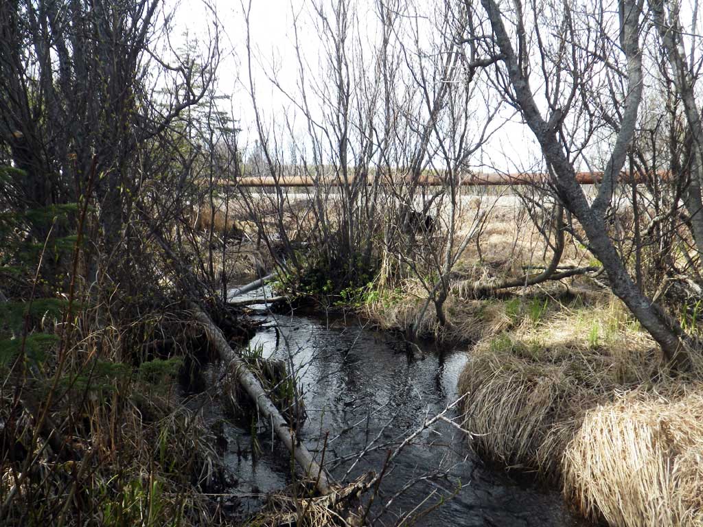
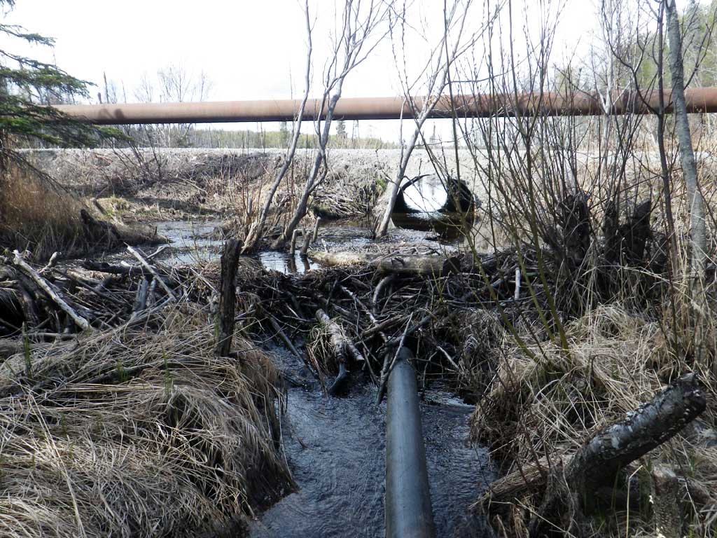
Backwatered: Yes
Step Pools: No
Construction Year:
Site Observations:
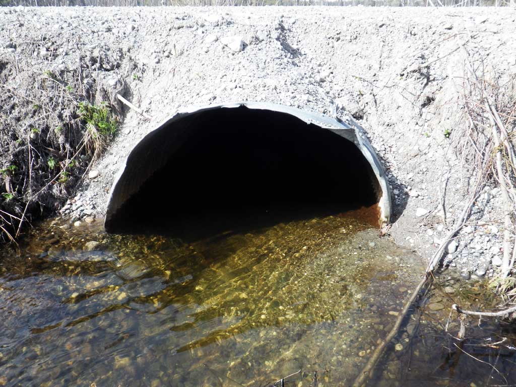
- Culvert gradient red
- Beaver Activity
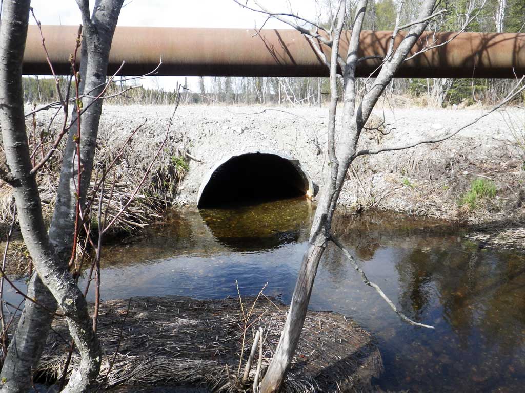
Comments: Cataloged anadromy currently ends at crossing. Site is currently backwatered by a beaver dam downstream and is most likely not a barrier at current flows. Culvert has been replaced since 2002 survey.
Culvert Measurements
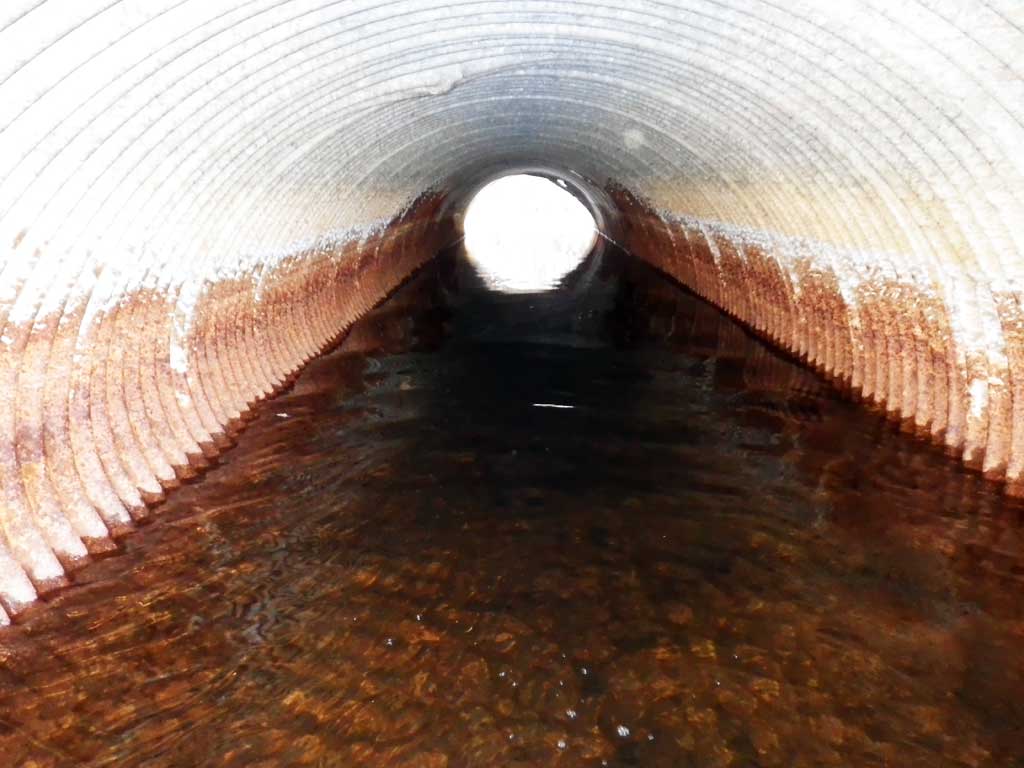
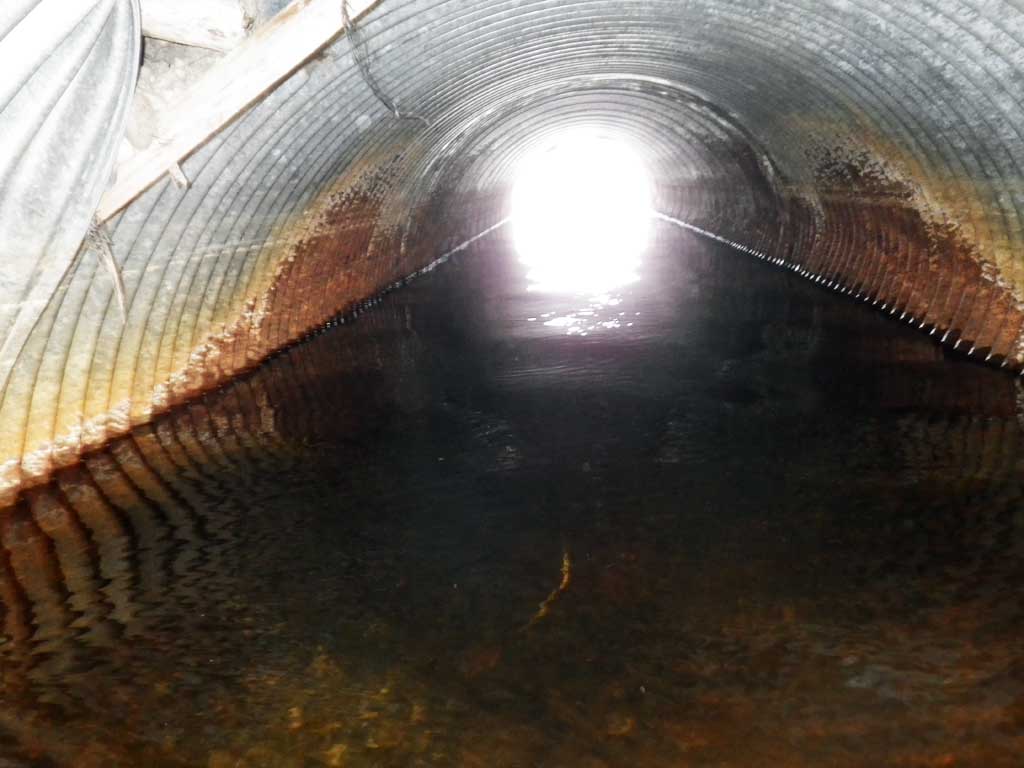
| ID: 1 | Structure Type: Circular pipe (Corrugated steel) | Fish Passage Rating: | |||||||||||||||||||||||||||||||||||||||||
|
|
|
|||||||||||||||||||||||||||||||||||||||||
Comments: Fish observed downstream from culvert |
|||||||||||||||||||||||||||||||||||||||||||
Culvert Observations:
|
|||||||||||||||||||||||||||||||||||||||||||
Stream Measurements
|
|
| Stream Width Type | Distance From Crossing (ft) |
Stream Width (ft) |
|---|---|---|
| Downstream ordinary high water | 50.0 | 4.70 |
| Downstream ordinary high water | 100.0 | 6.40 |
| Downstream ordinary high water | 150.0 | 6.00 |
Elevations
| Locator ID | Culvert Number |
River Distance (ft)1 |
Distance From Crossing (ft)2 |
Relative Elevation (ft) |
|---|---|---|---|---|
| Road Elev | 101.74 | |||
| D/S Thalweg | 0.00 | 95.04 | ||
| D/S Water Surface Elev | 0.00 | 96.01 | ||
| D/S Water Surface Elev | 42.00 | 96.49 | ||
| D/S Thalweg (Below beaver dam) | 42.00 | 95.80 | ||
| D/S Thalweg (Top of Beaver dam) | 47.00 | 97.23 | ||
| Max Pool Depth | 66.00 | 95.98 | ||
| Outlet Pool Water Elev | 66.00 | 97.53 | ||
| Outlet Culvert Top | 70.00 | 99.98 | ||
| Outlet Invert (On substrate) | 70.00 | 95.76 | ||
| D/S Water Surface Elev | 70.00 | 97.52 | ||
| Inlet Culvert Invert (On pipe, 1st resting, pond upstream) | 107.80 | 96.16 | ||
| Inlet Culvert Top | 107.80 | 100.70 | ||
| U/S Water Surface Elev | 107.80 | 97.55 |
Notes:
- River distance is measured continuously throughout the survey reach along the thalweg of the stream.
- Measured from each end of the crossing along the thalweg of the stream.
Fish Sampling Efforts
| Gear Type: Minnow Trap (A) | Trap Duration(h): 12.0 | |
Fish Observations
| Species: adult threespine stickleback | Life History: Unknown | ||
| Total Fish Observed: 4 | Fish Measured: | Fork Lengths (mm) Min: Max: Mean: | |
| Collected/Observed by Gear Type: Downstream Minnow Trap (4) | |||
Photos


Questions or comments about this report can be directed to dfg.dsf.webmaster@alaska.gov