Fish Passage Site 20502136
Coordinates (dec. deg.): 61.89806°, -150.07678°
Legal Description: S021N004W19
Region: South Central
Road Name: Parks Highway
Datum: NAD83
Quad Name / ITM: Tyonek D-1
AWC Stream #:
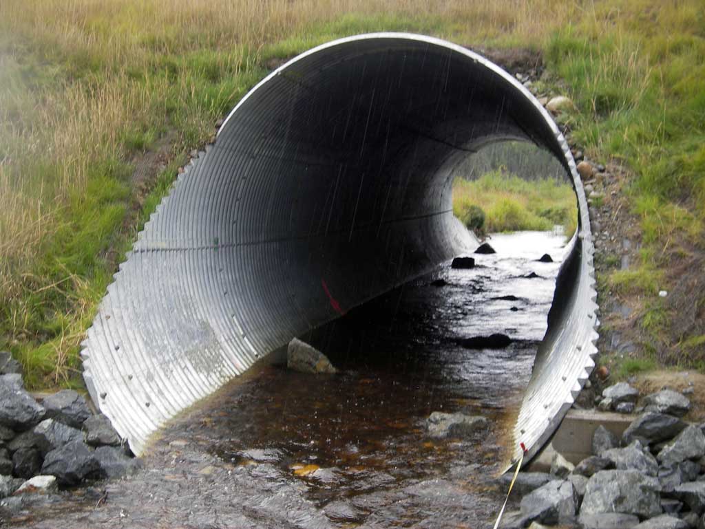
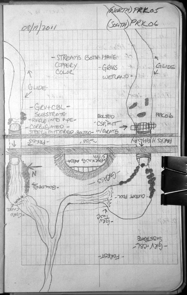
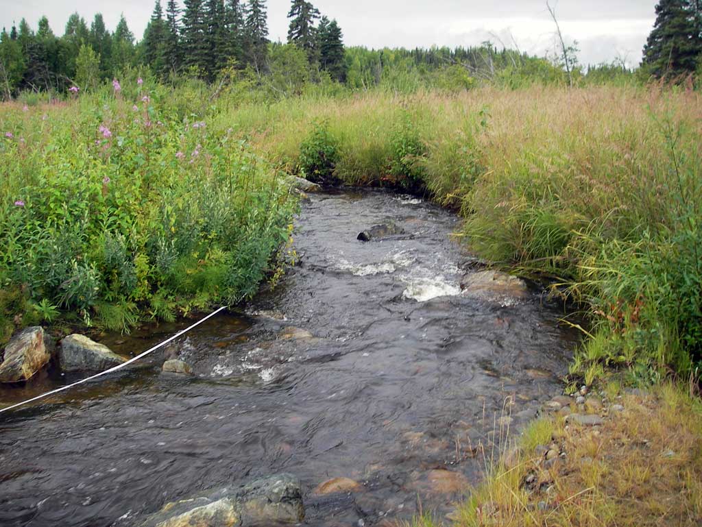
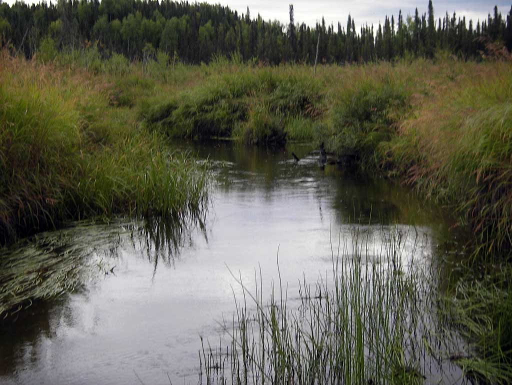
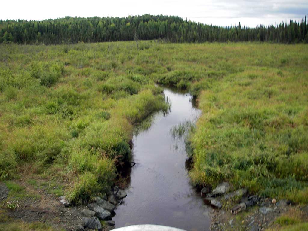
Stream Name: Grey's Creek
Elevation:
Site Comments: None
Survey MSB11-PRK05
Project Supervisor: Gillian O'Doherty, Alaska Department of Fish and Game
— Anchorage, AK
Observers: John Greuey, Abraham Gioffre
Overall Fish Passage Rating:
Tidal: No
Backwatered: No
Step Pools: No
Construction Year: 2010
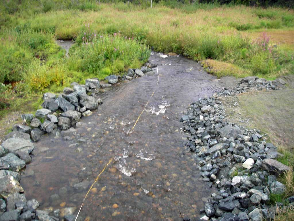
Comments: Upst area of both culverts at PRK05 and PRK06 which are on the same creek although several hundred feet apart is a lowland marsh area with slough flow. Appears several hundred feet outside of visual range Grey's Creek splits to form the two stream channels which cross the Parks Highway and rejoin somewhere in the downstream marsh.
Culvert Measurements
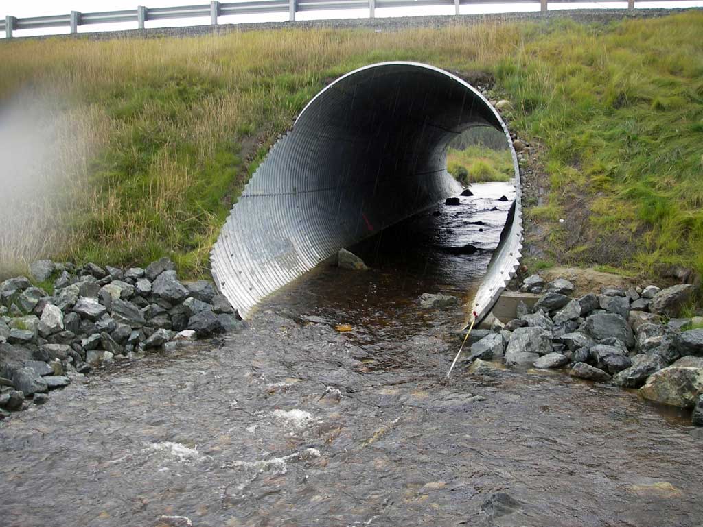
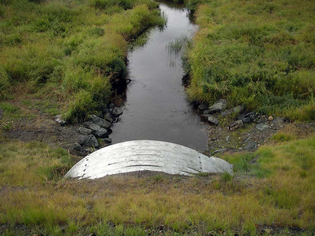
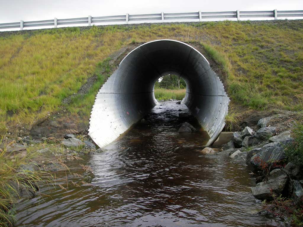
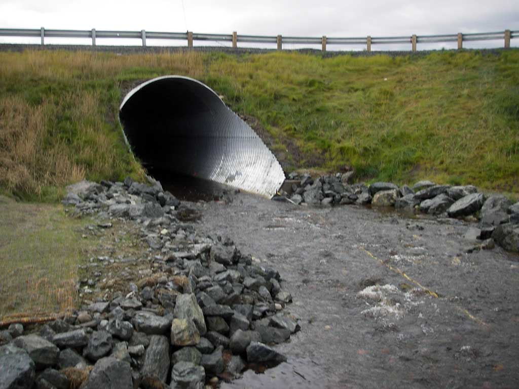
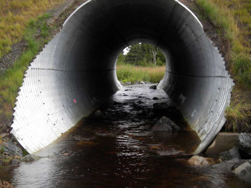
| ID: 1 | Structure Type: Circular pipe (Structural steel plate) | Fish Passage Rating: | |||||||||||||||||||||||||||||||||||||||||
|
|
|
|||||||||||||||||||||||||||||||||||||||||
Stream Measurements
|
|
| Stream Width Type | Distance From Crossing (ft) |
Stream Width (ft) |
|---|---|---|
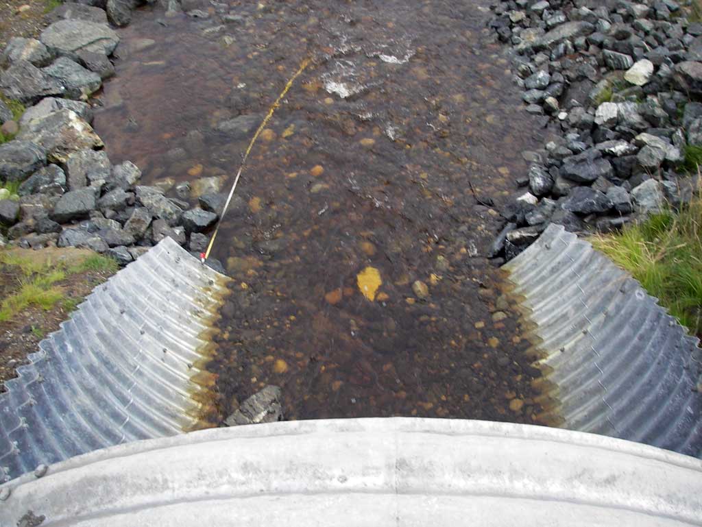
| Downstream ordinary high water | 66.0 | 10.00 |
| Downstream ordinary high water | 130.0 | 15.00 |
| Downstream ordinary high water | 190.0 | 13.00 |
Elevations
| Locator ID | Culvert Number |
River Distance (ft)1 |
Distance From Crossing (ft)2 |
Relative Elevation (ft) |
|---|---|---|---|---|
| D/S Water Surface Elev (Used for stream gradient) | 0.00 | 81.36 | ||
| D/S Water Surface Elev (Used for stream gradient) | 206.00 | 83.20 | ||
| D/S Water Surface Elev | 217.00 | 83.61 | ||
| D/S Thalweg | 217.00 | 82.88 | ||
| Outlet Invert (On substrate) | 304.40 | 84.38 | ||
| D/S Water Surface Elev (Water surface at outlet invert) | 304.40 | 85.04 | ||
| Outlet Culvert Top | 304.40 | 95.47 | ||
| Road Elev | 345.00 | 101.01 | ||
| Inlet Culvert Top | 386.20 | 95.88 | ||
| U/S Water Surface Elev (Water surface at inlet invert) | 386.20 | 85.51 | ||
| Inlet Culvert Invert (On substrate) | 386.20 | 84.82 | ||
| U/S Water Surface Elev | 461.20 | 85.75 | ||
| U/S Thalweg (Profile point. Middle of upstream glide.) | 461.20 | 83.99 |
Notes:
- River distance is measured continuously throughout the survey reach along the thalweg of the stream.
- Measured from each end of the crossing along the thalweg of the stream.
Fish Sampling Efforts
No fish sampling occurred during this survey.
Fish Observations
No fish observations occurred during this survey.
Photos
Questions or comments about this report can be directed to dfg.dsf.webmaster@alaska.gov