Fish Passage Site 20502114
Coordinates (dec. deg.): 62.73495°, -149.72937°
Legal Description: S031N002W31
Region: South Central
Road Name: Alaska Railroad
Datum: NAD83
Quad Name / ITM: Talkeetna Mts C-6
AWC Stream #:
Stream Name: Unnamed
Elevation:
Site Comments: Alaska Railroad site MP 264.48
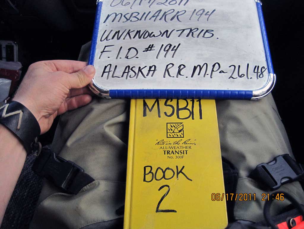
Survey MSB11-ARR194
Project Supervisor: Gillian O'Doherty, Alaska Department of Fish and Game
— Anchorage, AK
Observers: John Greuey, Abraham Gioffre
Overall Fish Passage Rating:
Tidal: No
Backwatered: No
Step Pools: No
Construction Year:
Site Observations:
- Outfall height red
- Compound gradient in pipe
- Mechanical damage or joints parting
- Sediment accumulation
- Subsidence
- Culvert gradient red
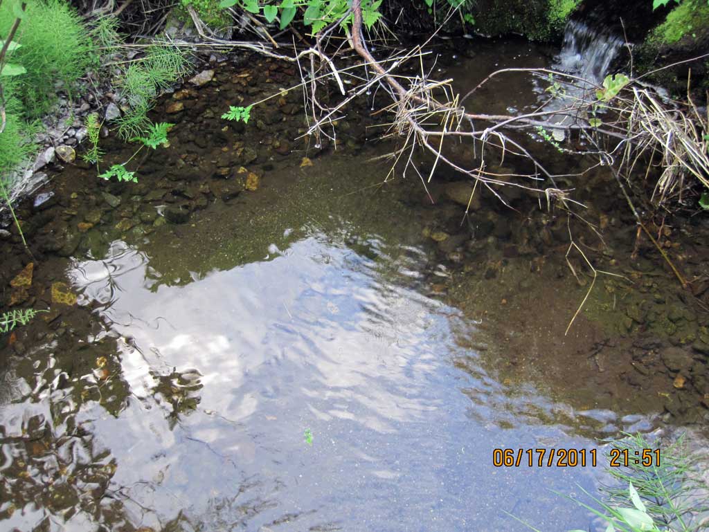
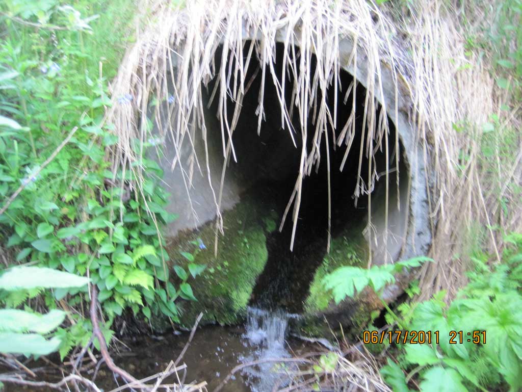
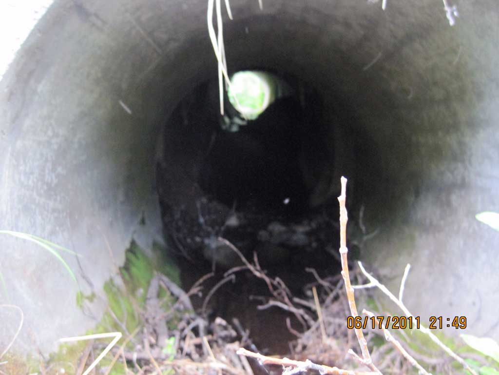
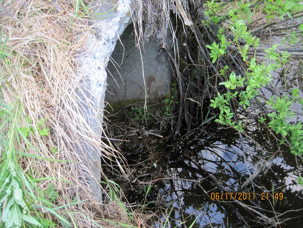
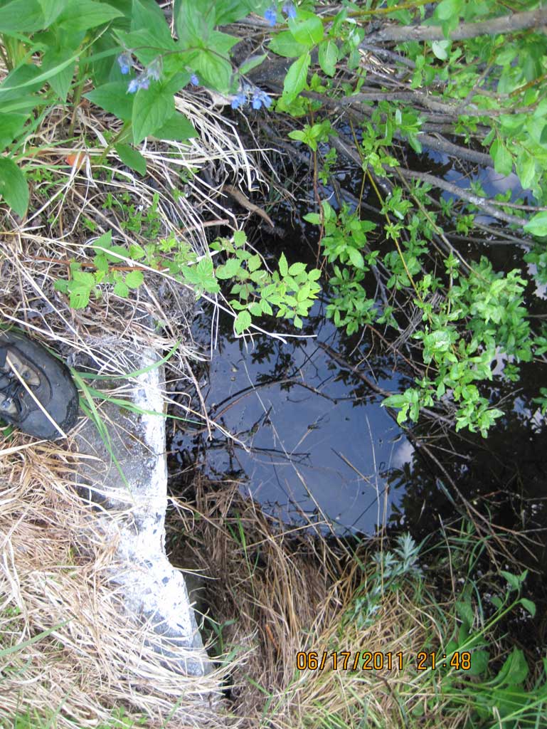
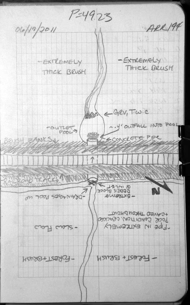
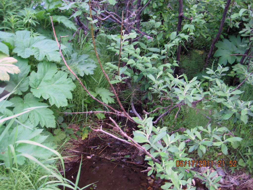
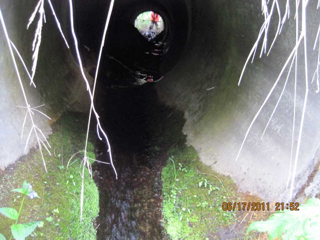
Comments: Alaska Railroad site MP 264.48. Wooden debris dam at inlet making up substrate material. Multiple joints of concrete culvert misaligned causing compound gradient in pipe. Upstream grade point used as zero point for this survey and distances move downstream.
Culvert Measurements
| ID: 1 | Structure Type: Circular pipe (Reinforced concrete) | Fish Passage Rating: | ||||||||||||||||||||||||||||||||||||||||||
|
|
|
||||||||||||||||||||||||||||||||||||||||||
Comments: Used algae growth line for high water mark in culvert. Several joints of pipe misaligned creating compound gradient. |
||||||||||||||||||||||||||||||||||||||||||||
Culvert Observations:
|
||||||||||||||||||||||||||||||||||||||||||||
Stream Measurements
|
|
| Stream Width Type | Distance From Crossing (ft) |
Stream Width (ft) |
|---|---|---|
| Upstream ordinary high water | 25.0 | 2.60 |
| Upstream ordinary high water | 30.0 | 2.20 |
| Upstream ordinary high water | 36.0 | 2.30 |
Elevations
| Locator ID | Culvert Number |
River Distance (ft)1 |
Distance From Crossing (ft)2 |
Relative Elevation (ft) |
|---|---|---|---|---|
| U/S Grade Ctrl (Thalweg) (Top of glide) | 0.00 | 90.01 | ||
| U/S Water Surface Elev (Use for stream gradient) | 0.00 | 90.15 | ||
| U/S Water Surface Elev (Use for stream gradient) | 18.00 | 89.99 | ||
| U/S Grade Ctrl (Thalweg) (Top of glide) | 18.00 | 89.81 | ||
| Max Pool Depth (Upstream max pool, where three drainages intersect before the inlet.) | 25.00 | 89.03 | ||
| U/S Water Surface Elev (Water surface at upstream max pool.) | 25.00 | 90.03 | ||
| U/S Water Surface Elev (Water surface at inlet) | 42.00 | 90.01 | ||
| Inlet Culvert Invert (On wooden debris) | 42.00 | 89.85 | ||
| Road Elev (Middle of railroad tracks. No Top of pipes readings taken due to broken and cracked concrete.) | 67.00 | 99.38 | ||
| D/S Water Surface Elev (Water surface at outlet) | 91.23 | 86.53 | ||
| Outlet Thalweg (Substrate where water pools at outlet from outfall .) | 91.23 | 85.42 | ||
| Outlet Invert (On pipe) | 91.23 | 85.91 | ||
| D/S Water Surface Elev (Pool surface elevation created by outfall height onto cobble rip rap.) | 91.23 | 86.08 | ||
| D/S Water Surface Elev (Tail water surface) | 101.23 | 86.10 | ||
| D/S Tailcrest or 1st Thalweg (Tail water control) | 101.23 | 86.00 |
Notes:
- River distance is measured continuously throughout the survey reach along the thalweg of the stream.
- Measured from each end of the crossing along the thalweg of the stream.
Fish Sampling Efforts
No fish sampling occurred during this survey.
Fish Observations
No fish observations occurred during this survey.
Photos
Questions or comments about this report can be directed to dfg.dsf.webmaster@alaska.gov