Fish Passage Site 20502109
Coordinates (dec. deg.): 62.78010°, -149.69373°
Legal Description: S031N002W17
Region: South Central
Road Name: Alaska Railroad
Datum: NAD83
Quad Name / ITM: Talkeetna Mts D-6
AWC Stream #:
Stream Name: Unnamed
Elevation:
Site Comments: Alaska Railroad site at MP 264.96.
Survey MSB11-ARR199
Project Supervisor: Gillian O'Doherty, Alaska Department of Fish and Game
— Anchorage, AK
Observers: John Greuey, Abraham Gioffre
Overall Fish Passage Rating:
Tidal: No
Backwatered: No
Step Pools: No
Construction Year:
Site Observations:
- Culvert gradient red
- Mechanical damage or joints parting
- Sediment accumulation
- Culvert sagging in middle
- Structural Problem
- Constriction ratio gray
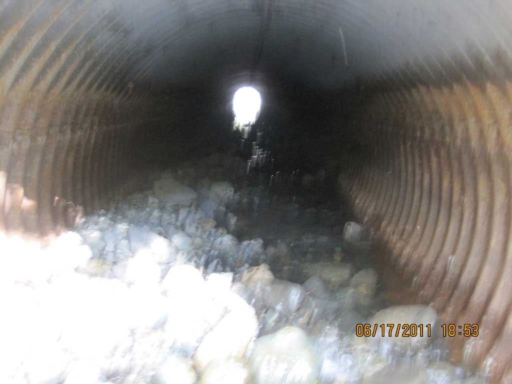
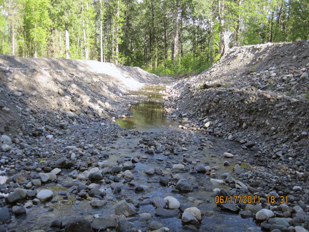
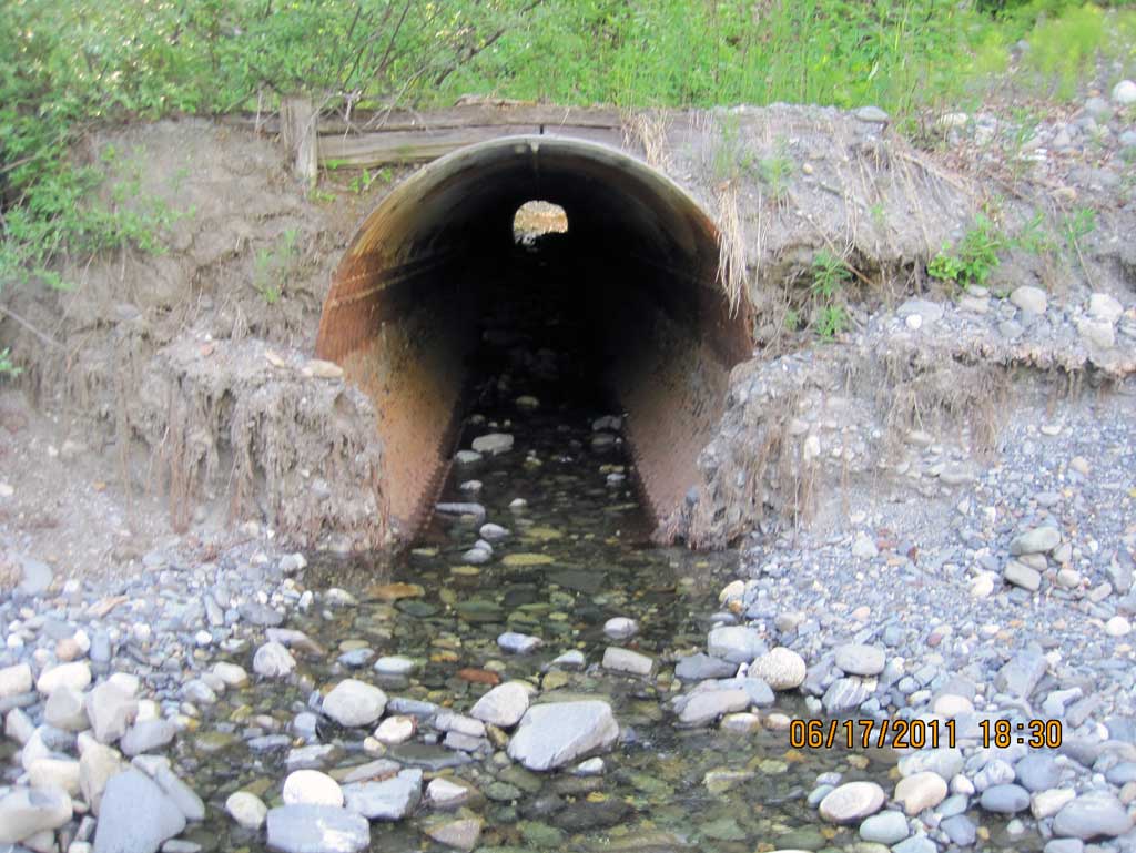
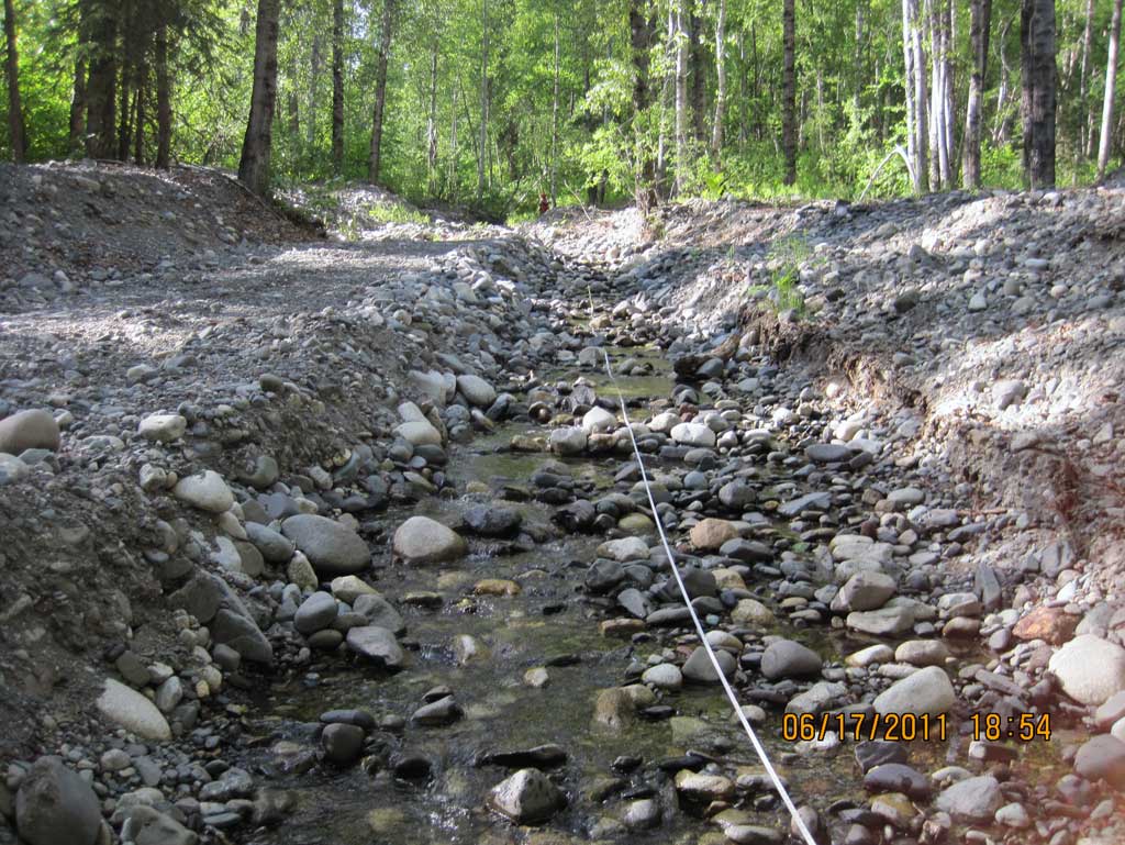
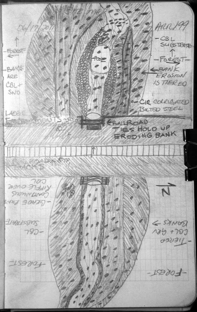
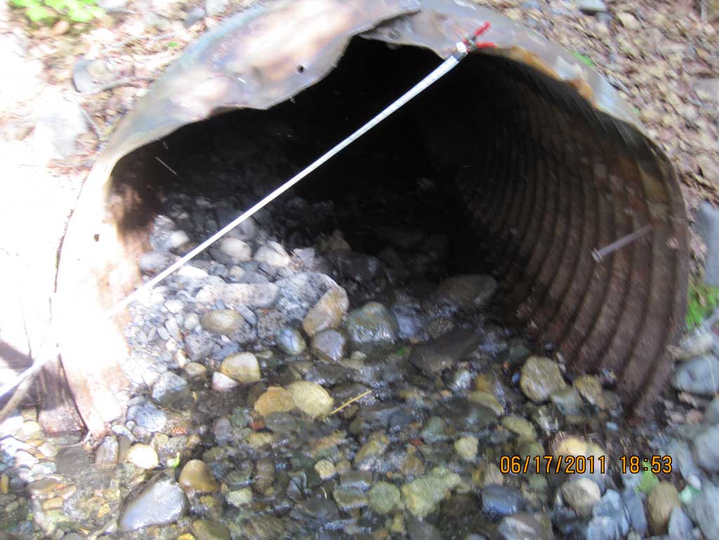
Comments: Alaska Railroad site at MP 264.96. Inlet and outlet edge of pipes did have an old piece of RR tie used to construct a partial headwall. Old headwall was mostly decomposed. Both upst and dwst areas for about 100' had been disturbed with heavy machinery so natural channel widths could not be taken but far upst. Long. Profile zero point is at upstream grade point for this survey. All points move downstream.
Culvert Measurements
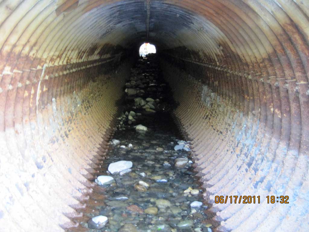
| ID: 1 | Structure Type: Circular pipe (Structural steel plate) | Fish Passage Rating: | ||||||||||||||||||||||||||||||||||||||||||
|
|
|
||||||||||||||||||||||||||||||||||||||||||
Culvert Observations:
|
||||||||||||||||||||||||||||||||||||||||||||
Stream Measurements
|
|
| Stream Width Type | Distance From Crossing (ft) |
Stream Width (ft) |
|---|---|---|
| Upstream ordinary high water | 206.0 | 10.50 |
| Upstream ordinary high water | 252.0 | 10.00 |
| Upstream ordinary high water | 282.0 | 14.50 |
Elevations
| Locator ID | Culvert Number |
River Distance (ft)1 |
Distance From Crossing (ft)2 |
Relative Elevation (ft) |
|---|---|---|---|---|
| U/S Grade Ctrl (Thalweg) (Top of continuous riffle) | 0.00 | 100.83 | ||
| U/S Water Surface Elev (Use for stream gradient) | 0.00 | 101.14 | ||
| U/S Grade Ctrl (Thalweg) (Top of step in continuous riffle) | 50.00 | 98.38 | ||
| U/S Water Surface Elev | 50.00 | 98.65 | ||
| U/S Grade Ctrl (Thalweg) (Top of step in continuous riffle) | 122.00 | 94.69 | ||
| U/S Water Surface Elev (Use for stream gradient) | 122.00 | 94.87 | ||
| Inlet Culvert Invert (On substrate) | 194.00 | 89.47 | ||
| U/S Water Surface Elev (Water surface at inlet) | 194.00 | 89.57 | ||
| Inlet Culvert Top | 194.00 | 94.00 | ||
| Road Elev (Center of railroad tracks) | 254.00 | 120.47 | ||
| Outlet Culvert Top | 313.48 | 90.04 | ||
| Outlet Invert (On substrate) | 313.48 | 83.72 | ||
| D/S Water Surface Elev (Water surface at outlet) | 313.48 | 84.23 | ||
| D/S Grade Ctrl (Thalweg) (Bottom of riffle) | 343.48 | 82.91 | ||
| D/S Water Surface Elev | 343.48 | 83.08 |
Notes:
- River distance is measured continuously throughout the survey reach along the thalweg of the stream.
- Measured from each end of the crossing along the thalweg of the stream.
Fish Sampling Efforts
No fish sampling occurred during this survey.
Fish Observations
No fish observations occurred during this survey.
Photos
Questions or comments about this report can be directed to dfg.dsf.webmaster@alaska.gov