Fish Passage Site 20502100
Coordinates (dec. deg.): 62.80787°, -149.65800°
Legal Description: S031N002W04
Region: South Central
Road Name: Alaska Railroad
Datum: NAD83
Quad Name / ITM: Talkeetna Mts D-6
AWC Stream #:
Stream Name: Unnamed
Elevation:
Site Comments: Alaska Railroad site at MP 267.3.
Survey MSB11-ARR202
Project Supervisor: Gillian O'Doherty, Alaska Department of Fish and Game
— Anchorage, AK
Observers: John Greuey, Abraham Gioffre
Overall Fish Passage Rating:
Tidal: No
Backwatered: Yes
Step Pools: No
Construction Year: 2004
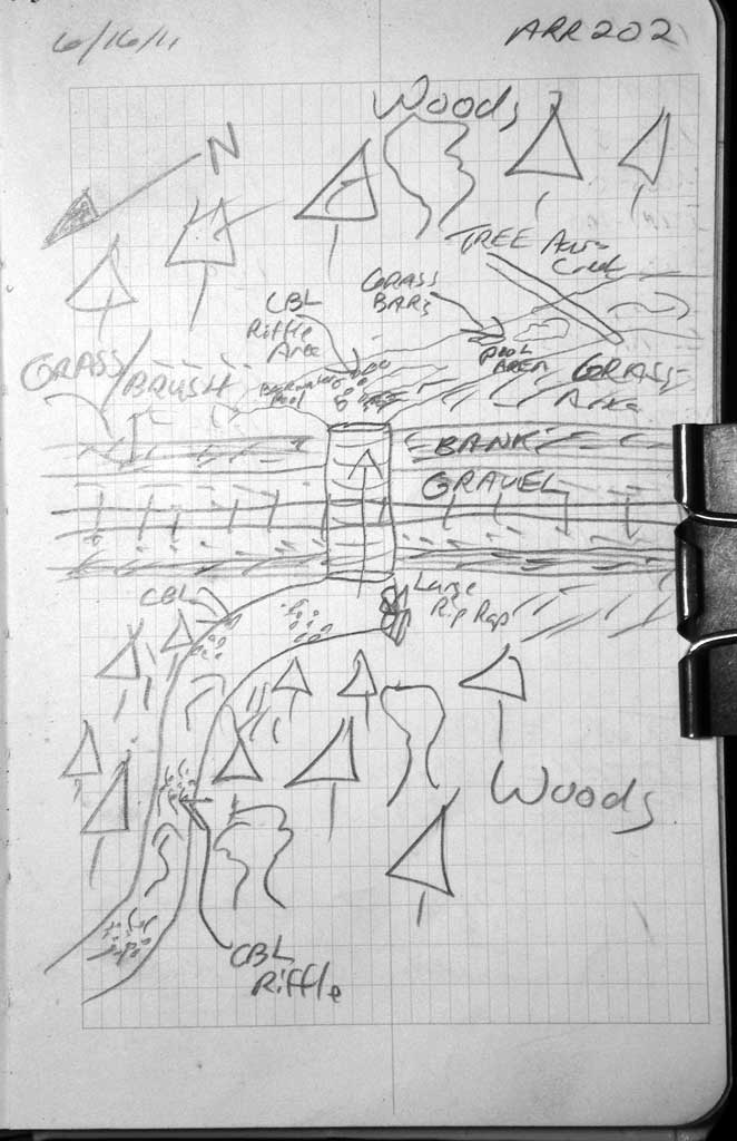
Site Observations:
- Culvert gradient gray
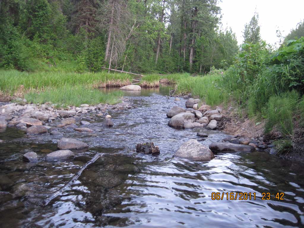
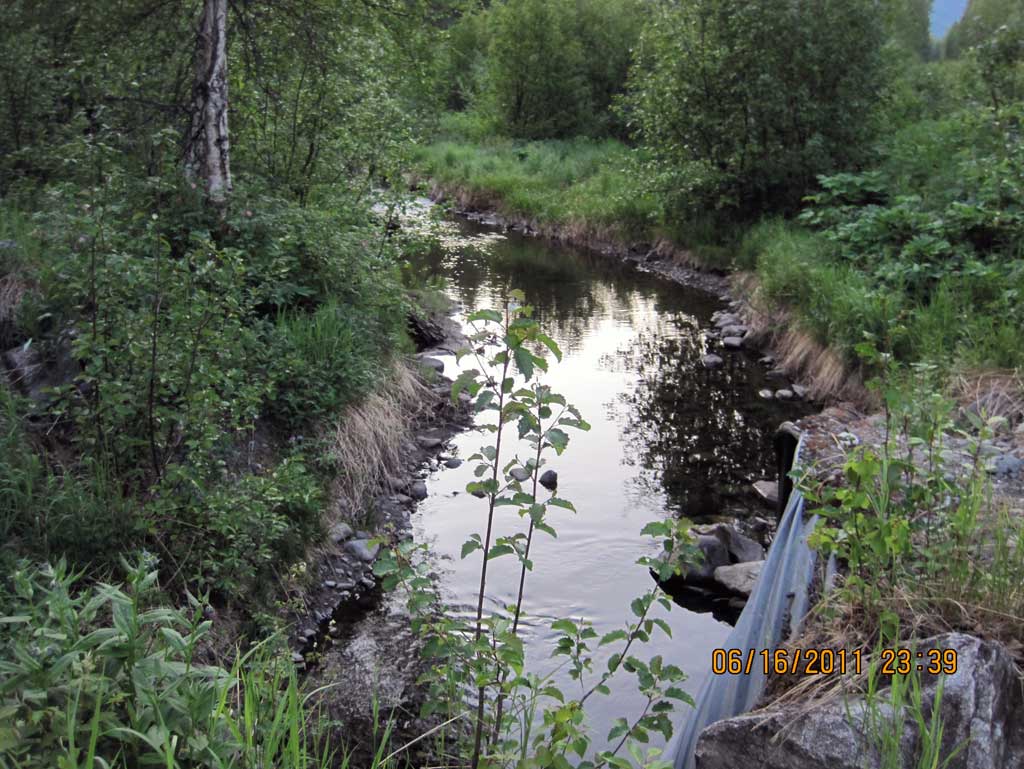
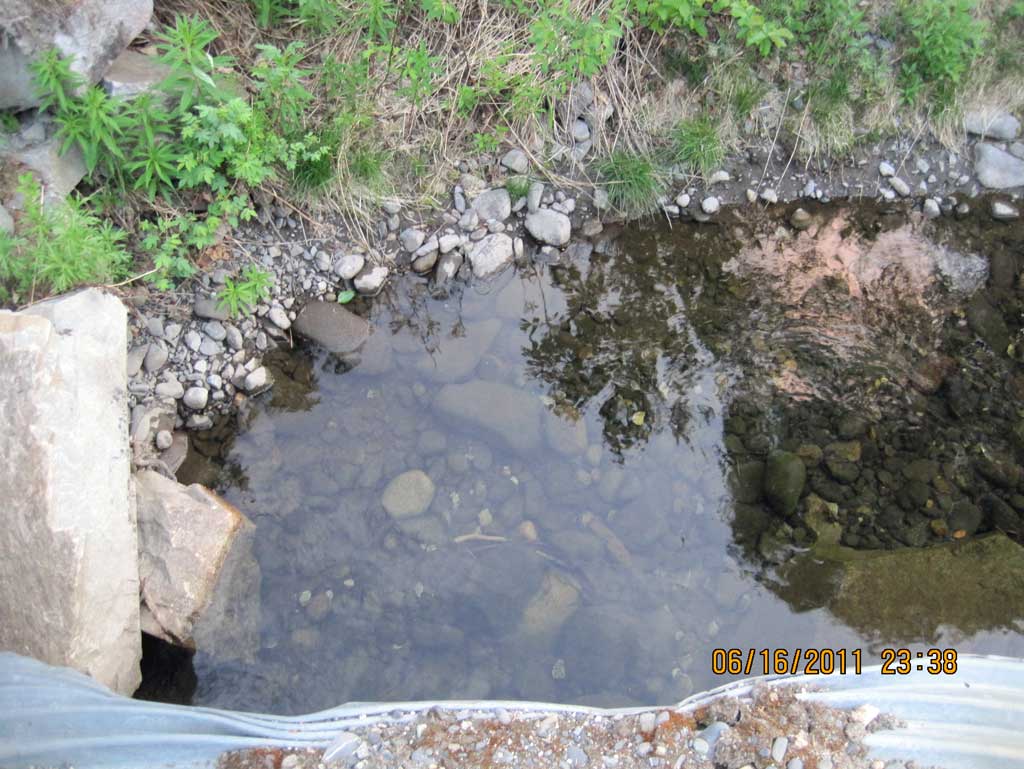
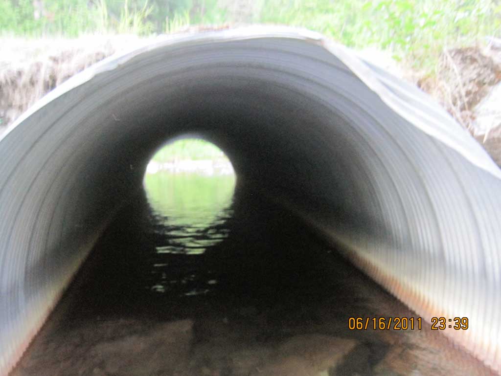
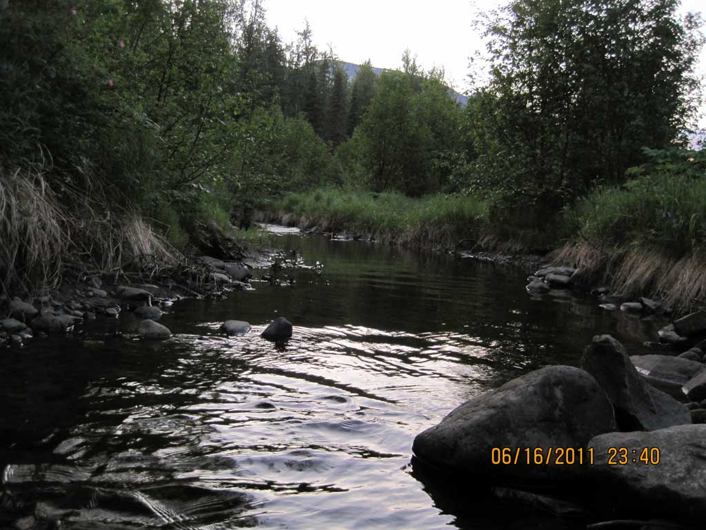
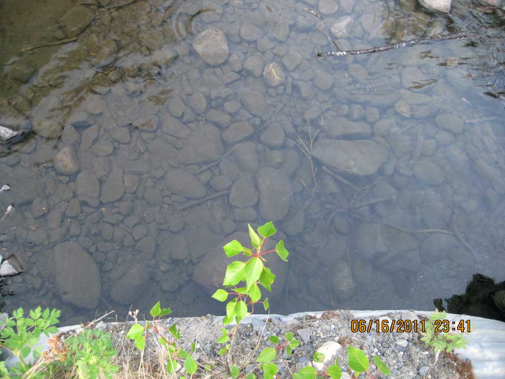
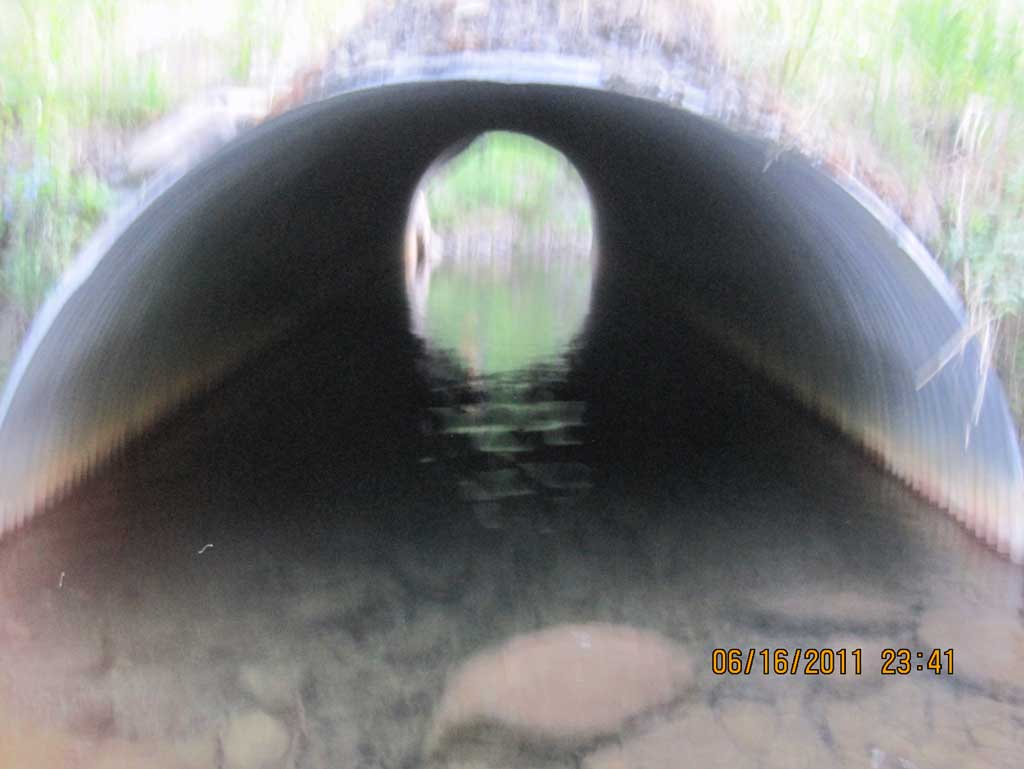
Comments: Smooth glide through pipe although pipe is backwatered due to a cobble riffle tailwater control dwst causing water to pond and flow back. Upst channel is relatively flat. Long. Profile zero point is at upstream grade point for this survey and all points are downstream from it.
Culvert Measurements
| ID: 1 | Structure Type: Circular pipe (Corrugated steel) | Fish Passage Rating: | ||||||||||||||||||||||||||||||||||||||||||
|
|
|
||||||||||||||||||||||||||||||||||||||||||
Culvert Observations:
|
||||||||||||||||||||||||||||||||||||||||||||
Stream Measurements
|
|
| Stream Width Type | Distance From Crossing (ft) |
Stream Width (ft) |
|---|---|---|
| Upstream ordinary high water | 100.0 | 9.20 |
| Upstream ordinary high water | 130.0 | 8.60 |
| Upstream ordinary high water | 160.0 | 9.00 |
Elevations
| Locator ID | Culvert Number |
River Distance (ft)1 |
Distance From Crossing (ft)2 |
Relative Elevation (ft) |
|---|---|---|---|---|
| U/S Grade Ctrl (Thalweg) (Top of riffle) | 0.00 | 91.03 | ||
| U/S Water Surface Elev | 0.00 | 91.47 | ||
| U/S Water Surface Elev (Water surface at inlet) | 100.00 | 91.18 | ||
| Inlet Culvert Invert (On substrate) | 100.00 | 88.77 | ||
| Inlet Culvert Top | 100.00 | 97.57 | ||
| Road Elev (Center of railroad tracks) | 125.00 | 99.84 | ||
| Outlet Invert (On substrate) | 149.90 | 89.30 | ||
| D/S Water Surface Elev (Water surface at outlet) | 149.90 | 91.18 | ||
| Outlet Culvert Top | 149.90 | 95.70 | ||
| D/S Tailcrest or 1st Thalweg (Taill water control.Top of riffle) | 159.90 | 90.70 | ||
| D/S Water Surface Elev (Tail water surface) | 159.90 | 91.14 |
Notes:
- River distance is measured continuously throughout the survey reach along the thalweg of the stream.
- Measured from each end of the crossing along the thalweg of the stream.
Fish Sampling Efforts
No fish sampling occurred during this survey.
Fish Observations
No fish observations occurred during this survey.
Photos
Questions or comments about this report can be directed to dfg.dsf.webmaster@alaska.gov