Fish Passage Site 20502089
Coordinates (dec. deg.): 62.82663°, -149.63768°
Legal Description: S032N002W34
Region: South Central
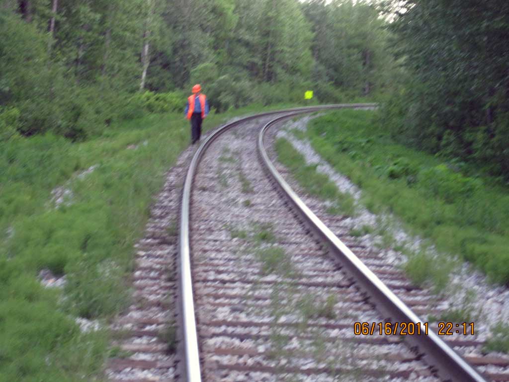
Road Name: Alaska Railroad
Datum: NAD83
Quad Name / ITM: Talkeetna Mts D-6
AWC Stream #:
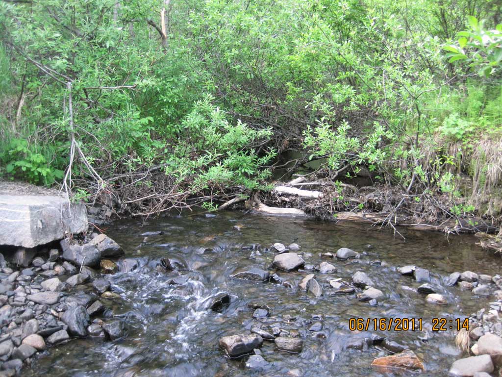
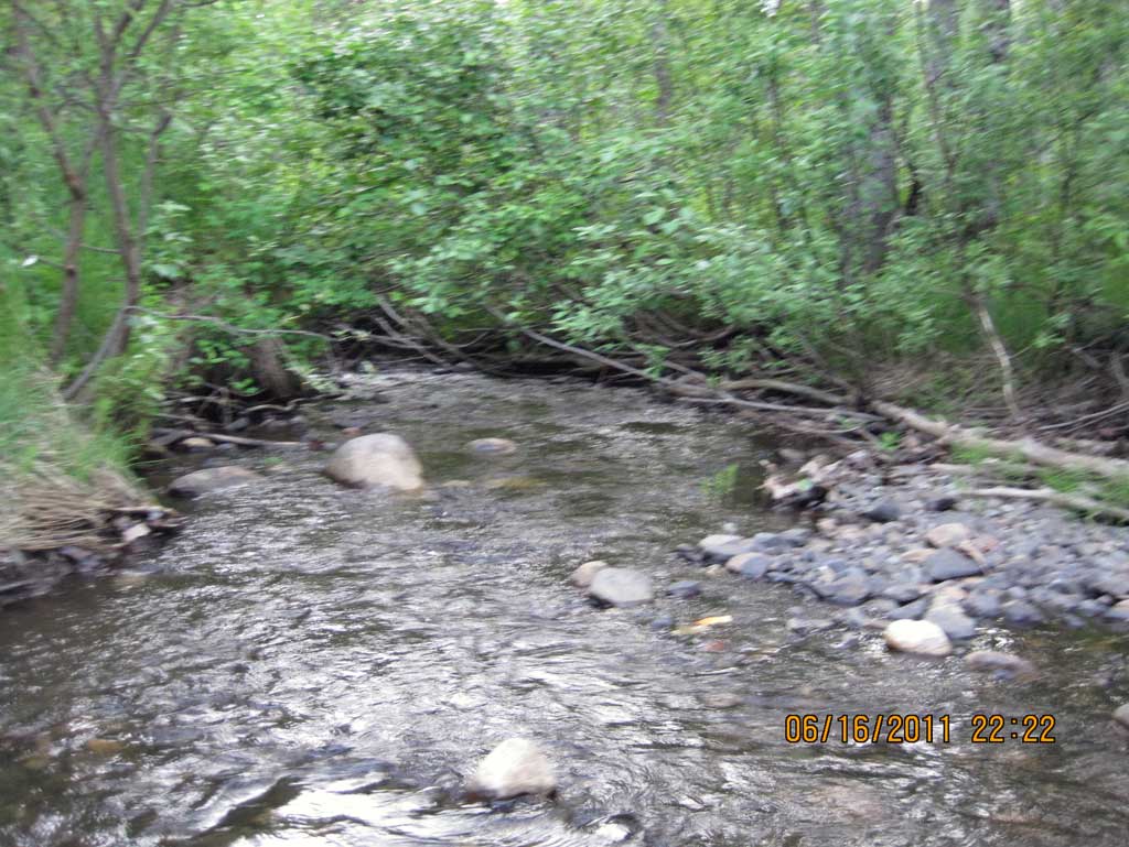
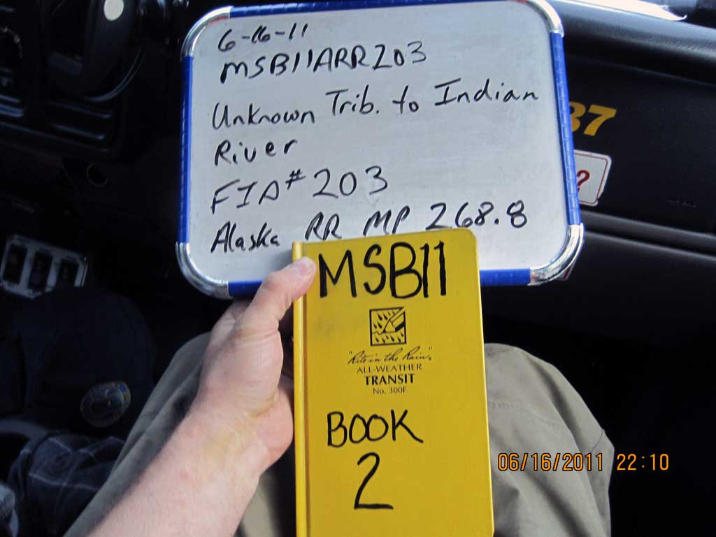
Stream Name: Indian River tributary
Elevation:
Site Comments: RR MP 268.8
Survey MSB11-ARR203
Project Supervisor: Gillian O'Doherty, Alaska Department of Fish and Game
— Anchorage, AK
Observers: John Greuey, Abraham Gioffre
Overall Fish Passage Rating:
Tidal: No
Backwatered: Yes
Step Pools: No
Construction Year: 2004
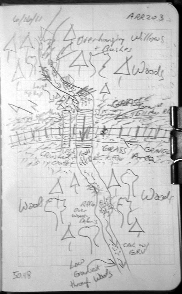
Site Observations:
- Culvert gradient gray
- Structural Problem
- Mechanical damage or joints parting
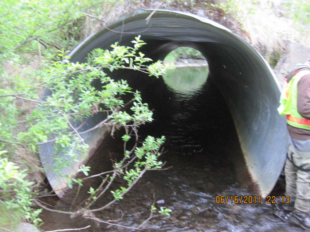
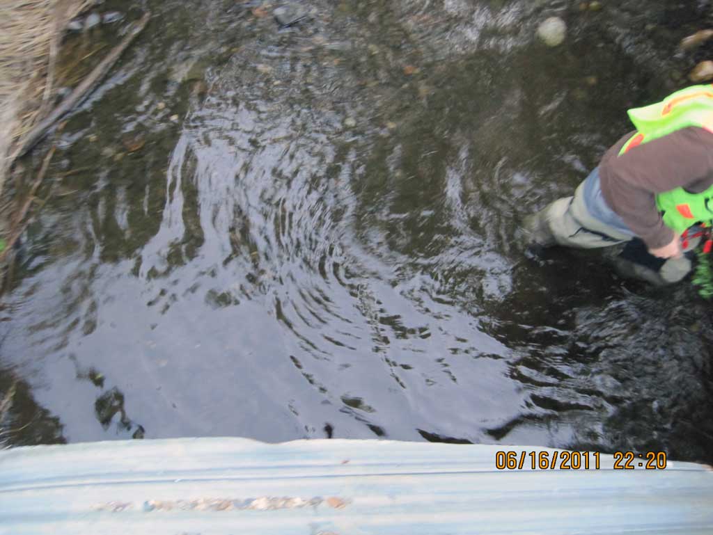
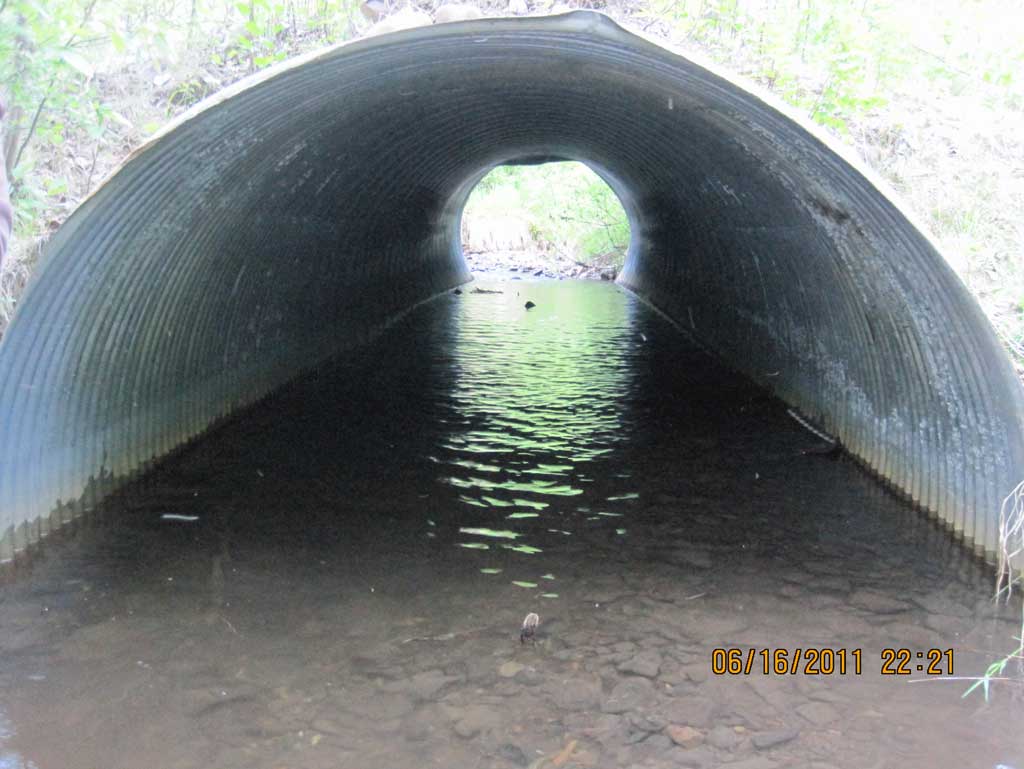
Comments: Alaska Railroad site at MP 268.8. Culvert is bent and caved in at a few points. Outlet is heavily embedded and actual bottom not found by driving a stake into substrate.
Culvert Measurements
| ID: 1 | Structure Type: Circular pipe (Corrugated steel) | Fish Passage Rating: | ||||||||||||||||||||||||||||||||||||||||||
|
|
|
||||||||||||||||||||||||||||||||||||||||||
Culvert Observations:
|
||||||||||||||||||||||||||||||||||||||||||||
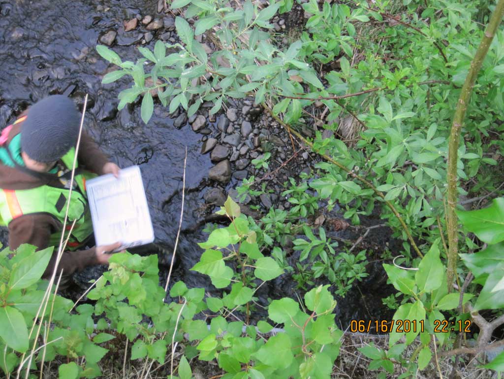
Stream Measurements
|
|
| Stream Width Type | Distance From Crossing (ft) |
Stream Width (ft) |
|---|---|---|
| Downstream ordinary high water | 40.0 | 9.40 |
| Downstream ordinary high water | 60.0 | 7.80 |
| Downstream ordinary high water | 100.0 | 9.20 |
Elevations
| Locator ID | Culvert Number |
River Distance (ft)1 |
Distance From Crossing (ft)2 |
Relative Elevation (ft) |
|---|---|---|---|---|
| D/S Grade Ctrl (Thalweg) (Resting pool before grade change.) | 0.00 | 88.90 | ||
| D/S Water Surface Elev | 0.00 | 89.20 | ||
| D/S Grade Ctrl (Thalweg) (Top of riffle) | 30.00 | 89.24 | ||
| D/S Water Surface Elev | 30.00 | 89.51 | ||
| D/S Grade Ctrl (Thalweg) (Top of continuous riffle) | 91.00 | 90.57 | ||
| D/S Water Surface Elev | 91.00 | 90.80 | ||
| D/S Water Surface Elev (Water surface at outlet) | 101.00 | 90.84 | ||
| Outlet Culvert Top | 101.00 | 95.33 | ||
| Outlet Invert (On substrate) | 101.00 | 90.08 | ||
| Road Elev (Center of railroad tracks) | 126.00 | 99.89 | ||
| Inlet Culvert Top | 151.48 | 97.88 | ||
| U/S Water Surface Elev (Water surface at inlet) | 151.48 | 90.86 | ||
| Inlet Culvert Invert (On substrate) | 151.48 | 89.65 | ||
| U/S Grade Ctrl (Thalweg) (Top of riffle) | 166.48 | 91.56 | ||
| U/S Water Surface Elev | 166.48 | 91.73 |
Notes:
- River distance is measured continuously throughout the survey reach along the thalweg of the stream.
- Measured from each end of the crossing along the thalweg of the stream.
Fish Sampling Efforts
No fish sampling occurred during this survey.
Fish Observations
No fish observations occurred during this survey.
Photos
Questions or comments about this report can be directed to dfg.dsf.webmaster@alaska.gov