Fish Passage Site 20502085
Coordinates (dec. deg.): 62.84651°, -149.63458°
Legal Description: S032N002W22
Region: South Central
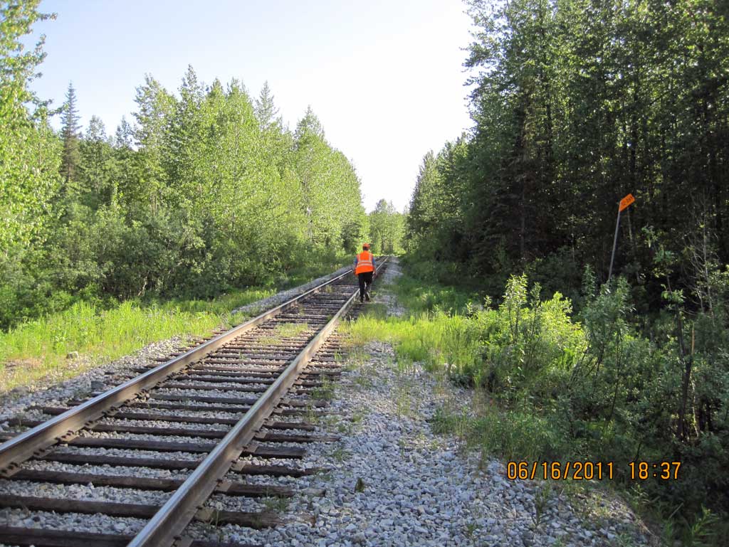
Road Name: Alaska Railroad
Datum: NAD83
Quad Name / ITM: Talkeetna Mts D-6
AWC Stream #:
Stream Name: Indian River tributary
Elevation:
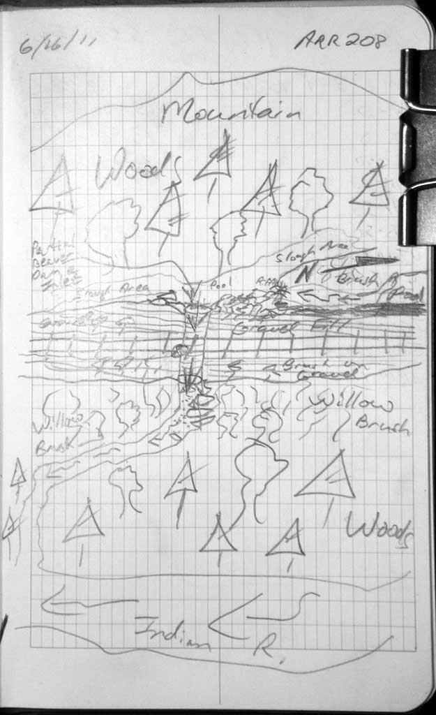
Site Comments: Alaska Railroad site at MP 270.6
Survey MSB11-ARR208
Project Supervisor: Gillian O'Doherty, Alaska Department of Fish and Game
— Anchorage, AK
Observers: John Greuey, Abraham Gioffre
Overall Fish Passage Rating:
Tidal: No
Backwatered: No
Step Pools: No
Construction Year:
Site Observations:
- Constriction ratio red
- Culvert gradient gray
- Beaver Activity
- Woody Debris
- Structural Problem
- Mechanical damage or joints parting
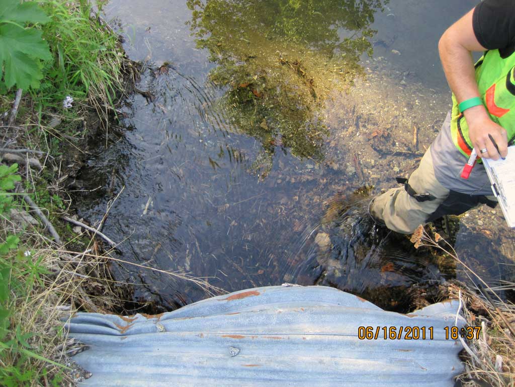
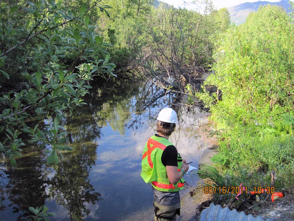
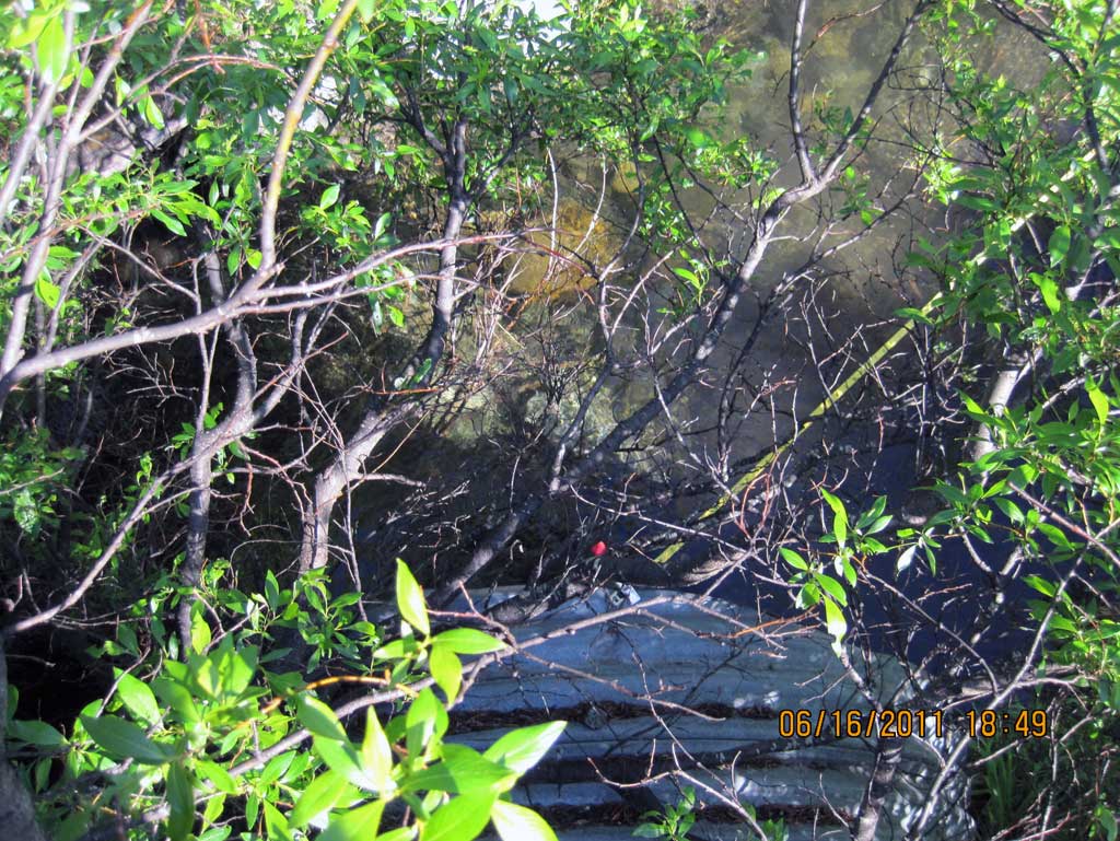
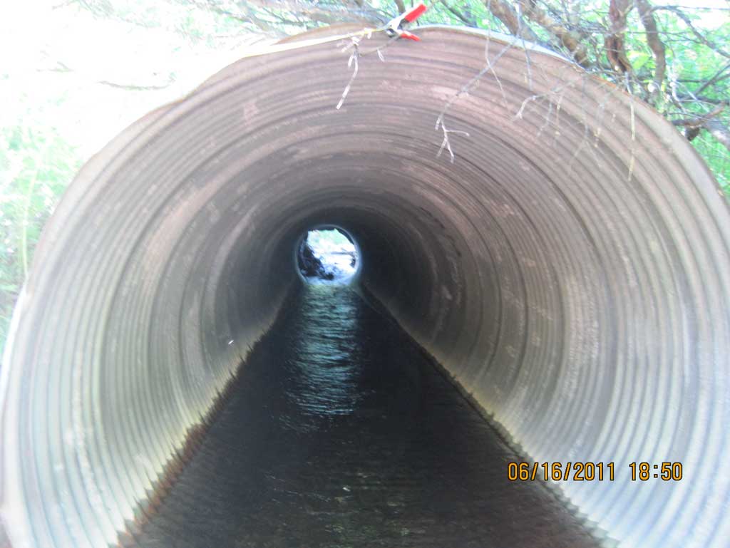
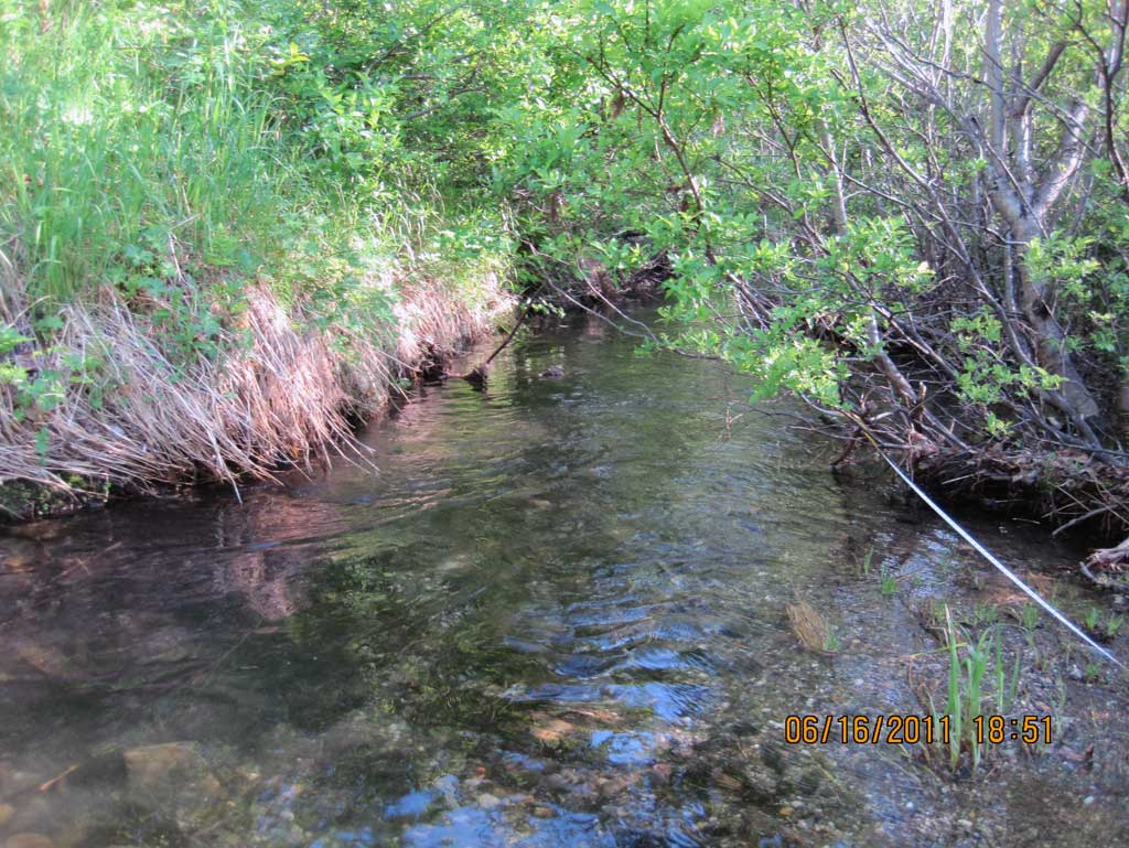
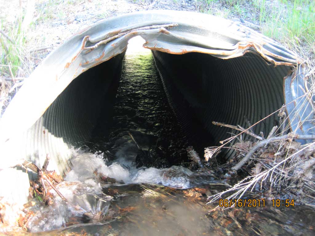
Comments: Alaska Railroad site at MP 270.6. Heavy beaver activity at inlet w/ lots of woody debris creating a vertical drop of 2.5' approx 4' into the inlet of pipe. Inlet is badly crushed and upst channel area is heavily ponded. Dwst channel flows into very thick wooded and brushy area.
Culvert Measurements
| ID: 1 | Structure Type: Circular pipe (Corrugated steel) | Fish Passage Rating: | ||||||||||||||||||||||||||||||||||||||||||
|
|
|
||||||||||||||||||||||||||||||||||||||||||
Culvert Observations:
|
||||||||||||||||||||||||||||||||||||||||||||
Stream Measurements
|
|
| Stream Width Type | Distance From Crossing (ft) |
Stream Width (ft) |
|---|---|---|
| Downstream ordinary high water | 35.0 | 11.10 |
| Downstream ordinary high water | 71.0 | 13.00 |
| Downstream ordinary high water | 105.0 | 13.80 |
Elevations
| Locator ID | Culvert Number |
River Distance (ft)1 |
Distance From Crossing (ft)2 |
Relative Elevation (ft) |
|---|---|---|---|---|
| D/S Water Surface Elev | 0.00 | 89.59 | ||
| D/S Grade Ctrl (Thalweg) (Mid point of glide) | 0.00 | 88.41 | ||
| Outlet Pool Water Elev (Water surface of max pool) | 40.00 | 89.64 | ||
| Max Pool Depth (max pool) | 40.00 | 87.59 | ||
| D/S Water Surface Elev (Water surface at outlet) | 50.00 | 89.66 | ||
| Outlet Invert | 50.00 | 88.64 | ||
| Outlet Culvert Top | 50.00 | 93.63 | ||
| Road Elev (Middle of railroad tracks) | 80.00 | 99.41 | ||
| Inlet Culvert Top | 109.67 | 94.41 | ||
| Inlet Culvert Invert (on substrate from beaver dam) | 109.67 | 91.21 | ||
| U/S Water Surface Elev (Water surface at inlet) | 109.67 | 91.81 |
Notes:
- River distance is measured continuously throughout the survey reach along the thalweg of the stream.
- Measured from each end of the crossing along the thalweg of the stream.
Fish Sampling Efforts
No fish sampling occurred during this survey.
Fish Observations
No fish observations occurred during this survey.
Photos

Questions or comments about this report can be directed to dfg.dsf.webmaster@alaska.gov