Fish Passage Site 20502083
Coordinates (dec. deg.): 62.85552°, -149.62180°
Legal Description: S032N002W22
Region: South Central
Road Name: Alaska Railroad
Datum: NAD83
Quad Name / ITM: Talkeetna Mts D-6
AWC Stream #:
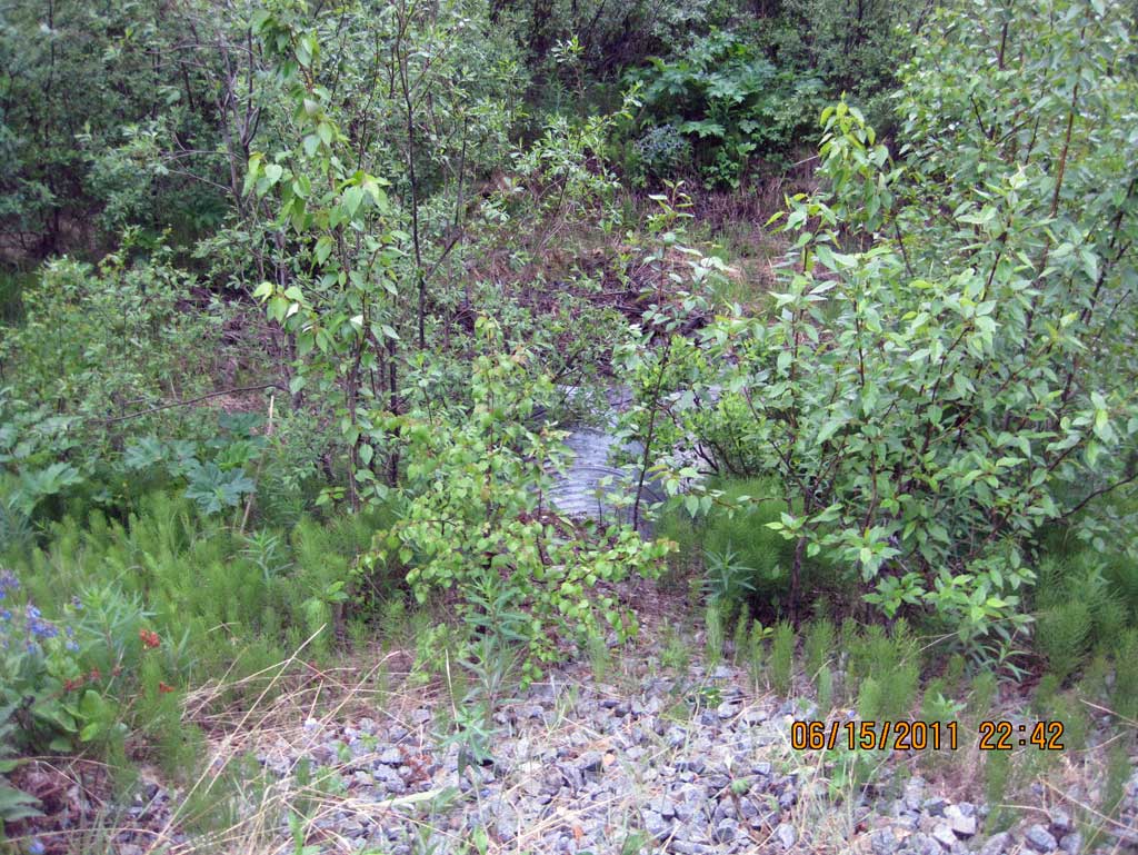
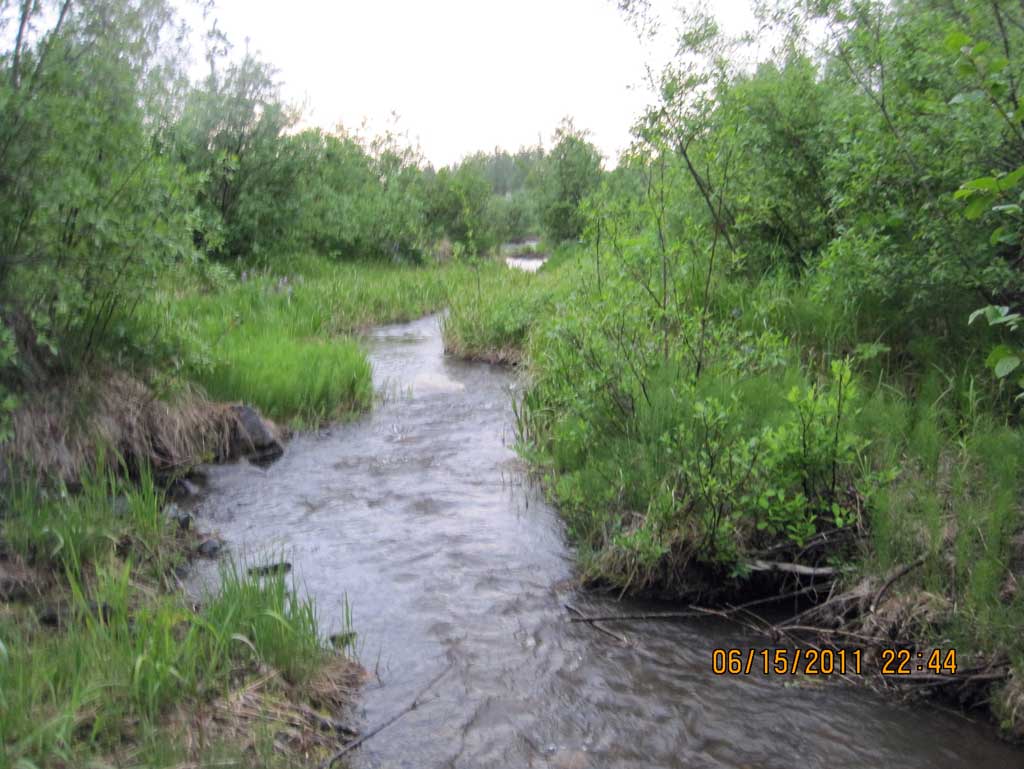
Stream Name: Susitna River tributary
Elevation:
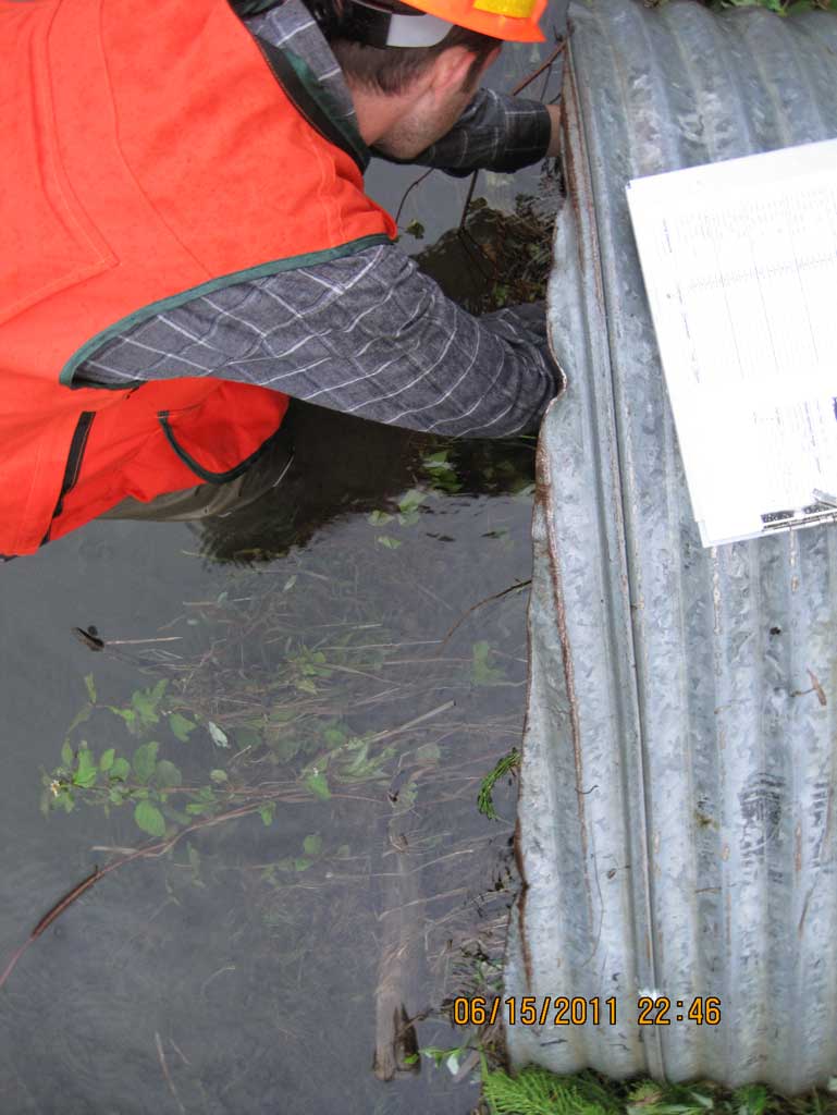
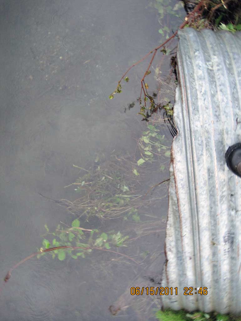
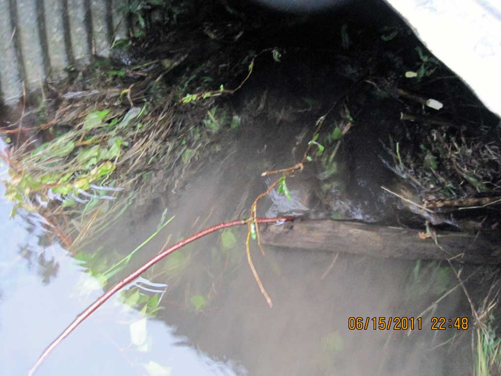
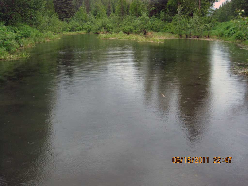
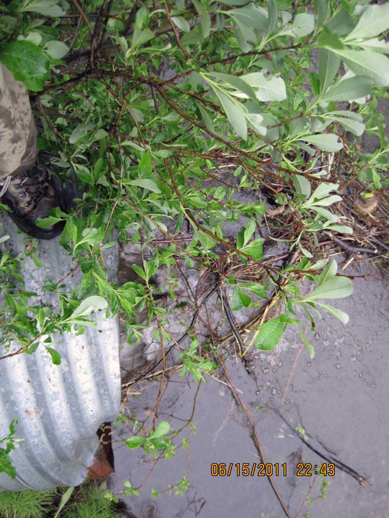
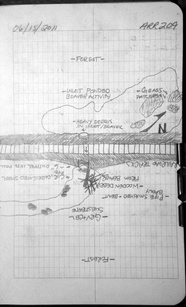
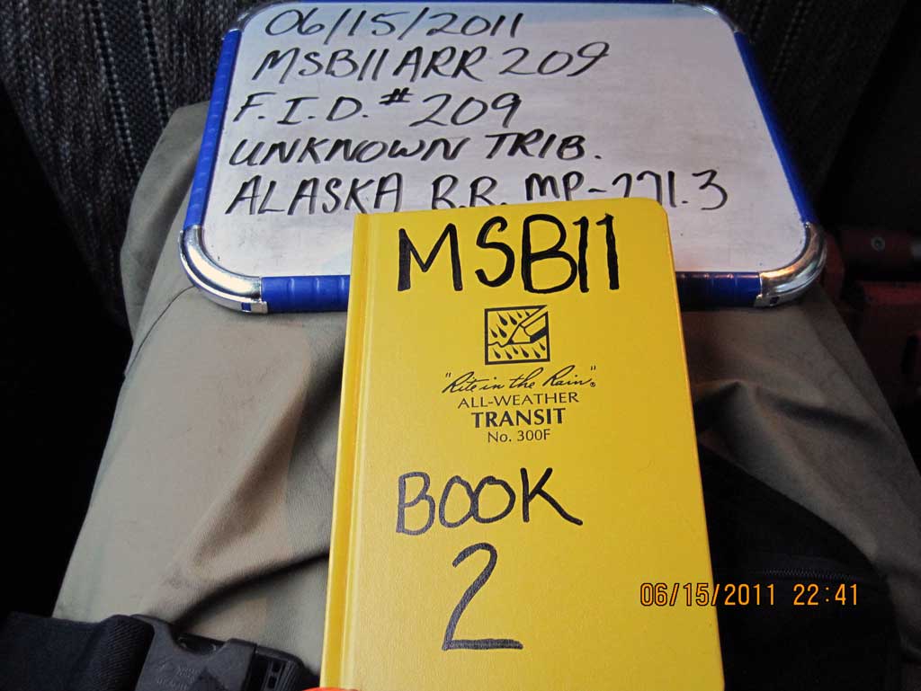
Site Comments: Alaska Railroad at MP 271.3.
Survey MSB11-ARR209
Project Supervisor: Gillian O'Doherty, Alaska Department of Fish and Game
— Anchorage, AK
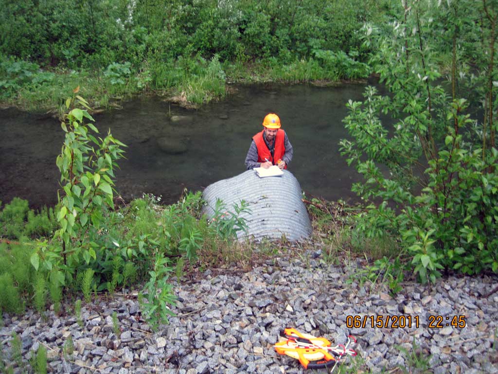
Observers: John Greuey, Abraham Gioffre
Overall Fish Passage Rating:
Tidal: No
Backwatered: No
Step Pools: No
Construction Year:
Site Observations:
- Culvert gradient red
- Outfall height red
- Constriction ratio gray
- Beaver Activity
- Structural Problem
- Woody Debris
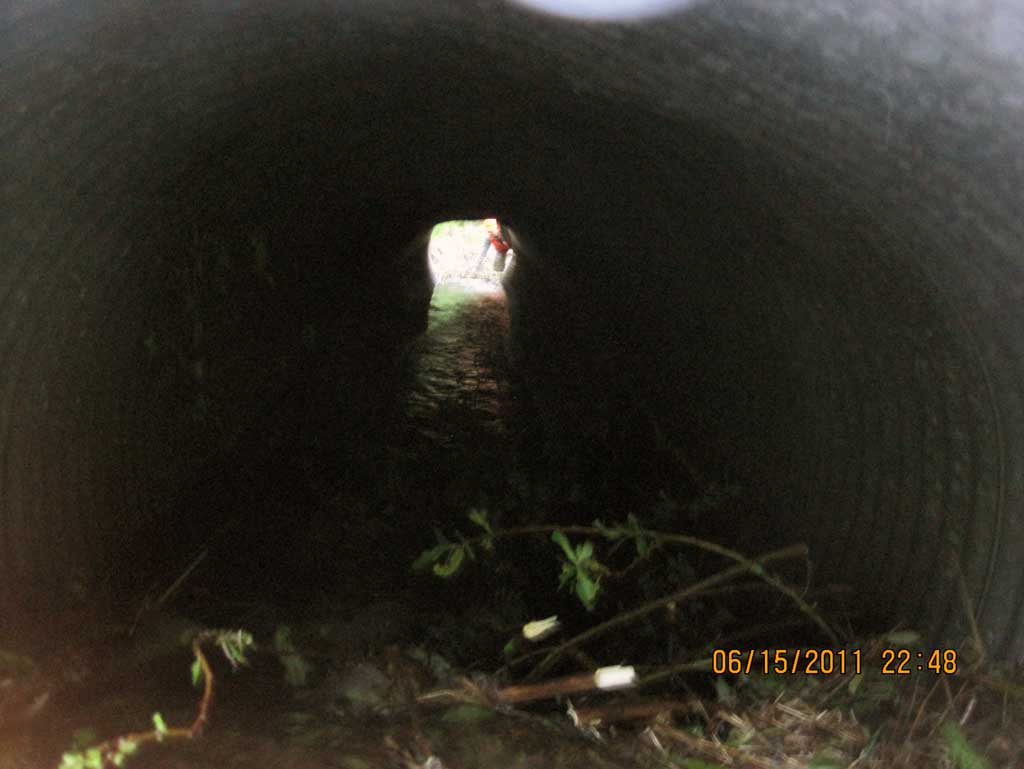
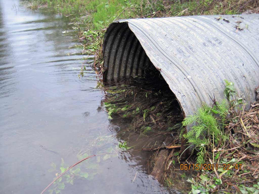
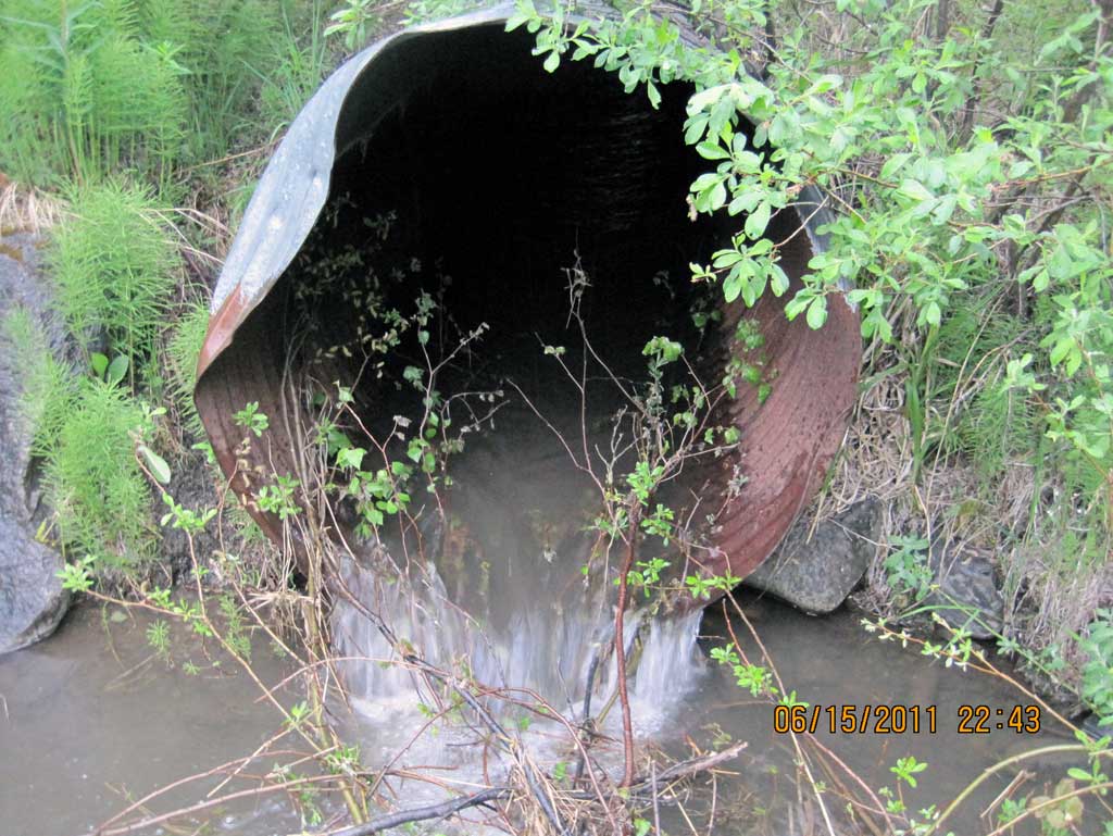
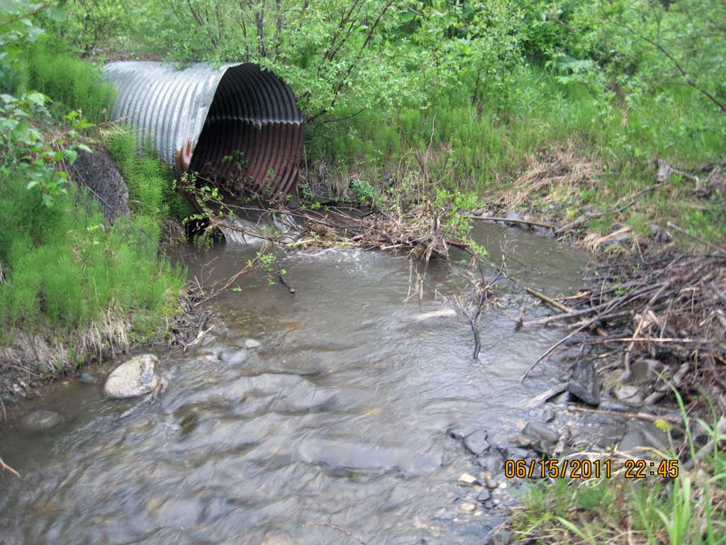
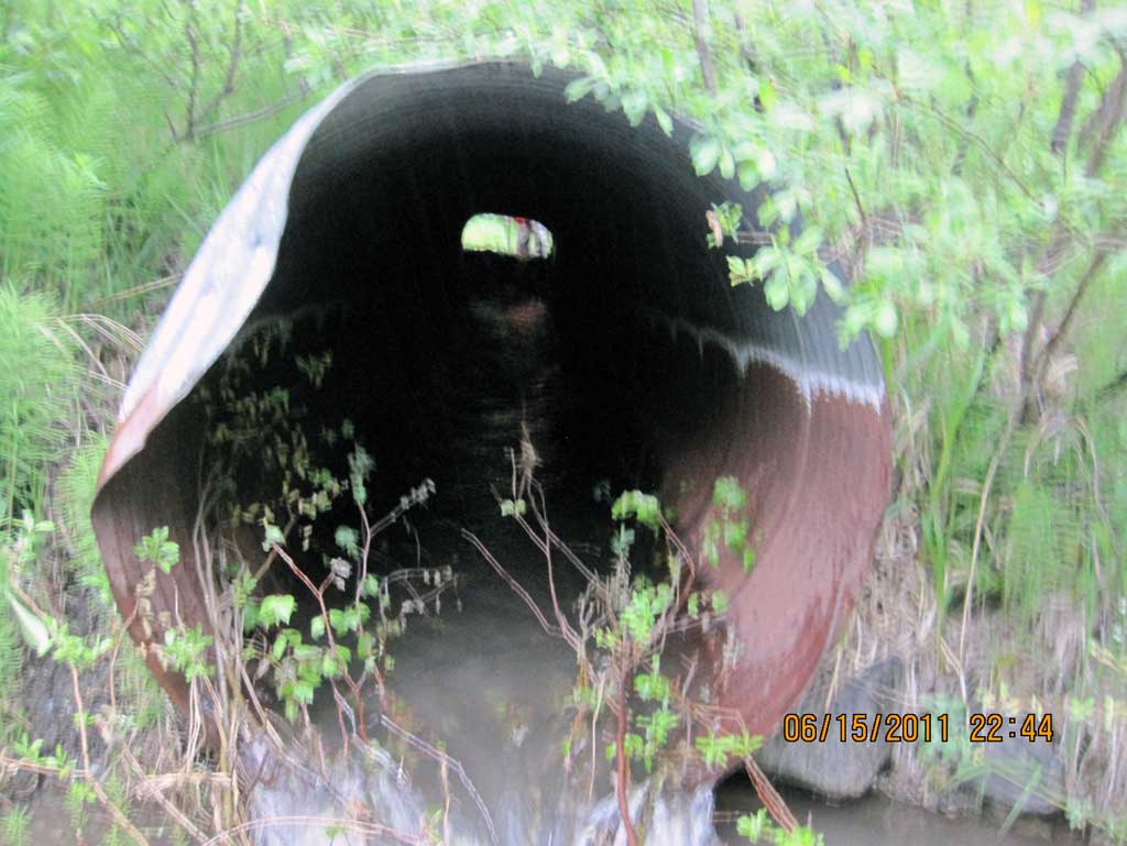
Comments: Alaska Railroad at MP 271.3. Beaver dam constructed in inlet w/ a depth of .90'. Inlet of culvert crushed to an oval shape and top of outlet crushed also. Beaver dam at inlet made meauring rust line difficult. A noticeable rust line at the outlet did measure 2.45'.
Culvert Measurements
| ID: 1 | Structure Type: Circular pipe (Corrugated steel) | Fish Passage Rating: | ||||||||||||||||||||||||||||||||||||||||||
|
|
|
||||||||||||||||||||||||||||||||||||||||||
Culvert Observations:
|
||||||||||||||||||||||||||||||||||||||||||||
Stream Measurements
|
|
| Stream Width Type | Distance From Crossing (ft) |
Stream Width (ft) |
|---|---|---|
| Downstream ordinary high water | 24.0 | 6.25 |
| Downstream ordinary high water | 34.0 | 6.00 |
| Downstream ordinary high water | 50.0 | 5.70 |
Elevations
| Locator ID | Culvert Number |
River Distance (ft)1 |
Distance From Crossing (ft)2 |
Relative Elevation (ft) |
|---|---|---|---|---|
| D/S Grade Ctrl (Thalweg) (Top of riffle) | 0.00 | 89.98 | ||
| D/S Water Surface Elev | 0.00 | 90.16 | ||
| D/S Grade Ctrl (Thalweg) | 42.00 | 90.45 | ||
| D/S Water Surface Elev | 42.00 | 90.73 | ||
| Outlet Pool Water Elev (Used for outfall height calculation) | 52.00 | 90.89 | ||
| Max Pool Depth (Outlet pool max depth) | 52.00 | 89.91 | ||
| Outlet Culvert Top | 56.00 | 95.03 | ||
| Outlet Invert | 56.00 | 90.97 | ||
| D/S Water Surface Elev (Water surface at outlet) | 56.00 | 91.30 | ||
| Road Elev (Center of railroad tracks) | 81.00 | 99.42 | ||
| Inlet Culvert Top | 106.12 | 96.16 | ||
| Inlet Culvert Invert (Reading taken on top of wooden beaver dam debris) | 106.12 | 93.20 | ||
| U/S Water Surface Elev (Water surface at inlet. Ponded due to beaver activity) | 106.12 | 93.99 |
Notes:
- River distance is measured continuously throughout the survey reach along the thalweg of the stream.
- Measured from each end of the crossing along the thalweg of the stream.
Fish Sampling Efforts
No fish sampling occurred during this survey.
Fish Observations
No fish observations occurred during this survey.
Photos
Questions or comments about this report can be directed to dfg.dsf.webmaster@alaska.gov