Fish Passage Site 20502081
Coordinates (dec. deg.): 62.85917°, -149.61298°
Legal Description: S032N002W15
Region: South Central
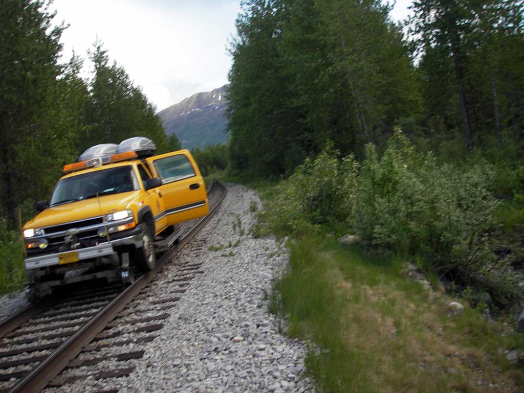
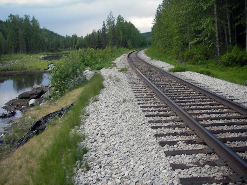
Road Name: Alaska Railroad
Datum: NAD83
Quad Name / ITM: Talkeetna Mts D-6
AWC Stream #:
Stream Name: Susitna River tributary
Elevation:
Site Comments: Alaska RR at MP 271.7
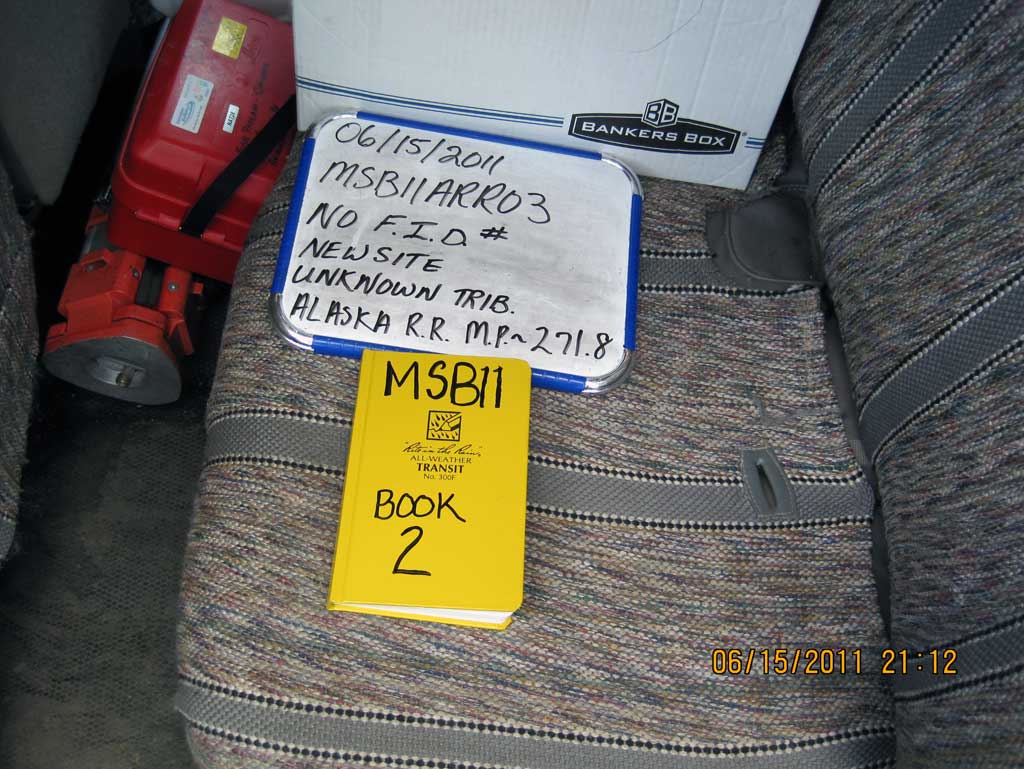
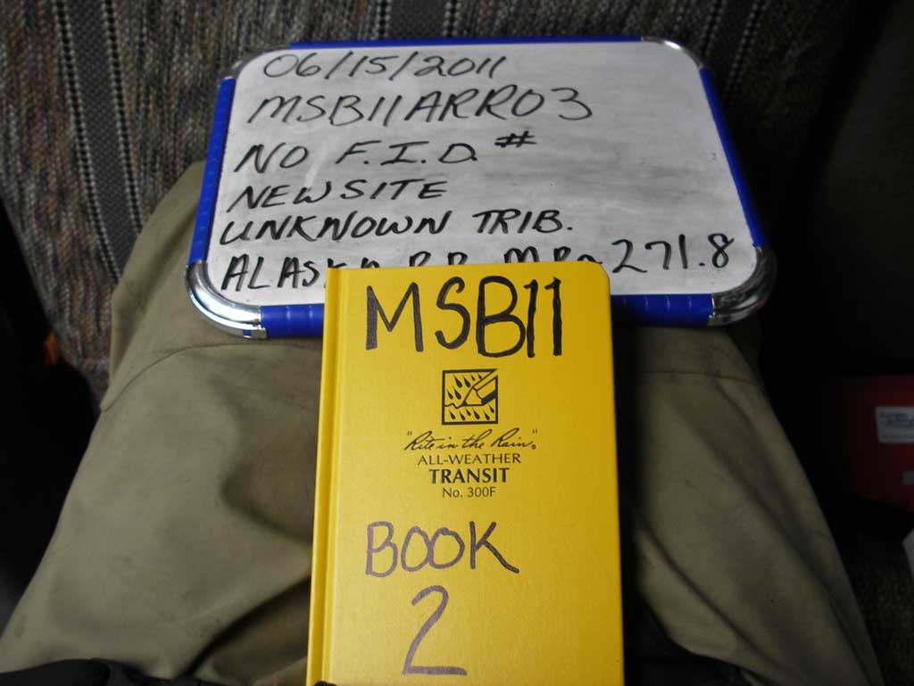
Survey MSB11-ARR03
Project Supervisor: Gillian O'Doherty, Alaska Department of Fish and Game
— Anchorage, AK
Observers: John Greuey, Abraham Gioffre
Overall Fish Passage Rating:
Tidal: No
Backwatered: No
Step Pools: No
Construction Year:
Site Observations:
- Culvert gradient gray
- Sediment accumulation
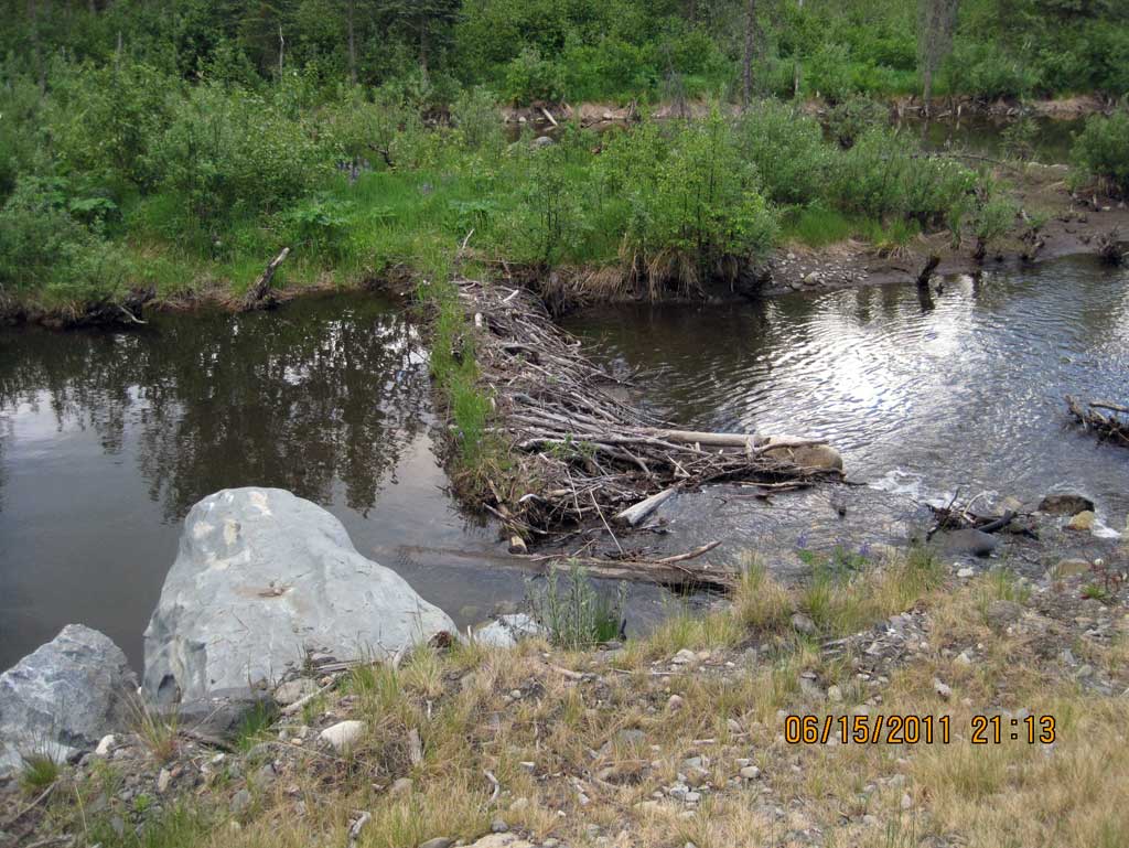
- Beaver Activity
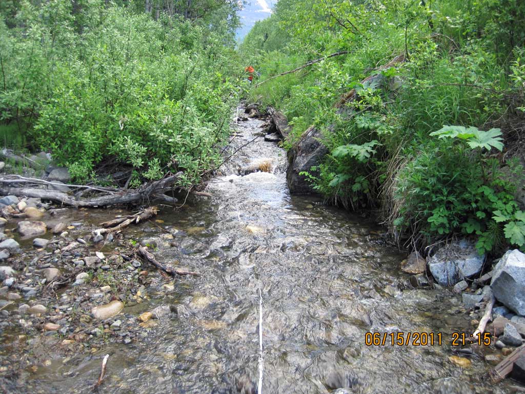
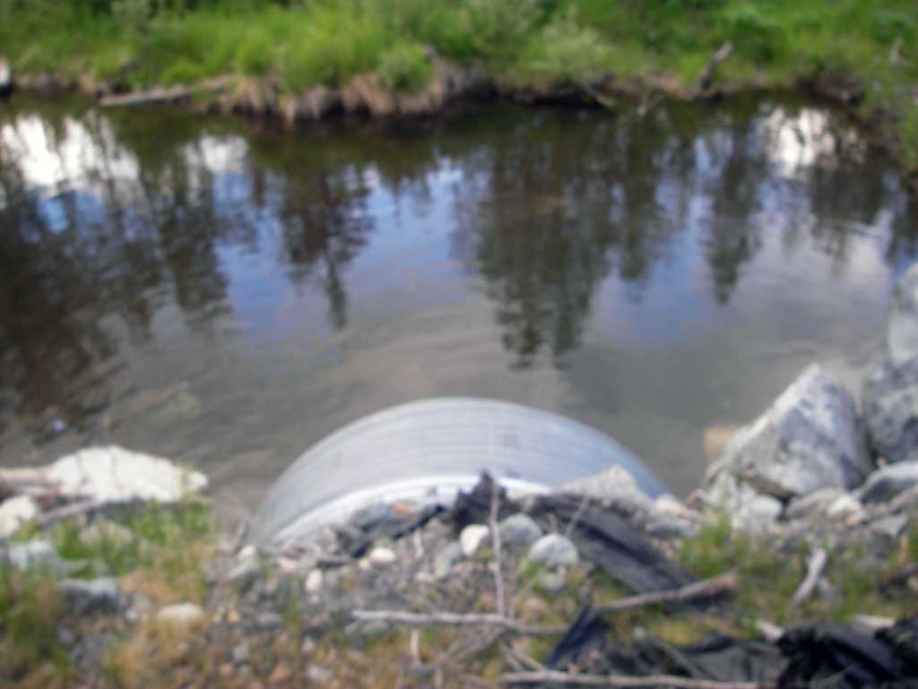
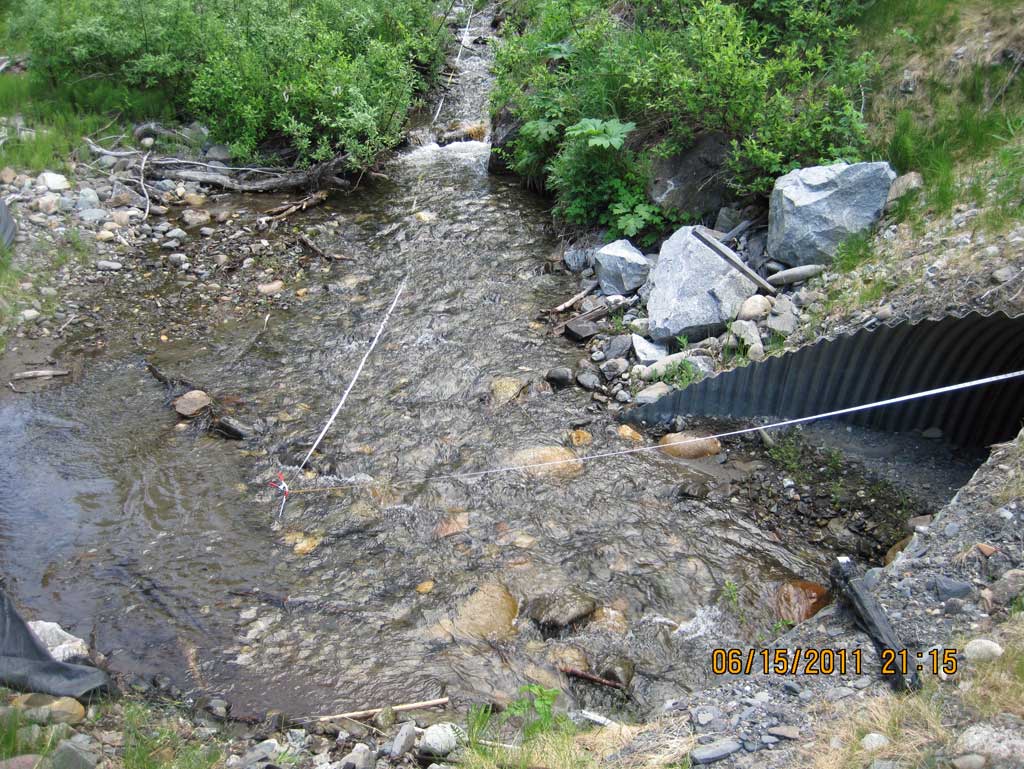
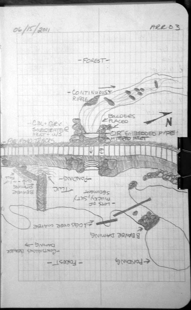
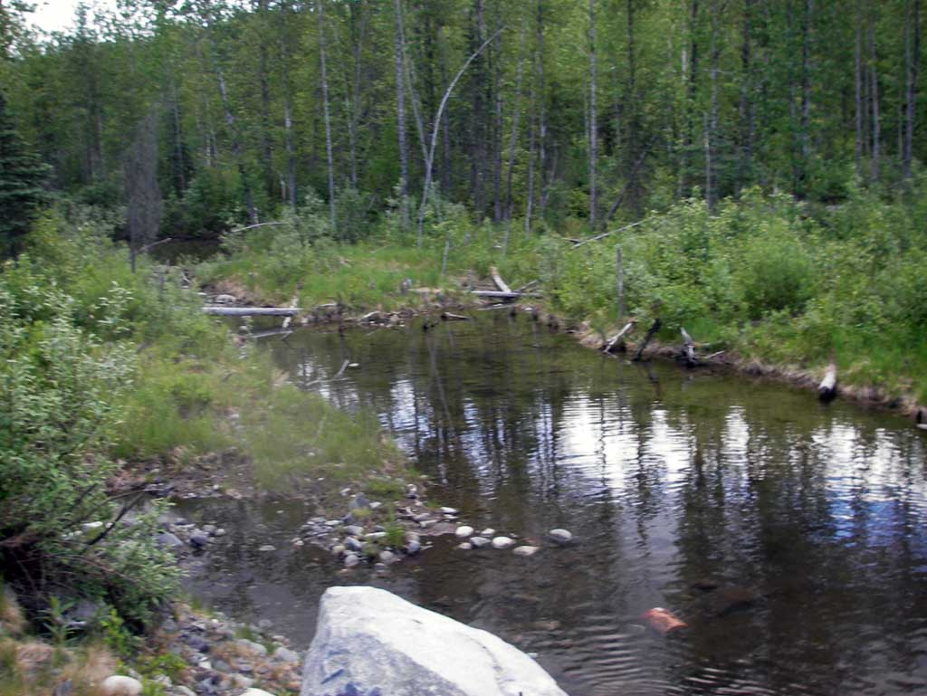
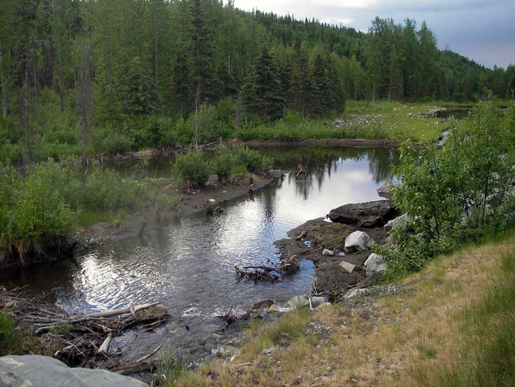
Comments: New site found on Alaska RR at MP 271.8. Dwst area from culvert is backwater ponded area from beaver dam. Long profile starts at upstream grade point.
Culvert Measurements
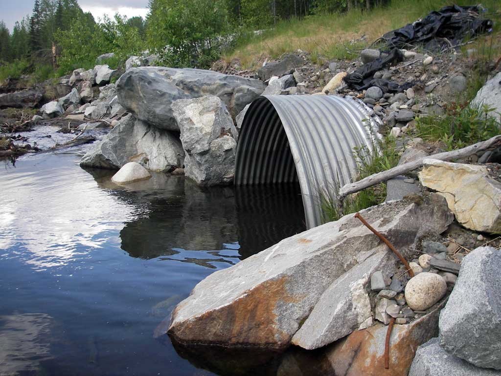
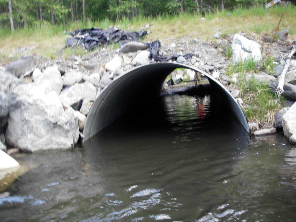
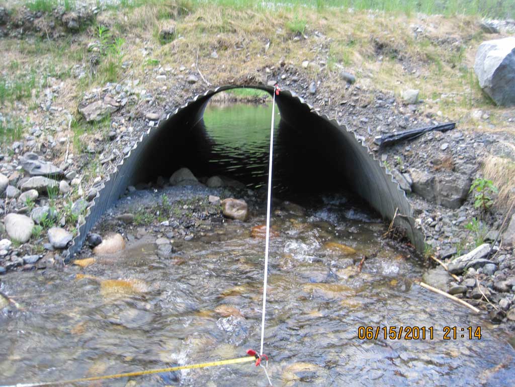
| ID: 1 | Structure Type: Circular pipe (Corrugated steel) | Fish Passage Rating: | ||||||||||||||||||||||||||||||||||||||||||
|
|
|
||||||||||||||||||||||||||||||||||||||||||
Culvert Observations:
|
||||||||||||||||||||||||||||||||||||||||||||
Stream Measurements
|
|
| Stream Width Type | Distance From Crossing (ft) |
Stream Width (ft) |
|---|---|---|
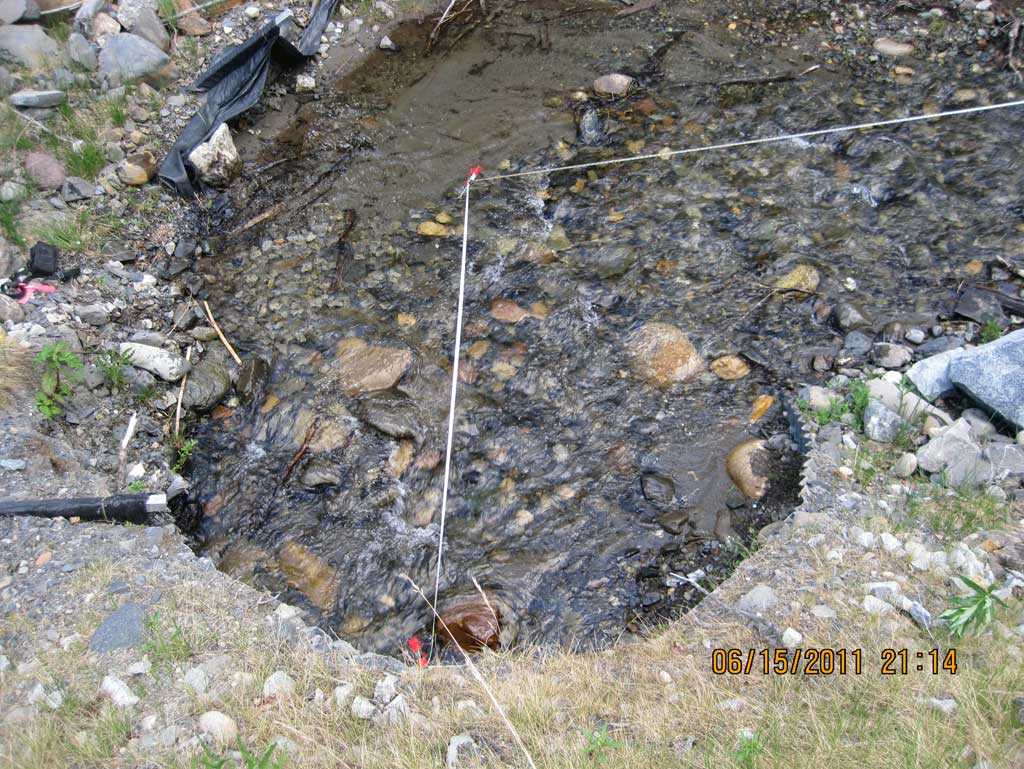
| Upstream ordinary high water | 52.0 | 6.80 |
| Upstream ordinary high water | 76.0 | 7.65 |
| Upstream ordinary high water | 85.0 | 7.60 |
Elevations
| Locator ID | Culvert Number |
River Distance (ft)1 |
Distance From Crossing (ft)2 |
Relative Elevation (ft) |
|---|---|---|---|---|
| U/S Grade Ctrl (Thalweg) (Middle of riffle) | 0.00 | 95.20 | ||
| U/S Water Surface Elev (Used for stream gradient) | 0.00 | 95.73 | ||
| U/S Grade Ctrl (Thalweg) (Top of riffle) | 36.00 | 94.61 | ||
| U/S Water Surface Elev | 36.00 | 94.98 | ||
| U/S Grade Ctrl (Thalweg) (Top of riffle) | 74.00 | 92.39 | ||
| U/S Water Surface Elev | 74.00 | 92.88 | ||
| U/S Grade Ctrl (Thalweg) | 100.00 | 91.57 | ||
| U/S Water Surface Elev (Used for stream gradient) | 100.00 | 91.95 | ||
| U/S Water Surface Elev (Water surface at inlet) | 112.00 | 91.57 | ||
| Inlet Culvert Invert | 112.00 | 91.25 | ||
| Inlet Culvert Top | 112.00 | 95.88 | ||
| Road Elev | 132.00 | 99.56 | ||
| Outlet Culvert Top | 153.28 | 95.19 | ||
| Outlet Invert | 153.28 | 88.43 | ||
| D/S Water Surface Elev (Water surface at outlet) | 153.28 | 91.32 | ||
| D/S Tailcrest or 1st Thalweg (Tail water control created by beaver dam, creates ponding) | 168.28 | 90.35 | ||
| D/S Water Surface Elev (Tail water surface) | 168.28 | 91.27 |
Notes:
- River distance is measured continuously throughout the survey reach along the thalweg of the stream.
- Measured from each end of the crossing along the thalweg of the stream.
Fish Sampling Efforts
No fish sampling occurred during this survey.
Fish Observations
No fish observations occurred during this survey.
Photos
Questions or comments about this report can be directed to dfg.dsf.webmaster@alaska.gov