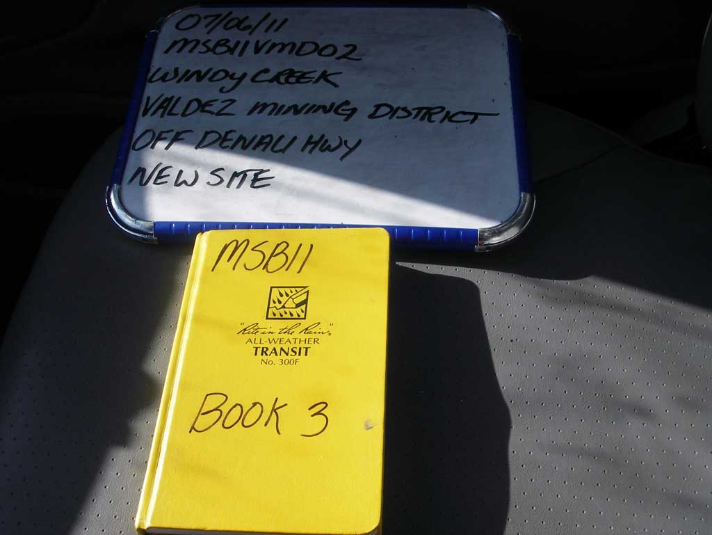
Fish Passage Site 20502068
Coordinates (dec. deg.): 63.11403°, -147.50644°
Legal Description: F021S001E11
Region: South Central
Road Name: Valdez Mining District Road
Datum: NAD83
Quad Name / ITM: Healy A-2
AWC Stream #:
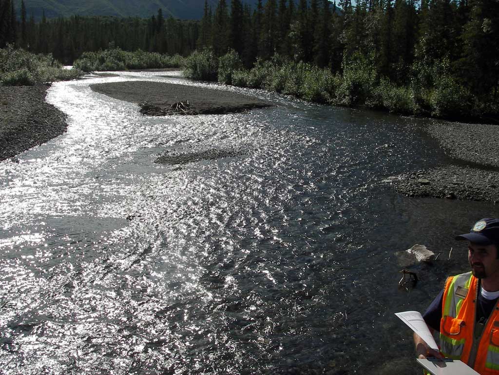
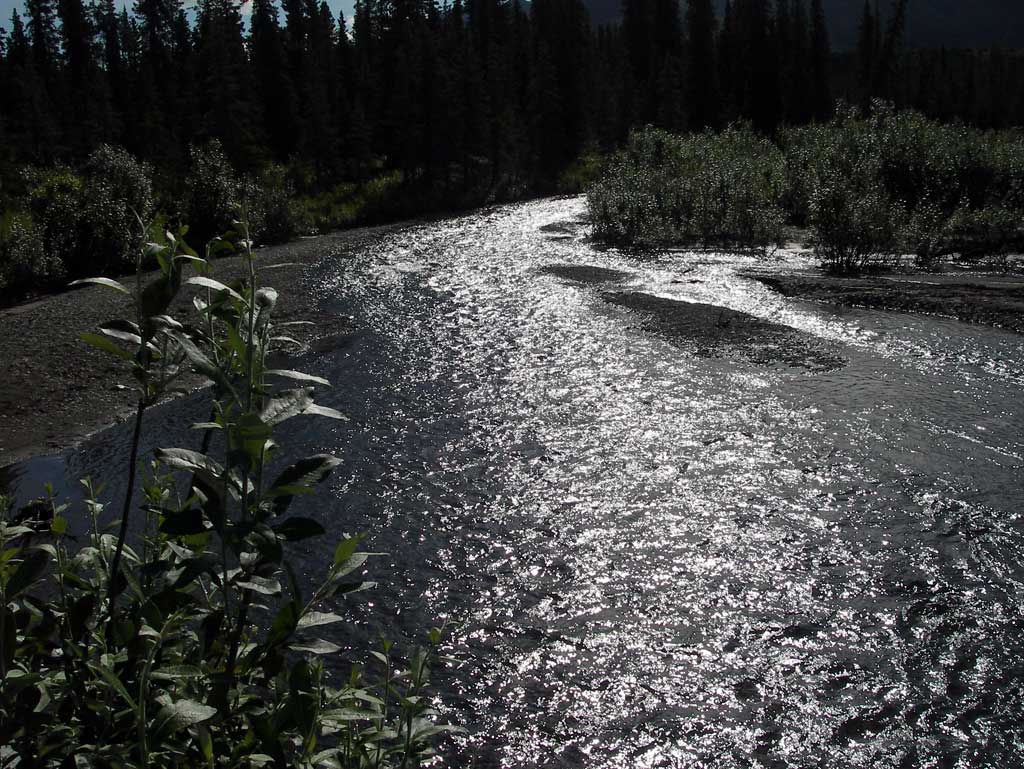
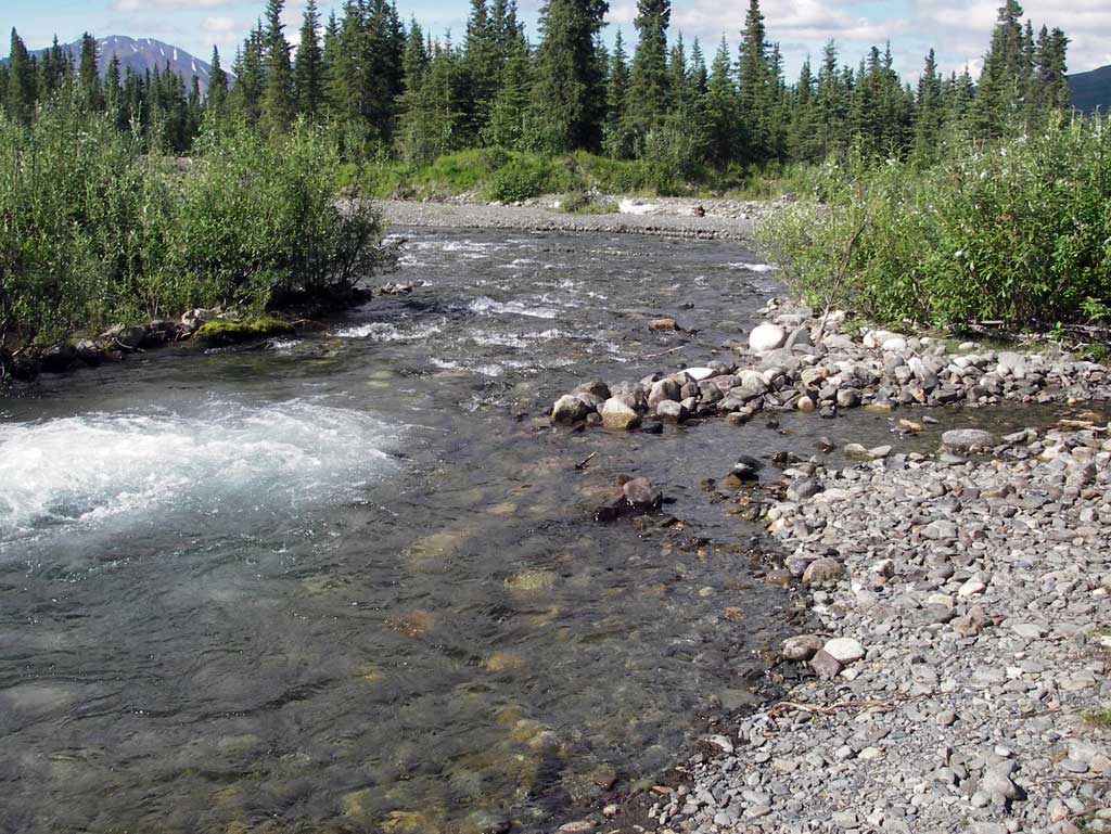
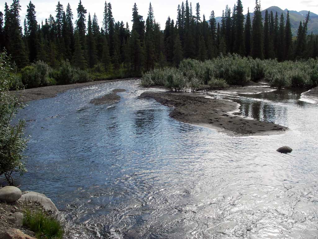
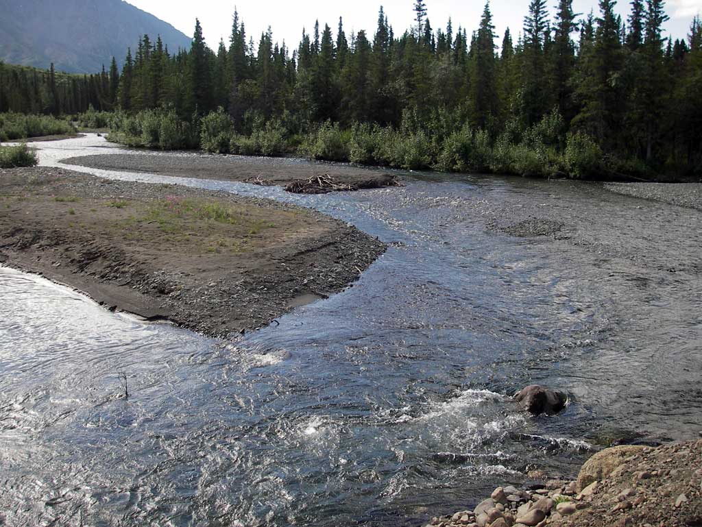
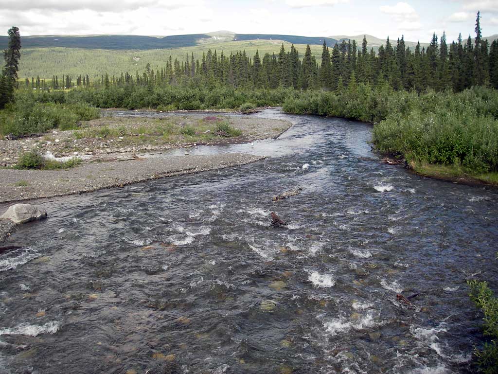
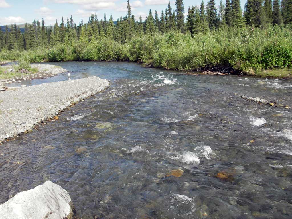
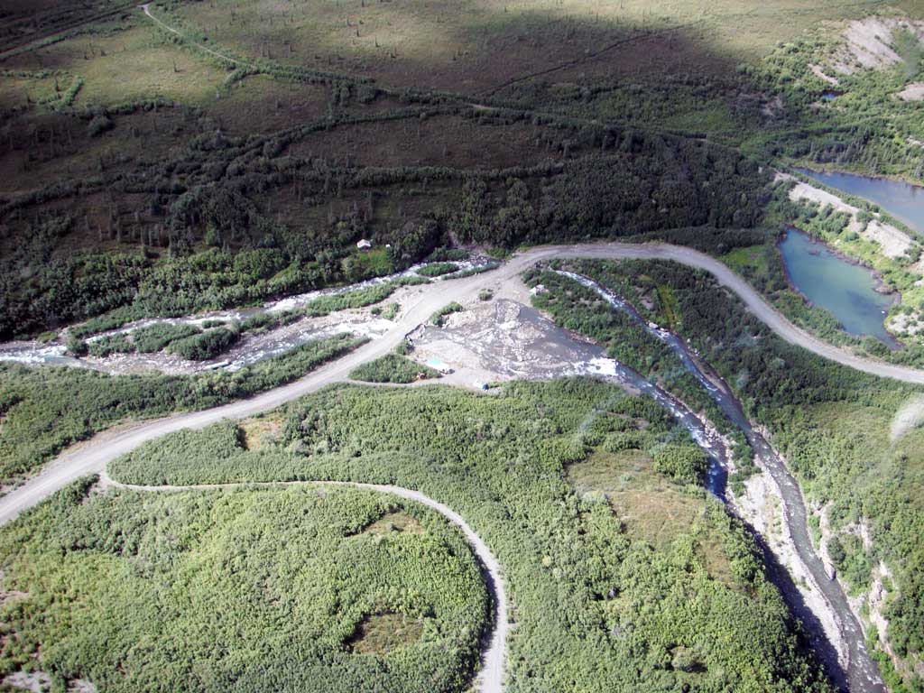
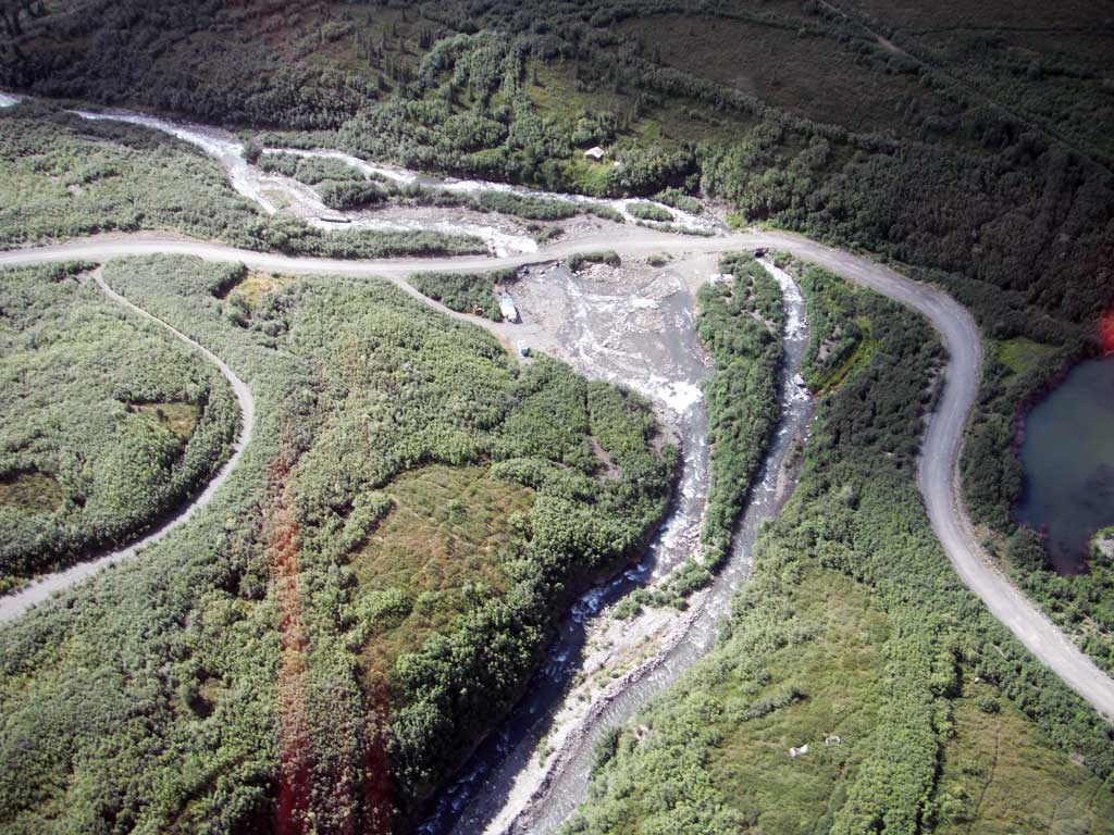
Stream Name: Windy Creek
Site Comments: None
Multiple surveys have been conducted at this site — click on the drop down
arrow to the right of the survey date below to choose a different report for this site.
Project Supervisor: Gillian O'Doherty, Alaska Department of Fish and Game
— Anchorage, AK
Observers: John Greuey, Abraham Gioffre
Overall Fish Passage Rating: Red
Tidal: No
Backwatered: No
Step Pools: No
Construction Year:
Site Observations:
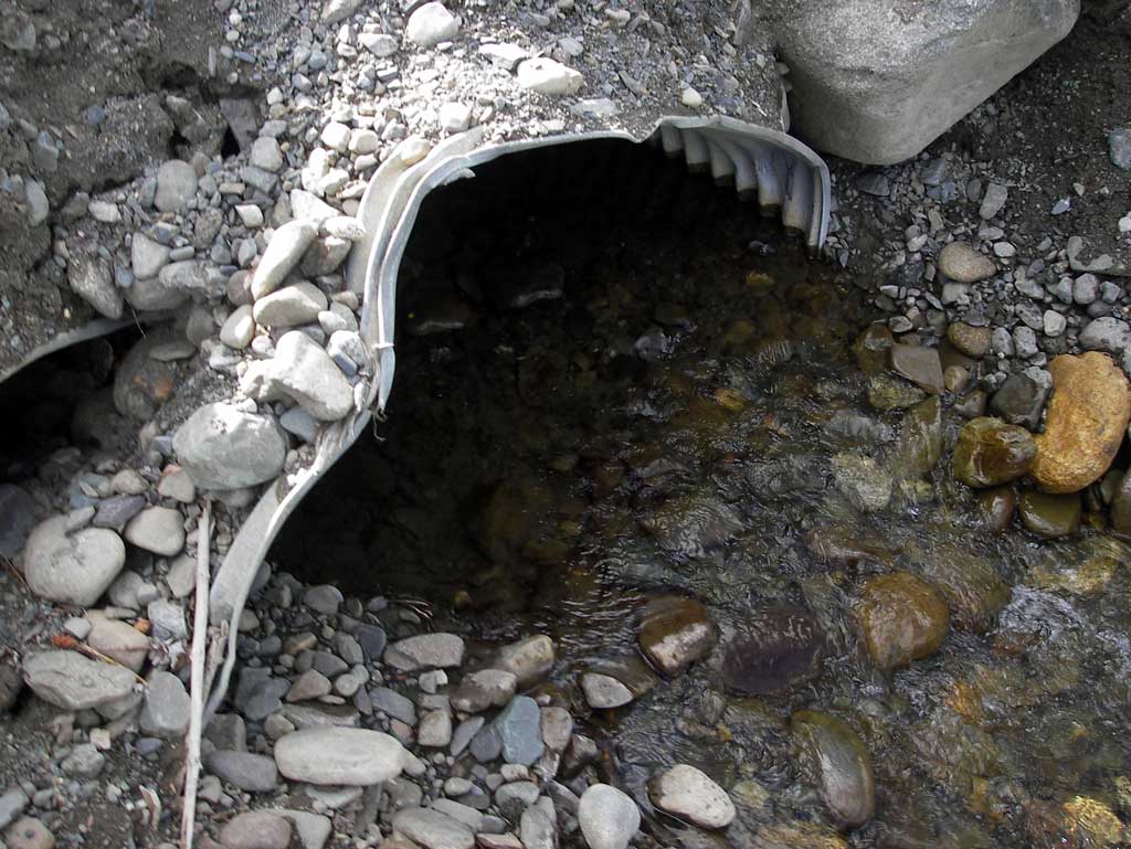
- Outfall height red
- Culvert sagging in middle
- Structural Problem
- Mechanical damage or joints parting
- Shallow fill; inadequate roadfill volume above culvert
- Sediment accumulation
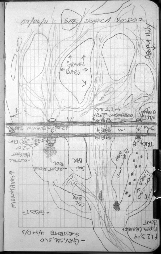
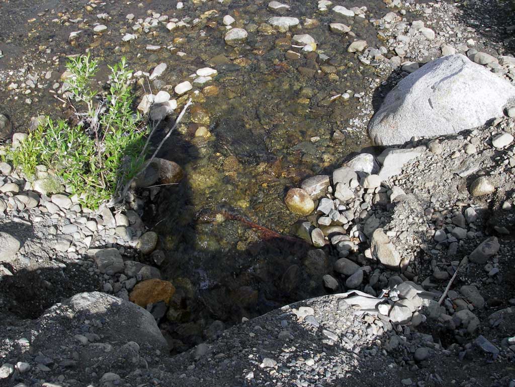
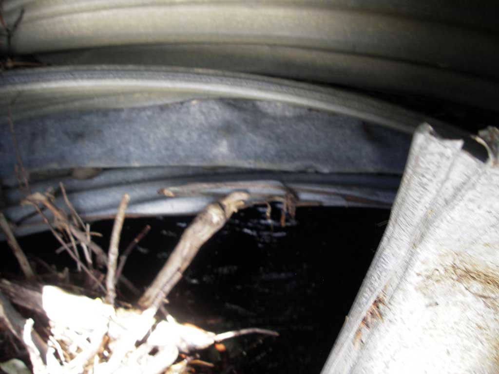
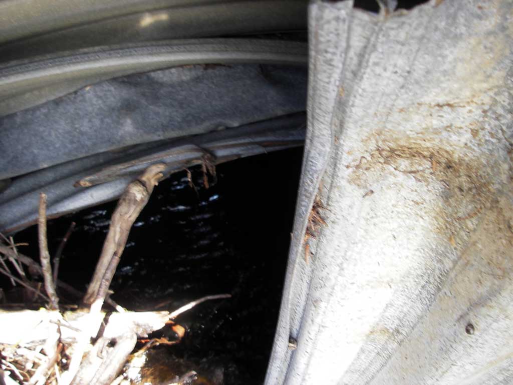
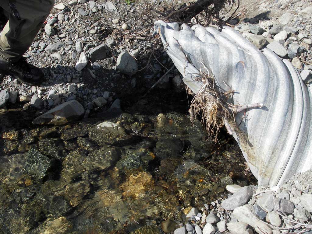
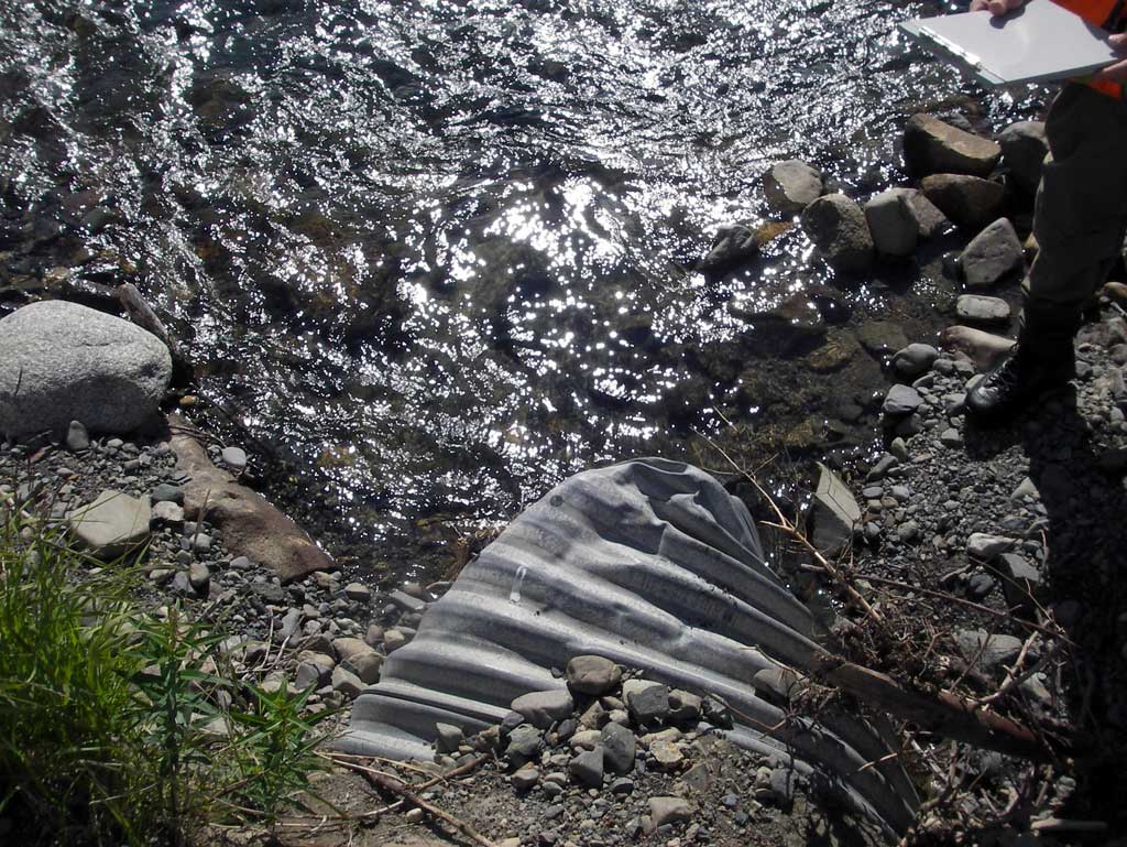
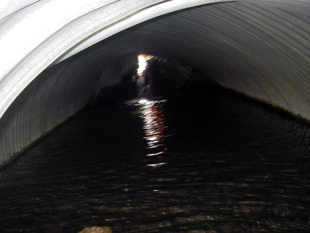
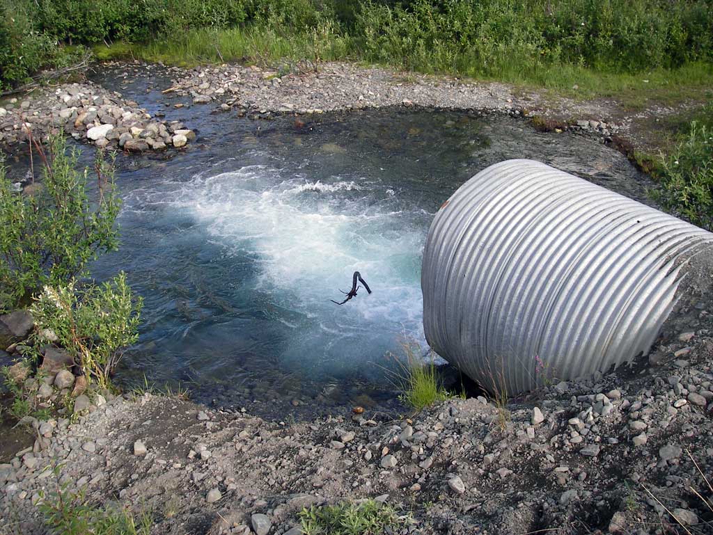
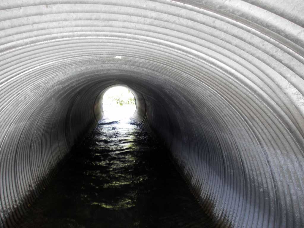
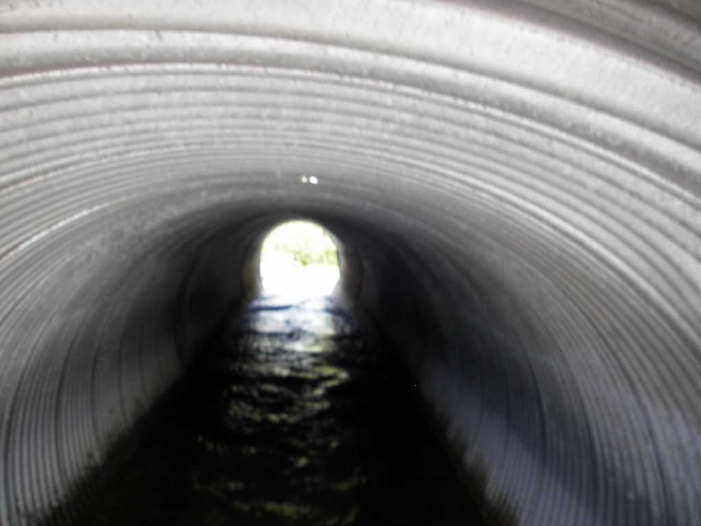
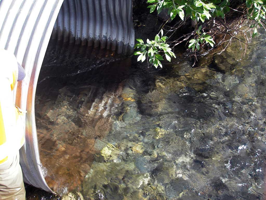
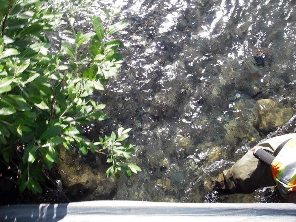
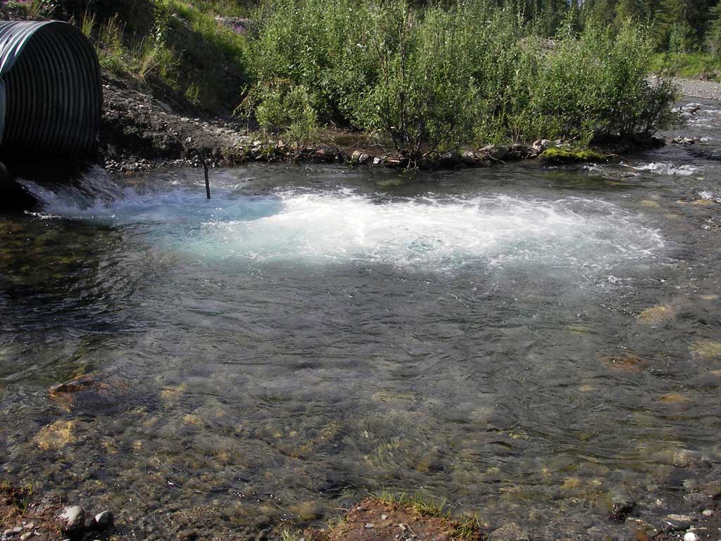
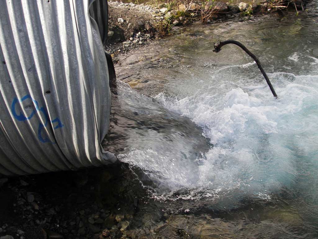
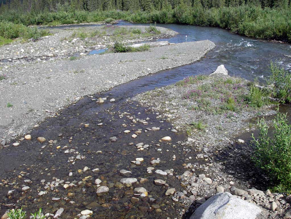
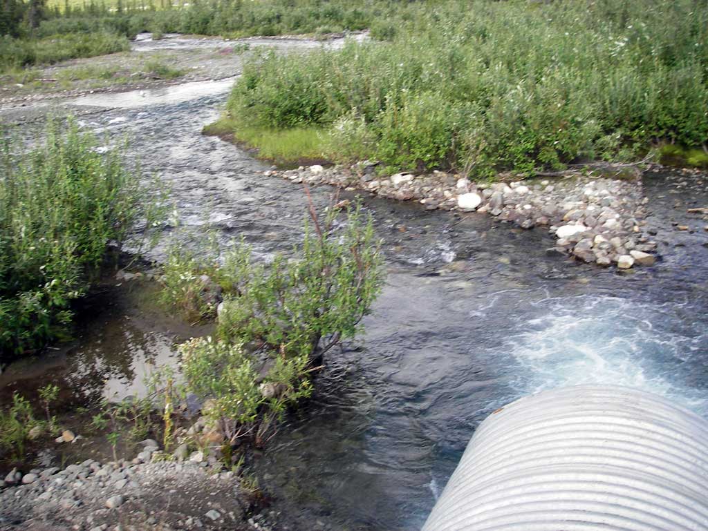
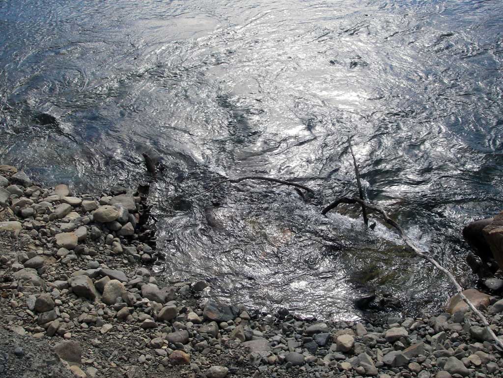
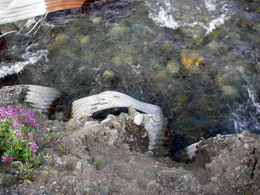
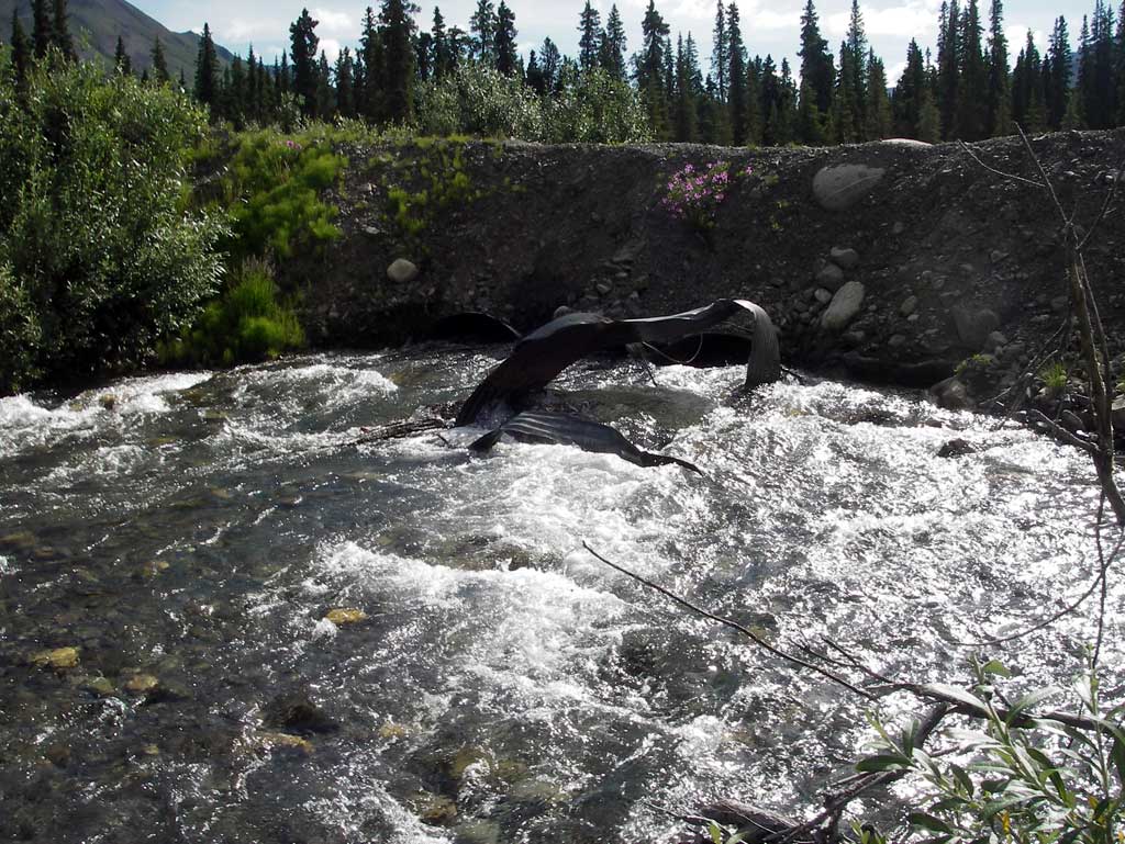
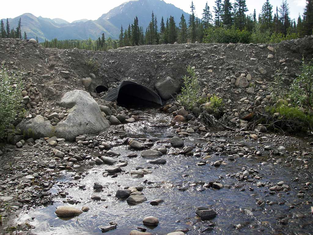
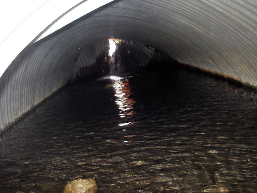
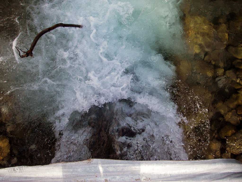
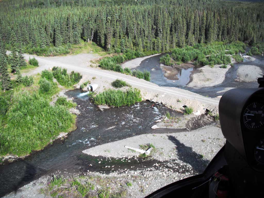
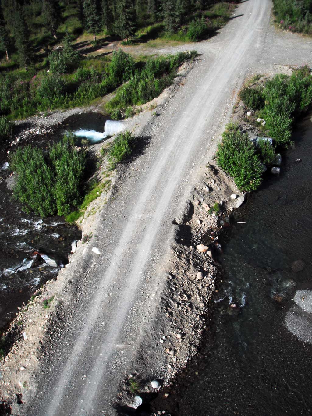
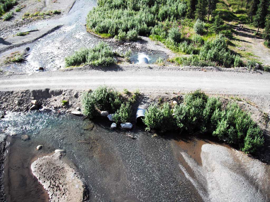
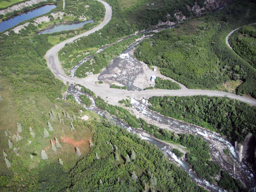
Comments: A series of five culverts of various sizes used to cross a wide braided Windy Creek. Pipe 1 inlet was 75% smashed and creating a hydraulic jump > 2.0 in pipe inlet and inlet was also plugged with debris. Pipes 2,3, and 4 inlets were totally submerged and 80% plugged with debris creating a very strong hydraulic. Pipes 2-4 outlets were 80% full of water and very strong current. Pipe 5 was the only culvert with no debris restrictions or pipe defects had a .78' outfall height. Residents stated that they commonly observe large amounts of fish downstream of road and nothing upstream.
Culvert Measurements
| ID: 1 |
Structure Type: Circular pipe (Corrugated steel) |
Fish Passage Rating: Gray |
| |
| Length(ft): 24.0 |
| Inlet Type: Projecting |
| Outlet Type: Projecting |
| Corrugation Depth(in.): 1.0 |
| Corrugation Width(in.): 3.0 |
| Condition Rating(1-5): 1 |
| Approach Angle: 3.0 |
| Sedimentation At Inlet: No |
| Inlet Substrate: Cobble |
| Outlet Substrate: Cobble |
|
| Inlet | Outlet |
|---|
| Width(ft): | 0.9 | 6.35 |
| Height(ft): | 1.1 | 2.25 |
| Apron Length(ft): | 0.0 | 0.0 |
| Water Depth(ft): | | 0.39 |
| Rustline Height(ft): | | |
| Substrate Depth(ft): | 2.0 | 2.0 |
|
| Backwatered?: No |
| Baffles Present: No |
| Embedded?: Yes |
| Embedded Depth(ft): 2.0 |
| Outfall Height: 0.0 |
| Outfall Type: At Stream Grade |
Constriction Ratio: 0.37 |
| Culvert Gradient: 3.45% |
| Max Slope: |
| Max Slope Length: |
|
| |
Culvert Observations:
- Culvert sagging in middle
- Structural Problem
- Mechanical damage or joints parting
- Shallow fill; inadequate roadfill volume above culvert
|
| ID: 2 |
Structure Type: Circular pipe (Corrugated steel) |
Fish Passage Rating: Gray |
| |
| Length(ft): 40.3 |
| Inlet Type: Projecting |
| Outlet Type: Projecting |
| Corrugation Depth(in.): 0.5 |
| Corrugation Width(in.): 3.0 |
| Condition Rating(1-5): 1 |
| Approach Angle: 3.0 |
| Sedimentation At Inlet: No |
| Inlet Substrate: Cobble |
| Outlet Substrate: Cobble |
|
| Inlet | Outlet |
|---|
| Width(ft): | | 4.0 |
| Height(ft): | | 2.65 |
| Apron Length(ft): | 0.0 | 0.0 |
| Water Depth(ft): | | 1.6 |
| Rustline Height(ft): | | |
| Substrate Depth(ft): | | |
|
| Backwatered?: No |
| Baffles Present: No |
| Embedded?: No |
| Outfall Height: 0.0 |
| Outfall Type: At Stream Grade |
Constriction Ratio: |
| Culvert Gradient: 1.20% |
| Max Slope: |
| Max Slope Length: |
|
| |
Comments: Inlet was totally submerged and had a very strong hydraulic current so measurements could not be taken. |
| |
Culvert Observations:
- Culvert sagging in middle
- Structural Problem
- Mechanical damage or joints parting
- Shallow fill; inadequate roadfill volume above culvert
|
| ID: 3 |
Structure Type: Circular pipe (Corrugated steel) |
Fish Passage Rating: Gray |
| |
| Length(ft): 40.3 |
| Inlet Type: Projecting |
| Outlet Type: Projecting |
| Corrugation Depth(in.): 0.5 |
| Corrugation Width(in.): 3.0 |
| Condition Rating(1-5): 1 |
| Approach Angle: 3.0 |
| Sedimentation At Inlet: No |
| Inlet Substrate: Cobble |
| Outlet Substrate: Cobble |
|
| Inlet | Outlet |
|---|
| Width(ft): | | 4.0 |
| Height(ft): | | 2.5 |
| Apron Length(ft): | 0.0 | 0.0 |
| Water Depth(ft): | | 1.55 |
| Rustline Height(ft): | | |
| Substrate Depth(ft): | | |
|
| Backwatered?: No |
| Baffles Present: No |
| Embedded?: No |
| Outfall Height: 0.0 |
| Outfall Type: At Stream Grade |
Constriction Ratio: 0.37 |
| Culvert Gradient: 0.00% |
| Max Slope: |
| Max Slope Length: |
|
| |
Comments: Inlet was totally submerged and blocked with debris creating a very stron hydraulic current so inlet measurements could not be taken. |
| |
Culvert Observations:
- Constriction ratio red
- Culvert sagging in middle
- Structural Problem
- Mechanical damage or joints parting
- Shallow fill; inadequate roadfill volume above culvert
|
| ID: 4 |
Structure Type: Circular pipe (Corrugated steel) |
Fish Passage Rating: Gray |
| |
| Length(ft): 40.3 |
| Inlet Type: Projecting |
| Outlet Type: Projecting |
| Corrugation Depth(in.): 0.5 |
| Corrugation Width(in.): 3.0 |
| Condition Rating(1-5): 1 |
| Approach Angle: 3.0 |
| Sedimentation At Inlet: No |
| Inlet Substrate: Cobble |
| Outlet Substrate: Cobble |
|
| Inlet | Outlet |
|---|
| Width(ft): | | 4.0 |
| Height(ft): | | 3.35 |
| Apron Length(ft): | 0.0 | 0.0 |
| Water Depth(ft): | | 2.12 |
| Rustline Height(ft): | | |
| Substrate Depth(ft): | | |
|
| Backwatered?: No |
| Baffles Present: No |
| Embedded?: No |
| Outfall Height: 0.0 |
| Outfall Type: At Stream Grade |
Constriction Ratio: 0.37 |
| Culvert Gradient: 1.20% |
| Max Slope: |
| Max Slope Length: |
|
| |
Comments: Inlet was totally submerged and partially smashed with debris creating a strong hydraulic and making inlet measurements impossible. Very swift flow at inlets and outlets of pipes 2-4 making measurements difficult. |
| |
Culvert Observations:
- Culvert sagging in middle
- Structural Problem
- Mechanical damage or joints parting
- Shallow fill; inadequate roadfill volume above culvert
|
| ID: 5 |
Structure Type: Circular pipe (Corrugated steel) |
Fish Passage Rating: Red |
| |
| Length(ft): 60.5 |
| Inlet Type: Projecting |
| Outlet Type: Projecting |
| Corrugation Depth(in.): 0.5 |
| Corrugation Width(in.): 3.0 |
| Condition Rating(1-5): 2 |
| Approach Angle: 3.0 |
| Sedimentation At Inlet: No |
| Inlet Substrate: Cobble |
| Outlet Substrate: Cobble |
|
| Inlet | Outlet |
|---|
| Width(ft): | 5.82 | 5.9 |
| Height(ft): | 6.1 | 5.05 |
| Apron Length(ft): | 0.0 | 0.0 |
| Water Depth(ft): | | 1.1 |
| Rustline Height(ft): | 2.15 | |
| Substrate Depth(ft): | 0.0 | 0.0 |
|
| Backwatered?: No |
| Baffles Present: No |
| Embedded?: No |
| Outfall Height: 0.78 |
| Outfall Type: Free Fall In To Pool |
Constriction Ratio: 0.37 |
| Culvert Gradient: 0.90% |
| Max Slope: |
| Max Slope Length: |
|
| |
Comments: Pipe 5 was the only large pipe of the five which did not have any inlet obstructions although it did have an outfall height of .78 and very swift flow. |
| |
Culvert Observations:
- Shallow fill; inadequate roadfill volume above culvert
- Outfall height red
|
Stream Measurements
| Stream Substrates | Upstream | Downstream |
|---|
| Dominant: | Gravel | Gravel |
| Subdominant: | Cobble | Cobble |
|
| Stream Slope(deg.): | 0.85 |
|---|
| Stream Flow Stage: | Medium |
|---|
|
| Stream Width Type |
Distance From
Crossing (ft) |
Stream
Width (ft) |
| Downstream ordinary high water |
|
|
Elevations
| Locator ID |
Culvert
Number |
River
Distance (ft)1 |
Distance From
Crossing (ft)2 |
Relative
Elevation (ft) |
| D/S Grade Ctrl (Thalweg) (Continuous riffle) |
|
0.00 |
|
85.14 |
| D/S Water Surface Elev |
|
0.00 |
|
86.20 |
| D/S Grade Ctrl (Thalweg) (middle of riffle) |
|
56.00 |
|
85.43 |
| D/S Water Surface Elev |
|
56.00 |
|
87.00 |
| D/S Water Surface Elev |
|
156.00 |
|
87.53 |
| D/S Grade Ctrl (Thalweg) (bottome of common riffle) |
|
156.00 |
|
86.24 |
| Max Pool Depth (Outlet pool) |
5 |
300.00 |
|
86.13 |
| D/S Water Surface Elev (Water surface at pipe 5 outlet invert) |
5 |
300.00 |
|
90.20 |
| D/S Water Surface Elev (Water surface at pipe 1 outlet invert) |
1 |
300.00 |
|
90.21 |
| Outlet Invert (Too swift to survey for inverts. Measured with measuring stick.) |
5 |
300.00 |
|
90.51 |
| Outlet Culvert Top |
2 |
300.00 |
|
90.67 |
| Outlet Culvert Top |
4 |
300.00 |
|
90.88 |
| Outlet Invert (Too swift to survey for inverts. Measured with measuring stick.) |
4 |
300.00 |
|
87.53 |
| Outlet Invert (Too swift to survey for inverts. Measured with measuring stick.) |
2 |
300.00 |
|
88.02 |
| Outlet Invert (Too swift to survey for inverts. Measured with measuring stick.) |
3 |
300.00 |
|
88.50 |
| Outlet Pool Water Elev (Water surface of outlet pool) |
5 |
300.00 |
|
89.42 |
| D/S Water Surface Elev (Water surface at pipe 2 outlet invert) |
2 |
300.00 |
|
89.72 |
| D/S Water Surface Elev (Water surface at pipe 3 outlet invert) |
3 |
300.00 |
|
89.76 |
| Outlet Invert (On substrate) |
1 |
300.00 |
|
89.82 |
| D/S Water Surface Elev (Water surface at pipe 4 outlet invert) |
4 |
300.00 |
|
89.85 |
| Outlet Culvert Top |
3 |
300.00 |
|
91.00 |
| Outlet Culvert Top (pipe crushed) |
1 |
300.00 |
|
92.74 |
| Outlet Culvert Top |
5 |
300.00 |
|
95.56 |
| U/S Water Surface Elev (Water surface at pipe 1 inlet invert) |
1 |
324.00 |
|
92.40 |
| Inlet Culvert Top |
1 |
324.00 |
|
93.57 |
| Inlet Culvert Invert |
1 |
324.00 |
|
91.71 |
| Road Elev |
|
330.00 |
|
96.68 |
| U/S Water Surface Elev (Water surface of pipes 2,3, and 4 due to the fact that they are completely submerged, bent and smashed.) |
234 |
340.30 |
|
91.95 |
| Inlet Culvert Top |
4 |
340.30 |
|
91.44 |
| Inlet Culvert Top |
2 |
340.30 |
|
91.47 |
| Inlet Culvert Top |
3 |
340.30 |
|
90.94 |
| Inlet Culvert Invert |
5 |
360.50 |
|
89.92 |
| U/S Water Surface Elev (Water surface at pipe 5 inlet invert) |
5 |
360.50 |
|
91.88 |
| Inlet Culvert Top |
5 |
360.50 |
|
96.12 |
| U/S Thalweg (Profile point in which all pipes have in common. Channel extremely braided.) |
|
660.00 |
|
94.35 |
| U/S Water Surface Elev |
|
660.00 |
|
94.68 |
Notes:
- River distance is measured continuously throughout the survey reach along the thalweg of the stream.
- Measured from each end of the crossing along the thalweg of the stream.
Fish Sampling Efforts
| Gear Type: Minnow Trap (B) |
Trap Duration(h): 2.0 |
| Comments: Trap set dwst and no fish caught. |
Fish Observations
No fish observations occurred during this survey.
Questions or comments about this report can be directed to dfg.dsf.webmaster@alaska.gov