Fish Passage Site 20501521
Coordinates (dec. deg.): 61.77174°, -150.06174°
Legal Description: S019N004W06
Region: South Central
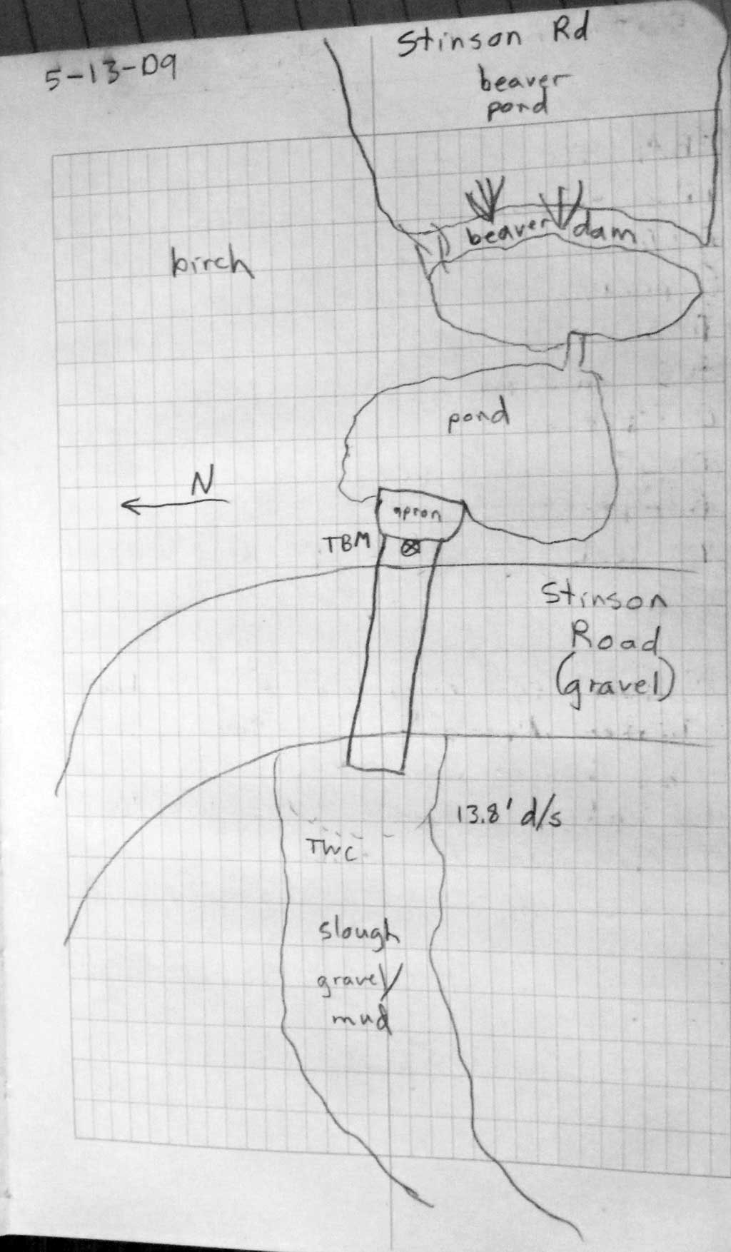
Road Name: Stinson Road
Datum: WGS84
Quad Name / ITM: Tyonek D-1
AWC Stream #:
Stream Name: Willow Creek tributary
Elevation:
Site Comments: None
Survey PRK09-STN01
Project Supervisor: Gillian O'Doherty, ADFG
Observers: Heidi Zimmer, Gillian O'Doherty
Overall Fish Passage Rating:
Tidal: No
Backwatered: Yes
Step Pools: No
Construction Year:
Site Observations:
- Beaver Activity
- Shallow fill; inadequate roadfill volume above culvert
- Inlet apron too steep
Comments: HWS= TWS= backwatered. No CR b/c u/s is beaver pond and d/s is slough.
Culvert Measurements
| ID: 1 | Structure Type: Circular pipe (Structural steel plate) | Fish Passage Rating: | |||||||||||||||||||||||||||||||||||||||||
|
|
|
|||||||||||||||||||||||||||||||||||||||||
Culvert Observations:
|
|||||||||||||||||||||||||||||||||||||||||||
Stream Measurements
|
|
No stream width data available.
Elevations
| Locator ID | Culvert Number |
River Distance (ft)1 |
Distance From Crossing (ft)2 |
Relative Elevation (ft) |
|---|---|---|---|---|
| D/S Grade Ctrl (Thalweg) | 1 | 0.00 | 34.5 | 95.09 |
| D/S Water Surface Elev (WS @ GP) | 1 | 0.00 | 34.5 | 97.61 |
| D/S Tailcrest or 1st Thalweg | 1 | 18.70 | 15.8 | 95.94 |
| D/S Water Surface Elev (WS @ TWC) | 1 | 18.70 | 15.8 | 97.55 |
| D/S Thalweg | 1 | 21.40 | 13.1 | 95.80 |
| D/S Thalweg | 1 | 25.50 | 9.0 | 95.49 |
| Outlet Invert | 1 | 34.50 | 0.0 | 95.50 |
| Outlet Pool Water Elev | 1 | 34.50 | 0.0 | 97.57 |
| Road Elev | 1 | 54.50 | 101.20 | |
| U/S Headwater | 1 | 74.50 | 0.0 | 97.56 |
| Inlet Culvert Invert | 1 | 74.50 | 0.0 | 96.05 |
| U/S Thalweg (end of apron) | 1 | 80.30 | 5.8 | 96.87 |
| U/S Thalweg (streambed at end of apron (on mud)) | 1 | 80.40 | 5.9 | 95.80 |
Notes:
- River distance is measured continuously throughout the survey reach along the thalweg of the stream.
- Measured from each end of the crossing along the thalweg of the stream.
Fish Sampling Efforts
No fish sampling occurred during this survey.
Fish Observations
No fish observations occurred during this survey.
Photos
Questions or comments about this report can be directed to dfg.dsf.webmaster@alaska.gov