Fish Passage Site 20501520
Coordinates (dec. deg.): 61.99387°, -149.96294°
Legal Description: S022N004W14
Region: South Central
Road Name: South Silver Salmon Drive
Datum: WGS84
Quad Name / ITM: Anchorage D-8
AWC Stream #: 247-41-10200-2190-3020
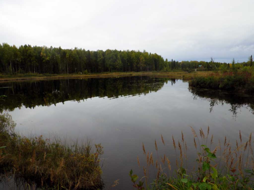
Stream Name: Caswell Creek tributary
Elevation:
Site Comments: None
arrow to the right of the survey date below to choose a different report for this site.
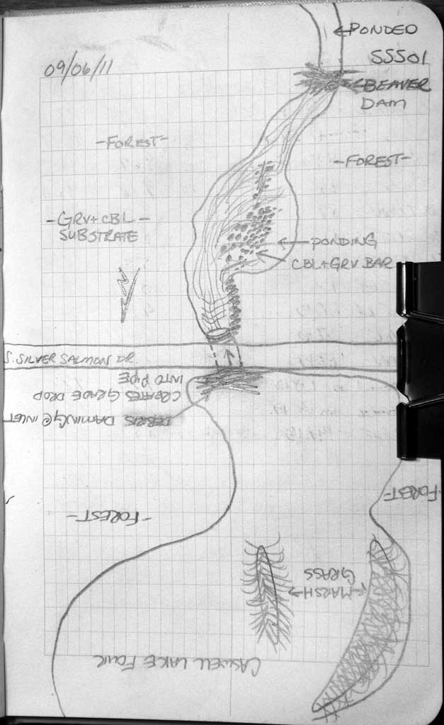
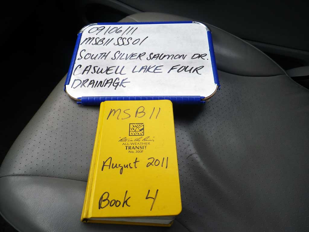
Survey MSB11-SSS01
Project Supervisor: Gillian O'Doherty, Alaska Department of Fish and Game
— Anchorage, AK
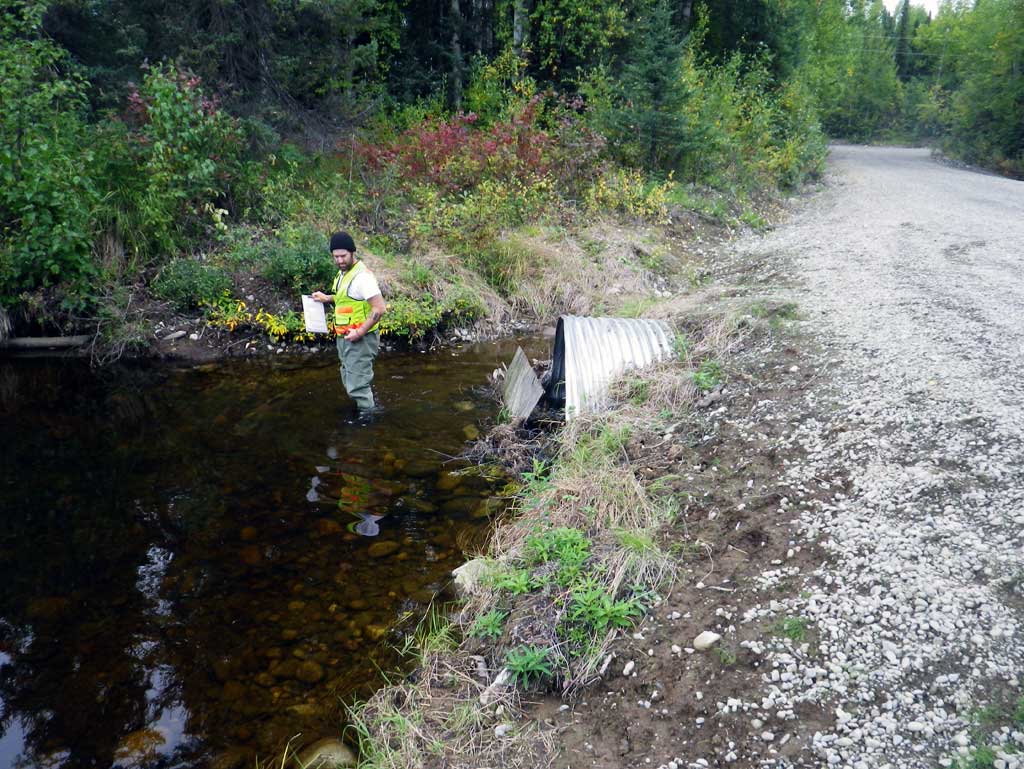
Observers: Abraham Gioffre, Jim Latham
Overall Fish Passage Rating:
Tidal: No
Backwatered: No
Step Pools: Yes
Construction Year: 2011
Site Observations:
- Culvert gradient gray
- Beaver Activity
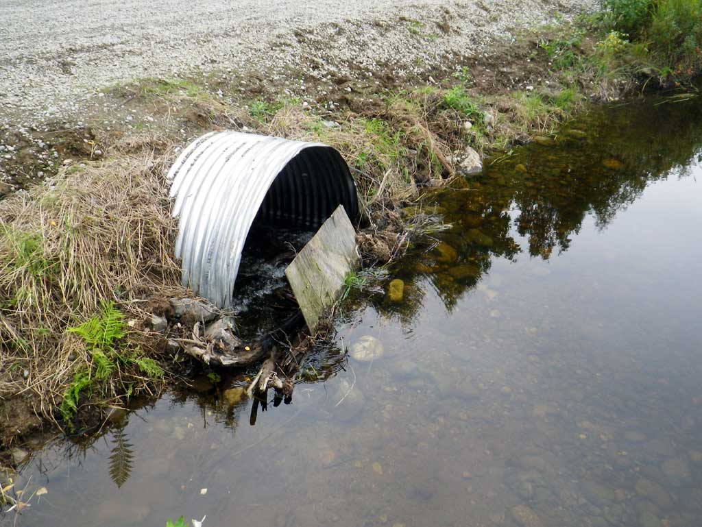
- Inlet perch
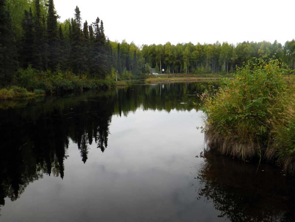
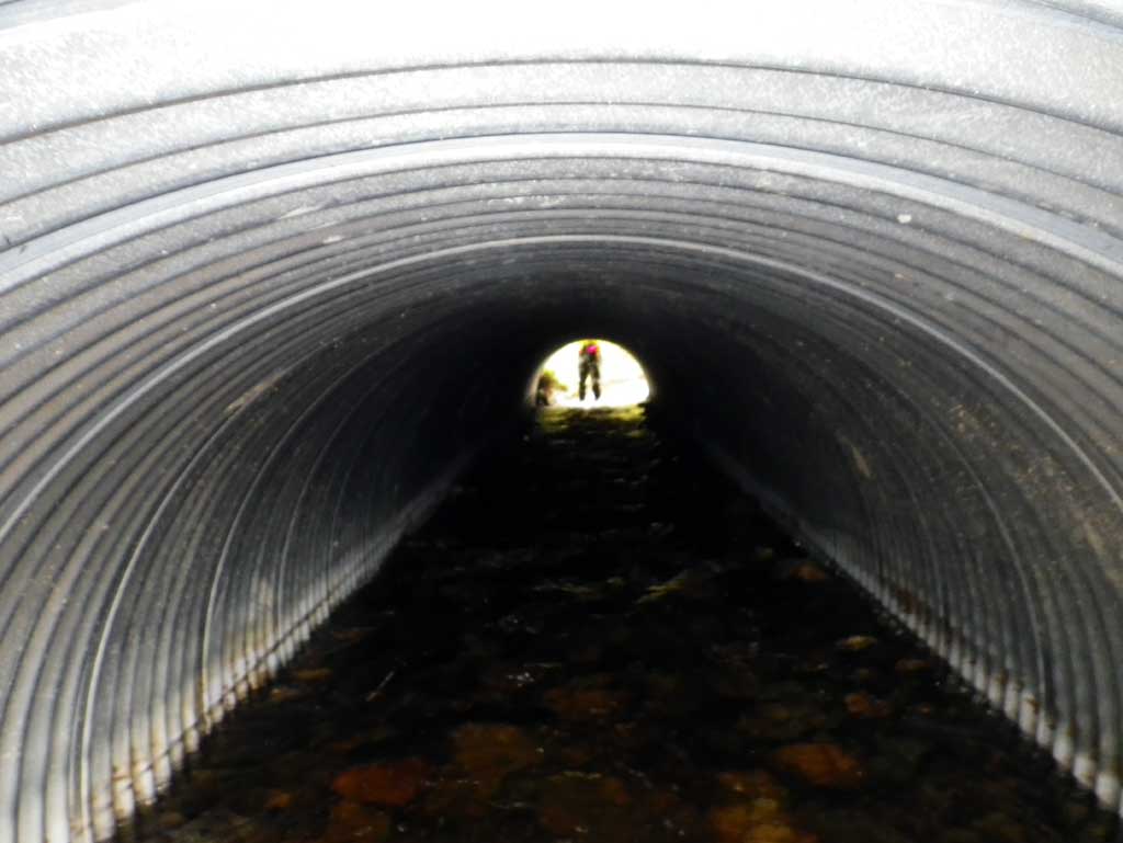
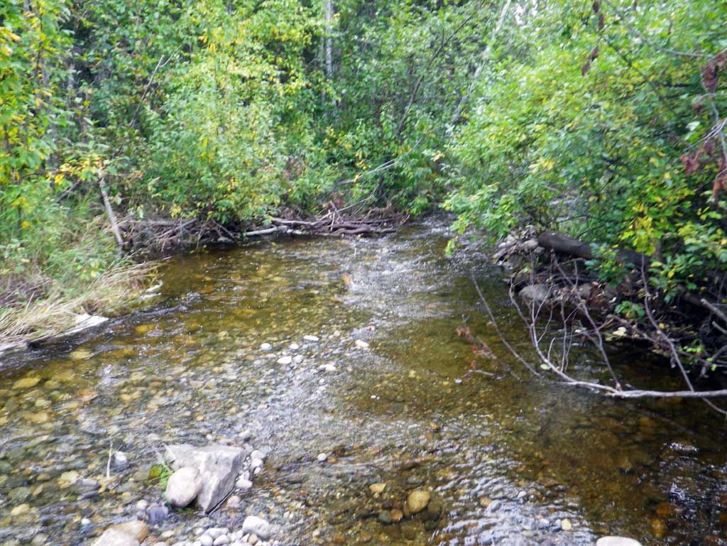
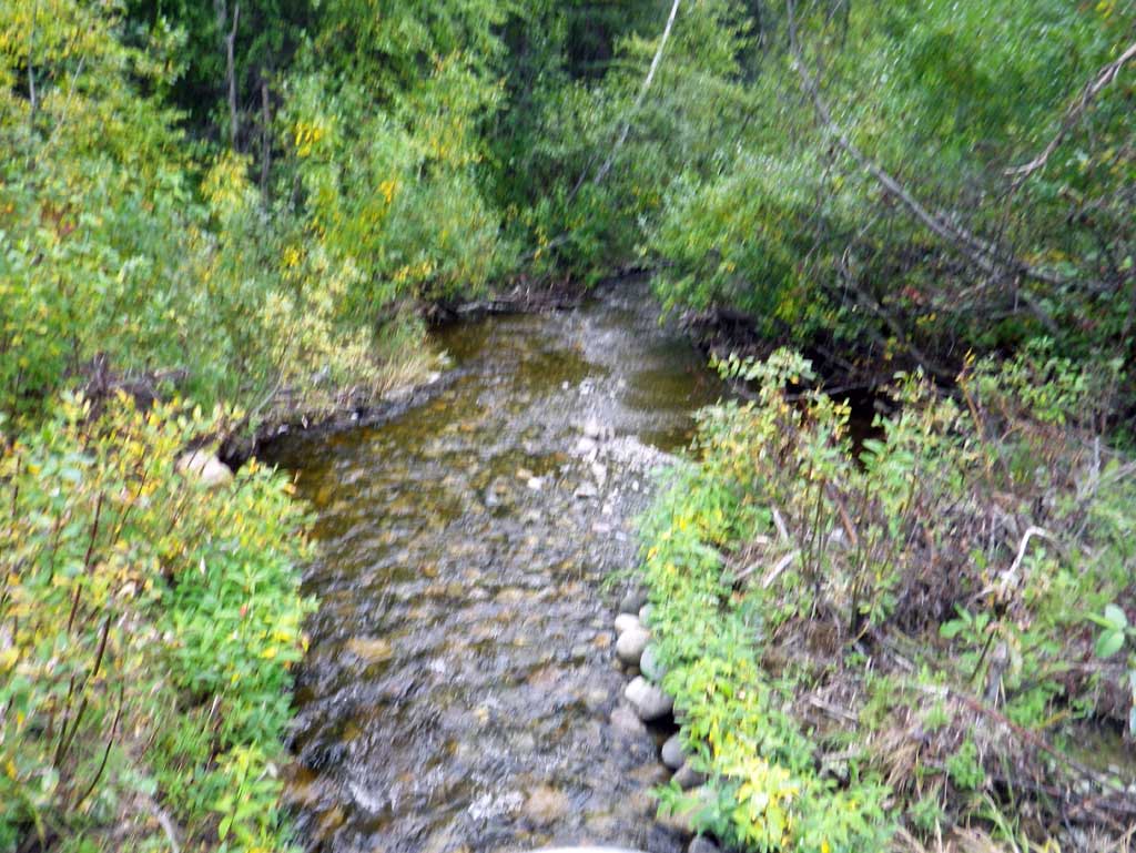
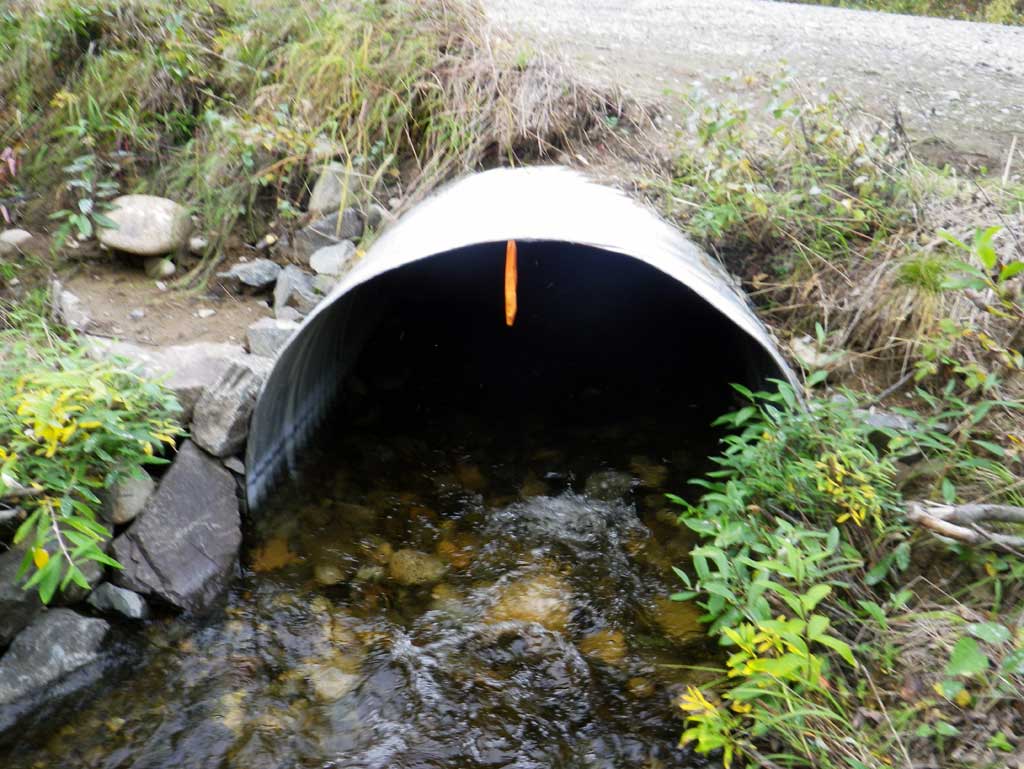
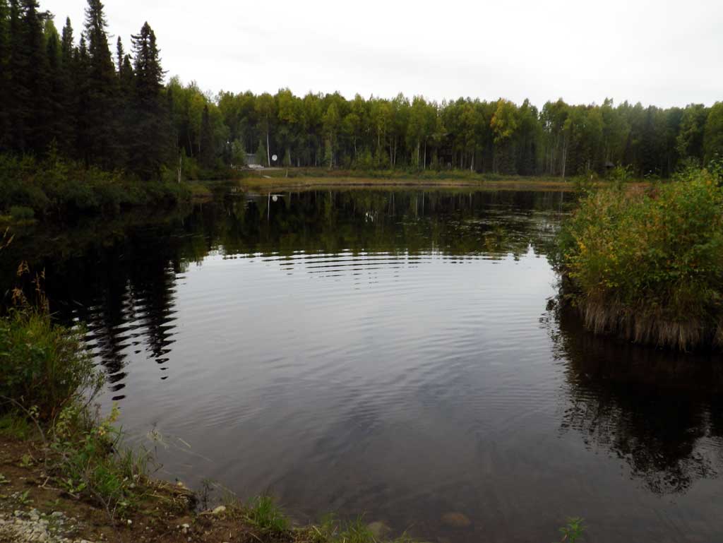
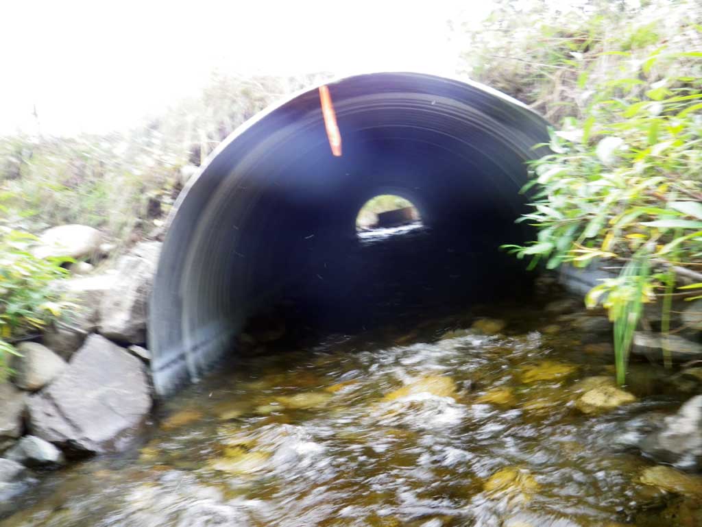
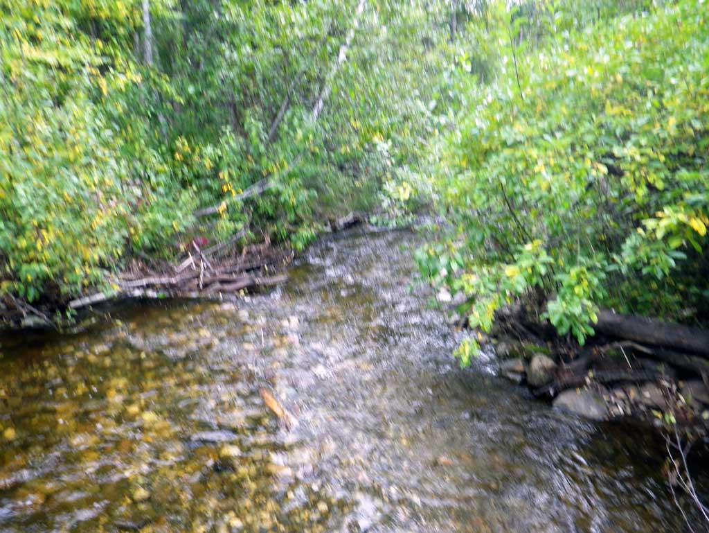
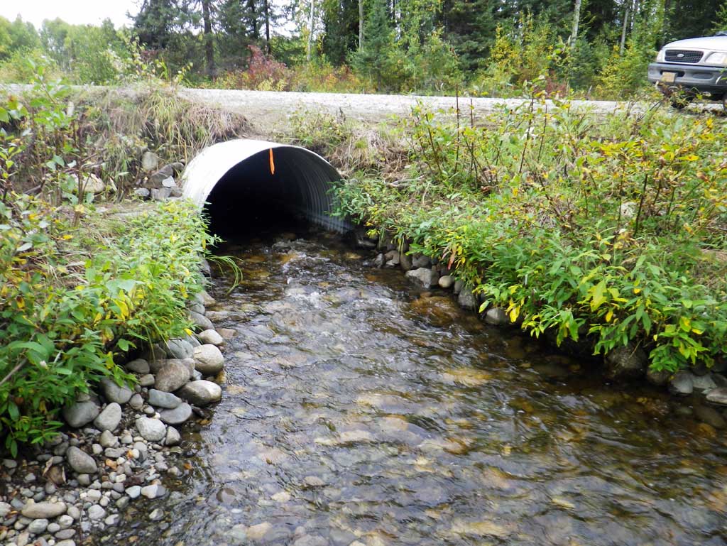
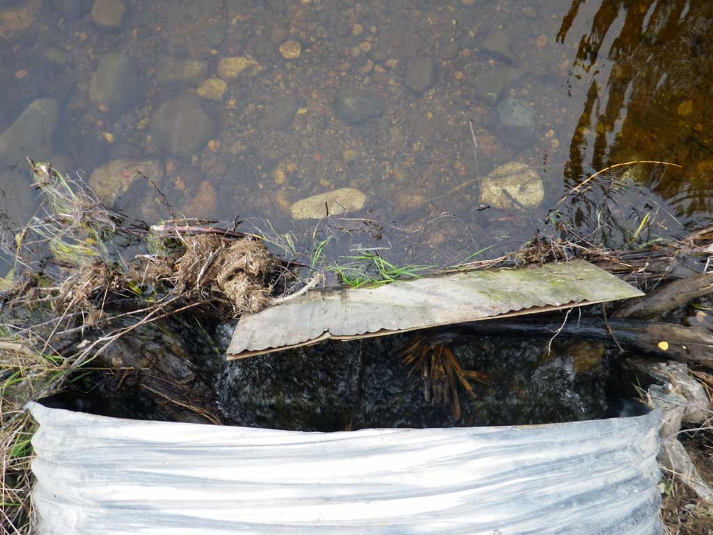
Comments: Survey of a replacement culvert on South Silver Salmon Drive. Upst is Caswell Lake IV and dwst is a cobble gravel riffle which flows to a beaver dam about 175' dwst. About 90' dwst the riffle area connects to the beginning of the beaver pool water surface elevation. No stream widths or gradients taken due to upst lake and dwst beaver impoundment.
Culvert Measurements
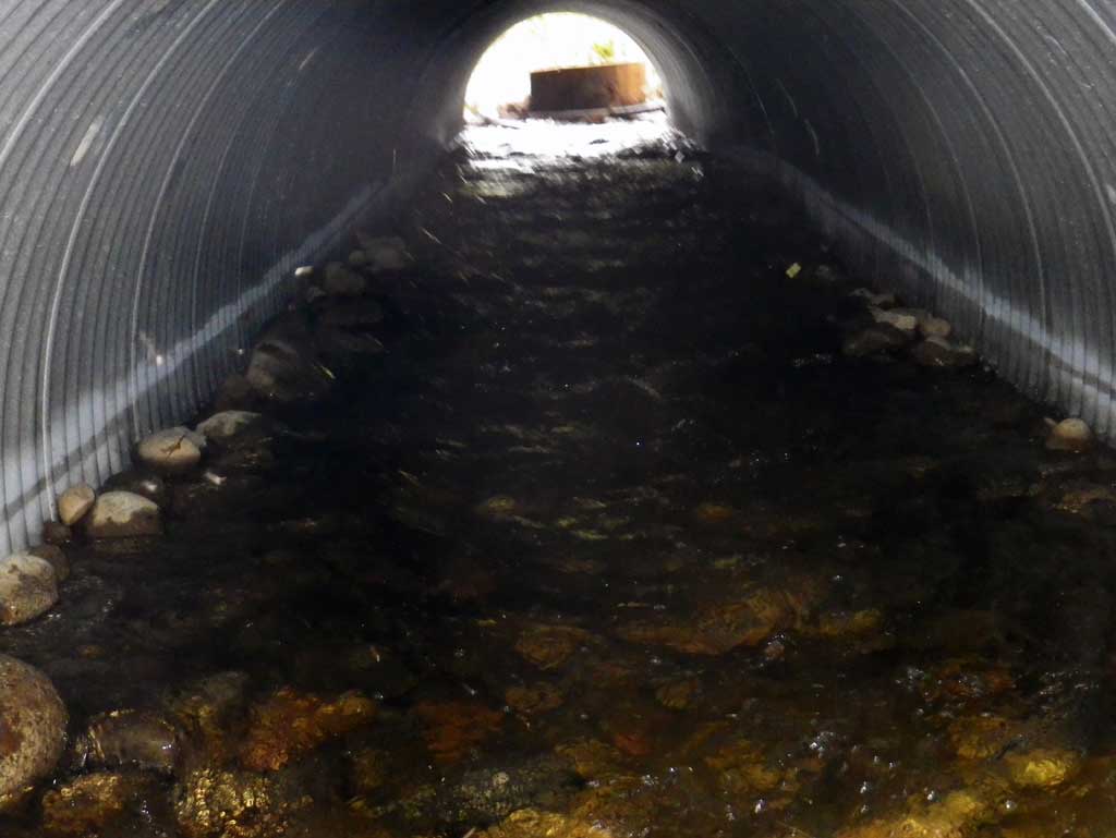
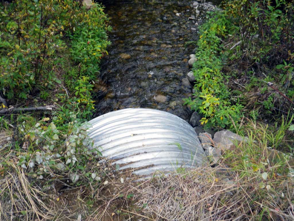
| ID: 1 | Structure Type: Circular pipe (Structural steel plate) | Fish Passage Rating: | ||||||||||||||||||||||||||||||||||||||||||
|
|
|
||||||||||||||||||||||||||||||||||||||||||
Culvert Observations:
|
||||||||||||||||||||||||||||||||||||||||||||
Stream Measurements
|
|
No stream width data available.
Elevations
| Locator ID | Culvert Number |
River Distance (ft)1 |
Distance From Crossing (ft)2 |
Relative Elevation (ft) |
|---|---|---|---|---|
| D/S Thalweg (profile pt) | 0.00 | 93.15 | ||
| D/S Water Surface Elev | 0.00 | 94.18 | ||
| D/S Grade Ctrl (Thalweg) (grade pt where natural channel begins) | 43.00 | 94.53 | ||
| D/S Water Surface Elev | 43.00 | 95.02 | ||
| Outlet Culvert Top | 87.00 | 98.90 | ||
| Outlet Invert (invert on substrate) | 87.00 | 94.70 | ||
| D/S Water Surface Elev (outlet water surface) | 87.00 | 95.41 | ||
| Road Elev | 112.00 | 100.98 | ||
| Inlet Culvert Top | 137.10 | 100.06 | ||
| Inlet Culvert Invert (invert on substrate) | 137.10 | 96.33 | ||
| U/S Water Surface Elev (inlet water surface) | 137.10 | 96.73 | ||
| U/S Grade Ctrl (Thalweg) (top of beaver dam) | 138.10 | 97.00 | ||
| U/S Water Surface Elev (water surface over dam) | 138.10 | 97.16 | ||
| U/S Water Surface Elev | 147.10 | 97.20 | ||
| U/S Grade Ctrl (Thalweg) (profile pt in Caswell Lake) | 147.10 | 95.33 |
Notes:
- River distance is measured continuously throughout the survey reach along the thalweg of the stream.
- Measured from each end of the crossing along the thalweg of the stream.
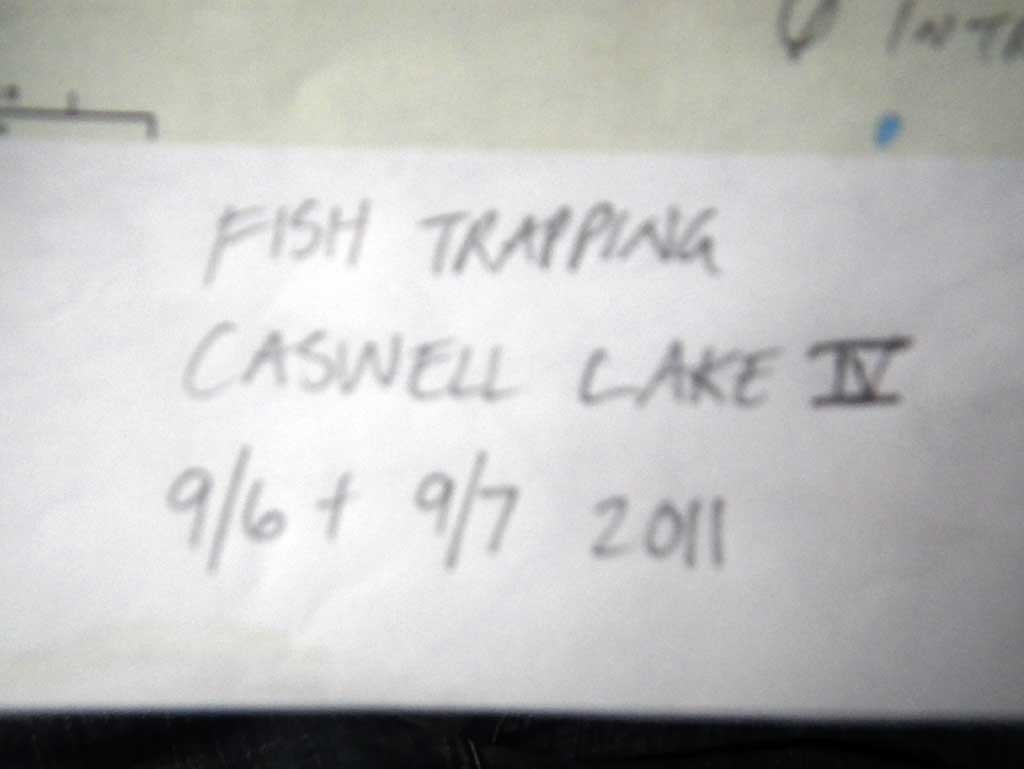
Fish Sampling Efforts
| Gear Type: Minnow Trap (A) | Trap Duration(h): 30.0 | |
| Comments: Trap set in lake away from culvert near boat launch. Set between 9/6/11 and 9/7/11. | ||
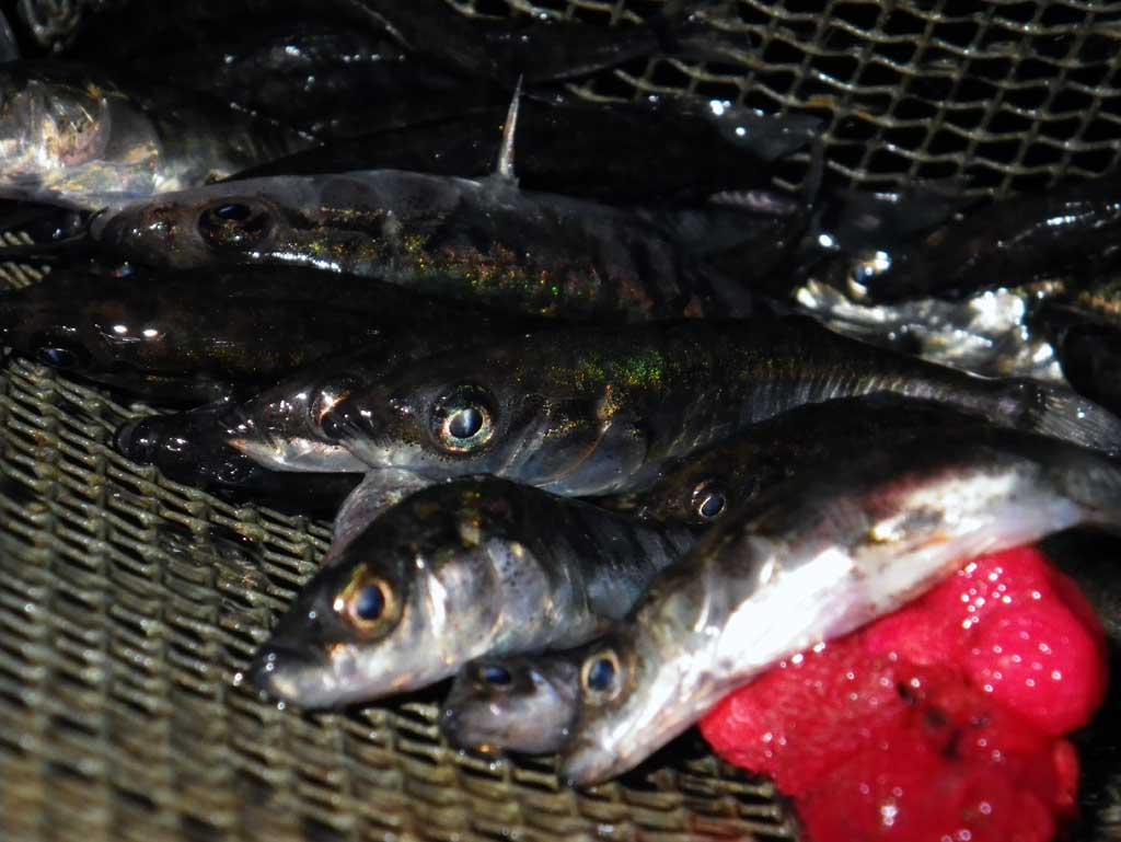
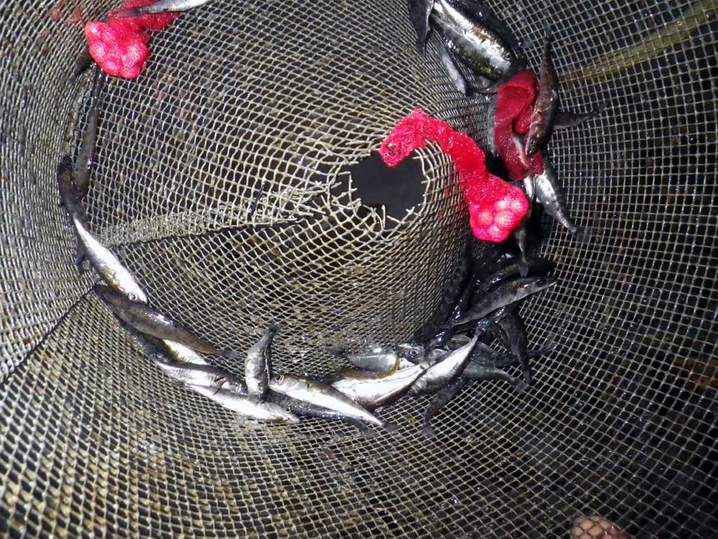
Fish Observations
| Species: threespine stickleback | Life History: Resident | ||
| Total Fish Observed: 30 | Fish Measured: | Fork Lengths (mm) Min: Max: Mean: | |
| Collected/Observed by Gear Type: Upstream Minnow Trap (30) | |||
Photos
Questions or comments about this report can be directed to dfg.dsf.webmaster@alaska.gov