Fish Passage Site 20501515
Coordinates (dec. deg.): 62.01909°, -149.94826°
Legal Description: S022N004W02
Region: South Central
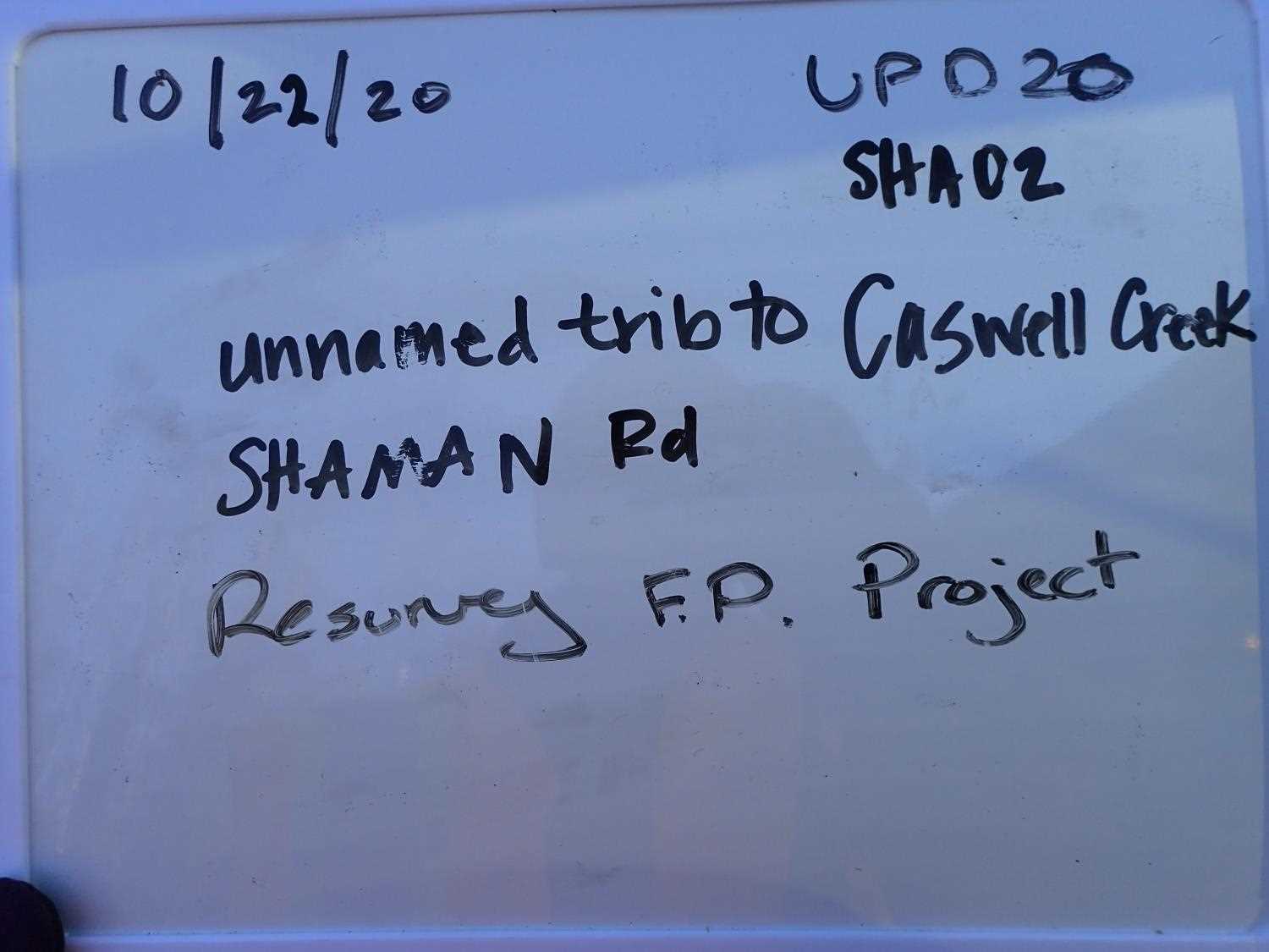
Road Name: Shaman Road
Datum: WGS84
Quad Name / ITM: Talkeetna Mts A-6
AWC Stream #: 247-41-10200-2190-3020-4052
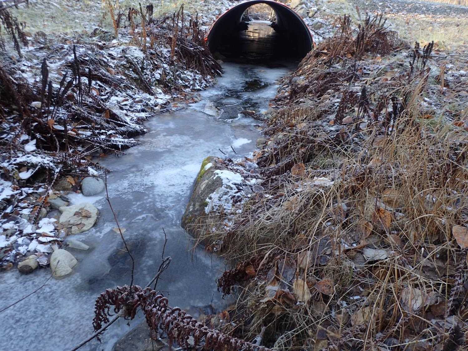
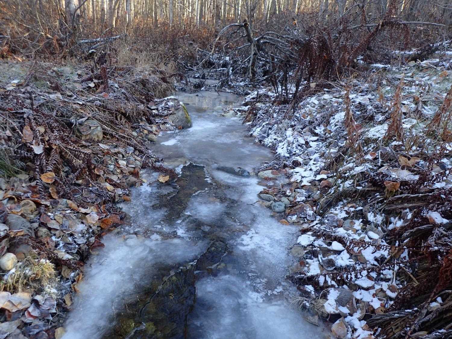
Stream Name: Caswell Creek Tributary
Elevation:
Site Comments: None
arrow to the right of the survey date below to choose a different report for this site.
Survey UPD20-SHA02
Project Supervisor: Gillian O'Doherty, Alaska Department of Fish and Game
— Anchorage, AK
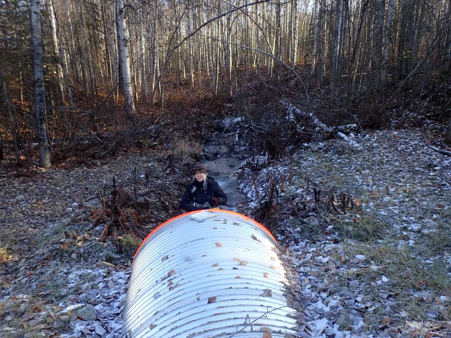
Observers: Gillian O'Doherty, Kim Clark
Overall Fish Passage Rating:
Tidal: No
Backwatered: No
Step Pools: No
Construction Year: 2019
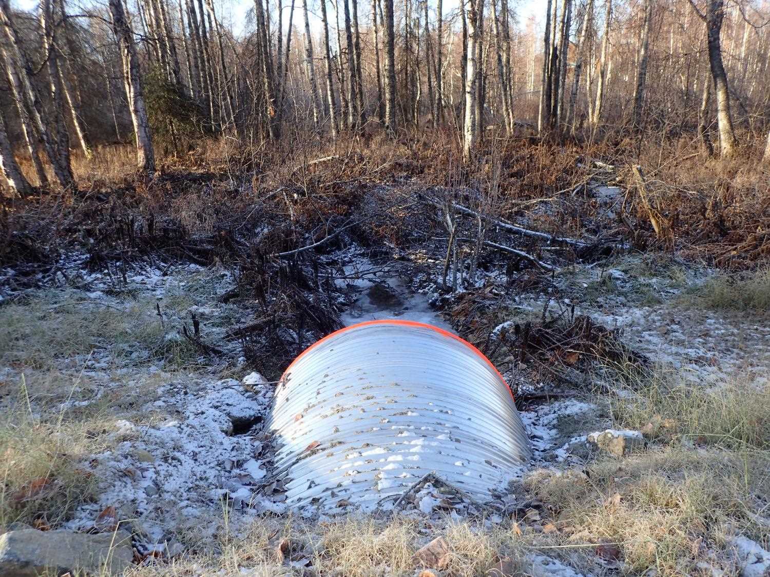
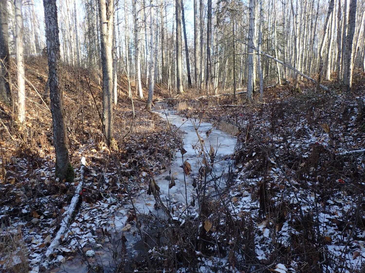
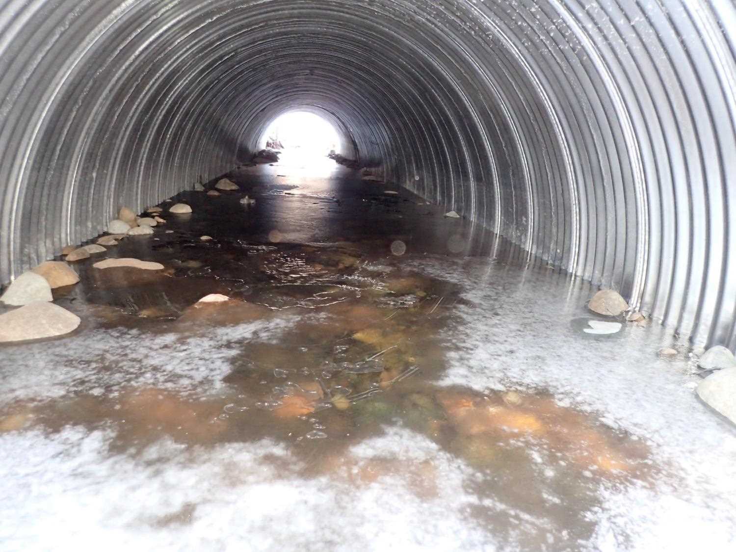
Comments: Shaman North per the plans. Landowner says it does not run all winter but was running at time of survey. Minor aggradation at inlet. Substrate is hard to see as stream is frozen with thick ice.
Culvert Measurements
| ID: 1 | Structure Type: Circular pipe (Corrugated steel) | Fish Passage Rating: | |||||||||||||||||||||||||||||||||||||||||
|
|
|
|||||||||||||||||||||||||||||||||||||||||
Comments: Due to ice outlet and inlet heights, water depth, and emebed depth were not measureable Per the designs: BFW 8 ft, Low flow channel consructed at 4' wide. OHM from old survey 5.83 ft. |
|||||||||||||||||||||||||||||||||||||||||||
Stream Measurements
|
|
No stream width data available.
Elevations
| Locator ID | Culvert Number |
River Distance (ft)1 |
Distance From Crossing (ft)2 |
Relative Elevation (ft) |
|---|---|---|---|---|
| Outlet Culvert Top (top of corregation) | 0.00 | 98.20 | ||
| Inlet Culvert Top | 60.46 | 99.22 |
Notes:
- River distance is measured continuously throughout the survey reach along the thalweg of the stream.
- Measured from each end of the crossing along the thalweg of the stream.
Fish Sampling Efforts
No fish sampling occurred during this survey.
Fish Observations
No fish observations occurred during this survey.
Photos


Questions or comments about this report can be directed to dfg.dsf.webmaster@alaska.gov