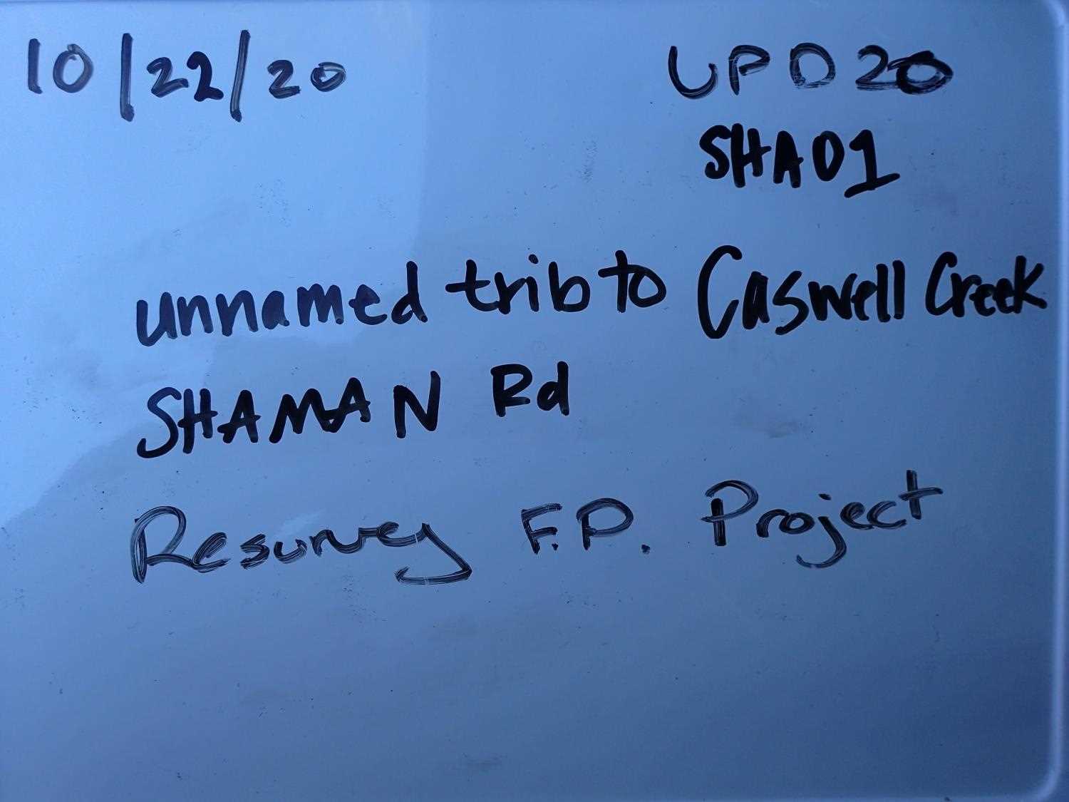
Fish Passage Site 20501514
Coordinates (dec. deg.): 62.01782°, -149.94847°
Legal Description: S022N004W11
Region: South Central
Road Name: Shaman Road
Datum: WGS84
Quad Name / ITM: Talkeetna Mts A-6
AWC Stream #: 247-41-10200-2190-3020
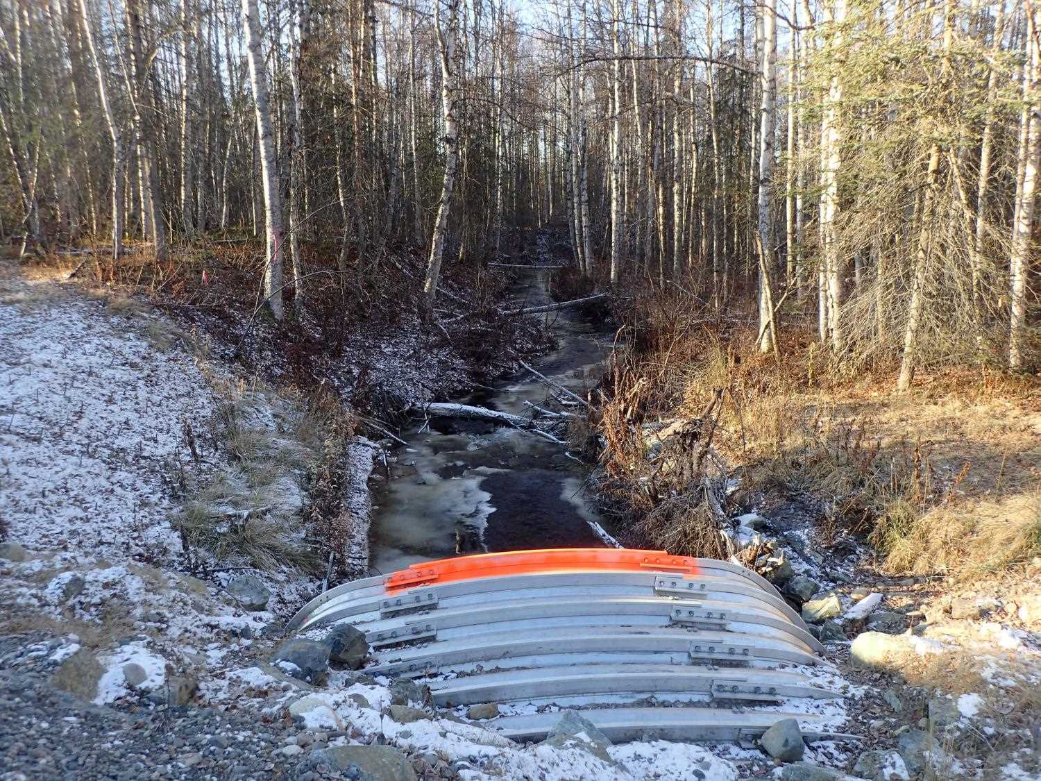
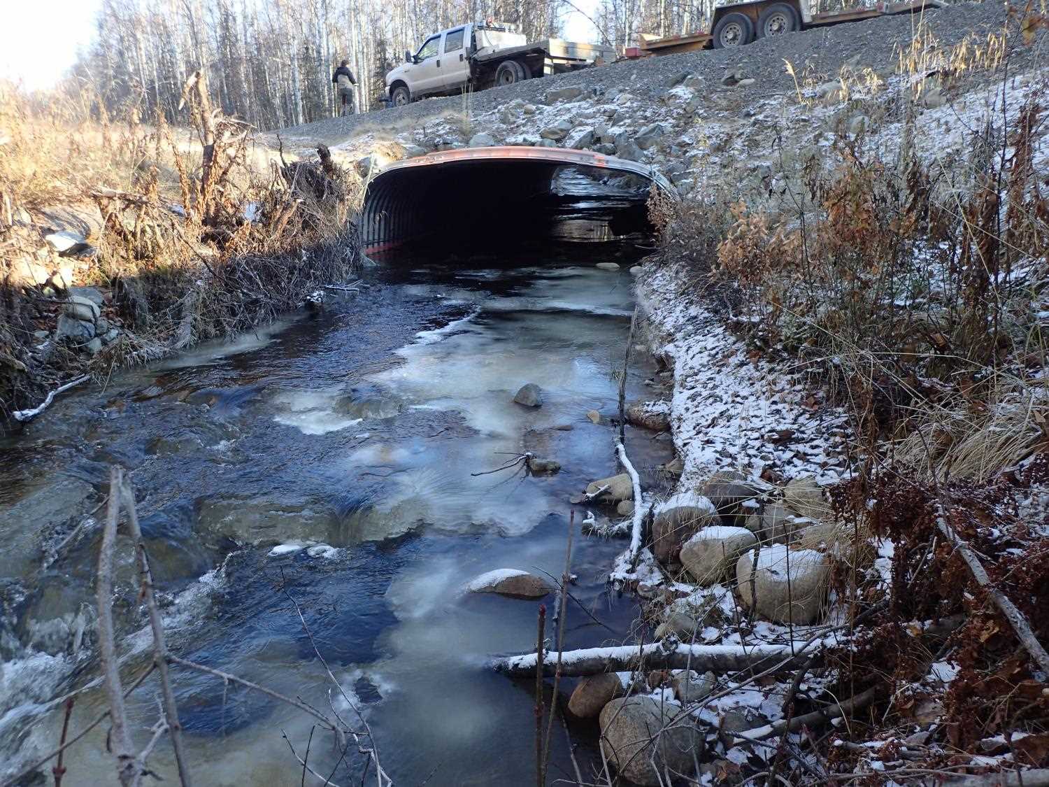
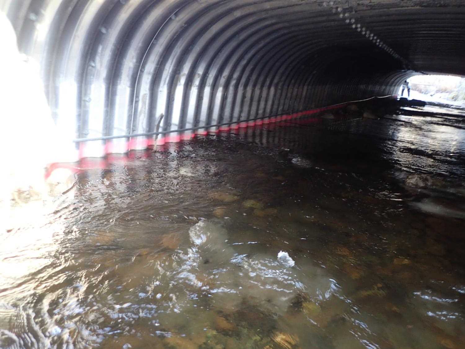
Stream Name: Caswell Creek
Elevation:
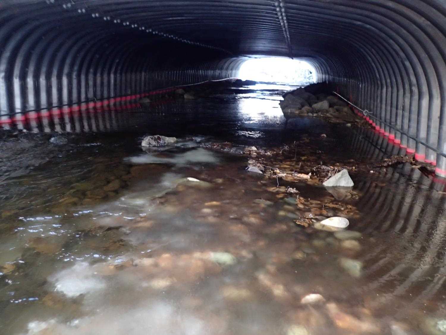
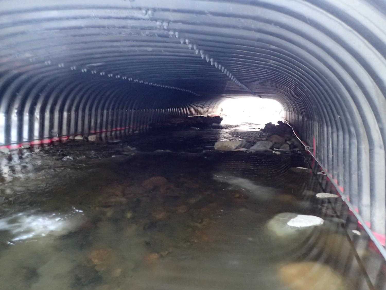
Site Comments: Water in this creek flows all winter.
arrow to the right of the survey date below to choose a different report for this site.
Survey UPD20-SHA01
Project Supervisor: Gillian O'Doherty, Alaska Department of Fish and Game
— Anchorage, AK
Observers: Gillian O'Doherty, Kim Clark, Michael Mazzacavallo
Overall Fish Passage Rating:
Tidal: No
Backwatered: No
Step Pools: No
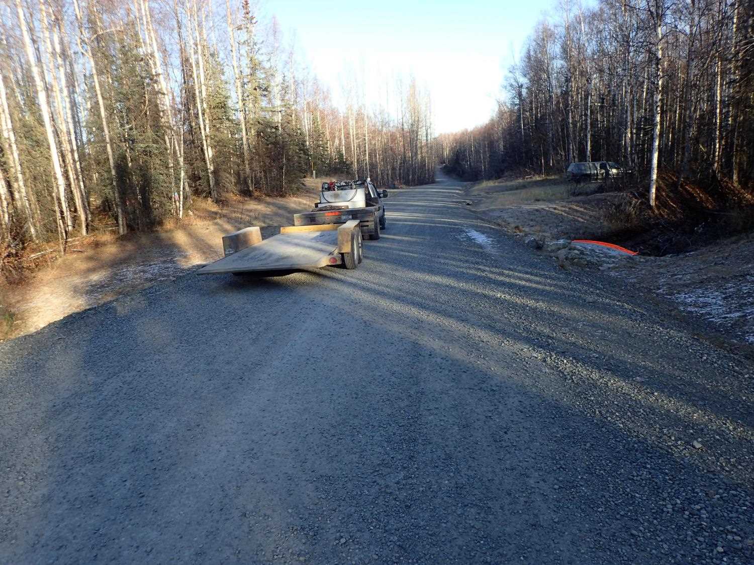
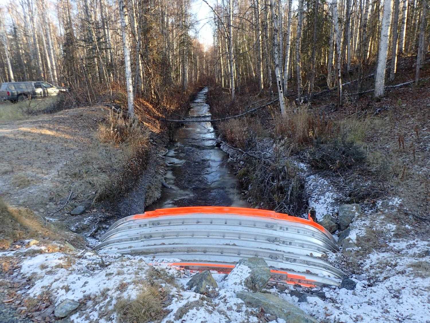
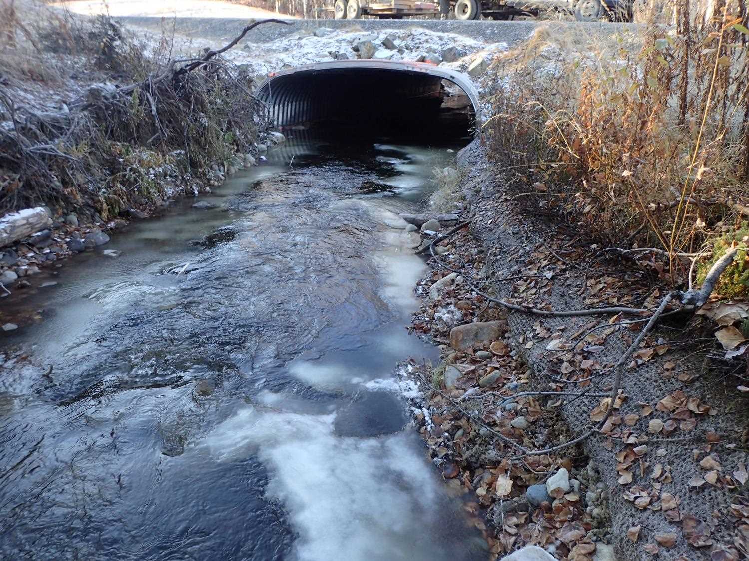
Construction Year: 2018
Comments: Resurvey of Fish Passage project. Landowner said he saw 50+ adults Coho up above culvert and smolt are overwintering on his property above a beaver dam.
Culvert Measurements
| ID: 1 | Structure Type: Box culvert (Structural aluminum plate) | Fish Passage Rating: | ||||||||||||||||||||||||||||||||||||||||||
|
|
|
||||||||||||||||||||||||||||||||||||||||||
Comments: Water depth in culvert 1/2 of adjacent stream. Per the designs BFW is 14-15' and the Low flow channel is 7' wide. OHM is from old survey at 10.4 ft. |
||||||||||||||||||||||||||||||||||||||||||||
Stream Measurements
|
|
No stream width data available.
Elevations
| Locator ID | Culvert Number |
River Distance (ft)1 |
Distance From Crossing (ft)2 |
Relative Elevation (ft) |
|---|---|---|---|---|
| D/S Thalweg (on riffle) | 0.00 | 90.83 | ||
| D/S Water Surface Elev | 0.00 | 91.97 | ||
| D/S Water Surface Elev | 18.00 | 92.29 | ||
| Outlet Invert (on substrate) | 18.00 | 91.38 | ||
| Outlet Culvert Top (on Rib) | 18.00 | 97.08 | ||
| Inlet Culvert Top | 67.97 | 98.50 | ||
| Inlet Culvert Invert | 67.97 | 92.63 | ||
| U/S Water Surface Elev | 67.97 | 93.72 | ||
| U/S Water Surface Elev | 79.97 | 93.70 | ||
| U/S Thalweg | 79.97 | 92.56 |
Notes:
- River distance is measured continuously throughout the survey reach along the thalweg of the stream.
- Measured from each end of the crossing along the thalweg of the stream.
Fish Sampling Efforts
No fish sampling occurred during this survey.
Fish Observations
No fish observations occurred during this survey.
Photos
Questions or comments about this report can be directed to dfg.dsf.webmaster@alaska.gov