Fish Passage Site 20501501
Coordinates (dec. deg.): 62.44318°, -150.70003°
Legal Description: S027N008W11
Region: South Central
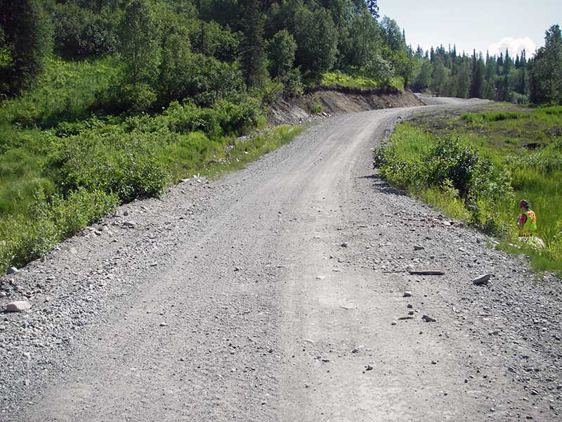
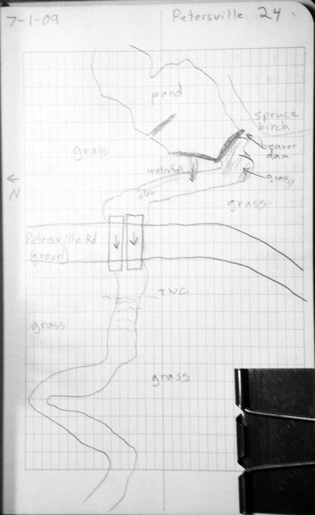
Road Name: Petersville Road
Datum: WGS84
Quad Name / ITM: Talkeetna B-2
AWC Stream #:
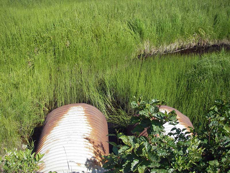
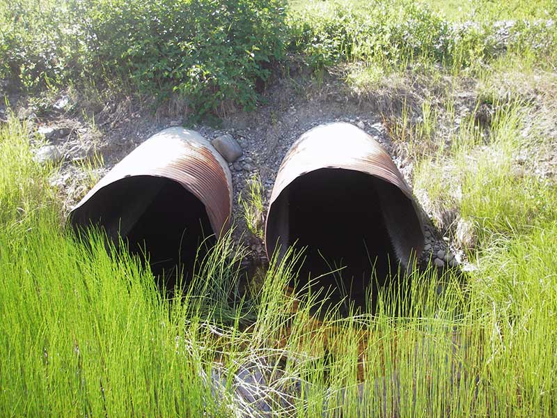
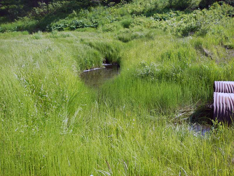
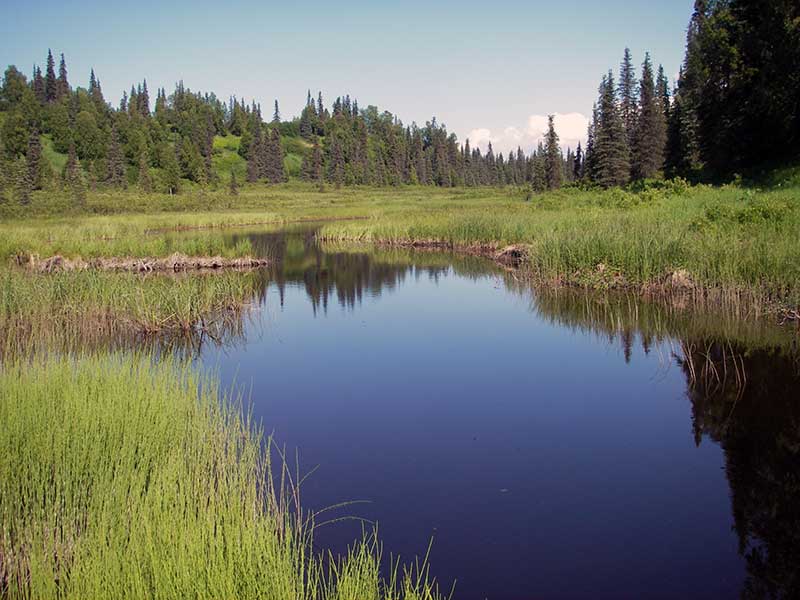
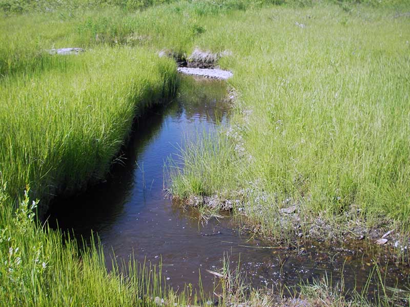
Stream Name: Deep Creek
Elevation:
Site Comments: None
arrow to the right of the survey date below to choose a different report for this site.
Survey PRK09-PVR24
Project Supervisor: Gillian O'Doherty, ADFG
Observers: Heidi Zimmer, Ben Histand
Overall Fish Passage Rating:
Tidal: No
Backwatered: No
Step Pools:
Construction Year:
Site Observations:
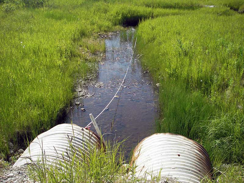
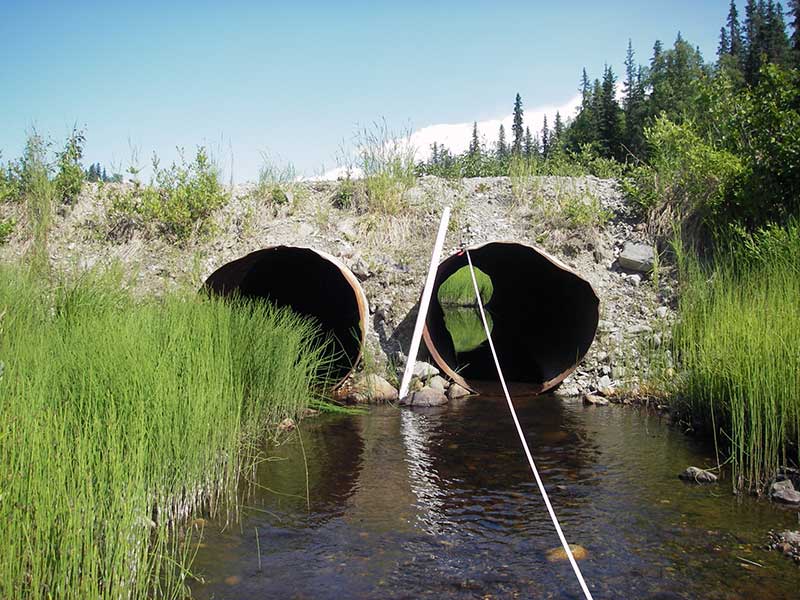
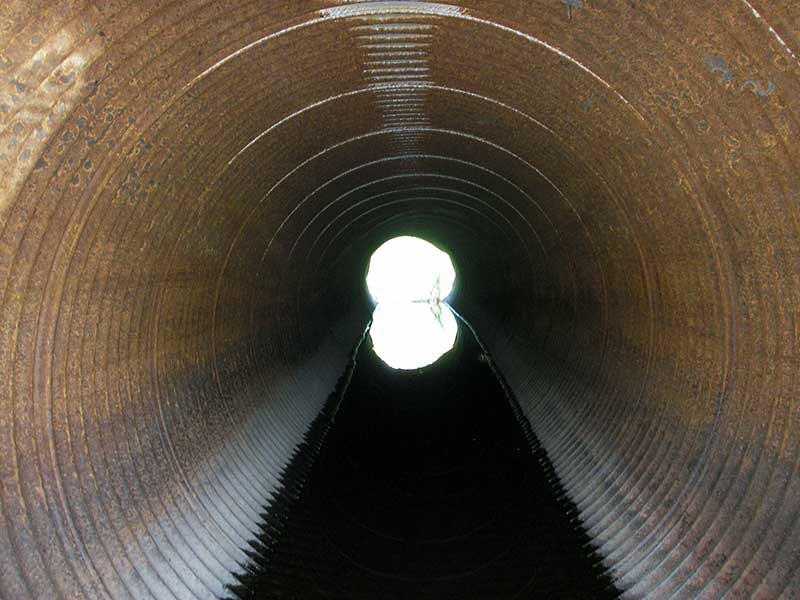
- Culvert is poorly aligned
- Beaver Activity
Comments: Visual observations of juvinile salmonids u/s and d/s. Adverse grade in both pipes. Beaver dams upstream from culverts
Culvert Measurements
| ID: 1 | Structure Type: Circular pipe (Corrugated steel) | Fish Passage Rating: | |||||||||||||||||||||||||||||||||||||||||
|
|
|
|||||||||||||||||||||||||||||||||||||||||
Comments: Adverse grade |
|||||||||||||||||||||||||||||||||||||||||||
Culvert Observations:
|
|||||||||||||||||||||||||||||||||||||||||||
| ID: 2 | Structure Type: Circular pipe (Corrugated steel) | Fish Passage Rating: | |||||||||||||||||||||||||||||||||||||||||
|
|
|
|||||||||||||||||||||||||||||||||||||||||
Comments: Adverse grade. |
|||||||||||||||||||||||||||||||||||||||||||
Culvert Observations:
|
|||||||||||||||||||||||||||||||||||||||||||
Stream Measurements
|
|
| Stream Width Type | Distance From Crossing (ft) |
Stream Width (ft) |
|---|---|---|
| Downstream ordinary high water | 35.0 | 8.50 |
| Downstream ordinary high water | 66.0 | 7.50 |
| Downstream ordinary high water | 123.0 | 6.00 |
Elevations
| Locator ID | Culvert Number |
River Distance (ft)1 |
Distance From Crossing (ft)2 |
Relative Elevation (ft) |
|---|---|---|---|---|
| Outlet Pool Water Elev | 1 | 96.75 | ||
| Outlet Pool Water Elev | 2 | 96.75 | ||
| U/S Headwater | 1 | 96.79 | ||
| U/S Headwater (pool immed u/s of inlets) | 2 | 96.80 | ||
| D/S Grade Ctrl (Thalweg) | 0.00 | 41.0 | 96.10 | |
| D/S Water Surface Elev (WS @ GP) | 0.00 | 41.0 | 96.45 | |
| D/S Tailcrest or 1st Thalweg | 29.00 | 12.0 | 96.41 | |
| D/S Water Surface Elev (WS @ TWC) | 29.00 | 12.0 | 96.71 | |
| D/S Thalweg (bottom of pool) | 1 | 36.00 | 5.0 | 95.78 |
| Outlet Invert | 2 | 41.00 | 0.0 | 96.48 |
| Outlet Invert | 1 | 41.00 | 0.0 | 96.60 |
| D/S Thalweg (stream bed @ end of pipe 1) | 1 | 41.00 | 0.0 | 96.18 |
| Road Elev | 63.00 | 102.82 | ||
| Inlet Culvert Invert | 1 | 85.00 | 0.0 | 96.24 |
| Inlet Culvert Invert | 2 | 85.00 | 0.0 | 96.17 |
Notes:
- River distance is measured continuously throughout the survey reach along the thalweg of the stream.
- Measured from each end of the crossing along the thalweg of the stream.
Fish Sampling Efforts
| Gear Type: Visual Observation, Ground (A) | ||
| Comments: Visual observations of juvenile salmonids upstream and downstream of culverts. | ||
Fish Observations
No fish observations occurred during this survey.
Photos
Questions or comments about this report can be directed to dfg.dsf.webmaster@alaska.gov