Fish Passage Site 20501493
Coordinates (dec. deg.): 62.49026°, -150.98520°
Legal Description: S028N009W29
Region: South Central
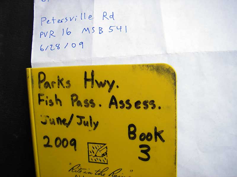
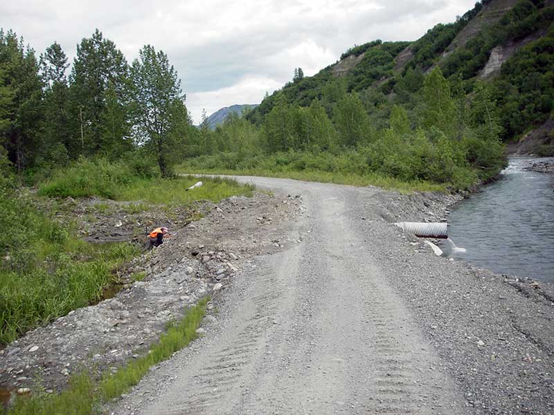
Road Name: Petersville Road
Datum: WGS84
Quad Name / ITM: Talkeetna B-2
AWC Stream #:
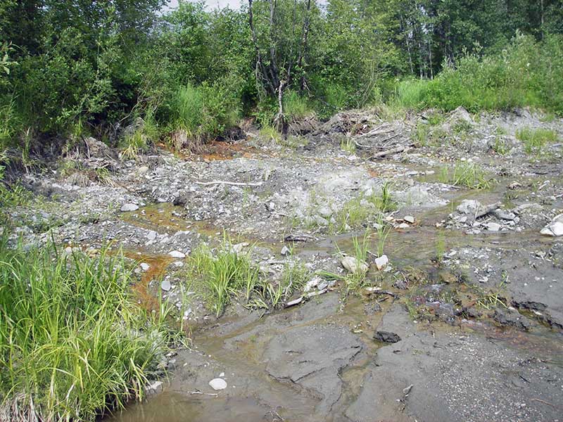
Stream Name: Cache Creek tributary
Elevation:
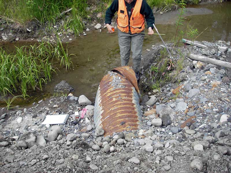
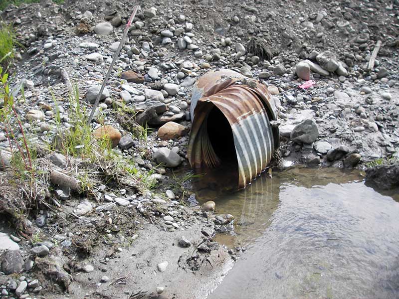
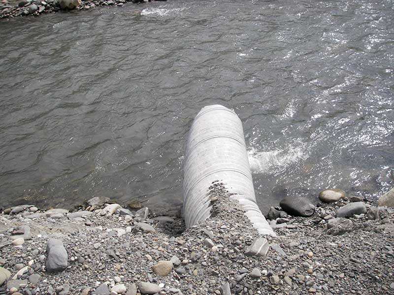
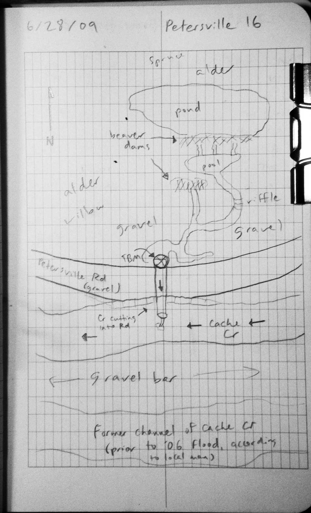
Site Comments: Outlet pours into Cache Creek.
Survey PRK09-PVR16
Project Supervisor: Gillian O'Doherty, ADFG
Observers: Heidi Zimmer, Ben Histand
Overall Fish Passage Rating:
Tidal: No
Backwatered: No
Step Pools:
Construction Year:
Site Observations:
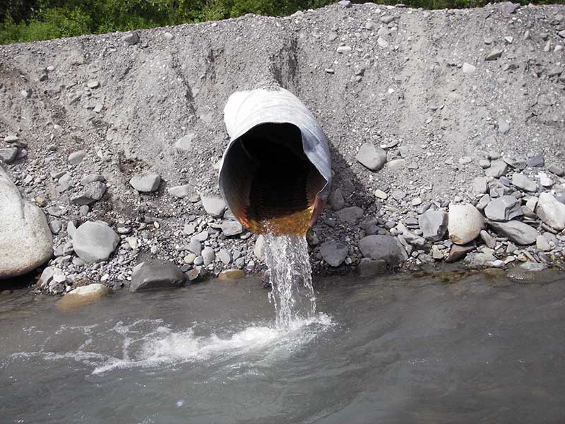
- Outfall height red
- Culvert gradient red
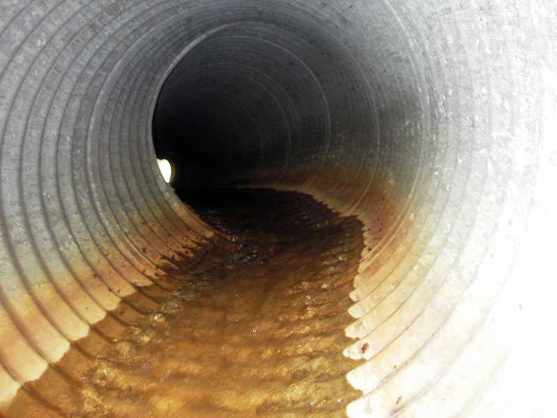
- Mechanical damage or joints parting
- Shallow fill; inadequate roadfill volume above culvert
- Road bank erosion
- Compound gradient in pipe
Comments: Inlet broken and twisted; multiple bends sideways in pipe; outlet pours into Cache Creek
Culvert Measurements
| ID: 1 | Structure Type: Circular pipe (Corrugated steel) | Fish Passage Rating: | |||||||||||||||||||||||||||||||||||||||||
|
|
|
|||||||||||||||||||||||||||||||||||||||||
Comments: No stream widths upstream is braided channels from beaver dam and Cache Creek is directly downstream. Inlet is broken and twisted. Multiple bends in pipe. |
|||||||||||||||||||||||||||||||||||||||||||
Culvert Observations:
|
|||||||||||||||||||||||||||||||||||||||||||
Stream Measurements
|
|
No stream width data available.
Elevations
| Locator ID | Culvert Number |
River Distance (ft)1 |
Distance From Crossing (ft)2 |
Relative Elevation (ft) |
|---|---|---|---|---|
| Outlet Pool Water Elev (= WS of cache cr below inv out) | 1 | 95.24 | ||
| U/S Headwater | 1 | 98.26 | ||
| D/S Thalweg (bottom of plunge, bed of cache cr) | 1 | 0.00 | 1.5 | 93.92 |
| D/S Water Surface Elev | 1 | 0.70 | 0.8 | 98.27 |
| Outlet Invert | 1 | 1.50 | 0.0 | 96.58 |
| Road Elev | 1 | 21.00 | 101.27 | |
| Inlet Culvert Invert | 1 | 40.50 | 0.0 | 97.82 |
| U/S Grade Ctrl (Thalweg) (1st TC u/s) | 1 | 41.30 | 0.8 | 97.96 |
Notes:
- River distance is measured continuously throughout the survey reach along the thalweg of the stream.
- Measured from each end of the crossing along the thalweg of the stream.
Fish Sampling Efforts
No fish sampling occurred during this survey.
Fish Observations
No fish observations occurred during this survey.
Photos
Questions or comments about this report can be directed to dfg.dsf.webmaster@alaska.gov