Fish Passage Site 20501492
Coordinates (dec. deg.): 62.49231°, -150.97864°
Legal Description: S028N009W29
Region: South Central
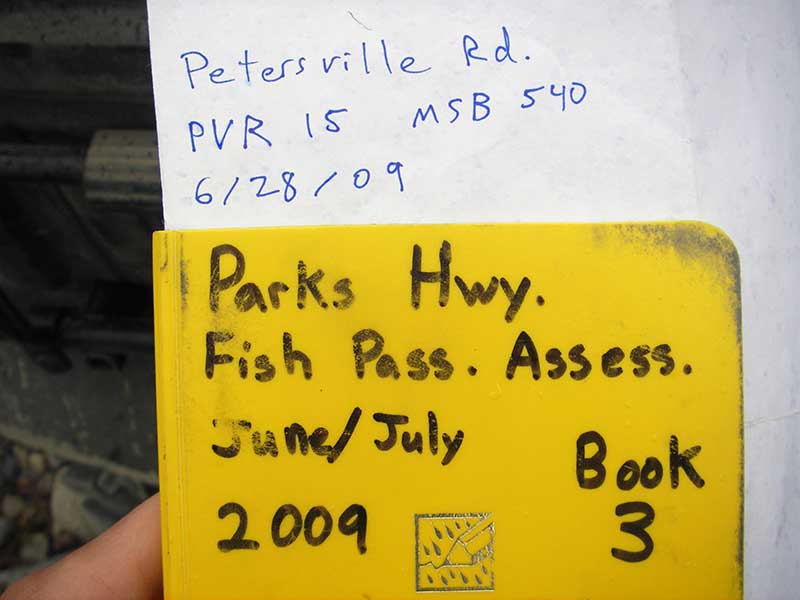
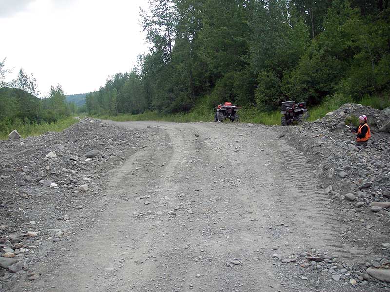
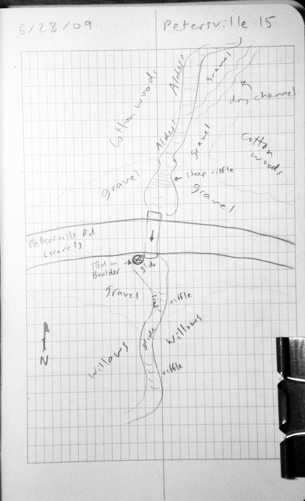
Road Name: Petersville Road
Datum: WGS84
Quad Name / ITM: Talkeetna B-2
AWC Stream #:
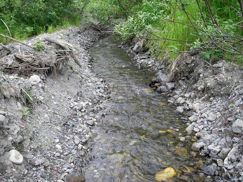
Stream Name: Rambler Creek
Elevation:
Site Comments: None
arrow to the right of the survey date below to choose a different report for this site.
Survey PRK09-PVR15
Project Supervisor: Gillian O'Doherty, ADFG
Observers: Heidi Zimmer, Ben Histand
Overall Fish Passage Rating:
Tidal: No
Backwatered: No
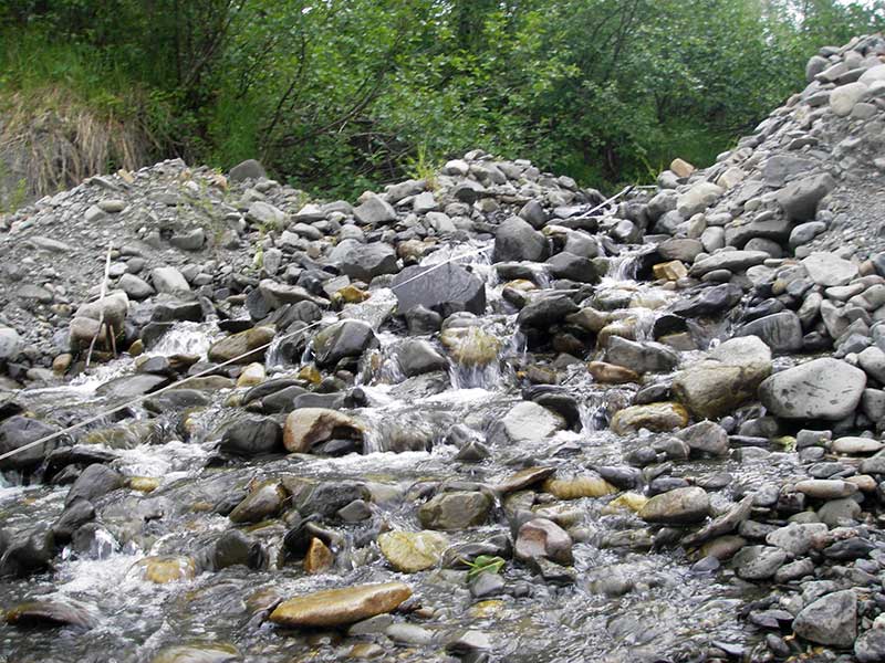
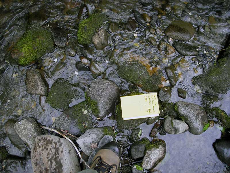
Step Pools: Yes
Construction Year:
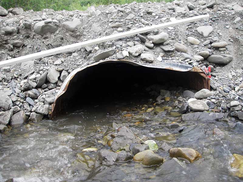
Site Observations:
- Constriction ratio gray
- Culvert gradient red
- Mechanical damage or joints parting
- Shallow fill; inadequate roadfill volume above culvert
- Compound gradient in pipe
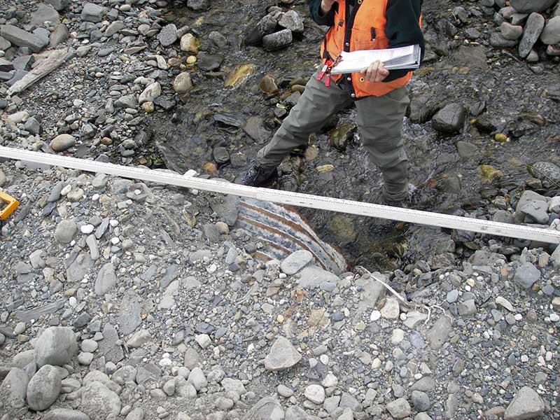
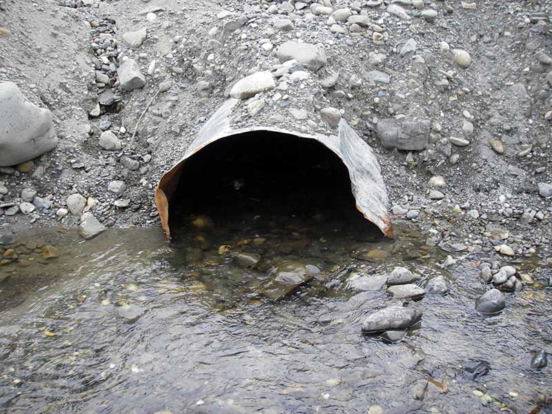
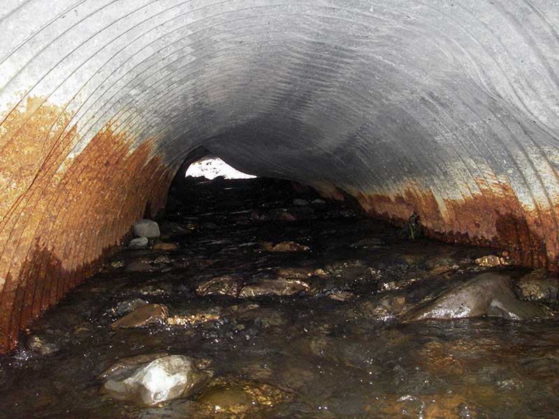
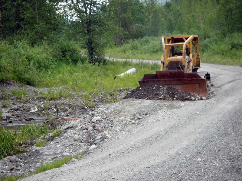
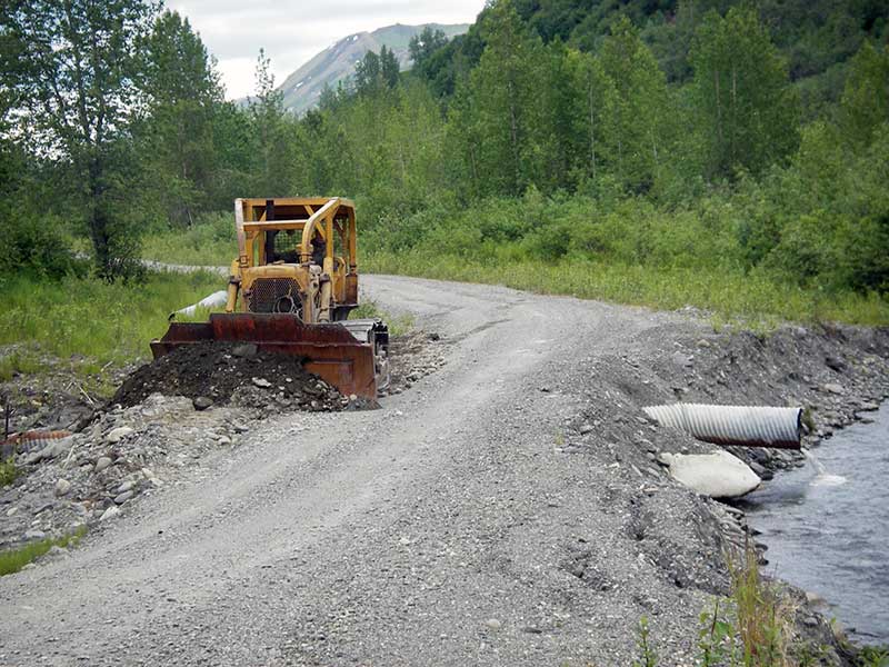
Comments: Pipe is badly dented and bent; inside pipe is subs (cg/sc) similar to stream bed, but pipe too small and damaged
Culvert Measurements
| ID: 1 | Structure Type: Pipe-arch (Corrugated steel) | Fish Passage Rating: | |||||||||||||||||||||||||||||||||||||||||
|
|
|
|||||||||||||||||||||||||||||||||||||||||
Comments: Inside of pipe has continuous substrate of small and large cobble similar to streambed and may function as a stream simulation but pipe is too small and damaged. |
|||||||||||||||||||||||||||||||||||||||||||
Culvert Observations:
|
|||||||||||||||||||||||||||||||||||||||||||
Stream Measurements
|
|
| Stream Width Type | Distance From Crossing (ft) |
Stream Width (ft) |
|---|---|---|
| Upstream ordinary high water | 90.0 | 7.00 |
| Upstream ordinary high water | 140.0 | 7.00 |
| Upstream ordinary high water | 200.0 | 8.00 |
Elevations
| Locator ID | Culvert Number |
River Distance (ft)1 |
Distance From Crossing (ft)2 |
Relative Elevation (ft) |
|---|---|---|---|---|
| Outlet Pool Water Elev | 1 | 97.60 | ||
| U/S Headwater | 1 | 99.42 | ||
| D/S Grade Ctrl (Thalweg) | 1 | 0.00 | 40.0 | 96.18 |
| D/S Water Surface Elev (ws @ GP) | 1 | 0.00 | 40.0 | 96.58 |
| D/S Water Surface Elev (ws @ GP) | 1 | 17.00 | 23.0 | 103.13 |
| D/S Tailcrest or 1st Thalweg | 1 | 35.00 | 5.0 | 97.32 |
| D/S Water Surface Elev | 1 | 35.00 | 5.0 | 97.57 |
| D/S Thalweg (bottom) | 1 | 37.60 | 2.4 | 97.11 |
| Outlet Invert | 1 | 40.00 | 0.0 | 97.15 |
| Road Elev | 1 | 60.00 | 102.16 | |
| Inlet Culvert Invert | 1 | 80.00 | 0.0 | 98.82 |
| U/S Grade Ctrl (Thalweg) (1st TC upstream (top of steep riffle)) | 1 | 103.00 | 23.0 | 102.85 |
Notes:
- River distance is measured continuously throughout the survey reach along the thalweg of the stream.
- Measured from each end of the crossing along the thalweg of the stream.
Fish Sampling Efforts
No fish sampling occurred during this survey.
Fish Observations
No fish observations occurred during this survey.
Photos
Questions or comments about this report can be directed to dfg.dsf.webmaster@alaska.gov