Fish Passage Site 20501480
Coordinates (dec. deg.): 62.31267°, -150.34764°
Legal Description: S026N006W26
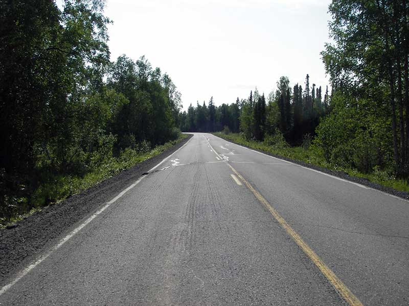
Region: South Central
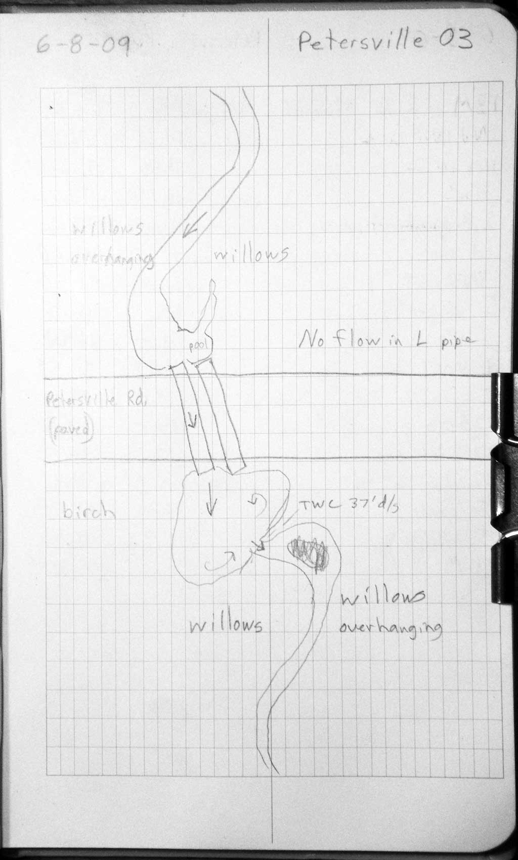
Road Name: Petersville Road
Datum: WGS84
Quad Name / ITM: Talkeetna B-1
AWC Stream #:
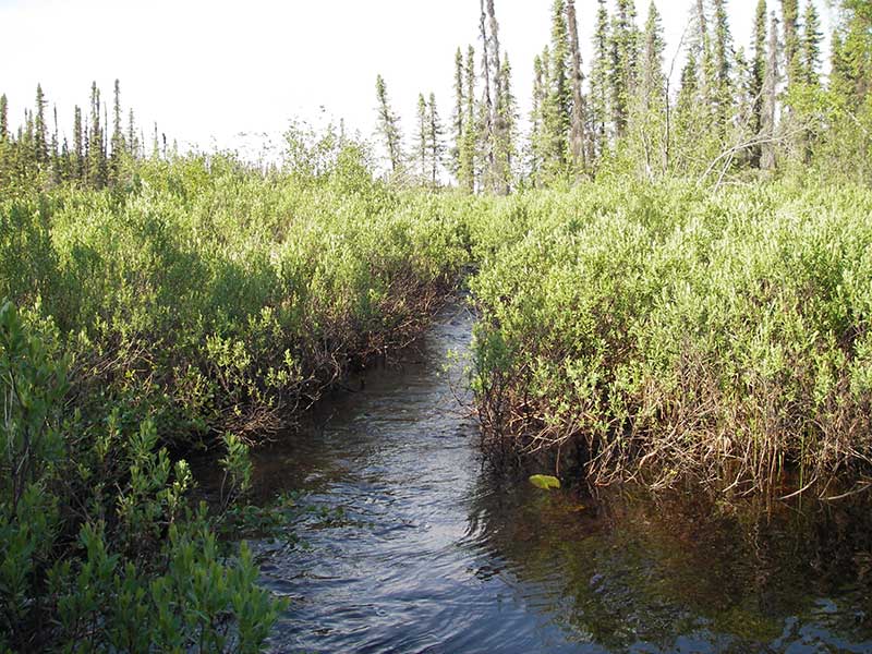
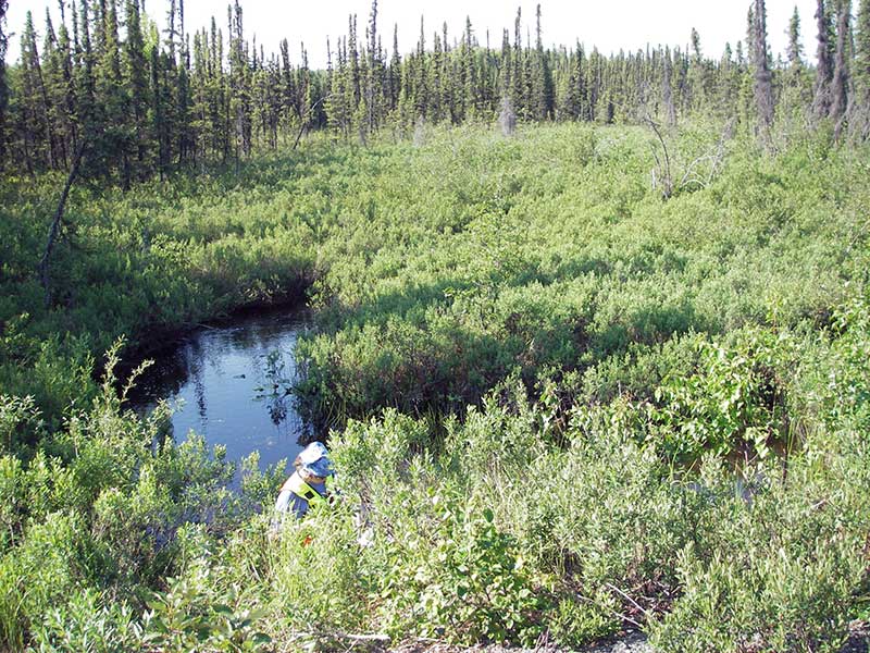
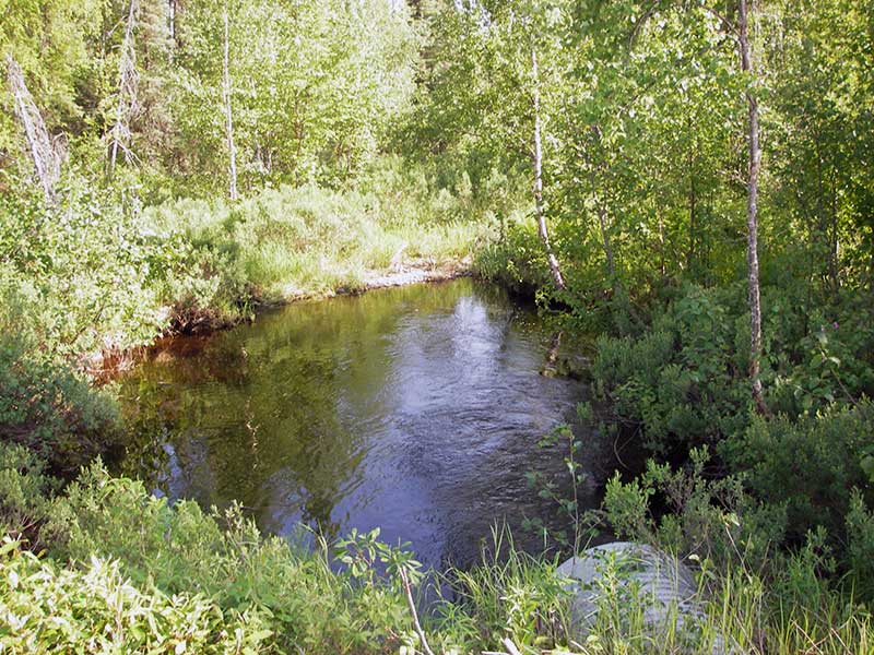
Stream Name: Ninemile Creek
Elevation:
Site Comments: None
Survey PRK09-PVR03
Project Supervisor: Gillian O'Doherty, ADFG
Observers: Heidi Zimmer, Ben Histand
Overall Fish Passage Rating:
Tidal: No
Backwatered: No
Step Pools: No
Construction Year:
Site Observations:
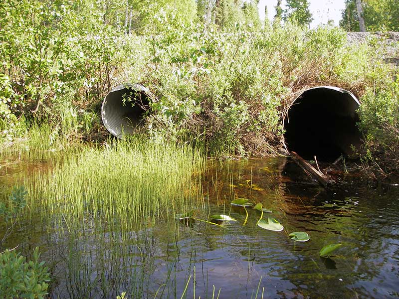
- Culvert gradient red
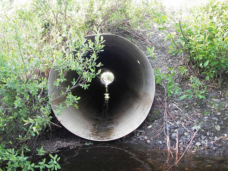
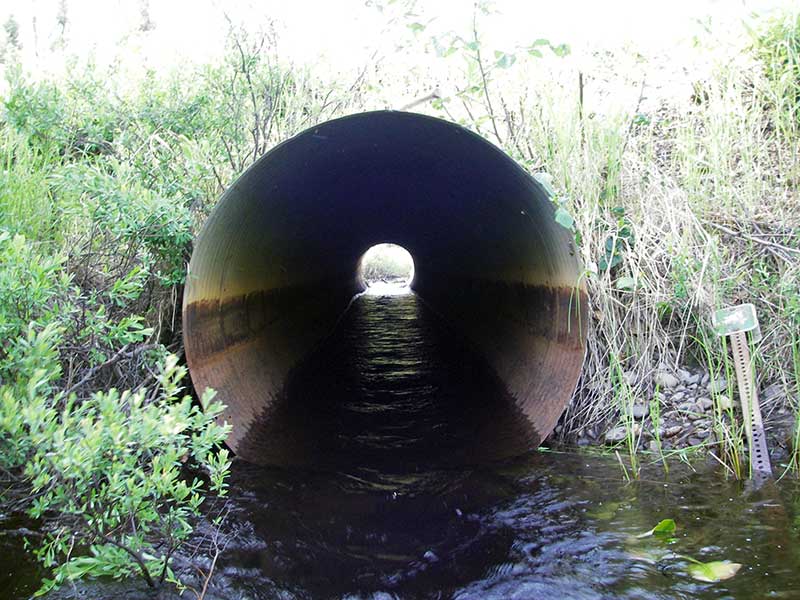
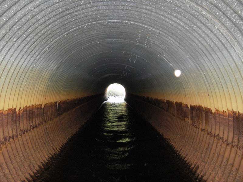
Comments: All flow is through pipe 2 so CR pipe 2 only = 0.63; vis obs juv salmonids u/s.
Culvert Measurements
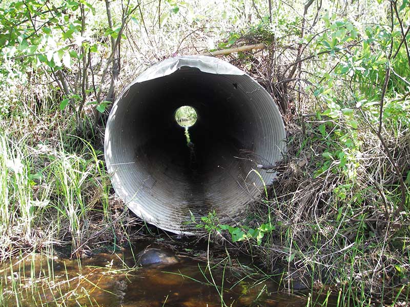
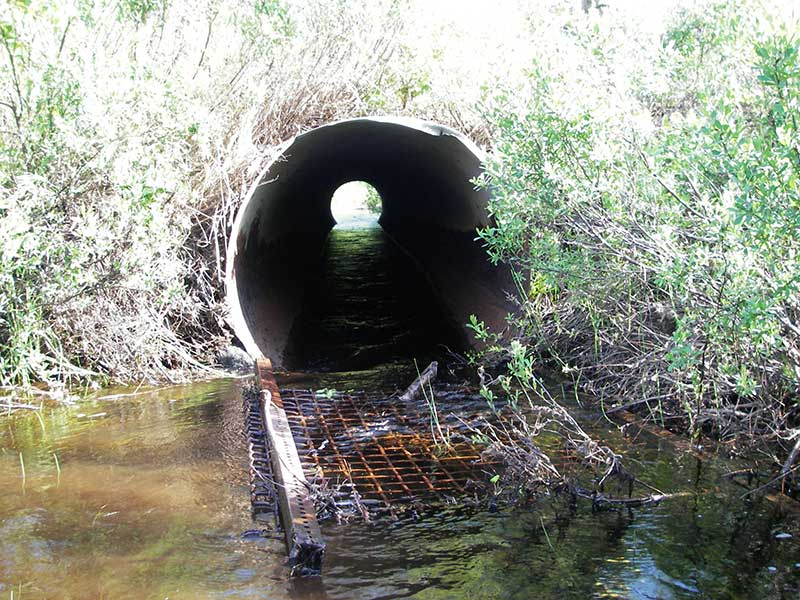
| ID: 1 | Structure Type: Circular pipe (Structural aluminum plate) | Fish Passage Rating: | |||||||||||||||||||||||||||||||||||||||||
|
|
|
|||||||||||||||||||||||||||||||||||||||||
Comments: All flow is through pipe 2 |
|||||||||||||||||||||||||||||||||||||||||||
Culvert Observations:
|
|||||||||||||||||||||||||||||||||||||||||||
| ID: 2 | Structure Type: Circular pipe (Corrugated steel) | Fish Passage Rating: | |||||||||||||||||||||||||||||||||||||||||
|
|
|
|||||||||||||||||||||||||||||||||||||||||
Comments: all flow is through pipe 2 (this pipe); CR pipe 2 only = 0.63. |
|||||||||||||||||||||||||||||||||||||||||||
Culvert Observations:
|
|||||||||||||||||||||||||||||||||||||||||||
Stream Measurements
|
|
| Stream Width Type | Distance From Crossing (ft) |
Stream Width (ft) |
|---|---|---|
| Upstream ordinary high water | 50.0 | 6.50 |
| Upstream ordinary high water | 95.0 | 6.00 |
| Upstream ordinary high water | 115.0 | 6.00 |
Elevations
| Locator ID | Culvert Number |
River Distance (ft)1 |
Distance From Crossing (ft)2 |
Relative Elevation (ft) |
|---|---|---|---|---|
| Outlet Pool Water Elev (between pipes) | 91.40 | |||
| U/S Headwater (hws for both pipes) | 92.02 | |||
| Road Elev (u/s edge of rd) | 99.20 | |||
| D/S Grade Ctrl (Thalweg) | 0.00 | 95.0 | 89.50 | |
| D/S Water Surface Elev (ws @ GP) | 0.00 | 95.0 | 90.43 | |
| D/S Tailcrest or 1st Thalweg | 58.00 | 37.0 | 90.42 | |
| D/S Water Surface Elev (ws @ TWC) | 58.00 | 37.0 | 91.41 | |
| D/S Thalweg (bottom of pool) | 72.50 | 22.5 | 87.90 | |
| D/S Thalweg | 1 | 90.00 | 5.0 | 88.96 |
| D/S Thalweg | 2 | 90.00 | 5.0 | 89.58 |
| Outlet Invert | 2 | 95.00 | 0.0 | 90.78 |
| Outlet Invert | 1 | 95.00 | 0.0 | 91.50 |
| Inlet Culvert Invert (no water) | 1 | 154.00 | 0.0 | 92.09 |
| Inlet Culvert Invert | 2 | 154.00 | 0.0 | 91.20 |
| U/S Thalweg | 1 | 156.80 | 2.8 | 91.13 |
Notes:
- River distance is measured continuously throughout the survey reach along the thalweg of the stream.
- Measured from each end of the crossing along the thalweg of the stream.
Fish Sampling Efforts
| Gear Type: Visual Observation, Ground (A) | ||
| Comments: Visual observation of juvenile salmonids, unidentified. | ||
Fish Observations
No fish observations occurred during this survey.
Photos

Questions or comments about this report can be directed to dfg.dsf.webmaster@alaska.gov