Fish Passage Site 20501473
Coordinates (dec. deg.): 62.18156°, -150.51703°
Legal Description: S024N007W11
Region: South Central
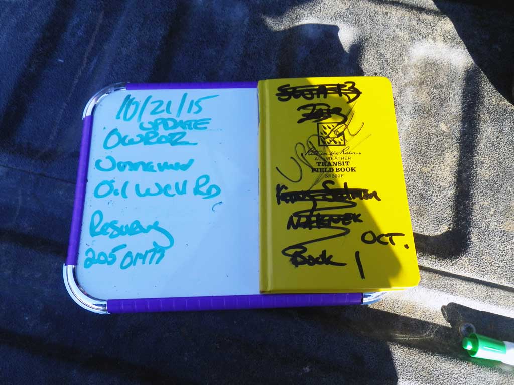
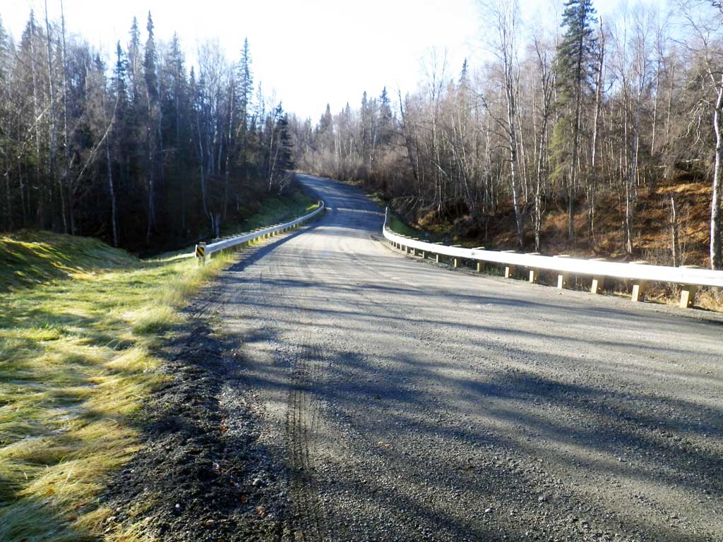
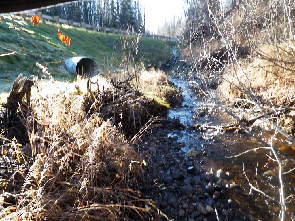
Road Name: Oil Well Road
Datum: WGS84
Quad Name / ITM: Talkeetna A-2
AWC Stream #:
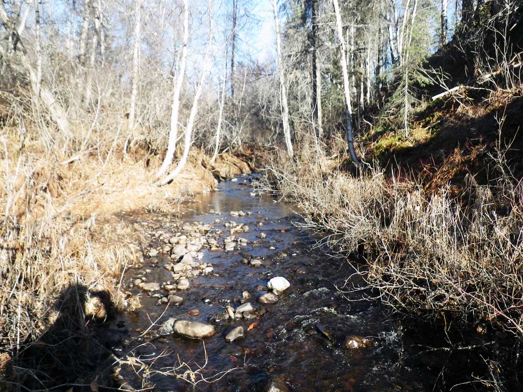
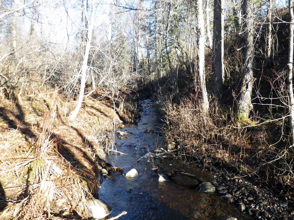
Stream Name: Unnamed
Elevation:
Site Comments: None
arrow to the right of the survey date below to choose a different report for this site.
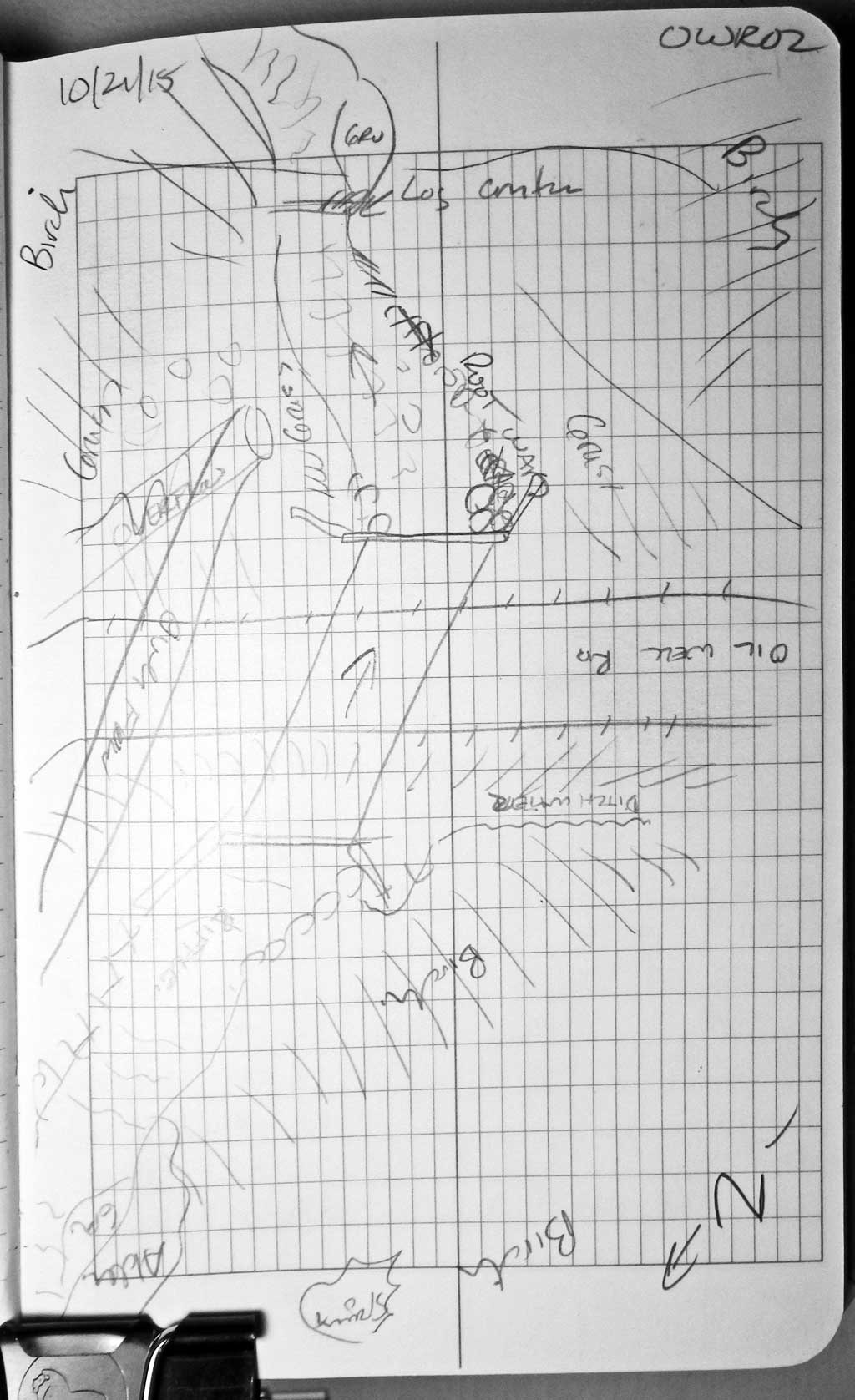
Survey UPDATE-OWR02
Project Supervisor: Gillian O'Doherty, ADFG
Observers: Gillian O'Doherty, Mark Eisenman
Overall Fish Passage Rating:
Tidal: No
Backwatered: No
Step Pools: No
Construction Year: 2014
Site Observations:
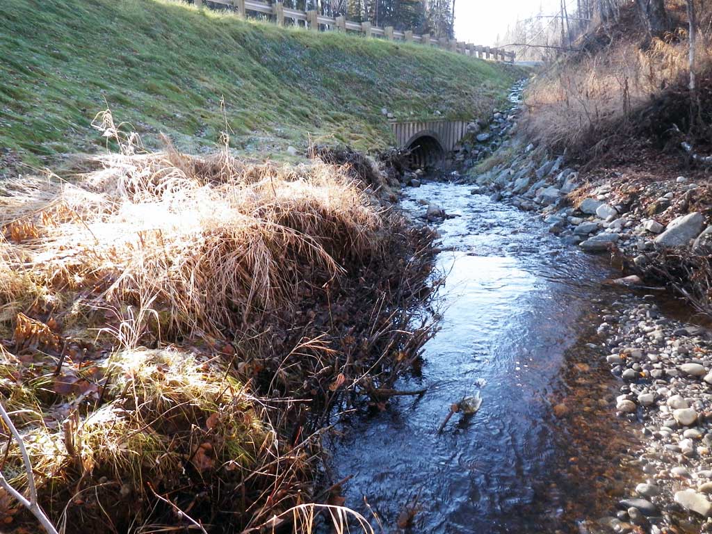
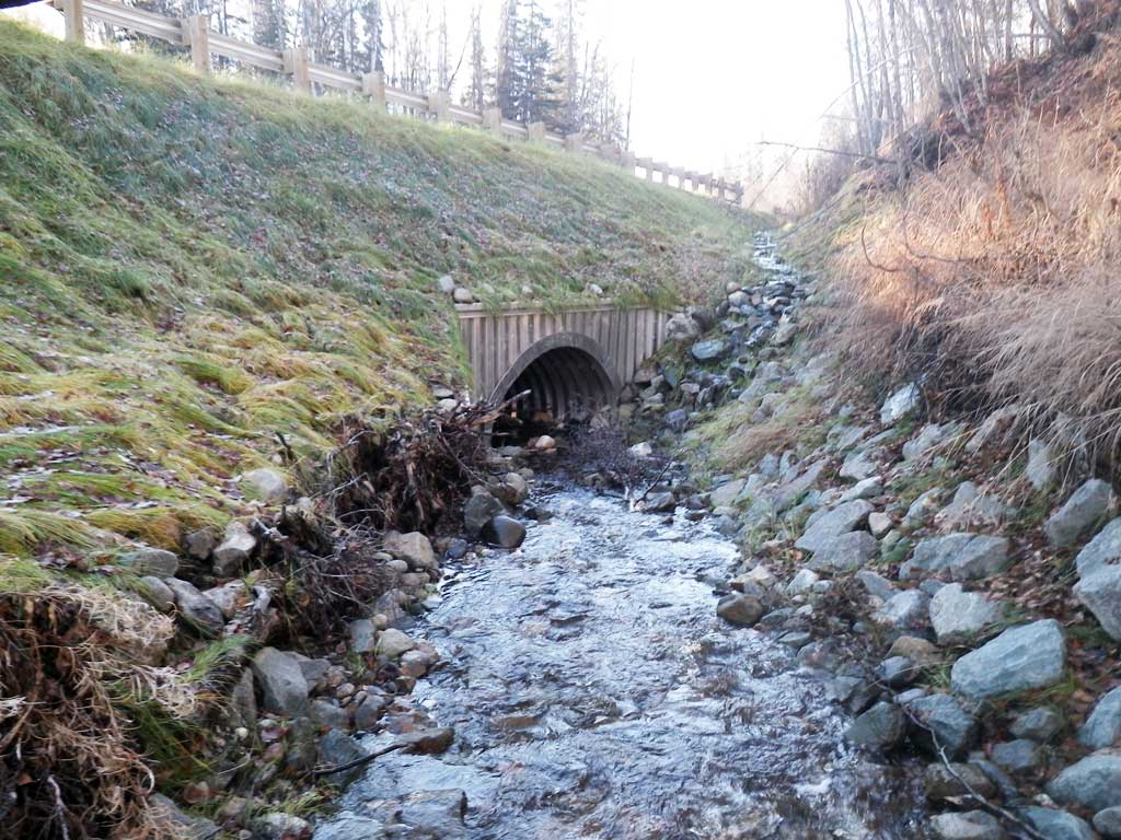
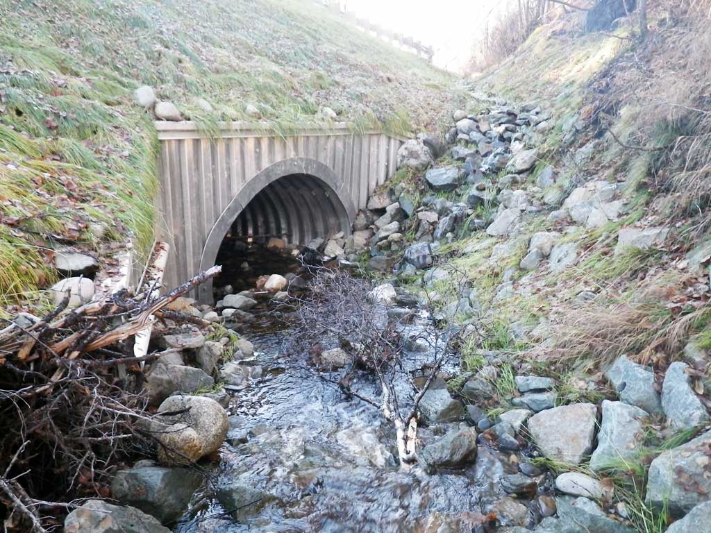
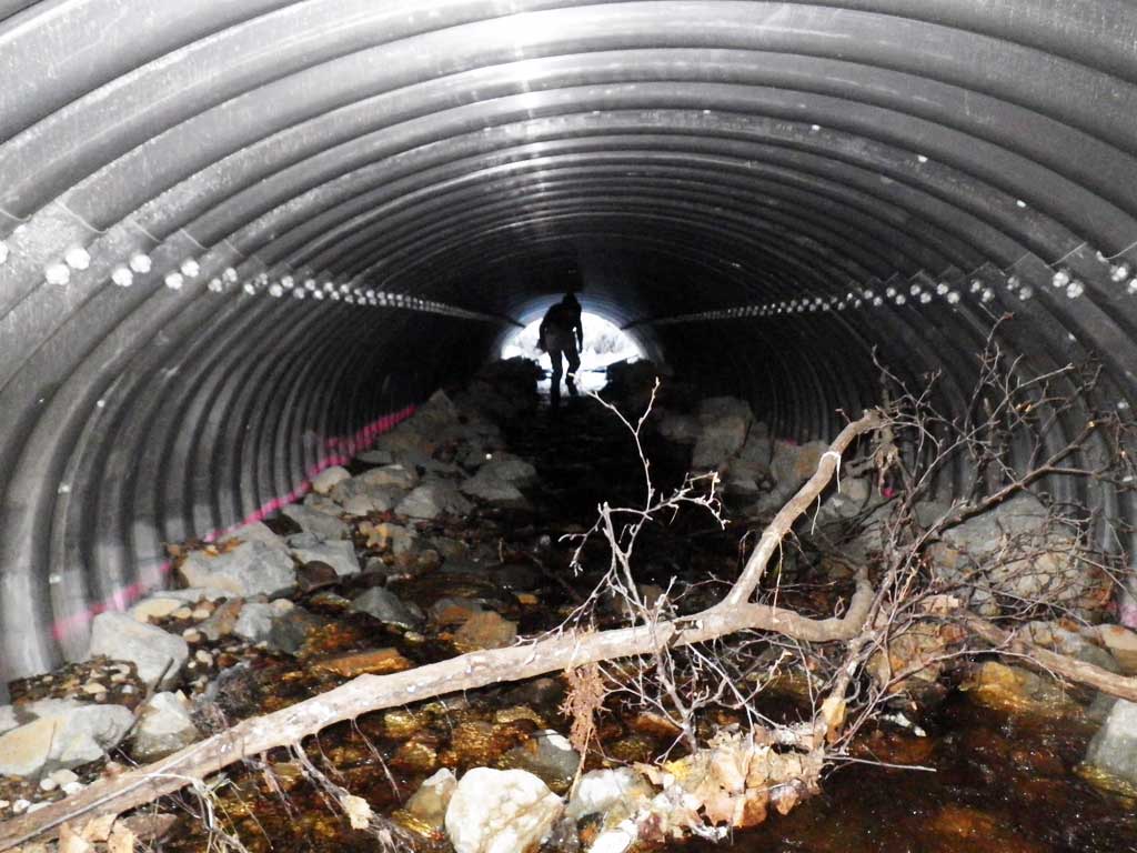
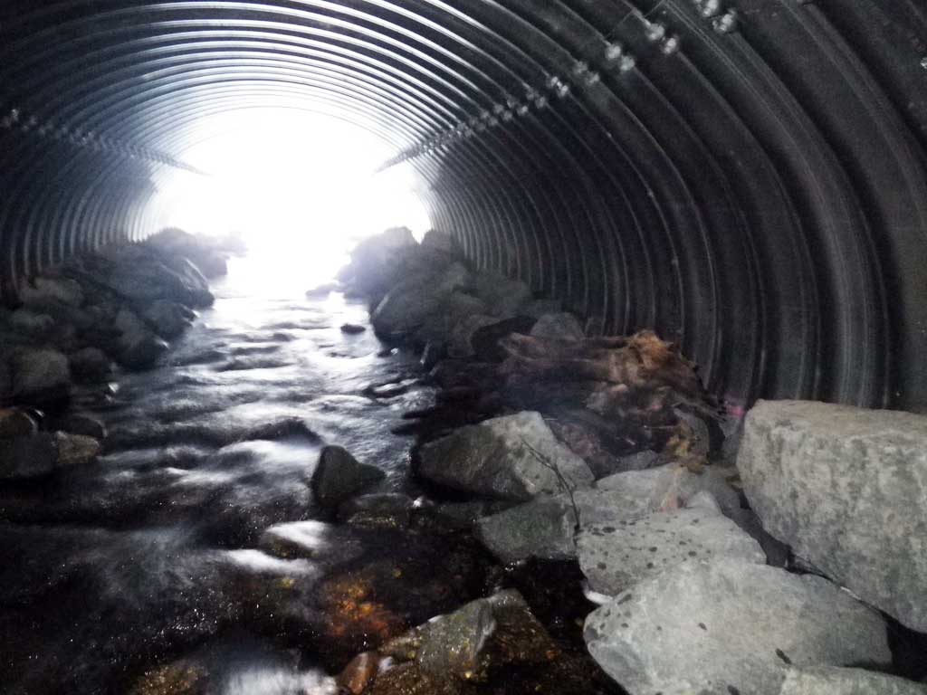
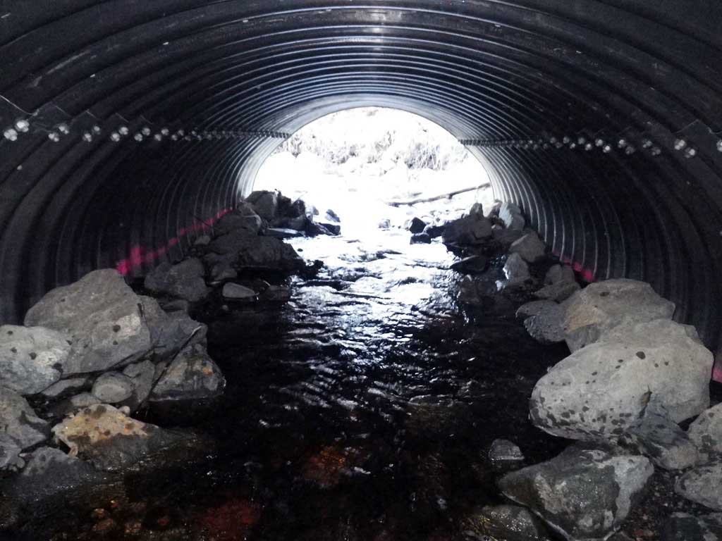
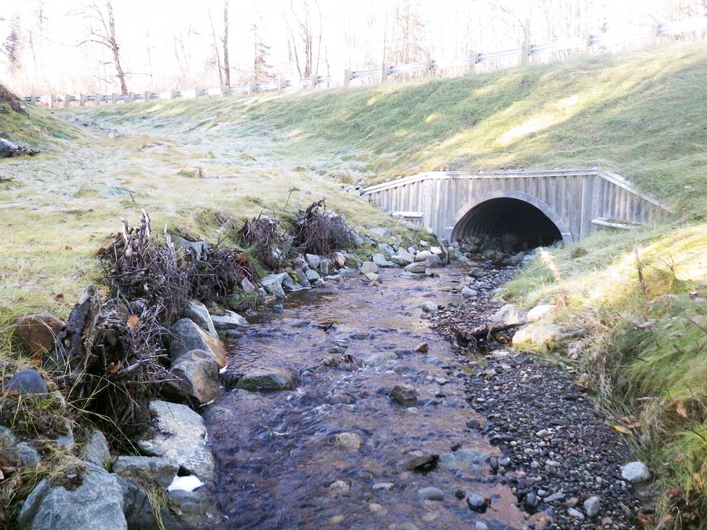
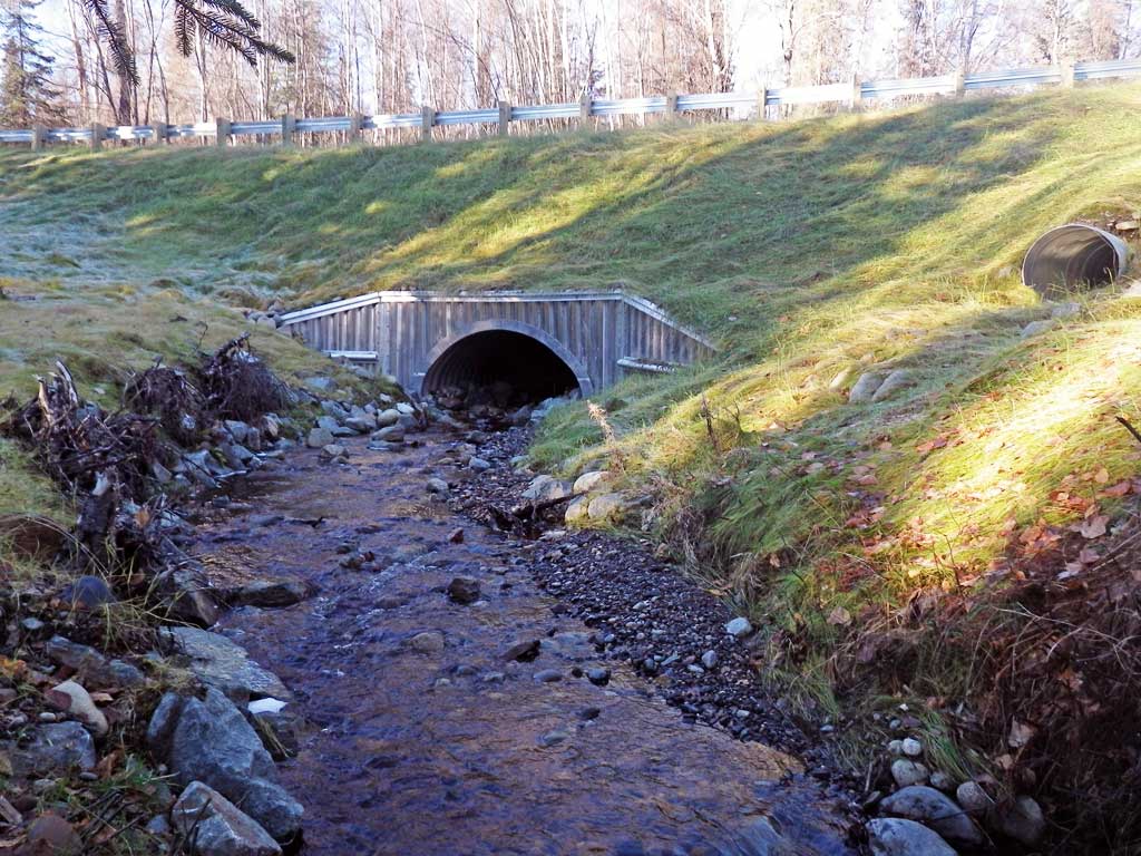
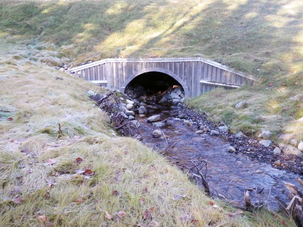
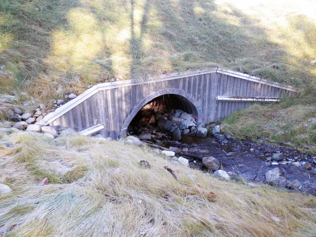
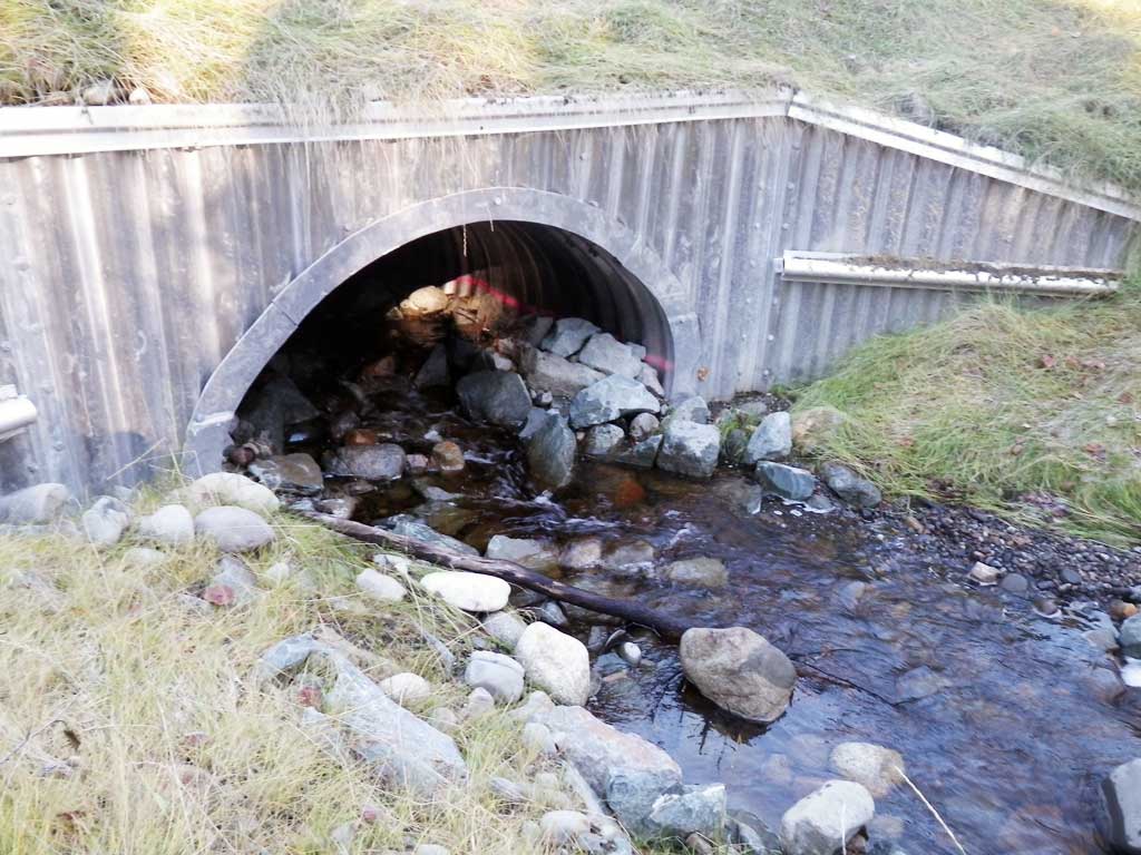
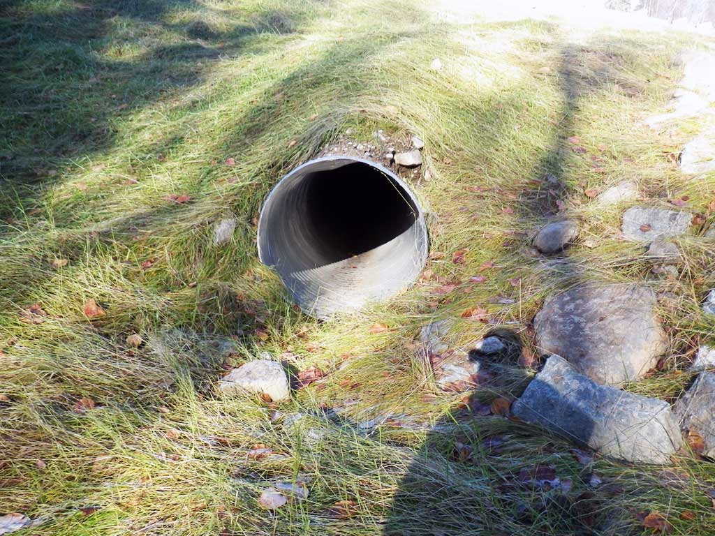
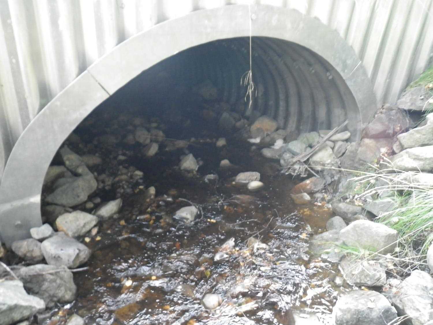
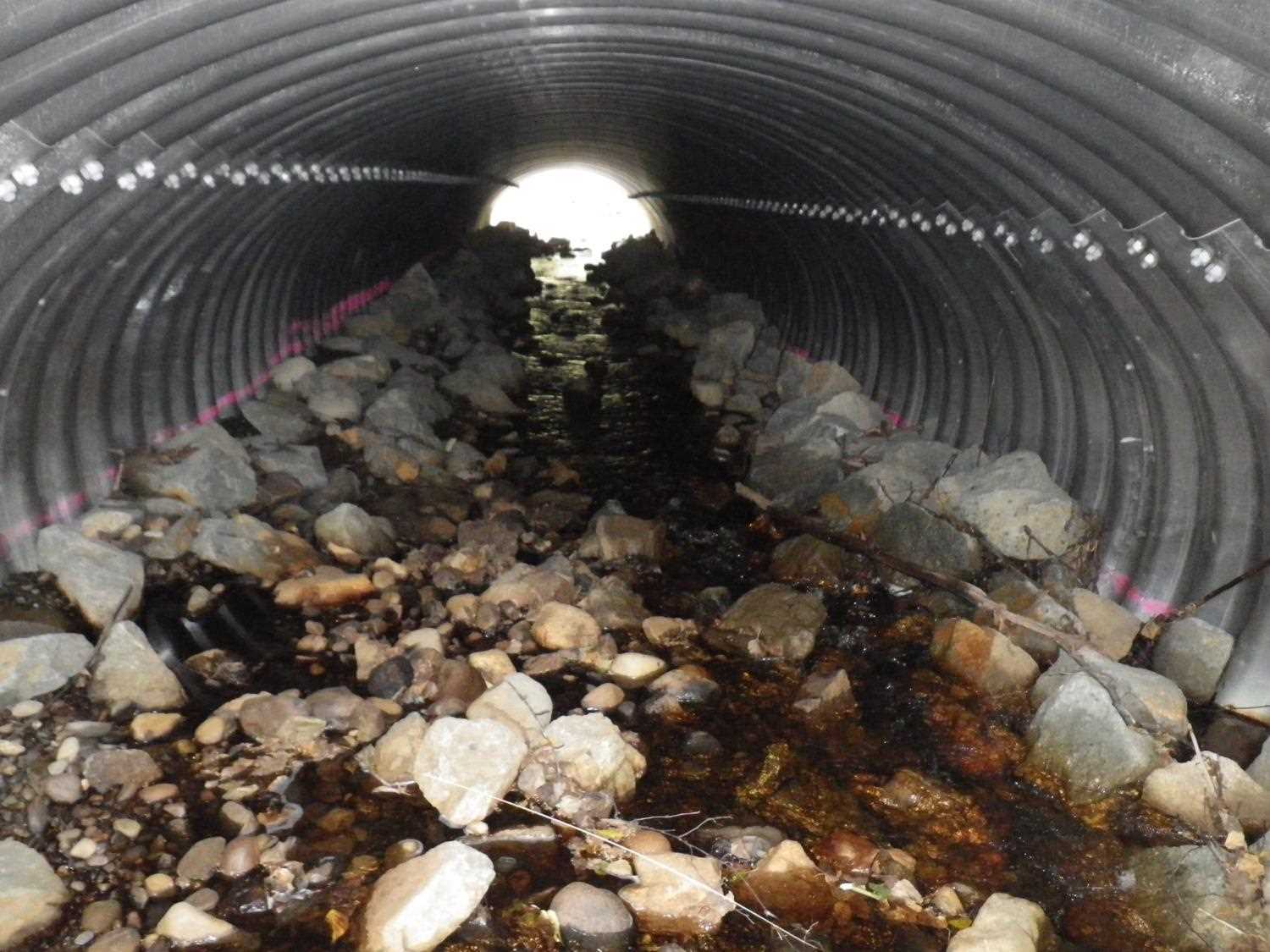
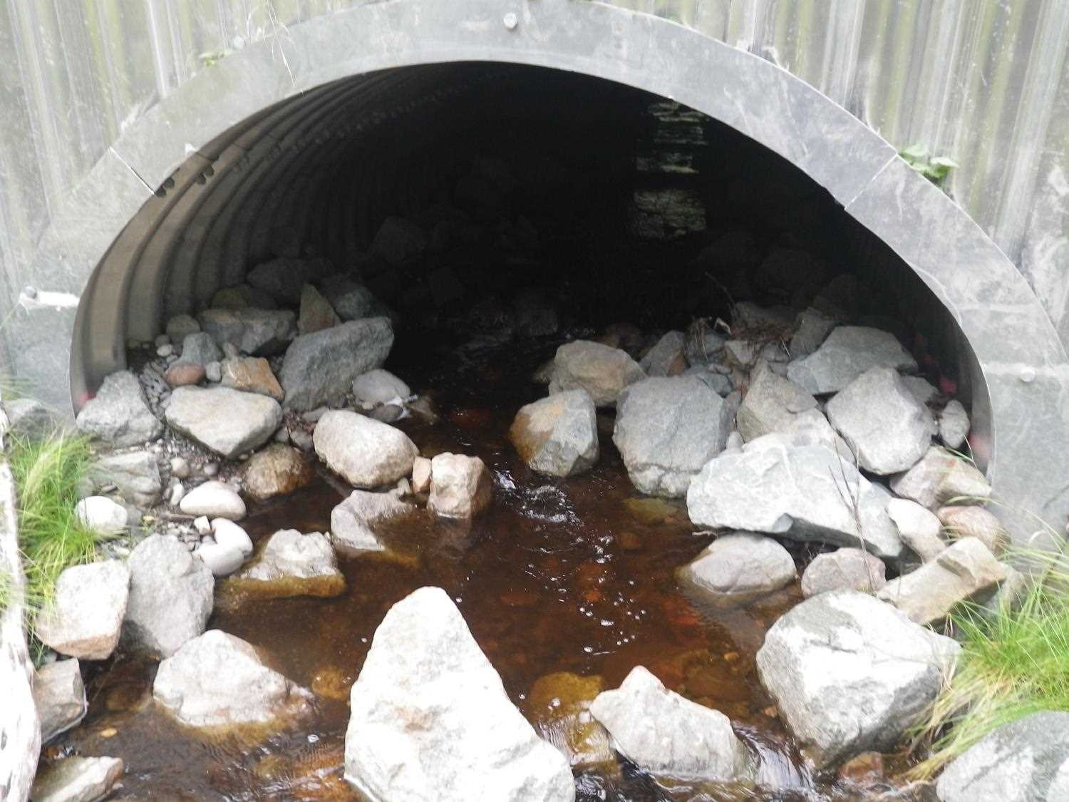
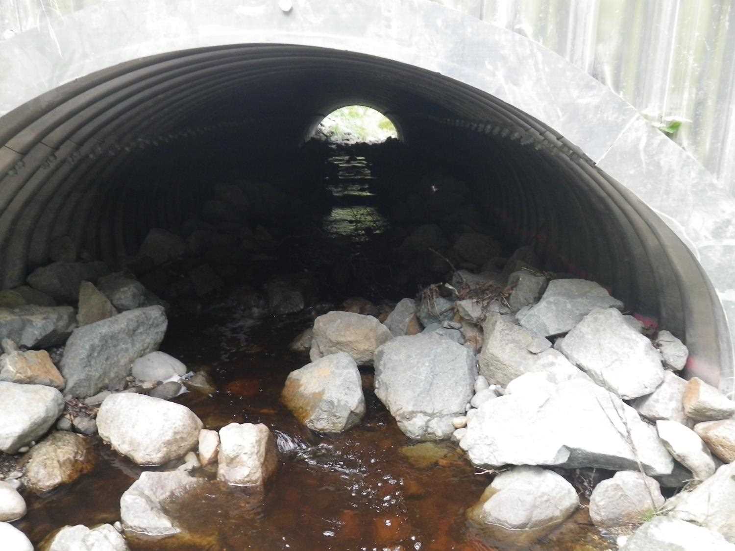
- Culvert is poorly aligned
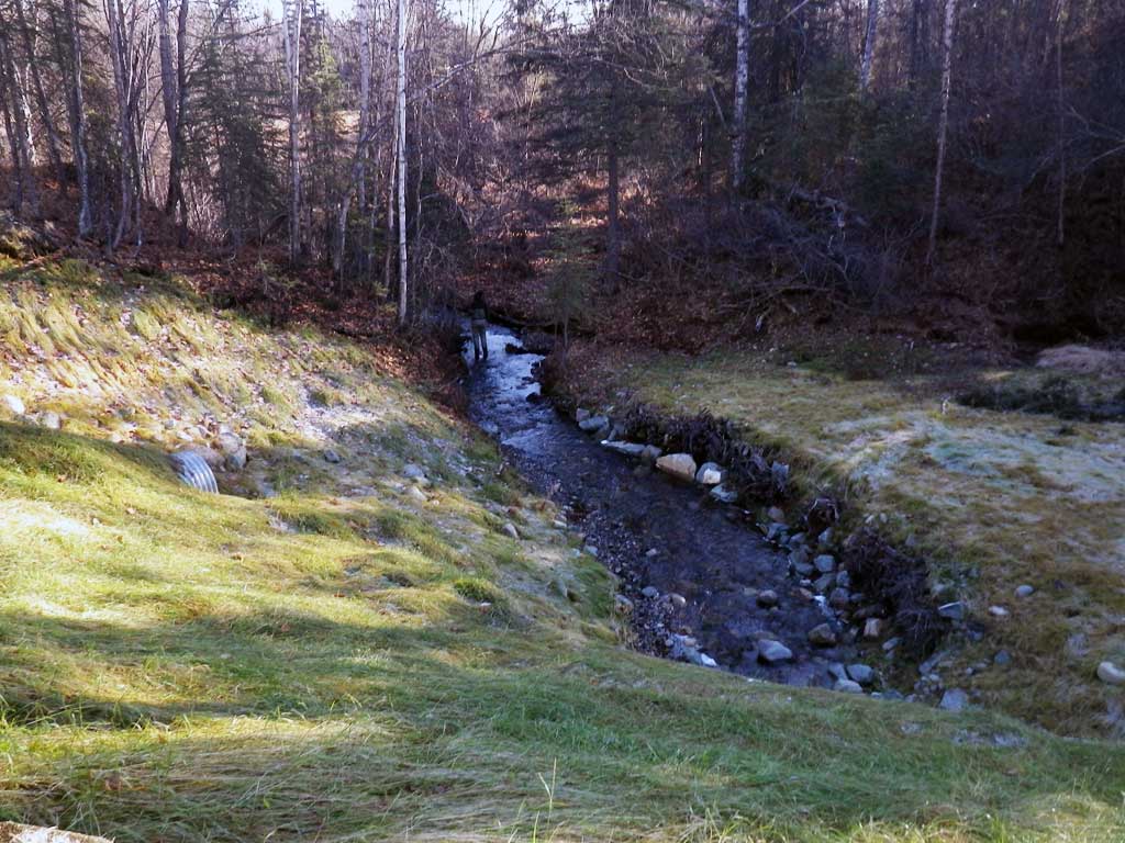
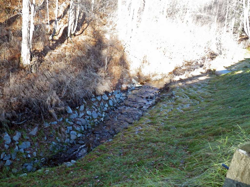
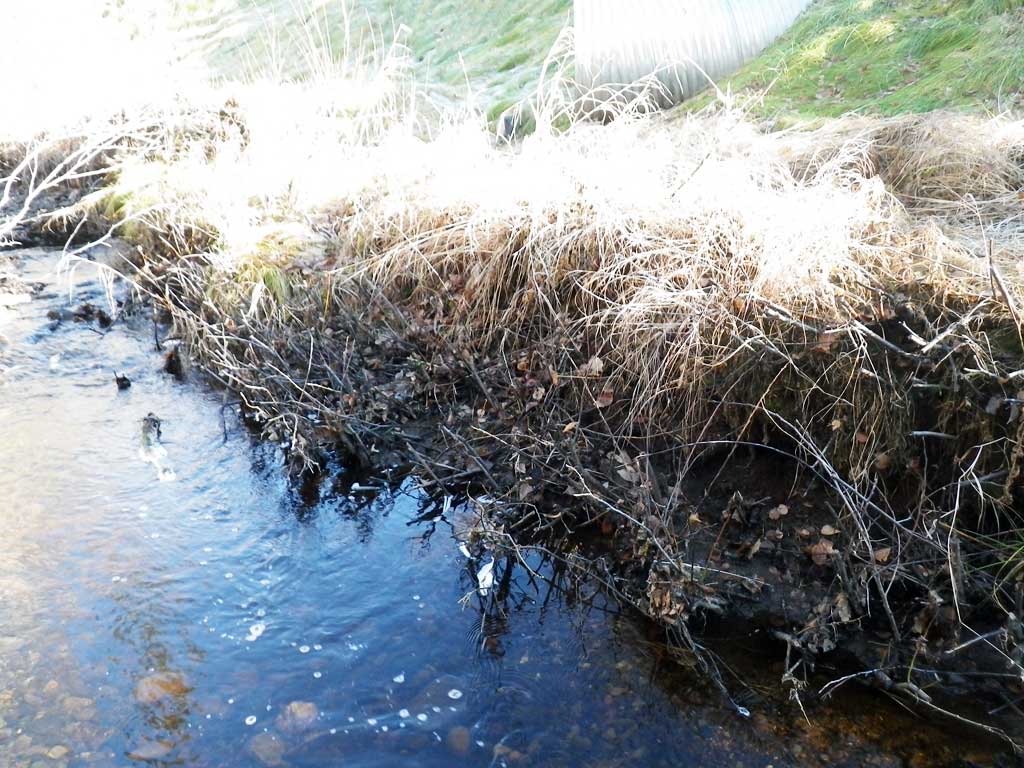
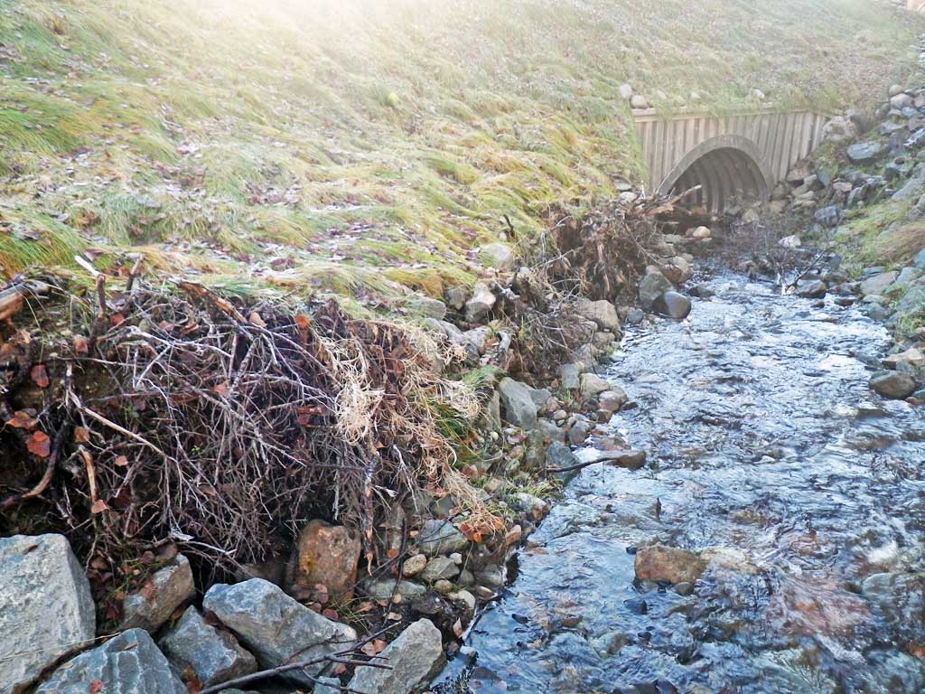
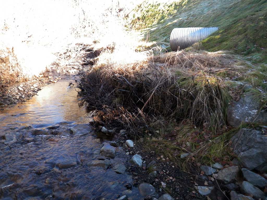
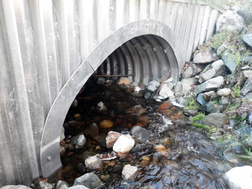
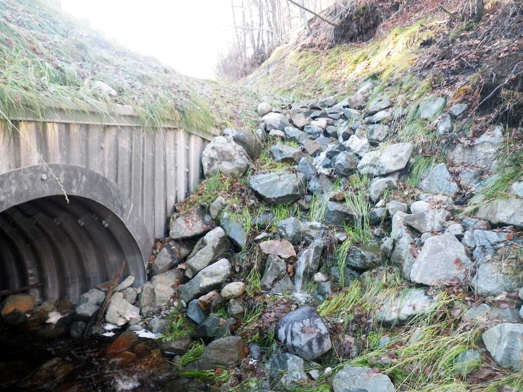
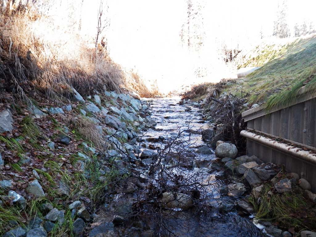
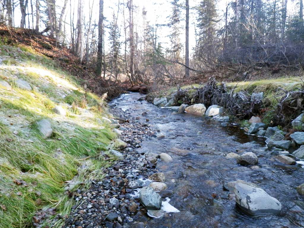
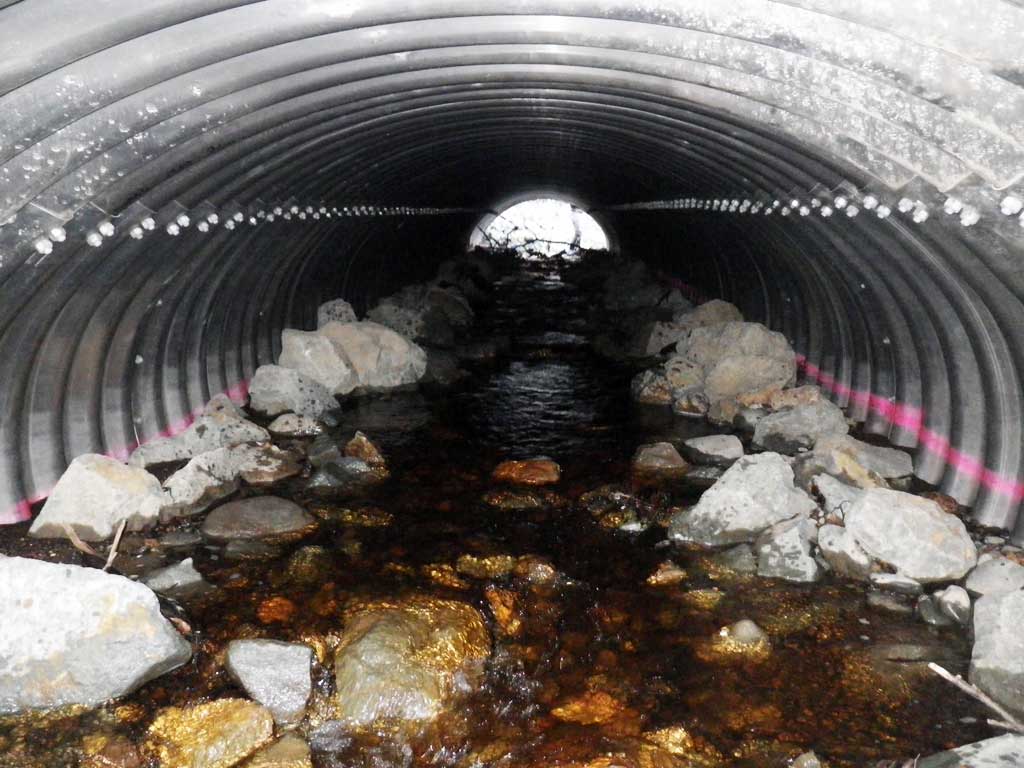
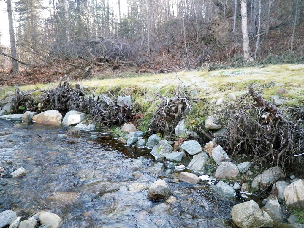
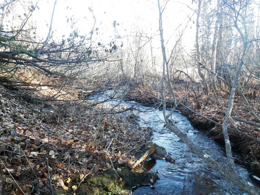
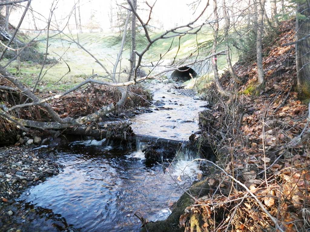
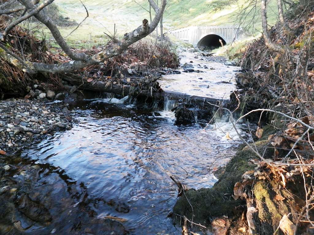
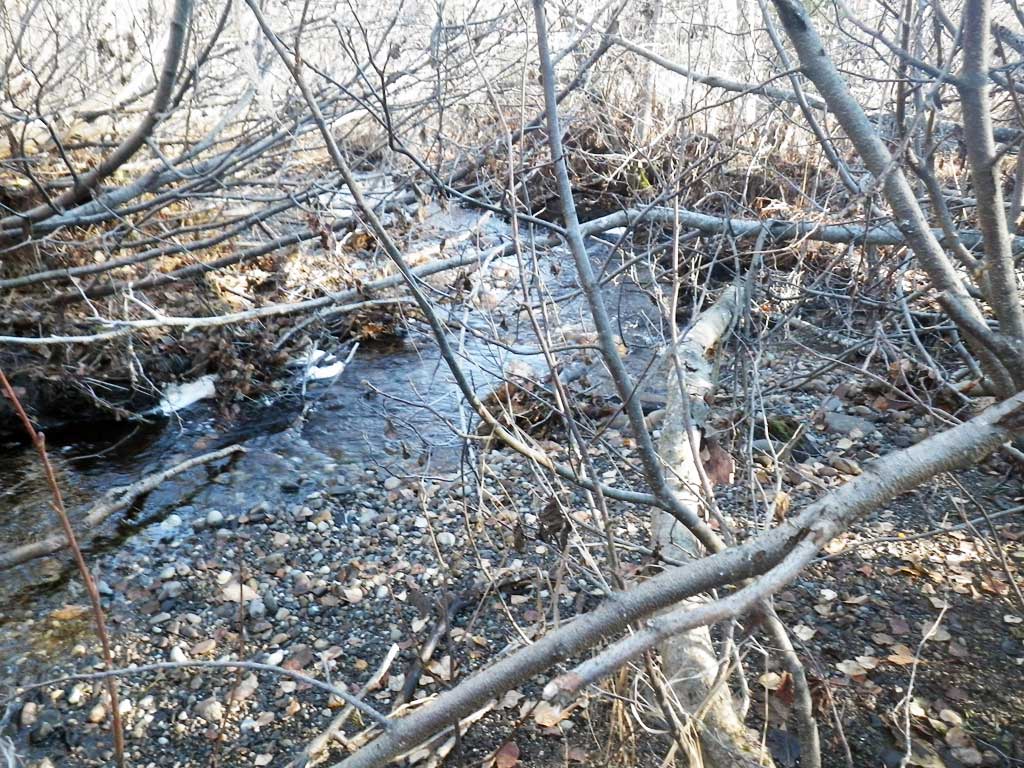
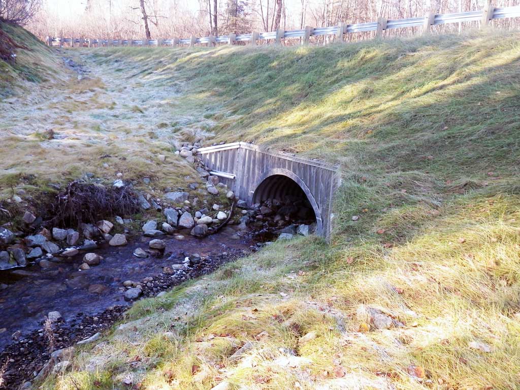
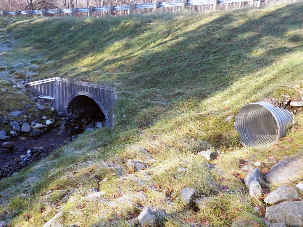
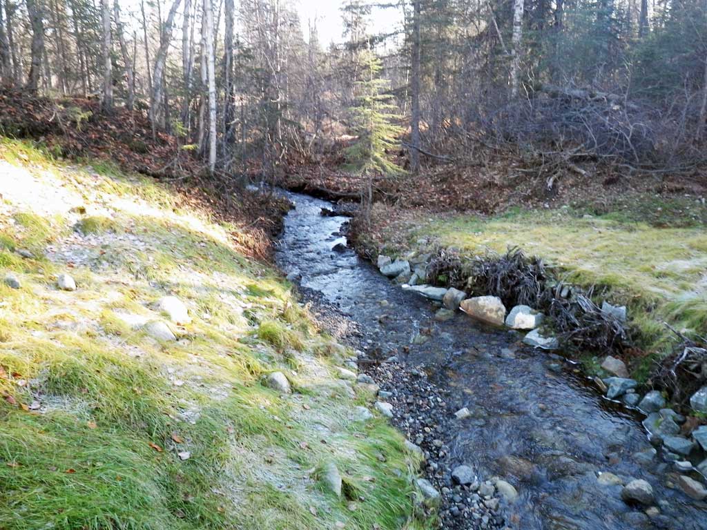
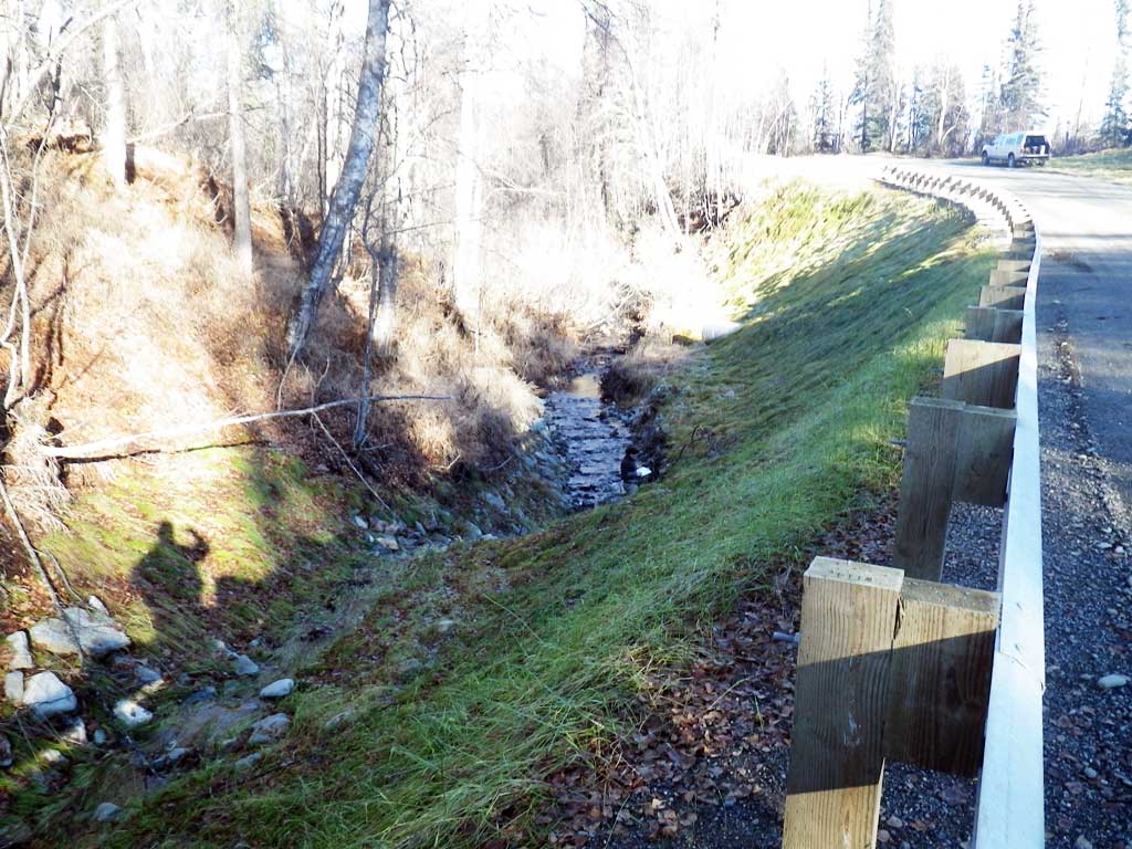
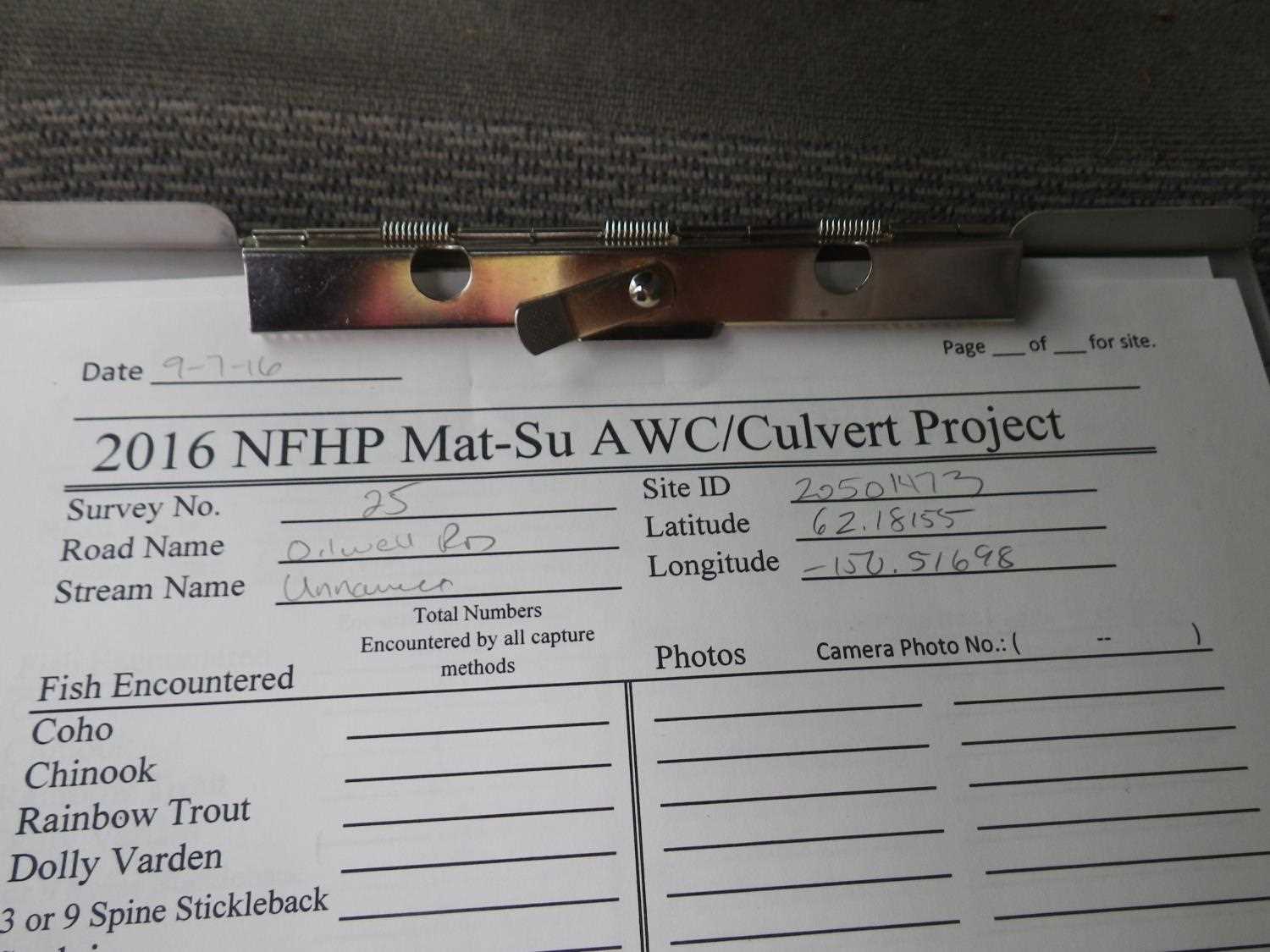
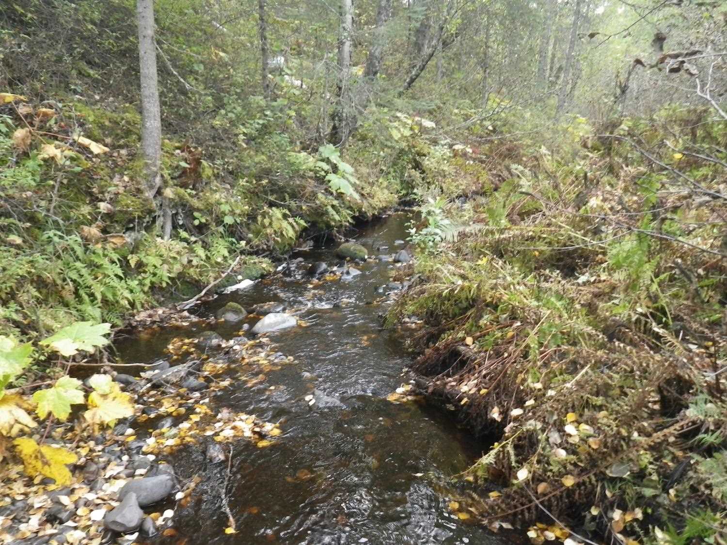
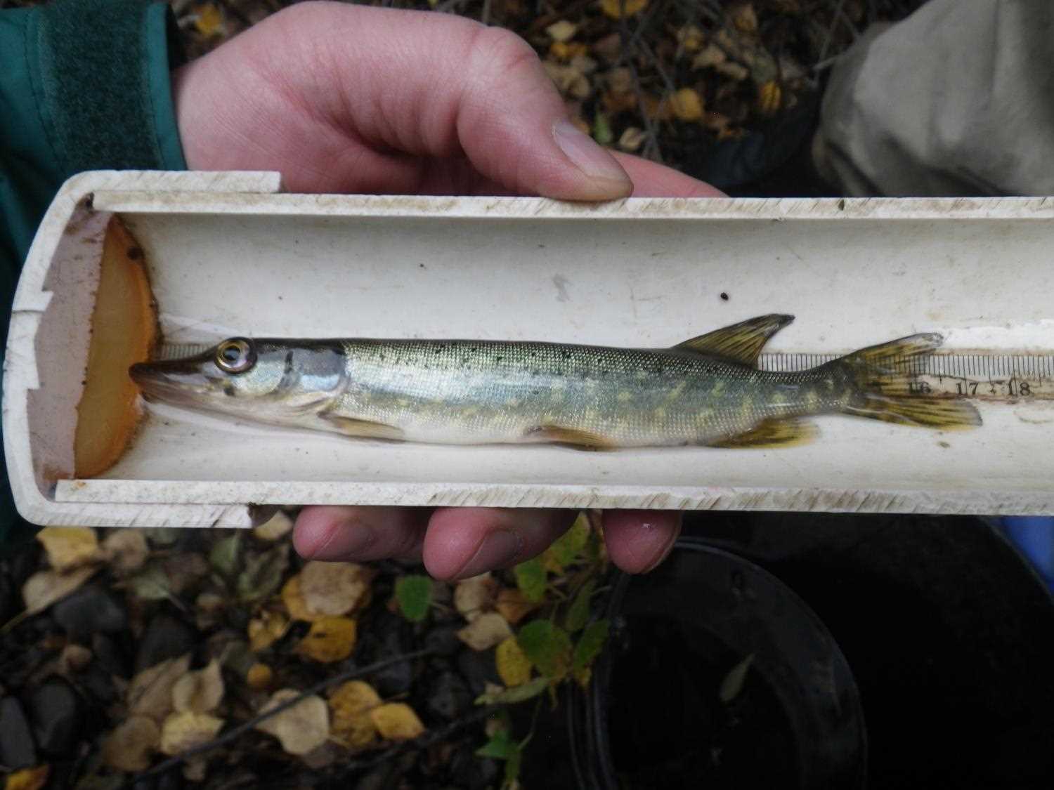
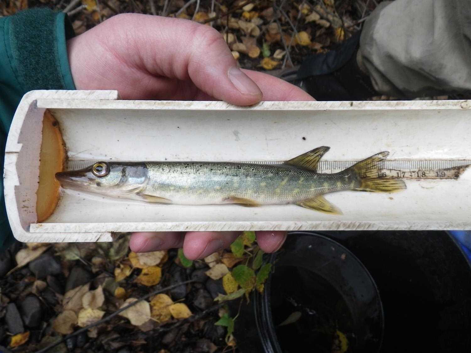
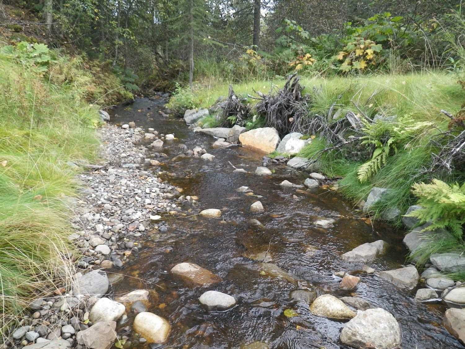
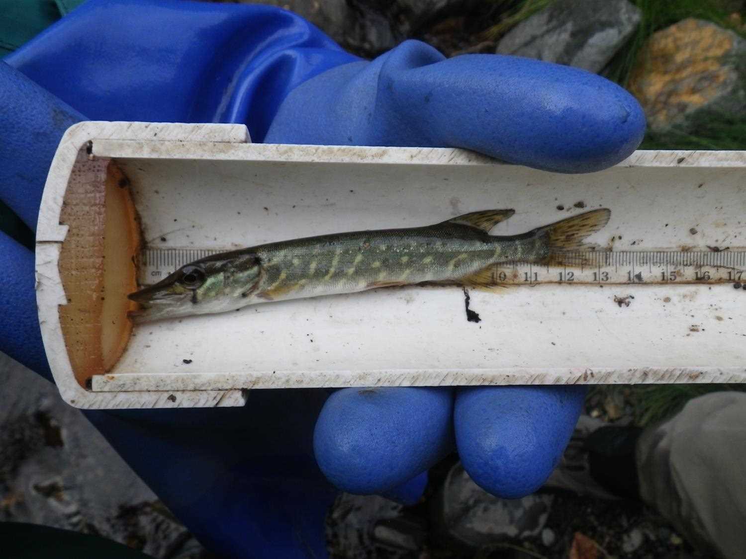
Comments: ***Updated photos added from 9/7/16 site visit from Sampling Unmapped Streams in the MSB project. Pike found upstream and downstream of culvert.Fish sampling informaiton entered into AFFI. *** Replaced in 2014, resurveyed Oct 21, 2015. Channel is lower at outlet than designed. Downstream root wads installed high with rock in front and back. Gaps between root wads upstream and willow brush layers looked to have failed to establish. Some aggradation at inlet, mostly rip rap. Erosion control at inlet too small and not angular, falling into pipe. Ditch armoring encroaches on about a third of the channel at inlet. **Updated photos and fish sampling information added from 9/7/16 site visit from Sampling Unmapped Streams in the MSB project. Pike found upstream and downstream of culvert.
Culvert Measurements
| ID: 1 | Structure Type: Pipe-arch (Structural aluminum plate) | Fish Passage Rating: | ||||||||||||||||||||||||||||||||||||||||||
|
|
|
||||||||||||||||||||||||||||||||||||||||||
Comments: Water surface gradient through culvert is 4.34%, substrate gradient 4.95% |
||||||||||||||||||||||||||||||||||||||||||||
Culvert Observations:
|
||||||||||||||||||||||||||||||||||||||||||||
Stream Measurements
|
|
| Stream Width Type | Distance From Crossing (ft) |
Stream Width (ft) |
|---|---|---|
| Downstream ordinary high water | 100.0 | 9.00 |
| Downstream ordinary high water | 200.0 | 7.90 |
| Upstream ordinary high water | 100.0 | 9.50 |
| Upstream ordinary high water | 200.0 | 7.50 |
| Upstream ordinary high water | 300.0 | 8.90 |
Elevations
| Locator ID | Culvert Number |
River Distance (ft)1 |
Distance From Crossing (ft)2 |
Relative Elevation (ft) |
|---|---|---|---|---|
| Road Elev | 113.06 | |||
| D/S Water Surface Elev | 0.00 | 90.52 | ||
| D/S Thalweg (riffle) | 0.00 | 90.09 | ||
| D/S Thalweg (riffle) | 12.00 | 90.20 | ||
| D/S Water Surface Elev | 12.00 | 90.82 | ||
| D/S Water Surface Elev | 29.00 | 91.11 | ||
| Max Pool Depth (Plunge pool below log step) | 29.00 | 90.02 | ||
| D/S Grade Ctrl (Thalweg) (Log step) | 32.00 | 91.81 | ||
| D/S Water Surface Elev | 32.00 | 92.02 | ||
| D/S Thalweg (End of rip rap) | 50.00 | 92.07 | ||
| D/S Water Surface Elev | 50.00 | 92.44 | ||
| D/S Thalweg (Middle of rootwads) | 74.00 | 92.61 | ||
| D/S Water Surface Elev | 74.00 | 93.06 | ||
| Outlet Pool Water Elev | 90.00 | 93.31 | ||
| Max Pool Depth | 90.00 | 92.64 | ||
| D/S Water Surface Elev | 92.00 | 93.52 | ||
| Outlet Invert (On substrate) | 92.00 | 92.58 | ||
| Outlet Culvert Top (On top of collar above center bolt) | 92.00 | 98.52 | ||
| U/S Water Surface Elev | 157.40 | 96.36 | ||
| Inlet Culvert Top (top of collar above center bolt) | 157.40 | 101.16 | ||
| Inlet Culvert Invert (on substrate) | 157.40 | 95.82 | ||
| U/S Thalweg (bottom of inlet riffle) | 161.40 | 96.27 | ||
| U/S Water Surface Elev | 161.40 | 96.57 | ||
| U/S Grade Ctrl (Thalweg) (rock step (rip rap)) | 173.40 | 96.84 | ||
| U/S Water Surface Elev | 173.40 | 97.22 | ||
| U/S Grade Ctrl (Thalweg) (rock step (rip rap)) | 190.40 | 97.91 | ||
| U/S Water Surface Elev | 190.40 | 98.41 | ||
| U/S Grade Ctrl (Thalweg) (Top of step (top of inlet riffle)) | 204.40 | 98.58 | ||
| U/S Water Surface Elev | 204.40 | 98.97 | ||
| U/S Water Surface Elev | 210.40 | 98.91 | ||
| U/S Thalweg (Pool) | 210.40 | 98.39 | ||
| U/S Grade Ctrl (Thalweg) (Top of riffle) | 237.40 | 99.73 | ||
| U/S Water Surface Elev | 237.40 | 99.96 |
Notes:
- River distance is measured continuously throughout the survey reach along the thalweg of the stream.
- Measured from each end of the crossing along the thalweg of the stream.
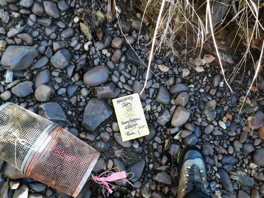
Fish Sampling Efforts
| Gear Type: Minnow Trap (A) | Trap Duration(h): 1.0 | |
| Comments: No fish caught | ||
| Gear Type: Minnow Trap (B) | Trap Duration(h): 1.0 | |
| Comments: No fish caught. | ||
Fish Observations
No fish observations occurred during this survey.
Photos


Questions or comments about this report can be directed to dfg.dsf.webmaster@alaska.gov