Fish Passage Site 20501472
Coordinates (dec. deg.): 62.10631°, -150.52565°
Legal Description: S023N007W03
Region: South Central
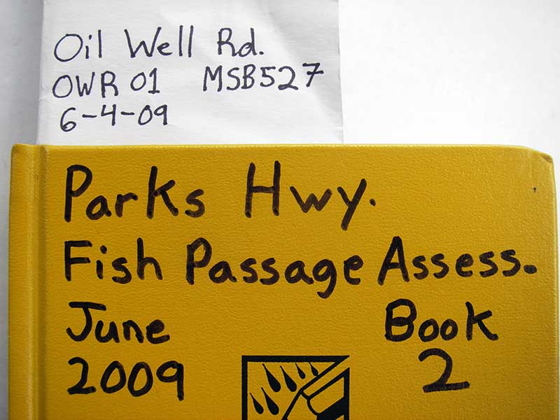
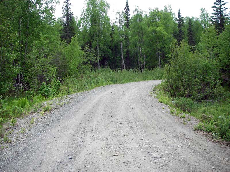
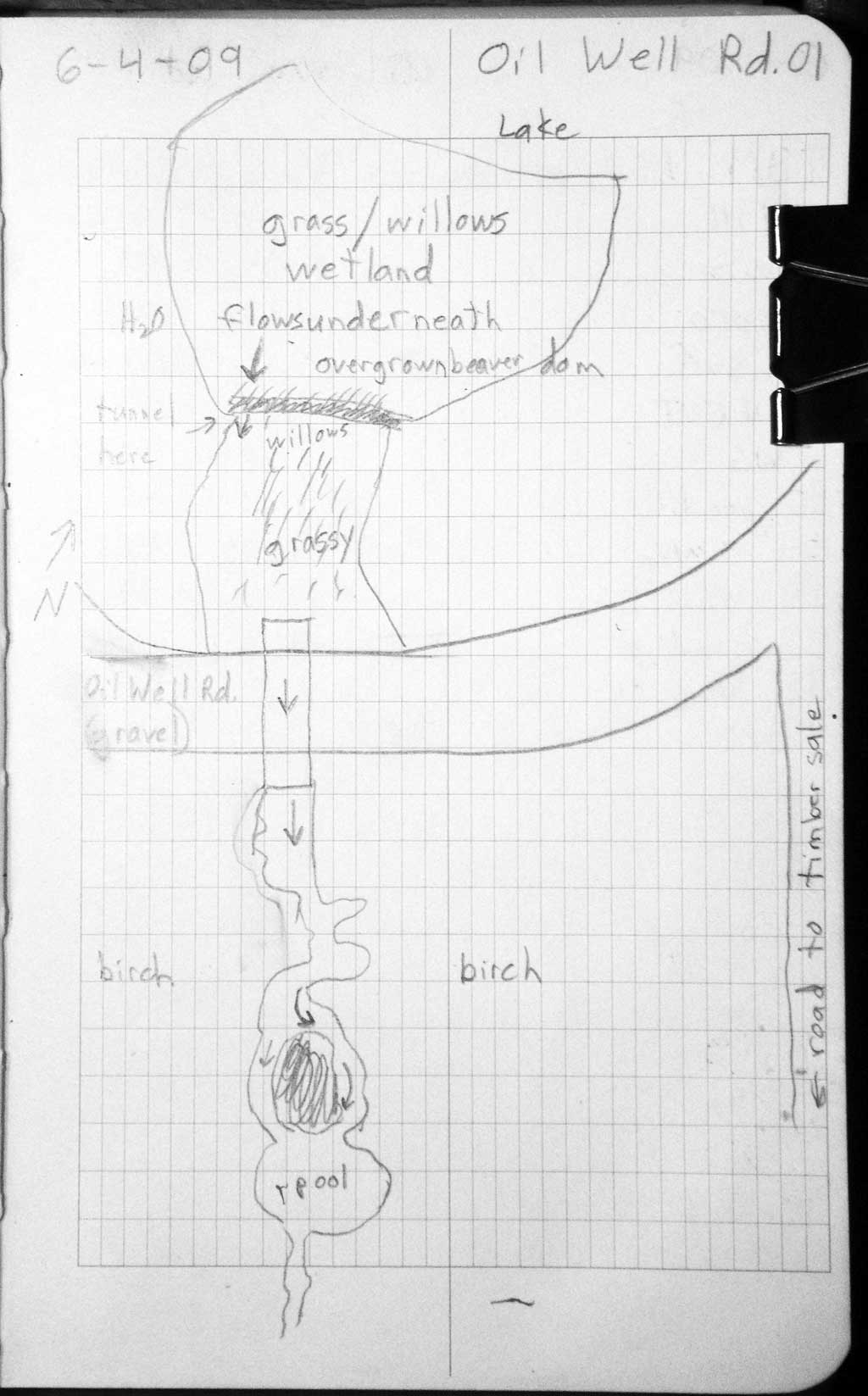
Road Name: Oil Well Road
Datum: WGS84
Quad Name / ITM: Talkeetna A-2
AWC Stream #:
Stream Name: Kroto Creek tributary
Elevation:
Site Comments: None
arrow to the right of the survey date below to choose a different report for this site.
Survey PRK09-OWR01
Project Supervisor: Gillian O'Doherty, ADFG
Observers: Heidi Zimmer, Ben Histand
Overall Fish Passage Rating:
Tidal: No
Backwatered: No
Step Pools:
Construction Year:
Site Observations:
- Constriction ratio red
- Culvert gradient red
Comments: no fish captured; 2 observed ~6-8 in.
Culvert Measurements
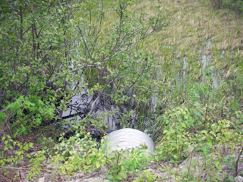
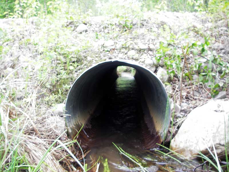
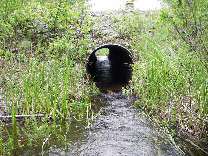
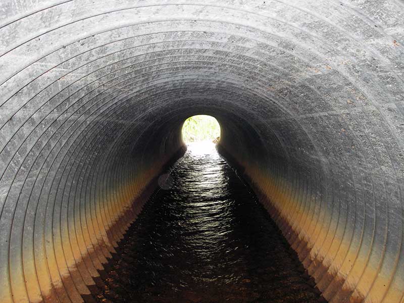
| ID: 1 | Structure Type: Circular pipe (Corrugated steel) | Fish Passage Rating: | |||||||||||||||||||||||||||||||||||||||||
|
|
|
|||||||||||||||||||||||||||||||||||||||||
Culvert Observations:
|
|||||||||||||||||||||||||||||||||||||||||||
Stream Measurements
|
|
| Stream Width Type | Distance From Crossing (ft) |
Stream Width (ft) |
|---|---|---|
| Downstream ordinary high water | 106.0 | 4.50 |
| Downstream ordinary high water | 130.0 | 4.50 |
| Downstream ordinary high water | 165.0 | 8.50 |
Elevations
| Locator ID | Culvert Number |
River Distance (ft)1 |
Distance From Crossing (ft)2 |
Relative Elevation (ft) |
|---|---|---|---|---|
| U/S Thalweg (wd = 0.51) | 1 | 97.41 | ||
| Outlet Pool Water Elev | 1 | 97.63 | ||
| U/S Headwater | 1 | 97.83 | ||
| D/S Grade Ctrl (Thalweg) | 1 | 0.00 | 52.0 | 96.51 |
| D/S Water Surface Elev (ws @ GP) | 1 | 0.00 | 52.0 | 97.30 |
| D/S Water Surface Elev (ws @ TWC) | 1 | 28.00 | 24.0 | 97.37 |
| D/S Tailcrest or 1st Thalweg | 1 | 28.00 | 24.0 | 96.65 |
| D/S Thalweg | 1 | 47.00 | 5.0 | 96.41 |
| Outlet Invert | 1 | 52.00 | 0.0 | 97.14 |
| Road Elev | 1 | 67.00 | 102.44 | |
| Inlet Culvert Invert | 1 | 82.00 | 0.0 | 97.47 |
Notes:
- River distance is measured continuously throughout the survey reach along the thalweg of the stream.
- Measured from each end of the crossing along the thalweg of the stream.
Fish Sampling Efforts
| Gear Type: Minnow Trap (A) | Trap Duration(h): 1.0 | |
| Comments: no fish caught; 70ft u/s | ||
| Gear Type: Minnow Trap (B) | Trap Duration(h): 1.0 | |
| Comments: no fish caught; 50ft d/s | ||
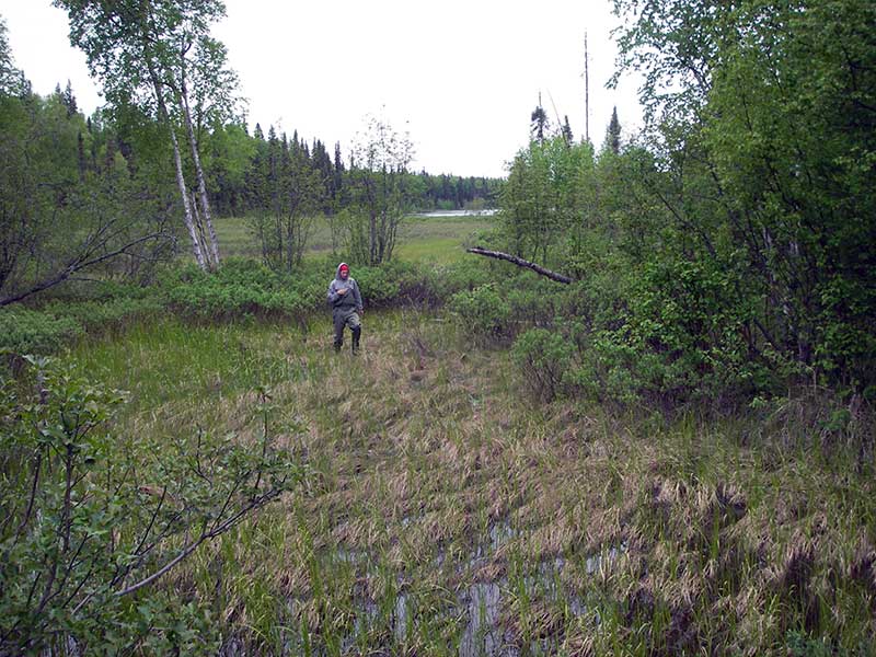
| Gear Type: Visual Observation, Ground (C) | ||
| Comments: 2 fish unidentified fish observed, location not recorded. | ||
Fish Observations
No fish observations occurred during this survey.
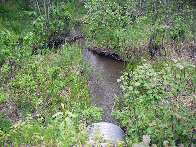
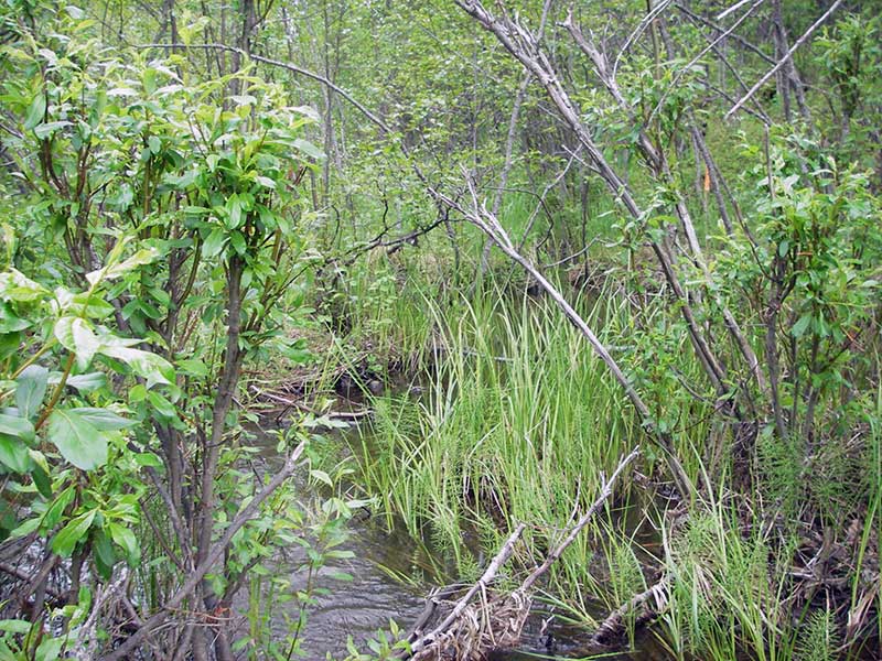
Photos
Questions or comments about this report can be directed to dfg.dsf.webmaster@alaska.gov